North Locheynort

Settlement in Inverness-shire

Scotland

North Locheynort

Bridge for peat track East Loch Olaidh This bridge carries the track to peat workings to the north of Loch Ceann a' Bhaigh. The drain from Loch Olaidh was, like many on South Uist, apparently dug by Dutch engineers two centuries ago along the line of an existing burn.
Bridge for peat track East Loch Olaidh Credit: AlastairG

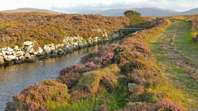
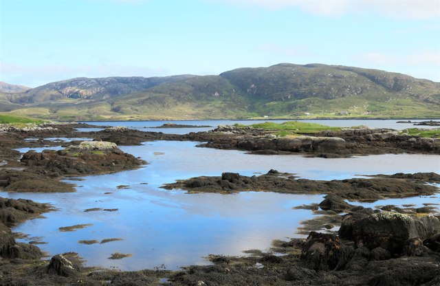
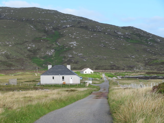
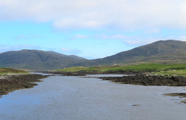
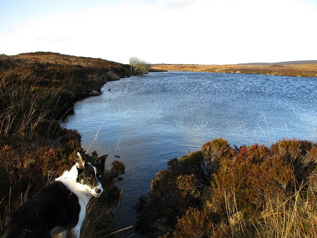
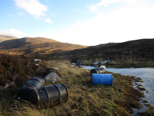
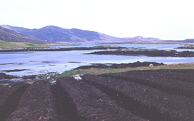
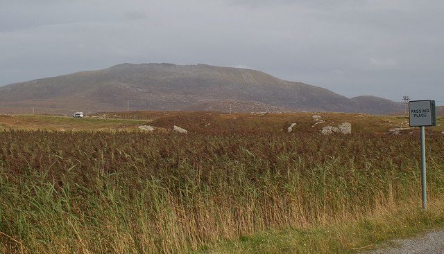
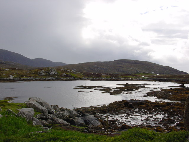
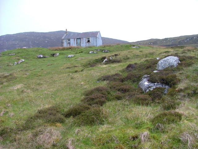
North Locheynort is a small village located in the picturesque area of Inverness-shire, Scotland. Situated on the eastern coast of the Isle of South Uist, North Locheynort is surrounded by stunning natural beauty. The village is nestled between the rocky hills and the tranquil waters of Loch Eynort, offering breathtaking views to its residents and visitors.

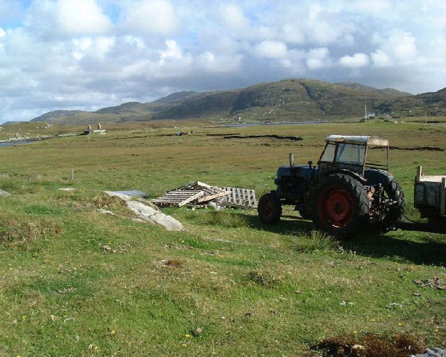
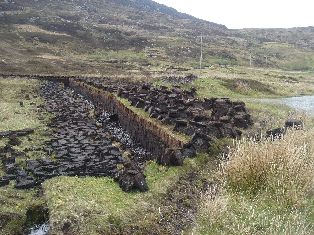
With a population of around 100 inhabitants, North Locheynort is known for its close-knit community and peaceful atmosphere. The village primarily relies on agriculture and fishing as its main industries, reflecting the traditional way of life that is still preserved in this area. Visitors can witness the daily activities of local fishermen as they bring in their catches or explore the fertile farmlands that surround the village.

North Locheynort is also a haven for outdoor enthusiasts and nature lovers. The surrounding landscape offers a variety of outdoor activities, including hiking, cycling, and bird-watching. The nearby Loch Eynort is renowned for its rich biodiversity, attracting numerous species of birds and wildlife.

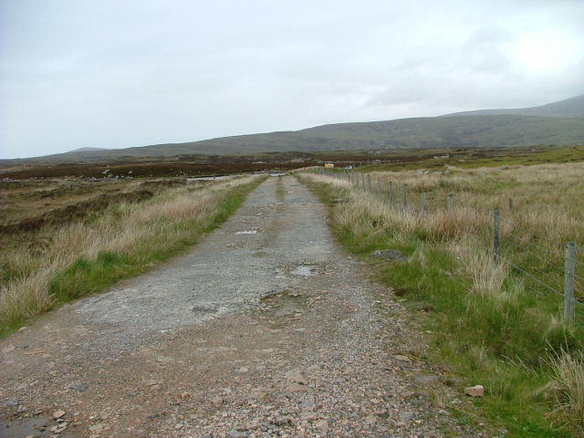
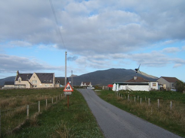
Although North Locheynort is a small village, it is not lacking in amenities. The community boasts a primary school, a post office, and a local convenience store, providing essential services for its residents. Additionally, the village is well-connected to the rest of the island through a network of roads, ensuring easy access to nearby towns and attractions.

Overall, North Locheynort is a charming and idyllic village that offers a peaceful retreat for those seeking a slower pace of life and a chance to immerse themselves in the beauty of the Scottish countryside.

If you have any feedback on the listing, please let us know in the comments section below.

North Locheynort Images

Images are sourced within 2km of 57.241679/-7.3633409 or Grid Reference NF7629. Thanks to Geograph Open Source API. All images are credited.

Bridge for peat track East Loch Olaidh This bridge carries the track to peat workings to the north of Loch Ceann a' Bhaigh. The drain from Loch Olaidh was, like many on South Uist, apparently dug by Dutch engineers two centuries ago along the line of an existing burn.
Bridge for peat track East Loch Olaidh
This bridge carries the track to peat workings to the north of Loch Ceann a' Bhaigh. The drain from Loch Olaidh was, like many on South Uist, apparently dug by Dutch engineers two centuries ago along the line of an existing burn.
Footbridge over East Loch Olaidh exit burn This footbridge is upstream from the much more substantial one shown in  <a href="https://www.geograph.org.uk/photo/7320487">NF7630 : Bridge for peat track East Loch Olaidh</a>.  The track on the right bank of the burn continues beyond the vehicle bridge. The masonry work retaining the banks of the burn has survived well over the past 200 years.
Footbridge over East Loch Olaidh exit burn
This footbridge is upstream from the much more substantial one shown in NF7630 : Bridge for peat track East Loch Olaidh. The track on the right bank of the burn continues beyond the vehicle bridge. The masonry work retaining the banks of the burn has survived well over the past 200 years.
Looking out into Loch Aineort The view near the head of the sea loch looking towards where it begins to widen.
Looking out into Loch Aineort
The view near the head of the sea loch looking towards where it begins to widen.
The north Loch Aineort road Heading south east towards the second of two causeways across arms of this complex sea loch.
The north Loch Aineort road
Heading south east towards the second of two causeways across arms of this complex sea loch.
Head of Loch Aineort At this point one is only 4km from the west coast, but this long and convoluted sea loch is one that has its mouth on the east side of the island.
Head of Loch Aineort
At this point one is only 4km from the west coast, but this long and convoluted sea loch is one that has its mouth on the east side of the island.
Lochan A small nameless lochan draining into the nearby Loch Ceann a' Bhaigh (Bayhead).
Lochan
A small nameless lochan draining into the nearby Loch Ceann a' Bhaigh (Bayhead).
Rubbish, Loch Ceann a' Bhaigh The remains of wrecked fish farm pontoons and cages on the shores of Loch Ceann a' Bhaigh. Apparently the remaining fish farm cages are to be removed from the loch, whether all this junk gets cleared up along with them is another matter...
Rubbish, Loch Ceann a' Bhaigh
The remains of wrecked fish farm pontoons and cages on the shores of Loch Ceann a' Bhaigh. Apparently the remaining fish farm cages are to be removed from the loch, whether all this junk gets cleared up along with them is another matter...
South Uist scene This view at Taobh a Deas, looking South-east - a former 'black house' which had been modernised, but is now roofless, can be seen in the distance
South Uist scene
This view at Taobh a Deas, looking South-east - a former 'black house' which had been modernised, but is now roofless, can be seen in the distance
Peat cuttings near Unasary The road along the southern side of Loch Eynort ends at Unasary.  Similar peat cuttings are a frequent roadside sight in South Uist.
Peat cuttings near Unasary
The road along the southern side of Loch Eynort ends at Unasary. Similar peat cuttings are a frequent roadside sight in South Uist.
Lazybeds by Loch Aineort Lazybeds are the traditional way of growing crops in small patches of soil. My thanks to Angus Campbell, who tells me that these ones were made by his father Neil, and that his father still cultivates them in 2008, albeit not on this site. <a href="https://www.geograph.org.uk/photo/1340713">NF7728 : Former Lazybeds by Loch Aineort</a> shows the same piece of land in 2008. Only potatoes can be grown, and Neil always plants Kerrs Pink. He starts by spreading seaweed on the ground in February, and then turns the soil to create the lazybeds. The seed potatoes are planted in April, and the crop is harvested from September onwards, depending on the weather. Angus also makes lazybeds, but he says they are not as good as his father's ones.
Lazybeds by Loch Aineort
Lazybeds are the traditional way of growing crops in small patches of soil. My thanks to Angus Campbell, who tells me that these ones were made by his father Neil, and that his father still cultivates them in 2008, albeit not on this site. NF7728 : Former Lazybeds by Loch Aineort shows the same piece of land in 2008. Only potatoes can be grown, and Neil always plants Kerrs Pink. He starts by spreading seaweed on the ground in February, and then turns the soil to create the lazybeds. The seed potatoes are planted in April, and the crop is harvested from September onwards, depending on the weather. Angus also makes lazybeds, but he says they are not as good as his father's ones.
Bornish Small lochan with reedbed in foreground - looking NE across A865 (main N-S road in South Uist) towards Beinn Mhor.
Bornish
Small lochan with reedbed in foreground - looking NE across A865 (main N-S road in South Uist) towards Beinn Mhor.
Head of Loch Aineort
Old Road Part of the old A865 that runs alongside the new one.
Old Road
Part of the old A865 that runs alongside the new one.
Building Under Construction This building will house a new Learning and Development Centre.
Building Under Construction
This building will house a new Learning and Development Centre.
Track to Loch Ceann a' Bhaigh The track is used for access to the fish farm.
Track to Loch Ceann a' Bhaigh
The track is used for access to the fish farm.
Deserted Corrugated House In the early 1900's, many houses were constructed using corrugated iron then v-lined inside with wood.
Deserted Corrugated House
In the early 1900's, many houses were constructed using corrugated iron then v-lined inside with wood.
Croft Building At the head of Loch Aineort.
Croft Building
At the head of Loch Aineort.
Nostalgia A wonderful old Bedford bus in Macbraynes livery. One can imagine riding on this around the single track roads of Mull, though this one is heading for Balamory and not Tobermory. Parked in a transport yard by the A865.
Nostalgia
A wonderful old Bedford bus in Macbraynes livery. One can imagine riding on this around the single track roads of Mull, though this one is heading for Balamory and not Tobermory. Parked in a transport yard by the A865.
Show me another place!

North Locheynort is located at Grid Ref: NF7629 (Lat: 57.241679, Lng: -7.3633409)

Unitary Authority: Na h-Eileanan an Iar

Police Authority: Highlands and Islands

Also known as: Taobh a Tuath Loch Aineort

What 3 Words

///shuttered.cover.whips. Near Lochboisdale, Na h-Eileanan Siar

Related Wikis

Bornish

Bornish (Scottish Gaelic: Bòrnais) is a village and community council area on South Uist in the Outer Hebrides, Scotland. Bornish is also within the civil...

Ormacleit Castle

Ormacleit Castle (Scottish Gaelic: Caisteal Ormacleit) is a ruined mansion house of the early 18th century. It is located on South Uist in the Western...

Milton (South Uist)

Milton (Scottish Gaelic: Geàrraidh Bhailteas) is the name of a tack or tenant farm on the island of South Uist in the Outer Hebrides, Scotland. It was...

Stoneybridge

Stoneybridge (Scottish Gaelic: Staoinebrig) is a village on the island of South Uist in Scotland. The Crois Chnoca Breaca standing stone is situated to...

South Uist

South Uist (Scottish Gaelic: Uibhist a Deas, [ˈɯ.ɪʃtʲ ə ˈtʲes̪] ; Scots: Sooth Uist) is the second-largest island of the Outer Hebrides in Scotland. At...

Beinn Mhòr (South Uist)

Beinn Mhòr is a mountain on the island of South Uist in the Outer Hebrides of Scotland. With a height of 620 metres (2,034 ft), it is the highest point...

Dun Vulan

Dun Vulan Broch (Scottish Gaelic: 'Dùn Mhùlan' or 'Dùn Mhaoilinn') is an Iron Age broch in South Uist, Scotland. == Location == Dun Vulan is located in...

Askernish

Askernish (Scottish Gaelic: Àisgearnais, Aisgernis) is a crofting community on South Uist, in the Outer Hebrides, Scotland. Askernish is in the parish...

Nearby Amenities

Located within 500m of 57.241679,-7.3633409
Barrier: cattle_grid
Lat/Long: 57.2410486/-7.363556
Power: pole
Lat/Long: 57.2418015/-7.3650843
Power: pole
Lat/Long: 57.2419053/-7.3635621
Power: pole
Lat/Long: 57.2430968/-7.3656623
Power: pole
Lat/Long: 57.243657/-7.3658742
Power: pole
Lat/Long: 57.2441968/-7.3660646
Barrier: cattle_grid
Lat/Long: 57.2439567/-7.3660807
Power: pole
Lat/Long: 57.2446462/-7.3669404
Power: pole
Lat/Long: 57.2451846/-7.3679865
Power: pole
Lat/Long: 57.2425673/-7.3654031
Power: pole
Lat/Long: 57.2396399/-7.3623534
Power: pole
Lat/Long: 57.239846/-7.3629972
Power: pole
Lat/Long: 57.2405891/-7.3632332
Power: pole
Lat/Long: 57.241203/-7.36418
Power: pole
Lat/Long: 57.2390593/-7.3627558
Power: pole
Lat/Long: 57.2385005/-7.3625787
Power: pole
Lat/Long: 57.2378227/-7.3623668
Power: pole
Lat/Long: 57.2403191/-7.3571609
Power: pole
Lat/Long: 57.2399374/-7.3560505
Power: pole
Lat/Long: 57.2419876/-7.362229
Power: pole
Lat/Long: 57.2421701/-7.35941
Power: pole
Lat/Long: 57.2415687/-7.3586804
Power: pole
Lat/Long: 57.2409468/-7.357924
Passing Place
Lat/Long: 57.2389701/-7.3615739
The data included in this document is from www.openstreetmap.org. The data is made available under ODbL.

Have you been to North Locheynort?

Leave your review of North Locheynort below (or comments, questions and feedback).