Littleton, North
Settlement in Worcestershire Wychavon
England
Littleton, North

Littleton is a small village located in the North district of Worcestershire, England. Nestled amidst the picturesque countryside, this tranquil settlement offers a serene and idyllic lifestyle to its residents. With a population of around 500 people, Littleton exudes a close-knit community feel and a friendly atmosphere.
The village is known for its stunning natural beauty, with rolling hills, lush green fields, and charming cottages dotting the landscape. The nearby River Avon adds to the village's charm, providing opportunities for leisurely walks and fishing. The surrounding countryside also offers numerous walking and cycling trails, making it an ideal destination for outdoor enthusiasts.
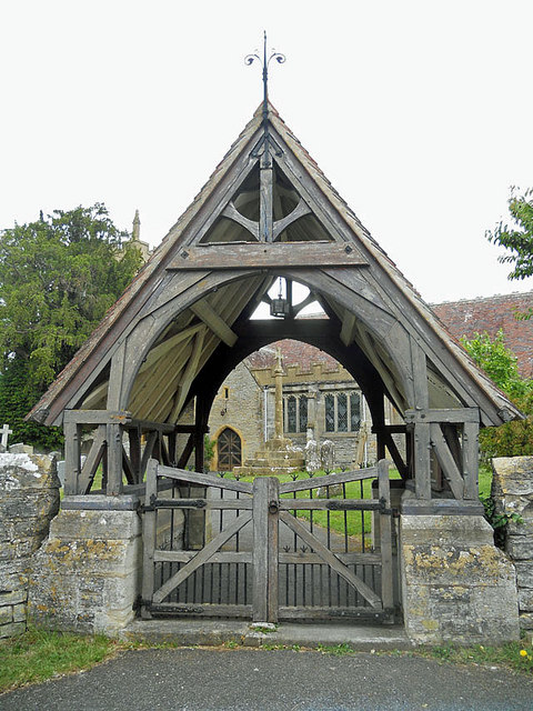
Despite its small size, Littleton has a rich history that can be traced back to the medieval period. Some historical landmarks, such as the 13th-century St. Michael and All Angels Church, still stand in the village, serving as a reminder of its past.
The village amenities include a primary school, village hall, and a local pub, providing essential services and a hub for social gatherings. For additional amenities, residents can easily access nearby towns, such as Evesham and Worcester, which offer a wider range of facilities, including shops, restaurants, and leisure centers.
Overall, Littleton, North, Worcestershire is a charming and peaceful village that offers a quality rural lifestyle while maintaining close proximity to larger towns. Its natural beauty, tight-knit community, and historical significance make it an attractive place to live or visit for those seeking a tranquil countryside experience.
If you have any feedback on the listing, please let us know in the comments section below.
Littleton, North Images
Images are sourced within 2km of 52.123518/-1.8782106 or Grid Reference SP0847. Thanks to Geograph Open Source API. All images are credited.


Littleton, North is located at Grid Ref: SP0847 (Lat: 52.123518, Lng: -1.8782106)
Administrative County: Worcestershire
District: Wychavon
Police Authority: West Mercia
What 3 Words
///sound.pegs.speedily. Near South Littleton, Worcestershire
Nearby Locations
Related Wikis
North and Middle Littleton
North and Middle Littleton is a civil parish located in the Wychavon district of Worcestershire, England. The parish comprises the villages of North Littleton...
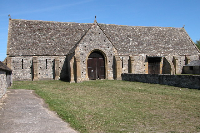
Middle Littleton Tythe Barn
Middle Littleton Tythe Barn, also known as Middle Littleton Tithe Barn, is a grade I listed 13th or 14th-century tithe barn in the village of Middle Littleton...

Littleton F.C.
Littleton Football Club is a football club based in North and Middle Littleton, near Evesham, Worcestershire. They are members of the Midland League Division...
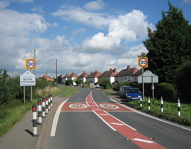
South Littleton
South Littleton is a village and civil parish located in the Wychavon district of Worcestershire, England. South Littleton is located midway between Evesham...
Nearby Amenities
Located within 500m of 52.123518,-1.8782106Have you been to Littleton, North?
Leave your review of Littleton, North below (or comments, questions and feedback).