Lee, North

Settlement in Buckinghamshire

England

Lee, North

Marsh Lane, Marsh Crossing the stream
Marsh Lane, Marsh Credit: David Howard

Lee is a small village located in the county of Buckinghamshire, in the southeastern region of England. Situated near the Chiltern Hills, it is part of the civil parish of The Lee, which also includes the neighboring villages of Lee Common and The Lee Clump. Lee is approximately 35 miles northwest of London, making it a popular commuter location for those working in the capital.

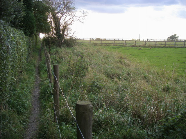
The village of Lee is known for its picturesque and idyllic setting, with traditional red-brick houses and charming thatched cottages dotting its landscape. It boasts a close-knit community atmosphere, with a population of around 800 residents. The village is surrounded by lush green fields, woodlands, and rolling hills, making it a perfect spot for outdoor enthusiasts and nature lovers.

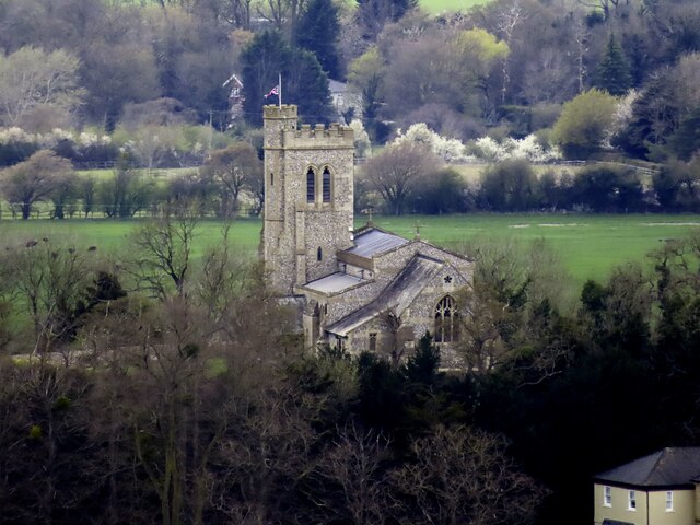
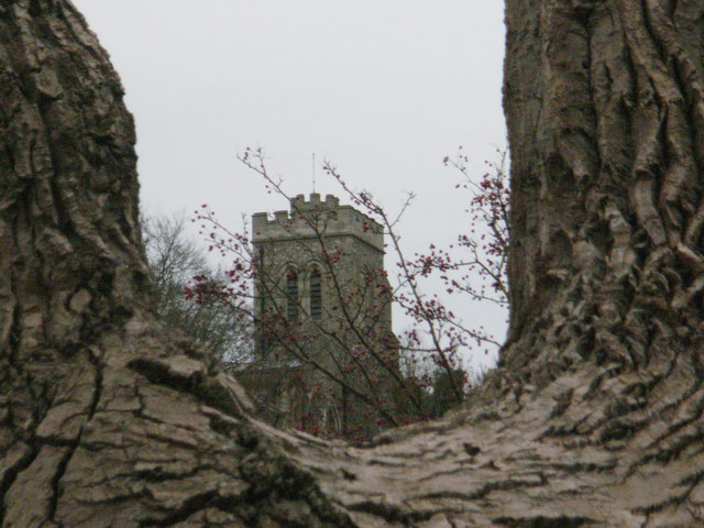
One of the notable landmarks in Lee is the medieval church of St. John the Baptist, which dates back to the 13th century. The church is known for its beautiful stained glass windows and peaceful atmosphere, attracting visitors from nearby areas.

Lee offers a range of amenities to its residents, including a village shop, a primary school, and a pub, which is a popular gathering spot for locals. The village also hosts various community events throughout the year, such as summer fetes and village fairs, adding to its vibrant and lively atmosphere.

Overall, Lee, North Buckinghamshire is a charming and quaint village that offers a tranquil countryside lifestyle, while still providing easy access to nearby towns and cities.

If you have any feedback on the listing, please let us know in the comments section below.
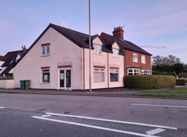
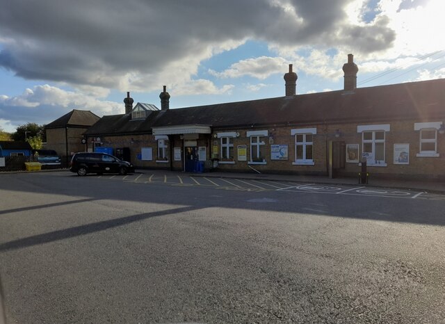
Lee, North Images

Images are sourced within 2km of 51.770904/-0.792574 or Grid Reference SP8308. Thanks to Geograph Open Source API. All images are credited.

Marsh Lane, Marsh Crossing the stream
Marsh Lane, Marsh
Crossing the stream
Marsh Lane, Marsh
Marsh Lane, Marsh
Lower Road, Stoke Mandeville
Houses on Station Road, Stoke Mandeville
Stoke Mandeville Station
Marroway, Weston Turville At the junction of Wendover Road
Marroway, Weston Turville
At the junction of Wendover Road
Marsh Road, Marsh
Marsh Road, Marsh
The road through Marsh There's only one road in Marsh and this is its last house.
The road through Marsh
There's only one road in Marsh and this is its last house.
St Peter and St Paul Church in Ellesborough
Farmland, Ellesborough Recently ploughed land to the north of North Lee.
Farmland, Ellesborough
Recently ploughed land to the north of North Lee.
Farmland, Ellesborough A footpath through oil-seed rape on the hillside above Apsley Manor Farm.
Farmland, Ellesborough
A footpath through oil-seed rape on the hillside above Apsley Manor Farm.
Farmland, Ellesborough A few trees in a former field boundary to the north of the village.
Farmland, Ellesborough
A few trees in a former field boundary to the north of the village.
Roundabout on the Wendover bypass
View of Ellesborough from Coombe Hill
Ellesborough seen from a hollow on Beacon Hill
Ellesborough Church A public footpath leads from Beacon Hill to the north past this church to connect with the Aylesbury Ring route.
Ellesborough Church
A public footpath leads from Beacon Hill to the north past this church to connect with the Aylesbury Ring route.
Tree reflections in a pond at the Springs Farm
Ellesborough Church framed between two tree branches
Show me another place!

Lee, North is located at Grid Ref: SP8308 (Lat: 51.770904, Lng: -0.792574)

Unitary Authority: Buckinghamshire

Police Authority: Thames Valley

What 3 Words

///objecting.movie.town. Near Weston Turville, Buckinghamshire

Nearby Locations

Lee, North North Lee

Related Wikis

North Lee

North Lee is a hamlet in the parish of Ellesborough, in Buckinghamshire, England. It is located in the very north of the parish, near the main road that...

Nash Lee

Nash Lee is a hamlet in the parish of Ellesborough, in Buckinghamshire, England. It is located to the north of the village, about two miles west of Wendover...

Terrick

Terrick (formerly Terwick) is a hamlet in the parish of Ellesborough, in Buckinghamshire, England. It is located in the north of the parish, where the...

Chalkshire

Chalkshire is a hamlet in the parish of Ellesborough (where the 2011 Census population was included), in Buckinghamshire, England. It is situated on the...

Nearby Amenities

Located within 500m of 51.770904,-0.792574
Power: tower
Lat/Long: 51.7710728/-0.7857559
Power: tower
Lat/Long: 51.7720522/-0.789595
North Lee
Place: hamlet
Wikidata: Q7055930
Lat/Long: 51.7715402/-0.7899636
Power: tower
Lat/Long: 51.7738463/-0.7936056
Power: pole
Source: Bing
Lat/Long: 51.7717704/-0.7981603
Power: pole
Source: Bing
Lat/Long: 51.771473/-0.7972715
Power: pole
Source: Bing
Lat/Long: 51.7709485/-0.7957612
Power: pole
Source: Bing
Lat/Long: 51.7707344/-0.7942619
Power: pole
Source: Bing
Lat/Long: 51.770477/-0.7923265
Power: pole
Source: Bing
Lat/Long: 51.7702342/-0.7906152
Power: pole
Source: Bing
Lat/Long: 51.7700173/-0.7892944
Power: pole
Source: Bing
Lat/Long: 51.7715638/-0.7986983
Power: pole
Source: Bing
Lat/Long: 51.7711722/-0.7970839
Power: pole
Source: Bing
Lat/Long: 51.7708198/-0.795666
Power: pole
Source: Bing
Lat/Long: 51.7705891/-0.7940862
Power: pole
Source: Bing
Lat/Long: 51.7703396/-0.7922708
Power: pole
Source: Bing
Lat/Long: 51.7701106/-0.790546
Power: pole
Source: Bing
Lat/Long: 51.7699003/-0.7891957
Power: pole
Source: Bing
Lat/Long: 51.7696298/-0.7874558
Historic: milestone
Inscription: Alyesbury 3½; Princes Risborough 4½
Lat/Long: 51.7739077/-0.788725
Power: pole
Source: Bing
Lat/Long: 51.7735511/-0.7979669
Power: pole
Source: Bing
Lat/Long: 51.7733536/-0.7937972
Power: pole
Source: Bing
Lat/Long: 51.773428/-0.7951565
Power: pole
Source: Bing
Lat/Long: 51.7735005/-0.7968117
Waste Basket
Waste: trash
Lat/Long: 51.7704174/-0.7890294
Best-one
Brand: Best-one
Brand Wikidata: Q4896532
Brand Wikipedia: en:Best-one
Shop: convenience
Lat/Long: 51.7703014/-0.7892856
Compressed Air
Lat/Long: 51.7704135/-0.7891086
Power: pole
Lat/Long: 51.769523/-0.7857236
Power: pole
Lat/Long: 51.769669/-0.7868716
Power: pole
Lat/Long: 51.7698583/-0.7881323
Turning Loop
Lat/Long: 51.7743618/-0.7895986
Barrier: stile
Lat/Long: 51.7696706/-0.7885779
Direction: 195
Generator Method: photovoltaic
Generator Output Electricity: yes
Generator Solar Modules: 19
Generator Source: solar
Generator Type: solar_photovoltaic_panel
Location: roof
Power: generator
Lat/Long: 51.7710682/-0.7903088
Power: pole
Lat/Long: 51.773275/-0.7884681
Power: pole
Lat/Long: 51.773297/-0.7881353
Power: pole
Lat/Long: 51.7733861/-0.7868645
Power: pole
Lat/Long: 51.7733561/-0.7902049
Crossing
Crossing: unmarked
Lat/Long: 51.774831/-0.7894544
Bus Stop
Bench: no
Bin: no
Bus: yes
Public Transport: platform
Shelter: no
Lat/Long: 51.7747305/-0.7892802
Power: pole
Lat/Long: 51.7744273/-0.789287
Power: pole
Lat/Long: 51.7747833/-0.7890992
The data included in this document is from www.openstreetmap.org. The data is made available under ODbL.

Have you been to Lee, North?

Leave your review of Lee, North below (or comments, questions and feedback).