North Hykeham

Settlement in Lincolnshire North Kesteven

England

North Hykeham

Station Road level crossing Hykeham
Station Road level crossing Hykeham Credit: Roy Hughes

The requested URL returned error: 429 Too Many Requests

If you have any feedback on the listing, please let us know in the comments section below.

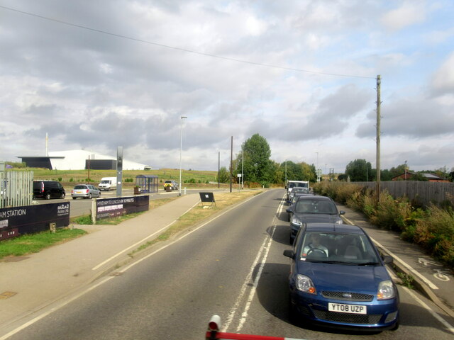
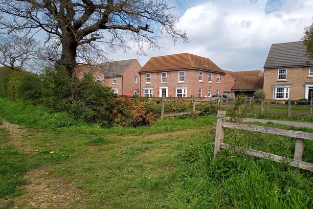
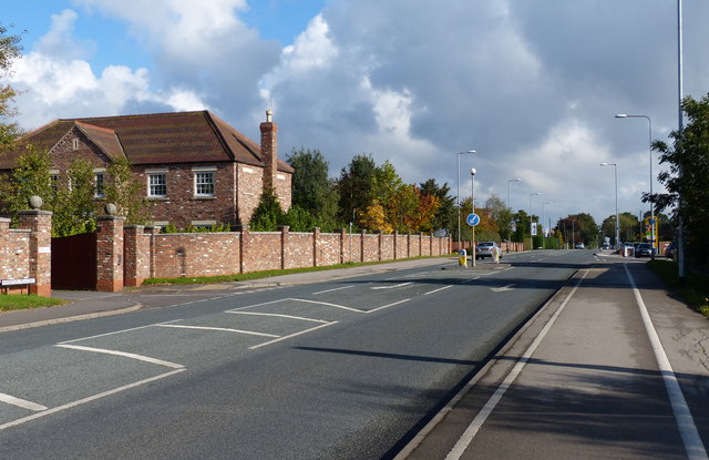
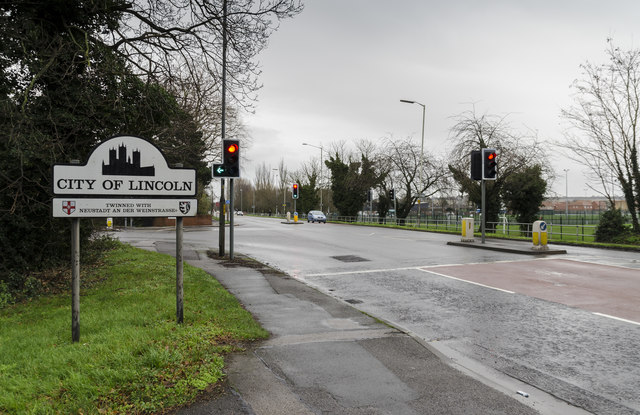
North Hykeham Images

Images are sourced within 2km of 53.18788/-0.596755 or Grid Reference SK9366. Thanks to Geograph Open Source API. All images are credited.

Station Road level crossing Hykeham
Energy plant, Whisby Road, Lincoln An energy from waste plant operated by FCC Environment and Lincolnshire County Council.
Since this photo the area in the foreground has been taken over by a car showroom.
Energy plant, Whisby Road, Lincoln
An energy from waste plant operated by FCC Environment and Lincolnshire County Council. Since this photo the area in the foreground has been taken over by a car showroom.
Teal Park Road, Lincoln The early days of a business park.
Teal Park Road, Lincoln
The early days of a business park.
Footpath near Caspian Court, North Hykeham Two public footpaths link over a small catchwater drain looking northwestwards towards Caspian Court, a road which lies on the southern edge of one of North Hykeham's more affluent housing estates.

This photograph was taken on a warm and still Saturday morning in late April.  Apart from the odd dog walker both paths were completely deserted, with many of the residents instead taking to the open green spaces on the estate. Left undisturbed, the twittering birds and buzzing insects easily drowned out the distant hum of traffic from Mill Lane to the southeast.

The unpaved route on the left continues for some 200 metres before terminating at a gated field. The paved path (right) stretches for more than a kilometre and provides a direct pedestrian link from Mill Lane to Newark Road, approximately 900 metres to the northwest.
Footpath near Caspian Court, North Hykeham
Two public footpaths link over a small catchwater drain looking northwestwards towards Caspian Court, a road which lies on the southern edge of one of North Hykeham's more affluent housing estates. This photograph was taken on a warm and still Saturday morning in late April. Apart from the odd dog walker both paths were completely deserted, with many of the residents instead taking to the open green spaces on the estate. Left undisturbed, the twittering birds and buzzing insects easily drowned out the distant hum of traffic from Mill Lane to the southeast. The unpaved route on the left continues for some 200 metres before terminating at a gated field. The paved path (right) stretches for more than a kilometre and provides a direct pedestrian link from Mill Lane to Newark Road, approximately 900 metres to the northwest.
Footpath towards Newark Road, North Hykeham A public footpath running between back gardens stretches into the distance, looking northwestwards towards Newark Road (the A1434) in North Hykeham.

This photograph was taken on a warm and sunny afternoon in early May. Despite its proximity to a busy single carriageway this footpath would be easily missed if not for the prominent 'no cycling' signs by its narrow and overgrown entrances. With tall trees and hedges casting shadows along much of its length, the path presents a somewhat intimidating route through the estate.

This footpath runs southeastwards from Newark Road to Mulberry Avenue for more than half a kilometre between the residential gardens of Elm Close (left) and Alder Close (right), and then Birch Close and Willow Road (not pictured). Perhaps an arborist could confirm whether any of the trees planted along the path match any of these names.
Footpath towards Newark Road, North Hykeham
A public footpath running between back gardens stretches into the distance, looking northwestwards towards Newark Road (the A1434) in North Hykeham. This photograph was taken on a warm and sunny afternoon in early May. Despite its proximity to a busy single carriageway this footpath would be easily missed if not for the prominent 'no cycling' signs by its narrow and overgrown entrances. With tall trees and hedges casting shadows along much of its length, the path presents a somewhat intimidating route through the estate. This footpath runs southeastwards from Newark Road to Mulberry Avenue for more than half a kilometre between the residential gardens of Elm Close (left) and Alder Close (right), and then Birch Close and Willow Road (not pictured). Perhaps an arborist could confirm whether any of the trees planted along the path match any of these names.
Signpost by a catchwater drain, North Hykeham A signpost indicating the direction of public footpaths rises above burnet-saxifrage wildflowers, looking northwestwards along the banks of a catchwater drain by the eastern suburbs of North Hykeham.

This photograph was taken on a cool morning in mid-May. For just over a kilometre the catchwater drain (here running parallel to the fences) marks the boundary between North Hykeham's eastern suburbs and the undeveloped floodplain of the River Witham. The estate on the right is primarily composed of bungalows and has no direct access to this walkway.

The footpath from which this image was taken is part of a network of local routes maintained by the Hill Holt Wood charity, as indicated by the lower 'Stepping Out' pair of signs. From this point southwards the path changes from wide and flat to narrow and uneven, and while admiring the view across the Witham floodplain one must take care not to lose one's footing.

For the same view fifteen years earlier, please see <a href="https://www.geograph.org.uk/photo/682240">SK9566 : Lowfields walk</a> by Richard Croft.
Signpost by a catchwater drain, North Hykeham
A signpost indicating the direction of public footpaths rises above burnet-saxifrage wildflowers, looking northwestwards along the banks of a catchwater drain by the eastern suburbs of North Hykeham. This photograph was taken on a cool morning in mid-May. For just over a kilometre the catchwater drain (here running parallel to the fences) marks the boundary between North Hykeham's eastern suburbs and the undeveloped floodplain of the River Witham. The estate on the right is primarily composed of bungalows and has no direct access to this walkway. The footpath from which this image was taken is part of a network of local routes maintained by the Hill Holt Wood charity, as indicated by the lower 'Stepping Out' pair of signs. From this point southwards the path changes from wide and flat to narrow and uneven, and while admiring the view across the Witham floodplain one must take care not to lose one's footing. For the same view fifteen years earlier, please see SK9566 : Lowfields walk by Richard Croft.
Lake shore at Millennium Green, North Hykeham A small group of mallards, canada geese, and swans swim close to the eastern shore of the lake at North Hykeham's Millennium Green reserve, looking northwestwards towards the northern shore.

This photograph was taken on a warm and breezy morning in late May. Sited on a former quarry, the Millennium Green reserve was created in 2000 as part of a nationwide project to develop green spaces in commemoration of the new millennium. A path approximately 1.6 kilometres long encircles the lake and provides a number of viewing spots across the water. 

Despite being bounded on three sides by housing estates there were very few people here on this pleasant weekend morning, probably because the reserve permits few recreational opportunities beyond walking. The lack of human activity however benefits the local wildlife, and the reserve successfully supports a wide range of birds, insects, trees, and flowers.
Lake shore at Millennium Green, North Hykeham
A small group of mallards, canada geese, and swans swim close to the eastern shore of the lake at North Hykeham's Millennium Green reserve, looking northwestwards towards the northern shore. This photograph was taken on a warm and breezy morning in late May. Sited on a former quarry, the Millennium Green reserve was created in 2000 as part of a nationwide project to develop green spaces in commemoration of the new millennium. A path approximately 1.6 kilometres long encircles the lake and provides a number of viewing spots across the water. Despite being bounded on three sides by housing estates there were very few people here on this pleasant weekend morning, probably because the reserve permits few recreational opportunities beyond walking. The lack of human activity however benefits the local wildlife, and the reserve successfully supports a wide range of birds, insects, trees, and flowers.
Footpath towards new houses, North Hykeham A public footpath cuts through the site of a housing estate under construction, looking northeastwards towards the East Village estate on Cleveland Avenue, the latest addition to North Hykeham's ever-expanding southern suburbs.

This photograph was taken on a warm morning in late May. There is perhaps nothing more geographically representative of this corner of North Hykeham than fields being consumed by new housing estates, and beyond the metal fencing on both sides of the path sits the next lot of land primed to meet the insatiable demand for housing nationwide.

This being the first day of a Bank Holiday weekend the site was deserted of workers, and with many of the new 'luxury houses' in frame still vacant the estate was eerily quiet for such a pleasant Saturday morning. There was once a distant eastwards view across the River Witham towards the village of Waddington from this path, but this is now partially obscured by the fencing.
Footpath towards new houses, North Hykeham
A public footpath cuts through the site of a housing estate under construction, looking northeastwards towards the East Village estate on Cleveland Avenue, the latest addition to North Hykeham's ever-expanding southern suburbs. This photograph was taken on a warm morning in late May. There is perhaps nothing more geographically representative of this corner of North Hykeham than fields being consumed by new housing estates, and beyond the metal fencing on both sides of the path sits the next lot of land primed to meet the insatiable demand for housing nationwide. This being the first day of a Bank Holiday weekend the site was deserted of workers, and with many of the new 'luxury houses' in frame still vacant the estate was eerily quiet for such a pleasant Saturday morning. There was once a distant eastwards view across the River Witham towards the village of Waddington from this path, but this is now partially obscured by the fencing.
A1434 Newark Road in South Hykeham Heading towards North Hykeham and Lincoln city centre.
A1434 Newark Road in South Hykeham
Heading towards North Hykeham and Lincoln city centre.
A1434 Newark Road in North Hykeham Heading towards Lincoln city centre.
A1434 Newark Road in North Hykeham
Heading towards Lincoln city centre.
Traffic lights on the A1434 Newark Road Heading towards Lincoln city centre.
Traffic lights on the A1434 Newark Road
Heading towards Lincoln city centre.
A1434 Newark Road in Lincoln
The Forum Shopping Centre, North Hykeham
Hirebike docking station on Newark Road Hirebike has 40 orange bikes available to hire from eight locations across Lincoln.
Hirebike docking station on Newark Road
Hirebike has 40 orange bikes available to hire from eight locations across Lincoln.
The Forum - Christmas Day 2015 Deserted shops - a rare sight here.
The Forum - Christmas Day 2015
Deserted shops - a rare sight here.
Junction of Newark Road and Tritton Road, Lincoln Pretty quiet traffic at noon, Christmas day, 2015.
Junction of Newark Road and Tritton Road, Lincoln
Pretty quiet traffic at noon, Christmas day, 2015.
Boat by the A46 Lincoln bypass at Wisby Garden Centre This 50ft 50 tonne Scottish wooden-hulled Fishing boat was built in 1955 at the Herd and Mackenzie shipyard in Buckie. It was first named Effulgence, before it was renamed as Silver Cord and then became Silver Cord II. It was brought here in 2010 by Richard White with the intention of restoring it.
Boat by the A46 Lincoln bypass at Wisby Garden Centre
This 50ft 50 tonne Scottish wooden-hulled Fishing boat was built in 1955 at the Herd and Mackenzie shipyard in Buckie. It was first named Effulgence, before it was renamed as Silver Cord and then became Silver Cord II. It was brought here in 2010 by Richard White with the intention of restoring it.
Show me another place!

North Hykeham is located at Grid Ref: SK9366 (Lat: 53.18788, Lng: -0.596755)

Division: Parts of Kesteven

Administrative County: Lincolnshire

District: North Kesteven

Police Authority: Lincolnshire

What 3 Words

///secures.unite.astounded. Near Bracebridge Heath, Lincolnshire

Related Wikis

North Kesteven Academy

North Kesteven Academy is a co-educational academy school on Moor Lane, off the A1434 at North Hykeham, in North Kesteven, Lincolnshire, England. ��2...

Sir Robert Pattinson Academy

Sir Robert Pattinson Academy (formerly Robert Pattinson School) is a secondary school on the northeast side of Moor Lane in North Hykeham, Lincolnshire...

North Hykeham

North Hykeham is a town and civil parish in the North Kesteven district, in the county of Lincolnshire, England. It forms part of the Lincoln Urban Area...

Hykeham railway station

Hykeham railway station serves both the town of North Hykeham and Lincoln city suburbs of Birchwood and Boultham Moor in Lincolnshire, England. The station...

Nearby Amenities

Located within 500m of 53.18788,-0.596755
Crossing
Crossing: traffic_signals
Crossing Island: no
Crossing Markings: dots
Crossing Ref: puffin
Kerb: flush
Tactile Paving: no
Lat/Long: 53.1879122/-0.5967573
Bus Stop
Bodmin Moor Close
Naptan AtcoCode: 270000007485
Naptan Bearing: NW
Naptan CommonName: Bodmin Moor Close
Naptan Indicator: adj
Naptan Landmark: Bodmin Moor Close
Naptan NaptanCode: lingjdmt
Naptan PlusbusZoneRef: LINCLNC
Naptan Street: Moor Lane
Naptan Verified: no
Source: naptan_import
Lat/Long: 53.185142/-0.5925112
Bus Stop
Bodmin Moor Close
Naptan AtcoCode: 270000007486
Naptan Bearing: SE
Naptan CommonName: Bodmin Moor Close
Naptan Indicator: opp
Naptan Landmark: Bodmin Moor Close
Naptan NaptanCode: lingjdmw
Naptan PlusbusZoneRef: LINCLNC
Naptan Street: Moor Lane
Naptan Verified: no
Shelter: no
Source: naptan_import
Lat/Long: 53.1860374/-0.5937241
Bus Stop
Health Centre
Naptan AtcoCode: 270000007487
Naptan Bearing: SE
Naptan CommonName: Health Centre
Naptan Indicator: opp
Naptan Landmark: Health Centre
Naptan NaptanCode: lingjdpa
Naptan PlusbusZoneRef: LINCLNC
Naptan Street: Moor Lane
Naptan Verified: no
Source: naptan_import
Lat/Long: 53.1873831/-0.5957755
Bus Stop
Health Centre
Naptan AtcoCode: 270000007488
Naptan Bearing: NW
Naptan CommonName: Health Centre
Naptan Indicator: o/s
Naptan Landmark: Health Centre
Naptan NaptanCode: lingjdpd
Naptan PlusbusZoneRef: LINCLNC
Naptan Street: Moor Lane
Naptan Verified: no
Shelter: no
Source: naptan_import
Lat/Long: 53.1870483/-0.5955918
Bus Stop
Memorial Hall
Naptan AtcoCode: 270000007633
Naptan Bearing: NE
Naptan CommonName: Memorial Hall
Naptan Indicator: adj
Naptan Landmark: Memorial Hall
Naptan NaptanCode: lingjpjw
Naptan PlusbusZoneRef: LINCLNC
Naptan Street: Newark Road
Naptan Verified: no
Shelter: no
Source: naptan_import
Lat/Long: 53.1865635/-0.6002324
Bus Stop
North Kesteven School
Naptan AtcoCode: 270000007634
Naptan Bearing: SW
Naptan CommonName: North Kesteven School
Naptan Indicator: adj
Naptan Landmark: North Kesteven School
Naptan NaptanCode: lingjpma
Naptan PlusbusZoneRef: LINCLNC
Naptan Street: Newark Road
Naptan Verified: no
Shelter: no
Source: naptan_import
Lat/Long: 53.1874243/-0.5977498
Bus Stop
Station Road
Naptan AtcoCode: 270000007635
Naptan Bearing: NE
Naptan CommonName: Station Road
Naptan Indicator: adj
Naptan Landmark: Station Road
Naptan NaptanCode: lingjpmd
Naptan PlusbusZoneRef: LINCLNC
Naptan Street: Newark Road
Naptan Verified: no
Source: naptan_import
Lat/Long: 53.1884343/-0.5957261
Bus Stop
Asda
Naptan AtcoCode: 270000007636
Naptan Bearing: SW
Naptan CommonName: Asda
Naptan Indicator: adj
Naptan Landmark: Asda Goods Entrance
Naptan NaptanCode: lingjpmg
Naptan PlusbusZoneRef: LINCLNC
Naptan Street: Newark Road
Naptan Verified: no
Shelter: no
Source: naptan_import
Lat/Long: 53.1894714/-0.5929532
Bus Stop
Kesteven Court
Naptan AtcoCode: 270002700133
Naptan Bearing: NW
Naptan CommonName: Kesteven Court
Naptan Indicator: adj
Naptan Landmark: Kesteven Court
Naptan NaptanCode: linjtawg
Naptan PlusbusZoneRef: LINCLNC
Naptan Street: Station Road
Naptan Verified: no
Source: naptan_import
Lat/Long: 53.1895444/-0.5976207
Bus Stop
Asda Layby
Naptan AtcoCode: 2700LNHA1421
Naptan Bearing: SW
Naptan CommonName: Asda Layby
Naptan Landmark: Asda Layby
Naptan NaptanCode: linajtwj
Naptan PlusbusZoneRef: LINCLNC
Naptan Street: Newark Road
Naptan Verified: no
Shelter: yes
Source: naptan_import
Lat/Long: 53.1894775/-0.5911868
Bus Stop
Asda
Naptan AtcoCode: 2700LNHA1422
Naptan Bearing: NE
Naptan CommonName: Asda
Naptan Indicator: opp
Naptan Landmark: Asda Good Entrance
Naptan NaptanCode: linajtwm
Naptan PlusbusZoneRef: LINCLNC
Naptan Street: Newark Road
Naptan Verified: no
Shelter: no
Source: naptan_import
Lat/Long: 53.189615/-0.5929335
Bus Stop
North Kesteven School
Naptan AtcoCode: 2700LNHNK500
Naptan Bearing: N
Naptan CommonName: North Kesteven School
Naptan Indicator: N - bound
Naptan Landmark: North Kesteven School
Naptan NaptanCode: linadpmd
Naptan PlusbusZoneRef: LINCLNC
Naptan Street: Moor Lane
Naptan Verified: no
Source: naptan_import
Lat/Long: 53.1865424/-0.5953839
Bus Stop
Robert Pattinson School
Naptan AtcoCode: 2700LNHR2087
Naptan Bearing: NW
Naptan CommonName: Robert Pattinson School
Naptan Landmark: Robert Pattinson School
Naptan NaptanCode: lindwdwg
Naptan PlusbusZoneRef: LINCLNC
Naptan Street: Moor Lane
Naptan Verified: no
Source: naptan_import
Lat/Long: 53.1871552/-0.5932236
Fuel
Asda
Brand: Asda
Brand Wikidata: Q297410
Brand Wikipedia: en:Asda
Contact Website: https://storelocator.asda.com/east-midlands/lincoln/newark-road-north-hykeham
Operator: Asda Stores Ltd
Lat/Long: 53.1897116/-0.5914885
Barrier: cycle_barrier
Lat/Long: 53.1895671/-0.5899677
Barrier: cycle_barrier
Lat/Long: 53.1905591/-0.5972981
Theatre
Terry O'Toole Theatre
Designation: Theatre
Source: Survey
Lat/Long: 53.1866384/-0.5976146
Turning Circle
Source: approx
Lat/Long: 53.1916846/-0.5998095
Barrier: kissing_gate
Bicycle: no
Foot: yes
Lat/Long: 53.1917469/-0.5998524
Barrier: kissing_gate
Bicycle: no
Foot: yes
Lat/Long: 53.1916373/-0.5997596
Waste Basket
Lat/Long: 53.1919774/-0.5987683
Bellamy's High Class Family Butchers
Addr City: Lincoln
Addr Country: GB
Addr Housename: Bellamy's High Class Family Butchers
Addr Housenumber: 1
Addr Postcode: LN6 9SF
Addr Street: Jaguar Road
Designation: Butcher
Shop: butcher
Source: Survey
Lat/Long: 53.1853458/-0.6018407
Lincoln Bra Lady
Addr City: Lincoln
Addr Country: GB
Addr Housename: Lincoln Bra Lady
Addr Housenumber: 320
Addr Postcode: LN6 8JX
Addr Street: Newark Road
Designation: Lincoln Bra Lady
Shop: clothes
Source: survey
Lat/Long: 53.1878516/-0.5964603
Hykeham Memorial Playing Field and Pavilion Club
Addr City: Lincoln
Addr Housename: Hykeham Memorial Playing Field and Pavilion Club
Addr Postcode: LN6 9RY
Addr Street: Newark Road
Designation: Community Centre
Leisure: sports_centre
Source: Survey
Lat/Long: 53.1864694/-0.6009438
Phil's Barbers
Addr City: Lincoln
Addr Country: GB
Addr Housename: Phil's Barbers
Addr Housenumber: 1
Addr Postcode: LN6 9AE
Addr Street: Moor Lane
Designation: Barber
Shop: hairdresser
Source: Survey
Lat/Long: 53.1874479/-0.59585
Moor Lane Launderette
Addr City: Lincoln
Addr Country: GB
Addr Housename: Moor Lane Launderette
Addr Housenumber: 1A
Addr Postcode: LN6 9AE
Addr Street: Moor Lane
Designation: Launderette
Shop: laundry
Source: Survey
Lat/Long: 53.1874801/-0.5959144
Moor Lane Shoe Repairs and Key Cutting
Addr City: Lincoln
Addr Country: GB
Addr Housename: Moor Lane Shoe Repairs and Key Cutting
Addr Postcode: LN6 9AE
Addr Street: Moor Lane
Designation: Show Repair
Shop: doityourself
Source: survey
Lat/Long: 53.187722/-0.5962161
Pharmacy
Crossroads Pharmacy - Lincolnshire Co-operative
Addr City: Lincoln
Addr Country: GB
Addr Housename: Crossroads Pharmacy - Lincolnshire Co-operative
Addr Housenumber: 275
Addr Postcode: LN6 8QE
Addr Street: Newark Road
Designation: Pharmacy
Dispensing: yes
Source: survey
Lat/Long: 53.1881616/-0.5966453
Restaurant
Sarga Indian Restaurant
Addr City: Lincoln
Addr Country: GB
Addr Housename: Sarga Indian Restaurant
Addr Housenumber: 275
Addr Postcode: LN6 8QE
Addr Street: Newark Road
Cuisine: indian
Source: survey
Lat/Long: 53.1881929/-0.596487
Cafe
Simply Divine Coffee House
Addr City: Lincoln
Addr Country: GB
Addr Housename: Simply Divine Coffee House
Addr Housenumber: 275
Addr Postcode: LN6 8QE
Addr Street: Newark Road
Source: survey
Lat/Long: 53.188233/-0.5963556
Fast Food
Hykeham Kebab House
Addr City: Lincoln
Addr Country: GB
Addr Housename: Hykeham Kebab House
Addr Housenumber: 273
Addr Postcode: LN6 8QE
Addr Street: Newark Road
Cuisine: kebab
Source: Survey
Lat/Long: 53.1883584/-0.5962403
Hykeham Off-License Convenience
Addr City: Lincoln
Addr Country: GB
Addr Housename: Hykeham Off-License Convenience
Addr Housenumber: 271
Addr Postcode: LN6 8QE
Addr Street: Newark Road
Shop: convenience
Source: survey
Lat/Long: 53.1884042/-0.596141
Restaurant
Jade Garden Chinese Takeaway
Addr City: Lincoln
Addr Country: GB
Addr Housename: Jade Garden Chinese Takeaway
Addr Housenumber: 269
Addr Postcode: LN6 8QE
Addr Street: Newark Road
Cuisine: chinese
Source: survey
Lat/Long: 53.1884428/-0.5959721
Restaurant
Chip Stop Fish Chips Shop
Addr City: Lincoln
Addr Country: GB
Addr Housename: Chip Stop Fish Chips Shop
Addr Housenumber: 267
Addr Postcode: LN6 8QE
Addr Street: Newark Road
Cuisine: fish_and_chips
Source: survey
Lat/Long: 53.1885467/-0.5957683
Arden Plastering
Addr City: Lincoln
Addr Country: GB
Addr Housename: Arden Plastering
Addr Housenumber: 265A
Addr Postcode: LN6 8QE
Addr Street: Newark Road
Designation: Home repair shop
Shop: doityourself
Source: survey
Lat/Long: 53.188577/-0.5956891
Spar
Addr City: Lincoln
Addr Country: GB
Addr Housenumber: 257
Addr Postcode: LN6 8QE
Addr Street: Newark Road
Brand: Spar
Brand Wikidata: Q610492
Brand Wikipedia: en:Spar (retailer)
Shop: supermarket
Lat/Long: 53.1889651/-0.5952009
Arrow Cycles
Addr City: Lincoln
Addr Country: GB
Addr Housename: Arrow Cycles
Addr Housenumber: 312
Addr Postcode: LN6 8JX
Addr Street: Newark Road
Designation: Cycle Shop
Shop: bicycle
Source: survey
Lat/Long: 53.1880796/-0.5959184
Head Office Hair and Beauty
Addr City: Lincoln
Addr Country: GB
Addr Housename: Head Office Hair and Beauty
Addr Housenumber: 310
Addr Postcode: LN6 8JX
Addr Street: Newark Road
Designation: Hairdresser
Shop: hairdresser
Source: survey
Lat/Long: 53.1881342/-0.595795
VAG Auto Care Services
Addr City: Lincoln
Addr Country: GB
Addr Housename: VAG Auto Care Services
Addr Housenumber: Unit 5, 296
Addr Postcode: LN6 8JX
Addr Street: Newark Road
Designation: Car repair shopr
Shop: car_repair
Source: Survey
Lat/Long: 53.1886525/-0.5943386
Car Wash
The Car Spa
Automated: no
Self Service: no
Source: Survey
Lat/Long: 53.1886164/-0.5944137
NXS Computers
Addr City: Lincoln
Addr Country: GB
Addr Housename: NXS Computers
Addr Housenumber: 2
Addr Postcode: LN6 9AQ
Addr Street: Station Road
Shop: hifi
Source: survey
Lat/Long: 53.1880163/-0.5971424
Castle Windows
Addr City: Lincoln
Addr Country: GB
Addr Postcode: LN6 9AQ
Addr Street: Station Road
Shop: doityourself
Lat/Long: 53.1880549/-0.5971531
Lincolnshire Community Health Services/North Hykeham Centre (Moore Lane Branch)
Health Facility: health_centre
Lat/Long: 53.1874249/-0.5964718
Electronics
Surviset Ltd.
Shop: hifi
Source: survey
Lat/Long: 53.1886174/-0.5955277
RJC Furniture
Addr City: Lincoln
Addr Country: GB
Addr Postcode:
Addr Street:
Shop: department_store
Lat/Long: 53.188611/-0.594251
The Sewing Room
Check Date: 2014-01-22
Shop: clothes
Lat/Long: 53.1854516/-0.5925993
The Sean Barkes Clinic
Health Facility: health_centre
Lat/Long: 53.1860495/-0.593522
Bicycle Parking
Lat/Long: 53.1868909/-0.5975615
Bicycle Parking
Lat/Long: 53.188842/-0.5951422
Bicycle Parking
Lat/Long: 53.1876624/-0.5961346
Bicycle Parking
Lat/Long: 53.1876318/-0.5970707
Bicycle Rental
Newark Road (Asda)
Capacity: 8
Network: hirebikeLincoln
Operator: hirebikelincoln
Lat/Long: 53.1902971/-0.5907689
Bicycle Parking
Lat/Long: 53.1889384/-0.5903008
Bicycle Parking
Lat/Long: 53.1865534/-0.5974516
Post Box
Ref: LN6 469
Lat/Long: 53.1856197/-0.602661
Post Box
Collection Times: Mo-Fr 09:00; Sa 07:00
Operator: Royal Mail
Post Box Design: type_b
Post Box Type: pillar
Ref: LN6 92
Lat/Long: 53.1882109/-0.5958116
Crossing
Lat/Long: 53.1869702/-0.5952848
Generator Method: photovoltaic
Generator Output Electricity: yes
Generator Source: solar
Generator Type: solar_photovoltaic_panel
Location: roof
Power: generator
Lat/Long: 53.1915445/-0.5924651
Generator Method: photovoltaic
Generator Output Electricity: yes
Generator Source: solar
Generator Type: solar_photovoltaic_panel
Location: roof
Power: generator
Lat/Long: 53.1915091/-0.5925429
Generator Method: photovoltaic
Generator Output Electricity: yes
Generator Source: solar
Generator Type: solar_photovoltaic_panel
Location: roof
Power: generator
Lat/Long: 53.191395/-0.5928245
Generator Method: photovoltaic
Generator Output Electricity: yes
Generator Source: solar
Generator Type: solar_photovoltaic_panel
Location: roof
Power: generator
Lat/Long: 53.1914127/-0.5936426
Generator Method: photovoltaic
Generator Output Electricity: yes
Generator Source: solar
Generator Type: solar_photovoltaic_panel
Location: roof
Power: generator
Lat/Long: 53.1913661/-0.5947745
Generator Method: photovoltaic
Generator Output Electricity: yes
Generator Source: solar
Generator Type: solar_photovoltaic_panel
Location: roof
Power: generator
Lat/Long: 53.1917164/-0.5963624
Generator Method: photovoltaic
Generator Output Electricity: yes
Generator Source: solar
Generator Type: solar_photovoltaic_panel
Location: roof
Power: generator
Lat/Long: 53.1913741/-0.5973896
Generator Method: photovoltaic
Generator Output Electricity: yes
Generator Source: solar
Generator Type: solar_photovoltaic_panel
Location: roof
Power: generator
Lat/Long: 53.1913131/-0.5975747
Generator Method: photovoltaic
Generator Output Electricity: yes
Generator Source: solar
Generator Type: solar_photovoltaic_panel
Location: roof
Power: generator
Lat/Long: 53.1911363/-0.5980495
Generator Method: photovoltaic
Generator Output Electricity: yes
Generator Source: solar
Generator Type: solar_photovoltaic_panel
Location: roof
Power: generator
Lat/Long: 53.1913468/-0.5980468
Generator Method: photovoltaic
Generator Output Electricity: yes
Generator Source: solar
Generator Type: solar_photovoltaic_panel
Location: roof
Power: generator
Lat/Long: 53.1908824/-0.5979288
Generator Method: photovoltaic
Generator Output Electricity: yes
Generator Source: solar
Generator Type: solar_photovoltaic_panel
Location: roof
Power: generator
Lat/Long: 53.190471/-0.5971402
Generator Method: photovoltaic
Generator Output Electricity: yes
Generator Source: solar
Generator Type: solar_photovoltaic_panel
Location: roof
Power: generator
Lat/Long: 53.1907361/-0.5974674
Generator Method: photovoltaic
Generator Output Electricity: yes
Generator Source: solar
Generator Type: solar_photovoltaic_panel
Location: roof
Power: generator
Lat/Long: 53.1910174/-0.5957106
Generator Method: photovoltaic
Generator Output Electricity: yes
Generator Source: solar
Generator Type: solar_photovoltaic_panel
Location: roof
Power: generator
Lat/Long: 53.1909499/-0.5955765
Generator Method: photovoltaic
Generator Output Electricity: yes
Generator Source: solar
Generator Type: solar_photovoltaic_panel
Location: roof
Power: generator
Lat/Long: 53.190479/-0.5957615
Generator Method: photovoltaic
Generator Output Electricity: yes
Generator Source: solar
Generator Type: solar_photovoltaic_panel
Location: roof
Power: generator
Lat/Long: 53.1907361/-0.5958715
Pharmacy
Addr City: Lincoln
Addr Country: GB
Addr Postcode: LN6 8JY
Addr Street: Newark Road
Addr Suburb: North Hykeham
Brand: Asda
Brand Wikidata: Q297410
Brand Wikipedia: en:Asda
Contact Phone: +44 1522 507810
Contact Website: https://storelocator.asda.com/east-midlands/lincoln/newark-road-north-hykeham/pharmacy
Fixme: Location not accurate
Opening Hours Covid19: Mo-Sa 08:00-22:00; Su 10:00-16:00
Operator: Asda Stores Ltd
Lat/Long: 53.188227/-0.5907862
Addr City: Lincoln
Addr Country: GB
Addr Postcode: LN6 8JY
Addr Street: Newark Road
Addr Suburb: North Hykeham
Brand: Asda
Brand Wikidata: Q297410
Brand Wikipedia: en:Asda
Contact Phone: +44 1522 581148
Contact Website: https://storelocator.asda.com/east-midlands/lincoln/newark-road-north-hykeham/opticians
Fixme: Location not accurate
Opening Hours Covid19: Mo-Th,Sa 09:00-18:00; Fr off; Su 10:00-16:00
Operator: Asda Stores Ltd
Shop: optician
Lat/Long: 53.1882845/-0.5908635
Cafe
Addr City: Lincoln
Addr Country: GB
Addr Postcode: LN6 8JY
Addr Street: Newark Road
Addr Suburb: North Hykeham
Brand: Asda
Brand Wikidata: Q297410
Brand Wikipedia: en:Asda
Contact Phone: +44 1522 507800
Contact Website: https://storelocator.asda.com/east-midlands/lincoln/newark-road-north-hykeham/cafe
Drinking Water Refill: yes
Drinking Water Refill Network: Refill
Fixme: Location not accurate
Internet Access: wlan
Internet Access Fee: no
Opening Hours Covid19: Mo-Su off
Operator: Asda Stores Ltd
Lat/Long: 53.1883428/-0.5909418
Generator Method: photovoltaic
Generator Output Electricity: yes
Generator Source: solar
Generator Type: solar_photovoltaic_panel
Location: roof
Power: generator
Lat/Long: 53.190137/-0.5964202
Generator Method: photovoltaic
Generator Output Electricity: yes
Generator Source: solar
Generator Type: solar_photovoltaic_panel
Location: roof
Power: generator
Lat/Long: 53.1904408/-0.5983702
Generator Method: photovoltaic
Generator Output Electricity: yes
Generator Source: solar
Generator Type: solar_photovoltaic_panel
Location: roof
Power: generator
Lat/Long: 53.1912957/-0.5989978
Generator Method: photovoltaic
Generator Output Electricity: yes
Generator Source: solar
Generator Type: solar_photovoltaic_panel
Location: roof
Power: generator
Lat/Long: 53.1914002/-0.5963076
Generator Method: photovoltaic
Generator Output Electricity: yes
Generator Source: solar
Generator Type: solar_photovoltaic_panel
Location: roof
Power: generator
Lat/Long: 53.1908104/-0.5942879
Generator Method: photovoltaic
Generator Output Electricity: yes
Generator Source: solar
Generator Type: solar_photovoltaic_panel
Location: roof
Power: generator
Lat/Long: 53.1897192/-0.5956384
Generator Method: photovoltaic
Generator Output Electricity: yes
Generator Source: solar
Generator Type: solar_photovoltaic_panel
Location: roof
Power: generator
Lat/Long: 53.1875421/-0.5968834
Generator Method: photovoltaic
Generator Output Electricity: yes
Generator Source: solar
Generator Type: solar_photovoltaic_panel
Location: roof
Power: generator
Lat/Long: 53.1869169/-0.5996595
Generator Method: photovoltaic
Generator Output Electricity: yes
Generator Source: solar
Generator Type: solar_photovoltaic_panel
Location: roof
Power: generator
Lat/Long: 53.1870594/-0.6026381
Generator Method: photovoltaic
Generator Output Electricity: yes
Generator Source: solar
Generator Type: solar_photovoltaic_panel
Location: roof
Power: generator
Lat/Long: 53.1870643/-0.6025415
Generator Method: photovoltaic
Generator Output Electricity: yes
Generator Source: solar
Generator Type: solar_photovoltaic_panel
Location: roof
Power: generator
Lat/Long: 53.1881716/-0.6029492
Generator Method: photovoltaic
Generator Output Electricity: yes
Generator Source: solar
Generator Type: solar_photovoltaic_panel
Location: roof
Power: generator
Lat/Long: 53.1853247/-0.6006536
Generator Method: photovoltaic
Generator Output Electricity: yes
Generator Source: solar
Generator Type: solar_photovoltaic_panel
Location: roof
Power: generator
Lat/Long: 53.1846337/-0.601236
Generator Method: photovoltaic
Generator Output Electricity: yes
Generator Source: solar
Generator Type: solar_photovoltaic_panel
Location: roof
Power: generator
Lat/Long: 53.1837579/-0.594
Generator Method: photovoltaic
Generator Output Electricity: yes
Generator Source: solar
Generator Type: solar_photovoltaic_panel
Location: roof
Power: generator
Lat/Long: 53.1848767/-0.5949238
Generator Method: photovoltaic
Generator Output Electricity: yes
Generator Source: solar
Generator Type: solar_photovoltaic_panel
Location: roof
Power: generator
Lat/Long: 53.185189/-0.5944798
Generator Method: photovoltaic
Generator Output Electricity: yes
Generator Source: solar
Generator Type: solar_photovoltaic_panel
Location: roof
Power: generator
Lat/Long: 53.1854212/-0.5934807
Generator Method: photovoltaic
Generator Output Electricity: yes
Generator Source: solar
Generator Type: solar_photovoltaic_panel
Location: roof
Power: generator
Lat/Long: 53.1856086/-0.600089
Generator Method: photovoltaic
Generator Output Electricity: yes
Generator Source: solar
Generator Type: solar_photovoltaic_panel
Location: roof
Power: generator
Lat/Long: 53.1856625/-0.600144
Generator Method: photovoltaic
Generator Output Electricity: yes
Generator Source: solar
Generator Type: solar_photovoltaic_panel
Location: roof
Power: generator
Lat/Long: 53.191771/-0.5958397
Generator Method: photovoltaic
Generator Output Electricity: yes
Generator Source: solar
Generator Type: solar_photovoltaic_panel
Location: roof
Power: generator
Lat/Long: 53.1909909/-0.5921161
Bicycle Rental
Moor Lane (one NK)
Capacity: 8
Network: hirebikeLincoln
Operator: hirebikeLincoln
Lat/Long: 53.1862233/-0.5973454
Crossing
Bicycle: yes
Crossing: unmarked
Kerb: lowered
Tactile Paving: yes
Lat/Long: 53.1909691/-0.5981652
Crossing
Bicycle: yes
Crossing: unmarked
Kerb: lowered
Tactile Paving: yes
Lat/Long: 53.1899804/-0.5976786
Crossing
Bicycle: yes
Crossing: traffic_signals
Crossing Ref: toucan
Kerb: lowered
Tactile Paving: yes
Lat/Long: 53.1879882/-0.5965727
Traffic Signals
Traffic Signals Direction: backward
Lat/Long: 53.1877997/-0.5965881
Crossing
Crossing: traffic_signals
Crossing Ref: puffin
Kerb: lowered
Tactile Paving: yes
Lat/Long: 53.1878325/-0.5966375
Traffic Signals
Traffic Signals Direction: backward
Lat/Long: 53.1880774/-0.5963574
Cycleway: asl
Lat/Long: 53.1880505/-0.5964225
Crossing
Crossing: traffic_signals
Crossing Ref: puffin
Kerb: lowered
Tactile Paving: yes
Lat/Long: 53.1880496/-0.5968253
Traffic Signals
Traffic Signals Direction: backward
Lat/Long: 53.1880914/-0.596846
Crossing
Crossing: traffic_signals
Crossing Ref: puffin
Kerb: lowered
Tactile Paving: yes
Lat/Long: 53.1878253/-0.5969558
Cycleway: asl
Lat/Long: 53.1877939/-0.5970299
Traffic Signals
Traffic Signals Direction: forward
Lat/Long: 53.1877738/-0.5970778
Camera Mount: pole
Camera Type: dome
Man Made: surveillance
Surveillance: public
Surveillance Type: camera
Surveillance Zone: town
Lat/Long: 53.1877702/-0.5968294
The data included in this document is from www.openstreetmap.org. The data is made available under ODbL.

Have you been to North Hykeham?

Leave your review of North Hykeham below (or comments, questions and feedback).