Heath, North

Settlement in Sussex Horsham

England

Heath, North

Closed footpath off Broomers Hill Lane
Closed footpath off Broomers Hill Lane Credit: Shazz

Heath, North, Sussex is a picturesque village located in the northern part of the county of Sussex, England. Nestled amidst the rolling hills and verdant countryside, it offers a tranquil and idyllic setting for its residents. With a population of approximately 2,500 people, it maintains a close-knit community atmosphere.

The village boasts a rich history dating back to the medieval era, as evidenced by the charming architecture of its buildings. The historic St. Mary's Church, a prominent feature of the village, stands as a testament to its heritage. Its Gothic design and intricate stained glass windows attract visitors from far and wide.

Heath is renowned for its natural beauty, with an abundance of green spaces and parks. The nearby Ashdown Forest, a designated Area of Outstanding Natural Beauty, provides breathtaking views and opportunities for outdoor activities such as hiking, cycling, and horseback riding.

The village offers a range of amenities to cater to the needs of its residents. Local shops, cafes, and pubs provide essential services and a sense of community. There are also several schools in the area, making it an attractive place for families.

Transport links are convenient, with easy access to major roads and public transportation. The nearby town of Tunbridge Wells offers additional amenities and is just a short drive away.

Overall, Heath, North, Sussex is a charming and peaceful village that offers a high quality of life for its residents. With its rich history, natural beauty, and strong community spirit, it is a truly delightful place to call home.

If you have any feedback on the listing, please let us know in the comments section below.
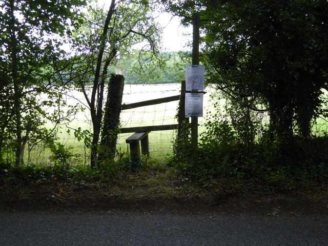
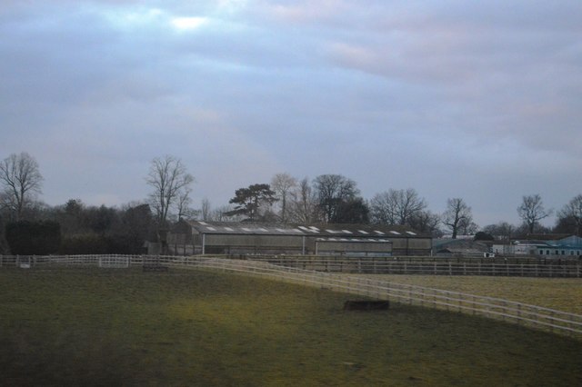
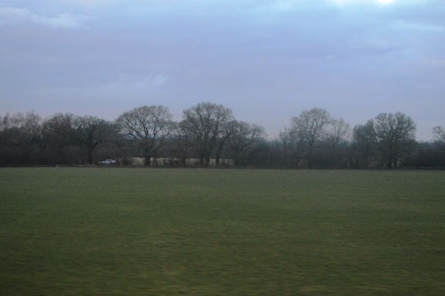
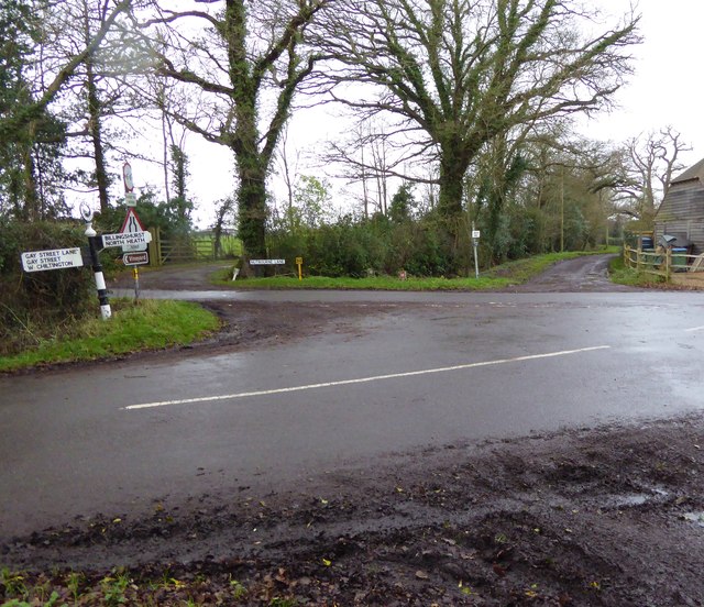
Heath, North Images

Images are sourced within 2km of 50.980816/-0.475126 or Grid Reference TQ0721. Thanks to Geograph Open Source API. All images are credited.

Closed footpath off Broomers Hill Lane
Junction of footpath and bridleway west of Borough Farm
The gates at Borough Farm The footpath is on the extreme left of the image.
The gates at Borough Farm
The footpath is on the extreme left of the image.
Looking across Nutbourne Lane at Beedings drive
Entrance to Redfold Vineyards See also <a title="https://www.geograph.org.uk/photo/2225927" href="https://www.geograph.org.uk/photo/2225927">Link</a> from 2011.
Entrance to Redfold Vineyards
See also Link from 2011.
Todhurst Farm
Todhurst Farm
Field by Stane Street
Unusual garden ornament in Adversane
Looking north on Stane Street south of Adversane
Footpath by Adversane Caravan Park The path leads to Stane Street.
Footpath by Adversane Caravan Park
The path leads to Stane Street.
Short stretch of footpath between bends This is south of Westlands Farm.
Short stretch of footpath between bends
This is south of Westlands Farm.
Footbridge on path near Westlands Farm
Junction of Nutbourne and Gay Street Lanes with crossing footpath For a view the other way see <a title="https://www.geograph.org.uk/photo/298829" href="https://www.geograph.org.uk/photo/298829">Link</a>.
Junction of Nutbourne and Gay Street Lanes with crossing footpath
For a view the other way see Link.
Footpath goes west from Nutbourne Lane
Footpath goes east from Gay Street Lane
Dog at crossing paths The animal was very muddy but friendly and we hit it off.
For a view the other way see <a title="https://www.geograph.org.uk/photo/4377803" href="https://www.geograph.org.uk/photo/4377803">Link</a>.
Dog at crossing paths
The animal was very muddy but friendly and we hit it off. For a view the other way see Link.
A bit of a mess at footpath junction The canine guardian of the crossing paths (see <a href="https://www.geograph.org.uk/photo/4771062">TQ0721 : Dog at crossing paths</a>) can be seen on the extreme left beyond the pile of rubble.
A bit of a mess at footpath junction
The canine guardian of the crossing paths (see TQ0721 : Dog at crossing paths) can be seen on the extreme left beyond the pile of rubble.
Footpath crosses stream on plank bridge See also <a title="https://www.geograph.org.uk/photo/4377984" href="https://www.geograph.org.uk/photo/4377984">Link</a> for a picture earlier in the year.
Footpath crosses stream on plank bridge
See also Link for a picture earlier in the year.
Show me another place!

Heath, North is located at Grid Ref: TQ0721 (Lat: 50.980816, Lng: -0.475126)

Administrative County: West Sussex

District: Horsham

Police Authority: Sussex

What 3 Words

///burglars.tune.intend. Near Pulborough, West Sussex

Nearby Locations

Heath, North North Heath

Related Wikis

North Heath

North Heath is a hamlet in the Horsham District of West Sussex, England. It lies just off the A29 road 1.9 miles (3 km) north of Pulborough. The Brinsbury...

Gay Street, West Sussex

Gay Street is a hamlet in the Horsham District of West Sussex, England. It lies on the North Heath to West Chiltington road 1.9 miles (3.1 km) northeast...

Pulborough (electoral division)

Pulborough is an electoral division of West Sussex in the United Kingdom and returns one member to sit on West Sussex County Council. The current County...

Codmore Hill

Codmore Hill is a hamlet in the Horsham District of West Sussex, England. It lies on the A29 road 1 mile (1.6 km) north of Pulborough. It is in the civil...

Adversane

Adversane is a large hamlet in the Horsham District of West Sussex, England, located 1.5 miles south of Billingshurst (where, at the 2011 Census, the population...

Nutbourne, Horsham

Nutbourne is a hamlet running north–south situated 1.5 miles (2.4 km) east of Pulborough in the Horsham District of West Sussex and is in Pulborough civil...
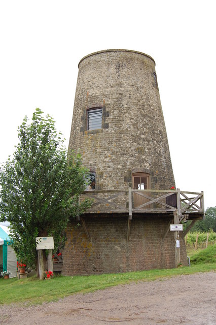
Nutbourne Windmill

Nutbourne Windmill is a tower mill at Nutbourne, Sussex, England which has been converted to retail use. == History == Nutbourne Windmill was built in...

Marehill Quarry

Marehill Quarry is a 1.1-hectare (2.7-acre) geological Site of Special Scientific Interest east of Pulborough in West Sussex. It is owned and managed...

Nearby Amenities

Located within 500m of 50.980816,-0.475126
Source: Landsat photo
Lat/Long: 50.9817403/-0.4791456
Source: Landsat photo
Lat/Long: 50.9816299/-0.4792794
Barrier: stile
Foot: yes
Lat/Long: 50.9769318/-0.4737904
Turning Loop
Turning Circle: circle
Lat/Long: 50.9792157/-0.4705433
Barrier: stile
Lat/Long: 50.9795487/-0.4799707
Railway: crossing
Lat/Long: 50.9849835/-0.4763713
Railway: crossing
Lat/Long: 50.9849945/-0.4764121
Railway: crossing
Lat/Long: 50.9803829/-0.480779
Railway: crossing
Lat/Long: 50.9804158/-0.4808035
North Heath
Place: hamlet
Lat/Long: 50.9819341/-0.4763013
Communication Mobile Phone: yes
Man Made: mast
Tower Type: communication
Lat/Long: 50.9775646/-0.476527
Barrier: stile
Lat/Long: 50.9826159/-0.4752966
Moons Farm
Place: isolated_dwelling
Lat/Long: 50.9792023/-0.470111
Little Brinsbury Farm
Place: farm
Lat/Long: 50.9812936/-0.4692376
Wansey Valley Farm
Place: farm
Lat/Long: 50.9790233/-0.4810766
Glebe Farm
Place: isolated_dwelling
Lat/Long: 50.9803652/-0.4732881
Gennetts Farm
Place: farm
Lat/Long: 50.979334/-0.4766519
The data included in this document is from www.openstreetmap.org. The data is made available under ODbL.

Have you been to Heath, North?

Leave your review of Heath, North below (or comments, questions and feedback).