Cowton, North

Settlement in Yorkshire Richmondshire

England

Cowton, North

North Cowton, Laurel Dene This property is completely obscured and enveloped by the thick roadside vegetation. According to the OS database there is a benchmark cut into road facing wall of the Laurel Dene farmhouse. Today, there was nothing to see.
North Cowton, Laurel Dene Credit: Mel Towler

Cowton is a small village located in North Yorkshire, England. Situated in the northern part of the county, it falls within the district of Hambleton and the civil parish of Felixkirk. With a population of around 200 residents, it exudes a quaint and peaceful charm.

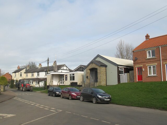
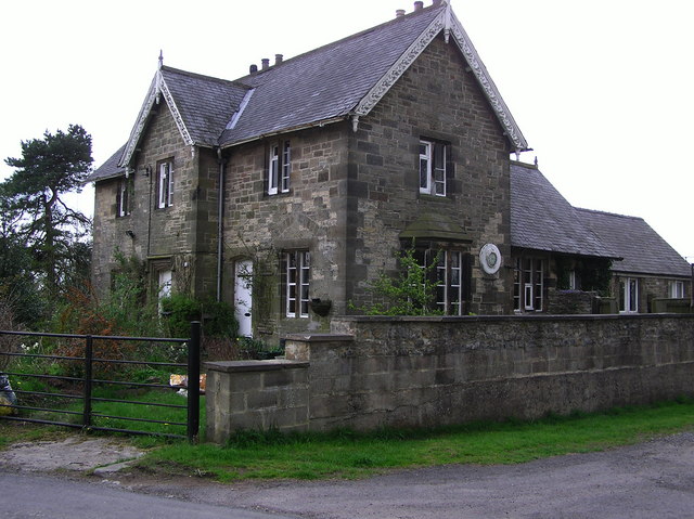
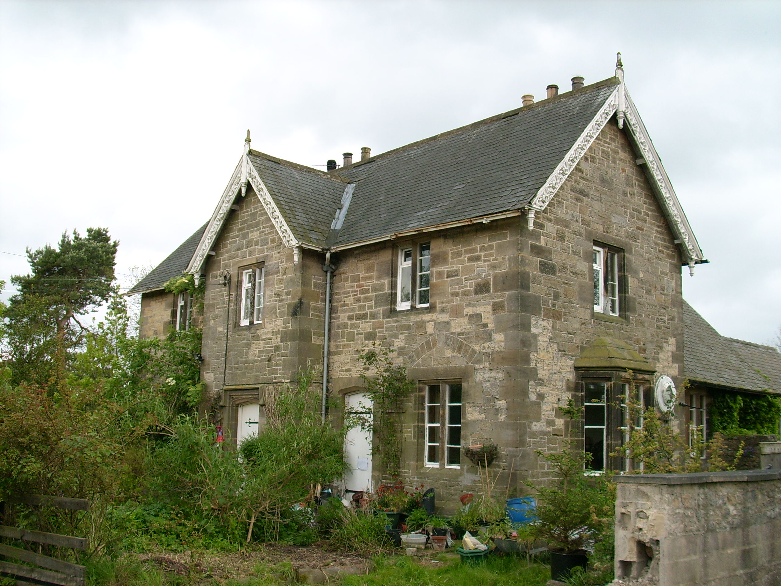
Surrounded by rolling countryside and picturesque views, Cowton offers a serene environment for its inhabitants. The village is primarily residential, consisting of traditional stone houses and cottages that add to its idyllic appeal. The local community is tight-knit and friendly, fostering a warm and welcoming atmosphere.

Despite its small size, Cowton is not devoid of amenities. The village boasts a local pub, which serves as a hub for socializing and offers a range of food and drinks. Additionally, there are various walking and cycling routes that allow residents and visitors to explore the stunning natural beauty of the area.

Cowton's location provides easy access to nearby towns and cities. Thirsk, a market town renowned for its connections to author James Herriot, is just a short drive away. The city of York, with its rich history and cultural attractions, is also within reach, offering residents the opportunity to enjoy a wider range of amenities and entertainment options.

In summary, Cowton is a charming village in North Yorkshire, offering a tranquil and close-knit community, surrounded by beautiful countryside, and conveniently located near larger towns and cities. It provides a perfect retreat for those seeking a peaceful rural lifestyle.

If you have any feedback on the listing, please let us know in the comments section below.

Cowton, North Images

Images are sourced within 2km of 54.428409/-1.571388 or Grid Reference NZ2703. Thanks to Geograph Open Source API. All images are credited.
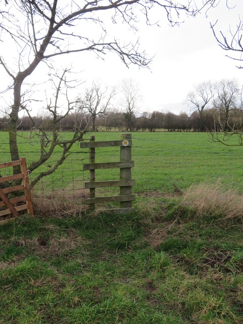
North Cowton, Laurel Dene This property is completely obscured and enveloped by the thick roadside vegetation. According to the OS database there is a benchmark cut into road facing wall of the Laurel Dene farmhouse. Today, there was nothing to see.
North Cowton, Laurel Dene
This property is completely obscured and enveloped by the thick roadside vegetation. According to the OS database there is a benchmark cut into road facing wall of the Laurel Dene farmhouse. Today, there was nothing to see.
North Cowton church and hall The church itself <a href="https://www.geograph.org.uk/photo/4741036">NZ2804 :  St Luke's Church, North Cowton</a> is now closed, but the hall may well remain in use by the parish.
North Cowton church and hall
The church itself NZ2804 : St Luke's Church, North Cowton is now closed, but the hall may well remain in use by the parish.
Former church of St Luke, North Cowton  Originally constructed as a pastoral centre for the parish of East Cowton in 1968, St Luke’s was consecrated as a parish church on 21 October 1990 following the closure of St Mary's. it was closed on 1 July 2018 due to dwindling numbers and lack of step-free access. Since this photo it has been sold to a private buyer for secular use.
Former church of St Luke, North Cowton
Originally constructed as a pastoral centre for the parish of East Cowton in 1968, St Luke’s was consecrated as a parish church on 21 October 1990 following the closure of St Mary's. it was closed on 1 July 2018 due to dwindling numbers and lack of step-free access. Since this photo it has been sold to a private buyer for secular use.
Former church of St Luke, North Cowton - interior Originally constructed as a pastoral centre for the parish of East Cowton in 1968, St Luke’s was consecrated as a parish church on 21 October 1990 following the closure of St Mary's. The stone arch seen in the east wall came from St Mary's when it was demolished. 

St Luke's was closed on 1 July 2018 and since this photo it has been sold to a private buyer for secular use and there is no public access. See <a href="https://www.geograph.org.uk/photo/7364235">NZ2804 : Former church of St Luke, North Cowton </a> for the outside.
Former church of St Luke, North Cowton - interior
Originally constructed as a pastoral centre for the parish of East Cowton in 1968, St Luke’s was consecrated as a parish church on 21 October 1990 following the closure of St Mary's. The stone arch seen in the east wall came from St Mary's when it was demolished. St Luke's was closed on 1 July 2018 and since this photo it has been sold to a private buyer for secular use and there is no public access. See NZ2804 : Former church of St Luke, North Cowton for the outside.
Former church of St Luke, North Cowton - consecration plaque See <a href="https://www.geograph.org.uk/photo/7364235">NZ2804 : Former church of St Luke, North Cowton </a> for the outside of this church, which was built in 1968.
Former church of St Luke, North Cowton - consecration plaque
See NZ2804 : Former church of St Luke, North Cowton for the outside of this church, which was built in 1968.
Bridleway and old rail track diverge The former LNER Richmond branch rail track is seen here on the left, whilst to the right is bridleway number 20.52/7 heading towards North Cowton.
Bridleway and old rail track diverge
The former LNER Richmond branch rail track is seen here on the left, whilst to the right is bridleway number 20.52/7 heading towards North Cowton.
Bridleway towards North Cowton The bridleway [number 20.52/7] follows the edge of a rather soggy field towards a crossing of the old railway line.
Bridleway towards North Cowton
The bridleway [number 20.52/7] follows the edge of a rather soggy field towards a crossing of the old railway line.
A stile on a terrible path 'Stile' is hardly an appropriate description for this fence crossing as there are no footboards and the upright posts have barbed wire attached. However this is probably the easiest crossing on a dreadful footpath that involves rotted timber stiles, fighting with vegetation, avoiding electric fencing, and crossing two water filled ditches, one of which has a footbridge, according to the NYCC official map, but which in fact doesn't exist. Other walkers should avoid path 20.52/4 and walk along the roadside instead.
A stile on a terrible path
'Stile' is hardly an appropriate description for this fence crossing as there are no footboards and the upright posts have barbed wire attached. However this is probably the easiest crossing on a dreadful footpath that involves rotted timber stiles, fighting with vegetation, avoiding electric fencing, and crossing two water filled ditches, one of which has a footbridge, according to the NYCC official map, but which in fact doesn't exist. Other walkers should avoid path 20.52/4 and walk along the roadside instead.
Houses on Holywell Lane A road leading out of the village with what look like ex local authority houses on the left.
Houses on Holywell Lane
A road leading out of the village with what look like ex local authority houses on the left.
Village hall, North Cowton Other contributors have placed the hall in the adjacent square, but the map would suggest that it is just inside this grid square. There have also been changes in recent years as the small church that stood to the left of the hall has gone, and a new house has been erected in its place on what is a very restricted site.
Village hall, North Cowton
Other contributors have placed the hall in the adjacent square, but the map would suggest that it is just inside this grid square. There have also been changes in recent years as the small church that stood to the left of the hall has gone, and a new house has been erected in its place on what is a very restricted site.
Moulton Railway Station This railway station was called Moulton, despite being on the outskirts of North Cowton. The line to Richmond closed to passengers in March 1969 and to freight a year later. The Darlington bound platform still survives.
Moulton Railway Station
This railway station was called Moulton, despite being on the outskirts of North Cowton. The line to Richmond closed to passengers in March 1969 and to freight a year later. The Darlington bound platform still survives.
Site Of Richmond Platform, Moulton Station Moulton Station (actually at North Cowton) had staggered platforms either side of a level crossing on the North Cowton to Moulton Road. The Richmond bound platform and track bed no longer exists, now covered by a farm building.
Site Of Richmond Platform, Moulton Station
Moulton Station (actually at North Cowton) had staggered platforms either side of a level crossing on the North Cowton to Moulton Road. The Richmond bound platform and track bed no longer exists, now covered by a farm building.
North Cowton Village Green Taken late afternoon on a Wintry Sunday
North Cowton Village Green
Taken late afternoon on a Wintry Sunday
Richmond Branch Line Trackbed, North Cowton A view looking west towards Moulton Station on the closed Richmond railway line, this section being lifted in 1970. I believe this was the only bridge that crossed the line.
Richmond Branch Line Trackbed, North Cowton
A view looking west towards Moulton Station on the closed Richmond railway line, this section being lifted in 1970. I believe this was the only bridge that crossed the line.
Barf House Farm Farm and farmland viewed from the Dalton Gates to Moulton Road (unclassified)
Barf House Farm
Farm and farmland viewed from the Dalton Gates to Moulton Road (unclassified)
Former Straggleton Gates Level Crossing The Richmond Branch line crossed just to the right of the present five bar gate. The structure to the left is a mystery and may or may not have a railway history.
Former Straggleton Gates Level Crossing
The Richmond Branch line crossed just to the right of the present five bar gate. The structure to the left is a mystery and may or may not have a railway history.
Dalton  Gates The Darlington to Richmond Railway Crossed here.
Dalton Gates
The Darlington to Richmond Railway Crossed here.
North Cowton  Grange
North Cowton Grange
Show me another place!

Cowton, North is located at Grid Ref: NZ2703 (Lat: 54.428409, Lng: -1.571388)

Division: North Riding

Administrative County: North Yorkshire

District: Richmondshire

Police Authority: North Yorkshire

What 3 Words

///mentioned.driven.storyline. Near Scorton, North Yorkshire

Nearby Locations

North Cowton Cowton, North

Related Wikis

Moulton End

Moulton End is a hamlet in North Yorkshire, in England. The hamlet gradually built up around the now disused railway station formerly serving North Cowton...

Moulton railway station (North Yorkshire)

Moulton railway station was a railway station in what is now the Richmondshire district of North Yorkshire, England. It was situated near the village of...

North Cowton

North Cowton is a village and civil parish, located in Richmondshire, North Yorkshire, England. It is 8 miles (13 km) north-west of the county town of...

Atley Hill

Atley Hill is a hamlet in the Hambleton district of North Yorkshire, England. It is situated on the B1263 road between the A167 and the village of Scorton...

Nearby Amenities

Located within 500m of 54.428409,-1.571388
Post Box
Source: survey
Lat/Long: 54.4299243/-1.5779991
Power: pole
Lat/Long: 54.4319361/-1.5687883
Power: pole
Lat/Long: 54.4317635/-1.5701828
Power: pole
Lat/Long: 54.4315743/-1.5717358
Power: pole
Lat/Long: 54.4314017/-1.5731994
Power: pole
Lat/Long: 54.4312196/-1.5746467
Power: pole
Lat/Long: 54.4310257/-1.5761265
Power: pole
Lat/Long: 54.4321324/-1.5671483
Addr City: Northallerton
Addr Housenumber: 1
Addr Postcode: DL7 0HH
Addr Street: Station Road
Addr Suburb: North Cowton
Building: house
Lat/Long: 54.4284189/-1.5712888
Generator Method: photovoltaic
Generator Output Electricity: yes
Generator Source: solar
Generator Type: solar_photovoltaic_panel
Location: roof
Power: generator
Lat/Long: 54.4288039/-1.5674991
Generator Method: photovoltaic
Generator Output Electricity: yes
Generator Source: solar
Generator Type: solar_photovoltaic_panel
Location: roof
Power: generator
Lat/Long: 54.4288142/-1.5674194
The data included in this document is from www.openstreetmap.org. The data is made available under ODbL.

Have you been to Cowton, North?

Leave your review of Cowton, North below (or comments, questions and feedback).