North Cotes

Settlement in Lincolnshire East Lindsey

England

North Cotes

Ploughed-out (salt) sleech mounds on fen near North Coates: aerial 2022 (2) For sleech mounds and salt production see: <span class="nowrap"><a title="https://webapps.kent.gov.uk/KCC.ExploringKentsPast.Web.Sites.Public/SingleResult.aspx?uid=MKE2605" rel="nofollow ugc noopener" href="https://webapps.kent.gov.uk/KCC.ExploringKentsPast.Web.Sites.Public/SingleResult.aspx?uid=MKE2605">Link</a><img style="margin-left:2px;" alt="External link" title="External link - shift click to open in new window" src="https://s1.geograph.org.uk/img/external.png" width="10" height="10"/></span>
Ploughed-out (salt) sleech mounds on fen near North Coates: aerial 2022 (2) Credit: Simon Tomson

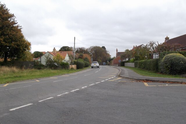
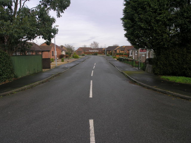
North Cotes is a charming village located in the East Lindsey district of Lincolnshire, England. Situated near the coast, it is nestled between the larger towns of Grimsby and Mablethorpe. With a population of around 700 residents, North Cotes offers a peaceful and close-knit community atmosphere.

The village is surrounded by beautiful countryside, with picturesque views of rolling hills and fertile farmland. It is also within close proximity to the Lincolnshire Wolds, an Area of Outstanding Natural Beauty, making it an ideal location for outdoor enthusiasts and nature lovers.

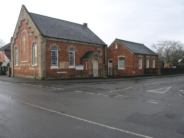
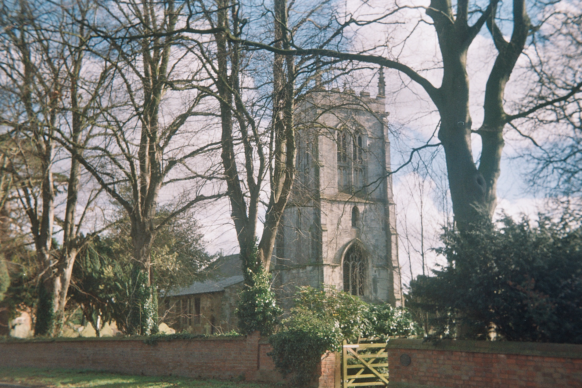
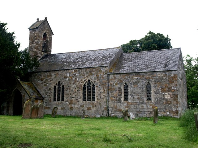
North Cotes boasts a rich history, dating back to medieval times. The village is known for its historic church, St. Nicholas Church, which dates back to the 13th century and features stunning architectural details. The village also has a number of well-preserved historic buildings, including traditional thatched cottages and charming farmhouses.

Despite its small size, North Cotes offers a range of amenities for its residents. These include a primary school, a village hall, a local pub, and a community shop. The village is also well-connected, with regular bus services to nearby towns and cities.

For those seeking recreational activities, North Cotes is home to several sports clubs, including football and cricket teams. The village also has access to scenic walking and cycling routes, allowing residents to explore the surrounding area.

Overall, North Cotes is a picturesque and tranquil village, offering a peaceful retreat from the hustle and bustle of city life. With its rich history, beautiful surroundings, and close-knit community, it is an idyllic place to call home.

If you have any feedback on the listing, please let us know in the comments section below.

North Cotes Images

Images are sourced within 2km of 53.485473/0.034050872 or Grid Reference TA3500. Thanks to Geograph Open Source API. All images are credited.

Ploughed-out (salt) sleech mounds on fen near North Coates: aerial 2022 (2) For sleech mounds and salt production see: <span class="nowrap"><a title="https://webapps.kent.gov.uk/KCC.ExploringKentsPast.Web.Sites.Public/SingleResult.aspx?uid=MKE2605" rel="nofollow ugc noopener" href="https://webapps.kent.gov.uk/KCC.ExploringKentsPast.Web.Sites.Public/SingleResult.aspx?uid=MKE2605">Link</a><img style="margin-left:2px;" alt="External link" title="External link - shift click to open in new window" src="https://s1.geograph.org.uk/img/external.png" width="10" height="10"/></span>
Ploughed-out (salt) sleech mounds on fen near North Coates: aerial 2022 (2)
For sleech mounds and salt production see: LinkExternal link
Ploughed-out (salt) sleech mounds on fen near North Coates: aerial 2022 (3) For sleech mounds and salt production see: <span class="nowrap"><a title="https://webapps.kent.gov.uk/KCC.ExploringKentsPast.Web.Sites.Public/SingleResult.aspx?uid=MKE2605" rel="nofollow ugc noopener" href="https://webapps.kent.gov.uk/KCC.ExploringKentsPast.Web.Sites.Public/SingleResult.aspx?uid=MKE2605">Link</a><img style="margin-left:2px;" alt="External link" title="External link - shift click to open in new window" src="https://s1.geograph.org.uk/img/external.png" width="10" height="10"/></span>
Ploughed-out (salt) sleech mounds on fen near North Coates: aerial 2022 (3)
For sleech mounds and salt production see: LinkExternal link
Ploughed-out (salt) sleech mounds on fen near North Coates: aerial 2022 (4) Near Poplar Farm.

For sleech mounds and salt production see: <span class="nowrap"><a title="https://webapps.kent.gov.uk/KCC.ExploringKentsPast.Web.Sites.Public/SingleResult.aspx?uid=MKE2605" rel="nofollow ugc noopener" href="https://webapps.kent.gov.uk/KCC.ExploringKentsPast.Web.Sites.Public/SingleResult.aspx?uid=MKE2605">Link</a><img style="margin-left:2px;" alt="External link" title="External link - shift click to open in new window" src="https://s1.geograph.org.uk/img/external.png" width="10" height="10"/></span>
Ploughed-out (salt) sleech mounds on fen near North Coates: aerial 2022 (4)
Near Poplar Farm. For sleech mounds and salt production see: LinkExternal link
Ploughed out sleech mounds near North Coates: aerial 2023 (1) The salt industry in Lincolnshire flourished during the Medieval period but was in decline by the seventeenth century and the bulk of these mounds will be Medieval and Post Medieval. The mounds are formed from the silt residues and waste from the salt production process. 

See: <span class="nowrap"><a title="https://www.heritagegateway.org.uk/Gateway/Results_Single.aspx?uid=54548d22-069e-4ccb-800d-aadf8a27122b&resourceID=19191" rel="nofollow ugc noopener" href="https://www.heritagegateway.org.uk/Gateway/Results_Single.aspx?uid=54548d22-069e-4ccb-800d-aadf8a27122b&resourceID=19191">Link</a><img style="margin-left:2px;" alt="External link" title="External link - shift click to open in new window" src="https://s1.geograph.org.uk/img/external.png" width="10" height="10"/></span>
Ploughed out sleech mounds near North Coates: aerial 2023 (1)
The salt industry in Lincolnshire flourished during the Medieval period but was in decline by the seventeenth century and the bulk of these mounds will be Medieval and Post Medieval. The mounds are formed from the silt residues and waste from the salt production process. See: LinkExternal link
Ploughed out sleech mounds near North Coates: aerial 2023 (2) The salt industry in Lincolnshire flourished during the Medieval period but was in decline by the seventeenth century and the bulk of these mounds will be Medieval and Post Medieval. The mounds are formed from the silt residues and waste from the salt production process. 

See: <span class="nowrap"><a title="https://www.heritagegateway.org.uk/Gateway/Results_Single.aspx?uid=54548d22-069e-4ccb-800d-aadf8a27122b&resourceID=19191" rel="nofollow ugc noopener" href="https://www.heritagegateway.org.uk/Gateway/Results_Single.aspx?uid=54548d22-069e-4ccb-800d-aadf8a27122b&resourceID=19191">Link</a><img style="margin-left:2px;" alt="External link" title="External link - shift click to open in new window" src="https://s1.geograph.org.uk/img/external.png" width="10" height="10"/></span>
Ploughed out sleech mounds near North Coates: aerial 2023 (2)
The salt industry in Lincolnshire flourished during the Medieval period but was in decline by the seventeenth century and the bulk of these mounds will be Medieval and Post Medieval. The mounds are formed from the silt residues and waste from the salt production process. See: LinkExternal link
Old river course and ploughed out saltern mounds at Tetney Lock: aerial 2023 (1) See: <span class="nowrap"><a title="https://www.heritagegateway.org.uk/Gateway/Results_Single.aspx?uid=54548d22-069e-4ccb-800d-aadf8a27122b&resourceID=19191" rel="nofollow ugc noopener" href="https://www.heritagegateway.org.uk/Gateway/Results_Single.aspx?uid=54548d22-069e-4ccb-800d-aadf8a27122b&resourceID=19191">Link</a><img style="margin-left:2px;" alt="External link" title="External link - shift click to open in new window" src="https://s1.geograph.org.uk/img/external.png" width="10" height="10"/></span>
Old river course and ploughed out saltern mounds at Tetney Lock: aerial 2023 (1)
See: LinkExternal link
Old river course and ploughed out saltern mounds at Tetney Lock: aerial 2023 (2) See: <span class="nowrap"><a title="https://www.heritagegateway.org.uk/Gateway/Results_Single.aspx?uid=54548d22-069e-4ccb-800d-aadf8a27122b&resourceID=19191" rel="nofollow ugc noopener" href="https://www.heritagegateway.org.uk/Gateway/Results_Single.aspx?uid=54548d22-069e-4ccb-800d-aadf8a27122b&resourceID=19191">Link</a><img style="margin-left:2px;" alt="External link" title="External link - shift click to open in new window" src="https://s1.geograph.org.uk/img/external.png" width="10" height="10"/></span>
Old river course and ploughed out saltern mounds at Tetney Lock: aerial 2023 (2)
See: LinkExternal link
A1031 in Marshchapel
Old Fleet Drain Looking towards Thoresby Bridge
Old Fleet Drain
Looking towards Thoresby Bridge
Footpath and Canal The footpath by the side of the Louth Canal is still in use, the canal however no longer carries the traffic for which it was built.
Footpath and Canal
The footpath by the side of the Louth Canal is still in use, the canal however no longer carries the traffic for which it was built.
Marshchapel Methodist Did this chapel give its name to the village?
Marshchapel Methodist
Did this chapel give its name to the village?
Plumtree Drive No sign of a plum tree at this end of Plumtree Drive in Marshchapel, there is a Eucalyptus however.
Plumtree Drive
No sign of a plum tree at this end of Plumtree Drive in Marshchapel, there is a Eucalyptus however.
Old Sluice Mechanism Looking along the Louth Canal at Thoresby Bridge.
Old Sluice Mechanism
Looking along the Louth Canal at Thoresby Bridge.
Footpath Along The Louth Canal
Sluice - Thoresby Bridge
Louth Canal Looking north from Thoresby Bridge
Louth Canal
Looking north from Thoresby Bridge
Footpath by the Louth Canal Footpath by the sluice gate on the west side of the Louth Canal from Thoresby Bridge
Footpath by the Louth Canal
Footpath by the sluice gate on the west side of the Louth Canal from Thoresby Bridge
Thoresby Bridge Farm Farmhouse and old wharf building by the Louth Canal at Thoresby Bridge
Thoresby Bridge Farm
Farmhouse and old wharf building by the Louth Canal at Thoresby Bridge
Show me another place!

North Cotes is located at Grid Ref: TA3500 (Lat: 53.485473, Lng: 0.034050872)

Division: Parts of Lindsey

Administrative County: Lincolnshire

District: East Lindsey

Police Authority: Lincolnshire

What 3 Words

///ghosts.cling.candles. Near Tetney, Lincolnshire

Nearby Locations

North Cotes Cotes, North

Related Wikis

North Cotes

North Cotes or North Coates is a village and civil parish in the East Lindsey district of Lincolnshire, England. It is situated close to the coast, 4 miles...

Marshchapel

Marshchapel is a coastal village and civil parish in the East Lindsey district of Lincolnshire, England. It is approximately 11 miles (18 km) south-east...

Tetney Lock

Tetney Lock is a part of Tetney, East Lindsey, Lincolnshire, England. The East side of the canal leads out to the North Sea, and the West Side leads to...
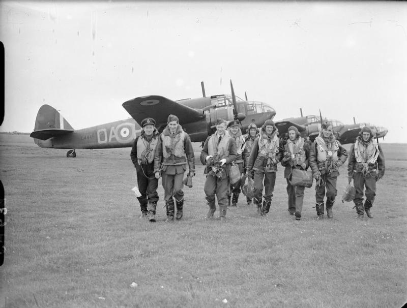
RAF North Coates

Royal Air Force North Coates or more simply RAF North Coates is a former Royal Air Force station in Lincolnshire, England, six miles south-east of Cleethorpes...
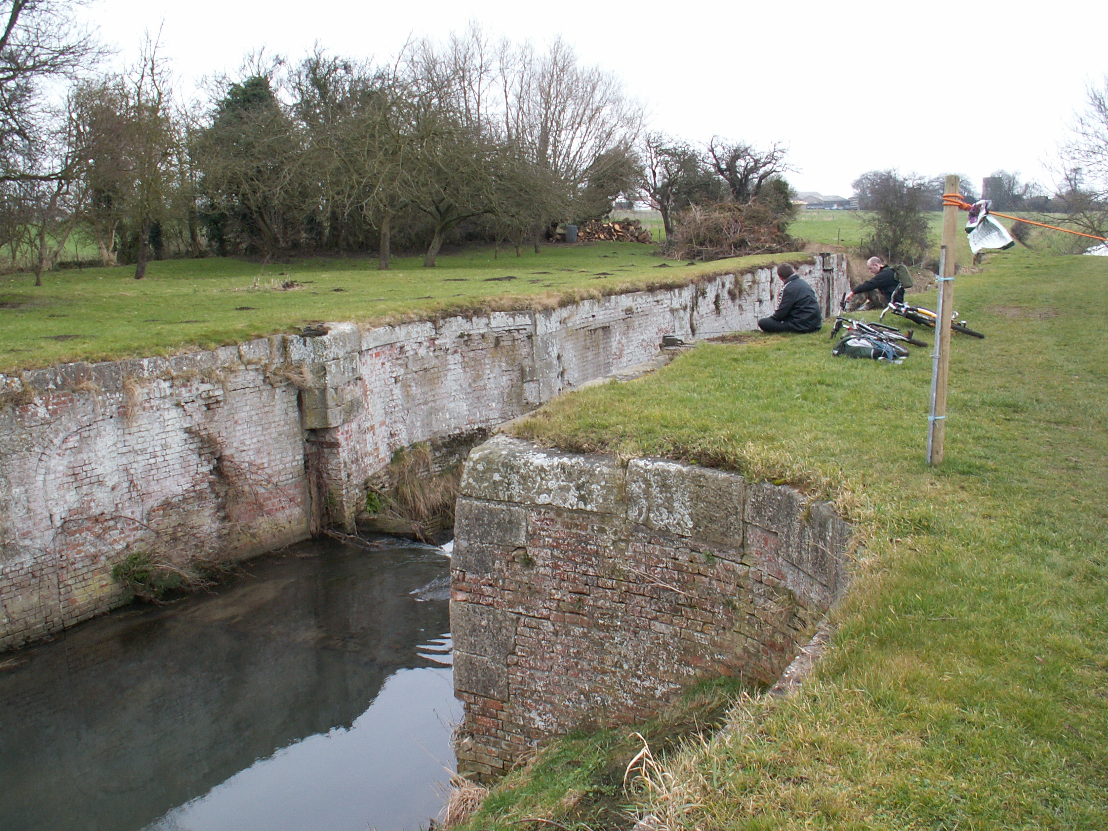
Louth Navigation

The Louth Navigation was a canalisation of the River Lud. It ran for 11 miles (18 km) from Louth in Lincolnshire, England, to Tetney Haven, at the mouth...

Tetney

Tetney is a village in the East Lindsey district of Lincolnshire, England, just west of the Prime Meridian. == History == On the edge of the village is...

Fulstow

Fulstow is a marsh village and civil parish in the East Lindsey district of Lincolnshire, England. It is situated 6 miles (10 km) north of Louth and 8...

Covenham Reservoir

Covenham Reservoir, located in East Lindsey is a 200-acre reservoir and treatment works constructed between 1963 and 1978 by W. & C. French. The reservoir...

Nearby Amenities

Located within 500m of 53.485473,0.034050872
North Cotes
Alt Name: North Coates
Is In: Lincolnshire, England, UK
Note: Historically called North Coates, more commonly referred to as North Cotes (spelt without an 'a').
Place: village
Source: npe
Wikidata: Q7054877
Lat/Long: 53.4847044/0.032448
Bus Stop
St Nicholas's Church
Naptan AtcoCode: 270000009926
Naptan Bearing: N
Naptan CommonName: St Nicholas's Church
Naptan Indicator: N - bound
Naptan Landmark: St Nicholas's Church
Naptan NaptanCode: linjgjgd
Naptan Street: Fleetway
Naptan Verified: no
Source: naptan_import
Lat/Long: 53.4848958/0.0341027
Bus Stop
St Nicholas's Church
Naptan AtcoCode: 270000009927
Naptan Bearing: NW
Naptan CommonName: St Nicholas's Church
Naptan Indicator: NW - bound
Naptan Landmark: St Nicholas's Church
Naptan NaptanCode: linjgjgj
Naptan Street: Lock Road
Naptan Verified: no
Source: naptan_import
Lat/Long: 53.4855654/0.0338483
Bus Stop
St Nicholas's Church
Naptan AtcoCode: 2700LNC00291
Naptan Bearing: SE
Naptan CommonName: St Nicholas's Church
Naptan Indicator: SE - bound
Naptan Landmark: St Nicholas's Church
Naptan NaptanCode: linadjpj
Naptan Street: Lock Road
Naptan Verified: no
Source: naptan_import
Lat/Long: 53.4855523/0.0340889
Bus Stop
St Nicholas's Church
Naptan AtcoCode: 2700LNCP3022
Naptan Bearing: S
Naptan CommonName: St Nicholas's Church
Naptan Indicator: S - bound
Naptan Landmark: St Nicholas's Church
Naptan NaptanCode: linawgdt
Naptan Street: Fleetway
Naptan Verified: no
Source: naptan_import
Lat/Long: 53.4849202/0.0342546
The Grange
Place: farm
Source: Bing
Lat/Long: 53.4866816/0.0397689
Historic: memorial
Memorial: war_memorial
Lat/Long: 53.4853104/0.0342404
Public Bookcase
Booth: K6
Disused Amenity: telephone
Man Made: telephone_box
Old Phone: +44 1472 388311
Public Bookcase Type: phone_box
Lat/Long: 53.4854573/0.034176
Generator Method: photovoltaic
Generator Output Electricity: yes
Generator Source: solar
Generator Type: solar_photovoltaic_panel
Location: roof
Power: generator
Lat/Long: 53.4878756/0.0309336
Generator Method: photovoltaic
Generator Output Electricity: yes
Generator Source: solar
Generator Type: solar_photovoltaic_panel
Location: roof
Power: generator
Lat/Long: 53.4880399/0.0316986
Generator Method: photovoltaic
Generator Output Electricity: yes
Generator Source: solar
Generator Type: solar_photovoltaic_panel
Location: roof
Power: generator
Lat/Long: 53.4881436/0.0298265
Leisure: playground
Lat/Long: 53.4867188/0.0334612
Information: board
Tourism: information
Lat/Long: 53.4863853/0.0331339
Post Box
Collection Times: Mo-Fr 09:00; Sa 07:00
Location: Lock Road
Operator: Royal Mail
Post Box Type: lamp
Ref: DN36 159
Lat/Long: 53.4872244/0.0322502
Post Box
Check Date: 2024-03-14
Collection Plate: CP7D
Collection Times: Mo-Fr 09:00; Sa 07:00
Image: https://i.postimg.cc/MGLwhq0Q/DN36-94D.jpg
Location: Fleetway
Operator: Royal Mail
Post Box Mounting: pier
Post Box Type: lamp
Ref: DN36 94D
Royal Cypher: EIIR
Royal Cypher Wikidata: Q33102113
Source: survey
Lat/Long: 53.4818698/0.0299911
Barrier: kissing_gate
Kissing Gate: triangular_profile
Material: metal
Lat/Long: 53.4842974/0.0336919
The data included in this document is from www.openstreetmap.org. The data is made available under ODbL.

Have you been to North Cotes?

Leave your review of North Cotes below (or comments, questions and feedback).