Cerney, North

Settlement in Gloucestershire Cotswold

England

Cerney, North

An inn at North Cerney
An inn at North Cerney Credit: Andrew Longton

Cerney is a small village located in the North of Gloucestershire, England. Situated on the edge of the picturesque Cotswolds, this rural settlement is surrounded by rolling hills and scenic countryside. It is part of the larger civil parish of North Cerney, which encompasses several other nearby villages.

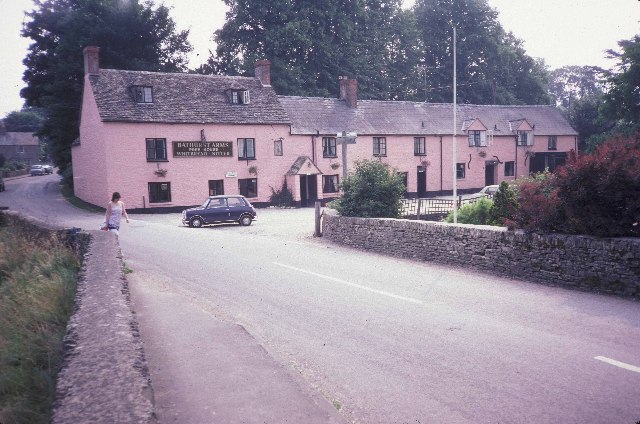
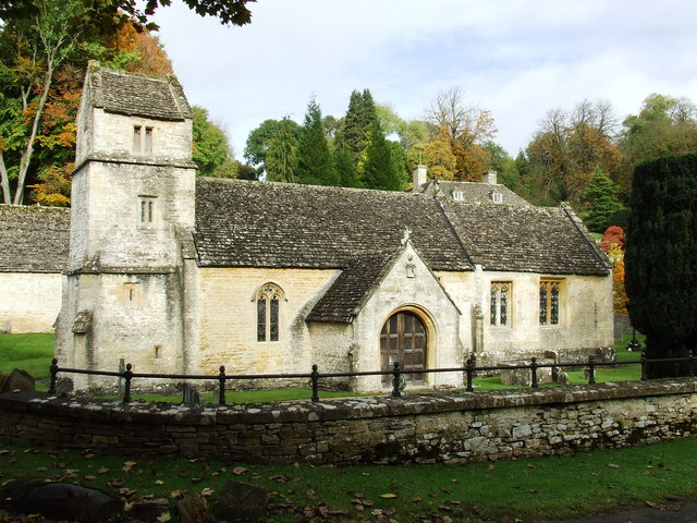
The village itself is home to a close-knit community, with a population of around 500 residents. It boasts a charming and traditional English village atmosphere, with its well-preserved historic buildings and quaint cottages. The centerpiece of Cerney is the beautiful All Saints' Church, which dates back to the 12th century and stands as a testament to the village's rich history.

Despite its small size, Cerney offers a range of amenities to its residents. These include a primary school, a village hall, and a local pub, providing a focal point for social gatherings and community events. The village also benefits from its proximity to larger towns such as Cirencester and Cheltenham, which provide additional amenities and services.

For nature enthusiasts, Cerney is a haven, offering ample opportunities for outdoor activities. The nearby Cotswold Water Park is a popular destination for boating, fishing, and wildlife watching, while the surrounding countryside provides numerous walking and cycling routes.

In summary, Cerney is a charming and idyllic village in the North of Gloucestershire, offering a peaceful rural lifestyle amidst stunning natural scenery.

If you have any feedback on the listing, please let us know in the comments section below.

Cerney, North Images

Images are sourced within 2km of 51.770717/-1.971853 or Grid Reference SP0208. Thanks to Geograph Open Source API. All images are credited.

An inn at North Cerney
Rendcomb Village Village street in Rendcomb, looking south-west.
Rendcomb Village
Village street in Rendcomb, looking south-west.
Rendcomb College Part of Rendcomb College, formed from a block of stables with a French influence. Looking west.
Rendcomb College
Part of Rendcomb College, formed from a block of stables with a French influence. Looking west.
Old Water Wheel in Bagendon This water wheel is located in the farm next to St. Margaret's Church in Bagendon. It was once used to work a cider press, but now water extraction has dried up the springs that used to drive it.
Old Water Wheel in Bagendon
This water wheel is located in the farm next to St. Margaret's Church in Bagendon. It was once used to work a cider press, but now water extraction has dried up the springs that used to drive it.
Old Park Farm, Woodmancote.
Rendcomb College. In all its Cotswold Gothic splendour.
Rendcomb College.
In all its Cotswold Gothic splendour.
Recycling facilities in Rendcomb
Gate by the Dog Kennel Piece Plantation.
Barns at Nordown Farm
Muddy track off Chapel Lane, North Cerney.
Telephone Exchange at North Cerney.
Bathurst Arms and village street, North Cerney.
North Cerney's cricket ground. On a bit of a slope!
North Cerney's cricket ground.
On a bit of a slope!
Lane approaching Woodmancote from the south. A late autumn scene.
Lane approaching Woodmancote from the south.
A late autumn scene.
A gate and footpath with a fine view of Merchants Downs.
Country lane near Bagendon House.
War memorial at Bagendon.
Entrance to Perrot's Brook Farm.
Show me another place!

Cerney, North is located at Grid Ref: SP0208 (Lat: 51.770717, Lng: -1.971853)

Administrative County: Gloucestershire

District: Cotswold

Police Authority: Gloucestershire

What 3 Words

///wades.ramming.shook. Near Stratton, Gloucestershire

Nearby Locations

North Cerney Cerney, North

Related Wikis

North Cerney

North Cerney is a village and civil parish in the English county of Gloucestershire, and lies within the Cotswolds, a range of hills designated an Area...

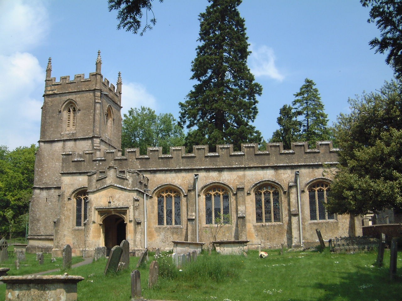
Church of St Margaret, Bagendon

The Anglican Church of St Margaret at Bagendon in the Cotswold District of Gloucestershire, England was built in the 12th century. It is a grade I listed...

Rendcomb

Rendcomb is a village in the Cotswold local authority area of the English county of Gloucestershire. It is about five miles north of Cirencester in the...

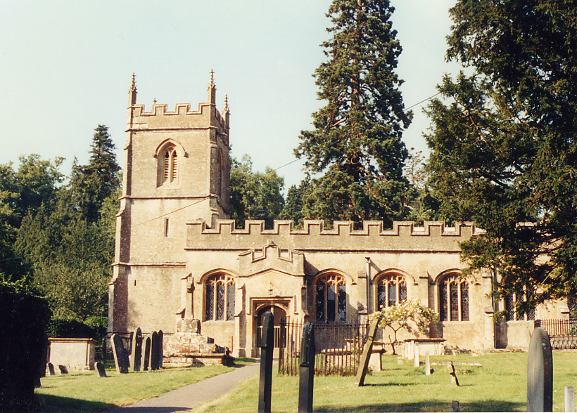
Church of St Peter, Rendcomb

The Anglican Church of St Peter within the grounds of Rendcomb College at Rendcomb in the Cotswold District of Gloucestershire, England was rebuilt in...

Rendcomb College

Rendcomb College is a public school (English private boarding and day school) for pupils aged 3–18, located in the village of Rendcomb five miles north...

Woodmancote, Cirencester

Woodmancote is a Cotswolds village near Cirencester, Gloucestershire, England. The village lies just off the A435. The village is 0.2 square miles (52...

Bagendon

Bagendon is a village and civil parish in the Cotswold district of Gloucestershire, England, about four miles north of Cirencester. According to the 2001...

A417 road

The A417 is a main road in England running from Streatley, Berkshire to Hope under Dinmore, Herefordshire. It is best known for its section between Cirencester...

Nearby Amenities

Located within 500m of 51.770717,-1.971853
North Cerney
Place: village
Source: NPE
Lat/Long: 51.7706357/-1.971829
Bus Stop
Phone Box
Bus: yes
Naptan AtcoCode: 1600GL3505
Naptan Bearing: W
Naptan CommonName: Phone Box
Naptan NaptanCode: glogadam
Naptan Street: Opp Oxyard Bungalows
Naptan Verified: no
Public Transport: platform
Source: naptan_import
Lat/Long: 51.7705043/-1.9719054
Bus Stop
North Cerney School
Bus: yes
Naptan AtcoCode: 1600GL3506
Naptan Bearing: NE
Naptan CommonName: North Cerney School
Naptan NaptanCode: glogadag
Naptan Street: Chapel Ln
Naptan Verified: no
Public Transport: platform
Source: naptan_import
Lat/Long: 51.7709136/-1.9717538
Bus Stop
Bathurst Arms
Bus: yes
Naptan AtcoCode: 1600GLC043
Naptan Bearing: SE
Naptan CommonName: Bathurst Arms
Naptan NaptanCode: glodwtjm
Naptan Street: A435
Naptan Verified: no
Public Transport: platform
Source: naptan_import
Lat/Long: 51.7697362/-1.973769
Bus Stop
Bathurst Arms
Bus: yes
Naptan AtcoCode: 1600GLC044
Naptan Bearing: N
Naptan CommonName: Bathurst Arms
Naptan Indicator: Opp
Naptan NaptanCode: glodwtgw
Naptan Street: A435
Naptan Verified: no
Public Transport: platform
Source: naptan_import
Lat/Long: 51.7703567/-1.9742324
Bus Stop
The Orchard
Bus: yes
Naptan AtcoCode: 1600GLC623
Naptan Bearing: SW
Naptan CommonName: The Orchard
Naptan NaptanCode: glogadma
Naptan Street: Chapel Lane
Naptan Verified: no
Public Transport: platform
Source: naptan_import
Lat/Long: 51.7723336/-1.969492
Bus Stop
The Orchard
Bus: yes
Naptan AtcoCode: 1600GLC624
Naptan Bearing: NE
Naptan CommonName: The Orchard
Naptan Indicator: Opp
Naptan NaptanCode: glogadmd
Naptan Street: Chapel Lane
Naptan Verified: no
Public Transport: platform
Source: naptan_import
Lat/Long: 51.7724235/-1.969463
Bus Stop
Village Hall
Bus: yes
Naptan AtcoCode: 1600GLC632
Naptan Bearing: E
Naptan CommonName: Village Hall
Naptan NaptanCode: glodwtpa
Naptan Street: Dark Lane
Naptan Verified: no
Public Transport: platform
Source: naptan_import
Lat/Long: 51.7704553/-1.9728266
Pub
Bathhurst Arms
Internet Access: wlan
Internet Access Fee: no
Lat/Long: 51.7701303/-1.9731691
Telephone
Defibrillator
Booth: K6
Covered: booth
Defibrillator Location: inside old red phone box in North Cerney
Emergency: defibrillator
Listed Status: Grade II
Man Made: telephone_box
Lat/Long: 51.7704992/-1.9720035
Post Box
Post Box Type: wall
Royal Cypher: EIIR
Royal Cypher Wikidata: Q33102113
Lat/Long: 51.7704444/-1.9729459
Advertising: board
Lat/Long: 51.770434/-1.9729847
Advertising: board
Lat/Long: 51.7704232/-1.9730371
Power: pole
Source: bing
Lat/Long: 51.7728269/-1.9668439
Power: pole
Source: bing
Lat/Long: 51.772902/-1.9657265
Barrier: stile
Material: wood
Stile: stepover
Lat/Long: 51.7682856/-1.9740324
The data included in this document is from www.openstreetmap.org. The data is made available under ODbL.

Have you been to Cerney, North?

Leave your review of Cerney, North below (or comments, questions and feedback).