Bitchburn, North

Settlement in Durham

England

Bitchburn, North

Constantine Farm
Constantine Farm Credit: Alex McGregor

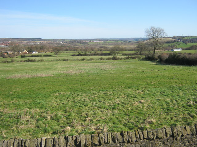
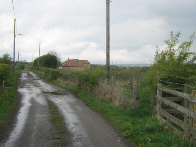
Bitchburn is a small village located in the county of Durham, in the North East of England. Situated about 5 miles west of the town of Crook, Bitchburn falls within the civil parish of Byers Green. The village is surrounded by picturesque countryside, with rolling hills and farmland dominating the landscape.

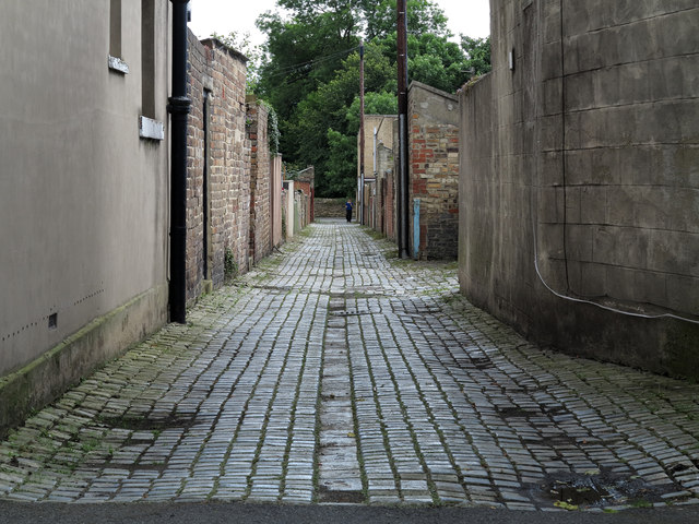
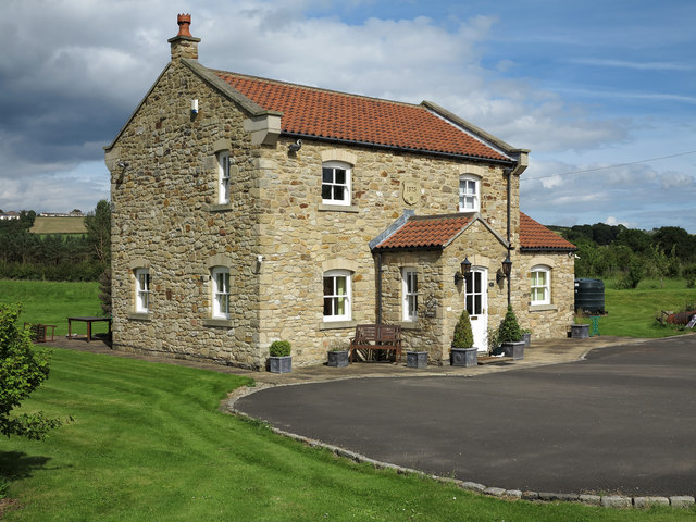
Bitchburn has a relatively small population, with a close-knit community that is known for its friendly and welcoming atmosphere. The village is primarily residential, consisting of a mix of traditional stone-built houses and more modern properties. There are no major amenities in Bitchburn itself, but nearby towns such as Crook and Bishop Auckland provide access to essential services and facilities.

The village benefits from its location, as it offers a peaceful and tranquil environment for residents. It is an ideal place for those who enjoy the countryside and outdoor activities, with numerous walking and cycling routes in the surrounding area. Bitchburn also boasts beautiful natural scenery, including the nearby Bitchburn Beck, a small stream that winds through the village.

Despite its small size, Bitchburn has a rich history, with evidence of human settlement in the area dating back to Roman times. The village has retained some of its historic charm, with a few older buildings still standing. Overall, Bitchburn is a charming village that provides a quiet retreat for its residents, while also offering easy access to the amenities of larger towns nearby.

If you have any feedback on the listing, please let us know in the comments section below.

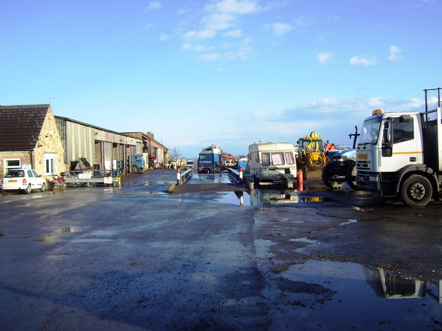
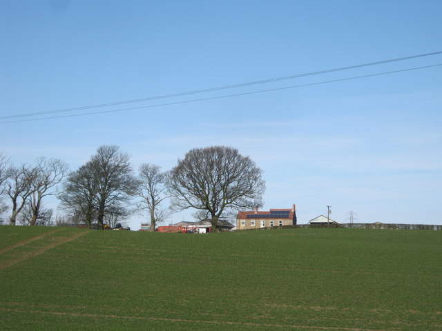
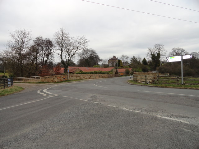
Bitchburn, North Images

Images are sourced within 2km of 54.688616/-1.732373 or Grid Reference NZ1732. Thanks to Geograph Open Source API. All images are credited.

Constantine Farm
Constantine Farm
Farmhouse at New House Farm
Blakeley Hill Farm
Blakeley Hill Farm
Grazing land east of Hunwick
Pasture Land at Lane Ends
Footpath off Roman Road north of Hunwick
The visitor centre at Low Barnes Low Barnes is a reserve of Durham Wildlife Trust.
The visitor centre at Low Barnes
Low Barnes is a reserve of Durham Wildlife Trust.
Alder wood at Low Barnes Alders will grow in wet conditions and these occupy a former oxbow lake which was once the course of the River Wear.
Alder wood at Low Barnes
Alders will grow in wet conditions and these occupy a former oxbow lake which was once the course of the River Wear.
Slotburn Bridge Bridge for the Weardale Railway over Low Lane.
Slotburn Bridge
Bridge for the Weardale Railway over Low Lane.
Beechburn crossroads Crossroads on Low Lane near High Grange.
Beechburn crossroads
Crossroads on Low Lane near High Grange.
Beechburn Beck Little stream which runs through the fields at Beechburn Bridge.
Beechburn Beck
Little stream which runs through the fields at Beechburn Bridge.
Road leading onto the bridge over the Wear
Public footpath on track to and beyond Victoria Farm Another footpath leaves the track at right to Victoria
Public footpath on track to and beyond Victoria Farm
Another footpath leaves the track at right to Victoria
Level crossing for footpath and multi user route over the Weardale Railway At this point the multi user route crosses to be alongside the southern side of the railway
Level crossing for footpath and multi user route over the Weardale Railway
At this point the multi user route crosses to be alongside the southern side of the railway
Western side of Field House Bridge over the Weardale Railway
Level crossing over the Weardale Railway for access to Enginemans Terrace
Howden-le-Wear: back lane of School Street The back lane is a feature of terraced housing throughout the UK.
Houses of School Street are certainly to the right in the image and possibly to the left as well. The building immediately to the left is an unusually named public house: 'The Australian'.
Howden-le-Wear: back lane of School Street
The back lane is a feature of terraced housing throughout the UK. Houses of School Street are certainly to the right in the image and possibly to the left as well. The building immediately to the left is an unusually named public house: 'The Australian'.
Victoria Farm Although named as a farm this property has been totally gentrified and now seems to be just an attractive detached home.
Victoria Farm
Although named as a farm this property has been totally gentrified and now seems to be just an attractive detached home.
Show me another place!

Bitchburn, North is located at Grid Ref: NZ1732 (Lat: 54.688616, Lng: -1.732373)

Unitary Authority: County Durham

Police Authority: Durham

What 3 Words

///unspoiled.ringers.petrified. Near Hunwick, Co. Durham

Related Wikis

North Bitchburn

North Bitchburn is a small village in County Durham, England. It is situated 3 miles (4.8 km) north west of Bishop Auckland, near Howden-le-Wear. In the...

High Grange

High Grange is a village in County Durham, in England. It is situated on the A689 between Bishop Auckland and Crook. The village consists of 62 brick-built...

Wear Valley Junction railway station

Wear Valley Junction railway station primarily served as an interchange between the Wear Valley Line and the Weardale Extension Railway (WXR) between 1847...

Beechburn railway station

Beechburn railway station served the hamlet of Low Beechburn, County Durham, England, from 1845 to 1965 on the Stanhope and Tyne Railway. == History... ==

Howden-le-Wear

Howden-le-Wear is a village in County Durham, in England. Howden-le-Wear is approximately 1 mile south of the large market town of Crook. It has a number...

New Hunwick

New Hunwick is a village in County Durham, in England. It is situated to the north of Bishop Auckland, joined with the older village of Hunwick. This area...

Witton-le-Wear (SSSI)

Witton-le-Wear (SSSI) is a Site of Special Scientific Interest located in the valley of the River Wear, immediately east of the village of Witton-le-Wear...

Witton Park Colliery

Witton Park Colliery was a coal mine in Witton Park, Witton-le-Wear near Bishop Auckland, County Durham, Northern England. == Development == Part of the...

Nearby Amenities

Located within 500m of 54.688616,-1.732373
Bus Stop
Old Colliery
Naptan AtcoCode: 13004310D
Naptan Bearing: SE
Naptan CommonName: Old Colliery
Naptan Indicator: south east bound
Naptan Landmark: Landmark not known
Naptan NaptanCode: durawtma
Naptan Notes: 1-4 mile SE of Howden-le-Wear on A689
Naptan Street: A689
Naptan Verified: no
Shelter: no
Source: naptan_import
Lat/Long: 54.6872236/-1.7392701
Bus Stop
Old Colliery
Mapillary: 473526873900156
Naptan AtcoCode: 13004310H
Naptan Bearing: NW
Naptan CommonName: Old Colliery
Naptan Indicator: north west bound
Naptan Landmark: Landmark not known
Naptan NaptanCode: durawtmd
Naptan Notes: On A689- 1-4 mile SE of Howden-le-Wear
Naptan Street: A689
Naptan Verified: no
Shelter: no
Source: naptan_import
Lat/Long: 54.6872509/-1.7394406
Bus Stop
North Beechburn Terrace
Naptan AtcoCode: 13004703D
Naptan Bearing: SE
Naptan CommonName: North Beechburn Terrace
Naptan Indicator: south east bound
Naptan Landmark: Landmark not known
Naptan NaptanCode: durdgadt
Naptan Notes: Hillcrest- 16 North Bitchburn Bank- North Bitchburn
Naptan Street: Unclassified Road
Naptan Verified: no
Source: naptan_import
Lat/Long: 54.6893289/-1.7321051
Bus Stop
North Beechburn Terrace
Naptan AtcoCode: 13004703H
Naptan Bearing: NW
Naptan CommonName: North Beechburn Terrace
Naptan Indicator: north west bound
Naptan Landmark: Landmark not known
Naptan NaptanCode: durdgadw
Naptan Notes: Opposite 11 North Bitchburn Bank- North Bitchburn
Naptan Street: Unclassified Road
Naptan Verified: no
Source: naptan_import
Lat/Long: 54.6895369/-1.7326932
Turning Circle
Lat/Long: 54.6897284/-1.7341529
North Bitchburn
Place: hamlet
Source: OS OpenData StreetView
Wikidata: Q7054202
Wikipedia: en:North Bitchburn
Lat/Long: 54.6900251/-1.7333187
High House
Ele: 172.0
Image: https://www.geograph.org.uk/photo/3739939
Man Made: survey_point
Material: concrete
Ref: S4211
Tpuk Ref: TP3788
Website: https://trigpointing.uk/trig/3788
Lat/Long: 54.6864163/-1.7268456
Power: tower
Lat/Long: 54.6915098/-1.727475
Power: tower
Lat/Long: 54.6928089/-1.7312462
Pub
The Red Lion
Addr City: Crook
Addr Postcode: DL15 8AL
Addr Street: North Bitchburn Terrace
Addr Village: North Bitchburn
Fhrs Id: 723610
Source Addr: FHRS Open Data
Lat/Long: 54.6897896/-1.7333936
Power: pole
Lat/Long: 54.6897039/-1.7296142
Power: pole
Lat/Long: 54.6890325/-1.7288653
Power: pole
Lat/Long: 54.6884613/-1.7282236
Power: pole
Lat/Long: 54.687811/-1.7275154
Power: pole
Lat/Long: 54.6873909/-1.7264705
Power: pole
Lat/Long: 54.6869772/-1.7254449
Cafe
The Dairy Barn
Addr City: Crook
Addr Postcode: DL15 8AN
Addr Suburb: Howden le Wear
Contact Facebook: thedairybarnicecream
Fhrs Id: 997699
Fixme: Confirm location within site
Operator: High House Farm
Lat/Long: 54.686708/-1.7319181
High House Farm
Addr City: Crook
Addr Postcode: DL15 8AN
Addr Suburb: Howden le Wear
Place: farm
Source Name: OS_OpenData_StreetView
Source Postcode: CodePoint Open
Lat/Long: 54.6864765/-1.7317286
Power: pole
Transformer: distribution
Lat/Long: 54.6905065/-1.7333022
Power: pole
Lat/Long: 54.6913916/-1.7342841
Power: pole
Lat/Long: 54.6910194/-1.732896
Power: pole
Lat/Long: 54.6907155/-1.7317777
Note: Pole position interpolated
Power: pole
Lat/Long: 54.6903373/-1.7303124
Power: pole
Lat/Long: 54.6850287/-1.7278831
Power: pole
Lat/Long: 54.6857102/-1.7281768
Power: pole
Lat/Long: 54.6864125/-1.7284799
Power: pole
Lat/Long: 54.6871001/-1.7287816
Power: pole
Lat/Long: 54.6865528/-1.7309891
Power: pole
Lat/Long: 54.6872048/-1.7300463
Power: pole
Lat/Long: 54.6876878/-1.7293409
Power: pole
Lat/Long: 54.6920628/-1.7368926
The data included in this document is from www.openstreetmap.org. The data is made available under ODbL.

Have you been to Bitchburn, North?

Leave your review of Bitchburn, North below (or comments, questions and feedback).