Newtown

Settlement in Worcestershire Wychavon

England

Newtown

Heron at Swan Pool, Droitwich Spa
Heron at Swan Pool, Droitwich Spa Credit: Jeff Gogarty

Newtown is a small village located in Worcestershire, England. Situated in the West Midlands region, it is part of the Wychavon district. With a population of around 500 residents, Newtown is a quiet and close-knit community.

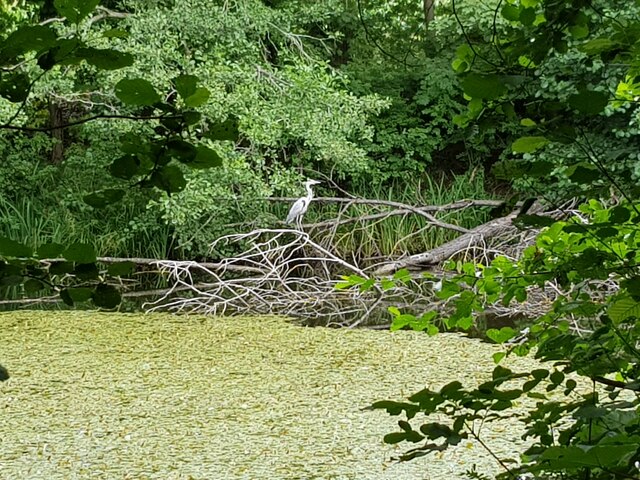
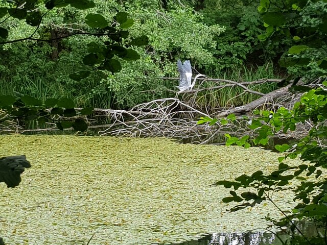
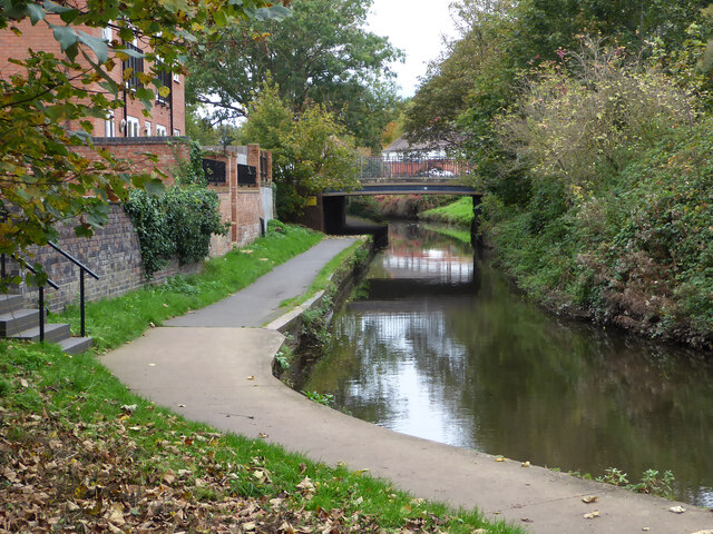
The village is surrounded by picturesque countryside, offering stunning views of rolling hills and meandering rivers. It is located near the River Avon, which adds to the natural beauty of the area. Newtown is also close to the larger towns of Evesham and Pershore, providing easy access to a wider range of amenities.

Although Newtown is small, it has a strong sense of community and offers a range of facilities for its residents. These include a local primary school, a village hall, and a small shop for everyday needs. The village hall is a hub for various community events and activities, such as local meetings, charity fundraisers, and social gatherings.

The surrounding area offers plenty of opportunities for outdoor activities, including walking, cycling, and fishing. Newtown is also within reach of several historical sites and attractions, such as the nearby Croome Court, a grand 18th-century mansion surrounded by beautiful gardens.

Overall, Newtown is a tranquil village with a close community spirit, offering residents a peaceful and picturesque place to call home. Its proximity to larger towns and natural surroundings make it an ideal location for those seeking a balance between rural living and access to amenities.

If you have any feedback on the listing, please let us know in the comments section below.
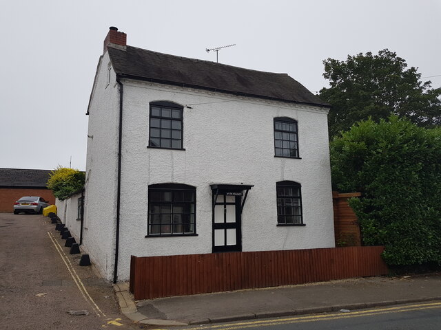
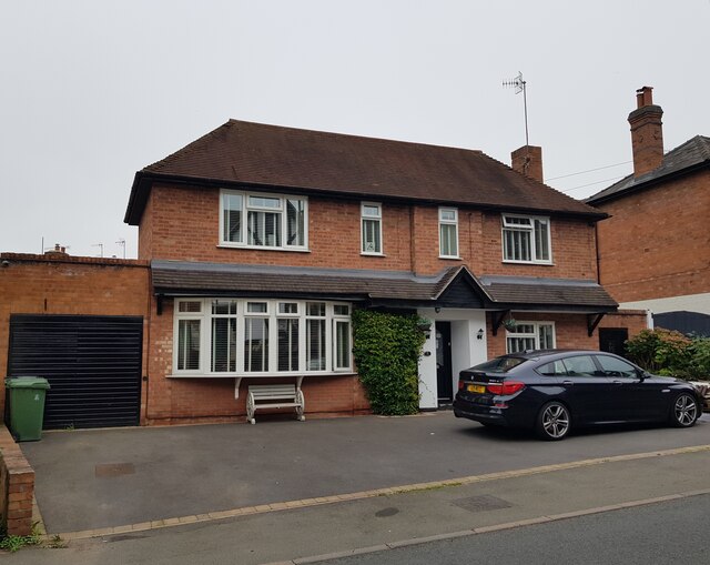
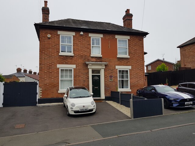
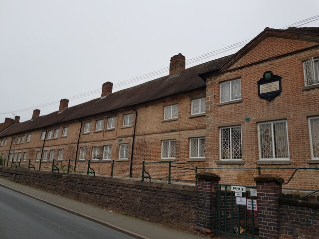
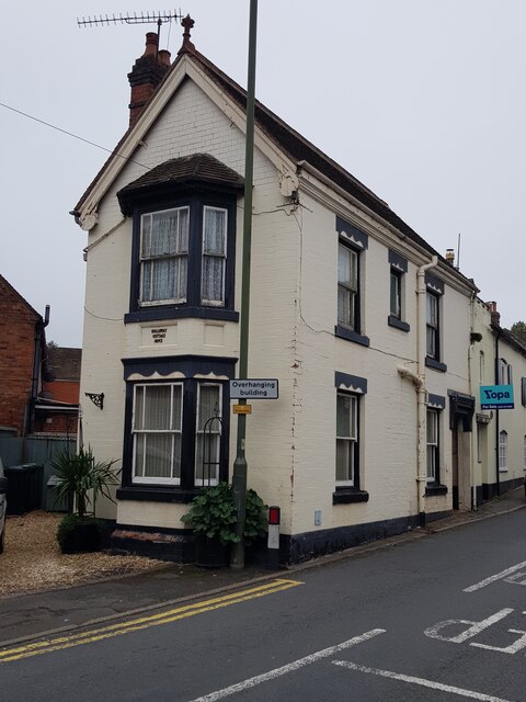
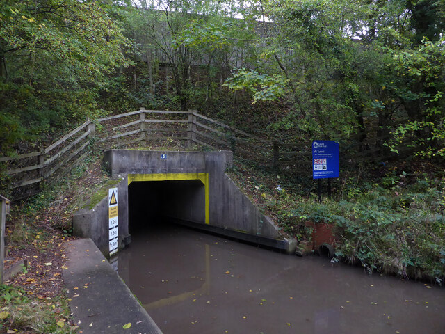
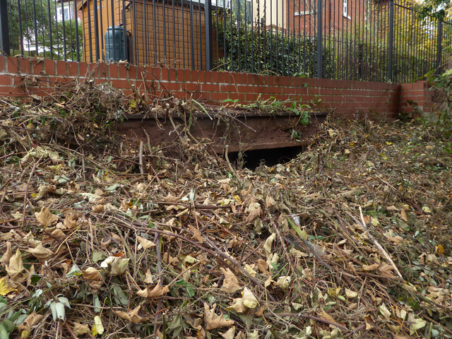
Newtown Images

Images are sourced within 2km of 52.268169/-2.1575 or Grid Reference SO8963. Thanks to Geograph Open Source API. All images are credited.

Heron at Swan Pool, Droitwich Spa
Heron taking flight at Swan Pool, Droitwich Spa
Narrow boat on the Droitwich Junction Canal The grating on the towpath is where water is taken from the canal and transferred via pipes under the towpath to where the canal begins again. This is because the re-builders of the canal did not want to pollute the River Salwarpe.
Narrow boat on the Droitwich Junction Canal
The grating on the towpath is where water is taken from the canal and transferred via pipes under the towpath to where the canal begins again. This is because the re-builders of the canal did not want to pollute the River Salwarpe.
Diamond Coffee Bar, at the crossroads Droitwich Many businesses have tried to flourish at this location which is subject to flooding.
Diamond Coffee Bar, at the crossroads Droitwich
Many businesses have tried to flourish at this location which is subject to flooding.
2, The Holloway, Droitwich Spa
5 The Holloway, Droitwich Spa This used to be a general store at least up to 2001 when the owner complained of too many roadworks in the road.
5 The Holloway, Droitwich Spa
This used to be a general store at least up to 2001 when the owner complained of too many roadworks in the road.
7 The Holloway, Droitwich Spa Presently a semi-detached house this was formally the Ring O'Bells <a href="https://www.geograph.org.uk/photo/5196358">SO9063 : Ring O' Bells, Droitwich</a> which is still marked in the glass above the door.
7 The Holloway, Droitwich Spa
Presently a semi-detached house this was formally the Ring O'Bells SO9063 : Ring O' Bells, Droitwich which is still marked in the glass above the door.
Coventry Almshouses, The Holloway, Droitwich Spa This is one of the original wings which has recently been repointed with lime mortar. Said to have been founded as a result of a horse race between Henry Coventry and Sir John Pakington of Westwood <a href="https://www.geograph.org.uk/photo/4583125">SO8763 : Westwood House from the drive</a>. The loser was to pay for the building of the property named after the winner. Henry Coventry horse won but John Pakington had no cash spare so promised the income of two farms for the upkeep and Henry Coventry left money the building of the houses in his will.
Coventry Almshouses, The Holloway, Droitwich Spa
This is one of the original wings which has recently been repointed with lime mortar. Said to have been founded as a result of a horse race between Henry Coventry and Sir John Pakington of Westwood SO8763 : Westwood House from the drive. The loser was to pay for the building of the property named after the winner. Henry Coventry horse won but John Pakington had no cash spare so promised the income of two farms for the upkeep and Henry Coventry left money the building of the houses in his will.
1, The Holloway, Droitwich Spa
Droitwich Junction Canal - the M5 tunnel Classed as bridge No. 5 this is actually a tight 60 metre long tunnel. The canal at this point carries water from the Body Brook and the headroom is variable through the tunnel. This waterfront is accessible by some steps from the left but is now virtually completely hidden from the nearby road by the growth of vegetation in the last decade or so.
Droitwich Junction Canal - the M5 tunnel
Classed as bridge No. 5 this is actually a tight 60 metre long tunnel. The canal at this point carries water from the Body Brook and the headroom is variable through the tunnel. This waterfront is accessible by some steps from the left but is now virtually completely hidden from the nearby road by the growth of vegetation in the last decade or so.
Droitwich Junction Canal - staircase locks The only staircase on this restored canal. Lock No. 5 is closest and share a set of gates with lock No. 4 in the background.
Droitwich Junction Canal - staircase locks
The only staircase on this restored canal. Lock No. 5 is closest and share a set of gates with lock No. 4 in the background.
Droitwich Junction Canal - how to ascend the staircase This instruction board is for craft going up from the lower lock (No. 5) to the upper lock (No.4). I forgot to photograph the instructions at the other end telling one how to descend.
Droitwich Junction Canal - how to ascend the staircase
This instruction board is for craft going up from the lower lock (No. 5) to the upper lock (No.4). I forgot to photograph the instructions at the other end telling one how to descend.
Droitwich Junction Canal - exiting lock No. 6 Heading away from Droitwich and up the locks.
Droitwich Junction Canal - exiting lock No. 6
Heading away from Droitwich and up the locks.
Rebuilding a roundabout on Hanbury Road, Droitwich The road was closed to vehicles and it was causing chaos.
Rebuilding a roundabout on Hanbury Road, Droitwich
The road was closed to vehicles and it was causing chaos.
Droitwich Junction Canal - bridge No. 6 Carrying Impney Way over the canal just after it emerges from under the M5. Undergrowth now effectively hides the canal from Impney Way and you would not know it was there.
Droitwich Junction Canal - bridge No. 6
Carrying Impney Way over the canal just after it emerges from under the M5. Undergrowth now effectively hides the canal from Impney Way and you would not know it was there.
Largely buried lintel by the Droitwich Junction Canal I believe this is the remains of the bridge that crossed the remnant of the original lock linking the Droitwich Junction Canal to the River Salwarpe. The newly restored canal joins the river further upstream. An earlier view is seen here - <a href="https://www.geograph.org.uk/photo/761976">SO9063 : Droitwich Junction Canal - beginning or end</a>.
Largely buried lintel by the Droitwich Junction Canal
I believe this is the remains of the bridge that crossed the remnant of the original lock linking the Droitwich Junction Canal to the River Salwarpe. The newly restored canal joins the river further upstream. An earlier view is seen here - SO9063 : Droitwich Junction Canal - beginning or end.
The canalised River Salwarpe in Droitwich Approaching bridge No. 8 and the barge lock at the entrance to Vines Park.
The canalised River Salwarpe in Droitwich
Approaching bridge No. 8 and the barge lock at the entrance to Vines Park.
Droitwich Junction Canal - warning sign This is the navigation warning system for craft contemplating joining the canalised River Salwarpe at lock No. 7. There is an indicator on the wing wall at the tail of the lock with colours matching those on the sign. Red means do not join the river, yellow is proceed with caution and green is for normal conditions. There is an electronic version with light signals by lock No. 1.
Droitwich Junction Canal - warning sign
This is the navigation warning system for craft contemplating joining the canalised River Salwarpe at lock No. 7. There is an indicator on the wing wall at the tail of the lock with colours matching those on the sign. Red means do not join the river, yellow is proceed with caution and green is for normal conditions. There is an electronic version with light signals by lock No. 1.
Show me another place!

Newtown is located at Grid Ref: SO8963 (Lat: 52.268169, Lng: -2.1575)

Administrative County: Worcestershire

District: Wychavon

Police Authority: West Mercia

What 3 Words

///shin.sweep.museum. Near Droitwich, Worcestershire

Related Wikis

Droitwich Spa railway station

Droitwich Spa railway station serves the town of Droitwich Spa in Worcestershire, England. It is located just to the south-west of Droitwich Spa Junction...

Droitwich Spa

Droitwich Spa (often abbreviated to Droitwich ) is a historic spa town in the Wychavon district in northern Worcestershire, England, on the River Salwarpe...

Old Town Hall, Droitwich Spa

The Old Town Hall is a municipal building in St Andrews Street, Droitwich Spa, Worcestershire, England. The structure, which was the headquarters of Droitwich...

Droitwich Spa High School

Droitwich Spa High School is a secondary school and specialist Sports College with academy status in Droitwich Spa, Worcestershire, England. It serves...

Droitwich Spa Lido

The Droitwich Spa Lido is a lido in Droitwich Spa, Worcestershire, England. It is one of the few remaining inland, open-air salt-water swimming pools...

RGS Dodderhill

RGS Dodderhill is a private school on the outskirts of Droitwich Spa, Worcestershire, England. Girls & Boys are educated from 2–11 years of age - most...

Church of the Sacred Heart and St Catherine of Alexandria

The Church of the Sacred Heart and St Catherine of Alexandria is a Catholic church situated in Droitwich Spa, Worcestershire, England, noted for its remarkable...

Westwood Priory

Westwood Priory (priory of St. Mary) was a priory of Benedictine nuns founded in 1153, near Droitwich, Worcestershire, England. It was a daughter house...

Nearby Amenities

Located within 500m of 52.268169,-2.1575
Railway: switch
Lat/Long: 52.2700511/-2.1560536
Droitwich Spa
Naptan AtcoCode: 9100DRTWCHS
Network: National Rail
Network Website: https://www.nationalrail.co.uk/stations/dtw/
Network Wikidata: Q26334
Operator: London Midland
Platforms: 2
Public Transport: station
Railway: station
Ref Crs: DTW
Train: yes
Wikidata: Q2360854
Wikipedia: en:Droitwich Spa railway station
Lat/Long: 52.2683805/-2.1583391
Crossing
Lat/Long: 52.2653915/-2.162165
Crossing
Crossing: traffic_signals
Source: visual survey;bing
Lat/Long: 52.2671391/-2.1518112
Barrier: bollard
Lat/Long: 52.26923/-2.1512732
Barrier: bollard
Source: survey
Lat/Long: 52.2695174/-2.1520749
Barrier: bollard
Source: survey
Lat/Long: 52.2696049/-2.1523683
Traffic Signals
Lat/Long: 52.268736/-2.157643
Traffic Signals
Lat/Long: 52.2688832/-2.1579365
Bus Stop
Ombersley Street East
Bus: yes
Naptan AtcoCode: 2000G001600
Naptan Bearing: E
Naptan CommonName: Ombersley Street East
Naptan Indicator: adj
Naptan NaptanCode: wocdgpag
Naptan PlusbusZoneRef: DRTWCHS
Naptan Street: Ombersley Street East
Naptan Verified: no
Public Transport: platform
Source: naptan_import
Lat/Long: 52.2673147/-2.1527822
Bus Stop
Ombersley Street East
Bus: yes
Local Ref: 2
Naptan AtcoCode: 2000G001601
Naptan Bearing: E
Naptan CommonName: Ombersley Street East
Naptan Indicator: Adj
Naptan NaptanCode: wocdgpaj
Naptan PlusbusZoneRef: DRTWCHS
Naptan Street: Ombersley Street East
Naptan Verified: no
Public Transport: platform
Source: naptan_import
Lat/Long: 52.2671874/-2.1526994
Bus Stop
Morrisons
Bus: yes
Naptan AtcoCode: 2000G001602
Naptan Bearing: N
Naptan CommonName: Morrisons
Naptan Indicator: Adj
Naptan NaptanCode: wocdgpam
Naptan PlusbusZoneRef: DRTWCHS
Naptan Verified: no
Public Transport: platform
Source: naptan_import
Lat/Long: 52.2685639/-2.1531528
Bus Stop
Victoria Square
Bus: yes
Naptan AtcoCode: 2000G001605
Naptan Bearing: SE
Naptan CommonName: Victoria Square
Naptan Indicator: Adj
Naptan NaptanCode: wocdgpat
Naptan PlusbusZoneRef: DRTWCHS
Naptan Street: Victoria Square
Naptan Verified: no
Public Transport: platform
Source: naptan_import
Lat/Long: 52.2671583/-2.1508823
Bus Stop
Union Lane Railway Bridge
Bus: yes
Naptan AtcoCode: 2000G003800
Naptan Bearing: N
Naptan CommonName: Union Lane Railway Bridge
Naptan Indicator: Adj
Naptan Landmark: Railway Bridge
Naptan NaptanCode: wocdptpg
Naptan PlusbusZoneRef: DRTWCHS
Naptan Street: Union Lane
Naptan Verified: no
Public Transport: platform
Source: naptan_import
Lat/Long: 52.2709369/-2.1535127
Bus Stop
Union Lane Railway Station
Bus: yes
Naptan AtcoCode: 2000G003801
Naptan Bearing: S
Naptan CommonName: Union Lane Railway Station
Naptan Indicator: Opp
Naptan Landmark: Railway Station
Naptan NaptanCode: wocdptpj
Naptan PlusbusZoneRef: DRTWCHS
Naptan Street: Union Lane
Naptan Verified: no
Public Transport: platform
Source: naptan_import
Lat/Long: 52.2682807/-2.1570925
Bus Stop
Ledwych Road- Droit-Vernon Grove
Bus: yes
Naptan AtcoCode: 2000G105000
Naptan Bearing: NE
Naptan CommonName: Ledwych Road- Droit-Vernon Grove
Naptan Indicator: Adj
Naptan Landmark: Vernon Grove
Naptan NaptanCode: wocgdawt
Naptan PlusbusZoneRef: DRTWCHS
Naptan Street: Ledwych Road
Naptan Verified: no
Public Transport: platform
Source: naptan_import
Lat/Long: 52.2689747/-2.1619323
Nunnery Avenue
Naptan AtcoCode: 2000G323173
Naptan Bearing: NE
Naptan BusStopType: CUS
Naptan CommonName: Nunnery Avenue
Naptan Indicator: Opp
Naptan Landmark: Nunnery Avenue
Naptan NaptanCode: wocdgaga
Naptan PlusbusZoneRef: DRTWCHS
Naptan Street: Stalls Farm Road
Naptan Verified: no
Source: naptan_import
Lat/Long: 52.2647713/-2.1588838
Nunnery Avenue
Naptan AtcoCode: 2000G323174
Naptan Bearing: SW
Naptan BusStopType: CUS
Naptan CommonName: Nunnery Avenue
Naptan Indicator: Adj
Naptan Landmark: Nunnery Avenue
Naptan NaptanCode: wocdgagd
Naptan PlusbusZoneRef: DRTWCHS
Naptan Street: Stalls Farm Road
Naptan Verified: no
Source: naptan_import
Lat/Long: 52.2646997/-2.1586198
Bus Stop
Health Centre
Bus: yes
Naptan AtcoCode: 2000G502724
Naptan Bearing: E
Naptan CommonName: Health Centre
Naptan Indicator: Opp
Naptan Landmark: Droitwich Health centre
Naptan NaptanCode: wocdgdtm
Naptan PlusbusZoneRef: DRTWCHS
Naptan Street: Ombersley Street East
Naptan Verified: no
Public Transport: platform
Source: naptan_import
Lat/Long: 52.2672/-2.15297
Bus Stop
Health Centre- Ombersley Street East
Bus: yes
Naptan AtcoCode: 2000G502726
Naptan Bearing: E
Naptan CommonName: Health Centre- Ombersley Street East
Naptan Indicator: Adj
Naptan Landmark: Droitwich Health centre
Naptan NaptanCode: wocdgdtp
Naptan PlusbusZoneRef: DRTWCHS
Naptan Street: Ombersley Street East
Naptan Verified: no
Public Transport: platform
Source: naptan_import
Lat/Long: 52.2671813/-2.1524842
Bus Stop
Railway Station
Bus: yes
Naptan AtcoCode: 2000G502730
Naptan Bearing: W
Naptan CommonName: Railway Station
Naptan Indicator: opp
Naptan Landmark: Railway Station
Naptan NaptanCode: wocdgdtw
Naptan PlusbusZoneRef: DRTWCHS
Naptan Street: Ombersley Way
Naptan Verified: no
Public Transport: platform
Source: naptan_import
Lat/Long: 52.2677473/-2.1587332
Bus Stop
Union Lane
Bus: yes
Naptan AtcoCode: 2000G52740A
Naptan Bearing: SW
Naptan CommonName: Union Lane
Naptan Indicator: opp
Naptan Landmark: Factory
Naptan NaptanCode: wocdtgdp
Naptan PlusbusZoneRef: DRTWCHS
Naptan Street: Union Lane
Naptan Verified: no
Public Transport: platform
Source: naptan_import
Lat/Long: 52.2691999/-2.1544152
Parking
Lat/Long: 52.2684109/-2.1585772
Pub
Railway Inn
Lat/Long: 52.2709105/-2.1533665
Turning Circle
Source: bing
Lat/Long: 52.2684983/-2.1630259
Post Box
Alt Ref: WR9 4910
Collection Plate: CP1-LC
Collection Times: Mo-Fr 18:30; Sa 12:30
Historic Operator: Royal Mail
Note: Royal Mail gives ref for right hand apperture as 'WR9 4910' but both plates are the same and are 'WR9 491'
Post Box Apertures: 2
Post Box Design: type_c
Post Box Type: pillar
Ref: WR9 491
Royal Cypher: EIIR
Royal Cypher Wikidata: Q33102113
Lat/Long: 52.2671812/-2.1509316
Post Box
Collection Plate: CP7
Collection Times: Mo-Fr 17:00; Sa 10:30
Historic Operator: Post Office
Post Box Type: lamp
Ref: WR9 76
Royal Cypher: EIIR
Royal Cypher Wikidata: Q33102113
Lat/Long: 52.2649326/-2.1583682
Post Box
Collection Plate: CP7
Collection Times: Mo-Fr 16:45; Sa 10:30
Historic Operator: Post Office
Post Box Type: lamp
Ref: WR9 342
Royal Cypher: EIIR
Royal Cypher Wikidata: Q33102113
Lat/Long: 52.2698527/-2.1533644
Post Box
Collection Plate: CP7
Collection Times: Mo-Fr 16:30; Sa 10:30
Historic Operator: Royal Mail
Post Box Type: lamp
Ref: WR9 202
Royal Cypher: EIIR
Royal Cypher Wikidata: Q33102113
Lat/Long: 52.2695441/-2.1610894
Fixme: continue
Lat/Long: 52.2694862/-2.1613376
Westcroft Street
Lat/Long: 52.2676059/-2.1547983
Give Way
Source: bing
Lat/Long: 52.2674508/-2.1566792
Railway: switch
Lat/Long: 52.2689625/-2.1575558
Railway: switch
Lat/Long: 52.2693364/-2.1572045
Railway: switch
Lat/Long: 52.26902/-2.1575444
Railway: buffer_stop
Lat/Long: 52.2689455/-2.1577259
Railway: switch
Lat/Long: 52.2693283/-2.1571394
Railway: switch
Lat/Long: 52.2699691/-2.1562862
Crossing
Lat/Long: 52.2682718/-2.1598893
Man Made: surveillance
Source: survey
Lat/Long: 52.267425/-2.1502483
War Memorial
Historic: memorial
Lat/Long: 52.2671075/-2.1506525
Entrance: yes
Lat/Long: 52.2681418/-2.151144
Entrance: yes
Lat/Long: 52.2683394/-2.1520506
Barrier: cycle_barrier
Source: survey
Lat/Long: 52.2684084/-2.15062
Bench
Source: survey
Lat/Long: 52.2681876/-2.1508296
Bicycle Parking
Source: survey
Lat/Long: 52.2682013/-2.1508967
Bench
Source: survey
Lat/Long: 52.268214/-2.1509727
Clock
Display: analog
Source: survey
Visibility: area
Lat/Long: 52.2681314/-2.1512475
Atm
Source: bing
Lat/Long: 52.2672214/-2.1512379
Atm
Source: survey
Lat/Long: 52.2672608/-2.1509914
Atm
Operator: Barclays Bank PLC
Source: bing
Lat/Long: 52.2672635/-2.1516064
Power: substation
Ref: 33252
Source: survey
Lat/Long: 52.2679407/-2.1511409
Bicycle Parking
Source: survey
Lat/Long: 52.2672335/-2.151652
Barrier: bollard
Lat/Long: 52.2672064/-2.1516478
Post Box
Collection Times: Mo-Fr 17:00; Sa 09:00
Post Box Type: lamp
Ref: WR9 341
Royal Cypher: EIIR
Royal Cypher Wikidata: Q33102113
Lat/Long: 52.2674129/-2.1559198
Droitwich Spa Railway Station
Naptan AtcoCode: 2000G003802
Naptan Bearing: N
Naptan BusStopType: CUS
Naptan CommonName: Droitwich Spa Railway Station
Naptan Indicator: Adj
Naptan NaptanCode: wocdptpm
Naptan PlusbusZoneRef: DRTWCHS
Naptan Street: Station Forecourt
Naptan Verified: no
Source: naptan_import
Lat/Long: 52.2683938/-2.1573185
Generator Method: photovoltaic
Generator Output Electricity: yes
Generator Source: solar
Generator Type: solar_photovoltaic_panel
Location: roof
Power: generator
Lat/Long: 52.270251/-2.1606722
Generator Method: photovoltaic
Generator Output Electricity: yes
Generator Source: solar
Generator Type: solar_photovoltaic_panel
Location: roof
Power: generator
Lat/Long: 52.2702624/-2.1605985
Generator Method: photovoltaic
Generator Output Electricity: yes
Generator Source: solar
Generator Type: solar_photovoltaic_panel
Location: roof
Power: generator
Lat/Long: 52.2690503/-2.1631265
Ombersley Street East
Bus: yes
Public Transport: stop_position
Lat/Long: 52.2671349/-2.1527063
Droitwich Spa Junction
Railway: junction
Lat/Long: 52.2700655/-2.156085
Generator Method: photovoltaic
Generator Output Electricity: yes
Generator Source: solar
Generator Type: solar_photovoltaic_panel
Location: roof
Power: generator
Lat/Long: 52.26636/-2.157121
Generator Method: photovoltaic
Generator Output Electricity: yes
Generator Source: solar
Generator Type: solar_photovoltaic_panel
Location: roof
Power: generator
Lat/Long: 52.2663583/-2.1571827
Generator Method: photovoltaic
Generator Output Electricity: yes
Generator Source: solar
Generator Type: solar_photovoltaic_panel
Location: roof
Power: generator
Lat/Long: 52.2667769/-2.161155
Generator Method: photovoltaic
Generator Output Electricity: yes
Generator Source: solar
Generator Type: solar_photovoltaic_panel
Location: roof
Power: generator
Lat/Long: 52.2668475/-2.1613133
Generator Method: photovoltaic
Generator Output Electricity: yes
Generator Source: solar
Generator Type: solar_photovoltaic_panel
Location: roof
Power: generator
Lat/Long: 52.2667162/-2.1620348
Generator Method: photovoltaic
Generator Output Electricity: yes
Generator Source: solar
Generator Type: solar_photovoltaic_panel
Location: roof
Power: generator
Lat/Long: 52.2690601/-2.1626142
Generator Method: photovoltaic
Generator Output Electricity: yes
Generator Source: solar
Generator Type: solar_photovoltaic_panel
Location: roof
Power: generator
Lat/Long: 52.2685973/-2.1621287
Generator Method: photovoltaic
Generator Output Electricity: yes
Generator Source: solar
Generator Type: solar_photovoltaic_panel
Location: roof
Power: generator
Lat/Long: 52.2684233/-2.1620509
Generator Method: photovoltaic
Generator Output Electricity: yes
Generator Source: solar
Generator Type: solar_photovoltaic_panel
Location: roof
Power: generator
Lat/Long: 52.2684233/-2.1621072
Generator Method: photovoltaic
Generator Output Electricity: yes
Generator Source: solar
Generator Type: solar_photovoltaic_panel
Location: roof
Power: generator
Lat/Long: 52.2690995/-2.1603236
Generator Method: photovoltaic
Generator Output Electricity: yes
Generator Source: solar
Generator Type: solar_photovoltaic_panel
Location: roof
Power: generator
Lat/Long: 52.2706375/-2.1593177
Generator Method: photovoltaic
Generator Output Electricity: yes
Generator Source: solar
Generator Type: solar_photovoltaic_panel
Location: roof
Power: generator
Lat/Long: 52.2707089/-2.1600272
Generator Method: photovoltaic
Generator Output Electricity: yes
Generator Source: solar
Generator Type: solar_photovoltaic_panel
Location: roof
Power: generator
Lat/Long: 52.2707327/-2.1599266
Generator Method: photovoltaic
Generator Output Electricity: yes
Generator Source: solar
Generator Type: solar_photovoltaic_panel
Location: roof
Power: generator
Lat/Long: 52.27069/-2.1586445
Generator Method: photovoltaic
Generator Output Electricity: yes
Generator Source: solar
Generator Type: solar_photovoltaic_panel
Location: roof
Power: generator
Lat/Long: 52.2706063/-2.1583173
Generator Method: photovoltaic
Generator Output Electricity: yes
Generator Source: solar
Generator Type: solar_photovoltaic_panel
Location: roof
Power: generator
Lat/Long: 52.2688254/-2.1601586
Droitwich Spa
Public Transport: stop_position
Railway: stop
Train: yes
Lat/Long: 52.2683642/-2.1583146
Droitwich Spa
Public Transport: stop_position
Railway: stop
Train: yes
Lat/Long: 52.2683888/-2.1583629
Give Way
Lat/Long: 52.2654432/-2.1525063
Generator Method: photovoltaic
Generator Output Electricity: yes
Generator Source: solar
Generator Type: solar_photovoltaic_panel
Location: roof
Power: generator
Lat/Long: 52.2650993/-2.1546212
Bicycle Parking
Bicycle Parking: rack
Capacity: 10
Covered: no
Lit: yes
Lat/Long: 52.268371/-2.1582154
Generator Method: photovoltaic
Generator Output Electricity: yes
Generator Source: solar
Generator Type: solar_photovoltaic_panel
Location: roof
Power: generator
Lat/Long: 52.2697462/-2.1535027
Generator Method: photovoltaic
Generator Output Electricity: yes
Generator Source: solar
Generator Type: solar_photovoltaic_panel
Location: roof
Power: generator
Lat/Long: 52.2695641/-2.1530199
Generator Method: photovoltaic
Generator Output Electricity: yes
Generator Source: solar
Generator Type: solar_photovoltaic_panel
Location: roof
Power: generator
Lat/Long: 52.268356/-2.1561085
Generator Method: photovoltaic
Generator Output Electricity: yes
Generator Source: solar
Generator Type: solar_photovoltaic_panel
Location: roof
Power: generator
Lat/Long: 52.2675065/-2.1634617
Generator Method: photovoltaic
Generator Output Electricity: yes
Generator Source: solar
Generator Type: solar_photovoltaic_panel
Location: roof
Power: generator
Lat/Long: 52.2653882/-2.1571881
Social Facility
Droitwich Spa Foodbank
Addr City: Droitwich
Addr Postcode: WR9 8QS
Addr Street: Ombersley Street East
Address: Droitwich Baptist Church Ombersley Street East WR9 8QS
Email: info@droitwichspa.foodbank.org.uk
Network: Trussell Trust
Parliamentary Constituency: Mid Worcestershire
Phone: 07532130604
Social Facility: food_bank
Social Facility For: underprivileged
Source: give_food
Url: https://www.givefood.org.uk/needs/at/droitwich-spa/
Lat/Long: 52.2675312/-2.1519712
Railway: railway_crossing
Lat/Long: 52.2703067/-2.1557662
Vending Machine
Vending: public_transport_tickets
Lat/Long: 52.2683433/-2.1585403
The data included in this document is from www.openstreetmap.org. The data is made available under ODbL.

Have you been to Newtown?

Leave your review of Newtown below (or comments, questions and feedback).