Newtonferry
Settlement in Inverness-shire
Scotland
Newtonferry

Newtonferry is a small village located in the Inverness-shire region of Scotland. Situated on the southern banks of Loch Ness, it is part of the larger Highland Council area. The village is nestled amidst picturesque landscapes, surrounded by rolling hills, lush greenery, and the famous Loch Ness, which stretches for approximately 37 kilometers.
Newtonferry is known for its serene and tranquil atmosphere, attracting visitors seeking a peaceful getaway. The village offers stunning views of the Loch and its surrounding mountains, making it a popular destination for nature lovers and outdoor enthusiasts. The area is also rich in wildlife, with various species of birds, deer, and occasionally even sightings of the elusive Loch Ness Monster.
Despite its small size, Newtonferry has a close-knit community with a strong sense of local pride. The village features a handful of amenities, including a local pub, a small grocery store, and a community hall that hosts various events throughout the year. Additionally, the village is home to a primary school, providing education to the local children.
For those interested in exploring the wider region, Newtonferry serves as an ideal base. Its location on the eastern shore of Loch Ness allows easy access to popular tourist spots such as Urquhart Castle and the Loch Ness Centre and Exhibition. Inverness, the capital of the Highlands, is also just a short drive away, offering a wider range of amenities and attractions.
In summary, Newtonferry is a charming, peaceful village nestled on the banks of Loch Ness, offering breathtaking natural beauty and a close-knit community. It serves as a gateway to explore the stunning landscapes and attractions of the Inverness-shire region.
If you have any feedback on the listing, please let us know in the comments section below.
Newtonferry Images
Images are sourced within 2km of 57.68708/-7.2116437 or Grid Reference NF8978. Thanks to Geograph Open Source API. All images are credited.
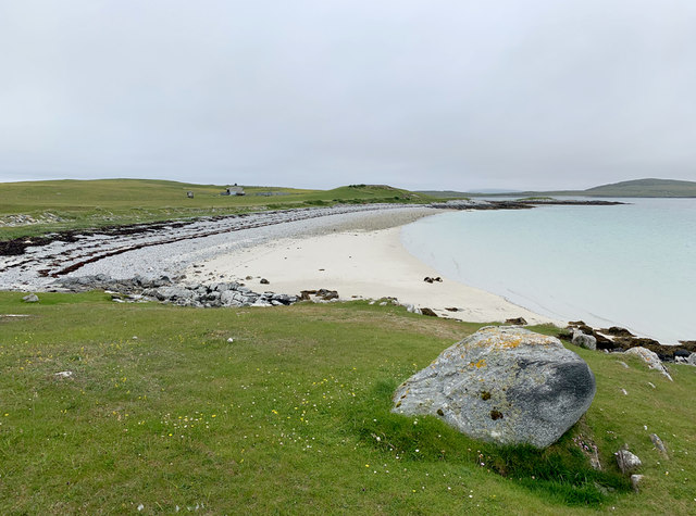
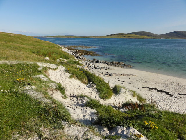
![Oystercatchers on the beach You are never far away from the sight or loud piping of oystercatchers on the Western Isles. This view is south towards the small island of Lingeigh [to the right] with the hills of North Uist beyond.](https://s3.geograph.org.uk/geophotos/06/21/07/6210727_b324520c.jpg)
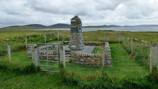

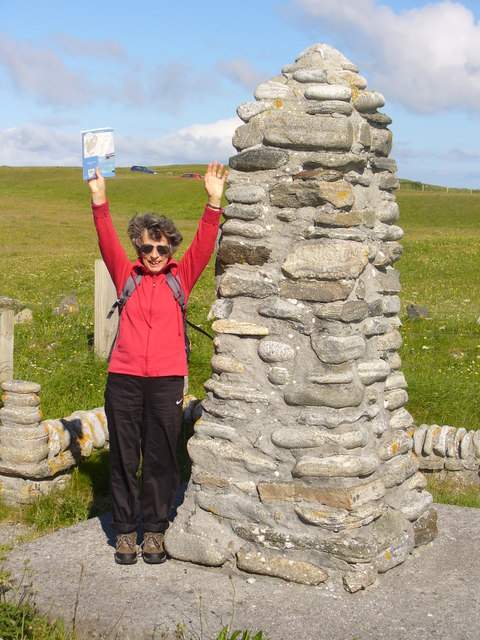


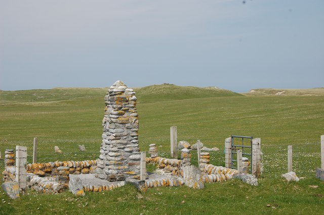
![The 'Giant MacAskill' memorial. Angus MacAskill [born on Berneray in 1825]was indeed a giant of a man. The memorial is the same height as he was [7ft 9&quot;/ 2.38m], whilst he weighed 193kg. At the age of 24 he toured with Barnum and Bailey&#039;s circus, and there are more details of his life in the museum at Dunvegan on Skye.](https://s3.geograph.org.uk/photos/50/46/504679_a2374ba5.jpg)


Newtonferry is located at Grid Ref: NF8978 (Lat: 57.68708, Lng: -7.2116437)
Unitary Authority: Na h-Eileanan an Iar
Police Authority: Highlands and Islands
Also known as: Port nan Long, Port-nan Long
What 3 Words
///eating.dove.conductor. Near Lochmaddy, Na h-Eileanan Siar
Related Wikis

Newtonferry
Newtonferry (Scottish Gaelic: Port nan Long, "the harbour of the ships") is a small crofting community on the island of North Uist in the Western Isles...

Dun an Sticir
Dun an Sticir (Scottish Gaelic: Dùn an Sticir [ˈt̪un əɲ ˈʃtʲiçkʲɪɾʲ]) is an Iron Age broch situated approximately 9.5 kilometers north of Lochmaddy in...

North Uist Machair and Islands
The North Uist Machair and Islands is a protected wetland area in the Outer Hebrides of Scotland. A total of 4,705 hectares comprises seven separate areas...

Otternish
Otternish is the former North Uist terminal for the ferry to Berneray, in the Outer Hebrides, Scotland. The slipway lies 6 miles (10 km) north of Lochmaddy...

Lingeigh, North Uist
Lingeigh is an uninhabited island off North Uist, south east of Boreray. It is separated from North Uist by Traigh Lingeigh. == Footnotes ==

Berneray (North Uist)
Berneray (Scottish Gaelic: Beàrnaraigh na Hearadh) is an island and community in the Sound of Harris, Scotland. It is one of fifteen inhabited islands...
Boreray, North Uist
Boreray (Scottish Gaelic: Boraraigh) is an island with a single croft, lying 2 kilometres (1.2 mi) north of North Uist in the Outer Hebrides of Scotland...
Loch an Duin
Loch an Duin is a complex system of freshwater, brackish and sea lochs, tidal channels and islands, on and close to North Uist off the west coast of Scotland...
Nearby Amenities
Located within 500m of 57.68708,-7.2116437Have you been to Newtonferry?
Leave your review of Newtonferry below (or comments, questions and feedback).