Bescot

Settlement in Staffordshire

England

Bescot

Tame Valley Canal towards Crankhall Lane Bridge
Tame Valley Canal towards Crankhall Lane Bridge Credit: Ian S

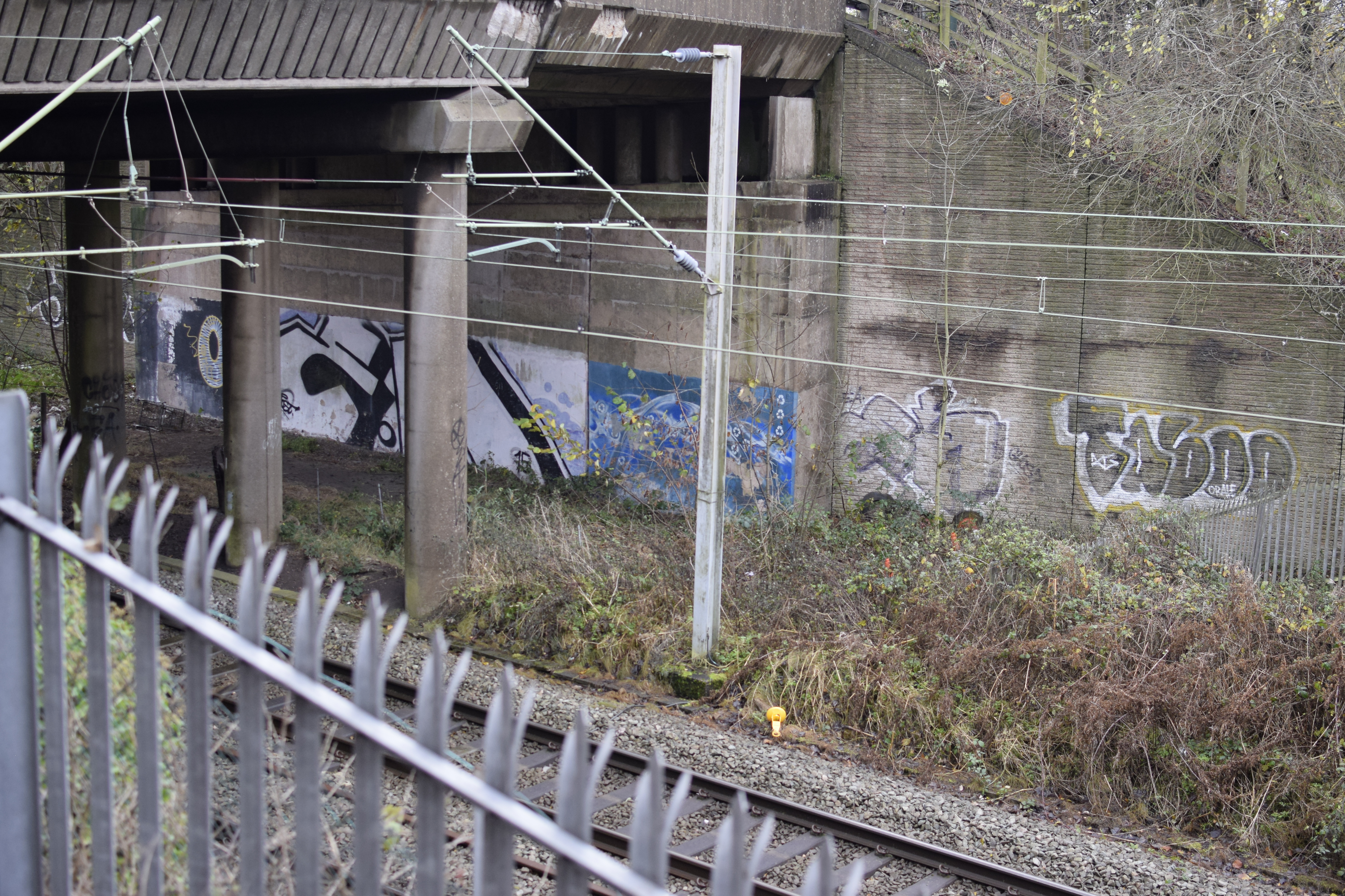
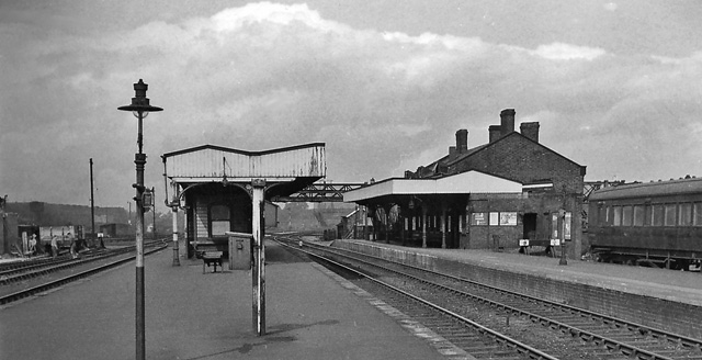
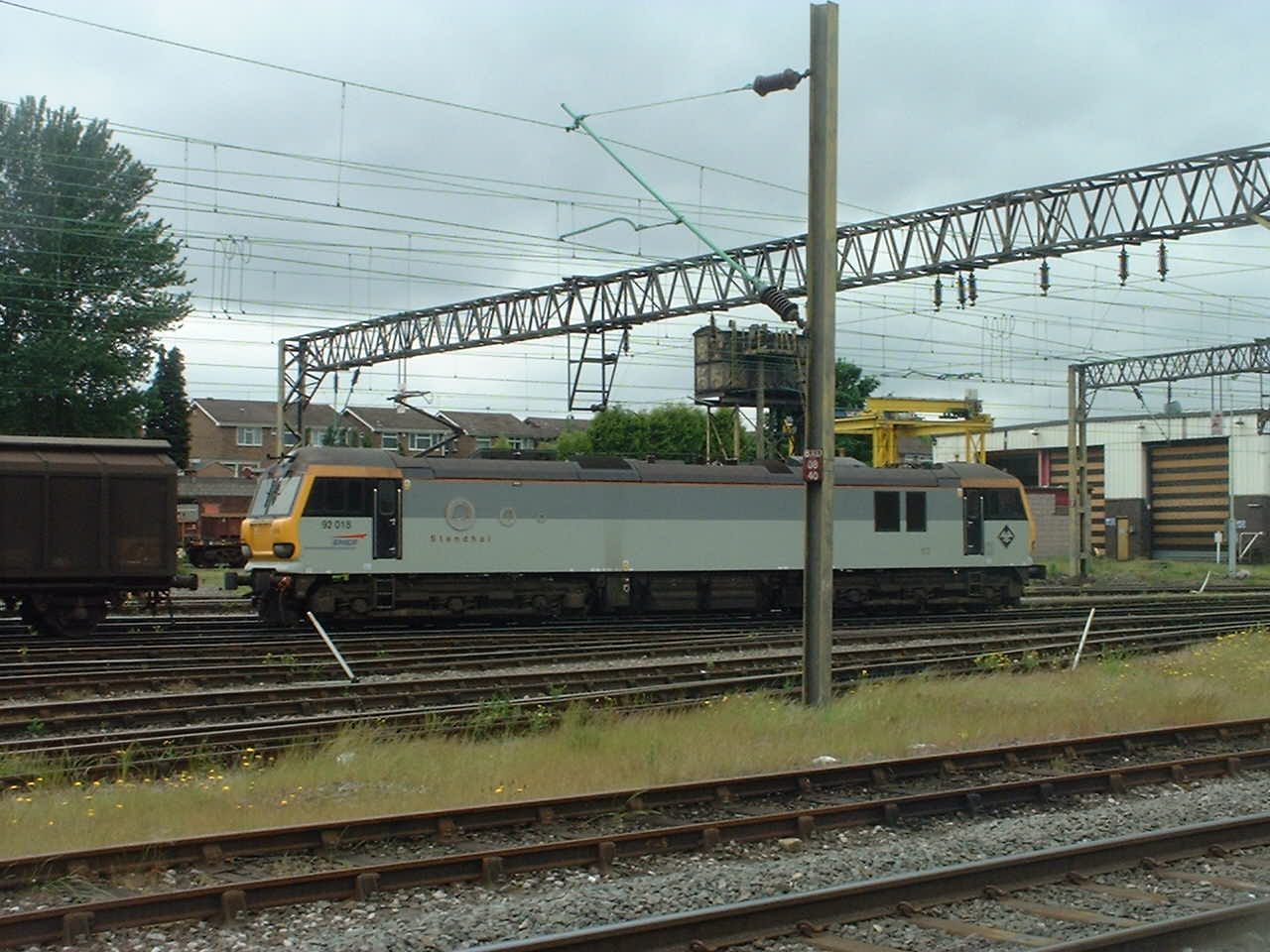
Bescot is a small suburban area located in Staffordshire, England. Situated approximately two miles north of Walsall town centre, it forms part of the wider West Midlands conurbation. Bescot is primarily known for its railway station and the adjacent Bescot Marshalling Yard, which has been a significant transport hub since its establishment in the 1960s.

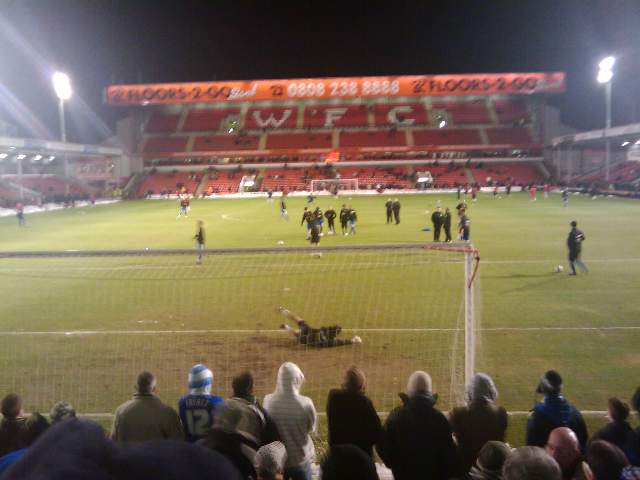
The area is predominantly residential, with a mix of housing types including terraced, semi-detached, and detached properties. Bescot benefits from good transport links, with the M6 motorway passing nearby and providing easy access to surrounding areas. The nearby Bescot Stadium is home to Walsall Football Club and also hosts other events such as music concerts.

Bescot is bounded by open green spaces, including the Bescot Park and Rough Wood Nature Reserve, providing opportunities for leisure activities and outdoor pursuits. The area also benefits from being close to the Walsall Arboretum, a picturesque park with beautiful gardens, a lake, and a range of recreational facilities.

Despite being a relatively small area, Bescot has a range of amenities and services to cater to its residents. These include local shops, schools, healthcare facilities, and public transport connections. The nearby town of Walsall offers a wider range of shopping, dining, and entertainment options.

In summary, Bescot is a well-connected residential area in Staffordshire, known for its railway station and marshalling yard. It offers a range of amenities and is surrounded by green spaces, making it an attractive place to live within the wider West Midlands region.

If you have any feedback on the listing, please let us know in the comments section below.
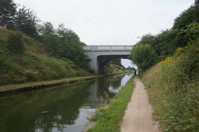
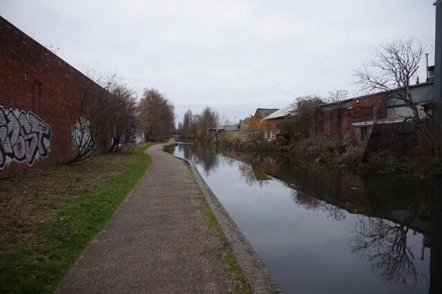
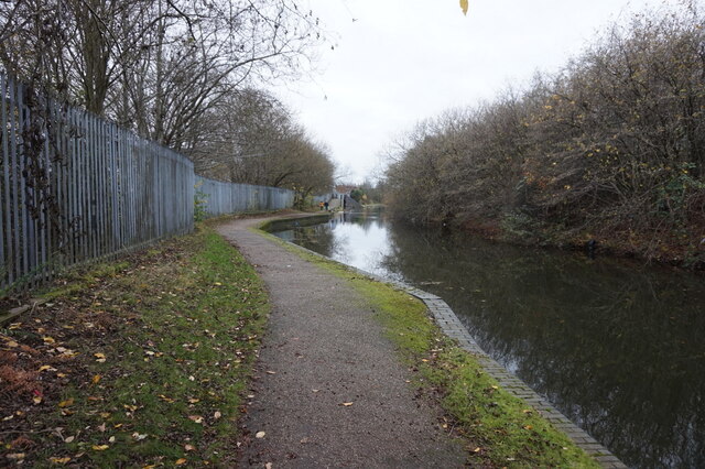
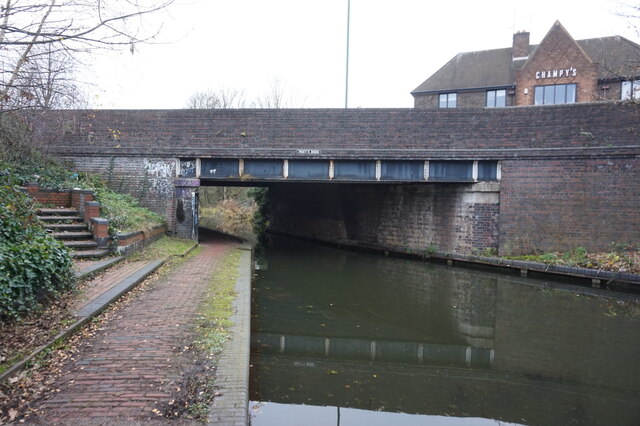
Bescot Images

Images are sourced within 2km of 52.565851/-1.997755 or Grid Reference SP0096. Thanks to Geograph Open Source API. All images are credited.

Tame Valley Canal towards Crankhall Lane Bridge
Tame Valley Canal at Crankhall Lane Bridge
Northbound M6 at Bescot Between junctions 8 and 9 of the M6 near Walsall.
Northbound M6 at Bescot
Between junctions 8 and 9 of the M6 near Walsall.
Walsall Canal towards Rollingmill Street Bridge
Walsall Canal at Rollingmill Street Bridge
Walsall Canal towards Pagett's Bridge
Walsall Canal at Pagett's Bridge
Carrington Road, Friar Park, Wednesbury This is a view westwards along the length of Carrington Road; the massive tower of St Francis of Assisi church provides a distant focal point. As so often with housing estates from the 1920s and 1930s, there is an odd mismatch between the monumental road layout of grand avenues and crescents and the much more modest scale of the housing, two-storey, semi-detached and inspired by rural cottages. Friar Park was built during this period by the borough council of West Bromwich to rehouse families from slum clearance. It later became part of Wednesbury, to which it is much closer. It's all in Sandwell Metropolitan Borough now. See Wikipedia on Friar Park <span class="nowrap"><a title="https://en.wikipedia.org/wiki/Friar_Park,_West_Midlands" rel="nofollow ugc noopener" href="https://en.wikipedia.org/wiki/Friar_Park,_West_Midlands">Link</a><img style="margin-left:2px;" alt="External link" title="External link - shift click to open in new window" src="https://s1.geograph.org.uk/img/external.png" width="10" height="10"/></span> . 

There are some fine lime trees in this avenue; the nearest on the right appears to have mistletoe growing on it, visible as a black ball near the top right of the photo.
Carrington Road, Friar Park, Wednesbury
This is a view westwards along the length of Carrington Road; the massive tower of St Francis of Assisi church provides a distant focal point. As so often with housing estates from the 1920s and 1930s, there is an odd mismatch between the monumental road layout of grand avenues and crescents and the much more modest scale of the housing, two-storey, semi-detached and inspired by rural cottages. Friar Park was built during this period by the borough council of West Bromwich to rehouse families from slum clearance. It later became part of Wednesbury, to which it is much closer. It's all in Sandwell Metropolitan Borough now. See Wikipedia on Friar Park LinkExternal link . There are some fine lime trees in this avenue; the nearest on the right appears to have mistletoe growing on it, visible as a black ball near the top right of the photo.
Lally's Newsagent, Friar Park, Wednesbury This row of shops at the canted corner of Carrington Road and School Road is dated 1934. Most have been demolished, leaving a jagged edge at the right of the photo. In the foreground can be seen one of the Friar Road estate's fine lime trees. For more on Friar Park, see <a href="https://www.geograph.org.uk/photo/7476781">SP0194 : Carrington Road, Friar Park, Wednesbury</a>.
Lally's Newsagent, Friar Park, Wednesbury
This row of shops at the canted corner of Carrington Road and School Road is dated 1934. Most have been demolished, leaving a jagged edge at the right of the photo. In the foreground can be seen one of the Friar Road estate's fine lime trees. For more on Friar Park, see SP0194 : Carrington Road, Friar Park, Wednesbury.
St Francis of Assisi church, Friar Park, Wednesbury This vast Church of England parish church dominates the Friar Park estate, forming a focal point to the avenue of Carrington Road <a href="https://www.geograph.org.uk/photo/7476781">SP0194 : Carrington Road, Friar Park, Wednesbury</a>. It was built 1938-41, of brick faced with pink sandstone. The architects were Harvey & Wicks of Birmingham, the builders the local firm of Dallows, assisted by Italian prisoners of war, who apparently painted frescos on the interior. The church is Grade II listed; see the Historic England site <span class="nowrap"><a title="https://historicengland.org.uk/listing/the-list/list-entry/1253744?section=official-list-entry" rel="nofollow ugc noopener" href="https://historicengland.org.uk/listing/the-list/list-entry/1253744?section=official-list-entry">Link</a><img style="margin-left:2px;" alt="External link" title="External link - shift click to open in new window" src="https://s1.geograph.org.uk/img/external.png" width="10" height="10"/></span> , also the church website <span class="nowrap"><a title="http://www.saintfrancisfriarpark.com/a-bit-of-history.php" rel="nofollow ugc noopener" href="http://www.saintfrancisfriarpark.com/a-bit-of-history.php">Link</a><img style="margin-left:2px;" alt="External link" title="External link - shift click to open in new window" src="https://s1.geograph.org.uk/img/external.png" width="10" height="10"/></span> .

The style is Italian Romanesque, appropriately for St Francis of Assisi, just as the friar Francis is appropriate to Friar Park. The large gilded statue atop the tower jars, however, with 'Il Poverello', 'the little poor one', as the saint was known. He is depicted preaching to the birds, as in the famous story recounted by St Bonaventure, with two of them perching on his hands. He has since been fitted with bird spikes, however, to keep real live ones from landing on him. Clearly love of God's creation has its limits.
St Francis of Assisi church, Friar Park, Wednesbury
This vast Church of England parish church dominates the Friar Park estate, forming a focal point to the avenue of Carrington Road SP0194 : Carrington Road, Friar Park, Wednesbury. It was built 1938-41, of brick faced with pink sandstone. The architects were Harvey & Wicks of Birmingham, the builders the local firm of Dallows, assisted by Italian prisoners of war, who apparently painted frescos on the interior. The church is Grade II listed; see the Historic England site LinkExternal link , also the church website LinkExternal link . The style is Italian Romanesque, appropriately for St Francis of Assisi, just as the friar Francis is appropriate to Friar Park. The large gilded statue atop the tower jars, however, with 'Il Poverello', 'the little poor one', as the saint was known. He is depicted preaching to the birds, as in the famous story recounted by St Bonaventure, with two of them perching on his hands. He has since been fitted with bird spikes, however, to keep real live ones from landing on him. Clearly love of God's creation has its limits.
St Francis of Assisi church and vicarage, Friar Park, Wednesbury The church <a href="https://www.geograph.org.uk/photo/7476847">SP0094 : St Francis of Assisi church, Friar Park, Wednesbury</a> and its handsome vicarage are seen here from Freeman Road.
St Francis of Assisi church and vicarage, Friar Park, Wednesbury
The church SP0094 : St Francis of Assisi church, Friar Park, Wednesbury and its handsome vicarage are seen here from Freeman Road.
Show me another place!

Bescot is located at Grid Ref: SP0096 (Lat: 52.565851, Lng: -1.997755)

Unitary Authority: Walsall

Police Authority: West Midlands

What 3 Words

///moss.sang.hung. Near Walsall, West Midlands

Nearby Locations

Bescot

Related Wikis

The Oval (Wednesbury)

The Oval was a cricket and football ground in Wednesbury, England. It was the home ground of Wednesbury Old Athletic, and also hosted two Walsall matches...

Wood Green (Old Bescot) railway station

Wood Green (Old Bescot) railway station was a railway station that opened on the Grand Junction Railway in 1837. It served the Wood Green area of Wednesbury...

Bescot Stadium

Bescot Stadium, also known as the Poundland Bescot Stadium for sponsorship purposes, is a football stadium in Walsall, England, and the current home ground...

Bescot

Bescot is an area of Walsall in the West Midlands of England. It is served by Bescot Stadium railway station, adjacent to which is Bescot depot where locomotives...

Bescot Hall

Bescot Hall is a former manor house in the area of Walsall in England that is known as Bescot. Only partial earthworks remain, including the moat, which...

Wood Green Academy

Wood Green Academy is a coeducational secondary school and sixth form with academy status located in Wednesbury, West Midlands, England. In 2009, Ofsted...

Bescot TMD

Bescot TMD is a locomotive traction maintenance depot in the West Midlands, England. Situated adjacent to Bescot Stadium station, the depot with code BS...

Stuart Bathurst Catholic High School

Stuart Bathurst Catholic High School is a co-educational Roman Catholic secondary school and sixth form, located in Wednesbury in the West Midlands of...

Nearby Amenities

Located within 500m of 52.565851,-1.997755
Motorway Junction
Wednesbury Interchange
Ref: 9
Lat/Long: 52.5652111/-1.9984074
Traffic Signals
Source: bing
Lat/Long: 52.5658309/-2.0037467
Traffic Signals
Source: bing
Lat/Long: 52.5657696/-2.0038738
Traffic Signals
Source: bing
Lat/Long: 52.5669374/-2.0036175
Traffic Signals
Source: bing
Lat/Long: 52.5670391/-2.0027499
Traffic Signals
Source: bing
Lat/Long: 52.5670859/-2.0025892
Traffic Signals
Source: bing
Lat/Long: 52.5661581/-2.0026579
Railway: switch
Lat/Long: 52.5654886/-1.9996418
Railway: switch
Lat/Long: 52.5632889/-1.9917166
Railway: switch
Lat/Long: 52.5652097/-1.9947455
Traffic Signals
Source: bing
Lat/Long: 52.5670307/-2.0037644
Access: no
Barrier: bollard
Bicycle: yes
Foot: yes
Lat/Long: 52.5700831/-1.9959421
Bus Stop
Wallows Lane / Morrisons Superstore
NaPTANAreaCode: 43000671602
Asset Ref: 203356
Bus: yes
Location: Wallows Lane;Morrisons Superstore
Naptan AtcoCode: 43000671602
Naptan Bearing: W
Naptan BusStopType: MKD
Naptan CommonName: Morrisons Superstore
Naptan Indicator: opp
Naptan NaptanCode: nwmjdgwm
Naptan PlusbusZoneRef: BHAMNWS
Naptan Status: ACT
Naptan StopType: BCT
Naptan Street: WALLOWS LANE
Naptan Towards: Bescot
Public Transport: platform
Route Ref: 637
Shelter: yes
Shelter Ref: 203356
Source: WMCA
Towards: Bescot
Lat/Long: 52.5702618/-1.99802
Post Box
Postal Code: WS1
Ref: WS1 187
Lat/Long: 52.5687146/-1.9932089
Pub
King George V
Addr Postcode: WS2 9BZ
Fhrs Id: 1156322
Source Addr: FHRS Open Data
Lat/Long: 52.5700205/-2.000273
Bus Stop
Bescot Rd / Wallows Lane
NaPTANAreaCode: 43000672102
Bench: yes
Bin: no
Bus: yes
Location: Bescot Road;Wallows Lane
Mapillary: 655190128783669
Naptan AtcoCode: 43000672102
Naptan Bearing: S
Naptan BusStopType: MKD
Naptan CommonName: Wallows Lane
Naptan Indicator: adj
Naptan NaptanCode: nwmjdgwt
Naptan PlusbusZoneRef: BHAMNWS
Naptan Status: ACT
Naptan StopType: BCT
Naptan Street: BESCOT RD
Naptan Towards: Wednesbury
Naptan Verified: no
Public Transport: platform
Route Ref: 11;13;311;313
Shelter: yes
Shelter Ref: 203390
Source: WMCA
Survey Date: 2021-08-06
Towards: Wednesbury;Friar Park
Lat/Long: 52.5683895/-2.0016613
Bus Stop
Wood Green Rd / Wood Green High School
NaPTANAreaCode: 43000978602
Bus: yes
Location: Wood Green Road;High School
Naptan AtcoCode: 43000978602
Naptan Bearing: SW
Naptan BusStopType: MKD
Naptan CommonName: Wood Green High School
Naptan Indicator: adj
Naptan NaptanCode: nwmpjawa
Naptan PlusbusZoneRef: BHAMNWS
Naptan Status: ACT
Naptan StopType: BCT
Naptan Street: WOOD GREEN RD
Naptan Towards: Wednesbury
Naptan Verified: yes
Public Transport: platform
Route Ref: 11;13;311;313
Shelter: yes
Shelter Ref: 303304
Source: WMCA
Towards: Wednesbury
Lat/Long: 52.56408/-2.0042781
Bus Stop
Bescot Cres / Wallows Lane
Bus: yes
Naptan AtcoCode: 43000669601
Naptan Bearing: S
Naptan BusStopType: MKD
Naptan CommonName: Wallows Lane
Naptan Indicator: opp
Naptan NaptanCode: nwmjdgjp
Naptan PlusbusZoneRef: BHAMNWS
Naptan Status: ACT
Naptan StopType: BCT
Naptan Street: BESCOT CRES
Naptan Towards: Yew Tree
Naptan Verified: no
Public Transport: platform
Route Ref: 45;401E
Source: WMCA
Lat/Long: 52.5687235/-1.9931393
Bus Stop
Bescot Cres / Wallows Lane
Bus: yes
Naptan AtcoCode: 43000669602
Naptan Bearing: N
Naptan BusStopType: MKD
Naptan CommonName: Wallows Lane
Naptan Indicator: adj
Naptan NaptanCode: nwmjdgjt
Naptan PlusbusZoneRef: BHAMNWS
Naptan Status: ACT
Naptan StopType: BCT
Naptan Street: BESCOT CRES
Naptan Towards: Walsall
Naptan Verified: no
Public Transport: platform
Route Ref: 45;401E
Source: WMCA
Lat/Long: 52.5688314/-1.9932868
Bus Stop
Bescot Cres / Sadlers Club
Bench: no
Bus: yes
Naptan AtcoCode: 43000669701
Naptan Bearing: NW
Naptan BusStopType: MKD
Naptan CommonName: Sadlers Club
Naptan Indicator: opp
Naptan NaptanCode: nwmjdgjw
Naptan PlusbusZoneRef: BHAMNWS
Naptan Status: ACT
Naptan StopType: BCT
Naptan Street: BESCOT CRES
Naptan Towards: Walsall
Naptan Verified: no
Public Transport: platform
Route Ref: 45;401E
Shelter: no
Source: WMCA
Tactile Paving: no
Lat/Long: 52.5647571/-1.9922306
Bus Stop
BS1
NaPTANAreaCode: 43000669702
Bench: yes
Bus: yes
Check Date Shelter: 2021-05-05
Naptan AtcoCode: 43000669702
Naptan Bearing: SE
Naptan BusStopType: MKD
Naptan CommonName: Sadlers Club
Naptan Indicator: Stop BS1
Naptan NaptanCode: nwmjdgma
Naptan PlusbusZoneRef: BHAMNWS
Naptan Status: ACT
Naptan StopType: BCT
Naptan Street: BESCOT CRES
Naptan Towards: Yew Tree
Naptan Verified: no
Public Transport: platform
Route Ref: 45;401E
Shelter: yes
Shelter Ref: 203380
Source: WMCA
Tactile Paving: no
Lat/Long: 52.5650523/-1.992535
Bus Stop
Bescot Rd / Pleck Motorway Island
NaPTANAreaCode: 43000672201
Bus: yes
Naptan AtcoCode: 43000672201
Naptan Bearing: N
Naptan BusStopType: MKD
Naptan CommonName: Pleck Motorway Island
Naptan Indicator: after
Naptan NaptanCode: nwmjdjad
Naptan PlusbusZoneRef: BHAMNWS
Naptan Status: ACT
Naptan StopType: BCT
Naptan Street: BESCOT RD
Naptan Towards: Walsall
Naptan Verified: no
Public Transport: platform
Route Ref: 11;13;311;313
Shelter: yes
Shelter Ref: 203391
Source: WMCA
Lat/Long: 52.5674786/-2.0024987
Traffic Signals
Lat/Long: 52.5648103/-2.004396
Turning Circle
Lat/Long: 52.5630975/-1.994509
Railway: switch
Lat/Long: 52.5633378/-1.9929857
Railway: switch
Lat/Long: 52.5634925/-1.9934656
Railway: buffer_stop
Lat/Long: 52.562847/-1.9925943
Railway: switch
Lat/Long: 52.5627176/-1.9926315
Railway: switch
Lat/Long: 52.5638346/-1.9939954
Railway: railway_crossing
Lat/Long: 52.5636487/-1.9928962
Railway: switch
Lat/Long: 52.5635192/-1.9929605
Railway: switch
Lat/Long: 52.5631417/-1.9921275
Railway: switch
Lat/Long: 52.5641573/-1.9947351
Railway: switch
Lat/Long: 52.5634672/-1.9931902
Railway: switch
Lat/Long: 52.5631572/-1.9919895
Railway: railway_crossing
Lat/Long: 52.5634247/-1.9921164
Railway: switch
Lat/Long: 52.5633002/-1.9927673
Railway: switch
Lat/Long: 52.5634258/-1.9925431
Railway: switch
Lat/Long: 52.5639993/-1.9943005
Railway: switch
Lat/Long: 52.5638815/-1.9938681
Railway: switch
Lat/Long: 52.5633844/-1.9926123
Traffic Signals
Lat/Long: 52.5647454/-2.0042079
Give Way
Direction: forward
Lat/Long: 52.5644278/-2.0041433
Give Way
Direction: forward
Lat/Long: 52.5644456/-2.0029067
Matalan
Brand: Matalan
Brand Wikidata: Q12061509
Brand Wikipedia: en:Matalan
Shop: clothes
Lat/Long: 52.5660714/-1.9933439
Railway: switch
Lat/Long: 52.5642402/-1.9936135
Railway: switch
Lat/Long: 52.5649203/-1.9945012
Railway: switch
Lat/Long: 52.5659143/-1.9993182
Halfords
Addr City: Walsall
Addr Street: Bescot Crescent
Brand: Halfords
Brand Wikidata: Q3398786
Brand Wikipedia: en:Halfords
Service Bicycle Repair: yes
Service Bicycle Retail: yes
Shop: car_parts
Lat/Long: 52.5662645/-1.9927083
Traffic Signals
Source: bing
Lat/Long: 52.5662649/-2.0027517
Give Way
Direction: forward
Lat/Long: 52.5696964/-2.0014421
Crossing
Crossing: traffic_signals
Source: survey
Lat/Long: 52.5698932/-2.0009473
Mini Roundabout
Direction: clockwise
Lat/Long: 52.5626932/-2.0002143
Mini Roundabout
Direction: clockwise
Lat/Long: 52.5619371/-1.9972321
Give Way
Direction: forward
Lat/Long: 52.5682355/-1.9925848
Crossing
Lat/Long: 52.570271/-1.9988089
Crossing
Lat/Long: 52.5701911/-1.9989724
Crossing
Crossing: traffic_signals
Lat/Long: 52.5702461/-1.9991847
Traffic Signals
Crossing: traffic_signals
Lat/Long: 52.5701409/-1.9989621
Traffic Signals
Crossing: traffic_signals
Lat/Long: 52.5702785/-1.9987183
Railway: railway_crossing
Lat/Long: 52.5635812/-1.9927802
Railway: switch
Lat/Long: 52.564211/-1.9951135
Man Made: surveillance
Source: OpenStreetCam survey
Lat/Long: 52.5657619/-2.0037416
Poundland
Addr Postcode: WS1 4DX
Brand: Poundland
Brand Wikidata: Q1434528
Brand Wikipedia: en:Poundland
Fhrs Id: 870175
Shop: variety_store
Lat/Long: 52.5665542/-1.9917548
Bescot
Place: suburb
Source: OS_OpenData_StreetView
Wikidata: Q4896198
Wikipedia: en:Bescot
Lat/Long: 52.5672538/-1.997307
Mini Roundabout
Direction: clockwise
Lat/Long: 52.5639487/-1.995909
Barrier: lift_gate
Lat/Long: 52.56831/-1.9955019
Give Way
Direction: forward
Lat/Long: 52.5694907/-2.0019353
Give Way
Direction: backward
Lat/Long: 52.5677919/-2.0022794
Access: customers
Door: hinged
Entrance: main
Wheelchair: limited
Lat/Long: 52.5650059/-2.0047592
Give Way
Direction: forward
Lat/Long: 52.5646094/-2.0028905
Give Way
Direction: forward
Lat/Long: 52.5644053/-2.0025961
Crossing
Button Operated: yes
Crossing: traffic_signals
Crossing Ref: pelican
Tactile Paving: yes
Lat/Long: 52.5648315/-2.0043324
Crossing
Button Operated: yes
Crossing: traffic_signals
Crossing Ref: pelican
Tactile Paving: yes
Lat/Long: 52.5646289/-2.0044708
Waste Disposal
Lat/Long: 52.5644025/-2.0045872
Loading Dock
Lat/Long: 52.5647558/-2.0017057
Loading Dock
Lat/Long: 52.5647347/-2.001619
Loading Dock
Lat/Long: 52.5647142/-2.0015347
Loading Dock
Lat/Long: 52.5646924/-2.0014449
Loading Dock
Lat/Long: 52.5646728/-2.001364
Loading Dock
Lat/Long: 52.5646513/-2.0012755
Loading Dock
Lat/Long: 52.5646303/-2.0011892
Loading Dock
Lat/Long: 52.5646099/-2.0011051
Entrance: yes
Lat/Long: 52.5645583/-2.0008925
Entrance: yes
Lat/Long: 52.564536/-2.000801
Give Way
Direction: backward
Lat/Long: 52.5681777/-1.9924413
Railway: switch
Lat/Long: 52.5640986/-1.9934751
Railway: railway_crossing
Lat/Long: 52.56328/-1.9923323
Bescot Junction
Railway: junction
Lat/Long: 52.5634089/-1.9924199
Bescot Curve Junction
Railway: junction
Lat/Long: 52.5658261/-1.9993368
Shop: vacant
Lat/Long: 52.5664576/-1.9920726
Pets at Home
Brand: Pets at Home
Brand Wikidata: Q7179258
Brand Wikipedia: en:Pets at Home
Shop: pet
Website: https://community.petsathome.com/store/walsall/
Lat/Long: 52.5661679/-1.9930261
The Food Warehouse
Brand: The Food Warehouse
Brand Wikidata: Q87263899
Shop: supermarket
Lat/Long: 52.5663611/-1.9923904
Railway: level_crossing
Lat/Long: 52.562861/-1.9929098
The data included in this document is from www.openstreetmap.org. The data is made available under ODbL.

Have you been to Bescot?

Leave your review of Bescot below (or comments, questions and feedback).