Bescaby

Settlement in Leicestershire Melton

England

Bescaby

Stonesby, St Peter
Stonesby, St Peter Credit: Dave Kelly

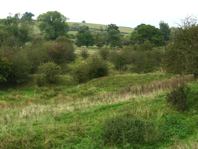
Bescaby is a small village located in the county of Leicestershire, England. Situated about 12 miles east of Melton Mowbray, it is part of the Melton district and falls within the Vale of Belvoir. The village is surrounded by picturesque countryside, characterized by rolling hills, farmlands, and charming rural landscapes.

Bescaby is known for its peaceful and idyllic atmosphere, making it an ideal place for those seeking a tranquil escape from the bustling city life. The village consists mainly of traditional stone houses and cottages, adding to its rustic charm. The local community is close-knit and friendly, creating a warm and welcoming environment for residents and visitors alike.

While Bescaby is primarily a residential area, it also boasts a rich agricultural heritage. The fertile land in the region has been used for farming for centuries, and agriculture continues to play a significant role in the local economy. The fields surrounding the village are often filled with crops, and livestock farming is also common in the area.

For those interested in exploring the outdoors, Bescaby offers plenty of opportunities. The village is surrounded by beautiful walking trails, allowing visitors to take in the stunning scenery and enjoy the tranquility of the countryside. Nearby attractions include Belvoir Castle, a magnificent stately home, and the charming village of Long Clawson, famous for its creamery and production of Stilton cheese.

Overall, Bescaby is a delightful village that preserves the traditional English countryside charm, offering a peaceful retreat for residents and visitors to enjoy the beauty of rural Leicestershire.

If you have any feedback on the listing, please let us know in the comments section below.

Bescaby Images

Images are sourced within 2km of 52.826989/-0.784875 or Grid Reference SK8126. Thanks to Geograph Open Source API. All images are credited.

Stonesby, St Peter
Stonesby, St Peter
The Green The road is named after the grass triangle, it appears.  Or, perhaps it's neighbour seen in <a href="https://www.geograph.org.uk/photo/7448807">SK8224 : Stonesby</a>.
The Green
The road is named after the grass triangle, it appears. Or, perhaps it's neighbour seen in SK8224 : Stonesby.
Stonesby I said in <a href="https://www.geograph.org.uk/photo/7448545">SK8224 : The Green</a> that the road name was taken from the grass triangle in that picture.  It might, of course, be this one - there a pair of grass triangles apex-to-apex within "The Green".  Both were bright with Daffodils when I visited.
Stonesby
I said in SK8224 : The Green that the road name was taken from the grass triangle in that picture. It might, of course, be this one - there a pair of grass triangles apex-to-apex within "The Green". Both were bright with Daffodils when I visited.
Village fixtures The erstwhile phone box, now home to a defibrillator, and the post box, still very much in use and bearing the marker of a "priority" post box from the Covid-19 pandemic.
Village fixtures
The erstwhile phone box, now home to a defibrillator, and the post box, still very much in use and bearing the marker of a "priority" post box from the Covid-19 pandemic.
Priority Postbicx The sticker is a memory of the dark days of Covid-19.
Priority Postbicx
The sticker is a memory of the dark days of Covid-19.
Inside the phone box The defibrillator device inside the erstwhile phone box from <a href="https://www.geograph.org.uk/photo/7448809">SK8224 : Village fixtures</a>.
Inside the phone box
The defibrillator device inside the erstwhile phone box from SK8224 : Village fixtures.
Hall Farm The house is a grade II listed building - <span class="nowrap"><a title="https://historicengland.org.uk/listing/the-list/list-entry/1074989?section=official-list-entry" rel="nofollow ugc noopener" href="https://historicengland.org.uk/listing/the-list/list-entry/1074989?section=official-list-entry">Link</a><img style="margin-left:2px;" alt="External link" title="External link - shift click to open in new window" src="https://s1.geograph.org.uk/img/external.png" width="10" height="10"/></span> .
Hall Farm
The house is a grade II listed building - LinkExternal link .
Gorse Farm A grade II listed building - <span class="nowrap"><a title="https://historicengland.org.uk/listing/the-list/list-entry/1294601" rel="nofollow ugc noopener" href="https://historicengland.org.uk/listing/the-list/list-entry/1294601">Link</a><img style="margin-left:2px;" alt="External link" title="External link - shift click to open in new window" src="https://s1.geograph.org.uk/img/external.png" width="10" height="10"/></span>
Gorse Farm
A grade II listed building - LinkExternal link
A dignified outbuilding
The path to the church The tower of St Peter's Church.
The path to the church
The tower of St Peter's Church.
Church of St Peter: chancel arch Above the chancel arch are these boards, with the ten commandments, the Lord's prayer, and the creed.  At one time these would have been on the lower walls, but seem to be out of harms way up here.  I suspect these are late 18th or 19th century.

The church is grade II* listed - see <span class="nowrap"><a title="https://historicengland.org.uk/listing/the-list/list-entry/1360956" rel="nofollow ugc noopener" href="https://historicengland.org.uk/listing/the-list/list-entry/1360956">Link</a><img style="margin-left:2px;" alt="External link" title="External link - shift click to open in new window" src="https://s1.geograph.org.uk/img/external.png" width="10" height="10"/></span> .  These boards are not mentioned in the listing.
Church of St Peter: chancel arch
Above the chancel arch are these boards, with the ten commandments, the Lord's prayer, and the creed. At one time these would have been on the lower walls, but seem to be out of harms way up here. I suspect these are late 18th or 19th century. The church is grade II* listed - see LinkExternal link . These boards are not mentioned in the listing.
Church of St Peter: the font This 12th century font has been reworked at some point, perhaps as late as the 1875 restoration, but the pattern is almost certainly original.

The church is grade II* listed - <span class="nowrap"><a title="https://historicengland.org.uk/listing/the-list/list-entry/1360956" rel="nofollow ugc noopener" href="https://historicengland.org.uk/listing/the-list/list-entry/1360956">Link</a><img style="margin-left:2px;" alt="External link" title="External link - shift click to open in new window" src="https://s1.geograph.org.uk/img/external.png" width="10" height="10"/></span> .
Church of St Peter: the font
This 12th century font has been reworked at some point, perhaps as late as the 1875 restoration, but the pattern is almost certainly original. The church is grade II* listed - LinkExternal link .
Church of St Peter: the organ Built in 1860 by Bryceson & Co, of London, for St. Mary Magdalene, Waltham on the Wolds.  It was moved here around 1968.  It has 6 stops.
Church of St Peter: the organ
Built in 1860 by Bryceson & Co, of London, for St. Mary Magdalene, Waltham on the Wolds. It was moved here around 1968. It has 6 stops.
Pasture near Croxton Park On the right, behind an overgrown dry-stone wall, Kennel Plantation.   Beneath the clump of trees on the left (middle distance) is a low, barrow-like mound - was this once the site of the windmill which gave the ridge its name?
Pasture near Croxton Park
On the right, behind an overgrown dry-stone wall, Kennel Plantation. Beneath the clump of trees on the left (middle distance) is a low, barrow-like mound - was this once the site of the windmill which gave the ridge its name?
Ordnance Survey FBM - Fundamental Bench Mark Found in the grass verge of Bescaby Lane, Waltham-on-the-Wold
Ordnance Survey FBM - Fundamental Bench Mark
Found in the grass verge of Bescaby Lane, Waltham-on-the-Wold
Farmland off the A607
Station Road towards Eaton
A607 towards Grantham
Show me another place!

Bescaby is located at Grid Ref: SK8126 (Lat: 52.826989, Lng: -0.784875)

Administrative County: Leicestershire

District: Melton

Police Authority: Leicestershire

What 3 Words

///sushi.elections.sourced. Near Wymondham, Leicestershire

Related Wikis

Bescaby

Bescaby is a hamlet, deserted medieval village and former civil parish, now in the parish of Sproxton, in the Melton district, in Leicestershire, England...

Framland

Framland was a hundred in north-east Leicestershire, England, roughly corresponding to today's borough of Melton. It was recorded in the Domesday Book...

Stonesby Quarry

Stonesby Quarry is a 3.2 hectares (7.9 acres) biological Site of Special Scientific Interest between Stonesby and Waltham on the Wolds in Leicestershire...

Croxton Park

Croxton Park is a 97.3-hectare (240-acre) biological Site of Special Scientific Interest south-west of Croxton Kerrial in Leicestershire.This medieval...

Nearby Amenities

Located within 500m of 52.826989,-0.784875
Hamwell Spring
Natural: spring
Source: OS OpenData StreetView
Source Name: OS OpenData StreetView
Lat/Long: 52.8255995/-0.7852435
Place: farm
Lat/Long: 52.8276411/-0.7895295
Place: farm
Lat/Long: 52.828406/-0.7805173
The data included in this document is from www.openstreetmap.org. The data is made available under ODbL.

Have you been to Bescaby?

Leave your review of Bescaby below (or comments, questions and feedback).