Newmill

Settlement in Roxburghshire

Scotland

Newmill

River Teviot Upstream of Newmill, beside the A7
River Teviot Credit: Richard Webb

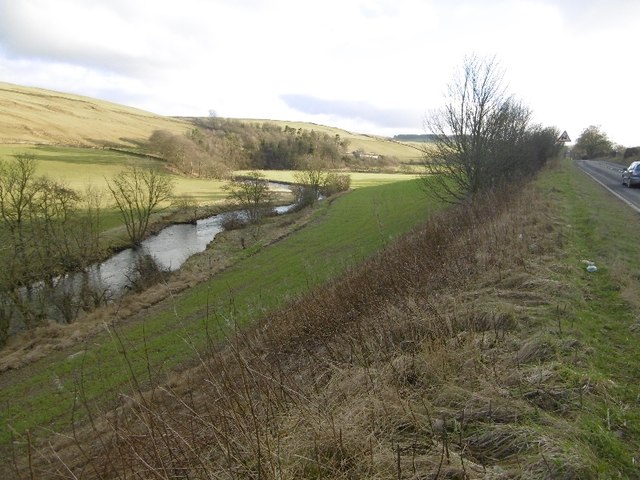
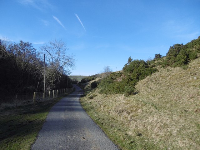
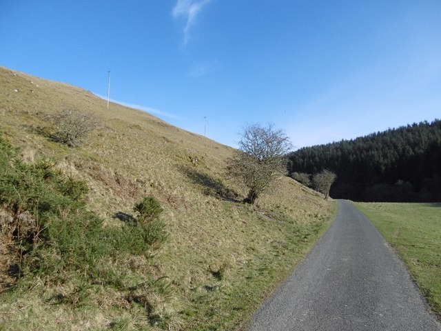
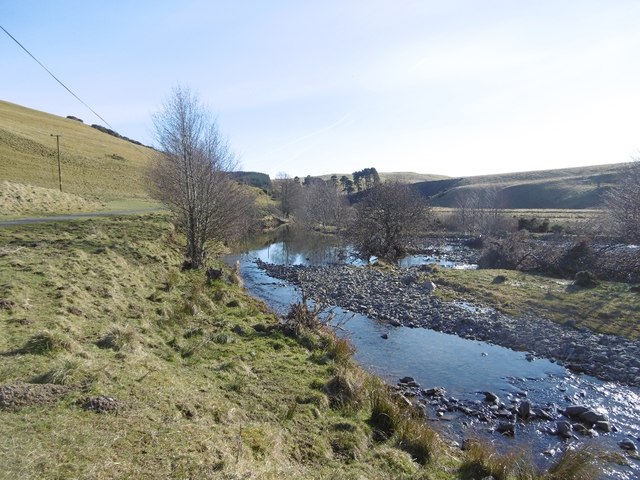
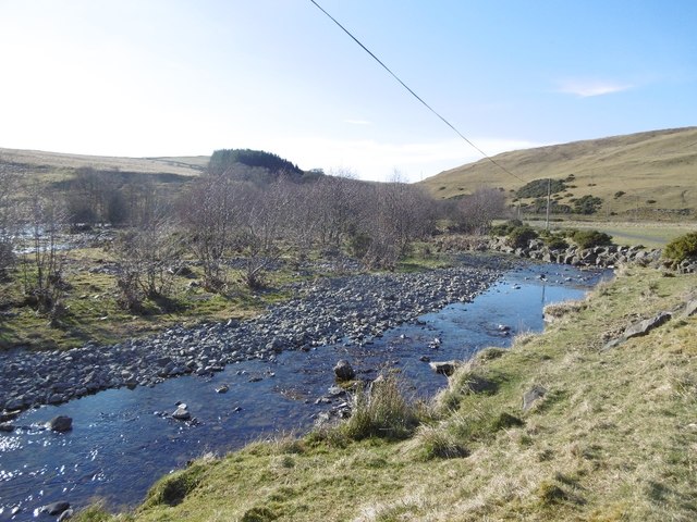
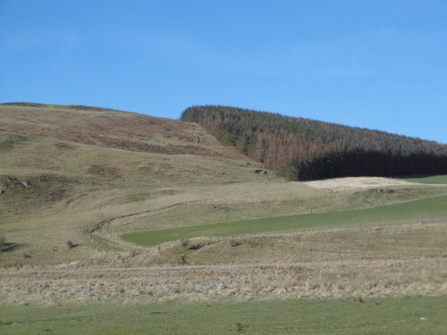
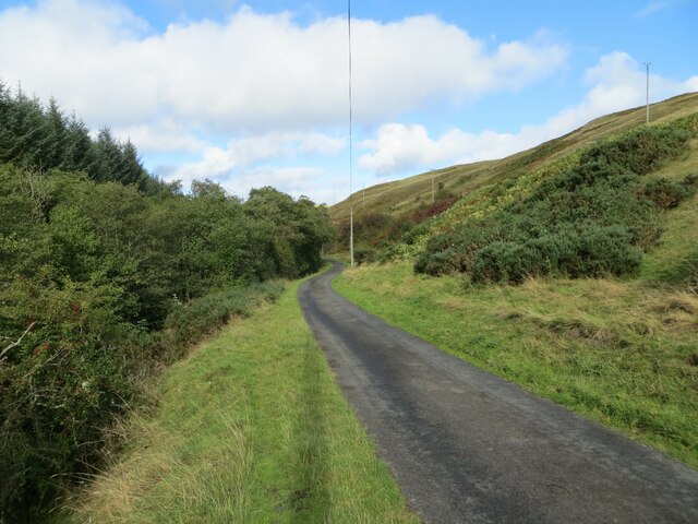
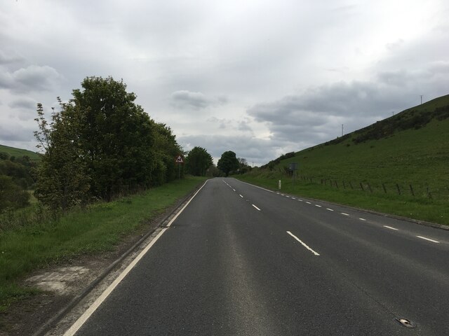
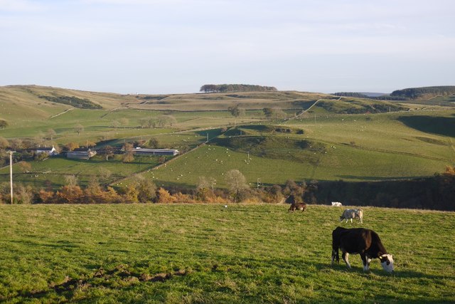
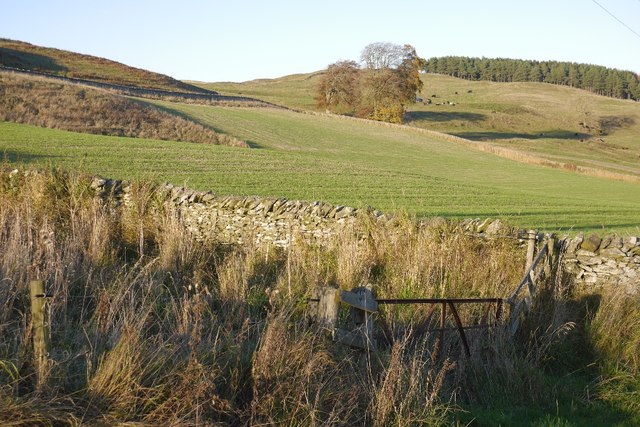
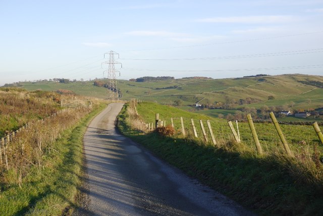
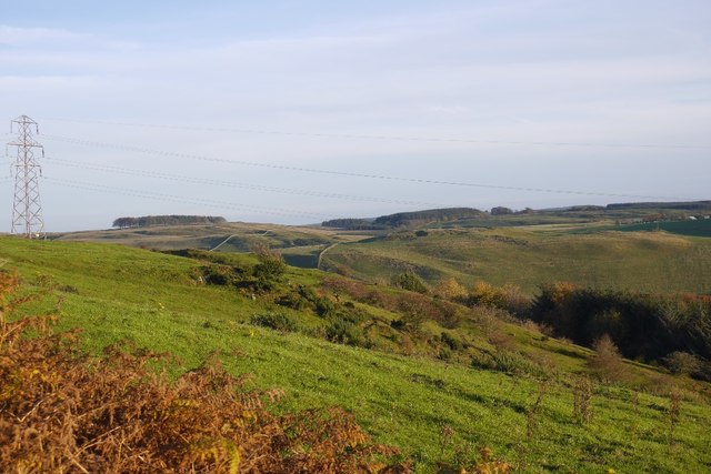
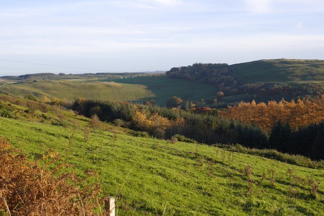
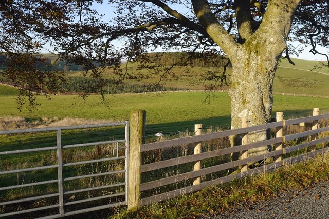
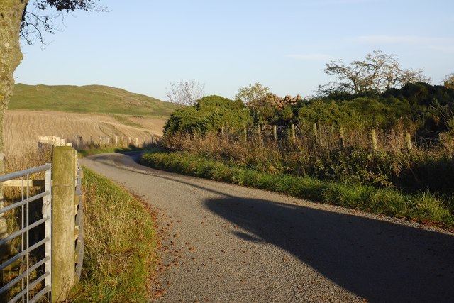
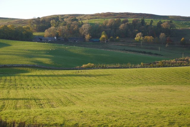
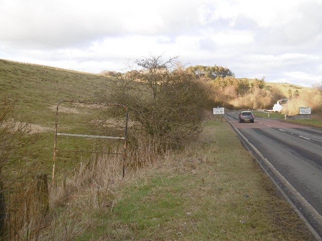
Newmill is a small village located in the region of Roxburghshire, Scotland. It is situated in the southern part of the country, near the border with England. The village is nestled among rolling hills and scenic countryside, offering residents and visitors a tranquil setting.

With a population of around 400 people, Newmill maintains a close-knit community atmosphere. The village primarily consists of traditional stone houses, adding to its picturesque charm. The local economy is predominantly based on agriculture, with farming being a major occupation for many residents.

Newmill boasts a rich history, dating back to the medieval era. The village is home to several historical landmarks, including a 13th-century church and a 16th-century castle ruin. These architectural remnants serve as reminders of the village's past and attract history enthusiasts from near and far.

Despite its small size, Newmill offers a range of amenities and services to its residents. These include a primary school, a community center, a post office, and a pub. The village also has a strong sense of community spirit, with various events and activities organized throughout the year, fostering a sense of togetherness among the locals.

For those seeking outdoor adventures, Newmill provides ample opportunities for walking, hiking, and exploring the surrounding countryside. The area is known for its scenic trails and breathtaking views, attracting nature lovers and outdoor enthusiasts.

In conclusion, Newmill is a charming village in Roxburghshire, Scotland, offering a peaceful and picturesque setting, a rich history, and a close-knit community.

If you have any feedback on the listing, please let us know in the comments section below.

Newmill Images

Images are sourced within 2km of 55.384983/-2.8619948 or Grid Reference NT4510. Thanks to Geograph Open Source API. All images are credited.

River Teviot Upstream of Newmill, beside the A7
River Teviot
Upstream of Newmill, beside the A7
Minor road along the Allan Water Beyond the Newmills fords, a very quiet road.
Minor road along the Allan Water
Beyond the Newmills fords, a very quiet road.
Allanhaugh A yellow road beside the Allan Water (Roxburghshire).
Allanhaugh
A yellow road beside the Allan Water (Roxburghshire).
Allan Water After several big spates in the preceding months.
Allan Water
After several big spates in the preceding months.
Allan Water Downstream view with evidence of recent spates.
Allan Water
Downstream view with evidence of recent spates.
Hill Head Rough grazing above the Allan Water.
Hill Head
Rough grazing above the Allan Water.
Minor road near to Lochburnfoot Looking north-westward.
Minor road near to Lochburnfoot
Looking north-westward.
Minor road beside Allan Water Looking north-westward in the direction of Newmill.
Minor road beside Allan Water
Looking north-westward in the direction of Newmill.
A7 towards Teviothead
Grazing, Branxholme A view across Teviotdale.
Grazing, Branxholme
A view across Teviotdale.
Branxholmpark Hill Grass fields above the Teviot, upstream of Hawick.
Branxholmpark Hill
Grass fields above the Teviot, upstream of Hawick.
Narrow road, Branxholme A scenic road with a couple of gates.
Narrow road, Branxholme
A scenic road with a couple of gates.
Branxholme Knowe A scrubby steep piece of hillside amongst improved fields.
Branxholme Knowe
A scrubby steep piece of hillside amongst improved fields.
Branxholm Glen Wooded slopes above the Teviot.
Branxholm Glen
Wooded slopes above the Teviot.
Branxholmtown Beeches beside a narrow, gated road.
Branxholmtown
Beeches beside a narrow, gated road.
Road, Branxholmtown
Road, Branxholmtown
Grassland, Branxholmtown Improved grazing with a view towards Chapelhill.
Grassland, Branxholmtown
Improved grazing with a view towards Chapelhill.
A7, Newmill The frame for an advertising sign remains in a field on the approach to Newmill in Teviotdale.
A7, Newmill
The frame for an advertising sign remains in a field on the approach to Newmill in Teviotdale.
Show me another place!

Newmill is located at Grid Ref: NT4510 (Lat: 55.384983, Lng: -2.8619948)

Unitary Authority: The Scottish Borders

Police Authority: The Lothians and Scottish Borders

What 3 Words

///cassettes.centuries.treaty. Near Hawick, Scottish Borders

Related Wikis

Newmill-on-Teviot

Newmill-on-Teviot, commonly called Newmill, is a hamlet in the Scottish Borders, 7 kilometres (4.3 mi) south of Hawick on the River Teviot. The remains...

Branxholme

Branxholme is a hamlet in the Scottish Borders area of Scotland, overlooking the River Teviot, 3 miles (5 kilometres) southwest of Hawick, on the A7 road...

Broadhaugh

Broadhaugh is a hamlet in the Scottish Borders area of Scotland, in the parish of Teviothead, in former Roxburghshire. == See also == List of places in...

Branxholme Castle

Branxholme Castle is a five-storey tower at Branxholme, about 3 miles south-west of Hawick in the Borders region of Scotland. == History == The present...

Nearby Amenities

Located within 500m of 55.384983,-2.8619948
Newmill road end
Naptan AtcoCode: 69001252
Naptan Bearing: N
Naptan BusStopType: CUS
Naptan CommonName: Newmill road end
Naptan Indicator: opp
Naptan Landmark: Post Box
Naptan NaptanCode: 72726432
Naptan Street: A7
Naptan Verified: no
Source: naptan_import
Lat/Long: 55.385587/-2.8650281
Bus Stop
Newmill Road End
Bus: yes
Naptan AtcoCode: 69001253
Naptan Bearing: SW
Naptan CommonName: Newmill Rd End
Naptan Indicator: adj
Naptan NaptanCode: 72726434
Naptan Street: A7
Operator: Scottish Borders Council
Public Transport: platform
Ref: 69001253
Source: NaPTAN
Lat/Long: 55.3854444/-2.8648672
Barrier: cattle_grid
Source: survey
Lat/Long: 55.3832959/-2.8598124
Post Box
Post Box Type: lamp
Ref: TD9 30
Royal Cypher: scottish_crown
Source: survey
Lat/Long: 55.3851324/-2.863874
Telephone
Booth: K6
Covered: booth
Source: survey
Lat/Long: 55.3851051/-2.863837
Newmill
Place: hamlet
Wikidata: Q7018608
Wikipedia: en:Newmill-on-Teviot
Lat/Long: 55.3847004/-2.86624
Damfoot
Place: hamlet
Lat/Long: 55.3869913/-2.8615036
Raesknowe
Place: isolated_dwelling
Lat/Long: 55.385018/-2.858727
Ford: yes
Lat/Long: 55.3848359/-2.8626099
Power: pole
Lat/Long: 55.3892319/-2.86068
Power: pole
Lat/Long: 55.3885332/-2.8615972
Power: pole
Lat/Long: 55.3878974/-2.8624101
Power: pole
Lat/Long: 55.3871963/-2.8633252
Power: pole
Lat/Long: 55.3867672/-2.8639806
Power: pole
Lat/Long: 55.3862647/-2.8647667
Power: pole
Lat/Long: 55.3859531/-2.8652095
Power: pole
Lat/Long: 55.3853797/-2.8661005
Power: pole
Lat/Long: 55.3850857/-2.8672566
Power: pole
Lat/Long: 55.3848532/-2.8681888
Power: pole
Lat/Long: 55.3845679/-2.8690977
Power: pole
Lat/Long: 55.3842373/-2.869538
Power: pole
Lat/Long: 55.3853329/-2.8660567
Power: pole
Lat/Long: 55.3850375/-2.8656421
Power: pole
Lat/Long: 55.3845796/-2.8649778
Power: pole
Lat/Long: 55.3847698/-2.8661108
Power: pole
Lat/Long: 55.3851574/-2.8633762
Power: pole
Lat/Long: 55.3854631/-2.863886
Power: pole
Lat/Long: 55.3856562/-2.8642053
Power: pole
Lat/Long: 55.3861359/-2.8644242
Power: pole
Lat/Long: 55.3857864/-2.8634715
Power: pole
Lat/Long: 55.3853578/-2.8622767
Power: pole
Lat/Long: 55.3850097/-2.8613446
Power: pole
Lat/Long: 55.3846732/-2.8603867
Power: pole
Lat/Long: 55.3843427/-2.8594545
Power: pole
Lat/Long: 55.3841554/-2.8592872
Power: pole
Lat/Long: 55.3836844/-2.8588288
Power: pole
Lat/Long: 55.383111/-2.8582315
Power: pole
Lat/Long: 55.3827453/-2.8578555
Power: pole
Lat/Long: 55.3824118/-2.8575079
Power: pole
Lat/Long: 55.3819349/-2.8570341
Power: pole
Lat/Long: 55.3869654/-2.8626549
Power: pole
Lat/Long: 55.3866487/-2.8617483
Power: pole
Lat/Long: 55.3867865/-2.8613993
Power: pole
Lat/Long: 55.3869521/-2.861195
The data included in this document is from www.openstreetmap.org. The data is made available under ODbL.

Have you been to Newmill?

Leave your review of Newmill below (or comments, questions and feedback).