Newcastle upon Tyne
Settlement in Northumberland
England
Newcastle upon Tyne

Newcastle upon Tyne, located in the county of Northumberland in northeast England, is a vibrant and historic city with a rich cultural heritage. Situated on the northern bank of the River Tyne, the city has a population of around 300,000 residents.
Newcastle is renowned for its iconic bridges, including the Tyne Bridge and the Gateshead Millennium Bridge, which connect the city to its neighboring town of Gateshead. These bridges have become symbols of the city's industrial past and are popular tourist attractions.
The city boasts an impressive collection of historical landmarks, such as the medieval Newcastle Castle Keep and the Grey's Monument, a column dedicated to Earl Grey, the famous British Prime Minister. Additionally, the Quayside area is a bustling hub of activity, with its picturesque waterfront, lively bars, and restaurants serving both traditional and international cuisine.
Newcastle is also well-known for its thriving arts and music scene. The city is home to several theaters, including the Theatre Royal and the Sage Gateshead, a world-class concert hall. The annual Newcastle International Film Festival and the Great North Run, the world's largest half-marathon, further showcase the city's commitment to arts and sports.
As a major university city, Newcastle is home to two prestigious institutions: Newcastle University and Northumbria University, attracting a large student population and contributing to the city's energetic atmosphere.
Overall, Newcastle upon Tyne offers a unique blend of history, culture, and modernity, making it an exciting destination for both residents and visitors alike.
If you have any feedback on the listing, please let us know in the comments section below.
Newcastle upon Tyne Images
Images are sourced within 2km of 54.978033/-1.610177 or Grid Reference NZ2564. Thanks to Geograph Open Source API. All images are credited.


Newcastle upon Tyne is located at Grid Ref: NZ2564 (Lat: 54.978033, Lng: -1.610177)
Unitary Authority: Newcastle upon Tyne
Police Authority: Northumbria
What 3 Words
///ridge.stroke.hoping. Near Newcastle upon Tyne, Tyne & Wear
Nearby Locations
Related Wikis

Newcastle City Hall
The Newcastle City Hall (currently known as O2 City Hall Newcastle for sponsorship reasons) is a concert hall located in Newcastle upon Tyne, England....

Newcastle City Baths
The Newcastle City Baths is a swimming and sports facility located in Newcastle upon Tyne, England. It is a Grade II listed building. == History == The...

Newcastle Civic Centre
Newcastle Civic Centre is a municipal building in the Haymarket area of Newcastle upon Tyne, England. Designed by George Kenyon, the centre was built for...
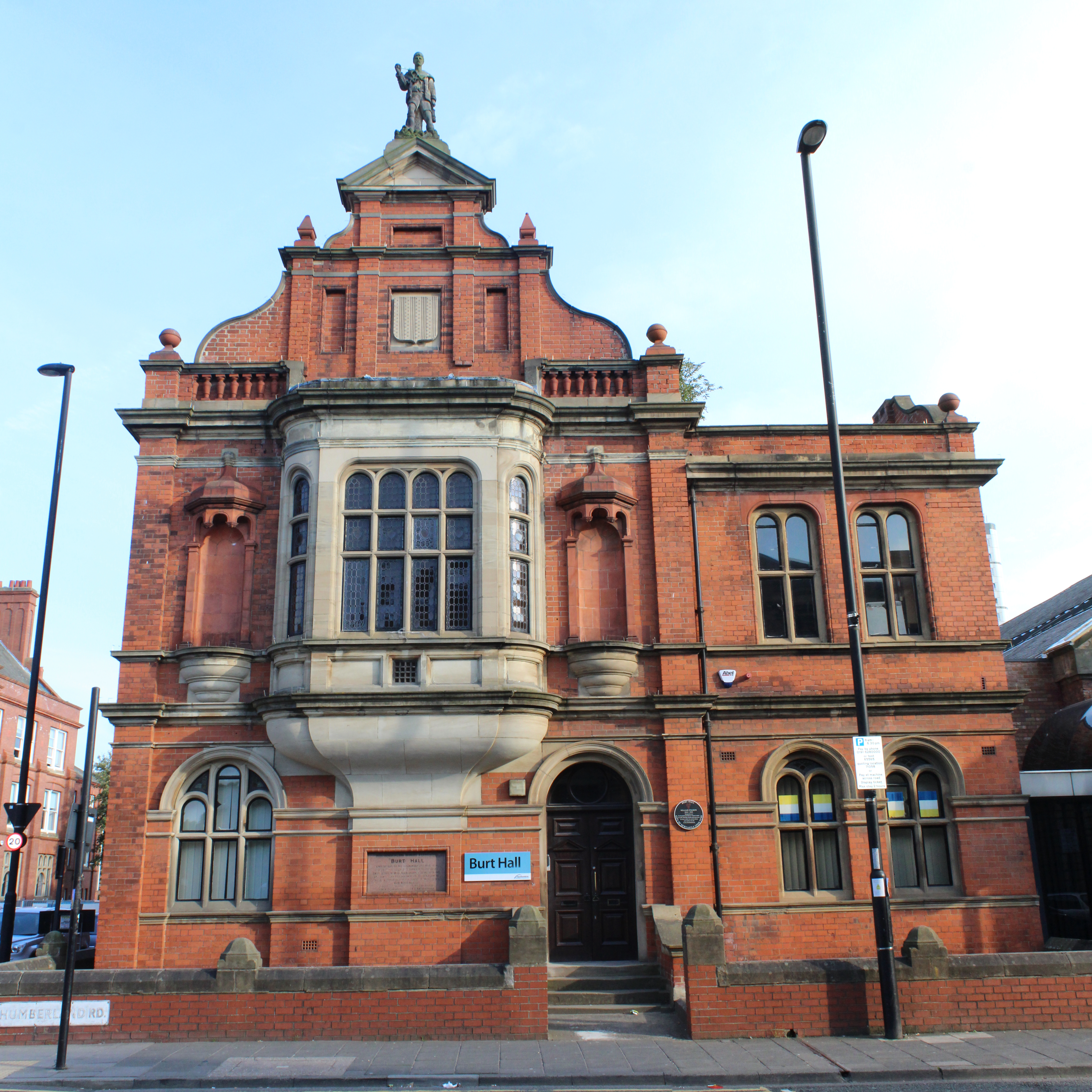
Burt Hall
Burt Hall is a public building in Northumberland Road in Newcastle upon Tyne. It is a Grade II listed building. == History == The building was designed...
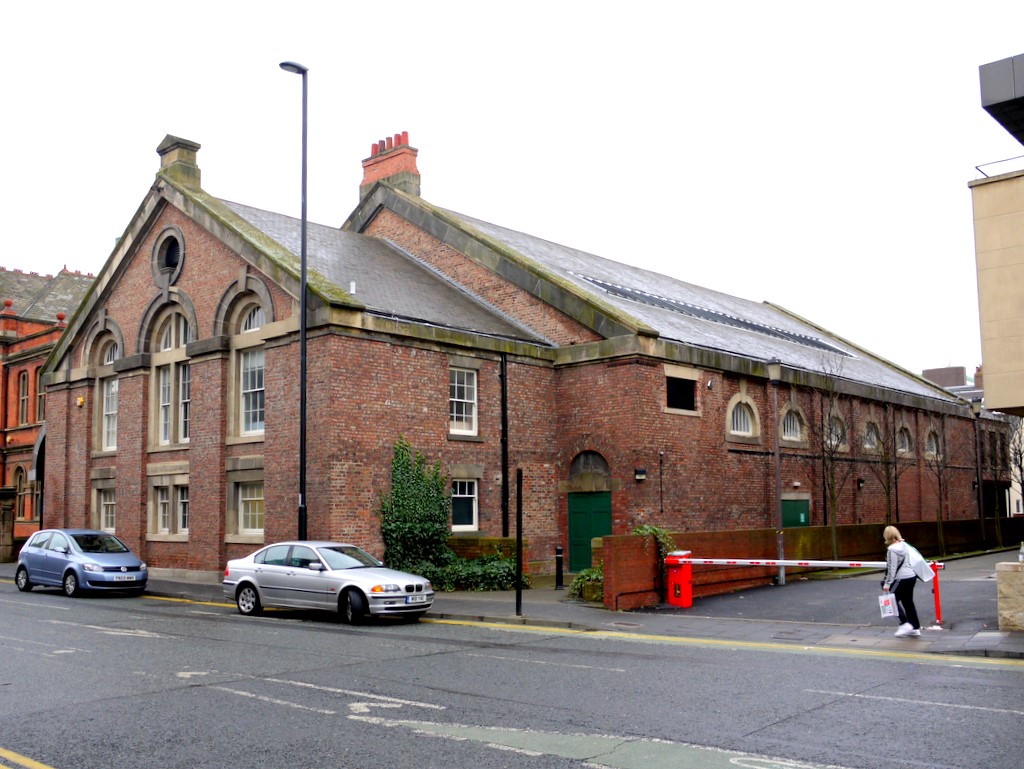
Army Riding School, Newcastle upon Tyne
The Army Riding School was a military installation in Northumberland Road, Newcastle upon Tyne. == History == The facility was designed by John Dobson...

Church of St Thomas the Martyr
The Church of St Thomas the Martyr (known as St Thomas' Newcastle) in Newcastle upon Tyne, Tyne and Wear, England. It is a prominent city centre landmarks...
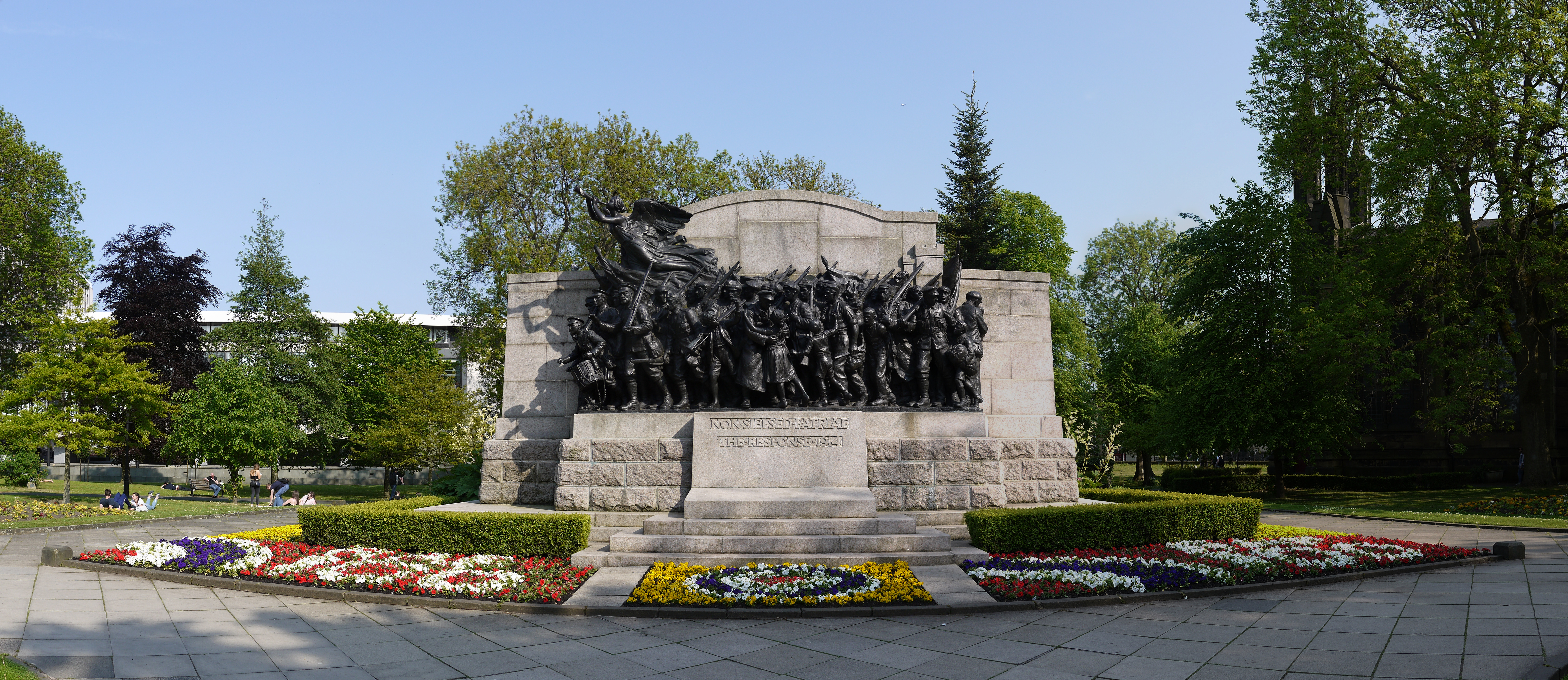
Northumberland Fusiliers Memorial
The Response 1914 (also known as the Northumberland Fusiliers Memorial) is a war memorial in the public gardens to the north of the Church of St Thomas...

North British Academy of Arts
The North British Academy of Arts (1908–1924) was an art institution of Newcastle upon Tyne in northern England. == Overview == The Academy, later known...
Related Videos

Walking around Newcastle city | Rainy day. 4K
Amazing walk around Newcastle city. Thanks for watching and sharing, please Like and subscribe to this YouTube channel for ...

Sunny walk in Newcastle upon Tyne | walking city tour.
Amazing walk in Newcastle upon Tyne or simply Newcastle, is a city and metropolitan borough in Tyne and Wear, England.

Walking in NEWCASTLE / England (UK) 🇬🇧- Newcastle upon Tyne - 4K 60fps (UHD)
Newcastle upon Tyne is a port city in the North East of England. The city was a major shipbuilding and manufacturing hub during ...

Newcastle Walking tour Exploring Newcastle upon Tyne ▪︎ 4K60FPS walk
Walking in Newcastle-upon-Tyne, Today's walk tour was filmed in Newcastle in 4k60fps Welcome to Newcastle City Marina ...
Nearby Amenities
Located within 500m of 54.978033,-1.610177Have you been to Newcastle upon Tyne?
Leave your review of Newcastle upon Tyne below (or comments, questions and feedback).