Berrow
Settlement in Somerset Sedgemoor
England
Berrow

Berrow is a small coastal village located in the county of Somerset, England. It is situated on the Bristol Channel and lies approximately 5 miles southwest of the town of Burnham-on-Sea. Berrow is known for its beautiful sandy beach, which stretches for over 7 miles and is backed by a large expanse of sand dunes.
The village itself is relatively small, with a population of around 1,000 residents. It has a charming, traditional feel and is surrounded by picturesque countryside. The main focal point of Berrow is the St. Mary's Church, a historic building that dates back to the 12th century. The church is well-preserved and features intricate stained glass windows and a unique octagonal tower.
Berrow is a popular destination for tourists, particularly during the summer months when visitors flock to its sandy shores. The beach offers opportunities for swimming, sunbathing, and various water sports. The sand dunes provide a peaceful retreat for nature lovers, with a diverse range of plant and animal species.
In addition to its natural beauty, Berrow is also home to a golf club that offers a challenging links course. The club attracts golf enthusiasts from far and wide, who come to enjoy the stunning coastal views and test their skills on the well-maintained greens.
Overall, Berrow is a tranquil and picturesque village that offers a perfect blend of natural beauty, historic charm, and recreational activities. It is a hidden gem on the Somerset coastline, providing a peaceful escape for both locals and visitors alike.
If you have any feedback on the listing, please let us know in the comments section below.
Berrow Images
Images are sourced within 2km of 51.266852/-3.012107 or Grid Reference ST2952. Thanks to Geograph Open Source API. All images are credited.


Berrow is located at Grid Ref: ST2952 (Lat: 51.266852, Lng: -3.012107)
Administrative County: Somerset
District: Sedgemoor
Police Authority: Avon and Somerset
What 3 Words
///horizons.originate.admiringly. Near Burnham-on-Sea, Somerset
Nearby Locations
Related Wikis

Berrow, Somerset
Berrow is a small residential coastal village and holiday area, a civil parish in Somerset, England, situated in between Burnham-on-Sea and Brean. According...

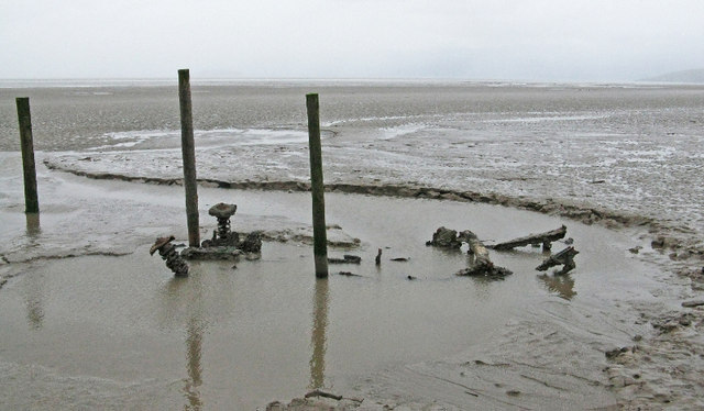
Nornen
The Nornen was a large sailing vessel of the barque type. The three masts were typical of barque ships; the foremast and mainmast square-rigged and the...
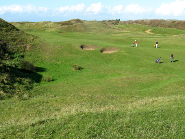
Burnham & Berrow Golf Club
Burnham & Berrow Golf Club is a 27-hole members golf club in Somerset, England which has hosted many of the leading amateur golf tournaments in Britain...

Brean Leisure Park
Brean Leisure Park is an amusement park in the coastal resort of Brean, near Burnham-on-Sea, Somerset, England. The park covers an area of 200 acres (80...

Bulldog Coaster (Brean Leisure Park)
Bulldog Coaster, formerly named Shock Wave or Crazy Loop is a roller coaster at Brean Leisure Park in Brean, Somerset, England. The ride, which was manufactured...

Astro Storm
Astro Storm is an enclosed, sit down roller coaster at Brean Leisure Park in Brean, England, created by German amusement ride manufacturer Zierer. It was...

Burnham-on-Sea High Lighthouse
The High lighthouse or pillar lighthouse is one of three lighthouses in Burnham-on-Sea, Somerset, England. A Grade II listed building, it is no longer...
Burnham-on-Sea Round Tower
The Round Tower was a lighthouse in Burnham-on-Sea, Somerset, England, established in 1801. It was decommissioned in 1832, having been replaced by a pair...
Nearby Amenities
Located within 500m of 51.266852,-3.012107Have you been to Berrow?
Leave your review of Berrow below (or comments, questions and feedback).