Marston, New

Settlement in Oxfordshire Oxford

England

Marston, New

Closure Notice at Santander Bank, Headington This notice is on the window of the Santander Bank branch at 116 London Road. It has the following wording:

             We're sorry that this branch is permanently
             closing on 12 August 2021 at 2.00pm

             Your nearest Santander branch(es):
             . Santander House, Carfax, Oxford OX1 1HB
             . 23 Bury Street, Abingdon OX14 3QT

             We look forward to welcoming you there.
Closure Notice at Santander Bank, Headington Credit: David Hillas

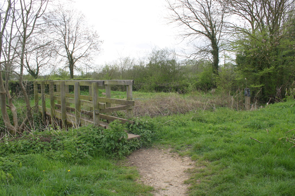
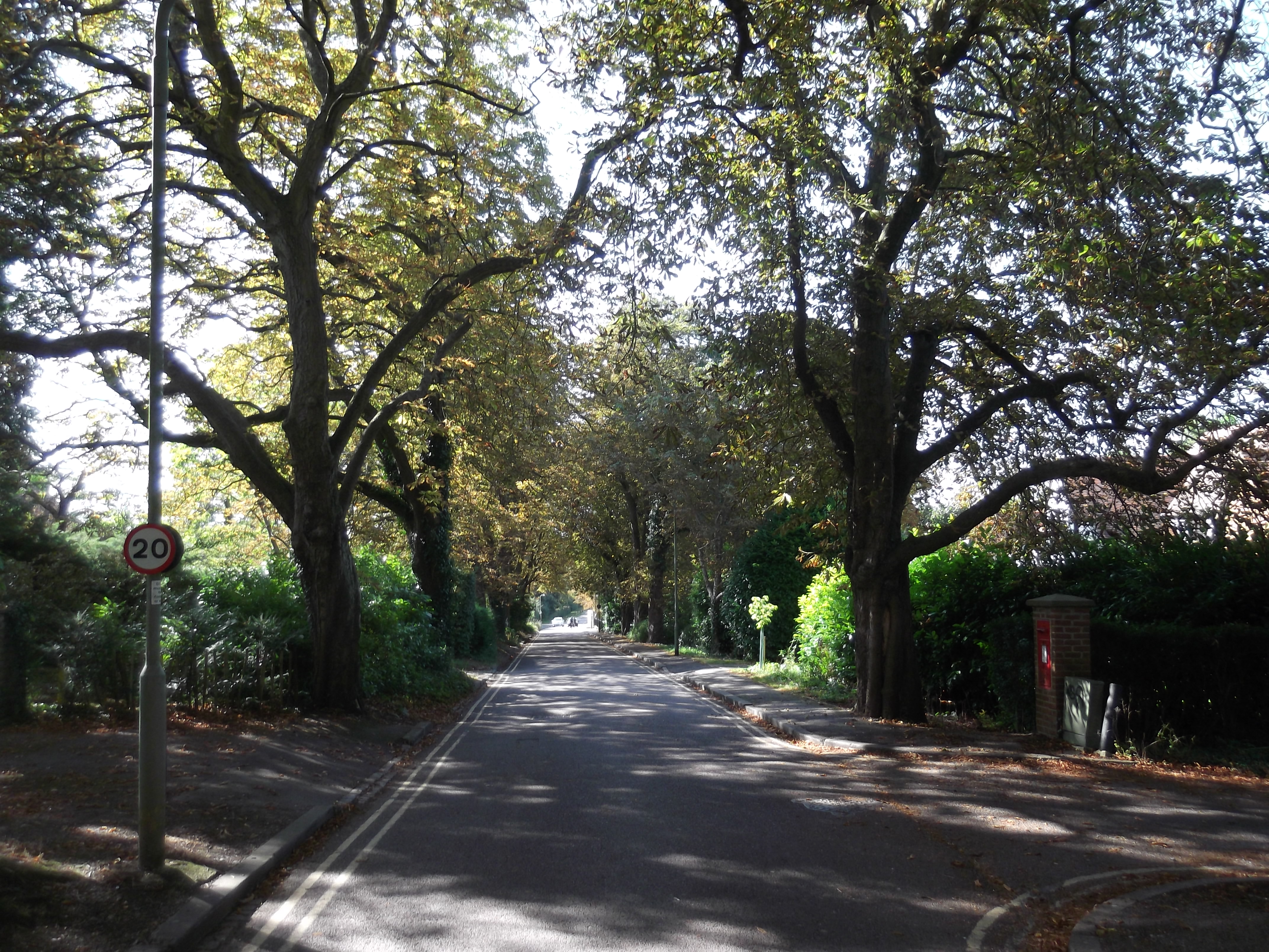
Marston, New, Oxfordshire is a small village located in the southern part of England, approximately five miles northeast of Oxford. It is situated on the northern bank of the River Cherwell, surrounded by picturesque countryside and rolling hills. Marston, New, Oxfordshire is known for its peaceful and rural setting, providing residents with a tranquil escape from the bustling city life of Oxford.

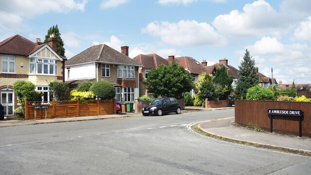
The village consists of a small cluster of traditional stone cottages and houses, giving it a charming and quaint atmosphere. The architecture in Marston, New, Oxfordshire is predominantly traditional English, with many buildings dating back several centuries. The village also features a historic church, St. Nicholas Church, which serves as a focal point for the community.

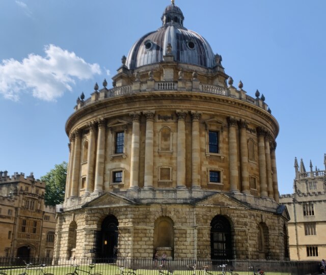
Although relatively small, Marston, New, Oxfordshire offers a range of amenities to its residents. There is a local primary school, a village hall, and a few small shops and businesses that cater to the needs of the community. For more extensive amenities, residents can easily access the nearby city of Oxford, which offers a wide variety of shopping, dining, and entertainment options.

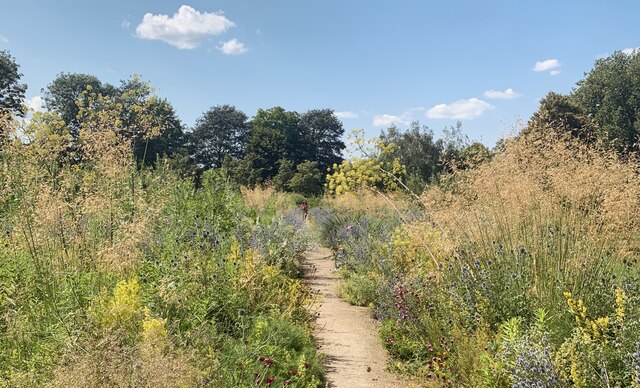
The natural surroundings of Marston, New, Oxfordshire make it an ideal location for outdoor enthusiasts. The village is surrounded by beautiful countryside, with numerous walking and cycling trails that provide stunning views of the landscape. Additionally, the River Cherwell offers opportunities for boating and fishing.

Overall, Marston, New, Oxfordshire is a peaceful and idyllic village, perfect for those seeking a quieter lifestyle while still having access to the amenities and attractions of nearby Oxford.

If you have any feedback on the listing, please let us know in the comments section below.

Marston, New Images

Images are sourced within 2km of 51.765921/-1.239189 or Grid Reference SP5207. Thanks to Geograph Open Source API. All images are credited.

Closure Notice at Santander Bank, Headington This notice is on the window of the Santander Bank branch at 116 London Road. It has the following wording:

             We're sorry that this branch is permanently
             closing on 12 August 2021 at 2.00pm

             Your nearest Santander branch(es):
             . Santander House, Carfax, Oxford OX1 1HB
             . 23 Bury Street, Abingdon OX14 3QT

             We look forward to welcoming you there.
Closure Notice at Santander Bank, Headington
This notice is on the window of the Santander Bank branch at 116 London Road. It has the following wording: We're sorry that this branch is permanently closing on 12 August 2021 at 2.00pm Your nearest Santander branch(es): . Santander House, Carfax, Oxford OX1 1HB . 23 Bury Street, Abingdon OX14 3QT We look forward to welcoming you there.
Travelling farrier shoeing pony, Marston, Oxford, 1957 When this pony was kept in Kemerton in the Vale of Evesham shoeing was done by the blacksmith at his forge. Moving to Oxford, the farrier brought his van to the horse.
Travelling farrier shoeing pony, Marston, Oxford, 1957
When this pony was kept in Kemerton in the Vale of Evesham shoeing was done by the blacksmith at his forge. Moving to Oxford, the farrier brought his van to the horse.
Bowness Avenue Bus Stop B4495 near John Radcliffe Hospital.
Bowness Avenue Bus Stop
B4495 near John Radcliffe Hospital.
Corner of Ambleside Drive The junction of Ambleside Drive with Eden Drive, part of an estate developed in the 1950s where all the street names have a Lake District connection.
Corner of Ambleside Drive
The junction of Ambleside Drive with Eden Drive, part of an estate developed in the 1950s where all the street names have a Lake District connection.
Trees along Ambleside Drive Part of an estate developed in the 1950s where all the street names have a Lake District connection.
Trees along Ambleside Drive
Part of an estate developed in the 1950s where all the street names have a Lake District connection.
Street View The Google street view car driving away from the traffic lights along Hedley Way in Headington
Street View
The Google street view car driving away from the traffic lights along Hedley Way in Headington
The Radcliffe Camera, Oxford
Botanic gardens, Oxford
St Andrew's Church
St Andrew's Church
Lodge, St Hugh's College
The entrance to the Botanic Gardens Oxford's Botanic Garden <span class="nowrap"><a title="https://www.obga.ox.ac.uk/" rel="nofollow ugc noopener" href="https://www.obga.ox.ac.uk/">Link</a><img style="margin-left:2px;" alt="External link" title="External link - shift click to open in new window" src="https://s1.geograph.org.uk/img/external.png" width="10" height="10"/></span> may not be as extensive as Cambridge's, but it has more history and a more spectacular entrance, part of which can be glimpsed here through the railings.  On the other side of the High can be seen the lodge of Magdalen College <span class="nowrap"><a title="https://www.magd.ox.ac.uk/" rel="nofollow ugc noopener" href="https://www.magd.ox.ac.uk/">Link</a><img style="margin-left:2px;" alt="External link" title="External link - shift click to open in new window" src="https://s1.geograph.org.uk/img/external.png" width="10" height="10"/></span>.
The entrance to the Botanic Gardens
Oxford's Botanic Garden LinkExternal link may not be as extensive as Cambridge's, but it has more history and a more spectacular entrance, part of which can be glimpsed here through the railings. On the other side of the High can be seen the lodge of Magdalen College LinkExternal link.
Merton Field looking towards Merton College
Broad Street
Broad Street
Balliol College Chapel Balliol College, founded in 1263, is one of the constituent colleges of the University of Oxford.
Among the college's alumni are three former prime ministers (H. H. Asquith, who once described Balliol men as possessing "the tranquil consciousness of an effortless superiority", Harold Macmillan, and Edward Heath), five Nobel laureates, and a number of literary figures and philosophers. Moral philosopher Adam Smith is perhaps the best known alumnus of the college.
Wikipedia: <span class="nowrap"><a title="http://en.wikipedia.org/wiki/Balliol_College,_Oxford" rel="nofollow ugc noopener" href="http://en.wikipedia.org/wiki/Balliol_College,_Oxford">Link</a><img style="margin-left:2px;" alt="External link" title="External link - shift click to open in new window" src="https://s1.geograph.org.uk/img/external.png" width="10" height="10"/></span> 
Website: <span class="nowrap"><a title="www.balliol.ox.ac.uk/" rel="nofollow ugc noopener" href="http://www.balliol.ox.ac.uk/">Link</a><img style="margin-left:2px;" alt="External link" title="External link - shift click to open in new window" src="https://s1.geograph.org.uk/img/external.png" width="10" height="10"/></span>
Balliol College Chapel
Balliol College, founded in 1263, is one of the constituent colleges of the University of Oxford. Among the college's alumni are three former prime ministers (H. H. Asquith, who once described Balliol men as possessing "the tranquil consciousness of an effortless superiority", Harold Macmillan, and Edward Heath), five Nobel laureates, and a number of literary figures and philosophers. Moral philosopher Adam Smith is perhaps the best known alumnus of the college. Wikipedia: LinkExternal link Website: LinkExternal link
Balliol College Library Balliol College, founded in 1263, is one of the constituent colleges of the University of Oxford.
Among the college's alumni are three former prime ministers (H. H. Asquith, who once described Balliol men as possessing "the tranquil consciousness of an effortless superiority", Harold Macmillan, and Edward Heath), five Nobel laureates, and a number of literary figures and philosophers. Moral philosopher Adam Smith is perhaps the best known alumnus of the college.
Wikipedia: <span class="nowrap"><a title="http://en.wikipedia.org/wiki/Balliol_College,_Oxford" rel="nofollow ugc noopener" href="http://en.wikipedia.org/wiki/Balliol_College,_Oxford">Link</a><img style="margin-left:2px;" alt="External link" title="External link - shift click to open in new window" src="https://s1.geograph.org.uk/img/external.png" width="10" height="10"/></span> 
Website: <span class="nowrap"><a title="www.balliol.ox.ac.uk/" rel="nofollow ugc noopener" href="http://www.balliol.ox.ac.uk/">Link</a><img style="margin-left:2px;" alt="External link" title="External link - shift click to open in new window" src="https://s1.geograph.org.uk/img/external.png" width="10" height="10"/></span>
Balliol College Library
Balliol College, founded in 1263, is one of the constituent colleges of the University of Oxford. Among the college's alumni are three former prime ministers (H. H. Asquith, who once described Balliol men as possessing "the tranquil consciousness of an effortless superiority", Harold Macmillan, and Edward Heath), five Nobel laureates, and a number of literary figures and philosophers. Moral philosopher Adam Smith is perhaps the best known alumnus of the college. Wikipedia: LinkExternal link Website: LinkExternal link
Balliol College Balliol College, founded in 1263, is one of the constituent colleges of the University of Oxford.
Among the college's alumni are three former prime ministers (H. H. Asquith, who once described Balliol men as possessing "the tranquil consciousness of an effortless superiority", Harold Macmillan, and Edward Heath), five Nobel laureates, and a number of literary figures and philosophers. Moral philosopher Adam Smith is perhaps the best known alumnus of the college.
Wikipedia: <span class="nowrap"><a title="http://en.wikipedia.org/wiki/Balliol_College,_Oxford" rel="nofollow ugc noopener" href="http://en.wikipedia.org/wiki/Balliol_College,_Oxford">Link</a><img style="margin-left:2px;" alt="External link" title="External link - shift click to open in new window" src="https://s1.geograph.org.uk/img/external.png" width="10" height="10"/></span> 
Website: <span class="nowrap"><a title="www.balliol.ox.ac.uk/" rel="nofollow ugc noopener" href="http://www.balliol.ox.ac.uk/">Link</a><img style="margin-left:2px;" alt="External link" title="External link - shift click to open in new window" src="https://s1.geograph.org.uk/img/external.png" width="10" height="10"/></span>
Balliol College
Balliol College, founded in 1263, is one of the constituent colleges of the University of Oxford. Among the college's alumni are three former prime ministers (H. H. Asquith, who once described Balliol men as possessing "the tranquil consciousness of an effortless superiority", Harold Macmillan, and Edward Heath), five Nobel laureates, and a number of literary figures and philosophers. Moral philosopher Adam Smith is perhaps the best known alumnus of the college. Wikipedia: LinkExternal link Website: LinkExternal link
Martyrs' Memorial The Martyrs' Memorial was built 300 years after the events of the English Reformation and commemorates the Bishop of Worcester Hugh Latimer and Bishop of London Nicholas Ridley, who were burned nearby on 16th October 1555, after having been convicted for heresy because of their Protestant beliefs.
Martyrs' Memorial
The Martyrs' Memorial was built 300 years after the events of the English Reformation and commemorates the Bishop of Worcester Hugh Latimer and Bishop of London Nicholas Ridley, who were burned nearby on 16th October 1555, after having been convicted for heresy because of their Protestant beliefs.
Cornmarket Street
Cornmarket Street
Show me another place!

Marston, New is located at Grid Ref: SP5207 (Lat: 51.765921, Lng: -1.239189)

Administrative County: Oxfordshire

District: Oxford

Police Authority: Thames Valley

What 3 Words

///owner.eager.moving. Near Oxford, Oxfordshire

Nearby Locations

Marston, New New Marston

Related Wikis

New Marston

New Marston is a suburb about 1.25 miles (2 km) northeast of the centre of Oxford, England. == History == New Marston is built on land that was originally...

Marston Road

Marston Road is a road in the east of Oxford, England. It links London Place, the junction of St Clements, the foot of Headington Hill (Headington Road...

New Marston Meadows

New Marston Meadows is a 44.7-hectare (110-acre) biological Site of Special Scientific Interest in Oxford in Oxfordshire.These meadows in the floodplain...

Milham Ford School

Milham Ford School was a girls' secondary school in Oxford, England, located in the suburb of New Marston on Marston Road. It was founded in East Oxford...
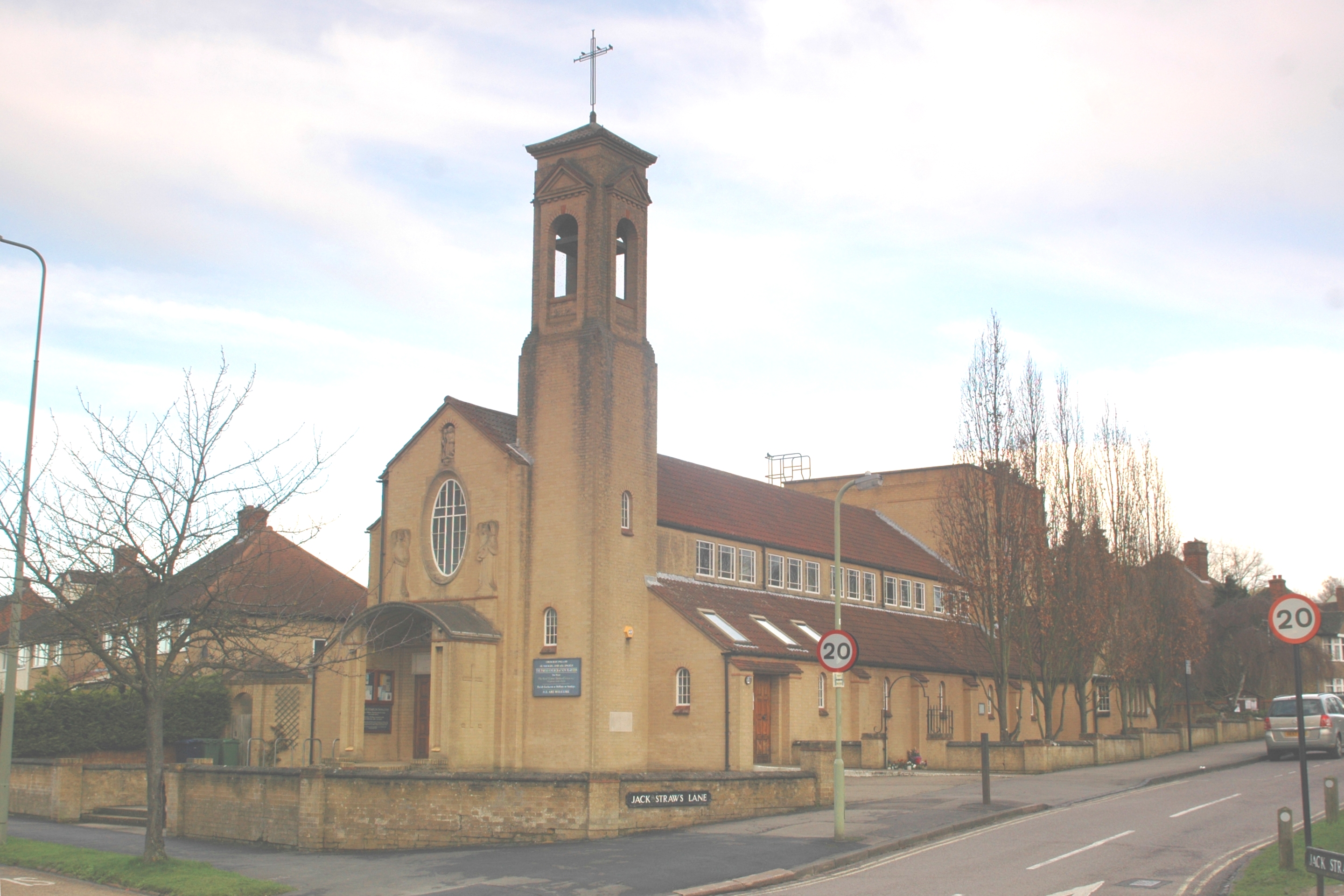
Jack Straw's Lane

Jack Straw's Lane is a residential road in Oxford, England. It runs between the north end of Pullens Lane on Headington Hill and Marston Road. == History... ==

Swan School, Oxford

The Swan School is a coeducational secondary school and sixth form located in Marston, Oxford. The school opened in September 2019 and was Oxford's first...

Dame's Delight

Dame's Delight was a place for women to bathe on the bank of the River Cherwell in the meadows near the Oxford University Parks opposite Mesopotamia Walk...
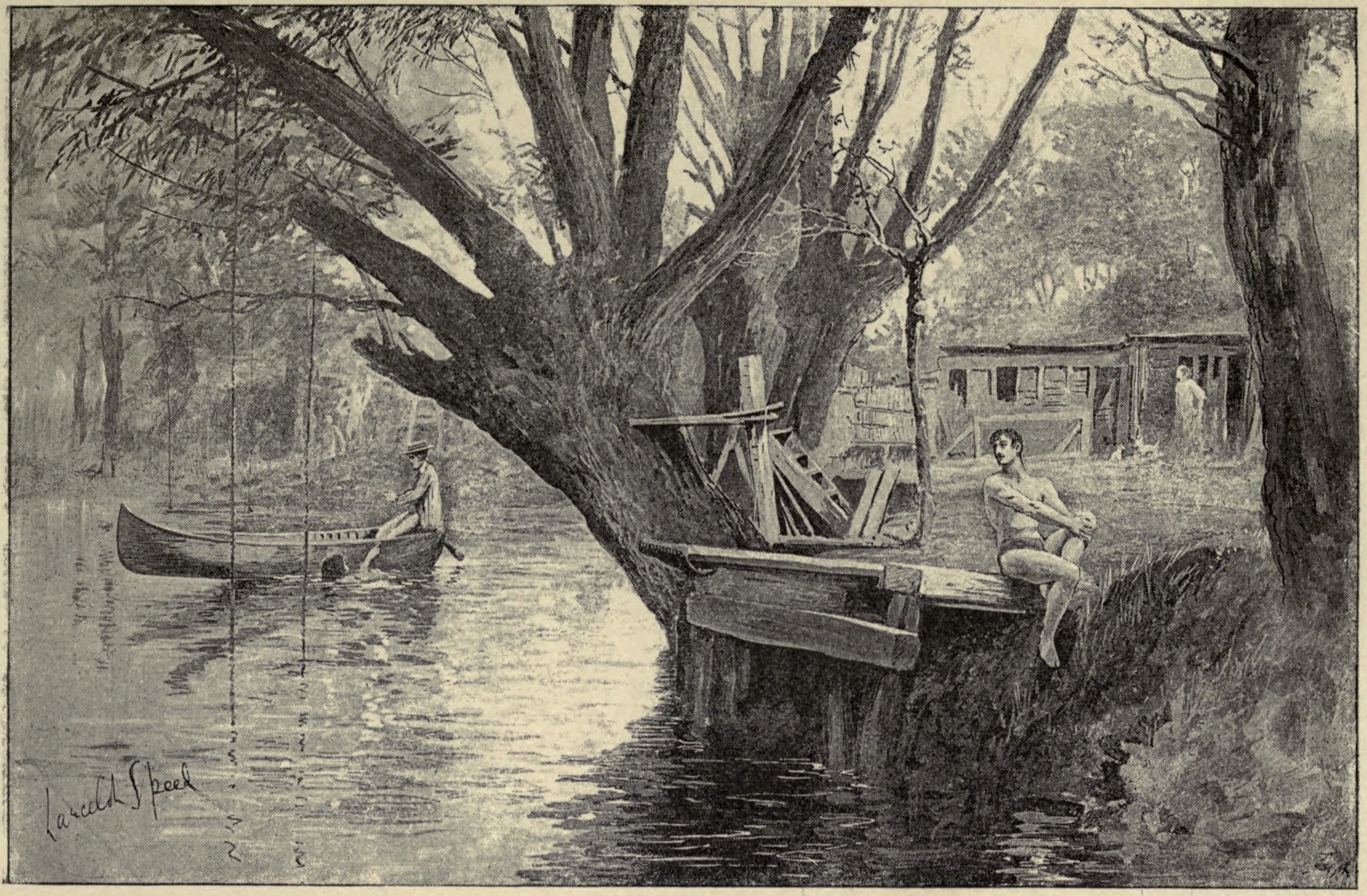
Parson's Pleasure

Parson's Pleasure in the University Parks at Oxford, England, was a secluded area for male-only nude bathing on the River Cherwell. It was located next...

Nearby Amenities

Located within 500m of 51.765921,-1.239189
Turning Circle
Turning Circle: knuckle
Lat/Long: 51.7634087/-1.2386604
Turning Circle
Turning Circle: square
Lat/Long: 51.7621992/-1.2381621
Turning Circle
Lat/Long: 51.763085/-1.2376862
Turning Circle
Lat/Long: 51.7641419/-1.2363018
Turning Circle
Lat/Long: 51.7648515/-1.2357735
Turning Circle
Turning Circle: y-head
Lat/Long: 51.7655751/-1.2354522
Turning Circle
Turning Circle: y-head
Lat/Long: 51.767335/-1.2337371
Turning Circle
Lat/Long: 51.7682085/-1.2342803
Turning Circle
Turning Circle: square
Lat/Long: 51.76677/-1.2403374
New Marston
Place: suburb
Lat/Long: 51.7658159/-1.2391699
Post Box
Check Date: 2021-08-03
Collection Times: Mo-Fr 17:00; Sa 12:00
Post Box Type: pillar
Ref: OX3 611
Lat/Long: 51.766109/-1.2344072
Traffic Signals
Bicycle: yes
Crossing: traffic_signals
Crossing Ref: toucan
Source Crossing: photograph
Lat/Long: 51.7626103/-1.2356012
Barrier: bollard
Source: photograph
Lat/Long: 51.7627977/-1.2390314
Turning Circle
Turning Circle: square
Lat/Long: 51.7627471/-1.2389739
Barrier: cycle_barrier
Bicycle: yes
Foot: yes
Lat/Long: 51.7639117/-1.2395836
Barrier: bollard
Lat/Long: 51.7629694/-1.2396935
Bus Stop
Jack Straw's Lane
Bench: yes
Bin: yes
Bus: yes
Bus Routes: 13;U5;U10;X13
Direction: S
Naptan AtcoCode: 340001270CNR
Naptan Bearing: S
Naptan CommonName: Jack Straw's Lane
Naptan Indicator: Corner
Naptan Landmark: Jack Straw's Lane
Naptan NaptanCode: oxfajajp
Naptan PlusbusZoneRef: OXFD
Naptan Street: Marston Road
Passenger Information Display: yes
Public Transport: platform
Ref: 69325257
Route Ref: 100;X3
Shelter: yes
Source: naptan_import;local knowledge
Timetable: yes
Lat/Long: 51.762481/-1.2354959
Bus Stop
Crotch Crescent
Bench: yes
Bin: yes
Bus: yes
Covered: yes
Direction: N
Lit: yes
Naptan AtcoCode: 340001275OCC
Naptan Bearing: N
Naptan CommonName: The Friar
Naptan Indicator: Opposite Crotch Crescent
Naptan Landmark: The Friar
Naptan NaptanCode: oxfajagj
Naptan PlusbusZoneRef: OXFD
Naptan Street: Marston Road
Passenger Information Display: no
Public Transport: platform
Ref: 69325245
Route Ref: X3
Shelter: yes
Source: naptan_import
Tactile Paving: no
Lat/Long: 51.7655842/-1.2340134
Barrier: stile
Lat/Long: 51.7667123/-1.2463049
Barrier: stile
Lat/Long: 51.7683233/-1.244469
Barrier: stile
Lat/Long: 51.768711/-1.2440656
Barrier: cycle_barrier
Lat/Long: 51.7656819/-1.2328026
Bus Stop
Jack Straw's Lane
Bench: no
Bin: no
Bus: yes
Covered: no
Naptan AtcoCode: 340001270OPP
Naptan Bearing: N
Naptan CommonName: Jack Straw's Lane
Naptan Indicator: Opposite
Naptan Landmark: Jack Straw's Lane
Naptan NaptanCode: oxfajajm
Naptan PlusbusZoneRef: OXFD
Naptan Street: Marston Road
Passenger Information Display: no
Public Transport: platform
Ref: 69325256
Route Ref: X3
Shelter: no
Source: naptan_import
Tactile Paving: no
Timetable: yes
Lat/Long: 51.7631484/-1.2355173
Bus Stop
Mortimer Drive
Bench: yes
Bin: no
Bus: yes
Covered: no
Naptan AtcoCode: 340001271CNR
Naptan Bearing: NW
Naptan CommonName: Mortimer Drive
Naptan Indicator: Corner
Naptan Landmark: Mortimer Drive
Naptan NaptanCode: oxfajajg
Naptan PlusbusZoneRef: OXFD
Naptan Street: Old Marston Road
Naptan Verified: no
Passenger Information Display: no
Public Transport: platform
Ref: 69325254
Route Ref: X3
Shelter: no
Source: naptan_import
Lat/Long: 51.768548/-1.2372567
Bus Stop
Mortimer Drive
Bench: yes
Bin: yes
Bus: yes
Covered: yes
Naptan AtcoCode: 340001271OPP
Naptan Bearing: SE
Naptan CommonName: Mortimer Drive
Naptan Indicator: Opposite
Naptan Landmark: Mortimer Drive
Naptan NaptanCode: oxfajajd
Naptan PlusbusZoneRef: OXFD
Naptan Street: Old Marston Road
Passenger Information Display: no
Public Transport: platform
Route Ref: X3
Shelter: yes
Source: naptan_import
Lat/Long: 51.7680306/-1.2368694
Bus Stop
Rippington Drive
Bench: no
Bin: no
Bus: yes
Covered: no
Naptan AtcoCode: 340001272CNR
Naptan Bearing: NW
Naptan CommonName: Rippington Drive
Naptan Indicator: corner
Naptan Landmark: Rippington Drive
Naptan NaptanCode: oxfajaja
Naptan PlusbusZoneRef: OXFD
Naptan Street: Old Marston Road
Passenger Information Display: no
Public Transport: platform
Ref: 69325252
Route Ref: X3
Shelter: no
Source: naptan_import
Lat/Long: 51.7676579/-1.2368106
Bus Stop
Crotch Crescent
Bench: yes
Bin: yes
Bus: yes
Bus Routes: 13;U5;X13
Covered: yes
Direction: S
Lit: yes
Naptan AtcoCode: 340001275CCC
Naptan Bearing: S
Naptan CommonName: The Friar
Naptan Indicator: Crotch Crescent Corner
Naptan Landmark: The Friar
Naptan NaptanCode: oxfajagm
Naptan PlusbusZoneRef: OXFD
Naptan Street: Marston Road
Passenger Information Display: no
Public Transport: platform
Ref: 69325246
Route Ref: 100;X3
Shelter: yes
Source: photograph
Tactile Paving: no
Timetable: yes
Lat/Long: 51.76517/-1.2341806
Post Box
Brand: Royal Mail
Brand Wikidata: Q638098
Brand Wikipedia: en:Royal Mail
Check Date: 2021-12-22
Collection Times: Mo-Fr 09:00; Sa 07:00
Drive Through: no
Operator: Royal Mail
Operator Wikidata: Q638098
Post Box Apertures: 1
Post Box Type: lamp
Ref: OX3 926D
Royal Cypher: EIIR
Royal Cypher Wikidata: Q33102113
Lat/Long: 51.762379/-1.2369689
Key Pit Security
Shop: locksmith
Lat/Long: 51.7682866/-1.2404631
Graham
Addr Housenumber: 9
Addr Postcode: OX3 0RX
Addr Street: Salford Road
Shop: hairdresser
Lat/Long: 51.7684237/-1.2402274
Salford Stores
Shop: convenience
Lat/Long: 51.7682547/-1.2405575
Post Box
Collection Times: Mo-Fr 17:00; Sa 11:30
Post Box Type: pillar
Ref: OX3 735
Royal Cypher: EIIR
Royal Cypher Wikidata: Q33102113
Lat/Long: 51.7684302/-1.2404581
Speed Camera
Lat/Long: 51.7619457/-1.2358805
Crossing
Crossing: unmarked
Crossing Island: yes
Crossing Markings: no
Tactile Paving: yes
Lat/Long: 51.7658793/-1.2336613
Barrier: cycle_barrier
Lat/Long: 51.7685977/-1.2344688
Crossing
Lat/Long: 51.7689309/-1.2339518
Turning Circle
Turning Circle: hammer
Lat/Long: 51.7696246/-1.2362665
Crossing
Crossing: unmarked
Crossing Markings: no
Kerb: lowered
Tactile Paving: yes
Lat/Long: 51.7658644/-1.2336061
Crossing
Crossing: unmarked
Crossing Island: yes
Crossing Markings: no
Tactile Paving: yes
Lat/Long: 51.7660115/-1.2337371
Crossing
Crossing: unmarked
Crossing Markings: no
Kerb: lowered
Tactile Paving: yes
Lat/Long: 51.7658962/-1.2337115
Atm
Check Date: 2021-01-17
Fee: no
Operator: Co-operative Bank
Lat/Long: 51.7661897/-1.2347331
Bicycle Parking
Bicycle Parking: stands
Capacity: 8
Covered: no
Source: survey
Lat/Long: 51.7630084/-1.2352267
Turning Circle
Turning Circle: knuckle
Lat/Long: 51.7638905/-1.2380109
Bicycle Parking
Bicycle Parking: stands
Capacity: 4
Covered: no
Lat/Long: 51.7661922/-1.2344403
Bicycle Parking
Bicycle Parking: stands
Capacity: 4
Covered: no
Lat/Long: 51.7662205/-1.2345317
Bench
Lat/Long: 51.7661314/-1.2336691
World War Rememberance Plaque
Historic: memorial
Memorial: plaque
Lat/Long: 51.7659007/-1.2334178
Bench
Lat/Long: 51.765056/-1.2400933
Bench
Lat/Long: 51.7651723/-1.240256
Waste Basket
Lat/Long: 51.7651017/-1.2401623
Waste Basket
Lat/Long: 51.7620959/-1.2411351
Waste Basket
Lat/Long: 51.7620031/-1.2411364
Bench
Lat/Long: 51.765603/-1.2404056
Bench
Lat/Long: 51.765769/-1.2398365
Addr Flats: 4;9;5;10;12
Addr Place: Ewin Court
Entrance: staircase
Lat/Long: 51.7691333/-1.2344461
Addr Flats: 3;8;12
Addr Place: Ewin Court
Entrance: staircase
Lat/Long: 51.7690325/-1.2344421
Addr Flats: 1;2;7
Addr Place: Ewin Court
Entrance: staircase
Lat/Long: 51.7689827/-1.2343616
Entrance: yes
Lat/Long: 51.7673299/-1.2323637
Addr City: Oxford
Addr Housenumber: 2
Addr Place: Rana Buildings
Entrance: yes
Lat/Long: 51.7672832/-1.2324421
Entrance: main
Lat/Long: 51.7668931/-1.2328931
Addr City: Oxford
Addr Housenumber: 473A
Addr Street: Marston Road
Entrance: yes
Lat/Long: 51.7668872/-1.2329002
Welcome to New Marston
Board Type: notice
Information: board
Tourism: information
Lat/Long: 51.7661476/-1.2336234
Turning Circle
Turning Circle: knuckle
Lat/Long: 51.7688416/-1.2353787
Turning Circle
Lat/Long: 51.7688277/-1.2346439
Barrier: bollard
Lat/Long: 51.7662374/-1.233526
Barrier: bollard
Lat/Long: 51.7662209/-1.2335243
Barrier: bollard
Lat/Long: 51.7661495/-1.2338574
Barrier: bollard
Lat/Long: 51.766165/-1.2338664
Addr City: Oxford
Addr Housenumber: 34a
Addr Street: Beechey Avenue
Entrance: yes
Lat/Long: 51.7679951/-1.2345008
Addr City: Oxford
Addr Flats: 2
Addr Housenumber: 30
Addr Street: Old Marston Road
Entrance: yes
Lat/Long: 51.7669448/-1.2359618
Turning Circle
Turning Circle: knuckle
Lat/Long: 51.7636892/-1.2374177
Wadham Park
Place: neighbourhood
Lat/Long: 51.7632588/-1.2382803
Turning Circle
Turning Circle: knuckle
Lat/Long: 51.7634724/-1.2394621
Addr City: Oxford
Addr Housenumber: 27A
Addr Street: Weldon Road
Entrance: yes
Lat/Long: 51.7633826/-1.2367317
Entrance: yes
Lat/Long: 51.7633882/-1.2367547
Barrier: kissing_gate
Lat/Long: 51.7660306/-1.2369625
Walk In Travel Clinic
Healthcare: vaccination_centre
Lat/Long: 51.7661077/-1.2346455
Waste Basket
Waste: dog_excrement
Lat/Long: 51.7655689/-1.2405242
Bicycle Parking
Bicycle Parking: stands
Capacity: 6
Covered: no
Lat/Long: 51.7684087/-1.2405058
Direction: 205
Generator Method: photovoltaic
Generator Output Electricity: yes
Generator Solar Modules: 6
Generator Source: solar
Generator Type: solar_photovoltaic_panel
Location: roof
Power: generator
Lat/Long: 51.7657731/-1.2326386
Direction: 250
Generator Method: photovoltaic
Generator Output Electricity: yes
Generator Solar Modules: 11
Generator Source: solar
Generator Type: solar_photovoltaic_panel
Location: roof
Power: generator
Lat/Long: 51.7663167/-1.2336204
Direction: 160
Generator Method: photovoltaic
Generator Output Electricity: yes
Generator Solar Modules: 4
Generator Source: solar
Generator Type: solar_photovoltaic_panel
Location: roof
Power: generator
Lat/Long: 51.7662815/-1.2335706
Direction: 220
Generator Method: photovoltaic
Generator Output Electricity: yes
Generator Solar Modules: 4
Generator Source: solar
Generator Type: solar_photovoltaic_panel
Location: roof
Power: generator
Lat/Long: 51.7665054/-1.2333927
Direction: 130
Generator Method: photovoltaic
Generator Output Electricity: yes
Generator Solar Modules: 5
Generator Source: solar
Generator Type: solar_photovoltaic_panel
Location: roof
Power: generator
Lat/Long: 51.7665089/-1.2333553
Fixme: solar panels?
Lat/Long: 51.7639296/-1.2332267
Direction: 180
Generator Method: photovoltaic
Generator Output Electricity: yes
Generator Solar Modules: 14
Generator Source: solar
Generator Type: solar_photovoltaic_panel
Location: roof
Power: generator
Lat/Long: 51.7637412/-1.2347592
Direction: 215
Fixme: survey for panel count
Generator Method: photovoltaic
Generator Output Electricity: yes
Generator Solar Modules: 18
Generator Source: solar
Generator Type: solar_photovoltaic_panel
Location: roof
Power: generator
Lat/Long: 51.7623389/-1.2411468
Direction: 110
Generator Method: photovoltaic
Generator Output Electricity: yes
Generator Solar Modules: 8
Generator Source: solar
Generator Type: solar_photovoltaic_panel
Location: roof
Power: generator
Lat/Long: 51.7635312/-1.2395691
Direction: 290
Generator Method: photovoltaic
Generator Output Electricity: yes
Generator Solar Modules: 8
Generator Source: solar
Generator Type: solar_photovoltaic_panel
Location: roof
Power: generator
Lat/Long: 51.7635467/-1.2396309
Direction: 110
Fixme: survey for panel count
Generator Method: photovoltaic
Generator Output Electricity: yes
Generator Solar Modules: 6
Generator Source: solar
Generator Type: solar_photovoltaic_panel
Location: roof
Power: generator
Lat/Long: 51.7633538/-1.2391821
Direction: 90
Generator Method: photovoltaic
Generator Output Electricity: yes
Generator Solar Modules: 8
Generator Source: solar
Generator Type: solar_photovoltaic_panel
Location: roof
Power: generator
Lat/Long: 51.7628881/-1.238098
Direction: 270
Generator Method: photovoltaic
Generator Output Electricity: yes
Generator Solar Modules: 8
Generator Source: solar
Generator Type: solar_photovoltaic_panel
Location: roof
Power: generator
Lat/Long: 51.7628884/-1.2381426
Direction: 205
Generator Method: photovoltaic
Generator Output Electricity: yes
Generator Solar Modules: 8
Generator Source: solar
Generator Type: solar_photovoltaic_panel
Location: roof
Power: generator
Lat/Long: 51.7625764/-1.2389672
Direction: 205
Generator Method: photovoltaic
Generator Output Electricity: yes
Generator Solar Modules: 15
Generator Source: solar
Generator Type: solar_photovoltaic_panel
Location: roof
Power: generator
Lat/Long: 51.7634298/-1.2371683
Direction: 230
Generator Method: photovoltaic
Generator Output Electricity: yes
Generator Solar Modules: 8
Generator Source: solar
Generator Type: solar_photovoltaic_panel
Location: roof
Power: generator
Lat/Long: 51.7668626/-1.2365543
Direction: 140
Fixme: survey for panel count
Generator Method: photovoltaic
Generator Output Electricity: yes
Generator Solar Modules: 6
Generator Source: solar
Generator Type: solar_photovoltaic_panel
Location: roof
Power: generator
Lat/Long: 51.766807/-1.2365443
Direction: 230
Generator Method: photovoltaic
Generator Output Electricity: yes
Generator Solar Modules: 8
Generator Source: solar
Generator Type: solar_photovoltaic_panel
Location: roof
Power: generator
Lat/Long: 51.7674248/-1.2333632
Direction: 225
Generator Method: photovoltaic
Generator Output Electricity: yes
Generator Solar Modules: 8
Generator Source: solar
Generator Type: solar_photovoltaic_panel
Location: roof
Power: generator
Lat/Long: 51.7696172/-1.2354522
Direction: 240
Generator Method: photovoltaic
Generator Output Electricity: yes
Generator Solar Modules: 7
Generator Source: solar
Generator Type: solar_photovoltaic_panel
Location: roof
Power: generator
Lat/Long: 51.7671547/-1.2382497
Direction: 60
Generator Method: photovoltaic
Generator Output Electricity: yes
Generator Solar Modules: 7
Generator Source: solar
Generator Type: solar_photovoltaic_panel
Location: roof
Power: generator
Lat/Long: 51.7671734/-1.2381982
Direction: 150
Generator Method: photovoltaic
Generator Output Electricity: yes
Generator Solar Modules: 8
Generator Source: solar
Generator Type: solar_photovoltaic_panel
Location: roof
Power: generator
Lat/Long: 51.766231/-1.2397335
Direction: 240
Generator Method: photovoltaic
Generator Output Electricity: yes
Generator Solar Modules: 3
Generator Source: solar
Generator Type: solar_photovoltaic_panel
Location: roof
Power: generator
Lat/Long: 51.7662076/-1.2397149
Direction: 60
Generator Method: photovoltaic
Generator Output Electricity: yes
Generator Solar Modules: 3
Generator Source: solar
Generator Type: solar_photovoltaic_panel
Location: roof
Power: generator
Lat/Long: 51.7662121/-1.2396996
Crossing
Lat/Long: 51.7670716/-1.241892
Direction: 280
Generator Method: photovoltaic
Generator Output Electricity: yes
Generator Solar Modules: 8
Generator Source: solar
Generator Type: solar_photovoltaic_panel
Location: roof
Power: generator
Lat/Long: 51.7689579/-1.2361704
Direction: 190
Generator Method: photovoltaic
Generator Output Electricity: yes
Generator Solar Modules: 5
Generator Source: solar
Generator Type: solar_photovoltaic_panel
Location: roof
Power: generator
Lat/Long: 51.7689439/-1.2361302
Direction: 195
Generator Method: photovoltaic
Generator Output Electricity: yes
Generator Solar Modules: 3
Generator Source: solar
Generator Type: solar_photovoltaic_panel
Location: roof
Power: generator
Lat/Long: 51.7690767/-1.2405534
Direction: 195
Generator Method: photovoltaic
Generator Output Electricity: yes
Generator Solar Modules: 6
Generator Source: solar
Generator Type: solar_photovoltaic_panel
Location: roof
Power: generator
Lat/Long: 51.7696858/-1.2397437
Direction: 160
Generator Method: photovoltaic
Generator Output Electricity: yes
Generator Solar Modules: 15
Generator Source: solar
Generator Type: solar_photovoltaic_panel
Location: roof
Power: generator
Lat/Long: 51.7693642/-1.2399146
Croft Road
Power: substation
Substation: minor_distribution
Lat/Long: 51.7660828/-1.2369027
Charging Station
Brand: Rolec EV
Capacity: 1
Lat/Long: 51.7682332/-1.2395748
Addr Flats: 1-8
Addr Housename: Jarn Court
Addr Postcode: OX3 0RX
Addr Street: Salford Road
Entrance: yes
Lat/Long: 51.7681215/-1.2412993
Addr Flats: 9-16
Addr Housename: Jarn Court
Addr Postcode: OX3 0RX
Addr Street: Salford Road
Entrance: yes
Lat/Long: 51.7682016/-1.2410253
Grit Bin
Lat/Long: 51.761695/-1.2413937
The data included in this document is from www.openstreetmap.org. The data is made available under ODbL.

Have you been to Marston, New?

Leave your review of Marston, New below (or comments, questions and feedback).