New Headington

Settlement in Oxfordshire Oxford

England

New Headington

United Reformed Church, Collinwood Road
United Reformed Church, Collinwood Road Credit: AJD

New Headington is a quaint village located in Oxfordshire, England. Situated on the eastern outskirts of Oxford, it offers a peaceful and picturesque setting while still being in close proximity to the city center. With a population of around 12,000 residents, it retains a strong sense of community and small-town charm.

The village is known for its historic buildings and architecture, with many properties dating back several centuries. The landmark St Andrew's Church, with its striking tower, dominates the village skyline, serving as a reminder of its rich heritage. Additionally, New Headington is home to a number of traditional thatched cottages, adding to its idyllic appeal.

The village boasts a range of amenities, including a primary school, several shops, and local pubs. It is also well-connected by public transportation, with regular bus services to Oxford, making it a popular choice for commuters. The nearby Headington Quarry provides opportunities for leisurely walks and outdoor activities in a beautiful natural setting.

New Headington benefits from its close proximity to Oxford, with its world-renowned university and cultural attractions. Residents have easy access to the city's museums, theaters, and shopping centers. Oxford's vibrant nightlife and diverse dining options are also within reach.

Overall, New Headington offers a desirable combination of tranquility and convenience. Its historic charm, strong community spirit, and access to nearby amenities make it an attractive place to live for both families and professionals looking for a peaceful retreat outside the bustling city of Oxford.

If you have any feedback on the listing, please let us know in the comments section below.

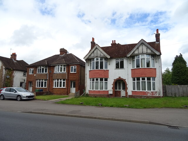
New Headington Images

Images are sourced within 2km of 51.752694/-1.210437 or Grid Reference SP5406. Thanks to Geograph Open Source API. All images are credited.

United Reformed Church, Collinwood Road
Risinghurst Post Office
The Pond, C.S. Lewis Nature Reserve
Old building, Kiln Lane
Strete, Old Road
Strete, Old Road
House at the junction of Lime Walk and Old Road
Pond next to Boundary Brook
Hill Top House
Hill Top House
New apartment building, edge of Warneford Meadow
Chapel, Warneford Hospital
South Park, Oxford
South Park, Oxford
Street View The Google street view car driving away from the traffic lights along Hedley Way in Headington
Street View
The Google street view car driving away from the traffic lights along Hedley Way in Headington
Houses on North Way, Barton, Oxford
Barracks Lane
Barracks Lane
Path through Cowley Marsh
Allotments, Barracks Lane
Quarry Hollow Play Area with children playing in the snow This old quarry was known locally as Munts's, the name of the builder whose yard it was when he built many of the houses in the area in the 1920s.
Quarry Hollow Play Area with children playing in the snow
This old quarry was known locally as Munts's, the name of the builder whose yard it was when he built many of the houses in the area in the 1920s.
Houses on Cowley Road, Oxford
Show me another place!

New Headington is located at Grid Ref: SP5406 (Lat: 51.752694, Lng: -1.210437)

Administrative County: Oxfordshire

District: Oxford

Police Authority: Thames Valley

What 3 Words

///oasis.image.cheese. Near Cowley, Oxfordshire

Related Wikis

Nuffield Orthopaedic Centre

The Nuffield Orthopaedic Centre (NOC) is an orthopaedic hospital, with strong affiliations to the University of Oxford. It provides routine and specialist...

Big Data Institute

The Big Data Institute (BDI), part of the Li Ka Shing Centre for Health Information and Discovery, is an interdisciplinary research institute at the University...

Old Road Campus

The Old Road Campus is a University of Oxford site south of Old Road, in Headington, east Oxford, England. The Churchill Hospital, a teaching hospital...

Wellcome Centre for Human Genetics

The Wellcome Centre for Human Genetics is a human genetics research centre of the Nuffield Department of Medicine in the Medical Sciences Division, University...

Nearby Amenities

Located within 500m of 51.752694,-1.210437
Traffic Signals
Traffic Signals Direction: both
Lat/Long: 51.7532399/-1.2059661
Turning Circle
Turning Circle: knuckle
Lat/Long: 51.7557083/-1.2122605
Turning Circle
Turning Circle: hammer
Lat/Long: 51.7557759/-1.2102448
Turning Circle
Turning Circle: knuckle
Lat/Long: 51.7565377/-1.2094309
Source: survey
Traffic Calming: table
Lat/Long: 51.756077/-1.2132349
Barrier: cycle_barrier
Bicycle: no
Foot: yes
Lat/Long: 51.7511641/-1.2044182
Turning Circle
Lat/Long: 51.7506922/-1.2113531
Crossing
Crossing: uncontrolled
Source: local_knowledge
Lat/Long: 51.7506723/-1.2118946
Traffic Signals
Traffic Signals: signal
Lat/Long: 51.7532879/-1.2119676
Turning Circle
Lat/Long: 51.7517624/-1.203436
Turning Circle
Lat/Long: 51.7511897/-1.2113405
Direction: both
Surface: asphalt
Traffic Calming: bump
Lat/Long: 51.7528173/-1.2143669
Post Box
Collection Times: Mo-Fr 17:15; Sa 11:30
Post Box Type: lamp
Ref: OX3 211
Royal Cypher: EIIR
Royal Cypher Wikidata: Q33102113
Lat/Long: 51.7560803/-1.2137058
Note: theboundries of this reserve are being chalenged often by the hospital construction projects. A rad has diappeared that went betweeen thenursary and roooseveltdrive and the southside of roosevelt drive need re serveying
Lat/Long: 51.7512689/-1.2157003
Barrier: swing_gate
Bicycle: yes
Bus: yes
Motor Vehicle: designated
Note: Bicycle exemption as a little barrier-avoiding C to the West (curiously signed)
Psv: yes
Lat/Long: 51.7544727/-1.2106984
Turning Circle
Lat/Long: 51.7558013/-1.2094224
Turning Circle
Lat/Long: 51.7516059/-1.2160055
Turning Circle
Turning Circle: knuckle
Lat/Long: 51.7522057/-1.2116294
Post Box
Collection Times: Mo-Fr 19:15, Sa 19:00
Ref: OX3 156
Royal Cypher: GR
Royal Cypher Wikidata: Q33102273
Source: photograph
Lat/Long: 51.7538584/-1.2056911
Bus Stop
Peat Moors
Bench: yes
Bin: yes
Bus: yes
Local Ref: adj
Naptan AtcoCode: 340001306PMC
Naptan Bearing: N
Naptan CommonName: Peat Moors
Naptan Indicator: Corner
Naptan Landmark: Peat Moors
Naptan NaptanCode: oxfajgwa
Naptan PlusbusZoneRef: OXFD
Naptan Street: The Slade
Passenger Information Display: yes
Public Transport: platform
Ref: 69325492
Route Ref: 15;U5;100
Shelter: yes
Source: gps;naptan_import
Tactile Paving: yes
Lat/Long: 51.7498582/-1.204946
Lit: yes
Old Phone: +44 1865 464016
Removed Amenity: telephone
Lat/Long: 51.7498218/-1.2049346
Bicycle Parking
Bicycle Parking: stands
Capacity: 6
Covered: no
Lat/Long: 51.74989/-1.2049657
Post Box
Collection Times: Mo-Fr 17:15; Sa 12:00
Postal Code: OX3
Ref: OX3 733
Royal Cypher: EIIR
Source: photograph
Lat/Long: 51.7509981/-1.2084534
Bicycle Parking
Bicycle Parking: stands
Capacity: 4
Covered: no
Note: Sheffield stands x2
Source: photograph
Lat/Long: 51.7510018/-1.2083638
Bicycle Parking
Bicycle Parking: stands
Capacity: 6
Covered: no
Note: Sheffield stands x3
Source: photograph
Lat/Long: 51.7510153/-1.2078513
Bicycle Parking
Bicycle Parking: stands
Capacity: 40
Source: survey
Lat/Long: 51.75015/-1.2134862
Traffic Signals
Bicycle: yes
Crossing: traffic_signals
Crossing Ref: toucan
Lat/Long: 51.7511632/-1.2053505
Bus Stop
Warren Crescent
Bench: no
Bin: no
Bus: yes
Covered: no
Direction: E
Lit: yes
Local Ref: opp
Naptan AtcoCode: 340001303OPP
Naptan Bearing: E
Naptan CommonName: Warren Crescent
Naptan Indicator: Opposite
Naptan Landmark: Girdlestone Road Shops
Naptan NaptanCode: oxfajgwm
Naptan PlusbusZoneRef: OXFD
Naptan Street: Girdlestone Road
Passenger Information Display: no
Public Transport: platform
Ref: 69325496
Route Ref: 15;U5;100
Shelter: no
Source: naptan_import;photograph
Tactile Paving: no
Lat/Long: 51.7512201/-1.2069419
Turning Circle
Lat/Long: 51.7539743/-1.2101839
The Oxford Clinic
Entrance: yes
Lat/Long: 51.7539038/-1.210871
Bus Stop
Lime Walk
Bench: no
Bin: no
Bus: yes
Covered: no
Direction: E
Lit: yes
Local Ref: G5
Naptan AtcoCode: 340003057COR
Naptan Bearing: E
Naptan CommonName: Lime Walk
Naptan Indicator: Corner
Naptan Landmark: Nuffield Centre
Naptan NaptanCode: oxfatpwp
Naptan PlusbusZoneRef: OXFD
Naptan Street: Old Road
Passenger Information Display: no
Public Transport: platform
Ref: 69328797
Route Ref: 15;100;700;ST2;U5
Shelter: no
Source: naptan_import
Tactile Paving: no
Lat/Long: 51.7533049/-1.2109205
Bench
Backrest: yes
Lat/Long: 51.7533145/-1.212822
Crossing
Button Operated: yes
Crossing: traffic_signals
Crossing Island: no
Crossing Ref: pelican
Tactile Paving: yes
Traffic Signals Sound: no
Traffic Signals Vibration: yes
Lat/Long: 51.7533035/-1.2121972
Girdlestone Stores
Check Date Opening Hours: 2023-10-28
Opening Hours Signed: no
Shop: convenience
Lat/Long: 51.7509851/-1.2082443
Bus Stop
Warren Crescent
Bench: yes
Bin: yes
Bus: yes
Lit: yes
Local Ref: o/s
Naptan AtcoCode: 340001303OUT
Naptan Bearing: W
Naptan CommonName: Warren Crescent
Naptan Indicator: Outside
Naptan Landmark: Girdlestone Road Shops
Naptan NaptanCode: oxfajgwj
Naptan PlusbusZoneRef: OXFD
Naptan Street: Girdlestone Road
Passenger Information Display: yes
Public Transport: platform
Ref: 69325495
Route Ref: 15;U5;100
Shelter: yes
Source: naptan_import
Tactile Paving: no
Lat/Long: 51.7510797/-1.2074107
Noexit: yes
Lat/Long: 51.7502395/-1.2163112
Noexit: yes
Lat/Long: 51.7503145/-1.2159704
Bicycle Parking
Access: private
Capacity: 24
Covered: yes
Lat/Long: 51.7518221/-1.2145002
Bicycle Parking
Capacity: 28
Covered: yes
Lat/Long: 51.7515885/-1.2143055
Parking
Access: private
Capacity: 4
Capacity Disabled: 4
Operator: Old Road Campus
Parking: surface
Lat/Long: 51.7516273/-1.2160621
Bicycle Parking
Capacity: 30
Covered: no
Lat/Long: 51.7517141/-1.2154671
Bicycle Parking
Capacity: 28
Covered: no
Lat/Long: 51.7518194/-1.2151401
Bicycle Parking
Bicycle Parking: stands
Capacity: 92
Check Date: 2023-08-02
Covered: no
Lat/Long: 51.7518058/-1.2155284
Bicycle Parking
Capacity: 36
Lat/Long: 51.7521916/-1.215144
Bicycle Parking
Capacity: 20
Covered: yes
Lat/Long: 51.7524169/-1.2153408
Bicycle Parking
Capacity: 34
Covered: no
Lat/Long: 51.752327/-1.2143515
Barrier: bollard
Bicycle: yes
Foot: yes
Lat/Long: 51.7559033/-1.2117239
Barrier: bollard
Bicycle: yes
Bollard: fixed
Foot: yes
Lat/Long: 51.7558578/-1.2121808
Kindergarten
Julia Durbin Day Nursery
Lat/Long: 51.7509525/-1.2159909
Crossing
Crossing: traffic_signals
Crossing Ref: pelican
Lat/Long: 51.7563985/-1.2082063
Barrier: cycle_barrier
Bicycle: yes
Foot: yes
Lat/Long: 51.7558318/-1.2100062
Barrier: bollard
Bicycle: yes
Bollard: fixed
Foot: yes
Lat/Long: 51.7558105/-1.2100971
Bicycle Parking
Capacity: 4
Lat/Long: 51.7538957/-1.2150086
Bicycle Parking
Capacity: 4
Lat/Long: 51.7538257/-1.214992
Barrier: cycle_barrier
Bicycle: no
Foot: yes
Lat/Long: 51.7513469/-1.2035948
Barrier: cycle_barrier
Bicycle: yes
Foot: yes
Note: Really a K-barrier
Source: local_knowledge
Lat/Long: 51.7506862/-1.2118178
Barrier: cycle_barrier
Bicycle: dismount
Foot: yes
Source: local_knowledge
Lat/Long: 51.7515389/-1.2161014
Bus Stop
Nuffield Orthopaedic
Bench: yes
Bin: yes
Bus: yes
Check Date Shelter: 2024-02-24
Departures Board: no
Frequency: 0
Lit: yes
Local Ref: N6
Naptan AtcoCode: 340001361OPP
Naptan Bearing: S
Naptan CommonName: Nuffield Orthopaedic
Naptan Indicator: Opposite
Naptan Landmark: Nuffield Hospital
Naptan NaptanCode: oxfajada
Naptan PlusbusZoneRef: OXFD
Naptan Street: Old Road
Naptan Verified: no
Public Transport: platform
Ref: 69325232
Route Ref: 10;700
Shelter: yes
Source: naptan_import
Tactile Paving: no
Wheelchair: yes
Lat/Long: 51.7536391/-1.2061192
Bus Stop
Old Road Campus
Bench: yes
Bin: yes
Bus: yes
Local Ref: C3
Naptan AtcoCode: 340000751H
Naptan Bearing: W
Naptan CommonName: Roosevelt Drive
Naptan Indicator: Hospital
Naptan Landmark: Hospital
Naptan NaptanCode: oxfapagp
Naptan PlusbusZoneRef: OXFD
Naptan Street: Old Road
Passenger Information Display: no
Public Transport: platform
Ref: 69327247
Route Ref: 15;700
Shelter: yes
Source: naptan_import
Tactile Paving: no
Lat/Long: 51.751837/-1.2128949
Bus Stop
Goslyn Close
Bench: yes
Bin: yes
Bus: yes
Bus Routes: 15;U5
Direction: N
Lit: yes
Local Ref: G2
Naptan AtcoCode: 340001301GCC
Naptan Bearing: N
Naptan CommonName: Goslyn Close
Naptan Indicator: Corner
Naptan Landmark: Churchill Hospital
Naptan NaptanCode: oxfajmag
Naptan PlusbusZoneRef: OXFD
Naptan Street: Girdlestone Road
Passenger Information Display: yes
Public Transport: platform
Ref: 69325624
Route Ref: 15;U5;100
Shelter: yes
Source: naptan_import;photograph
Tactile Paving: no
Lat/Long: 51.7510383/-1.2109091
Bus Stop
Goslyn Close
Bench: no
Bin: yes
Bus: yes
Covered: no
Direction: S
Lit: yes
Local Ref: G1
Naptan AtcoCode: 340001301OGC
Naptan Bearing: S
Naptan CommonName: Goslyn Close
Naptan Indicator: Opposite
Naptan Landmark: Churchill Hospital
Naptan NaptanCode: oxfajmad
Naptan PlusbusZoneRef: OXFD
Naptan Street: Girdlestone Road
Passenger Information Display: no
Public Transport: platform
Ref: 69325623
Route Ref: 15;U5;100
Shelter: no
Source: naptan_import
Tactile Paving: no
Lat/Long: 51.7513045/-1.2107453
Bus Stop
Girdlestone Close
Bench: no
Bin: no
Bus: yes
Bus Routes: 15;U5
Covered: no
Direction: S
Local Ref: G3
Naptan AtcoCode: 340001302CNR
Naptan Bearing: S
Naptan CommonName: Girdlestone Close
Naptan Indicator: Corner
Naptan Landmark: Girdlestone Road
Naptan NaptanCode: oxfajgwt
Naptan PlusbusZoneRef: OXFD
Naptan Street: Girdlestone Close
Passenger Information Display: no
Public Transport: platform
Ref: 69325498
Route Ref: 15;U5;100
Shelter: no
Source: naptan_import;photograph
Tactile Paving: no
Lat/Long: 51.7526383/-1.210027
Bus Stop
Girdlestone Close
Bin: yes
Bus: yes
Bus Routes: 15;U5
Direction: N
Lit: no
Local Ref: G4
Naptan AtcoCode: 340001302OPP
Naptan Bearing: N
Naptan CommonName: Girdlestone Close
Naptan Indicator: Opposite
Naptan Landmark: Girdlestone Road
Naptan NaptanCode: oxfajgwp
Naptan PlusbusZoneRef: OXFD
Naptan Street: Girdlestone Close
Passenger Information Display: no
Public Transport: platform
Ref: 69325497
Route Ref: 15;U5;100
Shelter: no
Source: naptan_import;photograph
Tactile Paving: no
Lat/Long: 51.7529803/-1.2101888
Bus Stop
Peat Moors
Bench: no
Bin: no
Bus: yes
Covered: no
Local Ref: opp
Naptan AtcoCode: 340001306SCC
Naptan Bearing: S
Naptan CommonName: Peat Moors
Naptan Indicator: Opposite
Naptan Landmark: Peat Moors
Naptan NaptanCode: oxfajgtw
Naptan PlusbusZoneRef: OXFD
Naptan Street: The Slade
Passenger Information Display: no
Public Transport: platform
Ref: 69325489
Route Ref: 15;U5;100
Shelter: no
Source: naptan_import
Tactile Paving: yes
Lat/Long: 51.7501109/-1.2048449
Bus Stop
Boundary Brook House
Bench: yes
Bin: yes
Bus: yes
Covered: yes
Local Ref: C8
Naptan AtcoCode: 340001322ENT
Naptan Bearing: N
Naptan CommonName: Churchill Drive
Naptan Indicator: Park Hospital Entrance
Naptan Landmark: Park Hospital
Naptan NaptanCode: oxfajmgp
Naptan PlusbusZoneRef: OXFD
Naptan Street: Churchill Drive
Naptan Verified: no
Public Transport: platform
Ref: 69325647
Route Ref: 15;700
Shelter: yes
Source: naptan_import
Lat/Long: 51.7524849/-1.2120275
Bus Stop
Boundary Brook House
Bench: no
Bin: no
Bus: yes
Covered: no
Local Ref: C2
Naptan AtcoCode: 340001322OPP
Naptan Bearing: S
Naptan CommonName: Churchill Drive
Naptan Indicator: Park Hospital Opposite
Naptan Landmark: Park Hospital
Naptan NaptanCode: oxfajgtg
Naptan PlusbusZoneRef: OXFD
Naptan Street: Churchill Drive
Naptan Verified: no
Passenger Information Display: no
Public Transport: platform
Ref: 69325484
Route Ref: 15;700
Shelter: no
Source: naptan_import
Tactile Paving: no
Lat/Long: 51.7526588/-1.211905
Bus Stop
Margaret Road
Bench: no
Bin: no
Bus: yes
Local Ref: adj
Naptan AtcoCode: 340001360CNR
Naptan Bearing: SE
Naptan CommonName: Margaret Road
Naptan Indicator: Corner
Naptan Landmark: Margaret Road
Naptan NaptanCode: oxfajgdw
Naptan PlusbusZoneRef: OXFD
Naptan Street: Windmill Road
Public Transport: platform
Route Ref: 10;600
Shelter: no
Source: naptan_import
Tactile Paving: no
Lat/Long: 51.7560836/-1.2078952
Bus Stop
Margaret Road
Bus: yes
Local Ref: opp
Naptan AtcoCode: 340001360OPP
Naptan Bearing: NW
Naptan CommonName: Margaret Road
Naptan Indicator: Opposite
Naptan Landmark: Margaret Road
Naptan NaptanCode: oxfagtpt
Naptan PlusbusZoneRef: OXFD
Naptan Street: Windmill Road
Public Transport: platform
Route Ref: 10;600;700
Source: naptan_import
Lat/Long: 51.7559089/-1.2079722
Bus Stop
Nuffield Orthopaedic Centre
Bench: yes
Bus: yes
Bus Routes: 10;600;700;N10
Local Ref: N5
Naptan AtcoCode: 340001361ENT
Naptan Bearing: N
Naptan CommonName: Nuffield Orthopaedic
Naptan Indicator: Entrance
Naptan Landmark: Nuffield Hospital
Naptan NaptanCode: oxfajmwd
Naptan PlusbusZoneRef: OXFD
Naptan Street: Old Road
Public Transport: platform
Shelter: yes
Source: naptan_import
Lat/Long: 51.7545305/-1.2069995
Bus Stop
Orthopaedic Centre
Bench: no
Bin: no
Bus: yes
Bus Routes: 700;600
Lit: yes
Naptan AtcoCode: 340001526OPP
Naptan Bearing: E
Naptan CommonName: Orthopaedic Centre
Naptan Indicator: Eastbound
Naptan Landmark: Nuffield Orthopaedic Centre
Naptan NaptanCode: oxfgdpgd
Naptan PlusbusZoneRef: OXFD
Naptan Street: Trapper Tom Way
Public Transport: platform
Shelter: no
Source: naptan_import;survey
Tactile Paving: no
Lat/Long: 51.7541545/-1.2110242
Bus Stop
Orthopaedic Centre
Bench: no
Bin: no
Bus: yes
Lit: no
Naptan AtcoCode: 340001526OUT
Naptan Bearing: W
Naptan CommonName: Orthopaedic Centre
Naptan Indicator: Westbound
Naptan Landmark: Nuffield Orthopaedic Centre
Naptan NaptanCode: oxfgdpga
Naptan PlusbusZoneRef: OXFD
Naptan Street: Trapper Tom Way
Note: This side is merely a little alphanumeric code sign.
Public Transport: platform
Shelter: no
Source: naptan_import;survey
Tactile Paving: no
Lat/Long: 51.7540644/-1.2109968
Bus Stop
East Entrance
Naptan AtcoCode: 340001527EAS
Naptan Bearing: N
Naptan CommonName: East Entrance
Naptan Indicator: Churchill Hospital
Naptan Landmark: Memorial
Naptan NaptanCode: oxfawgtj
Naptan PlusbusZoneRef: OXFD
Naptan Street: Churchill Drive
Note: [2023-11-25] no NAPTAN services (https://bustimes.org/stops/340001527EAS), but it is still physically present (no visible route_ref markings now)
Public Transport: platform
Source: naptan_import
Lat/Long: 51.7499077/-1.2119677
Bus Stop
Vaccine Centre
Bus: yes
Naptan AtcoCode: 340001527OPP
Naptan Bearing: S
Naptan CommonName: Vaccine Centre
Naptan Indicator: Vaccine Centre
Naptan Landmark: Churchill Hospital
Naptan NaptanCode: oxfgmatp
Naptan PlusbusZoneRef: OXFD
Naptan Street: Churchilll Drive
Naptan Verified: no
Note: [2023-11-25] no NAPTAN services (https://bustimes.org/stops/340001527OPP), didn't see it on the ground (needs checking)
Public Transport: platform
Source: naptan_import
Lat/Long: 51.7497885/-1.2118628
Bus Stop
Main Entrance
Bus: yes
Naptan AtcoCode: 340001528OPP
Naptan Bearing: SW
Naptan CommonName: Main Entrance
Naptan Indicator: Outside
Naptan Landmark: Nuffield Hospital
Naptan NaptanCode: oxfgdpdm
Naptan PlusbusZoneRef: OXFD
Naptan Street: Windmill Road
Naptan Verified: no
Public Transport: platform
Source: naptan_import;memory
Lat/Long: 51.7544922/-1.2084146
Bus Stop
Main Entrance
Bus: yes
Naptan AtcoCode: 340001528OUT
Naptan Bearing: NE
Naptan CommonName: Main Entrance
Naptan Indicator: Opposite
Naptan Landmark: Nuffield Hospital
Naptan NaptanCode: oxfgdmwj
Naptan PlusbusZoneRef: OXFD
Naptan Street: Windmill Road
Public Transport: platform
Source: naptan_import
Lat/Long: 51.7545561/-1.2086451
Bus Stop
Lime Walk
Bench: yes
Bin: yes
Bus: yes
Check Date Shelter: 2021-10-30
Lit: yes
Naptan AtcoCode: 340003057OPP
Naptan Bearing: W
Naptan CommonName: Lime Walk
Naptan Indicator: Opposite
Naptan Landmark: Nuffield Centre
Naptan NaptanCode: oxfawdgm
Naptan PlusbusZoneRef: OXFD
Naptan Street: Old Road
Naptan Verified: no
Public Transport: platform
Ref: 69329346
Shelter: yes
Source: naptan_import
Tactile Paving: no
Lat/Long: 51.7533132/-1.2129512
Fast Food
Nawabi
Check Date Opening Hours: 2023-10-28
Cuisine: indian
Opening Hours Signed: no
Lat/Long: 51.7509871/-1.2081433
Classic Cleaners
Dry Cleaning: yes
Laundry Service: yes
Opening Hours: Mo-Su 08:30-19:00
Self Service: yes
Shop: laundry
Lat/Long: 51.7509891/-1.2080423
Headington Auto Parts
Opening Hours: Mo-Sa 09:00-18:00; Su 09:00-16:00
Shop: car_repair
Lat/Long: 51.7509911/-1.2079413
Town Furze
Place: neighbourhood
Source: community notice board
Lat/Long: 51.7511292/-1.2081058
Nuffield Orthopaedic Reception
Entrance: main
Lat/Long: 51.7542232/-1.2089471
Entrance: main
Source: local_knowledge
Lat/Long: 51.7545908/-1.2086581
Oxford Centre for Enablement
Alt Name: OCE
Building: hospital
Entrance: yes
Source: local_knowledge
Lat/Long: 51.7551927/-1.2088121
Man Made: mast
Note: Airwave
Lat/Long: 51.7515756/-1.2126878
Bicycle Parking
Capacity: 12
Lat/Long: 51.7539269/-1.2073132
East Entrance
Entrance: main
Lat/Long: 51.749621/-1.2125401
Kerb: raised
Lat/Long: 51.7515272/-1.2166037
Main Entrance
Entrance: main
Lat/Long: 51.7498372/-1.2159547
Botnar Reception
Entrance: yes
Level: 0
Lat/Long: 51.7552171/-1.2112521
Crossing
Crossing: unmarked
Crossing Markings: no
Lat/Long: 51.7501311/-1.2050272
Crossing
Crossing: uncontrolled
Note: merely marked with white paint; not zebra
Lat/Long: 51.7504089/-1.2159682
Cycleway: asl
Lat/Long: 51.7534232/-1.2060772
Cycleway: asl
Lat/Long: 51.7530554/-1.205882
Man Made: flagpole
Lat/Long: 51.7496168/-1.2119958
Man Made: surveillance
Surveillance: outdoor
Lat/Long: 51.7508036/-1.2134421
Barrier: bollard
Lat/Long: 51.7507729/-1.2131045
Barrier: bollard
Lat/Long: 51.7507686/-1.2133289
Man Made: surveillance
Surveillance: outdoor
Lat/Long: 51.7500245/-1.2162224
Man Made: surveillance
Surveillance: outdoor
Lat/Long: 51.7514813/-1.213459
Crossing
Crossing: uncontrolled
Lat/Long: 51.7494122/-1.2118726
Barrier: bollard
Lat/Long: 51.7507641/-1.2135562
Crossing
Crossing Island: yes
Lat/Long: 51.752023/-1.2120888
Crossing
Crossing: uncontrolled
Lat/Long: 51.7494758/-1.2118326
Barrier: lift_gate
Lat/Long: 51.7510683/-1.2142518
Crossing
Bicycle: yes
Button Operated: yes
Crossing: traffic_signals
Crossing Ref: toucan
Kerb: flush
Tactile Paving: yes
Lat/Long: 51.7530959/-1.2058954
Crossing
Bicycle: yes
Button Operated: yes
Crossing: traffic_signals
Crossing Ref: toucan
Kerb: flush
Tactile Paving: yes
Lat/Long: 51.7532539/-1.2057198
Crossing
Bicycle: yes
Button Operated: yes
Crossing: traffic_signals
Crossing Ref: toucan
Kerb: flush
Tactile Paving: yes
Lat/Long: 51.7532326/-1.2062325
Crossing
Bicycle: yes
Button Operated: yes
Crossing: traffic_signals
Crossing Ref: toucan
Kerb: flush
Tactile Paving: yes
Lat/Long: 51.7533795/-1.2060485
Source: survey
Traffic Calming: choker
Lat/Long: 51.7559782/-1.2131925
Source: survey
Traffic Calming: choker
Lat/Long: 51.7561596/-1.2132898
Crossing
Crossing: unmarked
Crossing Island: no
Crossing Markings: no
Source: survey
Tactile Paving: yes
Traffic Calming: table
Lat/Long: 51.7561243/-1.2148363
Entrance: yes
Lat/Long: 51.7568968/-1.2124155
Barrier: kerb
Kerb: lowered
Lat/Long: 51.7500681/-1.2049937
Barrier: kerb
Kerb: lowered
Lat/Long: 51.7501748/-1.2050475
Traffic Sign: shared_use_footpath
Lat/Long: 51.7502651/-1.2052083
Crossing
Crossing: unmarked
Crossing Markings: no
Lat/Long: 51.7503495/-1.2049925
Crossing
Bicycle: yes
Crossing: uncontrolled
Crossing Island: no
Crossing Markings: surface
Kerb: flush
Tactile Paving: yes
Lat/Long: 51.7509734/-1.2052162
Traffic Sign: shared_use_footpath
Lat/Long: 51.7510931/-1.2052563
Traffic Sign: shared_use_footpath
Lat/Long: 51.7525233/-1.2056494
Traffic Sign: shared_use_footpath
Lat/Long: 51.7530247/-1.2059881
Turning Circle
Turning Circle: square
Lat/Long: 51.7516427/-1.2171584
Entrance: service
Lat/Long: 51.7518825/-1.2146907
Crossing
Crossing: zebra
Crossing Ref: zebra
Lat/Long: 51.7534871/-1.2139005
Bicycle Parking
Capacity: 30
Covered: no
Lat/Long: 51.7517578/-1.2155035
Bicycle Parking
Access: private
Capacity: 16
Covered: no
Lat/Long: 51.7518116/-1.2145293
Motorcycle Parking
Capacity: 7
Operator: Old Road Campus
Parking: surface
Lat/Long: 51.7518826/-1.2149452
Bicycle Parking
Capacity: 24
Covered: no
Lat/Long: 51.751938/-1.2150346
Bicycle Parking
Capacity: 12
Covered: no
Lat/Long: 51.7520108/-1.2149891
Bicycle Parking
Bicycle Parking: stands
Capacity: 12
Covered: yes
Lit: yes
Lat/Long: 51.7523624/-1.2141265
Bicycle Parking
Capacity: 50
Covered: no
Lat/Long: 51.7528332/-1.2163325
Bicycle Parking
Bicycle Parking: stands
Capacity: 12
Covered: no
Lat/Long: 51.7532623/-1.214516
Parking
Parking: surface
Lat/Long: 51.7488267/-1.2111974
Entrance: yes
Lat/Long: 51.750518/-1.2155249
Entrance: main
Lat/Long: 51.7516473/-1.2156481
Entrance: main
Lat/Long: 51.7517104/-1.2158164
Entrance: yes
Lat/Long: 51.7520488/-1.214596
Entrance: service
Lat/Long: 51.7521347/-1.2146727
Entrance: main
Wheelchair: yes
Lat/Long: 51.7522606/-1.2140026
Entrance: yes
Wheelchair: yes
Lat/Long: 51.7531048/-1.214486
Bench
Type: round a tree trunk
Lat/Long: 51.7508293/-1.2164809
Bicycle Parking: informal
Capacity: 10
Disused Amenity: bicycle_rental
Disused Network: Oxonbikes
Lat/Long: 51.7541924/-1.2087465
Bicycle Parking
Bicycle Parking: stands
Capacity: 20
Disused Amenity: bicycle_rental
Disused Network: Oxonbikes
Lat/Long: 51.7499289/-1.2158643
Bicycle Parking
Bicycle Parking: stands
Fixme: needs capacity, etc.
Lat/Long: 51.7541515/-1.2086955
Entrance: yes
Wheelchair: yes
Lat/Long: 51.7488818/-1.2111044
Addr City: Oxford
Addr Housename: Wellcome Trust Centre for Human Genetics
Addr Place: Old Road Campus
Addr Postcode: OX3 7BN
Addr Street: Roosevelt Drive
Wikidata: Q7981196
Wikipedia: en:Wellcome Centre for Human Genetics
Lat/Long: 51.7517799/-1.2158511
Direction: both
Surface: asphalt
Traffic Calming: bump
Lat/Long: 51.7531652/-1.2146567
Bicycle Parking
Access: private
Bicycle Parking: stands
Capacity: 200
Covered: yes
Note: Capacity is approximate, needs a proper count
Lat/Long: 51.7522857/-1.2153111
Community Centre
Maggie's Oxford
Addr Postcode: OX3 7LE
Addr Street: Roosevelt Drive
Email: oxford@maggiescentres.org
Opening Hours: Mo-Fr 09:00-17:00
Phone: +44 1865 751882
Website: https://www.maggiescentres.org/our-centres/maggies-oxford/
Lat/Long: 51.7505725/-1.216175
Crossing
Crossing: uncontrolled
Crossing Markings: zebra
Crossing Ref: zebra
Supervised: no
Tactile Paving: yes
Lat/Long: 51.7545257/-1.2071027
Bicycle Parking
Bicycle Parking: stands
Capacity: 4
Covered: no
Source: survey
Lat/Long: 51.7504379/-1.2160194
Bicycle Parking
Bicycle Parking: stands
Capacity: 40
Covered: yes
Source: survey
Lat/Long: 51.7504926/-1.21555
Bicycle Parking
Bicycle Parking: stands
Capacity: 10
Covered: no
Lat/Long: 51.7492273/-1.2121949
Bicycle Parking
Bicycle Parking: wall_hoops
Capacity: 14
Covered: yes
Lat/Long: 51.7498102/-1.2122753
Bicycle Parking
Bicycle Parking: stands
Capacity: 6
Covered: no
Lat/Long: 51.7499713/-1.21297
Post Box
Collection Times: Mo-Fr 16:00; Sa 11:45
Ref: OX3 671
Lat/Long: 51.749343/-1.2126125
Bus Stop
Churchill Hopsital Roosevelt Drive
Bench: yes
Bin: no
Bus: yes
Local Ref: W-Bound
Passenger Information Display: no
Public Transport: platform
Ref: 69348768
Route Ref: 15;700
Shelter: yes
Tactile Paving: no
Lat/Long: 51.7513068/-1.2148412
Bus Stop
Old Road Campus
Bench: no
Bin: no
Bus: yes
Covered: no
Departures Board: timetable
Local Ref: E-Bound
Naptan AtcoCode: 340000751OPP
Naptan NaptanCode: oxfgtwmg
Passenger Information Display: no
Public Transport: platform
Ref: 69348964
Route Ref: 15;700
Shelter: no
Tactile Paving: no
Lat/Long: 51.752023/-1.2127756
Bus Stop
Churchill Hospital Roosevelt Drive
Bench: no
Bin: no
Bus: yes
Covered: no
Local Ref: E-Bound
Naptan AtcoCode: 340000752EAS
Naptan NaptanCode: oxfgwjdj
Passenger Information Display: no
Public Transport: platform
Ref: 69349535
Route Ref: 15;700
Shelter: no
Tactile Paving: no
Lat/Long: 51.7515649/-1.2164271
Addr City: Oxford
Addr Country: GB
Addr Flats: 1
Addr Housenumber: 107
Addr Street: Windmill Road
Entrance: yes
Lat/Long: 51.7563094/-1.2080143
Waste Basket
Waste: dog_excrement
Lat/Long: 51.7536975/-1.2060831
Turning Circle
Lat/Long: 51.7543816/-1.2121281
Waste Basket
Lat/Long: 51.7544709/-1.2069706
Waste Basket
Lat/Long: 51.7540769/-1.206637
Bench
Lat/Long: 51.754089/-1.2066437
Bench
Backrest: yes
Material: wood
Seats: 3
Lat/Long: 51.7536574/-1.206334
William Kimber
Historic: memorial
Memorial: blue_plaque
Lat/Long: 51.755674/-1.2052171
Addr City: Oxford
Addr Country: GB
Addr Housenumber: 40 (Top)
Addr Street: St. Anne's Road
Lat/Long: 51.7556976/-1.2052336
Addr City: Oxford
Addr Country: GB
Addr Housenumber: 40 (Bottom)
Addr Street: St. Anne's Road
Lat/Long: 51.7557468/-1.2051895
Bench
Addr City: Oxford
Addr Housenumber: 89
Addr Street: Old Road
Backrest: yes
Material: wood
Seats: 3
Lat/Long: 51.7533198/-1.2054944
Leisure: outdoor_seating
Lat/Long: 51.7545107/-1.2043987
Addr City: Oxford
Addr Country: GB
Addr Housenumber: 1
Addr Street: Wooldridge Court
Lat/Long: 51.7566355/-1.2070997
Addr City: Oxford
Addr Country: GB
Addr Flats: 2
Addr Housenumber: 107
Addr Street: Windmill Road
Entrance: yes
Lat/Long: 51.7563549/-1.2078388
Addr City: Oxford
Addr Country: GB
Addr Flats: 3-4
Addr Housenumber: 107
Addr Street: Windmill Road
Entrance: yes
Lat/Long: 51.7563294/-1.2079372
Highfield Residents' Association Community Noticeboard
Board Type: notice
Information: board
Tourism: information
Lat/Long: 51.7560925/-1.213647
Addr City: Oxford
Addr Country: GB
Addr Housenumber: 56
Addr Street: Bickerton Road
Lat/Long: 51.7539226/-1.2150584
Addr City: Oxford
Addr Country: GB
Addr Flats: A-B
Addr Housenumber: 37
Addr Street: Stapleton Road
Entrance: yes
Lat/Long: 51.7545067/-1.2137373
Addr City: Oxford
Addr Country: GB
Addr Housenumber: 11A
Addr Street: Stapleton Road
Entrance: yes
Lat/Long: 51.7556886/-1.2139981
Addr City: Oxford
Addr Country: GB
Addr Flats: 1
Addr Housenumber: 93
Addr Street: All Saints Road
Entrance: yes
Lat/Long: 51.7560873/-1.2125722
Addr City: Oxford
Addr Country: GB
Addr Flats: 3
Addr Housenumber: 93
Addr Street: All Saints Road
Entrance: yes
Lat/Long: 51.7561006/-1.212447
Addr City: Oxford
Addr Country: GB
Addr Flats: 2
Addr Housenumber: 93
Addr Street: All Saints Road
Entrance: yes
Lat/Long: 51.7560771/-1.2124336
Addr City: Oxford
Addr Country: GB
Addr Housenumber: 67A
Addr Street: New High Street
Entrance: yes
Lat/Long: 51.7560555/-1.2121495
Addr City: Oxford
Addr Country: GB
Addr Housenumber: 67B
Addr Street: New High Street
Entrance: yes
Lat/Long: 51.7560625/-1.2121395
Bicycle Parking
Bicycle Parking: stands
Capacity: 4
Covered: no
Lat/Long: 51.7568871/-1.2124674
Addr City: Oxford
Addr Country: GB
Addr Housenumber: 1
Addr Street: Cecil Sharp Place
Lat/Long: 51.7553612/-1.2121006
Addr City: Oxford
Addr Country: GB
Addr Housenumber: 16
Addr Street: Cecil Sharp Place
Lat/Long: 51.7550325/-1.2120148
Addr City: Oxford
Addr Country: GB
Addr Housenumber: 19
Addr Street: Nursery Close
Lat/Long: 51.7542171/-1.2119383
Addr City: Oxford
Addr Country: GB
Addr Housenumber: 20
Addr Street: Nursery Close
Lat/Long: 51.7542016/-1.2118714
Addr City: Oxford
Addr Country: GB
Addr Housenumber: 21
Addr Street: Nursery Close
Lat/Long: 51.7542096/-1.2120523
Addr City: Oxford
Addr Country: GB
Addr Housenumber: 22
Addr Street: Nursery Close
Lat/Long: 51.7541941/-1.2119854
Addr City: Oxford
Addr Country: GB
Addr Housenumber: 23
Addr Street: Nursery Close
Lat/Long: 51.7542034/-1.2121656
Addr City: Oxford
Addr Country: GB
Addr Housenumber: 24
Addr Street: Nursery Close
Lat/Long: 51.7541879/-1.2120987
Addr City: Oxford
Addr Country: GB
Addr Housenumber: 25
Addr Street: Nursery Close
Lat/Long: 51.7541947/-1.2122885
Addr City: Oxford
Addr Country: GB
Addr Housenumber: 26
Addr Street: Nursery Close
Lat/Long: 51.7541792/-1.2122216
Addr City: Oxford
Addr Country: GB
Addr Housenumber: 17
Addr Street: Nursery Close
Lat/Long: 51.7543936/-1.2118844
Addr City: Oxford
Addr Country: GB
Addr Housenumber: 18
Addr Street: Nursery Close
Lat/Long: 51.7543646/-1.2118395
Addr City: Oxford
Addr Country: GB
Addr Housenumber: 15
Addr Street: Nursery Close
Lat/Long: 51.7544626/-1.2119058
Addr City: Oxford
Addr Country: GB
Addr Housenumber: 16
Addr Street: Nursery Close
Lat/Long: 51.7544335/-1.2118609
Addr City: Oxford
Addr Country: GB
Addr Housenumber: 13
Addr Street: Nursery Close
Lat/Long: 51.7545302/-1.2119246
Addr City: Oxford
Addr Country: GB
Addr Housenumber: 14
Addr Street: Nursery Close
Lat/Long: 51.7545012/-1.2118797
Addr City: Oxford
Addr Country: GB
Addr Housenumber: 11
Addr Street: Nursery Close
Lat/Long: 51.754602/-1.21194
Addr City: Oxford
Addr Country: GB
Addr Housenumber: 12
Addr Street: Nursery Close
Lat/Long: 51.754573/-1.2118951
Addr City: Oxford
Addr Country: GB
Addr Housenumber: 10
Addr Street: Nursery Close
Lat/Long: 51.7546415/-1.2119142
Addr City: Oxford
Addr Country: GB
Addr Housenumber: 9
Addr Street: Nursery Close
Lat/Long: 51.7546705/-1.2119592
Addr City: Oxford
Addr Country: GB
Addr Housenumber: 7
Addr Street: Nursery Close
Lat/Long: 51.7548266/-1.2120892
Addr City: Oxford
Addr Country: GB
Addr Housenumber: 8
Addr Street: Nursery Close
Lat/Long: 51.7548075/-1.2120249
Addr City: Oxford
Addr Country: GB
Addr Housenumber: 5
Addr Street: Nursery Close
Lat/Long: 51.7548158/-1.2121999
Addr City: Oxford
Addr Country: GB
Addr Housenumber: 6
Addr Street: Nursery Close
Lat/Long: 51.7547967/-1.2121355
Addr City: Oxford
Addr Country: GB
Addr Housenumber: 3
Addr Street: Nursery Close
Lat/Long: 51.7548021/-1.2123226
Addr City: Oxford
Addr Country: GB
Addr Housenumber: 4
Addr Street: Nursery Close
Lat/Long: 51.754783/-1.2122582
Addr City: Oxford
Addr Country: GB
Addr Housenumber: 2
Addr Street: Nursery Close
Lat/Long: 51.7547714/-1.2123722
Addr City: Oxford
Addr Country: GB
Addr Housenumber: 1
Addr Street: Nursery Close
Lat/Long: 51.7547905/-1.2124366
Addr City: Oxford
Addr Country: GB
Addr Housenumber: 109B
Addr Street: Lime Walk
Entrance: yes
Lat/Long: 51.7545591/-1.212634
Addr City: Oxford
Addr Country: GB
Addr Housenumber: 109A
Addr Street: Lime Walk
Entrance: yes
Lat/Long: 51.7545465/-1.2127597
Bench
Lat/Long: 51.7564068/-1.2130931
Historic: memorial
Memorial: war_memorial
Lat/Long: 51.7563259/-1.2131615
Board Type: notice
Information: board
Operator: All Saints' Church
Tourism: information
Lat/Long: 51.7561893/-1.2131688
Waste Basket
Lat/Long: 51.7561968/-1.2131923
Board Type: notice
Information: board
Operator: All Saints' Church
Tourism: information
Lat/Long: 51.7563898/-1.2132218
Addr City: Oxford
Addr Country: GB
Addr Flats: A
Addr Housenumber: 72
Addr Street: Lime Walk
Entrance: yes
Lat/Long: 51.7562604/-1.2134315
Addr City: Oxford
Addr Country: GB
Addr Housenumber: 74A
Addr Street: Lime Walk
Entrance: yes
Lat/Long: 51.7561981/-1.2133747
Addr City: Oxford
Addr Country: GB
Addr Housenumber: 84B
Addr Street: Lime Walk
Entrance: yes
Lat/Long: 51.7557253/-1.2132641
Entrance: yes
Lat/Long: 51.7557125/-1.2132607
Addr City: Oxford
Addr Country: GB
Addr Housenumber: 86B
Addr Street: Lime Walk
Entrance: yes
Lat/Long: 51.7555911/-1.2132913
Addr City: Oxford
Addr Country: GB
Addr Housenumber: 86A
Addr Street: Lime Walk
Entrance: yes
Lat/Long: 51.7555888/-1.2132789
Highfield
Place: neighbourhood
Lat/Long: 51.7560786/-1.2147604
Bicycle Parking
Access: private
Capacity: 4
Lat/Long: 51.7564794/-1.2091871
Addr City: Oxford
Addr Housenumber: 44
Addr Street: Mattock Close
Lat/Long: 51.7561964/-1.2082852
Addr City: Oxford
Addr Housenumber: 40
Addr Street: Mattock Close
Lat/Long: 51.756071/-1.208194
Addr City: Oxford
Addr Housenumber: 39
Addr Street: Mattock Close
Lat/Long: 51.7560544/-1.2082704
Edward Brooks VC
Erected By: Oxfordshire Blue Plaques Board
Historic: memorial
Inscription: Edward Brooks VC 1883-1944 Company Sergeant Major 2/4th Bn Oxford & Bucks LI Awarded the Victoria Cross for valour at Fayet on 28 April 2017 lived here 1915-1930 Darell-Brown Robin Trust
Memorial: blue_plaque
Lat/Long: 51.7568148/-1.2117017
Barrier: bollard
Lat/Long: 51.7557201/-1.2104557
Bench
Lat/Long: 51.7555339/-1.2105248
Bench
Lat/Long: 51.7556696/-1.2106797
Addr City: Oxford
Addr Housenumber: 17A
Addr Street: Gardiner Street
Entrance: yes
Lat/Long: 51.7565561/-1.2104173
Addr City: Oxford
Addr Housenumber: 34
Addr Street: Mattock Close
Lat/Long: 51.755949/-1.2086124
Barrier: lift_gate
Lat/Long: 51.7500249/-1.2161448
Crossing
Button Operated: yes
Crossing: traffic_signals
Crossing Island: no
Tactile Paving: yes
Traffic Signals Sound: no
Traffic Signals Vibration: yes
Lat/Long: 51.7532223/-1.2119721
Bicycle Parking
Access: permissive
Bicycle Parking: shed
Covered: yes
Fee: no
Operator: University of Oxford
Operator Type: private
Lat/Long: 51.7520908/-1.2129389
Bicycle Parking
Access: permissive
Bicycle Parking: shed
Covered: yes
Fee: no
Operator: University of Oxford
Operator Type: private
Lat/Long: 51.7533445/-1.2150581
Bicycle Parking
Access: yes
Bicycle Parking: hoop
Capacity: 18
Covered: no
Fee: no
Operator: University of Oxford
Lat/Long: 51.7529999/-1.2152099
Bicycle Repair Station
Fee: no
Operator: University of Oxford
Service Bicycle Pump: yes
Lat/Long: 51.7528875/-1.2155635
Access: permissive
Addr City: Oxford
Addr Housename: NDM Research Building
Addr Postcode: OX3 7FZ
Addr Street: Roosevelt Drive
Door: yes/manual/main_entrance
Entrance: main
Level: 0
Wheelchair: yes
Lat/Long: 51.753134/-1.2149655
Crossing
Crossing: unmarked
Crossing Markings: no
Lat/Long: 51.7526638/-1.2141604
Crossing
Crossing: unmarked
Crossing Markings: no
Lat/Long: 51.7533325/-1.2152978
Crossing
Crossing: unmarked
Crossing Markings: no
Lat/Long: 51.7520372/-1.2136123
Crossing
Crossing: unmarked
Crossing Markings: no
Lat/Long: 51.7521653/-1.2137233
Crossing
Crossing: marked
Crossing Markings: yes
Lat/Long: 51.75271/-1.2142719
Bicycle Parking
Bicycle Parking: loops
Capacity: 10
Covered: no
Fee: no
Operator: University of Oxford
Lat/Long: 51.7529408/-1.2154007
Bicycle Parking
Bicycle Parking: loops
Capacity: 16
Covered: no
Fee: no
Operator: University of Oxford
Lat/Long: 51.7529066/-1.2155076
Bicycle Parking
Bicycle Parking: loops
Covered: no
Fee: no
Operator: University of Oxford
Lat/Long: 51.7525425/-1.2148493
Bench: yes
Covered: no
Leisure: picnic_table
Lit: yes
Material: wood
Lat/Long: 51.7527719/-1.2145146
Bench: yes
Covered: no
Leisure: picnic_table
Lit: yes
Material: wood
Lat/Long: 51.7527171/-1.2145406
Bench: yes
Covered: no
Leisure: picnic_table
Lit: yes
Material: wood
Lat/Long: 51.7526552/-1.2146463
Bench
Backrest: yes
Material: wood
Lat/Long: 51.7526637/-1.2144894
Bench
Backrest: yes
Material: wood
Lat/Long: 51.7526199/-1.2146162
Bench
Backrest: yes
Material: wood
Lat/Long: 51.7527332/-1.2144593
Origin 2017
Artist Name: Julian Wild
Artwork Type: sculpture
Material: steel
Tourism: artwork
Lat/Long: 51.7530518/-1.2148554
Crossing
Lat/Long: 51.7529317/-1.2120249
Crossing
Crossing: unmarked
Crossing Markings: no
Tactile Paving: no
Lat/Long: 51.7533129/-1.2116405
Cycleway: asl
Lat/Long: 51.7532328/-1.2062894
Crossing
Crossing: unmarked
Crossing Markings: no
Tactile Paving: no
Lat/Long: 51.7531864/-1.2081663
Crossing
Crossing: unmarked
Crossing Island: no
Crossing Markings: no
Tactile Paving: yes
Lat/Long: 51.7531917/-1.210106
Crossing
Crossing: uncontrolled
Crossing Markings: no
Tactile Paving: yes
Lat/Long: 51.7541025/-1.2069134
Crossing
Crossing: unmarked
Crossing Island: no
Crossing Markings: no
Tactile Paving: yes
Lat/Long: 51.7533712/-1.2125894
Crossing
Crossing: unmarked
Crossing Island: no
Crossing Markings: no
Tactile Paving: yes
Lat/Long: 51.7535072/-1.2136521
Crossing
Crossing: unmarked
Crossing Island: no
Crossing Markings: no
Tactile Paving: yes
Traffic Calming: table
Lat/Long: 51.7536066/-1.2148564
Crossing
Crossing: unmarked
Crossing Island: no
Crossing Markings: no
Tactile Paving: yes
Lat/Long: 51.7536554/-1.216912
Crossing
Crossing: unmarked
Crossing Island: no
Crossing Markings: no
Tactile Paving: yes
Traffic Calming: table
Lat/Long: 51.7535697/-1.2174767
Crossing: uncontrolled
Crossing Ref: zebra
Lat/Long: 51.7534441/-1.2139094
Entrance: yes
Lat/Long: 51.7531692/-1.2138111
Entrance: yes
Lat/Long: 51.7530707/-1.2126799
Loading Dock
Access: customers
Door: shutter
Operator: un
Lat/Long: 51.7522205/-1.214914
Cycleway: asl
Lat/Long: 51.7533075/-1.2122652
Cycleway: asl
Lat/Long: 51.7531683/-1.2119712
Cycleway: asl
Lat/Long: 51.7532797/-1.2116792
Cycleway: asl
Lat/Long: 51.7532598/-1.2056464
Crossing
Crossing: unmarked
Crossing Markings: no
Lat/Long: 51.7515379/-1.2139244
Crossing
Crossing: unmarked
Crossing Markings: no
Lat/Long: 51.7516876/-1.2120066
Crossing
Crossing: unmarked
Crossing Markings: no
Lat/Long: 51.7514997/-1.2142753
Professor Gathorne Robert Girdlestone "GRG"
Erected By: Oxfordshire Blue Plaques Board; Nuffield Orthopaedic Centre NHS Trust
Historic: memorial
Inscription: Professor Gathorne Robert Girdlestrone "GRG" 1881-1950 Pioneering surgeon and founder of the Nuffield Orthopaedic Centre lived in the Red House on this site 1919-1948
Memorial: blue_plaque
Lat/Long: 51.753072/-1.2085681
Entrance: yes
Lat/Long: 51.7529275/-1.2148054
Access: delivery
Addr City: Oxford
Addr Postcode: OX3 7FZ
Addr Street: Roosevelt Drive
Door: loadingdock
Entrance: service
Level: -0.5
Wheelchair: no
Lat/Long: 51.7530593/-1.2157966
Crossing
Crossing: unmarked
Crossing Markings: no
Lat/Long: 51.7524384/-1.214102
Parking Entrance
Lat/Long: 51.7521827/-1.2136736
Crossing
Crossing: marked
Crossing Markings: yes
Lat/Long: 51.7522922/-1.21391
Entrance: yes
Lat/Long: 51.7523386/-1.2137698
Direction: both
Traffic Calming: bump
Lat/Long: 51.7523406/-1.2139527
Crossing
Crossing: unmarked
Crossing Markings: no
Lat/Long: 51.7524736/-1.2139945
Communication Mobile Phone: yes
Man Made: mast
Tower Type: communication
Lat/Long: 51.7536977/-1.2061366
Crossing
Crossing: uncontrolled
Crossing Island: no
Crossing Ref: zebra
Tactile Paving: yes
Lat/Long: 51.7552383/-1.2073831
Crossing
Crossing: marked
Crossing Markings: zebra
Lat/Long: 51.7546395/-1.2078178
Crossing
Lat/Long: 51.754357/-1.2095296
John Henry Brookes
Erected By: Oxfordshire Blue Plaques Board
Historic: memorial
Memorial: plaque
Lat/Long: 51.7516429/-1.2057926
Entrance: main
Lat/Long: 51.7513814/-1.2094154
Entrance: main
Lat/Long: 51.7513787/-1.2097285
Entrance: main
Lat/Long: 51.7510839/-1.2099163
Entrance: main
Lat/Long: 51.7512702/-1.2099206
Addr City: Oxford
Addr Flats: 6
Addr Housenumber: 2A
Addr Street: Girdlestone Road
Entrance: yes
Lat/Long: 51.7513198/-1.2062994
Addr City: Oxford
Addr Flats: 2
Addr Housenumber: 2A
Addr Street: Girdlestone Road
Entrance: yes
Lat/Long: 51.7513166/-1.2063233
Addr City: Oxford
Addr Flats: 4;5
Addr Housenumber: 2A
Addr Street: Girdlestone Road
Entrance: yes
Lat/Long: 51.7513072/-1.2063944
Addr City: Oxford
Addr Flats: 1
Addr Housenumber: 2A
Addr Street: Girdlestone Road
Entrance: yes
Lat/Long: 51.7513043/-1.2064157
Crossing
Crossing: uncontrolled
Crossing Markings: no
Lat/Long: 51.7510106/-1.2085283
Direction: 175
Generator Method: photovoltaic
Generator Output Electricity: yes
Generator Solar Modules: 4
Generator Source: solar
Generator Type: solar_photovoltaic_panel
Location: roof
Power: generator
Lat/Long: 51.7531727/-1.2041923
Direction: 85
Generator Method: photovoltaic
Generator Output Electricity: yes
Generator Solar Modules: 4
Generator Source: solar
Generator Type: solar_photovoltaic_panel
Location: roof
Power: generator
Lat/Long: 51.7531293/-1.2041691
Generator Method: photovoltaic
Generator Output Electricity: yes
Generator Solar Modules: 4
Generator Source: solar
Generator Type: solar_photovoltaic_panel
Location: roof
Power: generator
Tilted: no
Lat/Long: 51.7531249/-1.2042064
Direction: 220
Generator Method: photovoltaic
Generator Output Electricity: yes
Generator Solar Modules: 16
Generator Source: solar
Generator Type: solar_photovoltaic_panel
Location: roof
Power: generator
Lat/Long: 51.7536953/-1.2041446
Fixme: solar panels?
Lat/Long: 51.7544556/-1.206534
Direction: 160
Generator Method: photovoltaic
Generator Output Electricity: yes
Generator Solar Modules: 6
Generator Source: solar
Generator Type: solar_photovoltaic_panel
Location: roof
Power: generator
Lat/Long: 51.7555042/-1.2050433
Traffic Calming: hump
Lat/Long: 51.756498/-1.207045
Traffic Calming: hump
Lat/Long: 51.756302/-1.2077986
Direction: 165
Generator Method: photovoltaic
Generator Output Electricity: yes
Generator Solar Modules: 10
Generator Source: solar
Generator Type: solar_photovoltaic_panel
Location: roof
Power: generator
Lat/Long: 51.7569848/-1.2113684
Direction: 165
Generator Method: photovoltaic
Generator Output Electricity: yes
Generator Solar Modules: 9
Generator Source: solar
Generator Type: solar_photovoltaic_panel
Location: roof
Power: generator
Lat/Long: 51.7569354/-1.2115922
Generator Method: photovoltaic
Generator Output Electricity: yes
Generator Solar Modules: 20
Generator Source: solar
Generator Type: solar_photovoltaic_panel
Location: roof
Power: generator
Tilted: no
Lat/Long: 51.7568872/-1.2122326
Direction: 170
Generator Method: photovoltaic
Generator Output Electricity: yes
Generator Solar Modules: 12
Generator Source: solar
Generator Type: solar_photovoltaic_panel
Location: roof
Power: generator
Lat/Long: 51.7568612/-1.2122161
Crossing
Crossing: unmarked
Crossing Markings: no
Lat/Long: 51.7560665/-1.2133349
Crossing
Crossing: unmarked
Crossing Markings: no
Lat/Long: 51.7560864/-1.2131401
Direction: 170
Fixme: survey for panel count
Generator Method: photovoltaic
Generator Output Electricity: yes
Generator Solar Modules: 12
Generator Source: solar
Generator Type: solar_photovoltaic_panel
Location: roof
Power: generator
Lat/Long: 51.7559987/-1.2128688
Direction: 90
Generator Method: photovoltaic
Generator Output Electricity: yes
Generator Solar Modules: 4
Generator Source: solar
Generator Type: solar_photovoltaic_panel
Location: roof
Power: generator
Lat/Long: 51.755933/-1.2145537
Direction: 180
Generator Method: photovoltaic
Generator Output Electricity: yes
Generator Solar Modules: 3
Generator Source: solar
Generator Type: solar_photovoltaic_panel
Location: roof
Power: generator
Lat/Long: 51.7559592/-1.2146193
Direction: 170
Generator Method: photovoltaic
Generator Output Electricity: yes
Generator Solar Modules: 8
Generator Source: solar
Generator Type: solar_photovoltaic_panel
Location: roof
Power: generator
Lat/Long: 51.7537044/-1.2146982
Direction: 80
Generator Method: photovoltaic
Generator Output Electricity: yes
Generator Solar Modules: 4
Generator Source: solar
Generator Type: solar_photovoltaic_panel
Location: roof
Power: generator
Lat/Long: 51.75375/-1.2147042
Fixme: solar panels?
Lat/Long: 51.753748/-1.2147316
Direction: 170
Generator Method: photovoltaic
Generator Output Electricity: yes
Generator Solar Modules: 14
Generator Source: solar
Generator Type: solar_photovoltaic_panel
Location: roof
Power: generator
Lat/Long: 51.7542155/-1.2152823
Direction: 170
Generator Method: photovoltaic
Generator Output Electricity: yes
Generator Solar Modules: 16
Generator Source: solar
Generator Type: solar_photovoltaic_panel
Location: roof
Power: generator
Lat/Long: 51.7559028/-1.2151319
Direction: 170
Generator Method: photovoltaic
Generator Output Electricity: yes
Generator Solar Modules: 14
Generator Source: solar
Generator Type: solar_photovoltaic_panel
Location: roof
Power: generator
Lat/Long: 51.7538374/-1.2157495
Direction: 170
Generator Method: photovoltaic
Generator Output Electricity: yes
Generator Solar Modules: 13
Generator Source: solar
Generator Type: solar_photovoltaic_panel
Location: roof
Power: generator
Lat/Long: 51.7542634/-1.2168558
Direction: 165
Fixme: survey for panel count
Generator Method: photovoltaic
Generator Output Electricity: yes
Generator Solar Modules: 16
Generator Source: solar
Generator Type: solar_photovoltaic_panel
Location: roof
Power: generator
Lat/Long: 51.7505606/-1.2054294
Crossing
Crossing: uncontrolled
Crossing Markings: no
Kerb: flush
Tactile Paving: yes
Lat/Long: 51.7513439/-1.2055661
Direction: 175
Generator Method: photovoltaic
Generator Output Electricity: yes
Generator Solar Modules: 13
Generator Source: solar
Generator Type: solar_photovoltaic_panel
Location: roof
Power: generator
Lat/Long: 51.7515569/-1.2080171
Turning Circle
Turning Circle: square
Lat/Long: 51.7493222/-1.2086878
Fixme: solr panels?
Lat/Long: 51.7525126/-1.213592
Fixme: tilt unclear on imagery
Generator Method: photovoltaic
Generator Output Electricity: yes
Generator Solar Modules: 83
Generator Source: solar
Generator Type: solar_photovoltaic_panel
Location: roof
Power: generator
Tilted: no
Lat/Long: 51.7515948/-1.2145645
Fixme: tilt unclear on imagery
Generator Method: photovoltaic
Generator Output Electricity: yes
Generator Solar Modules: 41
Generator Source: solar
Generator Type: solar_photovoltaic_panel
Location: roof
Power: generator
Tilted: no
Lat/Long: 51.7515215/-1.2149107
Fixme: tilt unclear on imagery
Generator Method: photovoltaic
Generator Output Electricity: yes
Generator Solar Modules: 83
Generator Source: 33
Generator Type: solar_photovoltaic_panel
Location: roof
Power: generator
Tilted: no
Lat/Long: 51.7514634/-1.2152781
Fixme: tilt unclear on imagery
Generator Method: photovoltaic
Generator Output Electricity: yes
Generator Solar Modules: 76
Generator Source: solar
Generator Type: solar_photovoltaic_panel
Location: roof
Power: generator
Tilted: no
Lat/Long: 51.7515776/-1.2156854
Direction: 150
Generator Method: photovoltaic
Generator Output Electricity: yes
Generator Solar Modules: 64
Generator Source: solar
Generator Type: solar_photovoltaic_panel
Location: roof
Power: generator
Lat/Long: 51.7524307/-1.2147949
Direction: 150
Generator Method: photovoltaic
Generator Output Electricity: yes
Generator Solar Modules: 46
Generator Source: solar
Generator Type: solar_photovoltaic_panel
Location: roof
Power: generator
Lat/Long: 51.7530826/-1.2155273
Direction: 195
Generator Method: photovoltaic
Generator Output Electricity: yes
Generator Solar Modules: 44
Generator Source: solar
Generator Type: solar_photovoltaic_panel
Location: roof
Power: generator
Lat/Long: 51.7529073/-1.2148983
Direction: 150
Generator Method: photovoltaic
Generator Output Electricity: yes
Generator Solar Modules: 54
Generator Source: solar
Generator Type: solar_photovoltaic_panel
Location: roof
Power: generator
Lat/Long: 51.7527423/-1.2147423
Fixme: solar panels?
Lat/Long: 51.7527757/-1.2150412
Direction: 215
Generator Method: photovoltaic
Generator Output Electricity: yes
Generator Solar Modules: 16
Generator Source: solar
Generator Type: solar_photovoltaic_panel
Location: roof
Power: generator
Lat/Long: 51.753147/-1.217504
Conifers Guest House
Addr Housenumber: 116
Addr Postcode: OX3 7DX
Addr Street: The Slade
Tourism: guest_house
Website: https://www.conifersguesthouse.co.uk/
Lat/Long: 51.7519182/-1.2051864
Bicycle Parking
Bicycle Parking: stands
Capacity: 16
Covered: yes
Disused Amenity: bicycle_rental
Disused Network: Oxonbikes
Disused Operator: GSBikeshare
Lit: yes
Note: parking capacity is approximate: this is a big rail with some defunct boxes on it for the scheme's defunct ebike share
Old Name: Churchill Hospital
Lat/Long: 51.7523071/-1.2140801
Bicycle Parking
Bicycle Parking: stands
Capacity: 34
Lat/Long: 51.7541913/-1.2092083
Crossing
Bicycle: yes
Crossing: uncontrolled
Crossing Markings: surface
Kerb: flush
Lat/Long: 51.7513534/-1.2054792
Bicycle Parking
Bicycle Parking: stands
Capacity: 12
Covered: no
Lit: yes
Lat/Long: 51.752417/-1.214112
Bicycle Parking
Bicycle Parking: stands
Capacity: 12
Covered: no
Lit: yes
Lat/Long: 51.7522169/-1.2139434
Bicycle Parking
Bicycle Parking: stands
Capacity: 12
Covered: yes
Lit: yes
Lat/Long: 51.7522325/-1.2140112
Crossing
Crossing: uncontrolled
Crossing Markings: no
Lat/Long: 51.7510224/-1.2076565
Crossing
Crossing: uncontrolled
Crossing Markings: no
Lat/Long: 51.7511963/-1.2073892
Crossing
Crossing: uncontrolled
Crossing Markings: no
Lat/Long: 51.7511663/-1.2087869
Barrier: kerb
Kerb: flush
Tactile Paving: yes
Lat/Long: 51.7509326/-1.2052002
Barrier: kerb
Kerb: flush
Tactile Paving: yes
Lat/Long: 51.7510184/-1.2052285
Barrier: kerb
Kerb: flush
Tactile Paving: yes
Lat/Long: 51.7513017/-1.2055561
Barrier: kerb
Kerb: flush
Tactile Paving: yes
Lat/Long: 51.7513845/-1.2055757
Access: destination
Barrier: lift_gate
Lift Gate Type: single
Locked: no
Vehicle: delivery
Lat/Long: 51.754871/-1.2116571
Artwork Subject: animal
Artwork Type: statue
Tourism: artwork
Lat/Long: 51.7550437/-1.2110066
Entrance: yes
Level: 0
Lat/Long: 51.754928/-1.2109674
Entrance: yes
Level: 1
Lat/Long: 51.7551944/-1.2111349
Entrance: yes
Level: 0
Lat/Long: 51.7550965/-1.2109108
Crossing
Crossing: uncontrolled
Lat/Long: 51.756022/-1.2080517
Crossing
Crossing: uncontrolled
Crossing Island: no
Tactile Paving: yes
Lat/Long: 51.753775/-1.2061959
Crossing
Crossing: uncontrolled
Lat/Long: 51.7551754/-1.2072244
Crossing
Crossing: uncontrolled
Lat/Long: 51.7562565/-1.2079705
Crossing
Crossing: uncontrolled
Lat/Long: 51.7568887/-1.2086292
Crossing
Crossing: uncontrolled
Crossing Markings: no
Lat/Long: 51.7547442/-1.2075093
Crossing
Crossing: uncontrolled
Crossing Markings: no
Lat/Long: 51.7541982/-1.206774
Norton Close Garages
Location: outdoor
Operator: SSE Power Distribution
Power: substation
Ref: 2315401
Substation: minor_distribution
Lat/Long: 51.7562115/-1.2099019
The data included in this document is from www.openstreetmap.org. The data is made available under ODbL.

Have you been to New Headington?

Leave your review of New Headington below (or comments, questions and feedback).