Bury, New

Settlement in Lancashire

England

Bury, New

Moses Gate Country Park, Crompton Lodges The largest of the three lakes at Moses Gate CP. The lodges were formerly reservoirs for Farnworth Paper Mill. They are now used for sailing model boats and as a habitat for wildlife.
Moses Gate Country Park, Crompton Lodges Credit: David Dixon

Bury is a town located in the county of Lancashire, in the North West of England. It is situated on the River Irwell, approximately 8.5 miles north of Manchester city center. Bury is part of the Greater Manchester area and is surrounded by other towns such as Bolton, Rochdale, and Blackburn.

The town has a rich history that dates back to the medieval period. It was originally a market town and played a significant role in the textile industry during the Industrial Revolution. Bury is well-known for its traditional open-air market, which has been operating for over 500 years and is still a vibrant hub of activity today.

In terms of landmarks, Bury is home to the famous Bury Parish Church, a Grade I listed building that dates back to the 15th century. Another notable attraction is the Bury Transport Museum, which showcases the region's rich transport heritage, including steam trains, buses, and trams.

Bury is also renowned for its cultural events, such as the annual Bury Light Night, a celebration of arts and culture that takes place in the town center. The town has a thriving arts scene, with the Bury Art Museum and Sculpture Centre showcasing a wide range of contemporary and historical art.

The town benefits from excellent transport links, with easy access to the M66 motorway and regular train and bus services to Manchester and surrounding areas. Bury is also home to several schools and colleges, providing education opportunities for its residents.

Overall, Bury offers a combination of historical charm, cultural attractions, and convenient amenities, making it an attractive place to live and visit in Lancashire.

If you have any feedback on the listing, please let us know in the comments section below.
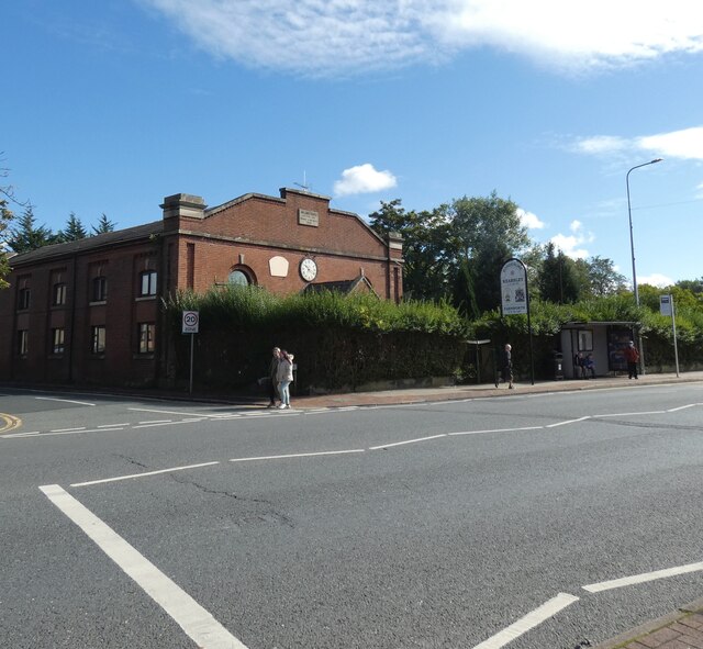
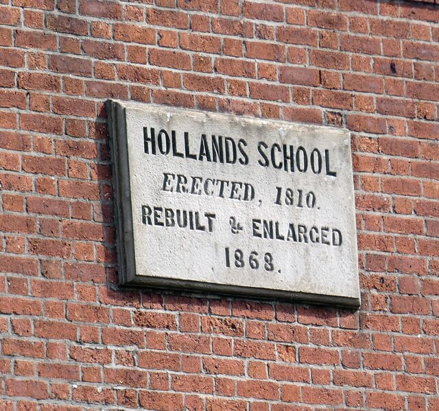
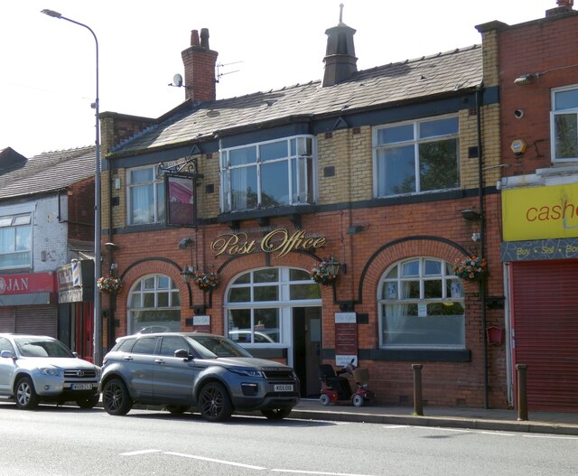
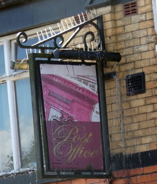
Bury, New Images

Images are sourced within 2km of 53.543642/-2.406669 or Grid Reference SD7305. Thanks to Geograph Open Source API. All images are credited.

Moses Gate Country Park, Crompton Lodges The largest of the three lakes at Moses Gate CP. The lodges were formerly reservoirs for Farnworth Paper Mill. They are now used for sailing model boats and as a habitat for wildlife.
Moses Gate Country Park, Crompton Lodges
The largest of the three lakes at Moses Gate CP. The lodges were formerly reservoirs for Farnworth Paper Mill. They are now used for sailing model boats and as a habitat for wildlife.
Cormorant at Crompton Lodges Cormorants are large and conspicuous waterbirds. They are found around the UK coastline on rocky shores, coastal lagoons and estuaries; they are increasingly being seen inland at reservoirs, lakes and gravel pits. This one is at Crompton Lodges. The lodges were formerly reservoirs for Farnworth Paper Mill. They are now used for sailing model boats and as a habitat for wildlife.
Cormorant at Crompton Lodges
Cormorants are large and conspicuous waterbirds. They are found around the UK coastline on rocky shores, coastal lagoons and estuaries; they are increasingly being seen inland at reservoirs, lakes and gravel pits. This one is at Crompton Lodges. The lodges were formerly reservoirs for Farnworth Paper Mill. They are now used for sailing model boats and as a habitat for wildlife.
Train leaving Moses Gate railway station Most trains do not stop at this small station, and only one train an hour makes a stop.
Train leaving Moses Gate railway station
Most trains do not stop at this small station, and only one train an hour makes a stop.
Water fowl in Moses Gate Country Park Plenty of fowl are enjoying damp conditions by the lodges.
Water fowl in Moses Gate Country Park
Plenty of fowl are enjoying damp conditions by the lodges.
Hollands School Former school <a href="https://www.geograph.org.uk/photo/7294302">SD7405 : Hollands School: Plaque</a>, now a nursing home on Higher  Market Street (A6053). The road forms the boundary between Kearsley (on the left) and Farnworth (on the right).
Hollands School
Former school SD7405 : Hollands School: Plaque, now a nursing home on Higher Market Street (A6053). The road forms the boundary between Kearsley (on the left) and Farnworth (on the right).
Hollands School: Plaque 
The plaque on Hollands School <a href="https://www.geograph.org.uk/photo/7294170">SD7405 : Hollands School</a> reads:

HOLLANDS SCHOOL
ERECTED, 1810.
REBUILT & ENLARGED
1868.
Hollands School: Plaque
The plaque on Hollands School SD7405 : Hollands School reads: HOLLANDS SCHOOL ERECTED, 1810. REBUILT & ENLARGED 1868.
Sign of the Post Office Sign for the Post Office <a href="https://www.geograph.org.uk/photo/7294383">SD7405 : Post Office Inn</a>.
Sign of the Post Office
Sign for the Post Office SD7405 : Post Office Inn.
Ye Olde Three Crowns The formerly vibrant public house <a href="https://www.geograph.org.uk/photo/1836757">SD7405 : Ye Olde Three Crowns</a> is vacant and up for sale.

<a href="https://www.geograph.org.uk/photo/7294790">SD7405 : Sign of Ye Olde Three Crowns</a>.
Ye Olde Three Crowns
The formerly vibrant public house SD7405 : Ye Olde Three Crowns is vacant and up for sale. SD7405 : Sign of Ye Olde Three Crowns.
Sign of Ye Olde Three Crowns Sign for Ye Olde Three Crowns <a href="https://www.geograph.org.uk/photo/7294788">SD7405 : Ye Olde Three Crowns</a>.
Sign of Ye Olde Three Crowns
Sign for Ye Olde Three Crowns SD7405 : Ye Olde Three Crowns.
Sign of the Black Horse Sign for the Black Horse [[[7294875]].
Sign of the Black Horse
Sign for the Black Horse [[[7294875]].
Higher Market Street The A6053 through Kearsley and Farnworth.
Higher Market Street
The A6053 through Kearsley and Farnworth.
Bolton-bound train on a frosty afternoon
Brackley Street, Farnworth One row of shops were demolished as part of a regeneration project.
Brackley Street, Farnworth
One row of shops were demolished as part of a regeneration project.
Love The Loopline The graffiti display on the Roe Green Loopline underneath Cleggs Lane, Little Hulton.
Love The Loopline
The graffiti display on the Roe Green Loopline underneath Cleggs Lane, Little Hulton.
Pipe Bridge south of Clegg's Lane Across a former railway now the Roe Green Loopline cycle route. The bridge carrying Clegg's Lane is just beyond the pipe bridge.
Pipe Bridge south of Clegg's Lane
Across a former railway now the Roe Green Loopline cycle route. The bridge carrying Clegg's Lane is just beyond the pipe bridge.
New development Off Anchor Lane and against the M61 motorway
New development
Off Anchor Lane and against the M61 motorway
Show me another place!

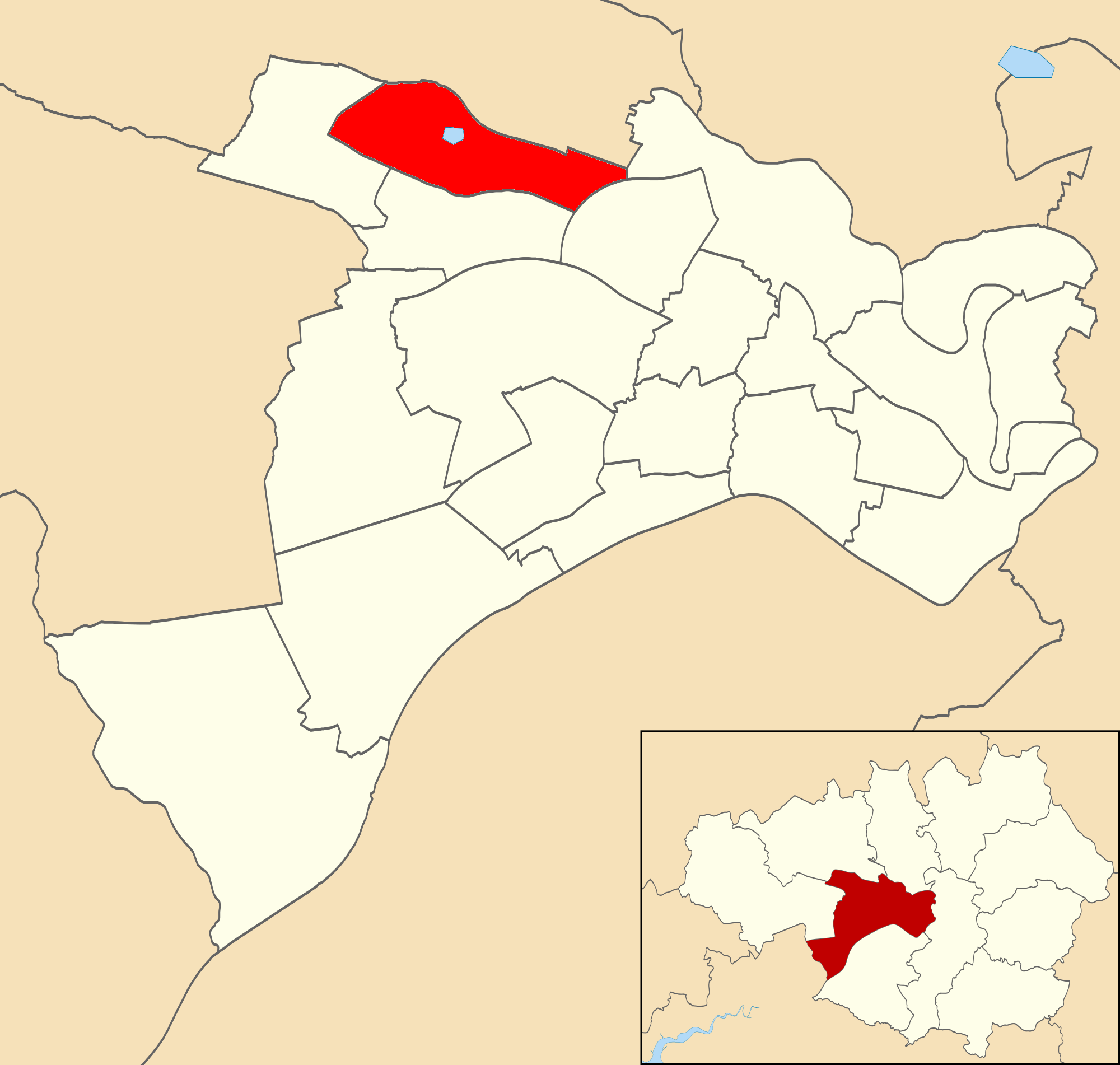
Bury, New is located at Grid Ref: SD7305 (Lat: 53.543642, Lng: -2.406669)

Unitary Authority: Bolton

Police Authority: Greater Manchester

What 3 Words

///modern.lived.copper. Near Farnworth, Manchester

Related Wikis

Century Mill, Farnworth

Century Mill, Farnworth is a former cotton spinning mill in Farnworth, Bolton, Greater Manchester, England which was built in the early 20th century for...

Municipal Borough of Farnworth

The Municipal Borough of Farnworth was a local government district centred on the town of Farnworth in the administrative county of Lancashire, England...

Farnworth

Farnworth is a town in the Metropolitan Borough of Bolton, Greater Manchester, England, 2 miles (3.2 km) southeast of Bolton, 4 miles south-west of Bury...

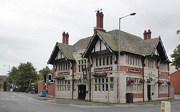
The Shakespeare, Farnworth

The Shakespeare is a Grade II listed public house at 1 Glynne Street, Farnworth, Greater Manchester BL4 7DN.It is on the Campaign for Real Ale's National...

St James's Church of England High School

St James's Church of England High School is a Coeducational Church of England secondary school located on Lucas Road, Farnworth in Greater Manchester,...

Harper Green School

Harper Green School is a coeducational secondary school located in Farnworth, Greater Manchester, England. On 1 March 2017 the school converted into an...

Farnworth Town Hall

Farnworth Town Hall is a municipal building in Market Street, Farnworth, Greater Manchester, England. The town hall, which was the headquarters of Farnworth...

Walkden North

Walkden North is an area and electoral ward of Salford, England. It is represented in Westminster by Barbara Keeley MP for Worsley and Eccles South. A...

Nearby Amenities

Located within 500m of 53.543642,-2.406669
New Bury
Is In: Bolton, Greater Manchester, England, UK
Place: suburb
Source: npe
Lat/Long: 53.5418533/-2.4054034
Mini Roundabout
Lat/Long: 53.5411359/-2.4081857
Bus Stop
Westland Avenue/Oakfield Grove
Bus: yes
Naptan AtcoCode: 1800WA09421
Naptan Bearing: W
Naptan CommonName: Westland Avenue/Oakfield Grove
Naptan Indicator: Os House 91a
Naptan Landmark: HOUSE 91
Naptan NaptanCode: manjwmwp
Naptan PlusbusZoneRef: MNCRPIC
Naptan ShortCommonName: Oakfield Grove
Naptan Street: Westland Avenue
Naptan Verified: no
Network: TfGM
Public Transport: platform
Source: naptan_import
Lat/Long: 53.5394768/-2.4069683
Bus Stop
Westland Avenue/Oakfield Grove
Bus: yes
Naptan AtcoCode: 1800WA09431
Naptan Bearing: E
Naptan CommonName: Westland Avenue/Oakfield Grove
Naptan Indicator: Opp House 83
Naptan Landmark: OPPOSITE HOUSE
Naptan NaptanCode: manjwmwt
Naptan Notes: INDICATOR AMENDED
Naptan PlusbusZoneRef: MNCRPIC
Naptan ShortCommonName: Oakfield Grove
Naptan Street: Westland Avenue
Naptan Verified: no
Network: TfGM
Public Transport: platform
Source: naptan_import
Lat/Long: 53.5395758/-2.4064817
Bus Stop
Westland Avenue/Buckley Lane
Bus: yes
Naptan AtcoCode: 1800WA09441
Naptan Bearing: W
Naptan CommonName: Westland Avenue/Buckley Lane
Naptan Indicator: Op House 115a
Naptan Landmark: HOUSE 113
Naptan NaptanCode: manjwpad
Naptan PlusbusZoneRef: MNCRPIC
Naptan ShortCommonName: Buckley Lane
Naptan Street: Westland Avenue
Naptan Verified: no
Network: TfGM
Public Transport: platform
Source: naptan_import
Lat/Long: 53.5396413/-2.4085105
Bus Stop
St James Street/Churchside
Bus: yes
Naptan AtcoCode: 1800WA09751
Naptan Bearing: W
Naptan CommonName: St James Street/Churchside
Naptan Indicator: Op House 95
Naptan Landmark: HOUSE 97
Naptan NaptanCode: mantgtma
Naptan PlusbusZoneRef: MNCRPIC
Naptan ShortCommonName: Churchside
Naptan Street: ST JAMES STREET
Naptan Verified: no
Network: TfGM
Public Transport: platform
Source: naptan_import
Lat/Long: 53.5417421/-2.4110929
Bus Stop
St James Street/Churchside
Bus: yes
Naptan AtcoCode: 1800WA10061
Naptan Bearing: E
Naptan CommonName: St James Street/Churchside
Naptan Indicator: Op House 95
Naptan Landmark: HOUSE 60
Naptan NaptanCode: manjwpjg
Naptan PlusbusZoneRef: MNCRPIC
Naptan ShortCommonName: Churchside
Naptan Street: ST JAMES STREET
Naptan Verified: no
Network: TfGM
Public Transport: platform
Source: naptan_import
Lat/Long: 53.5418321/-2.4110334
Bus Stop
Worsley Road/Longcauseway
Bus: yes
Naptan AtcoCode: 1800WA41881
Naptan Bearing: N
Naptan CommonName: Worsley Road/Longcauseway
Naptan Indicator: Car Sales Opp
Naptan Landmark: HOUSE 14
Naptan NaptanCode: manpgpta
Naptan PlusbusZoneRef: MNCRPIC
Naptan ShortCommonName: Longcauseway
Naptan Street: WORSLEY ROAD
Naptan Verified: no
Network: TfGM
Public Transport: platform
Source: naptan_import
Lat/Long: 53.5425709/-2.3999187
Bus Stop
Buckley Lane/Albert Road
Bus: yes
Naptan AtcoCode: 1800WA41891
Naptan Bearing: E
Naptan CommonName: Buckley Lane/Albert Road
Naptan Indicator: Bridgewater Hot
Naptan Landmark: BRIDGEWATER HOT
Naptan NaptanCode: manpgptd
Naptan PlusbusZoneRef: MNCRPIC
Naptan ShortCommonName: Albert Road
Naptan Street: BUCKLEY LANE
Naptan Verified: no
Network: TfGM
Public Transport: platform
Source: naptan_import
Lat/Long: 53.5429551/-2.4006316
Bus Stop
Buckley Lane/Elliott Street
Bus: yes
Naptan AtcoCode: 1800WA41901
Naptan Bearing: E
Naptan CommonName: Buckley Lane/Elliott Street
Naptan Indicator: Os House 110
Naptan Landmark: HOUSE 110
Naptan NaptanCode: manpgptg
Naptan PlusbusZoneRef: MNCRPIC
Naptan ShortCommonName: Elliott Street
Naptan Street: BUCKLEY LANE
Naptan Verified: no
Network: TfGM
Public Transport: platform
Source: naptan_import
Lat/Long: 53.5417367/-2.403403
Bus Stop
Buckley Lane/Elliot Street
Bus: yes
Naptan AtcoCode: 1800WA41911
Naptan Bearing: W
Naptan CommonName: Buckley Lane/Elliot Street
Naptan Indicator: Op House 116
Naptan Landmark: HOUSE 130
Naptan NaptanCode: manpgptj
Naptan PlusbusZoneRef: MNCRPIC
Naptan ShortCommonName: Elliot Street
Naptan Street: BUCKLEY LANE
Naptan Verified: no
Network: TfGM
Public Transport: platform
Source: naptan_import
Lat/Long: 53.5414609/-2.4043208
Bus Stop
Buckley Lane/Piggott Street
Bus: yes
Naptan AtcoCode: 1800WA41921
Naptan Bearing: W
Naptan CommonName: Buckley Lane/Piggott Street
Naptan Indicator: Os House 197
Naptan Landmark: HOUSE 197
Naptan NaptanCode: manpgptm
Naptan PlusbusZoneRef: MNCRPIC
Naptan ShortCommonName: Piggott Street
Naptan Street: BUCKLEY LANE
Naptan Verified: no
Network: TfGM
Public Transport: platform
Source: naptan_import
Lat/Long: 53.5412413/-2.4072667
Bus Stop
Buckley Lane/St James Street
Bus: yes
Naptan AtcoCode: 1800WA41941
Naptan Bearing: N
Naptan CommonName: Buckley Lane/St James Street
Naptan Indicator: House 254
Naptan Landmark: HOUSE 244
Naptan NaptanCode: manpgptw
Naptan PlusbusZoneRef: MNCRPIC
Naptan ShortCommonName: St James Street
Naptan Street: BUCKLEY LANE
Naptan Verified: no
Network: TfGM
Public Transport: platform
Source: naptan_import
Lat/Long: 53.5405163/-2.4086814
Bus Stop
Tennyson Road/Buckley Lane
Bus: yes
Naptan AtcoCode: 1800WA41951
Naptan Bearing: E
Naptan CommonName: Tennyson Road/Buckley Lane
Naptan Indicator: House 2
Naptan Landmark: HOUSE 8
Naptan NaptanCode: manpgpwa
Naptan PlusbusZoneRef: MNCRPIC
Naptan ShortCommonName: Buckley Lane
Naptan Street: TENNYSON ROAD
Naptan Verified: no
Network: TfGM
Public Transport: platform
Source: naptan_import
Lat/Long: 53.539829/-2.4106519
Bus Stop
George Street/Macdonald Avenue
Bus: yes
Naptan AtcoCode: 1800WA41991
Naptan Bearing: S
Naptan CommonName: George Street/Macdonald Avenue
Naptan Indicator: Op Church Inn
Naptan Landmark: OP CHURCH INN
Naptan NaptanCode: manpgpwm
Naptan PlusbusZoneRef: MNCRPIC
Naptan ShortCommonName: Macdonald Avenue
Naptan Street: GEORGE STREET
Naptan Verified: no
Network: TfGM
Public Transport: platform
Source: naptan_import
Lat/Long: 53.5435592/-2.4120026
Bus Stop
George Street/Macdonald Avenue
Bus: yes
Naptan AtcoCode: 1800WA42001
Naptan Bearing: N
Naptan CommonName: George Street/Macdonald Avenue
Naptan Indicator: House 76
Naptan Landmark: HOUSE 76
Naptan NaptanCode: manpgpwp
Naptan PlusbusZoneRef: MNCRPIC
Naptan ShortCommonName: Macdonald Avenue
Naptan Street: GEORGE STREET
Naptan Verified: no
Network: TfGM
Public Transport: platform
Source: naptan_import
Lat/Long: 53.5438329/-2.4121092
Bus Stop
George Street/Ramsay Avenue
Bus: yes
Naptan AtcoCode: 1800WA42011
Naptan Bearing: S
Naptan CommonName: George Street/Ramsay Avenue
Naptan Indicator: Factory
Naptan Landmark: FACTORY
Naptan NaptanCode: manpgpwt
Naptan PlusbusZoneRef: MNCRPIC
Naptan ShortCommonName: Ramsay Avenue
Naptan Street: GEORGE STREET
Naptan Verified: no
Network: TfGM
Public Transport: platform
Source: naptan_import
Lat/Long: 53.5458042/-2.4113134
Bus Stop
George Street/Ramsay Avenue
Bus: yes
Naptan AtcoCode: 1800WA42021
Naptan Bearing: N
Naptan CommonName: George Street/Ramsay Avenue
Naptan Indicator: House 32
Naptan Landmark: HOUSE 32
Naptan NaptanCode: manpgtad
Naptan PlusbusZoneRef: MNCRPIC
Naptan ShortCommonName: Ramsay Avenue
Naptan Street: GEORGE STREET
Naptan Verified: no
Network: TfGM
Public Transport: platform
Source: naptan_import
Lat/Long: 53.5457858/-2.4114188
Bus Stop
Harrowby Street/George Street
Bus: yes
Naptan AtcoCode: 1800WA42031
Naptan Bearing: W
Naptan CommonName: Harrowby Street/George Street
Naptan Indicator: Op Bowling Grn
Naptan Landmark: OP BOWLING GRN
Naptan NaptanCode: manpgtag
Naptan PlusbusZoneRef: MNCRPIC
Naptan ShortCommonName: George Street
Naptan Street: Harowby Street
Naptan Verified: no
Network: TfGM
Public Transport: platform
Source: naptan_import
Lat/Long: 53.5474532/-2.410122
Bus Stop
Harrowby Street/Shillingford Road
Bus: yes
Naptan AtcoCode: 1800WA42041
Naptan Bearing: E
Naptan CommonName: Harrowby Street/Shillingford Road
Naptan Indicator: Bowling Green
Naptan Landmark: BOWLING GREEN
Naptan NaptanCode: manpgtaj
Naptan PlusbusZoneRef: MNCRPIC
Naptan ShortCommonName: Shillingford Road
Naptan Street: HARROWBY STREET
Naptan Verified: no
Network: TfGM
Public Transport: platform
Source: naptan_import
Lat/Long: 53.5476894/-2.4093847
Bus Stop
Albert Road/Balmoral Road
Bus: yes
Naptan AtcoCode: 1800WA42111
Naptan Bearing: N
Naptan CommonName: Albert Road/Balmoral Road
Naptan Indicator: Os House 2
Naptan Landmark: FLATS 148-152
Naptan NaptanCode: manpgtdm
Naptan Notes: INDICATOR AMENDED
Naptan PlusbusZoneRef: MNCRPIC
Naptan ShortCommonName: Balmoral Road
Naptan Street: ALBERT ROAD
Naptan Verified: no
Network: TfGM
Public Transport: platform
Source: naptan_import
Lat/Long: 53.5453671/-2.3997036
Bus Stop
Albert Road/Longcauseway
Bus: yes
Naptan AtcoCode: 1800WA42121
Naptan Bearing: S
Naptan CommonName: Albert Road/Longcauseway
Naptan Indicator: Os House 199
Naptan Landmark: HOUSE 199
Naptan NaptanCode: manpgtdp
Naptan PlusbusZoneRef: MNCRPIC
Naptan ShortCommonName: Longcauseway
Naptan Street: ALBERT ROAD
Naptan Verified: no
Network: TfGM
Public Transport: platform
Source: naptan_import
Lat/Long: 53.5439383/-2.3995996
Mini Roundabout
Direction: clockwise
Lat/Long: 53.5432783/-2.4121419
Mini Roundabout
Lat/Long: 53.5412873/-2.4074148
Turning Circle
Lat/Long: 53.5422845/-2.4031757
Turning Circle
Lat/Long: 53.5410769/-2.4014566
Post Office
New Bury Post Office
Addr City: Bolton
Addr Postcode: BL4 9PU
Addr Suburb: Farnworth
Branch: New Bury
Brand: Post Office
Brand Wikidata: Q1783168
Check Date: 2020-02-20
Contact Website: https://www.postoffice.co.uk/branch-finder/216406x/new-bury
Ref Pol Id: 7954
Lat/Long: 53.5433678/-2.4118624
Mini Roundabout
Direction: clockwise
Lat/Long: 53.5433845/-2.4121521
Turning Circle
Lat/Long: 53.5419673/-2.4047896
Man Made: chimney
Lat/Long: 53.5455782/-2.4102969
Traffic Signals
Traffic Signals: signal
Traffic Signals Direction: forward
Lat/Long: 53.5429835/-2.3998311
Traffic Signals
Traffic Signals: signal
Traffic Signals Direction: forward
Lat/Long: 53.5433817/-2.399541
Traffic Signals
Traffic Signals: signal
Traffic Signals Direction: forward
Lat/Long: 53.543174/-2.4000516
Traffic Signals
Traffic Signals: signal
Traffic Signals Direction: forward
Lat/Long: 53.5435128/-2.3996844
Coco-Bay
Addr City: Bolton
Addr Housenumber: 80
Addr Postcode: BL4 9RJ
Addr Street: George Street
Addr Suburb: Farnworth
Beauty: tanning
Phone: +44 1204 770709
Shop: beauty
Lat/Long: 53.5435691/-2.4123418
Cafe
Nan's Cafe
Lat/Long: 53.5436077/-2.4122506
Post Box
Lat/Long: 53.5432903/-2.4119198
Waste Basket
Lat/Long: 53.547875/-2.4085853
Defibrillator
Emergency: defibrillator
Lat/Long: 53.5436514/-2.4116718
Waste Basket
Lat/Long: 53.5395762/-2.4064467
Waste Basket
Lat/Long: 53.5433262/-2.4120178
Barrier: bollard
Motor Vehicle: no
Lat/Long: 53.5445432/-2.40653
Barrier: bollard
Motor Vehicle: no
Lat/Long: 53.5446471/-2.406458
Noexit: yes
Lat/Long: 53.5476519/-2.4073691
Noexit: yes
Lat/Long: 53.5470305/-2.4073205
Turning Circle
Lat/Long: 53.543471/-2.4051883
Traffic Signals
Traffic Signals: signal
Traffic Signals Direction: forward
Lat/Long: 53.5433027/-2.3995226
Traffic Signals
Traffic Signals: signal
Traffic Signals Direction: forward
Lat/Long: 53.5432437/-2.3994876
Generator Method: photovoltaic
Generator Output Electricity: yes
Generator Source: solar
Generator Type: solar_photovoltaic_panel
Location: roof
Power: generator
Lat/Long: 53.5438792/-2.4038199
Generator Method: photovoltaic
Generator Output Electricity: yes
Generator Source: solar
Generator Type: solar_photovoltaic_panel
Location: roof
Power: generator
Lat/Long: 53.5440243/-2.4043536
Generator Method: photovoltaic
Generator Output Electricity: yes
Generator Source: solar
Generator Type: solar_photovoltaic_panel
Location: roof
Power: generator
Lat/Long: 53.54408/-2.4058637
Generator Method: photovoltaic
Generator Output Electricity: yes
Generator Source: solar
Generator Type: solar_photovoltaic_panel
Location: roof
Power: generator
Lat/Long: 53.5441231/-2.4059629
Generator Method: photovoltaic
Generator Output Electricity: yes
Generator Source: solar
Generator Type: solar_photovoltaic_panel
Location: roof
Power: generator
Lat/Long: 53.5441804/-2.4060568
Generator Method: photovoltaic
Generator Output Electricity: yes
Generator Source: solar
Generator Type: solar_photovoltaic_panel
Location: roof
Power: generator
Lat/Long: 53.5444179/-2.4061561
Generator Method: photovoltaic
Generator Output Electricity: yes
Generator Source: solar
Generator Type: solar_photovoltaic_panel
Location: roof
Power: generator
Lat/Long: 53.544759/-2.4047399
Generator Method: photovoltaic
Generator Output Electricity: yes
Generator Source: solar
Generator Type: solar_photovoltaic_panel
Location: roof
Power: generator
Lat/Long: 53.5430712/-2.4056652
Generator Method: photovoltaic
Generator Output Electricity: yes
Generator Source: solar
Generator Type: solar_photovoltaic_panel
Location: roof
Power: generator
Lat/Long: 53.5427412/-2.405102
Generator Method: photovoltaic
Generator Output Electricity: yes
Generator Source: solar
Generator Type: solar_photovoltaic_panel
Location: roof
Power: generator
Lat/Long: 53.5431971/-2.4038735
Generator Method: photovoltaic
Generator Output Electricity: yes
Generator Source: solar
Generator Type: solar_photovoltaic_panel
Location: roof
Power: generator
Lat/Long: 53.5433246/-2.4025485
Generator Method: photovoltaic
Generator Output Electricity: yes
Generator Source: solar
Generator Type: solar_photovoltaic_panel
Location: roof
Power: generator
Lat/Long: 53.540894/-2.4117485
Generator Method: photovoltaic
Generator Output Electricity: yes
Generator Source: solar
Generator Type: solar_photovoltaic_panel
Location: roof
Power: generator
Lat/Long: 53.540878/-2.4116841
Generator Method: photovoltaic
Generator Output Electricity: yes
Generator Source: solar
Generator Type: solar_photovoltaic_panel
Location: roof
Power: generator
Lat/Long: 53.5407298/-2.4041605
Generator Method: photovoltaic
Generator Output Electricity: yes
Generator Source: solar
Generator Type: solar_photovoltaic_panel
Location: roof
Power: generator
Lat/Long: 53.5401097/-2.4061802
The data included in this document is from www.openstreetmap.org. The data is made available under ODbL.

Have you been to Bury, New?

Leave your review of Bury, New below (or comments, questions and feedback).