Berefold

Settlement in Aberdeenshire

Scotland

Berefold

Farm road to Burnend
Farm road to Burnend Credit: Steven Brown

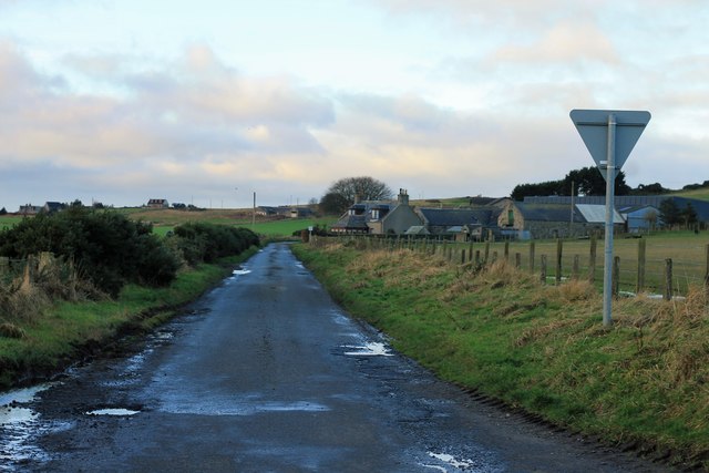
Berefold is a small village located in the county of Aberdeenshire, Scotland. Situated in the beautiful countryside, it is nestled between the towns of Inverurie and Insch. The village is known for its picturesque landscapes, rolling hills, and charming rural atmosphere.

With a population of around 500 residents, Berefold offers a close-knit and friendly community. The village is primarily residential, consisting of traditional stone-built houses, farmhouses, and cottages. Many of these buildings have retained their original character, adding to the village's timeless appeal.

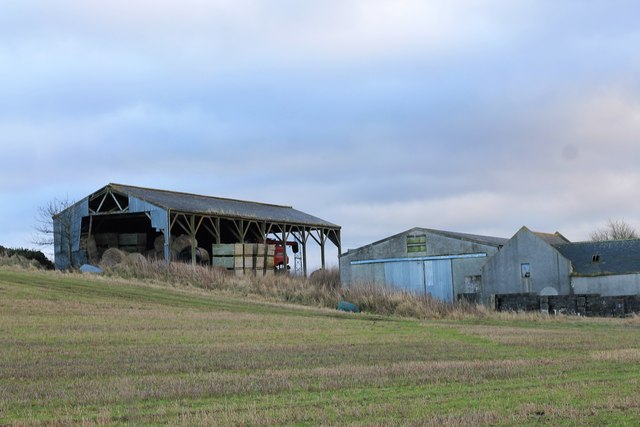
Berefold is surrounded by fertile farmland, which supports a strong agricultural sector in the area. The village itself has a few local amenities, including a village hall, a primary school, and a small convenience store. There are also several farms and agricultural businesses that contribute to the local economy.

The village is well-connected to the nearby towns and cities, with good transportation links. The A96 road runs close to Berefold, providing easy access to Inverurie, which is approximately 8 miles away, and the city of Aberdeen, which is around 25 miles to the east.

For outdoor enthusiasts, Berefold offers plenty of opportunities for exploration and outdoor activities. The surrounding countryside is perfect for hiking, cycling, and horse riding, with numerous trails and paths to be discovered. The village is also within a short distance of the River Urie, which is popular for fishing and canoeing.

In summary, Berefold is a peaceful and scenic village in Aberdeenshire, known for its rural charm, agricultural heritage, and close community spirit.

If you have any feedback on the listing, please let us know in the comments section below.

Berefold Images

Images are sourced within 2km of 57.40817/-2.046949 or Grid Reference NJ9735. Thanks to Geograph Open Source API. All images are credited.

Farm road to Burnend
Minor road near Overton
Minor road near Burrowley
Roadside Pumphouse A water pump station by Birness.
Roadside Pumphouse
A water pump station by Birness.
Woodland Burn by Birness A wee burn emerging from a shelter belt woo near Knaps of Birness.
Woodland Burn by Birness
A wee burn emerging from a shelter belt woo near Knaps of Birness.
Ploughed Field and Power A ploughed field with power lines leading the eye to iconic Bennachie in the distance.
Ploughed Field and Power
A ploughed field with power lines leading the eye to iconic Bennachie in the distance.
Road South by Birness The single carriageway road leading to knaps of Birness.
Road South by Birness
The single carriageway road leading to knaps of Birness.
Double Junction by Overton Two give way junctions within yards to the south of Overton Garage.
Double Junction by Overton
Two give way junctions within yards to the south of Overton Garage.
Roof Damage at Overton A once grand steading in deterioration at Overton of Birness.
Roof Damage at Overton
A once grand steading in deterioration at Overton of Birness.
Overton Barns The Dutch barn and buildings at Overton farm.
Overton Barns
The Dutch barn and buildings at Overton farm.
Slow for Berefold Traffic signs at the entrance to the hamlet of Berefold.
Slow for Berefold
Traffic signs at the entrance to the hamlet of Berefold.
Kamiri by Berefold A smallholding by Berefold with a new shed evident.
Kamiri by Berefold
A smallholding by Berefold with a new shed evident.
Road to Ardarg The road, albeit potholed, to Ardarg Farm and beyond.
Road to Ardarg
The road, albeit potholed, to Ardarg Farm and beyond.
Wellhead by Dudwick The smallholding of Wellhead by Dudwick plantation.
Wellhead by Dudwick
The smallholding of Wellhead by Dudwick plantation.
Dudwick Sheep Sheep grazing by Dudwick.
Dudwick Sheep
Sheep grazing by Dudwick.
Where There's Muck Usually money, but by Dudwick its sheep, hopefully it will amount to the same thing!
Where There's Muck
Usually money, but by Dudwick its sheep, hopefully it will amount to the same thing!
Blowing in the Wind Wires blowing in what was a strong breeze by the Mains of Dudwick.
Blowing in the Wind
Wires blowing in what was a strong breeze by the Mains of Dudwick.
Arthrath Road The minor road from Mains of Dudwick to Arthrath.
Arthrath Road
The minor road from Mains of Dudwick to Arthrath.
Show me another place!

Berefold is located at Grid Ref: NJ9735 (Lat: 57.40817, Lng: -2.046949)

Unitary Authority: Aberdeenshire

Police Authority: North East

What 3 Words

///streetcar.fearfully.thinker. Near Ellon, Aberdeenshire

Nearby Locations

Berefold

Related Wikis

Nearby Amenities

Located within 500m of 57.40817,-2.046949
Berefold
Place: hamlet
Lat/Long: 57.4065266/-2.0456805
Power: pole
Lat/Long: 57.4105411/-2.0410283
Power: pole
Lat/Long: 57.4103987/-2.0427167
Power: pole
Lat/Long: 57.4102492/-2.044255
Power: pole
Lat/Long: 57.4101098/-2.0460883
Power: pole
Lat/Long: 57.409935/-2.0475206
Power: pole
Lat/Long: 57.4097963/-2.0490521
Power: pole
Lat/Long: 57.4096937/-2.0500365
Power: pole
Lat/Long: 57.4095435/-2.0514634
Power: pole
Lat/Long: 57.4094091/-2.052885
Power: pole
Lat/Long: 57.4092834/-2.0542985
Power: pole
Lat/Long: 57.4115783/-2.0417163
Power: pole
Lat/Long: 57.4113233/-2.0412268
Power: pole
Lat/Long: 57.4038423/-2.0467603
Power: pole
Lat/Long: 57.4041034/-2.0466925
Power: pole
Lat/Long: 57.4044877/-2.0468301
Power: pole
Lat/Long: 57.4051354/-2.0469021
Power: pole
Lat/Long: 57.4055664/-2.046955
The data included in this document is from www.openstreetmap.org. The data is made available under ODbL.

Have you been to Berefold?

Leave your review of Berefold below (or comments, questions and feedback).