Bolsover, New

Settlement in Derbyshire Bolsover

England

Bolsover, New

Bolsover Castle As viewed across the Fountain Garden from the Wall Walk. On the left is the Terrace Range with its spectacular views over the Derbyshire countryside. To the right is the Little Castle <a href="https://www.geograph.org.uk/photo/4665188">SK4770 : Bolsover Little Castle</a>
Bolsover Castle Credit: Graham Hogg

The requested URL returned error: 429 Too Many Requests

If you have any feedback on the listing, please let us know in the comments section below.

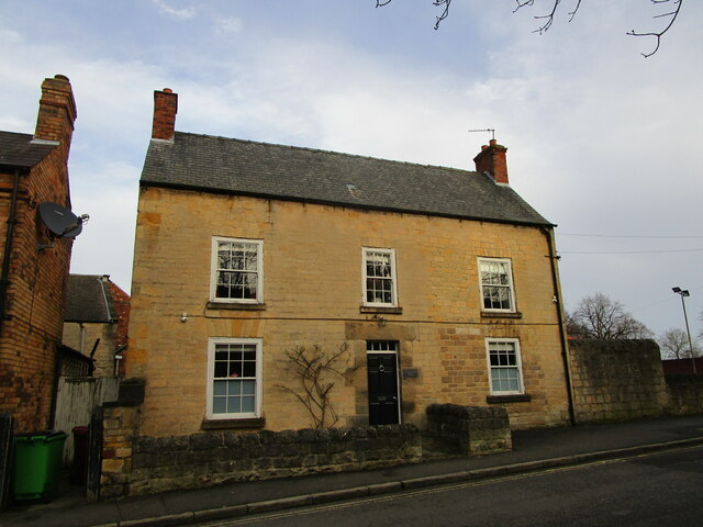
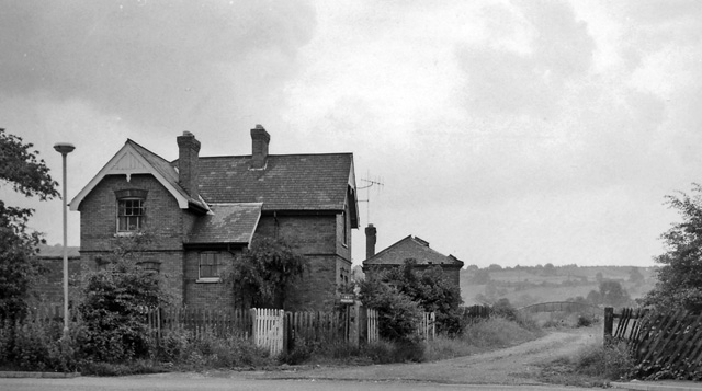
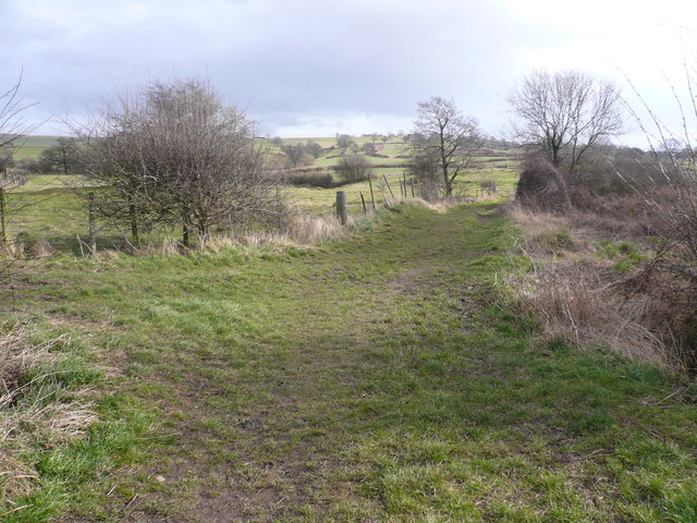
Bolsover, New Images

Images are sourced within 2km of 53.227082/-1.306865 or Grid Reference SK4670. Thanks to Geograph Open Source API. All images are credited.

Bolsover Castle As viewed across the Fountain Garden from the Wall Walk. On the left is the Terrace Range with its spectacular views over the Derbyshire countryside. To the right is the Little Castle <a href="https://www.geograph.org.uk/photo/4665188">SK4770 : Bolsover Little Castle</a>
Bolsover Castle
As viewed across the Fountain Garden from the Wall Walk. On the left is the Terrace Range with its spectacular views over the Derbyshire countryside. To the right is the Little Castle SK4770 : Bolsover Little Castle
The Indoor Riding School at Bolsover Castle Viewed from the visitor centre.
The Indoor Riding School at Bolsover Castle
Viewed from the visitor centre.
Large beech tree at Bolsover Castle The centrepiece of the Great Court between the Riding School and the Little Castle.
Large beech tree at Bolsover Castle
The centrepiece of the Great Court between the Riding School and the Little Castle.
Looking through a window at Bolsover Castle On the Terrace Range which enjoys dramatic views over the Derbyshire countryside.
Looking through a window at Bolsover Castle
On the Terrace Range which enjoys dramatic views over the Derbyshire countryside.
The Little Castle Viewd from the Wall Walk at Bolsover Castle
The Little Castle
Viewd from the Wall Walk at Bolsover Castle
View west from Hill Top, Bolsover
Church of St. Mary and St. Lawrence, Old Bolsover Partly medieval <span class="nowrap"><a title="https://historicengland.org.uk/listing/the-list/list-entry/1054045?section=official-listing" rel="nofollow ugc noopener" href="https://historicengland.org.uk/listing/the-list/list-entry/1054045?section=official-listing">Link</a><img style="margin-left:2px;" alt="External link" title="External link - shift click to open in new window" src="https://s1.geograph.org.uk/img/external.png" width="10" height="10"/></span>
Church of St. Mary and St. Lawrence, Old Bolsover
Partly medieval LinkExternal link
St. Bernadette's Roman Catholic church, Old Bolsover Designed by John Rochford and Partners 1967.
St. Bernadette's Roman Catholic church, Old Bolsover
Designed by John Rochford and Partners 1967.
2-4 Church Street, Old Bolsover Mid eighteenth century house <span class="nowrap"><a title="https://historicengland.org.uk/listing/the-list/list-entry/1054033?section=official-listing" rel="nofollow ugc noopener" href="https://historicengland.org.uk/listing/the-list/list-entry/1054033?section=official-listing">Link</a><img style="margin-left:2px;" alt="External link" title="External link - shift click to open in new window" src="https://s1.geograph.org.uk/img/external.png" width="10" height="10"/></span>
2-4 Church Street, Old Bolsover
Mid eighteenth century house LinkExternal link
15-19 Cotton Street. Old Bolsover Seventeenth century houses later altered <span class="nowrap"><a title="https://historicengland.org.uk/listing/the-list/list-entry/1108978?section=official-listing" rel="nofollow ugc noopener" href="https://historicengland.org.uk/listing/the-list/list-entry/1108978?section=official-listing">Link</a><img style="margin-left:2px;" alt="External link" title="External link - shift click to open in new window" src="https://s1.geograph.org.uk/img/external.png" width="10" height="10"/></span>
15-19 Cotton Street. Old Bolsover
Seventeenth century houses later altered LinkExternal link
Cotton Street, Old Bolsover
Former Primitive Methodist chapel, Cotton Street, Old Bolsover Built in 1865. At various times it has been a Salvation Army Citadel and Urban District Council offices.
Former Primitive Methodist chapel, Cotton Street, Old Bolsover
Built in 1865. At various times it has been a Salvation Army Citadel and Urban District Council offices.
The Cavendish, Old Bolsover
The White Swan, Old Bolsover Closed.
The White Swan, Old Bolsover
Closed.
Bolsover Assembly Hall Community Centre
Bolsover Methodist church Dates from 1896-7. Designed by John Wills <span class="nowrap"><a title="https://en.wikipedia.org/wiki/John_Wills_(architect)" rel="nofollow ugc noopener" href="https://en.wikipedia.org/wiki/John_Wills_(architect)">Link</a><img style="margin-left:2px;" alt="External link" title="External link - shift click to open in new window" src="https://s1.geograph.org.uk/img/external.png" width="10" height="10"/></span>
Bolsover Methodist church
Dates from 1896-7. Designed by John Wills LinkExternal link
Shops and houses, Town End, Old Bolsover
War memorial, Market Place, Old Bolsover Listed <span class="nowrap"><a title="https://historicengland.org.uk/listing/the-list/list-entry/1187012?section=official-listing" rel="nofollow ugc noopener" href="https://historicengland.org.uk/listing/the-list/list-entry/1187012?section=official-listing">Link</a><img style="margin-left:2px;" alt="External link" title="External link - shift click to open in new window" src="https://s1.geograph.org.uk/img/external.png" width="10" height="10"/></span> Designed by Sir Reginald Blomfield <span class="nowrap"><a title="https://en.wikipedia.org/wiki/Reginald_Blomfield" rel="nofollow ugc noopener" href="https://en.wikipedia.org/wiki/Reginald_Blomfield">Link</a><img style="margin-left:2px;" alt="External link" title="External link - shift click to open in new window" src="https://s1.geograph.org.uk/img/external.png" width="10" height="10"/></span>
War memorial, Market Place, Old Bolsover
Listed LinkExternal link Designed by Sir Reginald Blomfield LinkExternal link
Show me another place!

Bolsover, New is located at Grid Ref: SK4670 (Lat: 53.227082, Lng: -1.306865)

Administrative County: Derbyshire

District: Bolsover

Police Authority: Derbyshire

What 3 Words

///siblings.paints.diplomats. Near Bolsover, Derbyshire

Nearby Locations

New Bolsover Bolsover, New

Related Wikis

Doe Lea Viaduct

Doe Lea Viaduct is a former railway viaduct near Carr Vale, Bolsover, Derbyshire, England. == Location == The viaduct was originally, formally known as...

New Bolsover model village

New Bolsover model village is a village adjoining the town of Bolsover in Derbyshire. == History == The pit village was begun in 1891 by the Bolsover Mining...

Bolsover South railway station

Bolsover South is a former railway station in Carr Vale, Bolsover, Derbyshire, England. == History == The station was opened by the LD&ECR in March 1897...

Carr Vale

Carr Vale is a small village attached to the New Bolsover model village, Bolsover, Derbyshire, England. It is under Bolsover town. It was begun in the...

Nearby Amenities

Located within 500m of 53.227082,-1.306865
Barrier: cycle_barrier
Lat/Long: 53.2267088/-1.3099286
Bench
Created By: Potlatch 0.10e
Lat/Long: 53.2282927/-1.3097939
Bench
Created By: Potlatch 0.10e
Lat/Long: 53.2267461/-1.3139223
Bench
Created By: Potlatch 0.10e
Lat/Long: 53.2261963/-1.3141026
Note: Yes, this junction is odd like this
Lat/Long: 53.2245832/-1.3029685
Carr Vale
Place: suburb
Wikidata: Q5045991
Lat/Long: 53.222956/-1.3067764
Bench
Lat/Long: 53.2272189/-1.3137972
Bench
Lat/Long: 53.2269363/-1.3130505
Bench
Lat/Long: 53.2266534/-1.3118814
Bench
Lat/Long: 53.226628/-1.3101838
Bench
Ele: 79.91
Lat/Long: 53.2237947/-1.3029684
Ele: 93
Lat/Long: 53.226531/-1.301225
Ele: 96
Lat/Long: 53.2261703/-1.2997182
Ele: 79
Lat/Long: 53.2238242/-1.303042
Social Club
New Bolsover Social Club
Ele: 92.17
Lat/Long: 53.2256834/-1.3025768
Social Club
Carr Vale Working Mens Club
Lat/Long: 53.2235586/-1.3036524
Barrier: cycle_barrier
Lat/Long: 53.2253586/-1.3028368
Information: board
Tourism: information
Lat/Long: 53.2268427/-1.3112528
Information: board
Tourism: information
Lat/Long: 53.2268919/-1.3112999
Information: board
Tourism: information
Lat/Long: 53.2269155/-1.3111735
Breaking The Mould
Ele: 81.84
Tourism: artwork
Lat/Long: 53.2282246/-1.3097851
Bench
Ele: 85.44
Lat/Long: 53.2275727/-1.3104772
Bench
Ele: 89.77
Lat/Long: 53.2269043/-1.3112657
Ele: 89.77
Information: board
Tourism: information
Lat/Long: 53.2268895/-1.311178
Description: Stockley Trail
Ele: 72.22
Information: board
Tourism: information
Lat/Long: 53.2305848/-1.3109921
Millennium Marker "Breaking The Mould"
Ele: 76.55
Information: board
Tourism: information
Lat/Long: 53.2282636/-1.3098183
Ele: 84.24
Lat/Long: 53.2277788/-1.3103739
Ele: 77
Lat/Long: 53.2280384/-1.3086324
Barrier: cycle_barrier
Lat/Long: 53.2305225/-1.3106541
Barrier: cycle_barrier
Lat/Long: 53.2303461/-1.3101169
Bench
Lat/Long: 53.2254933/-1.304528
Barrier: horse_stile
Ele: 72.46
Lat/Long: 53.2266221/-1.3098938
Barrier: cycle_barrier
Lat/Long: 53.2265907/-1.3101808
Ele: 84.24
Lat/Long: 53.2259638/-1.3057082
Ele: 85.68
Lat/Long: 53.2258483/-1.3046702
Ele: 85.92
Lat/Long: 53.2256005/-1.3046522
Barrier: cycle_barrier
Ele: 85.2
Lat/Long: 53.2253834/-1.3044862
Ele: 85.2
Lat/Long: 53.2254805/-1.3045709
Barrier: cycle_barrier
Ele: 82.8
Lat/Long: 53.2256907/-1.3056158
Ele: 84.24
Lat/Long: 53.2257093/-1.3056901
Ele: 77
Lat/Long: 53.2261808/-1.3093821
Ele: 71.26
Lat/Long: 53.2244483/-1.3103633
Barrier: cycle_barrier
Ele: 75.59
Lat/Long: 53.2263445/-1.3097485
Ele: 79
Lat/Long: 53.2279002/-1.3072424
Barrier: cycle_barrier
Lat/Long: 53.2276174/-1.3059991
Ele: 89
Lat/Long: 53.2255521/-1.3031454
Ele: 88
Lat/Long: 53.2256863/-1.3034739
Barrier: cycle_barrier
Ele: 86.16
Lat/Long: 53.2258139/-1.3044494
Barrier: cycle_barrier
Lat/Long: 53.2266221/-1.3099298
Barrier: cycle_barrier
Lat/Long: 53.2256883/-1.3031629
Ele: 65.74
Lat/Long: 53.226757/-1.3140928
Noexit: yes
Lat/Long: 53.2231621/-1.3086867
Post Box
Brand: Royal Mail
Brand Wikidata: Q638098
Collection Times: Mo-Fr 09:00; Sa 07:00
Operator: Royal Mail
Operator Wikidata: Q638098
Post Box Type: lamp
Ref: S44 132D
Royal Cypher: EIIR
Royal Cypher Wikidata: Q33102113
Lat/Long: 53.2247552/-1.3029178
Post Box
Brand: Royal Mail
Brand Wikidata: Q638098
Collection Times: Mo-Fr 09:00; Sa 07:00
Operator: Royal Mail
Operator Wikidata: Q638098
Post Box Type: wall
Ref: S44 16D
Royal Cypher: GR
Royal Cypher Wikidata: Q33102273
Lat/Long: 53.2289981/-1.3055314
Ele: 61
Lat/Long: 53.2305165/-1.3112323
Ele: 71.98
Lat/Long: 53.2278897/-1.3103311
Bench
Ele: 60.93
Lat/Long: 53.226557/-1.3106207
Ele: 72
Lat/Long: 53.2275461/-1.3137965
Ele: 74
Lat/Long: 53.2274792/-1.3135032
Ele: 55
Lat/Long: 53.2268364/-1.3124661
Ele: 58
Lat/Long: 53.2265281/-1.3111143
Ele: 66
Lat/Long: 53.2264896/-1.3098375
Ele: 62
Lat/Long: 53.2241259/-1.3108246
Ele: 66
Lat/Long: 53.2234601/-1.3081713
Ele: 65
Lat/Long: 53.2230926/-1.3082873
Ele: 65
Lat/Long: 53.2231445/-1.3088052
Ele: 61
Lat/Long: 53.2228681/-1.3093626
Barrier: cycle_barrier
Lat/Long: 53.2257819/-1.3032011
Barrier: cycle_barrier
Lat/Long: 53.2269011/-1.3033328
Barrier: cycle_barrier
Lat/Long: 53.2285894/-1.3072768
Barrier: stile
Steps: 2
Stile: stepover
Lat/Long: 53.2282588/-1.3060914
Stockley Trail
Information: board
Tourism: information
Lat/Long: 53.2268461/-1.3100509
Information: board
Tourism: information
Lat/Long: 53.2301697/-1.3101756
Mini Roundabout
Source: Bing
Lat/Long: 53.2272981/-1.3008166
Barrier: horse_stile
Lat/Long: 53.2303395/-1.3101561
Cafe
Dotti Deli
Cuisine: sandwich
Lat/Long: 53.2244617/-1.3030135
Barrier: stile
Steps: 1
Stile: stepover
Lat/Long: 53.2240694/-1.310591
Shop: vacant
Source: View from south
Lat/Long: 53.2239565/-1.3073262
Barkers Boutique
Shop: clothes
Lat/Long: 53.2246702/-1.3027303
KD Bargains
Shop: discount
Lat/Long: 53.2246332/-1.3027477
Fast Food
Bengal Regency
Cuisine: indian
Lat/Long: 53.2248428/-1.3026659
Fast Food
Ginos
Cuisine: italian
Lat/Long: 53.224887/-1.3026471
Phillips Fashion
Shop: clothes
Lat/Long: 53.2246004/-1.3027665
Ele: 77
Lat/Long: 53.2256922/-1.3099765
Ele: 77
Lat/Long: 53.2262502/-1.3096524
Ele: 81.36
Lat/Long: 53.2258486/-1.3074514
Barrier: bollard
Lat/Long: 53.222881/-1.306029
Barrier: bollard
Lat/Long: 53.2242093/-1.3033283
Barrier: bollard
Lat/Long: 53.2239332/-1.30493
Barrier: bollard
Lat/Long: 53.2238324/-1.3055052
Barrier: bollard
Lat/Long: 53.2240333/-1.3043501
Barrier: bollard
Lat/Long: 53.2241329/-1.3037739
Barrier: bollard
Lat/Long: 53.2231528/-1.306169
Barrier: bollard
Lat/Long: 53.2242362/-1.3044509
Barrier: bollard
Lat/Long: 53.2236602/-1.3042188
Barrier: bollard
Lat/Long: 53.2244087/-1.3034205
Barrier: bollard
Lat/Long: 53.2237615/-1.3036443
Barrier: bollard
Lat/Long: 53.2241338/-1.3050231
Barrier: bollard
Lat/Long: 53.2236168/-1.3048567
Barrier: bollard
Lat/Long: 53.2240094/-1.305593
Barrier: bollard
Lat/Long: 53.2243532/-1.3038746
Barrier: bollard
Lat/Long: 53.2244918/-1.3052301
Barrier: bollard
Lat/Long: 53.2237236/-1.3055422
Barrier: bollard
Lat/Long: 53.2244009/-1.3043468
Barrier: bollard
Lat/Long: 53.2242581/-1.3051359
Barrier: bollard
Lat/Long: 53.2287679/-1.3048131
Barrier: bollard
Lat/Long: 53.2272873/-1.3039877
Barrier: bollard
Lat/Long: 53.2287423/-1.3054374
Barrier: bollard
Lat/Long: 53.2287982/-1.3041906
Barrier: bollard
Lat/Long: 53.2279061/-1.3029598
Barrier: bollard
Lat/Long: 53.228906/-1.3042043
Barrier: bollard
Lat/Long: 53.2288659/-1.3048278
Barrier: bollard
Lat/Long: 53.2272536/-1.3046026
Barrier: bollard
Lat/Long: 53.2272199/-1.3052226
Barrier: bollard
Lat/Long: 53.2283906/-1.3059447
Barrier: bollard
Lat/Long: 53.22828/-1.3032096
Barrier: bollard
Lat/Long: 53.2271833/-1.3039732
Barrier: bollard
Lat/Long: 53.2282664/-1.3034621
Barrier: bollard
Lat/Long: 53.227151/-1.3045883
Barrier: bollard
Lat/Long: 53.2287167/-1.3027989
Barrier: bollard
Lat/Long: 53.2271206/-1.3052073
Barrier: bollard
Lat/Long: 53.2283055/-1.3030215
Barrier: bollard
Lat/Long: 53.2291099/-1.303626
Barrier: bollard
Lat/Long: 53.2287008/-1.3030838
Barrier: bollard
Lat/Long: 53.2288394/-1.305469
Barrier: bollard
Lat/Long: 53.2285575/-1.305408
Barrier: bollard
Lat/Long: 53.2278825/-1.303416
Barrier: bollard
Lat/Long: 53.2278973/-1.3031398
Barrier: bollard
Lat/Long: 53.2290118/-1.3054911
Barrier: bollard
Lat/Long: 53.2289334/-1.3035994
Barrier: bollard
Lat/Long: 53.2275033/-1.3029253
Barrier: cycle_barrier
Lat/Long: 53.2264665/-1.3024858
Barrier: bollard
Lat/Long: 53.2270162/-1.3039428
Barrier: bollard
Lat/Long: 53.2272116/-1.3033471
Barrier: bollard
Lat/Long: 53.226987/-1.3045635
Barrier: bollard
Lat/Long: 53.22695/-1.3051792
Barrier: bollard
Lat/Long: 53.227045/-1.3033304
Defibrillator
Access: yes
Check Date: 2023-03-09
Defibrillator Location: On the outside wall of Bainbridge Hall. By the entrance.
Emergency: defibrillator
Indoor: no
Lat/Long: 53.2266458/-1.3019798
Building: entrance
Lat/Long: 53.226666/-1.3019823
Generator Method: photovoltaic
Generator Output Electricity: yes
Generator Source: solar
Generator Type: solar_photovoltaic_panel
Location: roof
Power: generator
Lat/Long: 53.2299588/-1.3045935
Generator Method: photovoltaic
Generator Output Electricity: yes
Generator Source: solar
Generator Type: solar_photovoltaic_panel
Location: roof
Power: generator
Lat/Long: 53.2299491/-1.3047464
Direction: SSE
Generator Method: photovoltaic
Generator Output Electricity: yes
Generator Solar Modules: 10
Generator Source: solar
Generator Type: solar_photovoltaic_panel
Location: roof
Power: generator
Lat/Long: 53.2244502/-1.3015411
Direction: 100
Generator Method: photovoltaic
Generator Output Electricity: yes
Generator Solar Modules: 9
Generator Source: solar
Generator Type: solar_photovoltaic_panel
Location: roof
Power: generator
Lat/Long: 53.2232699/-1.3078872
Direction: SSE
Generator Method: photovoltaic
Generator Output Electricity: yes
Generator Solar Modules: 18
Generator Source: solar
Generator Type: solar_photovoltaic_panel
Location: roof
Power: generator
Lat/Long: 53.223406/-1.3083371
Direction: SSE
Generator Method: photovoltaic
Generator Output Electricity: yes
Generator Solar Modules: 18
Generator Source: solar
Generator Type: solar_photovoltaic_panel
Location: roof
Power: generator
Lat/Long: 53.2234456/-1.3088188
Direction: SSE
Generator Method: photovoltaic
Generator Output Electricity: yes
Generator Solar Modules: 18
Generator Source: solar
Generator Type: solar_photovoltaic_panel
Location: roof
Power: generator
Lat/Long: 53.2232099/-1.3084576
Direction: SSE
Generator Method: photovoltaic
Generator Output Electricity: yes
Generator Solar Modules: 11
Generator Source: solar
Generator Type: solar_photovoltaic_panel
Location: roof
Power: generator
Lat/Long: 53.2240153/-1.3066552
Direction: WSW
Generator Method: photovoltaic
Generator Output Electricity: yes
Generator Solar Modules: 17
Generator Source: solar
Generator Type: solar_photovoltaic_panel
Location: roof
Power: generator
Lat/Long: 53.2251205/-1.3049799
Direction: 190
Generator Method: photovoltaic
Generator Output Electricity: yes
Generator Solar Modules: 16
Generator Source: solar
Generator Type: solar_photovoltaic_panel
Location: roof
Power: generator
Lat/Long: 53.2249828/-1.3029168
Direction: SW
Generator Method: photovoltaic
Generator Output Electricity: yes
Generator Solar Modules: 16
Generator Source: solar
Generator Type: solar_photovoltaic_panel
Location: roof
Power: generator
Lat/Long: 53.2259714/-1.299806
Direction: SW
Generator Method: photovoltaic
Generator Output Electricity: yes
Generator Solar Modules: 16
Generator Source: solar
Generator Type: solar_photovoltaic_panel
Location: roof
Power: generator
Lat/Long: 53.2262266/-1.3009433
Direction: SW
Generator Method: photovoltaic
Generator Output Electricity: yes
Generator Solar Modules: 16
Generator Source: solar
Generator Type: solar_photovoltaic_panel
Location: roof
Power: generator
Lat/Long: 53.2261174/-1.3004184
Tourism: artwork
Lat/Long: 53.2263039/-1.302008
Bus Stop
Bus: yes
Naptan AtcoCode: 1000DCVC7087
Naptan NaptanCode: dbsamadw
Public Transport: platform
Lat/Long: 53.2263023/-1.3023211
Bus Stop
Bus: yes
Naptan AtcoCode: 1000DCVC7089
Naptan NaptanCode: dbsamagd
Public Transport: platform
Shelter: yes
Lat/Long: 53.226314/-1.3018993
Bus Stop
Bus: yes
Public Transport: platform
Lat/Long: 53.2285764/-1.3003262
Bench
Lat/Long: 53.2292557/-1.3055717
Telephone
Booth: K6
Covered: booth
Listed Status: Grade II
Operator: BT
Phone: +44 1246 823430
Lat/Long: 53.2290045/-1.3057608
Defibrillator
Access: yes
Defibrillator Location: On the outside wall of the convenience store.
Emergency: defibrillator
Indoor: no
Lat/Long: 53.2248597/-1.3029091
Bus Stop
Bus: yes
Naptan AtcoCode: 1000DCVC7088
Naptan NaptanCode: dbsamaga
Public Transport: platform
Source: bustimes.org
Source Location: bing
Lat/Long: 53.2265797/-1.3024961
Bus Stop
Bus: yes
Naptan AtcoCode: 1000DCVC7457
Naptan NaptanCode: dbsamagt
Public Transport: platform
Source: bustimes.org
Source Location: bing
Lat/Long: 53.2238797/-1.3071311
The data included in this document is from www.openstreetmap.org. The data is made available under ODbL.

Have you been to Bolsover, New?

Leave your review of Bolsover, New below (or comments, questions and feedback).