Bilton, New

Settlement in Warwickshire Rugby

England

Bilton, New

Cow and calf at Newbold on Avon Meal time for the calf while its mother stands stoically in her field by the Oxford Canal.
Cow and calf at Newbold on Avon Credit: Stephen McKay

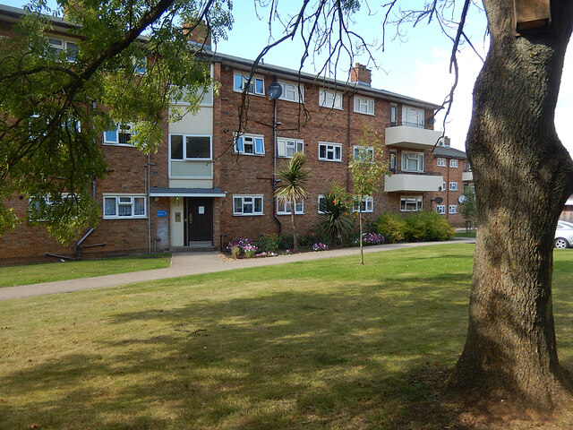
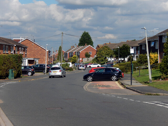
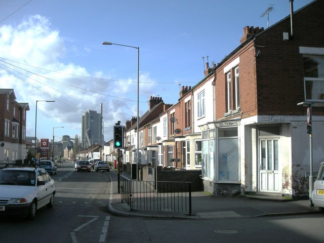
Bilton is a small village located in the county of Warwickshire, England. Situated approximately two miles east of Rugby, it falls within the borough of Rugby. Bilton is primarily a residential area, known for its peaceful atmosphere and picturesque surroundings.

The village dates back to the medieval period and still retains some of its historic charm. Bilton's architecture reflects its rich heritage, with several well-preserved buildings from different eras. The All Saints Church, a Grade II* listed building, is a notable landmark in the village, showcasing a combination of Norman and Gothic architectural styles.

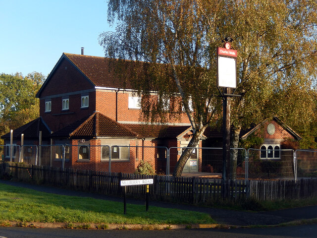
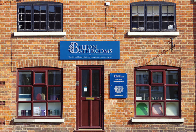
Bilton boasts a range of amenities that cater to the needs of its residents. The village center is home to various local businesses, including shops, cafes, and pubs, providing convenient access to everyday essentials. Additionally, Bilton has a primary school, a community center, and a library, serving as essential hubs for education and recreation.

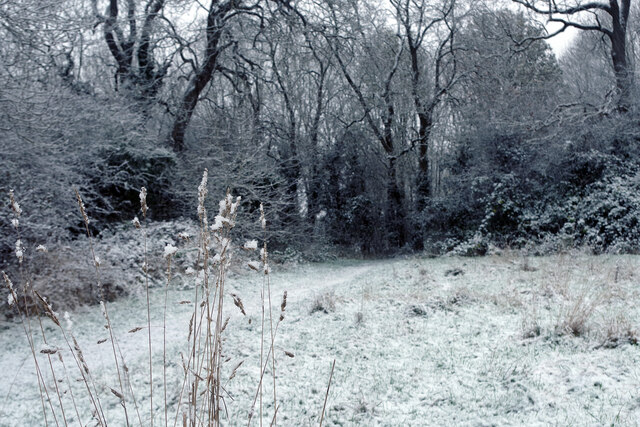
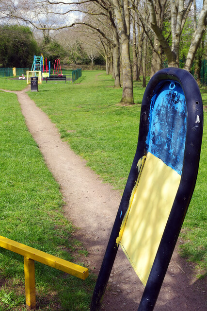
Nature enthusiasts will appreciate the village's proximity to beautiful green spaces. The nearby Draycote Water, a reservoir and nature reserve, offers opportunities for outdoor activities such as walking, cycling, and birdwatching. Bilton also benefits from its close proximity to various parks and recreational areas, providing residents with ample opportunities to enjoy the outdoors.

Transportation in Bilton is well-served, with regular bus services connecting the village to neighboring towns and cities. The nearby Rugby train station provides easy access to major cities such as Birmingham and London.

Overall, Bilton, New, Warwickshire presents itself as a tranquil village with a rich history, offering a peaceful lifestyle surrounded by natural beauty.

If you have any feedback on the listing, please let us know in the comments section below.

Bilton, New Images

Images are sourced within 2km of 52.374508/-1.280481 or Grid Reference SP4975. Thanks to Geograph Open Source API. All images are credited.

Cow and calf at Newbold on Avon Meal time for the calf while its mother stands stoically in her field by the Oxford Canal.
Cow and calf at Newbold on Avon
Meal time for the calf while its mother stands stoically in her field by the Oxford Canal.
St Botolph's Church, Newbold-on-Avon
Queensferry Close, Bilton The flats here were built in the 1950s by the English Electric Company - then a major employer in Rugby - to house its workers. The name came about because the company had a manufacturing plant in Queensferry. For some years after it was built the estate that includes these flats was called Kingsway (the company's headquarters were on Kingsway in London), but the name is seldom used now.
Queensferry Close, Bilton
The flats here were built in the 1950s by the English Electric Company - then a major employer in Rugby - to house its workers. The name came about because the company had a manufacturing plant in Queensferry. For some years after it was built the estate that includes these flats was called Kingsway (the company's headquarters were on Kingsway in London), but the name is seldom used now.
Frobisher Road, Bilton Frobisher Road forms the spine of the Admirals Estate where all the streets are named after British admirals - some better known than others. The area was developed around the 1970s, consisting mostly of semi-detached houses built for the private market. As is often the way nowadays, there seem to be more parked cars than the infrastructure can comfortably accommodate even though a regular bus service passes this way.
Frobisher Road, Bilton
Frobisher Road forms the spine of the Admirals Estate where all the streets are named after British admirals - some better known than others. The area was developed around the 1970s, consisting mostly of semi-detached houses built for the private market. As is often the way nowadays, there seem to be more parked cars than the infrastructure can comfortably accommodate even though a regular bus service passes this way.
The Bear, Bilton Wells & Co are undertaking a major refurbishment of this Bilton Lane pub and in this view it is surrounded by Heras fencing. The pub had closed in September 2020 during the height of the pandemic crisis and remained empty, but not boarded up, for many months.
The Bear, Bilton
Wells & Co are undertaking a major refurbishment of this Bilton Lane pub and in this view it is surrounded by Heras fencing. The pub had closed in September 2020 during the height of the pandemic crisis and remained empty, but not boarded up, for many months.
Oxford Canal, Newbold on Avon It is early on an autumn morning and light is only beginning to penetrate down to the canal. A swan is finding something for breakfast.
Oxford Canal, Newbold on Avon
It is early on an autumn morning and light is only beginning to penetrate down to the canal. A swan is finding something for breakfast.
Path to Apple Grove At about 3pm on this November Sunday afternoon, snow began to fall across the Rugby area following a stormy weekend. In this view it was beginning to settle and would lay overnight, but not at a depth to cause any serious disruption.
Path to Apple Grove
At about 3pm on this November Sunday afternoon, snow began to fall across the Rugby area following a stormy weekend. In this view it was beginning to settle and would lay overnight, but not at a depth to cause any serious disruption.
Apple Grove Play Area, Bilton The play area is tucked away at the end of Apple Grove, adjacent to open country and Henry Hinde Junior School. Note that the barrier designed to prevent motorcycles using the path has been painted in the colours of the Ukraine flag. This is an expression of solidarity with the Ukrainian people as they defend their country against the Russian invasion.
Apple Grove Play Area, Bilton
The play area is tucked away at the end of Apple Grove, adjacent to open country and Henry Hinde Junior School. Note that the barrier designed to prevent motorcycles using the path has been painted in the colours of the Ukraine flag. This is an expression of solidarity with the Ukrainian people as they defend their country against the Russian invasion.
Newbold on Avon War Memorial Evening sunshine catches the war memorial, erected in 1920, in St Botolph's churchyard. See <a href="https://www.geograph.org.uk/photo/6763220">SP4877 : Newbold on Avon War Memorial</a> for an alternative view.
Newbold on Avon War Memorial
Evening sunshine catches the war memorial, erected in 1920, in St Botolph's churchyard. See SP4877 : Newbold on Avon War Memorial for an alternative view.
Newbold on Avon Church This view shows the north door of the mainly 15th century grade I listed St Botolph's church.
Newbold on Avon Church
This view shows the north door of the mainly 15th century grade I listed St Botolph's church.
Old railway near Bilton This stretch of the old Rugby - Leamington railway has been kept clear and makes for a pleasant traffic-free path especially after a spell of dry weather with no mud underfoot. Passenger services on this route were withdrawn in 1959 but freight trains continued until 1985.
Old railway near Bilton
This stretch of the old Rugby - Leamington railway has been kept clear and makes for a pleasant traffic-free path especially after a spell of dry weather with no mud underfoot. Passenger services on this route were withdrawn in 1959 but freight trains continued until 1985.
Postbox topper at Bilton The practice of topping postboxes with knitted or crocheted designs ('yarn bombing') has reached the Rugby suburbs. Here, outside Bilton Post Office, is one interpretation of the platinum jubilee theme featuring some British icons and the royal corgis.
Postbox topper at Bilton
The practice of topping postboxes with knitted or crocheted designs ('yarn bombing') has reached the Rugby suburbs. Here, outside Bilton Post Office, is one interpretation of the platinum jubilee theme featuring some British icons and the royal corgis.
Bilton Bathrooms This bathroom supply company is a new addition to Bilton, having opened in April 2022. The building was formerly a hair salon.
Bilton Bathrooms
This bathroom supply company is a new addition to Bilton, having opened in April 2022. The building was formerly a hair salon.
Railway bridge, Rugby
Postbox topper outside Bilton Post Office The postbox outside Bilton Post Office on Main Street has acquired a Christmas-themed topper, part of which is seen here, featuring a Royal Mail van and a postbox, on a cold frosty morning. Behind that the post office itself lists its extensive services. Even in these days of e-cards and courier parcel delivery services, the Post Office and Royal Mail are still inextricably linked with Christmas.
Postbox topper outside Bilton Post Office
The postbox outside Bilton Post Office on Main Street has acquired a Christmas-themed topper, part of which is seen here, featuring a Royal Mail van and a postbox, on a cold frosty morning. Behind that the post office itself lists its extensive services. Even in these days of e-cards and courier parcel delivery services, the Post Office and Royal Mail are still inextricably linked with Christmas.
Christmas postbox topper outside Bilton Post Office The Royal Mail van that seemed quite appropriate for Christmas has been replaced by a more direct Christmas theme featuring Santa Claus, a tree and a snowman. See <a href="https://www.geograph.org.uk/photo/7357900">SP4873 : Postbox topper outside Bilton Post Office</a> for the previous incarnation.
Christmas postbox topper outside Bilton Post Office
The Royal Mail van that seemed quite appropriate for Christmas has been replaced by a more direct Christmas theme featuring Santa Claus, a tree and a snowman. See SP4873 : Postbox topper outside Bilton Post Office for the previous incarnation.
Trees at Bilton 0830 on a January morning, with a hard frost and a very light dusting of snow, sees the low sun illuminate the line of trees that run along the old railway line by Mulberry Road with a golden glow.
Trees at Bilton
0830 on a January morning, with a hard frost and a very light dusting of snow, sees the low sun illuminate the line of trees that run along the old railway line by Mulberry Road with a golden glow.
Snowdrops Of all garden bulbs, snowdrops are surely the most popular. Their white flowers, that usually start to appear towards the end of January, tell us that the winter won't last forever and that spring is just around the corner.
Snowdrops
Of all garden bulbs, snowdrops are surely the most popular. Their white flowers, that usually start to appear towards the end of January, tell us that the winter won't last forever and that spring is just around the corner.
Show me another place!

Bilton, New is located at Grid Ref: SP4975 (Lat: 52.374508, Lng: -1.280481)

Administrative County: Warwickshire

District: Rugby

Police Authority: Warwickshire

What 3 Words

///period.error.plan. Near Rugby, Warwickshire

Nearby Locations

Bilton, New New Bilton

Related Wikis

New Bilton

New Bilton is a suburb of Rugby, Warwickshire, in England, situated to the west of the town centre. New Bilton is also a ward of the Borough of Rugby whose...

Rugby Lions

The Rugby Lions RFC, nicknamed The Lions, is an English rugby union club based in Rugby, Warwickshire. The club plays its home matches at Webb Ellis Road...

107.1 Rugby FM

107.1 Rugby FM was an Independent Local Radio station in Warwickshire. At the time of closure, it was owned and operated by Quidem and broadcast from studios...

Rugby Western Relief Road

The Rugby Western Relief Road (RWRR) is a 3.7-mile (6 km) single carriageway bypass road which is on the outskirts of Rugby, Warwickshire, England. The...

Nearby Amenities

Located within 500m of 52.374508,-1.280481
Mini Roundabout
Direction: clockwise
Lat/Long: 52.3744611/-1.2791728
Barrier: bollard
Lat/Long: 52.3728782/-1.278509
Turning Circle
Source: Warwicks CC Aerial Imagery 2013
Lat/Long: 52.371657/-1.2790645
Post Box
Operator: Royal Mail
Lat/Long: 52.3714338/-1.2822325
Pub
The Holly Bush
Addr City: Rugby
Addr Postcode: CV21 2HR
Addr Street: Lawford Road
Addr Suburb: New Bilton
Fhrs Id: 210270
Source Addr: FHRS Open Data
Url: http://www.hollybush.biz/
Lat/Long: 52.3734317/-1.2771133
Fuel
BP
Addr City: Rugby
Addr Housenumber: 159-183
Addr Postcode: CV21 2HX
Addr Street: Lawford Road
Addr Suburb: New Bilton
Brand: BP
Brand Wikidata: Q152057
Brand Wikipedia: en:BP
Fhrs Id: 210141
Phone: +44 1788 540025
Lat/Long: 52.3738084/-1.2779861
Post Office
Bridget Street Post Office
Addr City: Rugby
Addr Housenumber: 103
Addr Postcode: CV21 2BU
Addr Street: Bridget Street
Addr Suburb: New Bilton
Fhrs Id: 210433
Opening Hours: Mo-Fr 09:00-17:30; Sa 09:00-13:30
Ref Pol Id: 14480
Source Addr: FHRS Open Data
Lat/Long: 52.3745566/-1.2732343
Post Box
Collection Times: Mo-Fr 17:00; Sa 12:00
Operator: Royal Mail
Operator Wikidata: Q638098
Post Box Type: pillar
Postal Code: CV21
Ref: CV21 47
Royal Cypher: EIIR
Royal Cypher Wikidata: Q33102113
Lat/Long: 52.3745906/-1.2731741
New Bilton
Is In: Rugby,Warwickshire
Place: suburb
Lat/Long: 52.3730633/-1.2753185
Post Box
Collection Times: Mo-Fr 09:00; Sa 07:00
Operator: Royal Mail
Operator Wikidata: Q638098
Post Box Type: pillar
Postal Code: CV21
Ref: CV21 59D
Royal Cypher: EIIR
Royal Cypher Wikidata: Q33102113
Source: survey
Lat/Long: 52.3757413/-1.275684
Turning Circle
Lat/Long: 52.3731108/-1.2737421
Railway: buffer_stop
Lat/Long: 52.37545/-1.2821028
Bus Stop
Pendred Road
Bus: yes
Naptan AtcoCode: 4200F056700
Naptan Bearing: N
Naptan CommonName: Pendred Road
Naptan Indicator: Opp
Naptan NaptanCode: wardagmp
Naptan PlusbusZoneRef: RUGBY
Naptan Street: Addison Road
Naptan Verified: no
Public Transport: platform
Source: naptan_import
Lat/Long: 52.3706588/-1.2826711
Bus Stop
Royal Oak
Bus: yes
Naptan AtcoCode: 4200F057900
Naptan Bearing: SE
Naptan CommonName: Royal Oak
Naptan Indicator: Adj
Naptan NaptanCode: waragagp
Naptan PlusbusZoneRef: RUGBY
Naptan Street: Lawford Road
Naptan Verified: no
Public Transport: platform
Source: naptan_import
Lat/Long: 52.3742696/-1.2785235
Bus Stop
Avenue Road
Bus: yes
Naptan AtcoCode: 4200F110301
Naptan Bearing: N
Naptan CommonName: Avenue Road
Naptan Crossing: Avenue Road
Naptan Indicator: Nr
Naptan NaptanCode: wardagpt
Naptan PlusbusZoneRef: RUGBY
Naptan Street: Campbell Street
Naptan Verified: no
Public Transport: platform
Source: naptan_import
Lat/Long: 52.3754431/-1.275513
Bus Stop
Bridge Street
Bus: yes
Naptan AtcoCode: 4200F110302
Naptan Bearing: S
Naptan CommonName: Bridge Street
Naptan Indicator: Nr
Naptan NaptanCode: wardagpw
Naptan PlusbusZoneRef: RUGBY
Naptan Street: Campbell Street
Naptan Verified: no
Public Transport: platform
Source: naptan_import
Lat/Long: 52.3737866/-1.2765287
Bus Stop
Pope Street
Bus: yes
Naptan AtcoCode: 4200F110501
Naptan Bearing: SW
Naptan CommonName: Pope Street
Naptan Indicator: Adj
Naptan NaptanCode: wardagta
Naptan PlusbusZoneRef: RUGBY
Naptan Street: Addison Road
Naptan Verified: no
Public Transport: platform
Source: naptan_import
Lat/Long: 52.3731989/-1.2809403
Bus Stop
Steele Street
Bus: yes
Naptan AtcoCode: 4200F110502
Naptan Bearing: N
Naptan CommonName: Steele Street
Naptan Indicator: Opp
Naptan NaptanCode: wardagtd
Naptan PlusbusZoneRef: RUGBY
Naptan Street: Addison Road
Naptan Verified: no
Public Transport: platform
Source: naptan_import
Lat/Long: 52.3724804/-1.2820981
Bus Stop
Pendred Road
Bus: yes
Naptan AtcoCode: 4200F110601
Naptan Bearing: S
Naptan CommonName: Pendred Road
Naptan Indicator: Adj
Naptan NaptanCode: wardagtg
Naptan PlusbusZoneRef: RUGBY
Naptan Street: Addison Road
Naptan Verified: no
Public Transport: platform
Source: naptan_import
Lat/Long: 52.3706211/-1.2823779
Bus Stop
Paynes Lane
Bus: yes
Naptan AtcoCode: 4200F118401
Naptan Bearing: E
Naptan CommonName: Paynes Lane
Naptan Indicator: Opp
Naptan NaptanCode: waragtjg
Naptan PlusbusZoneRef: RUGBY
Naptan Street: Lawford Road
Public Transport: platform
Shelter: yes
Source: naptan_import
Lat/Long: 52.3756142/-1.2853781
Bus Stop
Paynes Lane
Bus: yes
Naptan AtcoCode: 4200F118402
Naptan Bearing: W
Naptan CommonName: Paynes Lane
Naptan Indicator: Adj
Naptan NaptanCode: waragtjm
Naptan PlusbusZoneRef: RUGBY
Naptan Street: Lawford Road
Naptan Verified: no
Public Transport: platform
Source: naptan_import
Lat/Long: 52.3755312/-1.2855595
Bus Stop
Recreation Ground
Bus: yes
Naptan AtcoCode: 4200F118501
Naptan Bearing: NW
Naptan CommonName: Recreation Ground
Naptan Indicator: Adj
Naptan NaptanCode: waragtjp
Naptan PlusbusZoneRef: RUGBY
Naptan Street: Lawford Road
Naptan Verified: no
Public Transport: platform
Source: naptan_import
Lat/Long: 52.374752/-1.2801222
Bus Stop
Campbell Street
Bus: yes
Naptan AtcoCode: 4200F118601
Naptan Bearing: SE
Naptan CommonName: Campbell Street
Naptan Indicator: Adj
Naptan NaptanCode: waragtjt
Naptan PlusbusZoneRef: RUGBY
Naptan Street: Lawford Road
Naptan Verified: no
Public Transport: platform
Source: naptan_import
Lat/Long: 52.3734631/-1.2766471
Bus Stop
Glebe Crescent
Bus: yes
Naptan AtcoCode: 4200F118701
Naptan Bearing: NW
Naptan CommonName: Glebe Crescent
Naptan Indicator: Adj
Naptan NaptanCode: waragtjw
Naptan PlusbusZoneRef: RUGBY
Naptan Street: Lawford Road
Naptan Verified: no
Public Transport: platform
Source: naptan_import
Lat/Long: 52.3726923/-1.2755727
Bus Stop
Seabroke Avenue
Bus: yes
Naptan AtcoCode: 4200F118703
Naptan Bearing: W
Naptan CommonName: Seabroke Avenue
Naptan Indicator: Adj
Naptan NaptanCode: wardjtmt
Naptan Street: Lawford Road
Public Transport: platform
Source: naptan_import
Lat/Long: 52.372406/-1.2740802
Crossing
Crossing: traffic_signals
Lat/Long: 52.3752784/-1.2827803
Crossing
Crossing: traffic_signals
Source: Warwicks CC Aerial Imagery 2013
Lat/Long: 52.3753617/-1.2826491
Traffic Signals
Source: Warwicks CC Aerial Imagery 2013
Traffic Signals: signal
Lat/Long: 52.3755543/-1.2824498
Give Way
Direction: forward
Source: Warwicks CC Aerial Imagery 2013
Lat/Long: 52.3753914/-1.2840136
Traffic Signals
Source: Warwicks CC Aerial Imagery 2013
Traffic Signals: signal
Lat/Long: 52.3751619/-1.2838782
Crossing
Crossing: traffic_signals
Lat/Long: 52.3751374/-1.2833532
Traffic Signals
Source: bing
Traffic Signals: signal
Lat/Long: 52.3752237/-1.2835927
Traffic Signals
Source: bing
Traffic Signals: signal
Lat/Long: 52.3754292/-1.283606
Traffic Signals
Source: bing
Traffic Signals: signal
Lat/Long: 52.3755368/-1.2827034
Reena's
Addr City: Rugby
Addr Country: GB
Addr Housenumber: 103
Addr Postcode: CV21 2HW
Addr Street: Victoria Street
Fhrs Authority: Rugby
Fhrs Id: 210051
Shop: convenience
Source Addr: FHRS Open Data
Lat/Long: 52.3750843/-1.2739169
Co-op Food
Addr Housenumber: 216
Addr Postcode: CV21 2HS
Addr Street: Lawford Road
Brand: Co-op Food
Brand Wikidata: Q3277439
Brand Wikipedia: en:Co-op Food
Operator: Heart of England Co-operative Society
Operator Wikidata: Q5692254
Shop: supermarket
Lat/Long: 52.3735769/-1.2766664
Atm
Lat/Long: 52.3738104/-1.2781468
Fast Food
Arnie's Batch Bar
Addr City: Rugby
Addr Country: GB
Addr Housenumber: 274
Addr Postcode: CV21 2JQ
Addr Street: Lawford Road
Addr Suburb: New Bilton
Contact Facebook: https://www.facebook.com/arniesbatchbar
Cuisine: breakfast;lunch
Fhrs Id: 210291
Phone: +441788542484
Source Addr: FHRS Open Data
Lat/Long: 52.3746014/-1.2792133
Crossing
Crossing: traffic_signals
Lat/Long: 52.3753667/-1.2836423
Crossing
Crossing: traffic_signals
Source: Warwicks CC Aerial Imagery 2013
Lat/Long: 52.3754856/-1.2827777
Crossing
Crossing: traffic_signals
Source: Warwicks CC Aerial Imagery 2013
Lat/Long: 52.3755934/-1.2827796
Traffic Signals
Source: Warwicks CC Aerial Imagery 2013
Traffic Signals: signal
Lat/Long: 52.3752725/-1.28269
Crossing
Crossing: traffic_signals
Source: Warwicks CC Aerial Imagery 2013
Lat/Long: 52.3755877/-1.2829328
Traffic Signals
Traffic Signals: signal
Lat/Long: 52.3756139/-1.282749
Traffic Signals
Traffic Signals: signal
Lat/Long: 52.3751202/-1.2835805
Generator Method: photovoltaic
Generator Output Electricity: yes
Generator Source: solar
Generator Type: solar_photovoltaic_panel
Power: generator
Lat/Long: 52.3749106/-1.2752228
Crossing
Crossing: traffic_signals
Source: Warwicks CC Aerial Imagery 2013
Lat/Long: 52.3735826/-1.277052
Crossing
Crossing: uncontrolled
Source: Warwicks CC Aerial Imagery 2013
Lat/Long: 52.3719288/-1.2821348
Generator Method: photovoltaic
Generator Output Electricity: yes
Generator Source: solar
Generator Type: solar_photovoltaic_panel
Location: roof
Power: generator
Lat/Long: 52.3712589/-1.2762125
Crossing
Crossing: traffic_signals
Crossing Ref: toucan
Lat/Long: 52.3772762/-1.2804091
Crossing
Crossing: unmarked
Crossing Island: no
Crossing Markings: no
Tactile Paving: yes
Lat/Long: 52.3743257/-1.285346
Playground: climbingframe
Lat/Long: 52.3742893/-1.2815447
Bicycle Parking
Bicycle Parking: stands
Capacity: 6
Covered: no
Fee: no
Lat/Long: 52.3740467/-1.2812295
Bench
Backrest: yes
Colour: green
Lat/Long: 52.3744821/-1.2804083
Waste Basket
Waste: trash
Lat/Long: 52.373725/-1.2806027
Capacity: 6
Playground: swing
Lat/Long: 52.3741421/-1.2817093
Waste Basket
Waste: trash
Lat/Long: 52.3740125/-1.2811777
Waste Basket
Waste: trash
Lat/Long: 52.37488/-1.2805754
Bench
Backrest: yes
Colour: green
Material: metal
Lat/Long: 52.373905/-1.2804912
Playground: zipwire
Playground Theme: playground
Lat/Long: 52.3742052/-1.2816177
Shelter
Shelter Type: picnic_shelter
Lat/Long: 52.3749059/-1.2808525
Waste Basket
Waste: trash
Lat/Long: 52.3743425/-1.2800231
Bench
Backrest: yes
Colour: green
Material: metal
Lat/Long: 52.3741293/-1.2801844
Playground: climbingframe
Playground Theme: playground
Lat/Long: 52.374099/-1.2815525
Bench
Backrest: yes
Colour: green
Material: metal
Lat/Long: 52.3747959/-1.280848
Waste Basket
Waste: dog_excrement
Lat/Long: 52.3742736/-1.2800678
Parking
Access: customers
Operator Type: religious
Lat/Long: 52.3727043/-1.276693
Playground: climbingframe
Playground Theme: playground
Lat/Long: 52.3740224/-1.2813867
Crossing
Crossing: traffic_signals
Crossing Island: yes
Lat/Long: 52.3741293/-1.2782655
Waste Basket
Waste: dog_excrement
Lat/Long: 52.3747088/-1.2807185
Waste Basket
Waste: trash
Lat/Long: 52.374062/-1.2782164
Bench
Backrest: yes
Colour: green
Material: metal
Lat/Long: 52.3748102/-1.2811592
Information: guidepost
Tourism: information
Lat/Long: 52.3751315/-1.2809589
Bench
Backrest: yes
Colour: green
Material: metal
Lat/Long: 52.3741483/-1.2813666
Bench
Backrest: yes
Colour: black
Material: metal
Lat/Long: 52.3741081/-1.2786999
Waste Basket
Waste: trash
Lat/Long: 52.3730525/-1.2762676
Waste Basket
Waste: trash
Lat/Long: 52.3747577/-1.2811987
Barrier: kissing_gate
Lat/Long: 52.3742519/-1.2798942
Waste Basket
Waste: trash
Lat/Long: 52.374111/-1.2813596
Waste Basket
Waste: trash
Lat/Long: 52.3742579/-1.2813237
Baby: yes
Capacity: 2
Playground: swing
Lat/Long: 52.3740769/-1.2812945
Waste Basket
Waste: dog_excrement
Lat/Long: 52.3737695/-1.280671
Crossing
Crossing: traffic_signals
Crossing Ref: toucan
Lat/Long: 52.3755163/-1.2824428
Crossing
Crossing: traffic_signals
Lat/Long: 52.3751486/-1.2835311
Crossing
Crossing: traffic_signals
Lat/Long: 52.3752533/-1.2835338
Barrier: height_restrictor
Lat/Long: 52.376302/-1.2778108
Barrier: height_restrictor
Lat/Long: 52.3760248/-1.2778742
Generator Method: photovoltaic
Generator Output Electricity: yes
Generator Source: solar
Generator Type: solar_photovoltaic_panel
Power: generator
Lat/Long: 52.3757935/-1.2753032
Give Way
Direction: forward
Lat/Long: 52.3743337/-1.2792383
Give Way
Direction: forward
Lat/Long: 52.3745616/-1.279537
Give Way
Direction: forward
Lat/Long: 52.3753794/-1.2823397
Crossing
Crossing: traffic_signals
Lat/Long: 52.3754232/-1.2835252
Give Way
Direction: forward
Lat/Long: 52.375124/-1.2736755
Crossing
Crossing: unmarked
Crossing Island: no
Crossing Markings: no
Tactile Paving: yes
Lat/Long: 52.3742749/-1.285286
Traffic Signals
Traffic Signals: crossing
Traffic Signals Direction: forward
Lat/Long: 52.3772472/-1.2804445
Traffic Signals
Traffic Signals: crossing
Traffic Signals Direction: backward
Lat/Long: 52.3773207/-1.2803588
The data included in this document is from www.openstreetmap.org. The data is made available under ODbL.

Have you been to Bilton, New?

Leave your review of Bilton, New below (or comments, questions and feedback).