Benton

Settlement in Northumberland

England

Benton

Great Lime Road, Palmersville View looking west along this very long straight road in the northern suburbs of Newcastle.
Great Lime Road, Palmersville Credit: Robert Graham

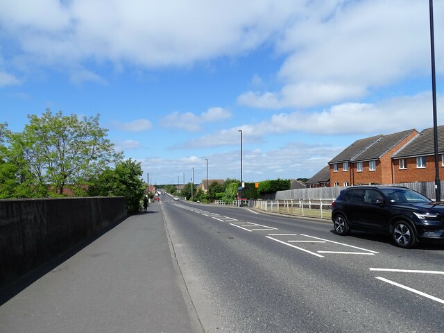
Benton is a small village located in the county of Northumberland, in the northeast of England. Situated approximately six miles north of the city of Newcastle upon Tyne, Benton is part of the borough of North Tyneside. The village is bordered by Longbenton to the south, Forest Hall to the east, and the town of Gosforth to the west.

Benton has a rich history that dates back centuries, with evidence of human activity in the area since the Roman times. The village's name is derived from the Old English words "bēonet" and "tūn," meaning "bent grass enclosure." This hints at the village's agricultural past.

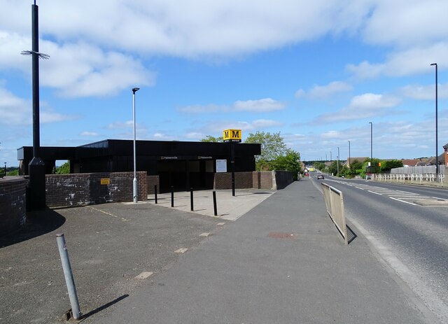
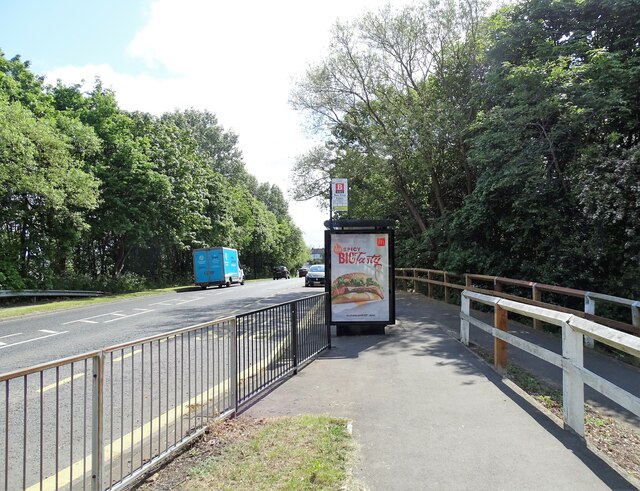
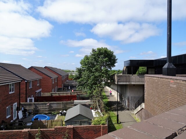
Today, Benton is a predominantly residential area, with many families and professionals choosing to call it home due to its proximity to Newcastle and its excellent transport links. The village benefits from easy access to major road networks, such as the A1(M) and A19, as well as a nearby Metro station, providing convenient transportation options for residents.

In terms of amenities, Benton offers a range of local shops, including grocery stores, restaurants, and small businesses. The village is also home to a number of schools, making it an attractive location for families with young children.

For those seeking recreational activities, Benton is surrounded by green spaces and parks, providing opportunities for outdoor pursuits, such as walking and cycling. Additionally, nearby attractions include the picturesque Rising Sun Country Park and the popular Northumberland Golf Club.

In summary, Benton is a charming village in Northumberland that offers a mix of residential properties, convenient transportation links, and access to amenities and recreational facilities.

If you have any feedback on the listing, please let us know in the comments section below.

Benton Images

Images are sourced within 2km of 55.014322/-1.558187 or Grid Reference NZ2868. Thanks to Geograph Open Source API. All images are credited.

Great Lime Road, Palmersville View looking west along this very long straight road in the northern suburbs of Newcastle.
Great Lime Road, Palmersville
View looking west along this very long straight road in the northern suburbs of Newcastle.
Palmersville Metro Station Located on Great Lime Road, this station was opened in 1986. This section of the  Metro line itself was opened in 1980, using mainly former stations on the old electrical line, but there wasn't one on this section, so this is a new station entirely.
Palmersville Metro Station
Located on Great Lime Road, this station was opened in 1986. This section of the Metro line itself was opened in 1980, using mainly former stations on the old electrical line, but there wasn't one on this section, so this is a new station entirely.
Bus stop on Great Lime Road Beside Palmersville Metro Station at Benton Square.
Bus stop on Great Lime Road
Beside Palmersville Metro Station at Benton Square.
Houses beside the metro Gardens right beside Palmersville Metro Station. View looking west from the bridge over the line.
Houses beside the metro
Gardens right beside Palmersville Metro Station. View looking west from the bridge over the line.
Platforms at Palmersville Metro The station here is one which was newly built for the Metro in 1986. It is right beside Great Lime Road, which crosses over the metro line, and is on the bridge on the right here.
Platforms at Palmersville Metro
The station here is one which was newly built for the Metro in 1986. It is right beside Great Lime Road, which crosses over the metro line, and is on the bridge on the right here.
Great Lime Road Looking west along Great Lime Road towards Palmersville.
Great Lime Road
Looking west along Great Lime Road towards Palmersville.
Houses in Palmersville Houses from different eras sit side by side in Palmersville.
Houses in Palmersville
Houses from different eras sit side by side in Palmersville.
Bamburgh Road This view shows the diverse housing stock to be found in Palmersville.
Bamburgh Road
This view shows the diverse housing stock to be found in Palmersville.
Colliery Monument This stone marks the location of an old colliery shaft.
Colliery Monument
This stone marks the location of an old colliery shaft.
Colliery Wheel The pit wheel from the old colliery now stands as a monument to the pit and the men who worked in it.
Colliery Wheel
The pit wheel from the old colliery now stands as a monument to the pit and the men who worked in it.
Killingworth Arms Hotel The old Killingworth Arms Hotel in Killingworth Village.
Killingworth Arms Hotel
The old Killingworth Arms Hotel in Killingworth Village.
Killingworth Road Looking south down Killingworth Road which connects Kilingworth Village with the Great Lime Road.
Killingworth Road
Looking south down Killingworth Road which connects Kilingworth Village with the Great Lime Road.
Gate House A rather unusual house in Killingworth Village.
Gate House
A rather unusual house in Killingworth Village.
House in Killingworth Village A rather unusual castellated house. I could insert some kind of 'Englishman's home is his castle' gag here, but I can't be bothered.
House in Killingworth Village
A rather unusual castellated house. I could insert some kind of 'Englishman's home is his castle' gag here, but I can't be bothered.
St Joseph's Business Centre This business centre used to be known as St Mary's RC Comprehensive Lower School; I know this, as I used to go there.
St Joseph's Business Centre
This business centre used to be known as St Mary's RC Comprehensive Lower School; I know this, as I used to go there.
Westmoor Methodist Church Quite a handsome church on Great Lime Road
Westmoor Methodist Church
Quite a handsome church on Great Lime Road
Ex- Jobcentre This used to be the dole office for the Killingworth/Westmoor area.  Have falling unemployment rates contributed towards its closure?  I doubt it.

Before it was ever the Job Centre, this was the old Westmoor Co-operative Society shop. It boasted grocery, butchers, clothing , furnishing and haberdashery departments. It was always knows as 'Westmoor Store'

Above the shop was the 'Store Hall'. This was a large hall with a stage, where  
pantomimes were held and the room was available for hire for other social occasions, such as weddings.
Ex- Jobcentre
This used to be the dole office for the Killingworth/Westmoor area. Have falling unemployment rates contributed towards its closure? I doubt it. Before it was ever the Job Centre, this was the old Westmoor Co-operative Society shop. It boasted grocery, butchers, clothing , furnishing and haberdashery departments. It was always knows as 'Westmoor Store' Above the shop was the 'Store Hall'. This was a large hall with a stage, where pantomimes were held and the room was available for hire for other social occasions, such as weddings.
Forest Hall Houses and shops in Forest Hall.
Forest Hall
Houses and shops in Forest Hall.
Show me another place!

Benton is located at Grid Ref: NZ2868 (Lat: 55.014322, Lng: -1.558187)

Unitary Authority: North Tyneside

Police Authority: Northumbria

What 3 Words

///cheer.seat.gained. Near Wallsend, Tyne & Wear

Nearby Locations

Benton

Related Wikis

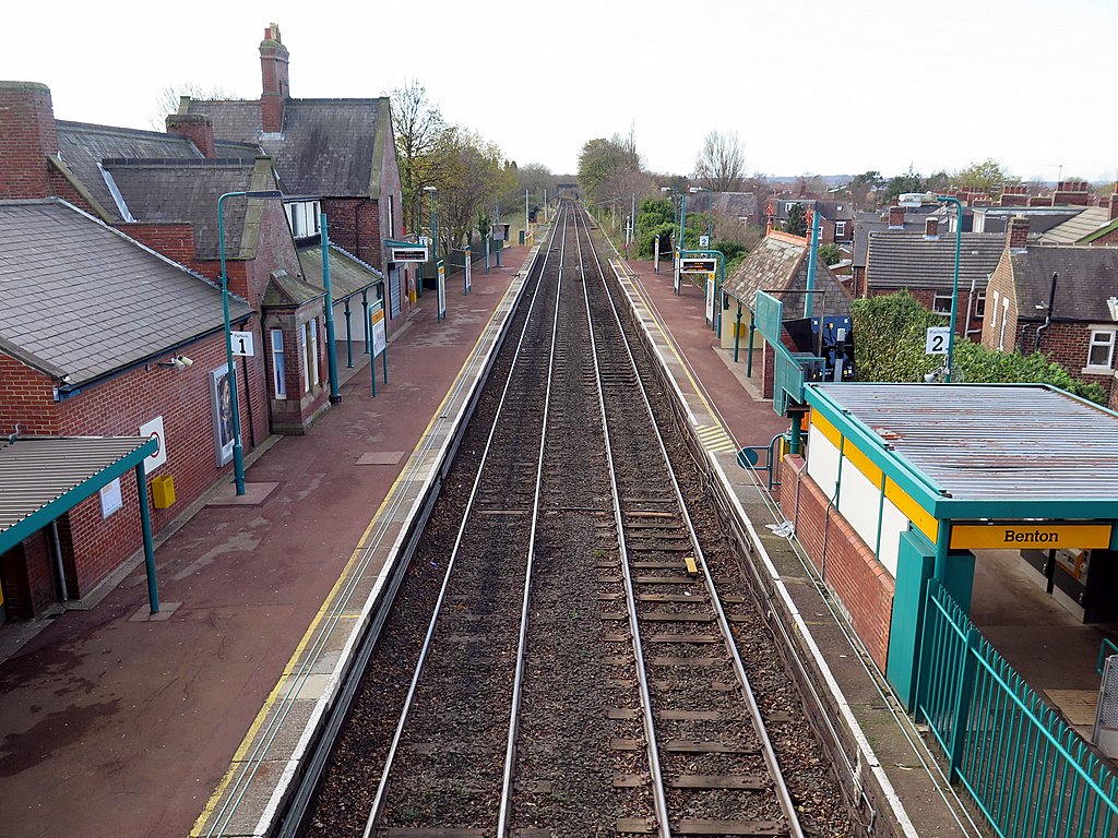
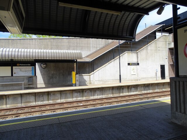
Benton Metro station

Benton is a Tyne and Wear Metro station, serving the suburb of Benton, North Tyneside in Tyne and Wear, England. It joined the network on 11 August 1980...

West Allotment Celtic F.C.

West Allotment Celtic Football Club is a football club who currently play their home games at East Palmersville Sports Pavilion, Palmersville, near Newcastle...

St Bartholomew's Church, Long Benton

St Bartholomew's Church, Long Benton is the Anglican parish church of Longbenton, in Newcastle upon Tyne, Tyne and Wear. It is built in the Gothic Revival...

North Tyneside

North Tyneside is a metropolitan borough in the metropolitan county of Tyne and Wear, England. It forms part of the greater Tyneside conurbation. North...

Forest Hall

Forest Hall is a village in the borough of North Tyneside, Tyne and Wear, England. It is 4 miles from Newcastle upon Tyne. It borders Killingworth to the...

North Tyneside (UK Parliament constituency)

North Tyneside is a constituency represented in the House of Commons of the UK Parliament since 2010 by Mary Glindon of the Labour Party.The seat is due...

Forest Hall railway station

Forest Hall railway station served the village of Forest Hall, Tyne and Wear, England from 1856 to 1958 on the East Coast Main Line. == History == The...

Team Northumbria F.C.

Team Northumbria Football Club is a football club based in Newcastle upon Tyne. They are the football team of Northumbria University and currently play...

Nearby Amenities

Located within 500m of 55.014322,-1.558187
Benton Station Junction
Historic Railway: junction
Railway: site
Lat/Long: 55.014528/-1.5655618
Post Box
Ref: NE12 402D
Source: survey
Lat/Long: 55.0144457/-1.5641449
Turning Circle
Lat/Long: 55.0125503/-1.560226
Bus Stop
WHITLEY ROAD-QUARRY BRIDGE-E/B
Bench: yes
Bus: yes
Departures Board: timetable
Local Ref: E
Naptan AtcoCode: 410000009068
Naptan Bearing: E
Naptan CommonName: WHITLEY ROAD-QUARRY BRIDGE-E/B
Naptan Indicator: E
Naptan Landmark: OPPOSITE NEWCASTLE UNITED TRAINING GROUND
Naptan NaptanCode: twramjtm
Naptan Street: WHITLEY ROAD
Naptan Verified: no
Passenger Information Display: no
Public Transport: platform
Shelter: yes
Source: naptan_import
Lat/Long: 55.0118912/-1.5603404
Bus Stop
Whitley Road
Bench: yes
Bus: yes
Departures Board: timetable
Local Ref: E
Naptan AtcoCode: 410000009069
Naptan Bearing: E
Naptan CommonName: WHITLEY ROAD-PROCTOR & GAMBLE-E/B
Naptan Indicator: E
Naptan Landmark: OUTSIDE PROCTOR AND GAMBLE
Naptan NaptanCode: twramjtp
Naptan Street: WHITLEY ROAD
Naptan Verified: no
Passenger Information Display: no
Public Transport: platform
Shelter: yes
Source: naptan_import
Lat/Long: 55.0140714/-1.5541483
Bus Stop
Whitley Road
Bench: yes
Bus: yes
Departures Board: timetable
Local Ref: W
Naptan AtcoCode: 410000009070
Naptan Bearing: W
Naptan CommonName: WHITLEY ROAD-PROCTOR & GAMBLE-W/B
Naptan Indicator: W
Naptan Landmark: OPPOSITE PROCTOR AND GAMBLE
Naptan NaptanCode: twramjtw
Naptan Street: WHITLEY ROAD
Naptan Verified: no
Passenger Information Display: no
Public Transport: platform
Shelter: yes
Source: naptan_import
Lat/Long: 55.0143047/-1.551767
Bus Stop
WHITLEY ROAD-QUARRY BRIDGE-W/B
Bench: no
Bus: yes
Departures Board: timetable
Local Ref: W
Naptan AtcoCode: 410000009071
Naptan Bearing: W
Naptan CommonName: WHITLEY ROAD-QUARRY BRIDGE-W/B
Naptan Indicator: W
Naptan Landmark: 90M EAST OF NEWCASTLE UNITED TRAINING GROUND
Naptan NaptanCode: twramjwa
Naptan Street: WHITLEY ROAD
Naptan Verified: no
Passenger Information Display: no
Public Transport: platform
Shelter: no
Source: naptan_import
Lat/Long: 55.011597/-1.5609848
Railway: switch
Lat/Long: 55.0131351/-1.5595394
Benton East Junction
Historic Railway: junction
Railway: site
Lat/Long: 55.0178836/-1.5549228
Location Transition: yes
Power: tower
Lat/Long: 55.0114025/-1.5576048
Power: tower
Lat/Long: 55.0123465/-1.5540489
Railway: switch
Lat/Long: 55.0100365/-1.5585158
Railway: switch
Lat/Long: 55.0109236/-1.5587514
Railway: switch
Lat/Long: 55.0116963/-1.5589535
Benton South Junction
Alt Name: Benton Quarry Junction
Historic Railway: junction
Railway: site
Lat/Long: 55.0125019/-1.559315
Railway: switch
Lat/Long: 55.0138769/-1.5598073
Man Made: tower
Tower Type: communication
Lat/Long: 55.0146964/-1.5594677
Entrance: yes
Lat/Long: 55.0140681/-1.5546455
Entrance: main
Lat/Long: 55.0146113/-1.5549903
Railway Electricity: joint
Lat/Long: 55.0126604/-1.5593831
Railway Electricity: joint
Lat/Long: 55.012667/-1.5593396
Man Made: mast
Tower Type: communication
Lat/Long: 55.0176918/-1.5533929
Camera Mount: pole
Camera Type: fixed
Man Made: surveillance
Surveillance Type: camera
Lat/Long: 55.0133137/-1.556321
Noexit: yes
Lat/Long: 55.0106516/-1.5618425
Noexit: yes
Lat/Long: 55.010726/-1.561114
Noexit: yes
Lat/Long: 55.0107859/-1.5613206
Noexit: yes
Lat/Long: 55.0110597/-1.5602142
Car Wash
Benton Hand Car Wash
Lat/Long: 55.0121334/-1.5583182
Fixme: Survey Street Sign - Briarsyde
Lat/Long: 55.0114819/-1.5617291
Crossing
Crossing: unmarked
Crossing Island: yes
Lat/Long: 55.011344/-1.5626909
Location: outdoor
Power: transformer
Transformer: traction
Voltage Primary: 132000
Voltage Secondary: 25000
Lat/Long: 55.0116028/-1.5576962
Power: switch
Lat/Long: 55.0115582/-1.5576857
Location Transition: yes
Power: pole
Lat/Long: 55.0116803/-1.5577149
Location Transition: yes
Power: pole
Lat/Long: 55.01257/-1.5591729
Benton North Junction
Railway: junction
Lat/Long: 55.0139251/-1.5598649
Give Way
Direction: backward
Lat/Long: 55.0158619/-1.5535676
Camera Mount: pole
Camera Type: dome
Man Made: surveillance
Surveillance: outdoor
Surveillance Type: camera
Lat/Long: 55.016311/-1.553109
Noexit: yes
Lat/Long: 55.0183587/-1.5549199
Location: outdoor
Power: transformer
Voltage Primary: 132000
Voltage Secondary: 25000
Lat/Long: 55.011902/-1.5578012
Location Transition: yes
Power: pole
Lat/Long: 55.0119795/-1.5578199
Location Transition: yes
Power: pole
Lat/Long: 55.0118574/-1.5577907
The data included in this document is from www.openstreetmap.org. The data is made available under ODbL.

Have you been to Benton?

Leave your review of Benton below (or comments, questions and feedback).