Netchells Green

Settlement in Warwickshire

England

Netchells Green

Under-station passage The Eastern labyrinth of passages underneath Birmingham New Street station
Under-station passage Credit: Martin

Netchells Green is a picturesque village located in Warwickshire, England. Situated approximately 8 miles southeast of the county town of Warwick, Netchells Green is surrounded by rolling countryside and offers a tranquil and idyllic setting for its residents.

The village itself is relatively small, with a population of around 500 people. It is characterized by its traditional thatched-roof cottages, charming narrow lanes, and well-manicured gardens. The community in Netchells Green is known for its strong sense of camaraderie and close-knit atmosphere, with many residents actively participating in local events and initiatives.

Despite its small size, Netchells Green is well-served by amenities and facilities. The village boasts a primary school, a village hall, a pub, and a local shop where residents can find their daily essentials. Additionally, the surrounding area offers a range of recreational activities, including walking and cycling trails, which allow residents and visitors to explore the beautiful countryside.

Netchells Green is conveniently located near several larger towns and cities, providing easy access to a wider range of services and employment opportunities. The nearby town of Warwick offers a wealth of historical attractions, including Warwick Castle, while the city of Coventry is within reasonable commuting distance.

Overall, Netchells Green provides a peaceful and welcoming environment, making it an attractive place to live for those seeking a rural lifestyle with convenient access to amenities and nearby urban centers.

If you have any feedback on the listing, please let us know in the comments section below.

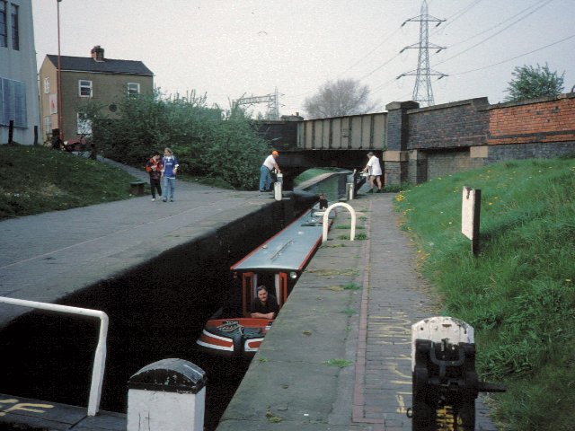
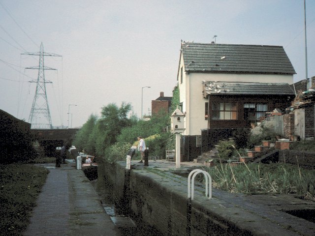
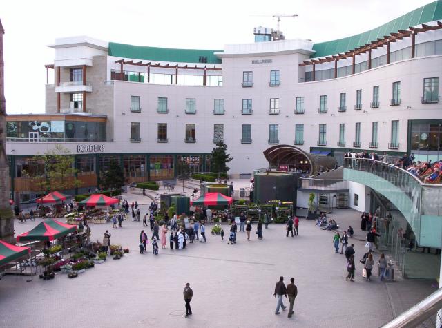
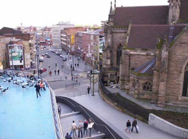
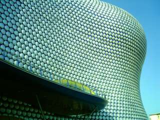
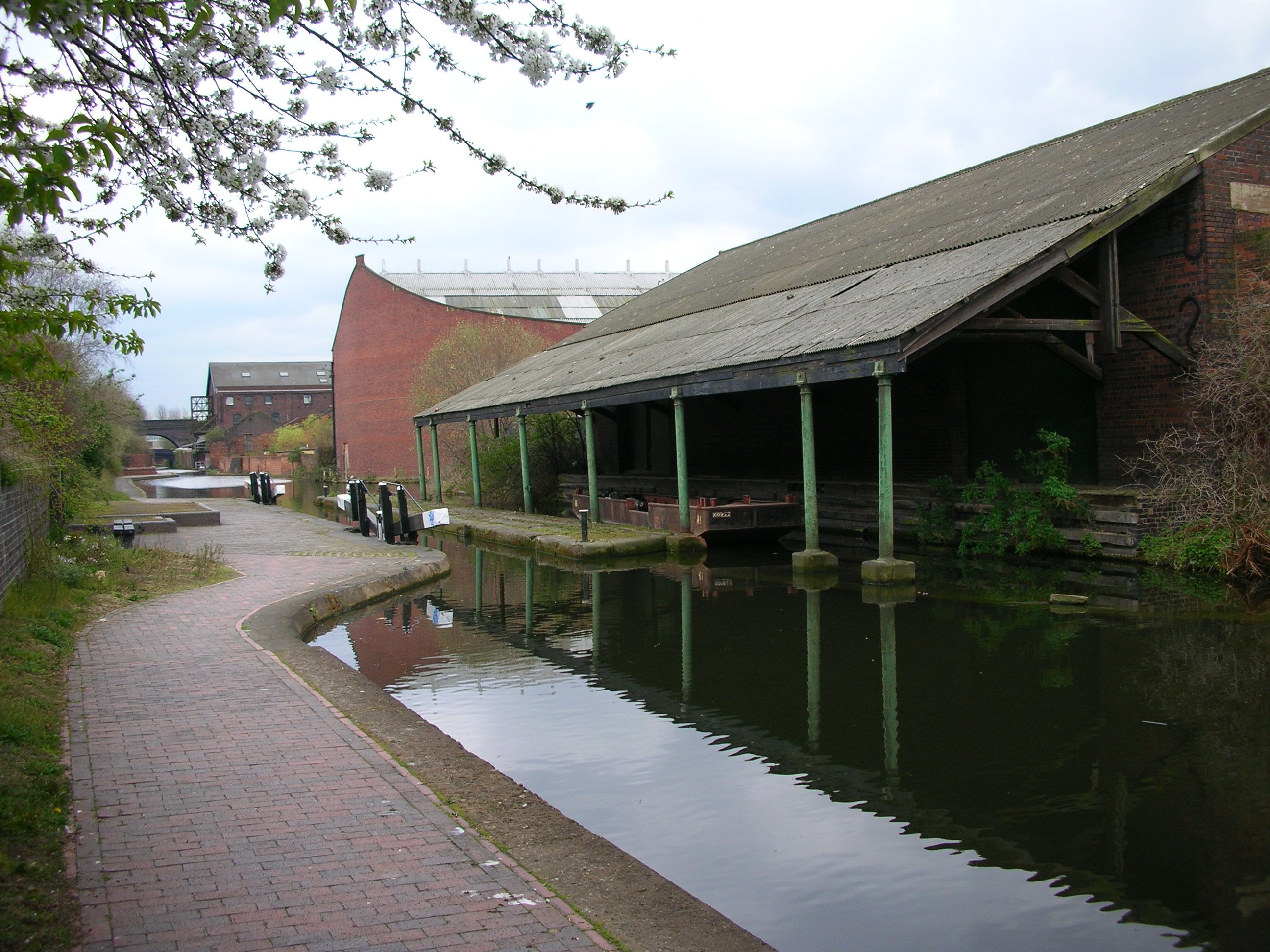
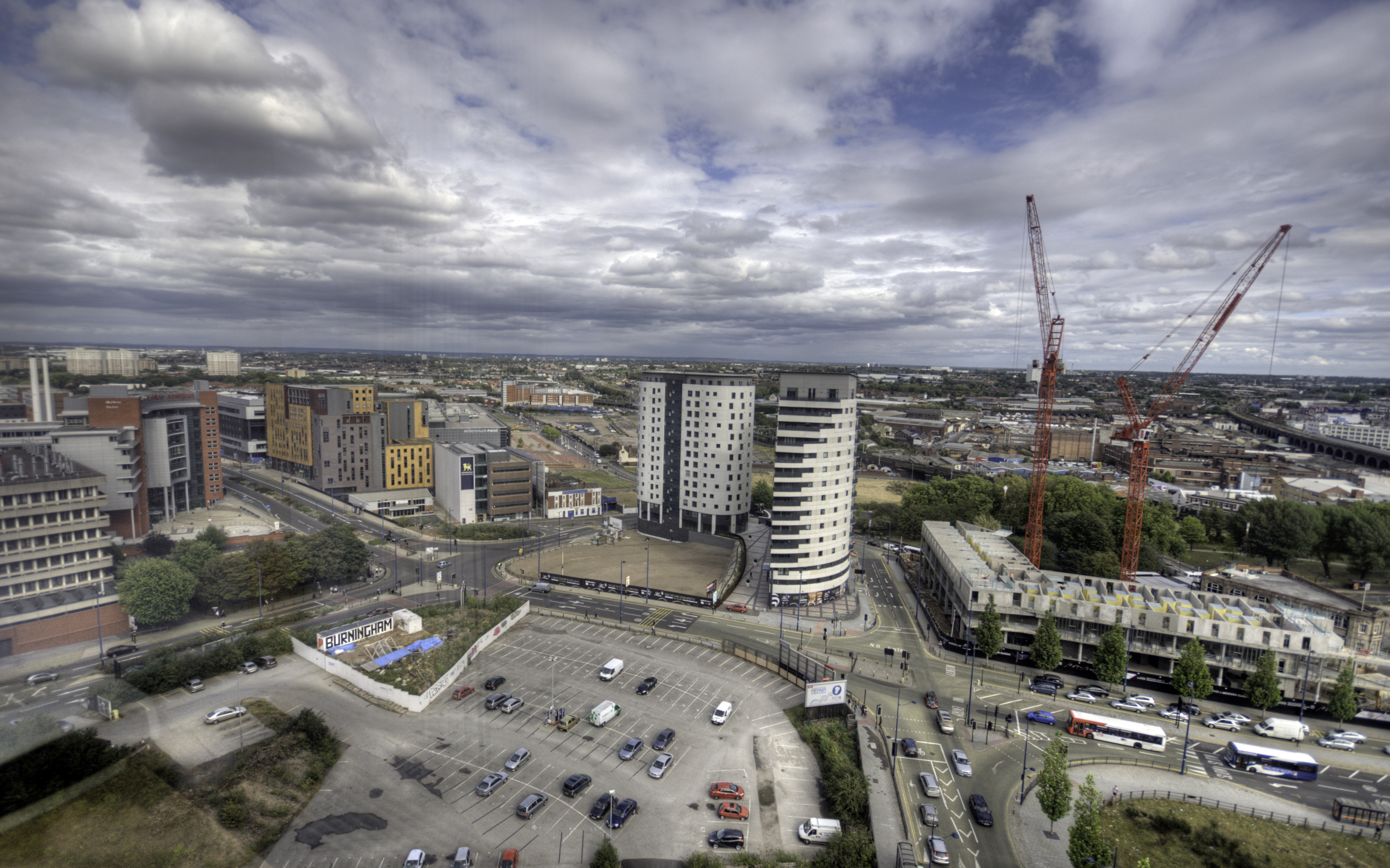
Netchells Green Images

Images are sourced within 2km of 52.480867/-1.8836335 or Grid Reference SP0887. Thanks to Geograph Open Source API. All images are credited.

Under-station passage The Eastern labyrinth of passages underneath Birmingham New Street station
Under-station passage
The Eastern labyrinth of passages underneath Birmingham New Street station
Birmingham New Street A pseudo-regressive image of Birmingham's main station
Birmingham New Street
A pseudo-regressive image of Birmingham's main station
Birmingham City Centre Tony Hancock Memorial in the Old Square, Corporation Street.  

The memorial stands on the filled in island that once had pedestrian underpasses and public toilets, that gave pedestrian access to the various roads off this island.  All changed during the city redevelopment and removal of elevated roads.
Birmingham City Centre
Tony Hancock Memorial in the Old Square, Corporation Street. The memorial stands on the filled in island that once had pedestrian underpasses and public toilets, that gave pedestrian access to the various roads off this island. All changed during the city redevelopment and removal of elevated roads.
Birmingham Snow Hill Birmingham Snow Hill station, or more precisely the car park above it.  In the middle foreground is the current Birmingham terminus of the Midland Metro.  On the skyline is the Birmingham BT Tower.
Birmingham Snow Hill
Birmingham Snow Hill station, or more precisely the car park above it. In the middle foreground is the current Birmingham terminus of the Midland Metro. On the skyline is the Birmingham BT Tower.
Sampson Road Wharf The warehouses on the right were the limit of navigation for broad-beamed boats from the South following the widening of the Grand Union canal in the 1930s.  The narrow lock on the right leads up from the extensive Birmingham Canal Navigations.
Sampson Road Wharf
The warehouses on the right were the limit of navigation for broad-beamed boats from the South following the widening of the Grand Union canal in the 1930s. The narrow lock on the right leads up from the extensive Birmingham Canal Navigations.
Bordesley The canal used to go straight ahead here through another lock and on towards the railway viaduct in the distance. When the Birmingham Middle ring road was built in the 1990s the canal was diverted to the left with dog-leg to use a brand new lock so as to make space for the road
Bordesley
The canal used to go straight ahead here through another lock and on towards the railway viaduct in the distance. When the Birmingham Middle ring road was built in the 1990s the canal was diverted to the left with dog-leg to use a brand new lock so as to make space for the road
Garrison Locks The top lock of the Garrison Locks, hidden away in the midst of Bordesley.  This is still technically part of the Grand Union/Birmingham & Warwick Canal although resembling much of the rest of the BCN.
Garrison Locks
The top lock of the Garrison Locks, hidden away in the midst of Bordesley. This is still technically part of the Grand Union/Birmingham & Warwick Canal although resembling much of the rest of the BCN.
Garrison Locks Lock No 63, hidden away only a short way from Adderley Park.
Garrison Locks
Lock No 63, hidden away only a short way from Adderley Park.
The Bullring, Birmingham Part of the Bullring shopping centre in Birmingham, recently rebuilt. The shell-like café right of centre has been praised by architectural commentators. At the very left edge of the image, part of St Martin's church is visible.
The Bullring, Birmingham
Part of the Bullring shopping centre in Birmingham, recently rebuilt. The shell-like café right of centre has been praised by architectural commentators. At the very left edge of the image, part of St Martin's church is visible.
View south from the Bullring, Birmingham The church is St Martin's.
View south from the Bullring, Birmingham
The church is St Martin's.
Moor St Station, post-refurbishment Steam Engine Parked at Moor St Station to show off the refurbishment of the station in the style of the late 1940s, Birmingham's New Bull Ring Selfridges "pillow thing" building can be seen in the background!
Moor St Station, post-refurbishment
Steam Engine Parked at Moor St Station to show off the refurbishment of the station in the style of the late 1940s, Birmingham's New Bull Ring Selfridges "pillow thing" building can be seen in the background!
The Farm Driving through on the main road, Sparkbrook looks like one of the grottiest places in Birmingham, but it's not such a bad place to live. There are lots of quiet streets, on one of which can be found one of the city's hidden gems: The Farm, the oddly named residence of the bank-founding Lloyd family. This is the rear view.
The Farm
Driving through on the main road, Sparkbrook looks like one of the grottiest places in Birmingham, but it's not such a bad place to live. There are lots of quiet streets, on one of which can be found one of the city's hidden gems: The Farm, the oddly named residence of the bank-founding Lloyd family. This is the rear view.
Victoria Square, Birmingham This is a popular point to rendezvous in Birmingham.
Victoria Square, Birmingham
This is a popular point to rendezvous in Birmingham.
From above New Street Station Looking west from the top of the multi-storey car park. In the foreground, the bridges that carry Hill Street and Navigation Street over the platforms. In the distance, the Holiday Inn and Hyatt hotels and Alpha Tower.
From above New Street Station
Looking west from the top of the multi-storey car park. In the foreground, the bridges that carry Hill Street and Navigation Street over the platforms. In the distance, the Holiday Inn and Hyatt hotels and Alpha Tower.
The start of the Aston Expressway Road sign warning of start of motorway restrictions (A38M).  The location is also above / alongside the junctions of two canals - Birmingham and Fazeley, and Digbeth Branch Canal.
The start of the Aston Expressway
Road sign warning of start of motorway restrictions (A38M). The location is also above / alongside the junctions of two canals - Birmingham and Fazeley, and Digbeth Branch Canal.
Aston canalside On the Birmingham & Fazeley Canal at the junction with the Digbeth Branch Canal, behind Mill Street. Waterlinks office building beyond.
Aston canalside
On the Birmingham & Fazeley Canal at the junction with the Digbeth Branch Canal, behind Mill Street. Waterlinks office building beyond.
Smallbrook Queensway The view from Debenham's cafe.
Smallbrook Queensway
The view from Debenham's cafe.
Bullring Shopping Centre, Birmingham Apparently this is a well known department store - a clear case of Form NOT following Function.
Bullring Shopping Centre, Birmingham
Apparently this is a well known department store - a clear case of Form NOT following Function.
Show me another place!

Netchells Green is located at Grid Ref: SP0887 (Lat: 52.480867, Lng: -1.8836335)

Unitary Authority: Birmingham

Police Authority: West Midlands

What 3 Words

///such.strong.best. Near Birmingham, West Midlands

Related Wikis

Birmingham Proof House

The Birmingham Gun Barrel Proof House is a weapons proving establishment in Banbury Street, Birmingham, UK. The building was designed by John Horton and...

Warwick Bar

The Warwick Bar conservation area is a conservation area in Birmingham, England which was home to many canalside factories during the Industrial Revolution...

Birmingham Curzon Street railway station (1838–1966)

Birmingham Curzon Street railway station (formerly Birmingham station) was a railway station in central Birmingham, England. Initially used as a major...

Birmingham Curzon Street railway station

Birmingham Curzon Street railway station is the planned northern terminus of High Speed 2 in the city centre of Birmingham, England. The new railway will...

The Woodman

The Woodman is a public house on Albert Street in Birmingham, England that is Grade II listed. It stands beside the Eastside City Park and the abandoned...

Eastside, Birmingham

Eastside is a district of Birmingham City Centre, England that is undergoing a major redevelopment project. The overall cost when completed is expected...

Birmingham City University Faculty of Computing, Engineering and the Built Environment

The Faculty of Computing, Engineering and the Built Environment (CEBE, formerly the Faculty of Technology, Engineering and the Environment or TEE) is...

Birmingham School of Acting

Birmingham School of Acting (BSA), previously known as Birmingham School of Speech Training and Dramatic Art (BSSTDA) and then as Birmingham School of...

Nearby Amenities

Located within 500m of 52.480867,-1.8836335
Crossing
Bicycle: yes
Crossing: traffic_signals
Crossing Ref: toucan
Ref: E0526
Source: survey
Lat/Long: 52.4817114/-1.8777152
Crossing
Crossing: traffic_signals
Crossing Ref: pelican
Ref: E0523
Source: survey
Source Type: BCC_CycleData
Lat/Long: 52.482879/-1.8795289
Crossing
Bicycle: yes
Crossing: traffic_signals
Crossing Ref: toucan
Ref: E0527
Source: survey
Lat/Long: 52.4815602/-1.8781042
Traffic Signals
Crossing: traffic_signals
Ref: E0533
Tactile Paving: no
Traffic Signals Sound: no
Lat/Long: 52.4820145/-1.8902815
Crossing
Bicycle: yes
Crossing: traffic_signals
Crossing Ref: toucan
Mapillary: 750744678935752
Source: survey
Survey Date: 2020-09-08
Tactile Paving: yes
Lat/Long: 52.4822622/-1.889705
Crossing
Button Operated: yes
Crossing: traffic_signals
Source: survey
Tactile Paving: yes
Traffic Signals Sound: no
Traffic Signals Vibration: yes
Lat/Long: 52.4822908/-1.8901521
Crossing
Bicycle: yes
Crossing: traffic_signals
Crossing Ref: toucan
Ref: E0533
Source: survey
Tactile Paving: yes
Lat/Long: 52.4823181/-1.8898865
Crossing
Kerb: lowered
Lat/Long: 52.4810975/-1.8894683
Railway: switch
Lat/Long: 52.4813526/-1.8774202
Operator: Network Rail
Railway: switch
Lat/Long: 52.4814846/-1.8788729
Crossing
Crossing: traffic_signals
Ref: E0529
Source: survey
Lat/Long: 52.4800224/-1.8769907
Barrier: bollard
Lat/Long: 52.4844254/-1.881316
Seamark Type: gate
Source: cities_revealed_aerial_imagery
Waterway: lock_gate
Lat/Long: 52.4832062/-1.8815471
Seamark Type: gate
Source: cities_revealed_aerial_imagery
Waterway: lock_gate
Lat/Long: 52.4829812/-1.8815424
Seamark Type: gate
Source: cities_revealed_aerial_imagery
Waterway: lock_gate
Lat/Long: 52.4835228/-1.8815936
Seamark Type: gate
Source: cities_revealed_aerial_imagery
Waterway: lock_gate
Lat/Long: 52.4837398/-1.8816467
Seamark Type: gate
Waterway: lock_gate
Lat/Long: 52.484216/-1.881862
Seamark Type: gate
Waterway: lock_gate
Lat/Long: 52.4844207/-1.8820127
Proof House Junction
Lat/Long: 52.4803182/-1.8840688
Seamark Type: gate
Source: cities_revealed_aerial_imagery
Waterway: lock_gate
Lat/Long: 52.4821943/-1.8817352
Seamark Type: gate
Source: cities_revealed_aerial_imagery
Waterway: lock_gate
Lat/Long: 52.4824089/-1.8816417
Towpath Access Point: bicycle
Lat/Long: 52.4828722/-1.8813274
Seamark Type: gate
Waterway: lock_gate
Lat/Long: 52.484886/-1.8825219
Seamark Type: gate
Waterway: lock_gate
Lat/Long: 52.4847018/-1.8823197
Note: Stop Lock gates
Seamark Type: gate
Waterway: lock_gate
Lat/Long: 52.4799387/-1.8834861
Barrier: cycle_barrier
Bicycle: dismount
Foot: yes
Wheelchair: yes
Wheelchair Key: Radar key scheme
Lat/Long: 52.4778679/-1.8797355
Waterway: turning_point
Lat/Long: 52.4845657/-1.8821522
Note: Stop Lock gates
Seamark Type: gate
Waterway: lock_gate
Lat/Long: 52.4797414/-1.8831392
Crossing
Button Operated: yes
Crossing: traffic_signals
Ref: E0533
Source: survey
Tactile Paving: yes
Traffic Signals Sound: no
Traffic Signals Vibration: yes
Lat/Long: 52.4821909/-1.8903177
Post Box
Ref: B9 480
Lat/Long: 52.4773879/-1.8806418
Fuel
Gulf
Brand: Gulf
Brand Wikidata: Q5617505
Brand Wikipedia: en:Gulf Oil LP
Opening Hours: 24/7
Lat/Long: 52.4837419/-1.8789566
Traffic Signals
Lat/Long: 52.4822295/-1.890003
Cafe
The Warehouse Cafe
Addr City: Birmingham
Addr Housename: The Warehouse
Addr Housenumber: 54-57
Addr Postcode: B5 5TH
Addr Street: Allison Street
Cuisine: coffee_shop;international;burger
Description: Co-operative run vegetarian cafe bar with added bookshop and community library, serving food, drinks and alcohol. Hosts regular community & entertainment events, as well as pop up kitchens.
Diet Vegan: yes
Diet Vegetarian: only
Fhrs Id: 1180054
Internet Access: wlan
Note: Food served: Tu-We 12:00-17:00 Th-Sa 12:00-20:30 Su 12:00-17:00
Opening Hours: Tu-We 10:00-18:00; Th 10:00-21:30; Fr-Sa 10:00-22:00; Su 11:00-18:00
Outdoor Seating: no
Phone: +44 121 348 7554
Website: https://www.thewarehousecafe.com/
Wheelchair: yes
Lat/Long: 52.4784227/-1.889577
Barrier: block
Lat/Long: 52.4800625/-1.8879179
Operator: Network Rail
Railway: switch
Lat/Long: 52.480889/-1.8843331
Crossing
Bicycle: yes
Crossing: traffic_signals
Crossing Ref: toucan
Source: survey
Lat/Long: 52.4817808/-1.8774112
Traffic Calming: island
Lat/Long: 52.4844357/-1.8843153
Parking Entrance
Lat/Long: 52.484132/-1.8851946
Mini Roundabout
Direction: clockwise
Source: survey
Lat/Long: 52.4841009/-1.8883346
Operator: Network Rail
Railway: signal
Ref: NS143
Lat/Long: 52.4814991/-1.8803422
Operator: Network Rail
Railway: switch
Lat/Long: 52.4815061/-1.8768266
Noexit: yes
Source: survey
Lat/Long: 52.4837466/-1.8796608
Crossing
Crossing: traffic_signals
Crossing Ref: pelican
Ref: E0524
Source: survey
Source Type: BCC_CycleData
Lat/Long: 52.4830078/-1.8795157
Power: substation
Ref: 55492
Source: survey
Lat/Long: 52.480223/-1.8885713
Internet Access: wlan
Operator: BT
Service: Birmingham FIZ
Source: survey
Lat/Long: 52.4782918/-1.8881276
Post Box
Ref: B5 1153
Source: survey
Lat/Long: 52.4782954/-1.8883033
Man Made: surveillance
Source: survey
Lat/Long: 52.480904/-1.8900594
Internet Access: wlan
Operator: BT
Service: Birmingham FIZ
Source: survey
Lat/Long: 52.4822428/-1.8901366
Bus Stop
JR1
Bus: yes
Naptan AtcoCode: 43002104402
Naptan Bearing: NE
Naptan BusStopType: MKD
Naptan CommonName: Matthew Boulton College
Naptan Indicator: Stop JR1
Naptan NaptanCode: nwmdmjpa
Naptan PlusbusZoneRef: West Midlands
Naptan Status: ACT
Naptan StopType: BCT
Naptan Street: JENNENS RD
Naptan Towards: Saltley, Alum Rock, Star City
Public Transport: platform
Route Ref: 14;55;55A;56;66;70;72;94
Shelter: yes
Source: WMCA
Lat/Long: 52.4830218/-1.8889295
Barrier: lift_gate
Source: survey
Lat/Long: 52.4827389/-1.8894994
Power: substation
Source: survey
Lat/Long: 52.4833226/-1.8898219
Power: substation
Source: survey
Lat/Long: 52.4832158/-1.8897414
Operator: Scottish and Southern Electricity Networks
Operator Wikidata: Q43080530
Power: substation
Source: survey
Lat/Long: 52.4816953/-1.8890708
Internet Access: wlan
Operator: BT
Service: Birmingham FIZ
Source: survey
Lat/Long: 52.4833224/-1.8882562
Internet Access: wlan
Operator: BT
Service: Birmingham FIZ
Source: survey
Lat/Long: 52.4845932/-1.8864897
Crossing
Button Operated: yes
Crossing: traffic_signals
Ref: E0517
Source: survey
Tactile Paving: yes
Traffic Signals Sound: no
Traffic Signals Vibration: yes
Lat/Long: 52.4845603/-1.8864524
Crossing
Button Operated: yes
Crossing: traffic_signals
Ref: E0516
Source: survey
Tactile Paving: yes
Traffic Signals Sound: no
Traffic Signals Vibration: yes
Lat/Long: 52.4843993/-1.8860854
Crossing
Button Operated: yes
Crossing: traffic_signals
Mapillary: 347043913510939
Source: survey
Survey Date: 2020-09-08
Tactile Paving: yes
Traffic Signals Sound: no
Traffic Signals Vibration: yes
Lat/Long: 52.4852244/-1.8850861
Internet Access: wlan
Operator: BT
Service: Birmingham FIZ
Source: survey
Lat/Long: 52.4851717/-1.8842948
Bus Stop
Jennens Rd / Millennium Point
NaPTANAreaCode: 43000209402
Bench: yes
Bin: yes
Bus: yes
Lit: yes
Naptan AtcoCode: 43000209402
Naptan Bearing: NE
Naptan BusStopType: MKD
Naptan CommonName: Millennium Point
Naptan NaptanCode: nwmajmdj
Naptan PlusbusZoneRef: BHAMNWS
Naptan Status: ACT
Naptan StopType: BCT
Naptan Street: JENNENS RD
Naptan Towards: Saltley, Nechells
Public Transport: platform
Route Ref: 14;55;55A;56;66;70;72;94
Shelter: yes
Shelter Ref: 5074136
Source: WMCA
Tactile Paving: yes
Towards: Saltley
Lat/Long: 52.4848564/-1.8859972
PA1
Asset Ref: 5074131
Local Ref: PA1
Name On Sign: Park Street
Naptan AtcoCode: 43000210101
Naptan Bearing: SW
Naptan BusStopType: MKD
Naptan CommonName: Masshouse Lane
Naptan Indicator: Stop PA1
Naptan NaptanCode: nwmajmdp
Naptan PlusbusZoneRef: BHAMNWS
Naptan Status: ACT
Naptan StopType: BCT
Naptan Street: PARK ST
Naptan Towards: Yardley, Airport and Kitts Gre
Route Ref: 17;58;59;60;73;97;97A;X1;X2
Shelter: yes
Source: WMCA
Lat/Long: 52.4810593/-1.8894026
Bus Stop
Great Barr St / Derby St
NaPTANAreaCode: 43000210501
Bus: yes
Naptan AtcoCode: 43000210501
Naptan Bearing: SW
Naptan BusStopType: MKD
Naptan CommonName: Derby St
Naptan Indicator: opp
Naptan NaptanCode: nwmajmgj
Naptan PlusbusZoneRef: BHAMNWS
Naptan Status: ACT
Naptan StopType: BCT
Naptan Street: GREAT BARR ST
Naptan Towards: Birmingham
Naptan Verified: no
Public Transport: platform
Route Ref: 97;97A
Shelter: yes
Shelter Ref: 507410
Source: WMCA
Tactile Paving: yes
Lat/Long: 52.4790377/-1.8776567
Bus Stop
Great Barr St / Derby St
NaPTANAreaCode: 43000210502
Bus: yes
Naptan AtcoCode: 43000210502
Naptan Bearing: NE
Naptan BusStopType: MKD
Naptan CommonName: Derby St
Naptan Indicator: adj
Naptan NaptanCode: nwmtdpaw
Naptan PlusbusZoneRef: BHAMNWS
Naptan Status: ACT
Naptan StopType: BCT
Naptan Street: GREAT BARR ST
Naptan Towards: Heartlands Hospital
Naptan Verified: no
Public Transport: platform
Route Ref: 97;97A
Shelter: yes
Shelter Ref: 607498
Source: WMCA
Tactile Paving: yes
Lat/Long: 52.4787692/-1.878418
Bus Stop
New Canal St / Fazeley St
Asset Ref: 607493
Bus: yes
Naptan AtcoCode: 43000210901
Naptan Bearing: N
Naptan BusStopType: MKD
Naptan CommonName: Fazeley St
Naptan Indicator: opp
Naptan NaptanCode: nwmajmgm
Naptan PlusbusZoneRef: BHAMNWS
Naptan Status: act
Naptan StopType: BCT
Naptan Street: NEW CANAL ST
Public Transport: platform
Shelter: yes
Source: WMCA
Towards: Fordbridge
Lat/Long: 52.4794305/-1.8877382
Bus Stop
Curzon St / Penn St
Bench: no
Bin: no
Bus: yes
Lit: yes
Mapillary: 521628428862381
Naptan AtcoCode: 43000241801
Naptan Bearing: NE
Naptan BusStopType: MKD
Naptan CommonName: Penn St
Naptan Indicator: adj
Naptan NaptanCode: nwmamgda
Naptan PlusbusZoneRef: BHAMNWS
Naptan Status: ACT
Naptan StopType: BCT
Naptan Street: CURZON ST
Naptan Towards: Saltley
Public Transport: platform
Route Ref: 14
Shelter: no
Source: WMCA
Survey Date: 2018-11-15
Tactile Paving: no
Lat/Long: 52.4826966/-1.8824889
Bus Stop
Curzon St / Penn St
Bench: no
Bin: no
Bus: yes
Lit: yes
Naptan AtcoCode: 43000241802
Naptan Bearing: SW
Naptan BusStopType: MKD
Naptan CommonName: Penn St
Naptan NaptanCode: nwmtpjdj
Naptan PlusbusZoneRef: BHAMNWS
Naptan Status: ACT
Naptan StopType: BCT
Naptan Street: CURZON ST
Naptan Towards: Birmingham
Public Transport: platform
Route Ref: 14
Shelter: no
Source: WMCA
Tactile Paving: no
Lat/Long: 52.4825396/-1.8828004
Bus Stop
Curzon St / Millenium Point
Bench: no
Bin: no
Bus: yes
Lit: yes
Naptan AtcoCode: 43000241901
Naptan Bearing: NE
Naptan BusStopType: MKD
Naptan CommonName: Millenium Point
Naptan Indicator: adj
Naptan NaptanCode: nwmamgdg
Naptan PlusbusZoneRef: BHAMNWS
Naptan Status: ACT
Naptan StopType: BCT
Naptan Street: CURZON ST
Public Transport: platform
Route Ref: 26;26A
Shelter: no
Source: WMCA
Tactile Paving: no
Wheelchair: limited
Lat/Long: 52.4822213/-1.8848725
Bus Stop
Curzon St / Millenium Point
Bench: no
Bin: no
Bus: yes
Lit: yes
Naptan AtcoCode: 43000241902
Naptan Bearing: SW
Naptan BusStopType: MKD
Naptan CommonName: Millenium Point
Naptan NaptanCode: nwmtpjdg
Naptan PlusbusZoneRef: BHAMNWS
Naptan Status: ACT
Naptan StopType: BCT
Naptan Street: CURZON ST
Public Transport: platform
Route Ref: 26;26A
Shelter: no
Source: WMCA
Tactile Paving: no
Lat/Long: 52.4820084/-1.8854677
Bus Stop
JR2
Asset Ref: 5074139
Bench: yes
Bin: no
Bus: yes
Lit: yes
Mapillary: 4357382290965233
Naptan AtcoCode: 43002104401
Naptan Bearing: SW
Naptan BusStopType: MKD
Naptan CommonName: Matthew Boulton College
Naptan Indicator: Stop JR2
Naptan NaptanCode: nwmdmjmw
Naptan PlusbusZoneRef: BHAMNWS
Naptan Status: ACT
Naptan StopType: BCT
Naptan Street: JENNENS RD
Naptan Towards: City Centre
Passenger Information Display: yes
Public Transport: platform
Route Ref: 14;55;55A;56;66;70;72;94
Shelter: yes
Source: WMCA
Survey Date: 2020-09-08
Tactile Paving: no
Lat/Long: 52.4825678/-1.8891886
Addr City: Birmingham
Addr Housename: Fazeley Studios
Addr Housenumber: 191
Addr Postcode: B5 5SE
Addr Street: Fazeley Street
Lat/Long: 52.4779281/-1.8818873
Fast Food
Subway
Addr City: Birmingham
Addr Postcode: B5 5JR
Addr Street: Jennens Road
Brand: Subway
Brand Wikidata: Q244457
Brand Wikipedia: en:Subway (restaurant)
Contact Website: https://restaurants.subway.com/united-kingdom/en/birmingham/jennens-court-250-jennens-rd
Cuisine: sandwich
Fhrs Id: 603085
Source: survey
Takeaway: yes
Lat/Long: 52.4827802/-1.8885903
Man Made: surveillance
Source: survey
Lat/Long: 52.4821363/-1.8860216
Man Made: surveillance
Source: survey
Lat/Long: 52.4823998/-1.8844508
Man Made: surveillance
Source: survey
Lat/Long: 52.4826793/-1.882571
Brand: National Grid
Brand Wikidata: Q1465461
Operator: National Grid Electricity Distribution
Operator Old: Western Power Distribution
Operator Wikidata: Q7988183
Owner: National Grid Electricity Distribution (West Midlands) Plc
Owner Wikidata: Q114397791
Power: substation
Ref: 1485
Source: survey
Lat/Long: 52.4833442/-1.8824253
Katyn 1940
Historic: memorial
Source: survey
Lat/Long: 52.4791039/-1.890268
Fast Food
Bordesley Diner
Check Date Opening Hours: 2023-02-12
Opening Hours Signed: no
Source: survey
Lat/Long: 52.478631/-1.8895761
Brand: National Grid
Brand Wikidata: Q1465461
Operator: National Grid Electricity Distribution
Operator Old: Western Power Distribution
Operator Wikidata: Q7988183
Owner: National Grid Electricity Distribution (West Midlands) Plc
Owner Wikidata: Q114397791
Power: substation
Source: survey
Lat/Long: 52.4807765/-1.8903127
Brand: National Grid
Brand Wikidata: Q1465461
Operator: National Grid Electricity Distribution
Operator Old: Western Power Distribution
Operator Wikidata: Q7988183
Owner: National Grid Electricity Distribution (West Midlands) Plc
Owner Wikidata: Q114397791
Power: substation
Ref: 6494
Source: survey
Lat/Long: 52.4838643/-1.8787507
Man Made: surveillance
Source: survey
Lat/Long: 52.4822091/-1.8884477
Give Way
Source: bing
Lat/Long: 52.4773809/-1.8844398
Maxheight: 3.96
Note: sign reads 13 feet
Source: survey
Lat/Long: 52.4814304/-1.879085
Grand Junction
Railway: junction
Lat/Long: 52.4814314/-1.8777213
Give Way
Lat/Long: 52.4803356/-1.8770002
Brand: National Grid
Brand Wikidata: Q1465461
Operator: National Grid Electricity Distribution
Operator Old: Western Power Distribution
Operator Wikidata: Q7988183
Owner: National Grid Electricity Distribution (West Midlands) Plc
Owner Wikidata: Q114397791
Power: substation
Source: survey
Lat/Long: 52.4786227/-1.8828832
Brand: National Grid
Brand Wikidata: Q1465461
Operator: National Grid Electricity Distribution
Operator Old: Western Power Distribution
Operator Wikidata: Q7988183
Owner: National Grid Electricity Distribution (West Midlands) Plc
Owner Wikidata: Q114397791
Power: substation
Ref: 01071
Source: survey
Lat/Long: 52.4777426/-1.8804163
Man Made: surveillance
Source: survey
Lat/Long: 52.4842367/-1.8878679
Addr Housename: William Murdoch Residences
Addr Housenumber: A1
Lat/Long: 52.4842241/-1.8875147
Addr Housename: William Murdoch Residences
Addr Housenumber: A2
Lat/Long: 52.4844485/-1.8871754
Barrier: bollard
Source: survey
Lat/Long: 52.4840465/-1.8880777
Brand: National Grid
Brand Wikidata: Q1465461
Operator: National Grid Electricity Distribution
Operator Old: Western Power Distribution
Operator Wikidata: Q7988183
Owner: National Grid Electricity Distribution (West Midlands) Plc
Owner Wikidata: Q114397791
Power: substation
Source: survey
Lat/Long: 52.4841757/-1.8873189
Bench
Backrest: no
Lat/Long: 52.4807356/-1.8908088
Bench
Backrest: no
Lat/Long: 52.4808721/-1.8903357
Bench
Backrest: no
Lat/Long: 52.4807883/-1.8906235
Bench
Backrest: no
Lat/Long: 52.4809198/-1.8901928
Madonna and Child
Artist Name: Tadeusz Zielinski
Artwork Type: sculpture
Start Date: 1966
Tourism: artwork
Lat/Long: 52.4791358/-1.8902635
Group of Trophies
PMSA Ref: WMbiBIxx142
Artist Name: William Hollins
Artwork Material: stone, painted
Artwork Type: sculpture
Heritage: 2
Heritage Operator: Historic England
Listed Status: Grade II*
Source: survey;PMSA
Start Date: 1813
Tourism: artwork
Lat/Long: 52.4805114/-1.8847739
Towpath Access Point: foot
Lat/Long: 52.4818189/-1.8816486
Towpath Access Point: foot
Lat/Long: 52.4841734/-1.8817142
Towpath Access Point: bicycle
Lat/Long: 52.4796619/-1.885197
Towpath Access Point: foot
Lat/Long: 52.4779276/-1.8797057
Operator: Network Rail
Railway: switch
Lat/Long: 52.4807348/-1.88486
Bicycle Parking
Millennium Point Car Park (cycles)
Bcc Ref: 472
Bicycle Parking: stands
Capacity: 10
Check Date Capacity: 2022-11-13
Covered: no
Source: survey
Lat/Long: 52.4842005/-1.8850031
Fast Food
Chicago Gourmet Burger Co
Addr City: Birmingham
Addr Postcode: B5 5JW
Addr Street: Etna Street
Source: survey
Lat/Long: 52.4824735/-1.8883667
Simply Fresh
Addr City: Birmingham
Addr Postcode: B5 5JW
Addr Street: Etna Street
Shop: convenience
Lat/Long: 52.4825058/-1.8882522
Brand: National Grid
Brand Wikidata: Q1465461
Operator: National Grid Electricity Distribution
Operator Old: Western Power Distribution
Operator Wikidata: Q7988183
Owner: National Grid Electricity Distribution (West Midlands) Plc
Owner Wikidata: Q114397791
Power: substation
Source: survey
Lat/Long: 52.4825398/-1.8880959
Brand: National Grid
Brand Wikidata: Q1465461
Operator: National Grid Electricity Distribution
Operator Old: Western Power Distribution
Operator Wikidata: Q7988183
Owner: National Grid Electricity Distribution (West Midlands) Plc
Owner Wikidata: Q114397791
Power: substation
Ref: 01180
Source: survey
Lat/Long: 52.4822267/-1.8884637
Crossing
Bicycle: yes
Button Operated: yes
Crossing: traffic_signals
Crossing Ref: toucan
Source: survey
Source Type: BCC_CycleData
Tactile Paving: yes
Traffic Signals Sound: yes
Traffic Signals Vibration: yes
Lat/Long: 52.4815779/-1.8888698
Bicycle Parking
Millennium Point Curzon St (Think Tank)
Bcc Ref: 177
Bicycle Parking: stands
Capacity: 20
Covered: no
Lat/Long: 52.482765/-1.8847005
Motorcycle Parking
Millennium Point Car Park (motorcycles)
Bcc Ref: 473
Capacity: 6
Check Date Capacity: 2022-11-13
Covered: no
Lat/Long: 52.4841725/-1.885077
Barrier: bollard
Bollard: fixed
Lat/Long: 52.4822659/-1.8874592
Parking Entrance
Lat/Long: 52.4838329/-1.8845498
Operator: Network Rail
Railway: switch
Lat/Long: 52.4767219/-1.885886
Operator: Network Rail
Railway: switch
Lat/Long: 52.4809504/-1.883474
Operator: Network Rail
Railway: switch
Lat/Long: 52.4813899/-1.877515
Operator: Network Rail
Railway: switch
Lat/Long: 52.4808825/-1.883684
Operator: Network Rail
Railway: switch
Lat/Long: 52.4807694/-1.8848365
Operator: Network Rail
Railway: switch
Lat/Long: 52.481498/-1.8772114
Operator: Network Rail
Railway: switch
Lat/Long: 52.4811269/-1.8821552
Operator: Network Rail
Railway: switch
Lat/Long: 52.4812833/-1.8813448
Operator: Network Rail
Railway: switch
Lat/Long: 52.4808474/-1.8840625
Operator: Network Rail
Railway: switch
Lat/Long: 52.4805601/-1.8860819
Operator: Network Rail
Railway: switch
Lat/Long: 52.4814466/-1.8814287
Operator: Network Rail
Railway: switch
Lat/Long: 52.4805715/-1.8861504
Operator: Network Rail
Railway: switch
Lat/Long: 52.4815193/-1.8777477
Operator: Network Rail
Railway: switch
Lat/Long: 52.4804643/-1.8864579
Operator: Network Rail
Railway: switch
Lat/Long: 52.4802968/-1.8869373
Operator: Network Rail
Railway: switch
Lat/Long: 52.4802494/-1.8869835
Operator: Network Rail
Railway: switch
Lat/Long: 52.4803827/-1.8865828
Operator: Network Rail
Railway: switch
Lat/Long: 52.4813631/-1.8766814
Operator: Network Rail
Railway: switch
Lat/Long: 52.4814903/-1.8792743
Operator: Network Rail
Railway: switch
Lat/Long: 52.4815289/-1.8798233
Bicycle Parking
Aston University Halls of Residence
Access: private
Bicycle Parking: stands
Capacity: 20
Covered: yes
Lat/Long: 52.4844874/-1.8875954
Railway: buffer_stop
Lat/Long: 52.4775552/-1.8884527
Operator: Network Rail
Railway: switch
Lat/Long: 52.4769339/-1.8865137
Bicycle Parking
Bcc Ref: 526
Bicycle Parking: stands
Capacity: 30
Check Date Capacity: 2022-11-14
Covered: yes
Source: visual survey; estimate
Lat/Long: 52.4828307/-1.8876763
Cafe
Sbragia's
Source: visual survey; estimate
Lat/Long: 52.4788717/-1.8833934
Toilets
Urinals
Fee: no
Heritage: 2
Heritage Operator: Historic England
Listed Status: Grade II
Source: visual survey;bing;Birmingham_City_Council
Wheelchair: no
Lat/Long: 52.4775291/-1.8804222
Entrance: yes
Source: survey
Lat/Long: 52.4825348/-1.8859418
Sprocket Cycles
Opening Hours: Mo-Sa 10:00-17:00; Tu off
Shop: bicycle
Source: survey
Lat/Long: 52.4784698/-1.8895413
Traffic Signals
Source: survey
Lat/Long: 52.479877/-1.887493
Traffic Signals
Source: survey
Lat/Long: 52.4799634/-1.8872662
Traffic Signals
Source: survey
Lat/Long: 52.4800258/-1.8876686
Traffic Signals
Source: survey
Lat/Long: 52.48009/-1.8873862
48sheetart: yes
Man Made: billboard
Operator: JCDecaux
Ref: 40001
Sheets: 48
Lat/Long: 52.4775179/-1.8804696
48sheetart: yes
Man Made: billboard
Operator: JCDecaux
Ref: 530201
Sheets: 48
Lat/Long: 52.4775661/-1.8804186
48sheetart: yes
Man Made: billboard
Operator: JCDecaux
Ref: 224102
Sheets: 48
Lat/Long: 52.4797871/-1.8872482
48sheetart: yes
Man Made: billboard
Operator: JCDecaux
Ref: 224103
Sheets: 48
Lat/Long: 52.479797/-1.8873604
48sheetart: yes
Man Made: billboard
Operator: JCDecaux
Ref: 225801
Sheets: 48
Lat/Long: 52.4798139/-1.886914
48sheetart: yes
Man Made: billboard
Operator: JCDecaux
Ref: 224101
Sheets: 48
Lat/Long: 52.4798376/-1.8871687
48sheetart: yes
Man Made: billboard
Operator: JCDecaux
Ref: 3401
Sheets: 48
Lat/Long: 52.4799415/-1.8866121
48sheetart: yes
Man Made: billboard
Operator: Primesight
Ref: 528301
Sheets: 48
Lat/Long: 52.4800461/-1.8875554
48sheetart: yes
Man Made: billboard
Operator: JCDecaux
Ref: 3501
Sheets: 48
Lat/Long: 52.4801149/-1.887155
48sheetart: yes
Man Made: billboard
Operator: Clearchannel
Ref: 25504
Sheets: 96
Lat/Long: 52.4807474/-1.8771352
48sheetart: yes
Man Made: billboard
Operator: Clearchannel
Ref: 25503
Sheets: 48
Lat/Long: 52.4808154/-1.87721
48sheetart: yes
Man Made: billboard
Operator: Clearchannel
Ref: 25502
Sheets: 48
Lat/Long: 52.4808683/-1.8772647
48sheetart: yes
Man Made: billboard
Operator: Clearchannel
Ref: 25501
Sheets: 48
Lat/Long: 52.4809304/-1.8773107
Crossing
Crossing: traffic_signals
Ref: E0532
Lat/Long: 52.4813031/-1.8908111
Bus Stop
MS12
Bench: no
Bin: no
Bus: yes
Lit: yes
Local Ref: MS12
Name On Sign: Moor Street Queensway
Naptan AtcoCode: 43000206804
Naptan Bearing: SW
Naptan BusStopType: MKD
Naptan CommonName: Albert St
Naptan Indicator: Stop MS12
Naptan NaptanCode: nwmwgpgj
Naptan PlusbusZoneRef: BHAMNWS
Naptan Status: ACT
Naptan StopType: BCT
Naptan Street: MOOR ST QUEENSWAY
Naptan Towards: xxx
Naptan Code: nwmwgpgj
Public Transport: platform
Route Ref: 22;23;24;29;110;X14;X3;X4;X5
Shelter: no
Source: WMCA
Tactile Paving: no
Lat/Long: 52.4810281/-1.8909934
Bus Stop
BT1
Bench: no
Bin: no
Bus: yes
Lit: yes
Naptan AtcoCode: 43002104801
Naptan Bearing: SE
Naptan BusStopType: MKD
Naptan CommonName: Albert St
Naptan Indicator: Stop BT1
Naptan NaptanCode: nwmwgpjw
Naptan PlusbusZoneRef: West Midlands
Naptan Status: ACT
Naptan StopType: BCT
Naptan Street: PARK ST
Public Transport: platform
Route Ref: 70;X61
Shelter: no
Source: WMCA
Tactile Paving: no
Lat/Long: 52.4817414/-1.8888643
Operator: Scottish and Southern Electricity Networks
Operator Wikidata: Q43080530
Power: substation
Source: survey
Lat/Long: 52.4811834/-1.8901822
Cafe
Café Ezra
Source: survey
Lat/Long: 52.4810428/-1.8902087
Crossing
Crossing: unmarked
Tactile Paving: no
Lat/Long: 52.4851096/-1.8813428
Crossing
Bicycle: yes
Button Operated: yes
Crossing: traffic_signals
Crossing Ref: toucan
Ref: E0521
Source Type: BCC_CycleData
Tactile Paving: yes
Traffic Signals Sound: no
Traffic Signals Vibration: yes
Lat/Long: 52.4836281/-1.8805371
Crossing
Bicycle: yes
Button Operated: yes
Crossing: traffic_signals
Crossing Ref: toucan
Ref: E0522
Source Type: BCC_CycleData
Tactile Paving: yes
Traffic Signals Sound: no
Traffic Signals Vibration: yes
Lat/Long: 52.4837835/-1.8804024
Give Way
Source: bing
Lat/Long: 52.4850801/-1.8813757
Bicycle Parking
New Canal Street
Bicycle Parking: stands
Capacity: 8
Covered: yes
Lat/Long: 52.4815544/-1.8868314
Bicycle Parking
Bicycle Parking: bollard
Capacity: 30
Covered: no
Image: https://storage11.openstreetcam.org/files/photo/2019/6/23/lth/1564569_b2f29_567.jpg
Mapillary: 1925076160990631
Source: visual survey;estimate
Survey Date: 2019-06-23
Lat/Long: 52.4816886/-1.8887133
Barrier: bollard
Source: survey
Lat/Long: 52.4815267/-1.8868585
Crossing
Crossing: marked
Crossing Island: no
Tactile Paving: yes
Lat/Long: 52.4829176/-1.8835226
Traffic Signals
Crossing: traffic_signals
Ref: E0520
Tactile Paving: yes
Lat/Long: 52.4848902/-1.8846481
Give Way
Source: bing
Lat/Long: 52.4849761/-1.8847737
Crossing
Crossing: traffic_signals
Ref: E0520
Source: survey
Lat/Long: 52.4849237/-1.8845451
Information: guidepost
Source: survey
Tourism: information
Lat/Long: 52.4823829/-1.8901454
Communication Mobile Phone: yes
Man Made: mast
Operator: O2;Vodafone
Source: survey
Tower Construction: tube
Tower Type: communication
Lat/Long: 52.4824149/-1.889687
A B
Historic Removed: memorial
Note: Old Aston / Birmingham border marker
Source: survey
Lat/Long: 52.484791/-1.8847873
Crossing
Button Operated: yes
Crossing: traffic_signals
Ref: E0520
Source: survey
Tactile Paving: yes
Traffic Signals Sound: no
Traffic Signals Vibration: yes
Lat/Long: 52.4849125/-1.8850028
Bicycle Parking
Bicycle Parking: stands
Capacity: 10
Check Date Capacity: 2022-11-13
Covered: yes
Lat/Long: 52.4847463/-1.8871137
Bicycle Parking
Access: private
Bicycle Parking: stands
Capacity: 32
Lat/Long: 52.4820791/-1.8888346
Bicycle Parking
Bicycle Parking: stands
Capacity: 36
Covered: no
Lat/Long: 52.4818143/-1.888854
Grit Bin
Source: survey
Lat/Long: 52.4841359/-1.8885234
Barrier: lift_gate
Bicycle: yes
Foot: yes
Lat/Long: 52.484156/-1.8882546
Bench
Lat/Long: 52.484398/-1.8873681
Waste Basket
Lat/Long: 52.4843392/-1.8874593
Bench
Lat/Long: 52.4843751/-1.8874057
Bench
Lat/Long: 52.4843572/-1.8874352
Waste Basket
Lat/Long: 52.484416/-1.8873359
Recycling
Recycling Glass Bottles: yes
Recycling Type: container
Lat/Long: 52.4844647/-1.8875677
Entrance: yes
Lat/Long: 52.4844777/-1.8872274
Bench
Backrest: no
Source: survey 2013
Lat/Long: 52.4847254/-1.8871763
Bench
Backrest: no
Source: survey 2013
Lat/Long: 52.4847449/-1.8872307
Waste Basket
Check Date: 2022-11-13
Source: survey 2013
Lat/Long: 52.4847516/-1.8872081
Bench
Backrest: no
Source: survey 2013
Lat/Long: 52.4847577/-1.8872452
Bench
Backrest: no
Source: survey 2013
Lat/Long: 52.48476/-1.8872984
Cafe
Coffee Kup
Opening Hours: Mo-Sa 07:00-22:00; Su off
Source: survey
Lat/Long: 52.4829593/-1.8883036
Addr City: Birmingham
Addr Postcode: B5 5JE
Addr Street: Masshouse Plaza
Disused Shop: yes
Source: survey
Lat/Long: 52.4814543/-1.8904297
Charging Station
Millennium Point Car Park Electric Charging Point
Access: yes
Capacity: 2
Fuel Electricity: yes
Level: 3
Operator: Birmingham City Council
Operator Wikidata: Q4916650
Parking: electric vehicles only
Ref: APT-2028-0002/12P
Source: National Charge Point Registry
Lat/Long: 52.4836455/-1.8855177
Charging Station
Smart/Mercedes Benz Birmingham Central 1 Electric Charge Point
Access: customers
Fuel Electricity: yes
Note: Restricted access to Smart/ Mercedes customers
Ref: 11172343/11172350P
Source: National Charge Point Register
Lat/Long: 52.4794564/-1.8776878
Traffic Signals
Source: survey
Lat/Long: 52.4773949/-1.8804367
Cafe
The Bond Café
Source: survey
Lat/Long: 52.478483/-1.8813
Man Made: surveillance
Source: survey
Lat/Long: 52.4834768/-1.8836436
Power: substation
Source: survey
Lat/Long: 52.4775117/-1.8819072
Fast Food
Papa John's
Addr City: Birmingham
Addr Place: Masshouse Plaza
Addr Postcode: B5 5JF
Brand: Papa John's
Brand Wikidata: Q2759586
Brand Wikipedia: en:Papa John's Pizza
Check Date Opening Hours: 2022-09-18
Cuisine: pizza
Fhrs Id: 1051313
Opening Hours Signed: no
Source: survey
Takeaway: yes
Website: https://www.papajohns.co.uk/stores/birmingham-central
Lat/Long: 52.4814156/-1.8901914
Atm
Check Date: 2021-08-06
Source: survey
Lat/Long: 52.4814972/-1.890481
Man Made: surveillance
Source: survey
Lat/Long: 52.4821978/-1.8901485
The Sign Factory
Office: company
Lat/Long: 52.4769857/-1.8873708
Ace Auto MOT Centre
Shop: car_repair
Lat/Long: 52.477709/-1.8854461
Astons Catering Equipment
Office: company
Lat/Long: 52.4768834/-1.8842771
Cambridge Car & Commercials Ltd
Shop: car_repair
Lat/Long: 52.4801336/-1.8859634
Cheap Taxi Repair Centre
Office: company
Lat/Long: 52.4767763/-1.8819269
Fast Food
Chicken.com
Lat/Long: 52.4778502/-1.8884694
Direct Auto
Shop: car_repair
Lat/Long: 52.4769541/-1.8817539
Eurocity Spares
Shop: car_parts
Lat/Long: 52.4769038/-1.8818028
Glendale
Lat/Long: 52.477967/-1.8842957
Gurmag Ltd
Lat/Long: 52.4777793/-1.88572
Ikon Studio
Craft: photographer
Lat/Long: 52.4776509/-1.8852621
Reynolds (UK) Ltd
Lat/Long: 52.4781365/-1.8855756
Smart Tecnic
Shop: car_repair
Lat/Long: 52.4803846/-1.8863349
Unique Accident Solutions Ltd
Office: company
Lat/Long: 52.4767567/-1.8819482
Power: substation
Ref: 5479
Source: survey
Wpd Ref: 724077
Lat/Long: 52.4786346/-1.8852225
Barrier: fence
Lat/Long: 52.4791751/-1.8867996
Bus Stop
Great Barr St / Liverpool St
Bench: no
Bin: no
Bus: yes
Mapillary: 915549422344059
Naptan AtcoCode: 43000210402
Naptan Bearing: SW
Naptan BusStopType: MKD
Naptan CommonName: Liverpool St
Naptan Indicator: adj
Naptan NaptanCode: nwmajmgd
Naptan PlusbusZoneRef: BHAMNWS
Naptan Status: ACT
Naptan StopType: BCT
Naptan Street: GREAT BARR ST
Naptan Towards: Birmingham
Naptan Verified: no
Public Transport: platform
Route Ref: 97;97A
Shelter: no
Source: WMCA
Survey Date: 2020-09-08
Tactile Paving: no
Lat/Long: 52.4776493/-1.8802269
Training
Jobskills at BMET
Lat/Long: 52.4824648/-1.8889994
Fixme: stub
Lat/Long: 52.479411/-1.8810504
Operator: Network Rail
Railway: switch
Lat/Long: 52.4776921/-1.8887231
Operator: Network Rail
Railway: switch
Lat/Long: 52.477451/-1.8880345
Operator: Network Rail
Railway: switch
Lat/Long: 52.4772699/-1.8874168
Operator: Network Rail
Railway: switch
Lat/Long: 52.4775596/-1.8883527
Operator: Network Rail
Railway: switch
Lat/Long: 52.4773451/-1.8878641
Barrier: bollard
Lat/Long: 52.4824536/-1.8782675
Barrier: bollard
Lat/Long: 52.4824299/-1.8782357
Barrier: bollard
Lat/Long: 52.4824419/-1.8782518
Barrier: bollard
Source: survey
Lat/Long: 52.4820527/-1.8882443
Man Made: monitoring_station
Monitoring Traffic: yes
Operator: bcc
Traffic Scoot Node Ref: E0533
Traffic Scoot Region Ref: J1
Traffic Sensor: loop
Traffic Sensor Ref: N19121G
Lat/Long: 52.4822687/-1.890107
Man Made: monitoring_station
Monitoring Traffic: yes
Operator: bcc
Traffic Scoot Node Ref: E0532
Traffic Scoot Region Ref: J1
Traffic Sensor: loop
Traffic Sensor Ref: N19111N
Lat/Long: 52.4811089/-1.8895322
Motorway Junction
Curzon Circle
Ref: 16
Lat/Long: 52.4834731/-1.8799491
Motorway Junction
Curzon Circle
Ref: 16
Lat/Long: 52.4831479/-1.8801928
Motorway Junction
Garrison Circus
Ref: 17
Lat/Long: 52.4794625/-1.8766162
Crossing
Crossing: traffic_signals
Ref: E0528
Source: survey
Lat/Long: 52.480143/-1.8768925
Moby Dick's
Artwork Type: previous pub sign
Source: survey
Tourism: artwork
Lat/Long: 52.4835404/-1.8830267
Power: substation
Ref: 725693
Source: survey
Lat/Long: 52.483606/-1.8840222
Man Made: street_cabinet
Source: survey
Lat/Long: 52.4824182/-1.8896638
Man Made: street_cabinet
Source: survey
Lat/Long: 52.4824262/-1.8896572
Man Made: street_cabinet
Source: survey
Lat/Long: 52.4824343/-1.8896462
Man Made: street_cabinet
Source: survey
Lat/Long: 52.4812427/-1.888917
Man Made: street_cabinet
Operator: bcc
Ref: E0539
Source: survey
Street Cabinet: traffic_signals
Lat/Long: 52.4812789/-1.8888613
Man Made: street_cabinet
Source: survey
Lat/Long: 52.4821051/-1.8879439
Man Made: street_cabinet
Source: survey
Lat/Long: 52.48211/-1.8879037
Traffic Signals
Button Operated: yes
Crossing: traffic_signals
Ref: E0533
Tactile Paving: yes
Traffic Signals Sound: no
Traffic Signals Vibration: yes
Lat/Long: 52.4823083/-1.8896915
Traffic Signals
Button Operated: yes
Crossing: traffic_signals
Ref: E0533
Tactile Paving: yes
Traffic Signals Sound: no
Traffic Signals Vibration: yes
Lat/Long: 52.4823757/-1.8903432
Man Made: surveillance
Source: survey
Lat/Long: 52.4832639/-1.8808536
Barrier: bollard
Bollard: rising
Lat/Long: 52.4823432/-1.884336
Bicycle Parking
Bicycle Parking: stands
Capacity: 86
Covered: yes
Mapillary: 301834234725308
Source: survey
Survey Date: 2018-11-15
Lat/Long: 52.482792/-1.8822251
Bicycle Parking
Bicycle Parking: stands
Capacity: 6
Covered: no
Mapillary: 4125788380797411
Source: survey
Survey Date: 2020-07-09
Lat/Long: 52.4831195/-1.8813266
Bench
Backrest: no
Source: survey
Lat/Long: 52.4831775/-1.8813346
Barrier: bollard
Bollard: removable
Lat/Long: 52.4833269/-1.8812965
Bicycle Parking
Bicycle Parking: stands
Capacity: 10
Covered: no
Source: survey
Lat/Long: 52.4834282/-1.8813749
Man Made: surveillance
Source: survey
Lat/Long: 52.4836353/-1.8810562
Man Made: surveillance
Source: survey
Lat/Long: 52.4837472/-1.8810824
Entrance: main
Lat/Long: 52.4838048/-1.881347
Barrier: bollard
Bollard: removable
Lat/Long: 52.4839912/-1.8815362
Power: substation
Source: survey
Lat/Long: 52.4840246/-1.8811655
Man Made: surveillance
Source: survey
Lat/Long: 52.4840458/-1.8814168
Bicycle Parking
Bicycle Parking: stands
Capacity: 10
Covered: no
Source: survey
Lat/Long: 52.4840926/-1.8815438
Stop
Source: bing
Lat/Long: 52.4783337/-1.888141
Stop
Source: bing
Lat/Long: 52.4783614/-1.8882536
Give Way
Source: bing
Lat/Long: 52.4783088/-1.8825433
Give Way
Source: bing
Lat/Long: 52.4774287/-1.8846046
Give Way
Direction: backward
Lat/Long: 52.4789782/-1.8780435
Give Way
Direction: backward
Lat/Long: 52.4781026/-1.8794114
Give Way
Direction: backward
Lat/Long: 52.4781826/-1.8795026
Traffic Signals
Source: survey
Lat/Long: 52.4775978/-1.880487
Traffic Signals
Source: survey
Lat/Long: 52.4776059/-1.8808813
Traffic Signals
Source: survey
Lat/Long: 52.4774181/-1.8808411
Give Way
Lat/Long: 52.4823473/-1.8884252
Give Way
Lat/Long: 52.4825417/-1.8877976
Crossing
Crossing: traffic_signals
Mapillary: 239806594569948
Source: survey
Survey Date: 2020-09-08
Tactile Paving: yes
Lat/Long: 52.4849324/-1.8846816
Traffic Signals
Button Operated: yes
Crossing: traffic_signals
Ref: E0520
Source: survey
Tactile Paving: yes
Traffic Signals Sound: no
Traffic Signals Vibration: yes
Lat/Long: 52.4851911/-1.8851582
Traffic Signals
Ref: E0520
Source: survey
Lat/Long: 52.4852508/-1.8843389
Give Way
Source: bing
Lat/Long: 52.4846186/-1.8855083
Crossing
Lat/Long: 52.4813464/-1.8907668
Crossing
Crossing: traffic_signals
Ref: E0532
Lat/Long: 52.4813769/-1.8906914
Traffic Signals
Crossing: traffic_signals
Ref: E0532
Lat/Long: 52.4813422/-1.890735
Give Way
Lat/Long: 52.4835297/-1.880141
Give Way
Lat/Long: 52.4834091/-1.8796928
Give Way
Lat/Long: 52.4830765/-1.8799078
Give Way
Lat/Long: 52.4832501/-1.8804703
Give Way
Direction: forward
Lat/Long: 52.4796/-1.8768891
Give Way
Direction: forward
Lat/Long: 52.4799382/-1.8765866
Fire Hydrant
Emergency: fire_hydrant
Fire Hydrant Type: underground
Source: survey
Lat/Long: 52.4835005/-1.8876408
Power: substation
Source: estimate
Lat/Long: 52.4836786/-1.8869113
Fire Hydrant
Emergency: fire_hydrant
Fire Hydrant Diameter Signed: no
Fire Hydrant Position: sidewalk
Fire Hydrant Type: underground
Source: survey
Lat/Long: 52.484448/-1.8868469
Fire Hydrant
Emergency: fire_hydrant
Fire Hydrant Diameter: 100
Fire Hydrant Type: underground
Operator: WMFS
Source: survey
Lat/Long: 52.4824997/-1.8885601
Man Made: street_cabinet
Source: survey
Lat/Long: 52.4807106/-1.8900602
Give Way
Lat/Long: 52.4777603/-1.881337
Check Date: 2016-12-22
Disused Amenity: toilets
Heritage: 6
Heritage Operator: Birmingham City Council
Listed Status: local_grade_B
Source: survey
Lat/Long: 52.4771665/-1.8873344
Vending Machine
Source: survey
Vending: parking_tickets
Lat/Long: 52.4785706/-1.8888277
Fire Hydrant
Emergency: fire_hydrant
Fire Hydrant Type: underground
Operator: WMFS
Source: survey
Lat/Long: 52.4800253/-1.8904544
Give Way
Direction: backward
Lat/Long: 52.4792869/-1.8772902
Albert Street
Proposed Railway: tram_stop
Start Date: 2025-01-01
Lat/Long: 52.480765/-1.8903749
Power: substation
Lat/Long: 52.4838837/-1.8868182
Bus Stop
Cardigan St / Gopsal St
Bench: no
Bin: no
Bus: yes
Lit: no
Naptan AtcoCode: 43002107001
Naptan Bearing: S
Naptan BusStopType: MKD
Naptan CommonName: Gopsal St
Naptan Indicator: opposite
Naptan NaptanCode: nwmwgwta
Naptan Status: ACT
Naptan StopType: BCT
Naptan Street: CARDIGAN ST
Naptan Towards: Saltley
Public Transport: platform
Route Ref: 14
Shelter: no
Source: WMCA
Tactile Paving: yes
Lat/Long: 52.4841039/-1.8840407
Bus Stop
Heath Mill Lane / Fazeley St
Bus: yes
Naptan AtcoCode: 43000212601
Naptan Bearing: NE
Naptan BusStopType: MKD
Naptan CommonName: Fazeley St
Naptan Indicator: adj
Naptan NaptanCode: nwmtmpwg
Naptan Status: ACT
Naptan StopType: BCT
Naptan Street: HEATH MILL LANE
Naptan Towards: Heartlands Hospital
Public Transport: platform
Route Ref: 97;97A
Source: WMCA
Lat/Long: 52.4766456/-1.8819965
Bus Stop
Lawley St / Curzon St
NaPTANAreaCode: 43000241302
Bench: no
Bin: no
Bus: yes
Lit: no
Naptan AtcoCode: 43000241302
Naptan Bearing: NW
Naptan BusStopType: MKD
Naptan CommonName: Curzon St
Naptan Indicator: adj
Naptan NaptanCode: nwmamgad
Naptan Status: ACT
Naptan StopType: BCT
Naptan Street: LAWLEY ST
Naptan Towards: Birmingham
Public Transport: platform
Shelter: yes
Shelter Ref: 607410
Source: WMCA
Tactile Paving: no
Lat/Long: 52.4837094/-1.8807498
Bus Stop
Lawley St / Curzon St
NaPTANAreaCode: 43000241301
Bus: yes
Naptan AtcoCode: 43000241301
Naptan Bearing: SE
Naptan BusStopType: MKD
Naptan CommonName: Curzon St
Naptan Indicator: opp
Naptan NaptanCode: nwmamdwt
Naptan Status: ACT
Naptan StopType: BCT
Naptan Street: LAWLEY ST
Naptan Towards: Saltley
Public Transport: platform
Shelter: yes
Shelter Ref: 607409
Source: WMCA
Lat/Long: 52.4838781/-1.8802861
Bus Stop
Millennium Point
Bus: yes
Naptan AdministrativeAreaCode: 105
Naptan AtcoCode: 43000209401
Naptan Bearing: SW
Naptan BusStopType: MKD
Naptan CommonName: Millennium Point
Naptan Indicator: outside
Naptan LocalityCode: N0072530
Naptan LocalityName: Aston University
Naptan NaptanCode: nwmajmdg
Naptan ParentLocality: Birmingham
Naptan PlusbusZoneRef: BHAMNWS
Naptan Status: act
Naptan StopType: BCT
Naptan Street: JENNENS RD
Naptan TimingStatus: OTH
Naptan Verified: no
Public Transport: platform
Lat/Long: 52.4834235/-1.8877857
Bus Stop
Cardigan St / Gopsal St
Bench: no
Bin: no
Bus: yes
Lit: no
Naptan AtcoCode: 43002107002
Naptan Bearing: N
Naptan BusStopType: MKD
Naptan CommonName: Gopsal St
Naptan Indicator: adjacent
Naptan NaptanCode: nwmwgwtd
Naptan Status: ACT
Naptan StopType: BCT
Naptan Street: CARDIGAN ST
Naptan Towards: Birmingham
Public Transport: platform
Route Ref: 14
Shelter: no
Source: WMCA
Tactile Paving: yes
Lat/Long: 52.4837111/-1.8840211
Fire Hydrant
Emergency: fire_hydrant
Fire Hydrant Type: underground
Operator: WMFS
Source: survey
Lat/Long: 52.4850482/-1.8845683
Arts Centre
West Midlands Centre for Circus & Physical Theatre
Url: http://www.rogueplay.co.uk/west-midlands-creation-centre
Lat/Long: 52.4789708/-1.8832514
Fire Hydrant
Emergency: fire_hydrant
Fire Hydrant Type: underground
Operator: WMFS
Source: survey
Lat/Long: 52.4793114/-1.8845442
Level: 2
Lat/Long: 52.4827813/-1.8859781
Level: 0
Lat/Long: 52.4829424/-1.8860342
Cafe
Mulino's
Addr City: Birmingham
Addr Postcode: B4 7XG
Addr Street: Curzon Street
Diet Vegan: limited
Diet Vegetarian: yes
Level: 2
Wheelchair: yes
Lat/Long: 52.4830987/-1.8863252
Vending Machine
Lat/Long: 52.4825973/-1.8861388
Vending Machine
Source: survey
Vending: drinks
Lat/Long: 52.4825491/-1.8861052
Information: kiosk
Source: survey
Tourism: information
Lat/Long: 52.4827427/-1.8861052
Thinktank Birmingham Science Museum Entrance
Entrance: yes
Level: 1
Lat/Long: 52.4826474/-1.8862302
Entrance: main
Lat/Long: 52.48365/-1.8856076
Entrance: yes
Lat/Long: 52.4839541/-1.8860152
Bicycle Parking
Bicycle Parking: stands
Capacity: 36
Covered: yes
Lat/Long: 52.4843745/-1.8857807
Entrance: main
Lat/Long: 52.484275/-1.8861453
Bicycle Parking
Bicycle Parking: stands
Capacity: 22
Covered: no
Lat/Long: 52.4838224/-1.8857753
Arts Centre
Centrala
Addr City: Birmingham
Addr Housenumber: 158
Addr Postcode: B5 5RT
Addr Street: Fazeley Street
Addr Unit: 4
Website: https://centrala-shop.co.uk/
Lat/Long: 52.4790117/-1.8823126
Fire Hydrant
Emergency: fire_hydrant
Fire Hydrant Type: underground
Operator: WMFS
Source: survey
Lat/Long: 52.4788303/-1.8837315
Fire Hydrant
Emergency: fire_hydrant
Fire Hydrant Type: underground
Operator: WMFS
Source: survey
Lat/Long: 52.4797321/-1.8860301
ShortDescription: CCCPS200 Jennens Road
Bcc Ref: V053
Operator: Birmingham City Council
Ref: CCCPS200
Traffic Sign: variable_message
Traffic Sign Location: roadside
Variable Message Information: parking
Lat/Long: 52.4852883/-1.8844034
Source: survey
Lat/Long: 52.4848713/-1.8812349
Source: survey
Lat/Long: 52.4848331/-1.8815706
Vending Machine
Source: survey
Vending: parking_tickets
Lat/Long: 52.4790174/-1.8901727
Vending Machine
Source: survey
Vending: parking_tickets
Lat/Long: 52.479458/-1.8892464
Vending Machine
Source: survey
Vending: parking_tickets
Lat/Long: 52.4797764/-1.8886461
Fire Hydrant
Emergency: fire_hydrant
Fire Hydrant Type: underground
Operator: WMFS
Source: survey
Lat/Long: 52.4792849/-1.8892424
Fire Hydrant
Emergency: fire_hydrant
Fire Hydrant Type: underground
Operator: WMFS
Source: survey
Lat/Long: 52.4788927/-1.8894869
Fire Hydrant
Emergency: fire_hydrant
Fire Hydrant Type: underground
Operator: WMFS
Source: survey
Lat/Long: 52.4789871/-1.890113
Fire Hydrant
Emergency: fire_hydrant
Fire Hydrant Type: underground
Operator: WMFS
Source: survey
Lat/Long: 52.4796039/-1.8906487
Fire Hydrant
Emergency: fire_hydrant
Fire Hydrant Type: underground
Operator: WMFS
Source: survey
Lat/Long: 52.4796185/-1.8906358
Barrier: bollard
Historic: boundary_stone
Source: survey
Lat/Long: 52.4787486/-1.8894571
Entrance: main
Lat/Long: 52.4809678/-1.89018
Restaurant
Boulton's Bar & Restaurant
Lat/Long: 52.4839563/-1.886285
Defibrillator
Emergency: defibrillator
Indoor: yes
Lat/Long: 52.4841033/-1.8862662
Nightclub
Eastside Jazz Club
Lat/Long: 52.484087/-1.8860704
Bicycle Parking
Bicycle Parking: stands
Capacity: 30
Covered: yes
Source: survey
Lat/Long: 52.4830914/-1.8847574
Bicycle Parking
Bicycle Parking: stands
Capacity: 32
Covered: yes
Source: survey
Lat/Long: 52.4831045/-1.8846005
Man Made: surveillance
Source: survey
Lat/Long: 52.4837841/-1.8819322
Entrance: main
Lat/Long: 52.4834405/-1.885969
Entrance: yes
Lat/Long: 52.4829241/-1.8839166
Cafe
Starbucks
Addr City: Birmingham
Addr Housename: The Parkside Building
Addr Street: Cardigan Street
Brand: Starbucks
Brand Wikidata: Q37158
Brand Wikipedia: en:Starbucks
Cuisine: coffee_shop
Internet Access: wlan
Official Name: Starbucks Coffee
Outdoor Seating: yes
Takeaway: yes
Lat/Long: 52.4829275/-1.8843457
Entrance: yes
Lat/Long: 52.4829653/-1.8833958
Crossing
Crossing: unmarked
Crossing Island: yes
Crossing Markings: no
Tactile Paving: yes
Lat/Long: 52.4832255/-1.8881219
Crossing
Crossing: unmarked
Crossing Island: yes
Crossing Markings: no
Tactile Paving: yes
Lat/Long: 52.4831583/-1.8882519
Addr City: Birmingham
Addr Housename: 2 Exchange Square
Addr Street: The Priory Queensway
Entrance: yes
Lat/Long: 52.4822422/-1.8906137
Barrier: bollard
Source: survey
Lat/Long: 52.4817707/-1.890775
Barrier: bollard
Bollard: fixed
Source: survey
Lat/Long: 52.4822093/-1.8904356
Power: substation
Lat/Long: 52.4819717/-1.8882537
Entrance: yes
Lat/Long: 52.482006/-1.8882751
Barrier: block
Lat/Long: 52.4842699/-1.8823095
Man Made: surveillance
Source: survey
Lat/Long: 52.4837276/-1.8808664
Royal Birmingham Conservatoire Practice Pods
Entrance: yes
Lat/Long: 52.4841794/-1.8814322
Entrance: yes
Lat/Long: 52.4834655/-1.8825889
Power: substation
Source: survey
Lat/Long: 52.4837766/-1.8832977
Entrance: yes
Lat/Long: 52.483627/-1.8836983
Fire Hydrant
Emergency: fire_hydrant
Fire Hydrant Diameter Signed: no
Fire Hydrant Position: lane
Fire Hydrant Type: underground
Operator: WMFS
Source: survey
Lat/Long: 52.4835718/-1.8838095
Camera Mount: pole
Camera Type: dome
Man Made: surveillance
Source: survey
Surveillance: outdoor
Surveillance Type: camera
Lat/Long: 52.4845785/-1.8855146
Man Made: street_cabinet
Ref: E0516
Street Cabinet: traffic_control
Lat/Long: 52.4843953/-1.8862297
Fire Hydrant
Emergency: fire_hydrant
Fire Hydrant Type: underground
Operator: WMFS
Source: survey
Lat/Long: 52.4835448/-1.8800529
Man Made: street_cabinet
Ref: E0523/E0524
Street Cabinet: traffic_control
Lat/Long: 52.483029/-1.8793979
Man Made: street_cabinet
Ref: E0521/E0522
Street Cabinet: traffic_control
Lat/Long: 52.483793/-1.8802804
Fire Hydrant
Emergency: fire_hydrant
Fire Hydrant Type: underground
Operator: WMFS
Source: survey
Lat/Long: 52.4830797/-1.8801657
New Canal Street
Railway Proposed: tram_stop
Lat/Long: 52.4806955/-1.8873639
Operator: Network Rail
Railway: switch
Lat/Long: 52.4814078/-1.8779241
Proof House Junction
Railway: junction
Lat/Long: 52.4807526/-1.8848423
Curzon Street Junction
Railway: junction
Lat/Long: 52.4814259/-1.8814218
Addr City: Birmingham
Addr Postcode: B4 7EW
Addr Street: Jennens Road
Lat/Long: 52.4846979/-1.8874758
Generator Method: photovoltaic
Generator Output Electricity: yes
Generator Source: solar
Generator Type: solar_photovoltaic_panel
Location: roof
Power: generator
Lat/Long: 52.483592/-1.8824601
Addr City: Birmingham
Addr Postcode: B5 5AE
Addr Street: Fox Street
Lat/Long: 52.4819357/-1.8884119
Addr City: Birmingham
Addr Postcode: B5 5JL
Addr Street: Masshouse Plaza
Lat/Long: 52.4815567/-1.8893695
Addr City: Birmingham
Addr Postcode: B5 5JN
Addr Street: Masshouse Plaza
Lat/Long: 52.4816286/-1.8893293
Addr City: Birmingham
Addr Postcode: B5 5JP
Addr Street: Masshouse Plaza
Lat/Long: 52.481676/-1.8892434
Barrier: yes
Lat/Long: 52.4772181/-1.8802703
Crossing
Button Operated: yes
Crossing: traffic_signals
Ref: E0532
Source: local knowledge
Tactile Paving: yes
Traffic Signals Sound: yes
Traffic Signals Vibration: no
Lat/Long: 52.4812209/-1.8909453
Clinic
NHS Covid19 Mass Vaccination Centre
Healthcare: vaccination_centre
Note: precise location in building required
Start Date: 11/01/2021
Vaccination: covid19
Lat/Long: 52.4832257/-1.8862564
Barrier: bollard
Source: survey
Lat/Long: 52.4827756/-1.8888875
Crossing
Crossing: unmarked
Crossing Island: no
Crossing Markings: no
Kerb: lowered
Tactile Paving: yes
Lat/Long: 52.4845635/-1.8853974
Crossing
Crossing: unmarked
Crossing Island: no
Crossing Markings: no
Tactile Paving: yes
Lat/Long: 52.4837955/-1.8877931
Crossing
Crossing: pedestrian_signals
Tactile Paving: yes
Lat/Long: 52.4821871/-1.8900551
Crossing
Button Operated: yes
Crossing: traffic_signals
Kerb: flush
Tactile Paving: yes
Traffic Signals Sound: no
Traffic Signals Vibration: yes
Lat/Long: 52.4821246/-1.8899921
Crossing
Crossing: pedestrian_signals
Mapillary: 769481897099989
Survey Date: 2020-09-08
Tactile Paving: yes
Lat/Long: 52.4821987/-1.8899347
Cycleway: asl
Direction: forward
Lat/Long: 52.4823411/-1.8896449
Crossing
Crossing: pedestrian_signals
Mapillary: 915961322578247
Survey Date: 2020-09-08
Tactile Paving: yes
Lat/Long: 52.4814257/-1.8909103
Crossing
Crossing: unmarked
Crossing Island: yes
Crossing Markings: no
Tactile Paving: no
Lat/Long: 52.4835062/-1.8797631
Crossing
Crossing: unmarked
Crossing Island: no
Crossing Markings: no
Tactile Paving: no
Lat/Long: 52.483448/-1.879665
Cycleway: asl
Direction: backward
Lat/Long: 52.4773674/-1.8803925
Cycleway: asl
Direction: forward
Lat/Long: 52.4776276/-1.8809326
Cycleway: asl
Direction: backward
Lat/Long: 52.479957/-1.8872234
Cycleway: asl
Direction: forward
Lat/Long: 52.4798387/-1.8875113
Cycleway: asl
Direction: backward
Lat/Long: 52.4801192/-1.8873704
Cycleway: asl
Direction: forward
Lat/Long: 52.4800339/-1.8877235
Addr City: Birmingham
Addr Postcode: B4 7AP
Addr Street: Howe Street
Lat/Long: 52.4828619/-1.8857324
Meriden Street
Railway Proposed: tram_stop
Lat/Long: 52.4786343/-1.8881061
Bicycle Rental
Aston University - Jennens Rd
Bicycle Rental: docking_station
Capacity: 18
Email: support@beryl.cc
Fee: yes
Network: West Midlands Cycle Hire
Network Regional: Starley
Official Name: Aston University - Jennens Rd
Operator: Beryl
Operator Wikidata: Q106575369
Payment App: yes
Payment Cash: no
Payment Credit Cards: no
Payment Cryptocurrencies: no
Payment Debit Cards: no
Payment Electronic Purses: no
Phone: +44 20 3003 5044
Ref Gbfs: beryl_west_midlands:2777
Ref Wmch: 37
Rental: city_bike;ebike
Source: tfwm/serco
Website: https://beryl.cc/scheme/west-midlands
Lat/Long: 52.4851999/-1.8852269
Bicycle Rental
Birmingham City University
Bicycle Rental: docking_station
Capacity: 18
Email: support@beryl.cc
Fee: yes
Network: West Midlands Cycle Hire
Network Regional: Starley
Official Name: Birmingham City University
Operator: Beryl
Operator Wikidata: Q106575369
Payment App: yes
Payment Cash: no
Payment Credit Cards: no
Payment Cryptocurrencies: no
Payment Debit Cards: no
Payment Electronic Purses: no
Phone: +44 20 3003 5044
Ref Gbfs: beryl_west_midlands:2791
Ref Wmch: 43
Rental: city_bike;ebike
Source: tfwm/serco
Website: https://beryl.cc/scheme/west-midlands
Lat/Long: 52.4835078/-1.8837378
Man Made: street_cabinet
Operator: EE/Hutchison 3G
Utility: telecom
Lat/Long: 52.4793457/-1.884917
Man Made: street_cabinet
Operator: EE/Hutchison 3G
Utility: telecom
Lat/Long: 52.479322/-1.8849023
Man Made: street_cabinet
Operator: EE/Hutchison 3G
Utility: telecom
Lat/Long: 52.4793065/-1.8848942
Man Made: mast
Operator: EE/Hutchison 3G
Ref: BHM571
Tower Type: mobile_phone
Lat/Long: 52.4793327/-1.8849036
Old Name: The Empire Remains Shop
Was Tourism: gallery
Lat/Long: 52.4795867/-1.8848392
Crossing
Lat/Long: 52.4816851/-1.8906948
Man Made: surveillance
Mapillary: 850144329047189
Source Position: Mapillary 2020-07-09
Survey Date: 2018-11-15
Lat/Long: 52.4826577/-1.8831998
Enforcement: Clean Air Zone
Man Made: surveillance
Source: survey
Surveillance: public
Surveillance Quantity: 1
Surveillance Type: ALPR
Surveillance Zone: traffic
Lat/Long: 52.4829734/-1.8813906
University Locks Co-op
Addr City: Birmingham
Addr Housenumber: 50
Addr Postcode: B4 7XJ
Addr Street: Curzon Street
Brand: Co-op Food
Brand Wikidata: Q3277439
Opening Hours: Mo-Su 06:00-22:00
Operator: The Co-operative Group
Operator Wikidata: Q117202
Shop: convenience
Source: survey
Website: https://www.coop.co.uk/store-finder/B4-7XJ/50-curzon-street
Lat/Long: 52.4835618/-1.8808937
Fire Hydrant
Emergency: fire_hydrant
Fire Hydrant Type: underground
Opening Hours: WMFS
Source: survey
Lat/Long: 52.4835871/-1.8805819
Fire Hydrant
Emergency: fire_hydrant
Fire Hydrant Type: underground
Opening Hours: WMFS
Source: survey
Lat/Long: 52.4836002/-1.8805873
Fire Hydrant
Emergency: fire_hydrant
Fire Hydrant Type: underground
Opening Hours: WMFS
Source: survey
Lat/Long: 52.4848245/-1.8816903
Bicycle Parking
Millennium Point near Jennens Row
Bcc Ref: 471
Bicycle Parking: stands
Capacity: 22
Covered: no
Source: survey
Lat/Long: 52.4838277/-1.8869766
Barrier: bollard
Source: survey
Lat/Long: 52.4837113/-1.8873833
Barrier: bollard
Source: survey
Lat/Long: 52.4838142/-1.8872049
Give Way
Source: bing
Lat/Long: 52.4837509/-1.8872955
Give Way
Source: bing
Lat/Long: 52.483162/-1.8882731
Barrier: bollard
Source: survey
Lat/Long: 52.4832233/-1.8881846
Barrier: bollard
Source: survey
Lat/Long: 52.4831306/-1.8883462
Barrier: bollard
Source: survey
Lat/Long: 52.4827316/-1.8889625
Natural: rock
Source: visual estimate
Lat/Long: 52.4817638/-1.8900664
Fast Food
Tin Tin
Source: survey
Lat/Long: 52.4815376/-1.8894968
Papa Asian Mart
Shop: convenience
Source: survey
Lat/Long: 52.4813424/-1.8897561
Neo Skin
Check Date Opening Hours: 2022-09-18
Opening Hours Signed: no
Shop: tattoo
Source: survey
Lat/Long: 52.4813629/-1.8898724
Bar
Phoenix
Check Date Opening Hours: 2022-09-18
Opening Hours Signed: no
Source: survey
Lat/Long: 52.4813809/-1.8899765
Tefu Hair & Beauty
Check Date Opening Hours: 2022-09-18
Opening Hours Signed: no
Shop: hairdresser
Source: survey
Lat/Long: 52.4814027/-1.8900653
Entrance: yes
Source: survey
Lat/Long: 52.4814773/-1.8902389
Exchange Square's Co-op
Opening Hours: Mo-Su 07:00-22:00
Shop: convenience
Source: survey
Lat/Long: 52.4821635/-1.8906481
Operator: Network Rail
Railway: switch
Lat/Long: 52.4804617/-1.8864679
Operator: Network Rail
Railway: switch
Lat/Long: 52.4803795/-1.8865951
Waterway: weir
Lat/Long: 52.4834694/-1.8817025
Source: survey
Tourism: artwork
Lat/Long: 52.4783014/-1.8896981
Bicycle Repair Station
Service Bicycle Pump: yes
Lat/Long: 52.4782859/-1.8896732
Parking
Operator: Voi
Parking: e_scooter
Source: survey
Lat/Long: 52.4767437/-1.886415
Halton Turner Brewing Company
Addr City: Birmingham
Addr Housenumber: 40
Addr Postcode: B5 5NL
Addr Street: Trent Street
Craft: brewery
Source: survey
Lat/Long: 52.4767695/-1.8863654
Addr City: Birmingham
Addr Postcode: B7 4EY
Addr Street: Vauxhall Place
Source Addr Postcode: code-point_open
Lat/Long: 52.4840964/-1.8789714
Barrier: block
Source: visual estimate
Lat/Long: 52.4846276/-1.8835947
Entrance: yes
Source: survey
Lat/Long: 52.483331/-1.8859168
Loading Dock
Millennium Point Loading Bay
Lat/Long: 52.4832842/-1.8867756
Barrier: lift_gate
Lat/Long: 52.4834753/-1.8871082
Barrier: lift_gate
Lat/Long: 52.4843808/-1.8853948
Barrier: lift_gate
Lat/Long: 52.4844135/-1.8854094
Parking Entrance
Lat/Long: 52.4837709/-1.8845795
Parking Entrance
Lat/Long: 52.4837592/-1.8846452
Barrier: lift_gate
Lat/Long: 52.4844092/-1.8852469
Bicycle Rental
Bartholomew Row
Capacity: 10
Email: support@beryl.cc
Fee: yes
Network: West Midlands Cycle Hire
Operator: Beryl
Operator Wikidata: Q106575369
Payment App: yes
Payment Cash: no
Payment Credit Cards: no
Payment Cryptocurrencies: no
Payment Debit Cards: no
Payment Electronic Purses: no
Phone: +44 20 3003 5044
Ref Gbfs: beryl_west_midlands:3040
Rental: city_bike;ebike
Website: https://beryl.cc/scheme/west-midlands
Lat/Long: 52.4818701/-1.8888997
Gun Barrell Proof House
Tourism: museum
Lat/Long: 52.4804695/-1.8849635
Car Rental
AVC Chauffers
Lat/Long: 52.4794065/-1.884453
Crossing
Crossing: uncontrolled
Crossing Island: no
Crossing Markings: zebra
Lat/Long: 52.4796375/-1.8771974
Bridge Support: pier
Lat/Long: 52.4820506/-1.8829578
Bridge Support: pier
Lat/Long: 52.4818969/-1.8829379
Bridge Support: pier
Lat/Long: 52.4816699/-1.882907
Bridge Support: pier
Lat/Long: 52.4815319/-1.8831507
Bridge Support: pier
Lat/Long: 52.4816319/-1.8832246
Bridge Support: pier
Lat/Long: 52.4815329/-1.8835783
Bridge Support: pier
Lat/Long: 52.4814339/-1.8834926
Bridge Support: pier
Lat/Long: 52.4817001/-1.8836985
Bridge Support: pier
Lat/Long: 52.4818542/-1.8838023
Bridge Support: pier
Lat/Long: 52.481789/-1.883334
Bridge Support: pier
Lat/Long: 52.4819437/-1.8834428
Bridge Support: pier
Lat/Long: 52.4821385/-1.8825191
Bridge Support: pier
Lat/Long: 52.4819915/-1.8825483
Bridge Support: pier
Lat/Long: 52.4817949/-1.8825915
Pub
The Ruin
Lat/Long: 52.4764405/-1.8838339
The data included in this document is from www.openstreetmap.org. The data is made available under ODbL.

Have you been to Netchells Green?

Leave your review of Netchells Green below (or comments, questions and feedback).