Neaton

Settlement in Norfolk Breckland

England

Neaton

Country Lane, heading towards Ovington This road is called The Street as it enters Ovington village.
Country Lane, heading towards Ovington Credit: Robert Edwards

Neaton is a small village located in the county of Norfolk, England. Situated approximately 10 miles southwest of Norwich, it falls within the district of Breckland. With a population of around 400 residents, Neaton is known for its peaceful and rural atmosphere.

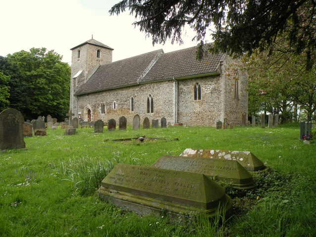
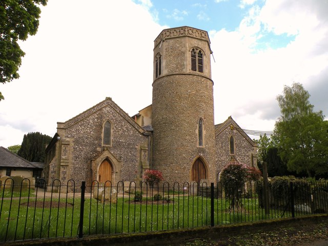
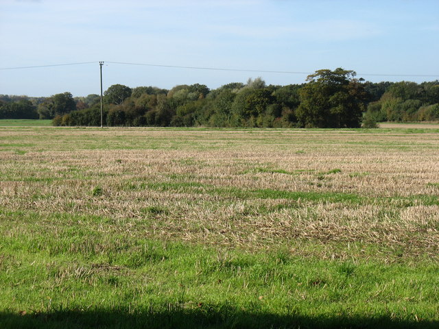
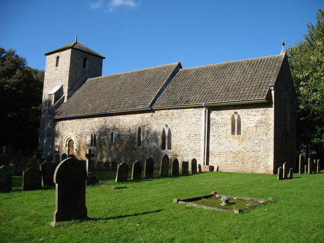
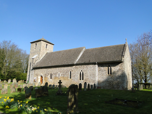
The village is surrounded by picturesque countryside, offering beautiful views and a tranquil environment. Neaton is characterized by its traditional English architecture, with many of its buildings dating back to the 18th and 19th centuries. The village church, dedicated to St. Peter and St. Paul, is a notable landmark, displaying historic features and serving as a focal point for the community.

Neaton is well-connected to neighboring towns and cities, making it an attractive place for commuters. The A11 road runs nearby, providing easy access to Norwich, Cambridge, and London. The village is also served by regular bus services, ensuring convenient transportation for residents.

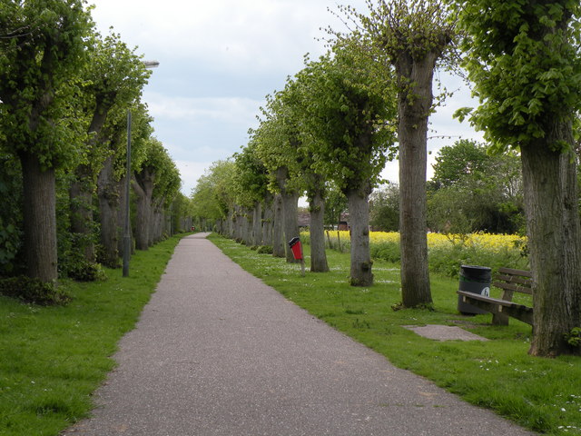
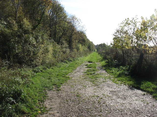
While Neaton itself is a small village, it benefits from its proximity to larger towns and cities. Nearby Dereham offers a wider range of amenities, including shops, supermarkets, schools, and healthcare facilities. Additionally, the surrounding area boasts a variety of recreational opportunities, such as nature reserves, walking trails, and golf courses.

Overall, Neaton offers residents a peaceful and idyllic lifestyle in a rural setting, while still providing easy access to essential services and amenities. Whether enjoying the tranquility of the countryside or exploring the nearby towns, Neaton provides a charming place to call home.

If you have any feedback on the listing, please let us know in the comments section below.

Neaton Images

Images are sourced within 2km of 52.577877/0.830021 or Grid Reference TF9101. Thanks to Geograph Open Source API. All images are credited.

Country Lane, heading towards Ovington This road is called The Street as it enters Ovington village.
Country Lane, heading towards Ovington
This road is called The Street as it enters Ovington village.
St. John Evangelist: the parish church of Ovington This Norman church has hardly changed over the centuries and appears to have been left alone by the Victorian restorers.
St. John Evangelist: the parish church of Ovington
This Norman church has hardly changed over the centuries and appears to have been left alone by the Victorian restorers.
St. Mary: the parish church of Watton This church dates from the Norman period right through to Victorian.
St. Mary: the parish church of Watton
This church dates from the Norman period right through to Victorian.
Church Walk at Watton This pathway connects Church Road with Cadman Way.
Church Walk at Watton
This pathway connects Church Road with Cadman Way.
Farmland north of Watton Not very exciting, but typical of the square!
Farmland north of Watton
Not very exciting, but typical of the square!
St John the Evangelist church, Ovington
Farm track near Saham Toney This track (which is not a Right of Way) runs parallel to a disused railway, behind the trees on the left.
Farm track near Saham Toney
This track (which is not a Right of Way) runs parallel to a disused railway, behind the trees on the left.
The Old Bell, Saham Toney
St. Mary's church, Watton I was fortunate to find the church open on my third visit due to a funeral taking place, no keyholder, usually locked and inhospitable.  The tower is Norman with a later upper stage and parapet. The south arcade is 14th c. but much restoration and re-building has destroyed much of its appeal. The 15th c. font has geometric patterns carved around the bowl. In the nave, attached to a pillar is a unique poor-man’s box dated, a carved wooden figure holding out his hand with a slot in his wrist for the offering. On his chest is written ‘Remember the poore-1639’ The nave itself is quite well lit but some nice Victorian wood carving can be found in dark corners and on the handrail of the pulpit and readers desk. Behind the altar rail is a sedilia, on its left is a piscina bowl cut directly into the sill.
St. Mary's church, Watton
I was fortunate to find the church open on my third visit due to a funeral taking place, no keyholder, usually locked and inhospitable. The tower is Norman with a later upper stage and parapet. The south arcade is 14th c. but much restoration and re-building has destroyed much of its appeal. The 15th c. font has geometric patterns carved around the bowl. In the nave, attached to a pillar is a unique poor-man’s box dated, a carved wooden figure holding out his hand with a slot in his wrist for the offering. On his chest is written ‘Remember the poore-1639’ The nave itself is quite well lit but some nice Victorian wood carving can be found in dark corners and on the handrail of the pulpit and readers desk. Behind the altar rail is a sedilia, on its left is a piscina bowl cut directly into the sill.
Ovington St. John the evangelist This lovely church is little changed since it was built in the 12th c. In the south wall is a series of styles of window architecture. Beside the Norman entrance door looking right, a 15th c., then an Early English, a lancet, then two double lancets with Y tracery windows. Notice to the extension of the chancel. The tower with a later pyramidal cap is 13th c. Shields beneath the bell openings were once painted with the heraldic devices of the donors. Some minor restoration was done during the Victorian period but it hasn’t affected the overall charm. In the nave is the square font, originally from Watton (their loss) which is quite unique in having large carvings of the four Evangelists at the corners all cut from one solid block of stone. The floor of the chancel has been raised making the sedilia only a few inches from the floor.
Ovington St. John the evangelist
This lovely church is little changed since it was built in the 12th c. In the south wall is a series of styles of window architecture. Beside the Norman entrance door looking right, a 15th c., then an Early English, a lancet, then two double lancets with Y tracery windows. Notice to the extension of the chancel. The tower with a later pyramidal cap is 13th c. Shields beneath the bell openings were once painted with the heraldic devices of the donors. Some minor restoration was done during the Victorian period but it hasn’t affected the overall charm. In the nave is the square font, originally from Watton (their loss) which is quite unique in having large carvings of the four Evangelists at the corners all cut from one solid block of stone. The floor of the chancel has been raised making the sedilia only a few inches from the floor.
Watton Town Hall Viewed from the south.
Watton Town Hall
Viewed from the south.
Ordnance Survey Flush Bracket S0264 This can be found on the wall of The Town Hall in Watton.
For more detail see : <span class="nowrap"><a title="http://www.bench-marks.org.uk/bm10731" rel="nofollow ugc noopener" href="http://www.bench-marks.org.uk/bm10731">Link</a><img style="margin-left:2px;" alt="External link" title="External link - shift click to open in new window" src="https://s1.geograph.org.uk/img/external.png" width="10" height="10"/></span>
Ordnance Survey Flush Bracket S0264
This can be found on the wall of The Town Hall in Watton. For more detail see : LinkExternal link
Former Brewery Building formerly Watton Brewery on the High Street Watton, Norfolk. Production ceased in about 1912 after it had been taken over by Morgans Brewery of Norwich.
Former Brewery
Building formerly Watton Brewery on the High Street Watton, Norfolk. Production ceased in about 1912 after it had been taken over by Morgans Brewery of Norwich.
Watton Brewery Sign Old name on former brewery building at Watton, Norfolk for view of the building see <a title="https://www.geograph.org.uk/photo/4308213" href="https://www.geograph.org.uk/photo/4308213">Link</a>
Watton Brewery Sign
Old name on former brewery building at Watton, Norfolk for view of the building see Link
High Street, Watton Looking along the eastern end of the High Street, dozing at midday on a Sunday. Watton is a small market town with a population of about 6,800 - a centre for a deeply rural district.
High Street, Watton
Looking along the eastern end of the High Street, dozing at midday on a Sunday. Watton is a small market town with a population of about 6,800 - a centre for a deeply rural district.
High Street, Watton Looking along the north side of Watton's High Street with the Post Office immediately ahead.
High Street, Watton
Looking along the north side of Watton's High Street with the Post Office immediately ahead.
J.C. Books, Watton Books, many with an East Anglian theme, look out from the window of this second-hand bookshop's window onto Watton High Street.
J.C. Books, Watton
Books, many with an East Anglian theme, look out from the window of this second-hand bookshop's window onto Watton High Street.
The Manor House, Watton This splendid building on Dereham Road dates from the 18th century. It is now occupied by a firm of solicitors.
The Manor House, Watton
This splendid building on Dereham Road dates from the 18th century. It is now occupied by a firm of solicitors.
Show me another place!

Neaton is located at Grid Ref: TF9101 (Lat: 52.577877, Lng: 0.830021)

Administrative County: Norfolk

District: Breckland

Police Authority: Norfolk

What 3 Words

///mistaking.repayment.bonkers. Near Watton, Norfolk

Nearby Locations

Neaton Loch Neaton

Related Wikis

Loch Neaton

Loch Neaton is a freshwater lake near Watton in Norfolk, England. It was created after earth was excavated in 1875 to create a mile long embankment for...

Watton United F.C.

Watton United Football Club is an English football club based in Watton, Norfolk. The club are currently members of the Anglian Combination Division One...
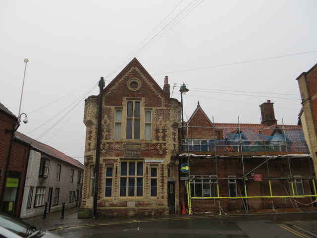
Wayland Hall

Wayland Hall, also known as Watton Town Hall, is a community events venue in Middle Street, Watton, Norfolk, England: the structure, which also accommodates...

Watton, Norfolk

Watton is a market town in the district of Breckland in the English county of Norfolk, about 25 miles (40 km) west-southwest of Norwich and 15 miles (24...

Nearby Amenities

Located within 500m of 52.577877,0.830021
Bus Stop
Lime Tree Walk
Bus: yes
Naptan AtcoCode: 2900W1235
Naptan Bearing: S
Naptan BusStopType: CUS
Naptan CommonName: Lime Tree Walk
Naptan Indicator: adj
Naptan Landmark: Lime Tree Walk
Naptan Latitude: 52.5739544
Naptan Locality: Watton
Naptan Longitude: 0.8280592
Naptan NaptanCode: nfogdjda
Naptan ShortCommonName: Dereham Road
Naptan Street: Dereham Road
Public Transport: platform
Source: naptan_import;survey
Lat/Long: 52.5738092/0.8280994
Bus Stop
Lime Tree Walk
Bus: yes
Naptan AtcoCode: 2900W1236
Naptan Bearing: N
Naptan BusStopType: CUS
Naptan CommonName: Lime Tree Walk
Naptan Indicator: opp
Naptan Landmark: Walnut Grove
Naptan Locality: Watton
Naptan NaptanCode: nfogdjdg
Naptan ShortCommonName: Dereham Road
Naptan Street: Dereham Road
Public Transport: platform
Source: naptan_import;survey
Lat/Long: 52.5737897/0.8279492
Bus Stop
Loch Lane, adj
Bus: yes
Naptan AtcoCode: 2900W1237
Naptan Bearing: NE
Naptan BusStopType: CUS
Naptan CommonName: Loch Lane
Naptan Indicator: adj
Naptan Landmark: Loch Lane
Naptan Locality: Watton
Naptan NaptanCode: nfogdjdj
Naptan ShortCommonName: Dereham Road
Naptan Street: Dereham Road
Naptan Verified: no
Public Transport: platform
Source: naptan_import
Lat/Long: 52.5777523/0.8301933
Bus Stop
Loch Lane, opp
Bus: yes
Naptan AtcoCode: 2900W1238
Naptan Bearing: SW
Naptan BusStopType: CUS
Naptan CommonName: Loch Lane
Naptan Indicator: opp
Naptan Landmark: Loch Lane
Naptan Locality: Watton
Naptan NaptanCode: nfogdjdm
Naptan ShortCommonName: Dereham Road
Naptan Street: Dereham Road
Naptan Verified: no
Public Transport: platform
Source: naptan_import
Lat/Long: 52.578024/0.8304913
Barrier: cycle_barrier
Bicycle: yes
Foot: yes
Lat/Long: 52.5742498/0.8259174
Power: pole
Source: Bing
Lat/Long: 52.5784933/0.8244011
Power: pole
Source: Bing
Lat/Long: 52.5810636/0.8342582
Power: pole
Source: Bing
Lat/Long: 52.5780288/0.8227917
Power: pole
Source: Bing
Lat/Long: 52.5807409/0.8328125
Power: pole
Source: Bing
Lat/Long: 52.5789073/0.8257958
Power: pole
Source: Bing
Lat/Long: 52.5796841/0.8285268
Post Box
Collection Times: Mo-Fr 17:00; Sa 09:00
Drive Through: no
Post Box Mounting: telegraph_pole
Post Box Type: lamp
Ref: IP25 3359
Royal Cypher: EIIR
Royal Cypher Wikidata: Q33102113
Lat/Long: 52.5778484/0.8301809
Defibrillator
Defibrillator Location: On wall in coridoor inside Watton Sports Association & Social Club, near to the bar.
Emergency: defibrillator
Indoor: yes
Lat/Long: 52.5752182/0.8262573
Entrance: main
Lat/Long: 52.5753421/0.8264616
Fixme: incomplete
Lat/Long: 52.5774627/0.8279633
Bar
Watton Sports Association & Social Club Bar
Lat/Long: 52.5751694/0.8262144
Entrance: yes
Lat/Long: 52.5752213/0.8264106
Entrance: yes
Lat/Long: 52.5751677/0.8261019
Light Source: floodlight
Man Made: mast
Material: metal
Tower Construction: freestanding
Tower Type: lighting
Lat/Long: 52.5758561/0.8258037
Light Source: floodlight
Man Made: mast
Material: metal
Tower Construction: freestanding
Tower Type: lighting
Lat/Long: 52.5756462/0.8239405
Light Source: floodlight
Man Made: mast
Material: metal
Tower Construction: freestanding
Tower Type: lighting
Lat/Long: 52.5751964/0.8259978
Note: Loch Neaton Parkrun Finish
Lat/Long: 52.5764427/0.8271706
Note: Loch Neaton Parkrun Start
Lat/Long: 52.5775267/0.8273664
Generator Method: photovoltaic
Generator Output Electricity: yes
Generator Source: solar
Generator Type: solar_photovoltaic_panel
Location: roof
Power: generator
Lat/Long: 52.5736424/0.8305863
Generator Method: photovoltaic
Generator Output Electricity: yes
Generator Source: solar
Generator Type: solar_photovoltaic_panel
Location: roof
Power: generator
Lat/Long: 52.5735724/0.8287302
Generator Method: photovoltaic
Generator Output Electricity: yes
Generator Source: solar
Generator Type: solar_photovoltaic_panel
Location: roof
Power: generator
Lat/Long: 52.5735772/0.8287731
Generator Method: photovoltaic
Generator Output Electricity: yes
Generator Source: solar
Generator Type: solar_photovoltaic_panel
Location: roof
Power: generator
Lat/Long: 52.5743597/0.8275554
Generator Method: photovoltaic
Generator Output Electricity: yes
Generator Source: solar
Generator Type: solar_photovoltaic_panel
Location: roof
Power: generator
Lat/Long: 52.5742162/0.8275178
Golf: pin
Lat/Long: 52.5796535/0.825182
Golf: pin
Lat/Long: 52.5806586/0.8260383
Golf: pin
Lat/Long: 52.5800099/0.8254753
Natural: shrub
Lat/Long: 52.5791184/0.8231086
Natural: shrub
Lat/Long: 52.5791938/0.8230563
Natural: shrub
Lat/Long: 52.5791531/0.8230351
Natural: shrub
Lat/Long: 52.5791343/0.8229617
Natural: shrub
Lat/Long: 52.5794475/0.8246386
Natural: shrub
Lat/Long: 52.5794273/0.8244694
Natural: shrub
Lat/Long: 52.5799042/0.8247989
Natural: shrub
Lat/Long: 52.5799771/0.8247679
Natural: shrub
Lat/Long: 52.5797582/0.8245897
Natural: shrub
Lat/Long: 52.5799028/0.824289
Natural: shrub
Lat/Long: 52.5805194/0.8249963
Natural: shrub
Lat/Long: 52.5808889/0.82568
Love Wood Farm
Place: farm
Lat/Long: 52.5810808/0.8308099
The data included in this document is from www.openstreetmap.org. The data is made available under ODbL.

Have you been to Neaton?

Leave your review of Neaton below (or comments, questions and feedback).