Achadh Rìdhisgil

Settlement in Sutherland

Scotland

Achadh Rìdhisgil

Houses at Achriesgill Achriesgill is a scattered settlement, presumably once a crofting community, alongside the B801 to the north of Loch Inchard.
Houses at Achriesgill Credit: Trevor Littlewood

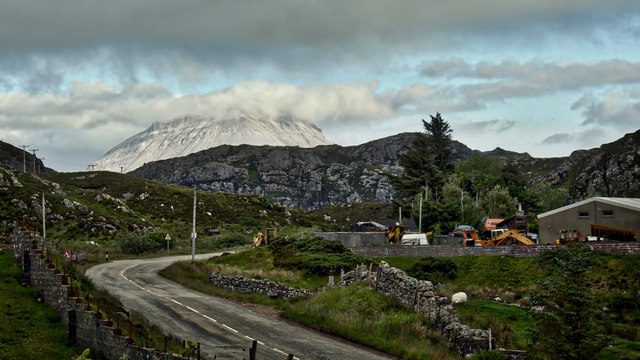
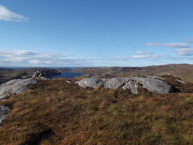
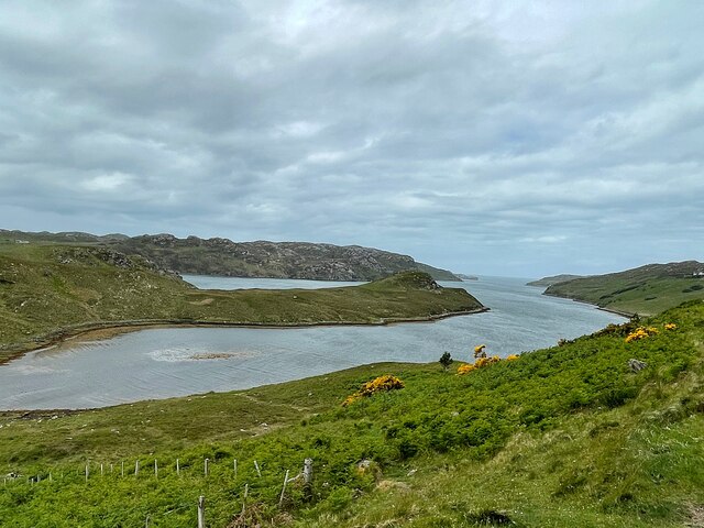
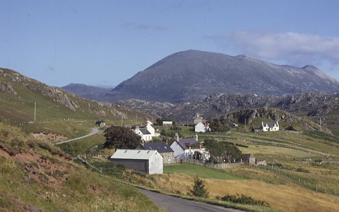
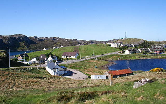
Achadh Rìdhisgil is a small hamlet located in the county of Sutherland, in the northernmost part of the Scottish Highlands. Situated amidst stunningly picturesque landscapes, this tranquil village is nestled between the towering Ben Klibreck and Ben Hope mountains, offering breathtaking views of the surrounding wilderness.

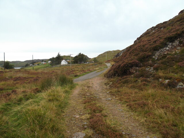
The hamlet consists of a handful of traditional stone cottages, which are scattered across the rolling green hills. The rugged terrain and sparse population contribute to the secluded and peaceful atmosphere of Achadh Rìdhisgil.

Despite its modest size, Achadh Rìdhisgil boasts a rich history. The area has evidence of human settlement dating back thousands of years, with ancient standing stones and burial cairns dotted throughout the landscape. The nearby ruins of a medieval castle add to the historical charm of the region.

The natural beauty of Achadh Rìdhisgil attracts outdoor enthusiasts from far and wide. The numerous hiking trails provide opportunities for exploration and adventure, while the nearby lochs and rivers offer fishing and boating activities. Wildlife enthusiasts can also spot a variety of native animals, including red deer, golden eagles, and otters.

Achadh Rìdhisgil is a place where visitors can escape the hustle and bustle of modern life and immerse themselves in the tranquility of the Scottish Highlands. With its stunning scenery, rich history, and ample outdoor activities, this small hamlet is a hidden gem waiting to be discovered.

If you have any feedback on the listing, please let us know in the comments section below.

Achadh Rìdhisgil Images

Images are sourced within 2km of 58.440022/-4.989757 or Grid Reference NC2554. Thanks to Geograph Open Source API. All images are credited.

Houses at Achriesgill Achriesgill is a scattered settlement, presumably once a crofting community, alongside the B801 to the north of Loch Inchard.
Houses at Achriesgill
Achriesgill is a scattered settlement, presumably once a crofting community, alongside the B801 to the north of Loch Inchard.
Trig point at summit area of Garbh Shron Although the pillar is on the very rocky top of Garbh Shron it's known to the OS by the name of an adjacent hill top, Creag an Fhithich There's no flush bracket and the pillar has never had one. The distant, central hill is Farrmheal.
Trig point at summit area of Garbh Shron
Although the pillar is on the very rocky top of Garbh Shron it's known to the OS by the name of an adjacent hill top, Creag an Fhithich There's no flush bracket and the pillar has never had one. The distant, central hill is Farrmheal.
The head of Loch Inchard The loch runs north westwards towards the ocean and is hemmed in by lumpy gneiss hills.
The head of Loch Inchard
The loch runs north westwards towards the ocean and is hemmed in by lumpy gneiss hills.
Loch Sheigra in summer
Foinaven from Inshegra An overcast, rather dull evening but late on the clouds broke over Foinaven shining white with its covering of quartzite rock and boulders. Shame about the ubiquitous graveyard for redundant motor vehicles in the foreground. Foinaven is, of course, with its neighbour Arkle, famous after the pair of eponymous racehorses from the stable of the Duchess of Westminster in the 1960s.

From my photo-diary for 26 June 2019 see <span class="nowrap"><a title="http://www.fhithich.uk/?p=21311" rel="nofollow ugc noopener" href="http://www.fhithich.uk/?p=21311">Link</a><img style="margin-left:2px;" alt="External link" title="External link - shift click to open in new window" src="https://s1.geograph.org.uk/img/external.png" width="10" height="10"/></span>
Foinaven from Inshegra
An overcast, rather dull evening but late on the clouds broke over Foinaven shining white with its covering of quartzite rock and boulders. Shame about the ubiquitous graveyard for redundant motor vehicles in the foreground. Foinaven is, of course, with its neighbour Arkle, famous after the pair of eponymous racehorses from the stable of the Duchess of Westminster in the 1960s. From my photo-diary for 26 June 2019 see LinkExternal link
Broken Dam, Achriesgill
Path at Achriesgill East
Waterfall below the broken dam
Summit rocks, Garbh Shron
Ruin by Loch Inchard
Old bridge over Achriesgill Water
Looking west to Cnoc an Leathaid Bhàin
Druim Loch na Gainimh
Looking west across the moorland
View from Creag An Fhithich Trig Point
Loch Sheigra
Loch Sheigra
Moorland streams Draining into General's Loch
Moorland streams
Draining into General's Loch
Loch Inchard
Loch Inchard
Show me another place!

Achadh Rìdhisgil is located at Grid Ref: NC2554 (Lat: 58.440022, Lng: -4.989757)

Unitary Authority: Highland

Police Authority: Highlands and Islands

Also known as: Achriesgill

What 3 Words

///warned.monument.estuaries. Near Oldshoremore, Highland

Related Wikis

Achriesgill

Achriesgill (Scottish Gaelic: Achadh Rìdhisgil) is a village that lies on the eastern bank of Loch Inchard in Lairg, Sutherland, in the Scottish council...

Inshegra

Inshegra is a small crofting village, located two miles south east of Badcall and lies at the south east coast of Loch Inchard, in Lairg, Sutherland,...

Rhiconich

Rhiconich is a remote hamlet, located at the head of Loch Inchard, in Sutherland, Scottish Highlands in the Scottish council area of Highland. Rhiconich...

Achlyness

Achlyness (Scottish Gaelic:Achadh Linn an Eas) is a crofting hamlet on the shores of Loch Inchard, located near Rhiconich, Sutherland, Scotland, within...

Badcall, Rhiconich

Badcall is a remote crofting township, located on the northern shore of the sea loch, Loch Inchard, in Sutherland, Scottish Highlands and is in the Scottish...

Kinlochbervie High School

Kinlochbervie High School (Scottish Gaelic: Ard Sgoil Cheann Loch Biorbhaidh) is a secondary school in Kinlochbervie, in the county of Sutherland in the...

Kinlochbervie

Kinlochbervie (Scottish Gaelic: Ceann Loch Biorbhaidh, IPA: [ˈkʲʰaun̪ˠˈɫ̪ɔxˈpiɾivɪ]) is a scattered harbour village in the north west of Sutherland, in...

Oldshoremore

Oldshoremore is a scattered crofting hamlet in the Eddrachillis parish of Sutherland, Scotland. It incorporates around twenty houses, though several of...

Related Videos

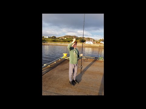
Fishing Lochinchard plus holiday accomodation Lochinchard holiday cottages

Holiday footage from Lochinchard and also a lookaround in our accomodation. Kinlochbervie is a place in the highlands in ...

Nearby Amenities

Located within 500m of 58.440022,-4.989757
Source: PGS
Lat/Long: 58.440795/-4.9979782
Source: PGS
Lat/Long: 58.4410153/-4.996705
Source: PGS
Lat/Long: 58.4411923/-4.9967855
Created By: almien_coastlines
Source: PGS
Lat/Long: 58.441181/-4.996514
Source: PGS
Lat/Long: 58.4411763/-4.9962958
Source: PGS
Lat/Long: 58.4411847/-4.9961744
Source: PGS
Lat/Long: 58.4408163/-4.9947535
Source: PGS
Lat/Long: 58.4404003/-4.9943909
Source: PGS
Lat/Long: 58.440383/-4.9940485
Source: PGS
Lat/Long: 58.4404573/-4.9937105
Source: PGS
Lat/Long: 58.4404167/-4.9931994
Source: PGS
Lat/Long: 58.4391739/-4.9924689
Source: PGS
Lat/Long: 58.4390309/-4.9936177
Source: PGS
Lat/Long: 58.4387632/-4.9941184
Source: PGS
Lat/Long: 58.4387108/-4.9946804
Source: PGS
Lat/Long: 58.4384729/-4.9952968
Source: PGS
Lat/Long: 58.4380598/-4.996362
Source: survey
Tourism: picnic_site
Lat/Long: 58.4386679/-4.9925741
Post Box
Ref: IV27 295
Source: survey
Lat/Long: 58.4440034/-4.9919925
Achriesgill
Name En: Achriesgill
Name Gd: Achadh Rìsgil
Place: village
Wikidata: Q3777272
Wikipedia: en:Achriesgill
Lat/Long: 58.4437465/-4.9940264
Power: pole
Lat/Long: 58.4409152/-4.9882677
Power: pole
Lat/Long: 58.4412338/-4.9880746
Power: pole
Lat/Long: 58.4416213/-4.9877742
Power: pole
Lat/Long: 58.4419863/-4.9875838
Power: pole
Lat/Long: 58.4438757/-4.9906307
Power: pole
Lat/Long: 58.4441508/-4.9912798
Power: pole
Lat/Long: 58.4429843/-4.9880371
Power: pole
Lat/Long: 58.4432875/-4.9889034
Power: pole
Lat/Long: 58.4435935/-4.9897912
Power: pole
Lat/Long: 58.4404832/-4.9886288
Power: pole
Lat/Long: 58.4401082/-4.9889481
Power: pole
Lat/Long: 58.439719/-4.989719
Power: pole
Lat/Long: 58.4393064/-4.9905074
Power: pole
Lat/Long: 58.4389202/-4.9912628
Power: pole
Lat/Long: 58.4384922/-4.9921018
Power: pole
Lat/Long: 58.4379451/-4.9929973
Power: pole
Lat/Long: 58.4373867/-4.9938908
Power: pole
Lat/Long: 58.4369617/-4.9945586
The data included in this document is from www.openstreetmap.org. The data is made available under ODbL.

Have you been to Achadh Rìdhisgil?

Leave your review of Achadh Rìdhisgil below (or comments, questions and feedback).