Nantyrhibo

Settlement in Carmarthenshire

Wales

Nantyrhibo

River Towy, near Ffairfach
River Towy, near Ffairfach Credit: Chris Morgan

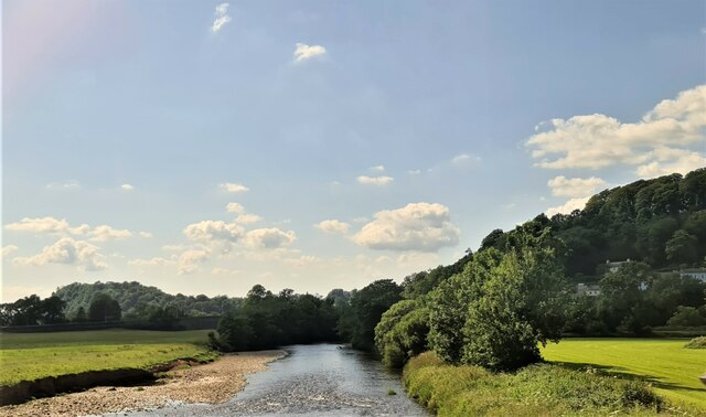
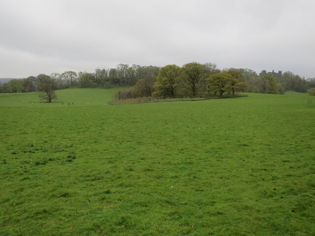
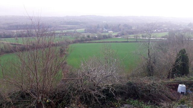
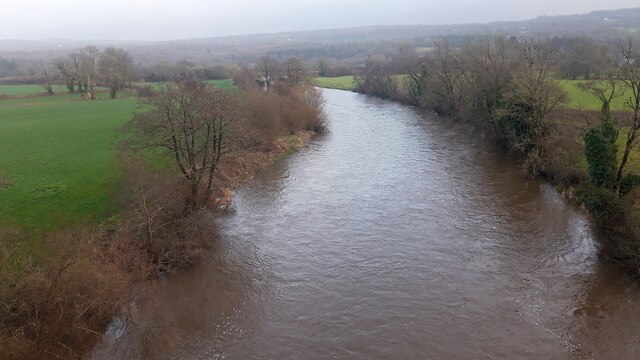
Nantyrhibo is a small village located in the county of Carmarthenshire, Wales. Situated in the beautiful countryside, it is surrounded by rolling hills and green fields, creating a picturesque setting for its residents and visitors alike.

The village is home to a tight-knit community, with a population of around 500 people. The local economy primarily relies on agriculture, with farming being the main occupation for many residents. The fertile land in the area allows for the cultivation of crops and the rearing of livestock.

Nantyrhibo is known for its tranquil atmosphere and scenic landscapes, making it a popular destination for nature enthusiasts and those seeking a peaceful retreat. The village offers various walking and hiking trails, allowing visitors to explore the surrounding countryside and enjoy the stunning views.

Despite its small size, Nantyrhibo has a strong sense of community spirit. The village has a primary school, a community hall, and a local pub, which serves as a meeting point for residents to socialize and relax.

In terms of amenities, the nearest town, Carmarthen, is just a short drive away. Here, residents can access a wider range of services, including shops, healthcare facilities, and educational institutions.

Overall, Nantyrhibo offers a peaceful and idyllic lifestyle, with its rural charm and natural beauty attracting both locals and visitors who appreciate the tranquility and close-knit community that the village has to offer.

If you have any feedback on the listing, please let us know in the comments section below.
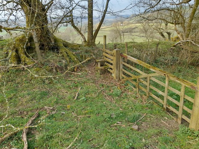
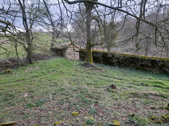
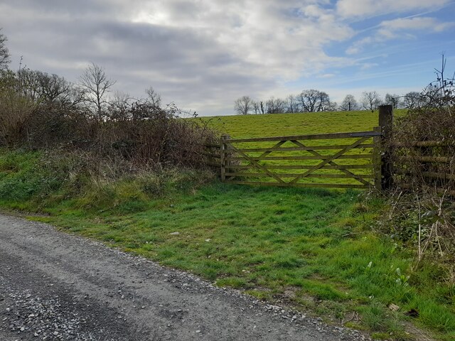
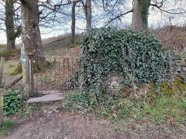
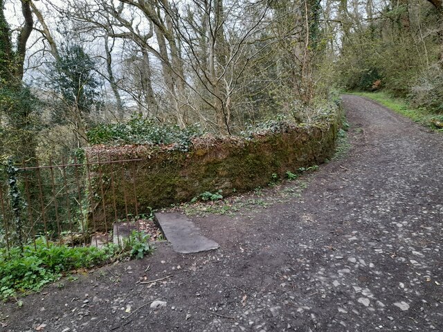
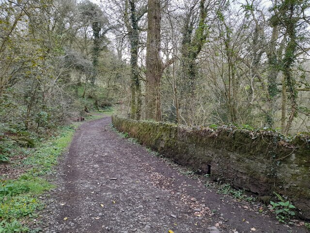
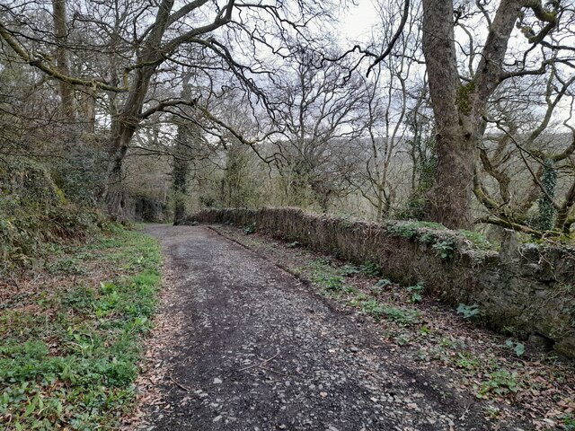
Nantyrhibo Images

Images are sourced within 2km of 51.889564/-4.000938 or Grid Reference SN6223. Thanks to Geograph Open Source API. All images are credited.

River Towy, near Ffairfach
Dinefwr Park
Dinefwr Park
Llandyfeisant Church, Dinefwr Park See <span class="nowrap"><a title="https://friendsofllandyfeisantchurch.org/" rel="nofollow ugc noopener" href="https://friendsofllandyfeisantchurch.org/">Link</a><img style="margin-left:2px;" alt="External link" title="External link - shift click to open in new window" src="https://s1.geograph.org.uk/img/external.png" width="10" height="10"/></span>
Llandyfeisant Church, Dinefwr Park
See LinkExternal link
Newton House, Dinefwr, Llandeilo This Grade II* listed property is partly managed by the National Trust.
Newton House, Dinefwr, Llandeilo
This Grade II* listed property is partly managed by the National Trust.
Dinefwr or Dynevor Castle <span class="nowrap"><a title="http://www.castlewales.com/dinefwr.html" rel="nofollow ugc noopener" href="http://www.castlewales.com/dinefwr.html">Link</a><img style="margin-left:2px;" alt="External link" title="External link - shift click to open in new window" src="https://s1.geograph.org.uk/img/external.png" width="10" height="10"/></span>
Dinefwr or Dynevor Castle
Newton House, Dinefwr Park
St Teilo's Well and Church
River Towy Railway Bridge
The River Towy View from the road bridge leading northward into Llandeilo.
The River Towy
View from the road bridge leading northward into Llandeilo.
Icehouse
Icehouse
Ordnance Survey Cut Mark This OS cut mark can be found on a gatepost SE side of track. It marks a point 255.3ft above mean sea level.
Ordnance Survey Cut Mark
This OS cut mark can be found on a gatepost SE side of track. It marks a point 255.3ft above mean sea level.
Stile in Sunken Lane
Estate Wall Close to the location of Parc-llwyn. A house which once stood here.
Estate Wall
Close to the location of Parc-llwyn. A house which once stood here.
Field Gateway
Field Gateway
Kissing Gate
Kissing Gate
Bridge Parapet & Path to Church
Estate Track
Estate Track
Estate Track
Estate Track
Show me another place!

Nantyrhibo is located at Grid Ref: SN6223 (Lat: 51.889564, Lng: -4.000938)

Unitary Authority: Carmarthenshire

Police Authority: Dyfed Powys

Also known as: Nant-y-rhibo

What 3 Words

///financial.desk.examiner. Near Llandeilo, Carmarthenshire

Nearby Locations

Nant-y-rhibo Nantyrhibo

Related Wikis

Crûg Farm Quarry

Crûg Farm Quarry is a Site of Special Scientific Interest (SSSI) in Carmarthenshire, Wales, for the geological records preserved in its limestone. ��2...

Battle of Llandeilo Fawr

The Battle of Llandeilo Fawr took place during the conquest of Wales by Edward I, at Llandeilo between an English army led by Gilbert de Clare, 6th Earl...

Llandeilo

Llandeilo (Welsh pronunciation: [ɬanˈdeilɔ]) is a town and community in Carmarthenshire, Wales, situated at the crossing of the River Towy by the A483...

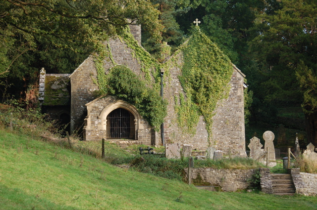
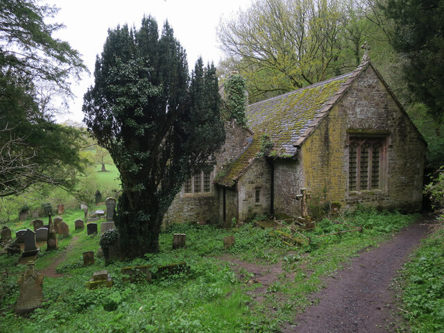
St Tyfi's Church, Llandyfeisant

St Tyfi's Church is the former parish church of Llandyfeisant, near Llandeilo and part of the Dinefwr Park estate in Carmarthenshire, Wales. It was dedicated...

St Teilo's Church, Llandeilo

The St Teilo's Church, is an Anglican parish church in the town of Llandeilo, Carmarthenshire, Wales. The fabric of the building has medieval origins but...

Llandeilo railway station

Llandeilo railway station (formerly Llandilo Junction for the Carmarthen Line) serves the town of Llandeilo, Carmarthenshire. The station is 30+3⁄4 miles...

District of Dinefwr

Dinefwr was one of six local government districts of the county of Dyfed, Wales from 1974 to 1996. It was named after Dinefwr Castle which in the Middle...

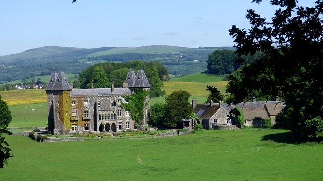
Newton House, Llandeilo

Newton House is a Grade II* listed country house situated just to the west of the market town of Llandeilo in Carmarthenshire, Wales. It is partially owned...

Nearby Amenities

Located within 500m of 51.889564,-4.000938
Turning Circle
Lat/Long: 51.8861073/-3.9981786
Turning Circle
Lat/Long: 51.8871304/-3.9956385
Power: pole
Lat/Long: 51.888563/-3.9942876
Post Box
Collection Times: Mo-Fr 17:00; Sa 07:45
Post Box Type: lamp
Ref: SA19 316
Royal Cypher: EIIR
Royal Cypher Wikidata: Q33102113
Lat/Long: 51.8890377/-4.0023248
Parking
Parking: layby
Lat/Long: 51.8898653/-3.9938843
Parking
Parking: layby
Lat/Long: 51.8898816/-3.9959873
Direction: 170
Generator Method: photovoltaic
Generator Output Electricity: yes
Generator Solar Modules: 14
Generator Source: solar
Generator Type: solar_photovoltaic_panel
Location: roof
Power: generator
Lat/Long: 51.887027/-3.9981946
Direction: 190
Generator Method: photovoltaic
Generator Output Electricity: yes
Generator Solar Modules: 3
Generator Source: solar
Generator Type: solar_photovoltaic_panel
Location: roof
Power: generator
Lat/Long: 51.8858253/-3.9981239
Direction: 235
Generator Method: photovoltaic
Generator Output Electricity: yes
Generator Solar Modules: 13
Generator Source: solar
Generator Type: solar_photovoltaic_panel
Location: roof
Power: generator
Lat/Long: 51.885667/-3.9989832
Direction: 190
Generator Method: photovoltaic
Generator Output Electricity: yes
Generator Solar Modules: 15
Generator Source: solar
Generator Type: solar_photovoltaic_panel
Location: roof
Power: generator
Lat/Long: 51.8858613/-3.9982275
Direction: WSW
Generator Method: photovoltaic
Generator Output Electricity: yes
Generator Solar Modules: 17
Generator Source: solar
Generator Type: solar_photovoltaic_panel
Location: roof
Power: generator
Lat/Long: 51.8867563/-3.9991042
Direction: 265
Generator Method: photovoltaic
Generator Output Electricity: yes
Generator Solar Modules: 12
Generator Source: solar
Generator Type: solar_photovoltaic_panel
Location: roof
Power: generator
Lat/Long: 51.8865611/-3.9990496
Direction: 165
Generator Method: photovoltaic
Generator Output Electricity: yes
Generator Solar Modules: 18
Generator Source: solar
Generator Type: solar_photovoltaic_panel
Location: roof
Power: generator
Lat/Long: 51.8866986/-3.999292
Direction: 165
Generator Method: photovoltaic
Generator Output Electricity: yes
Generator Solar Modules: 18
Generator Source: solar
Generator Type: solar_photovoltaic_panel
Location: roof
Power: generator
Lat/Long: 51.8866501/-3.9995948
Direction: SSW
Generator Method: photovoltaic
Generator Output Electricity: yes
Generator Solar Modules: 14
Generator Source: solar
Generator Type: solar_photovoltaic_panel
Location: roof
Power: generator
Lat/Long: 51.8870775/-3.9985728
Direction: 175
Generator Method: photovoltaic
Generator Output Electricity: yes
Generator Solar Modules: 16
Generator Source: solar
Generator Type: solar_photovoltaic_panel
Location: roof
Power: generator
Lat/Long: 51.8873278/-3.9992085
Direction: 165
Generator Method: photovoltaic
Generator Output Electricity: yes
Generator Solar Modules: 8
Generator Source: solar
Generator Type: solar_photovoltaic_panel
Location: roof
Power: generator
Lat/Long: 51.8884976/-3.9974225
Direction: 165
Generator Method: photovoltaic
Generator Output Electricity: yes
Generator Solar Modules: 8
Generator Source: solar
Generator Type: solar_photovoltaic_panel
Location: roof
Power: generator
Lat/Long: 51.8884794/-3.9975127
Direction: 235
Generator Method: photovoltaic
Generator Output Electricity: yes
Generator Solar Modules: 15
Generator Source: solar
Generator Type: solar_photovoltaic_panel
Location: roof
Power: generator
Lat/Long: 51.8898636/-4.0026384
The data included in this document is from www.openstreetmap.org. The data is made available under ODbL.

Have you been to Nantyrhibo?

Leave your review of Nantyrhibo below (or comments, questions and feedback).