Nance

Settlement in Cornwall

England

Nance

Illogan Downs former church Wesleyan
Illogan Downs former church Credit: Paul Barnett

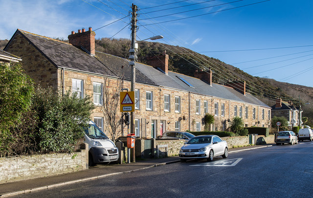
Nance is a small village located in the county of Cornwall, England. Situated on the southern coast, it is nestled between the towns of Truro and Falmouth. With a population of around 500 residents, Nance is known for its picturesque surroundings and tranquil atmosphere.

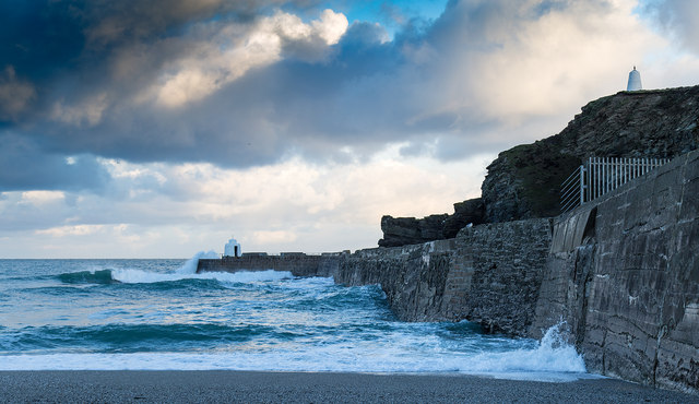
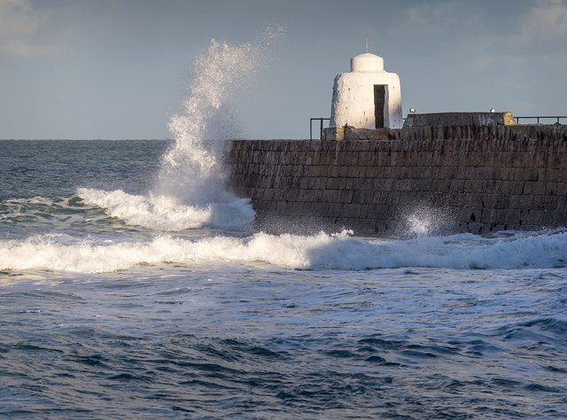
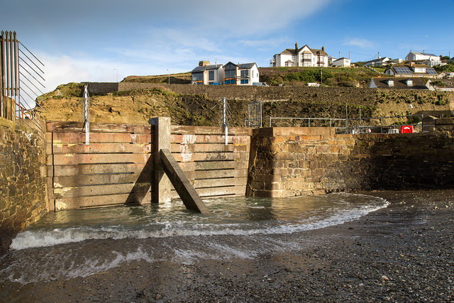
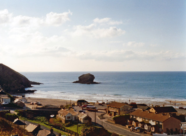
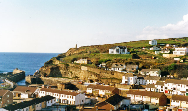
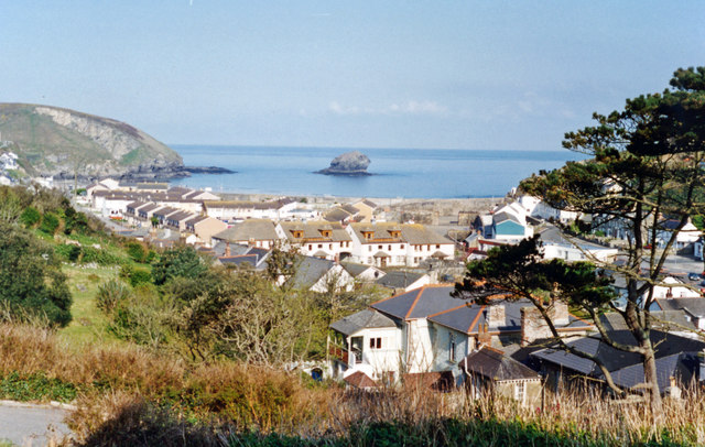
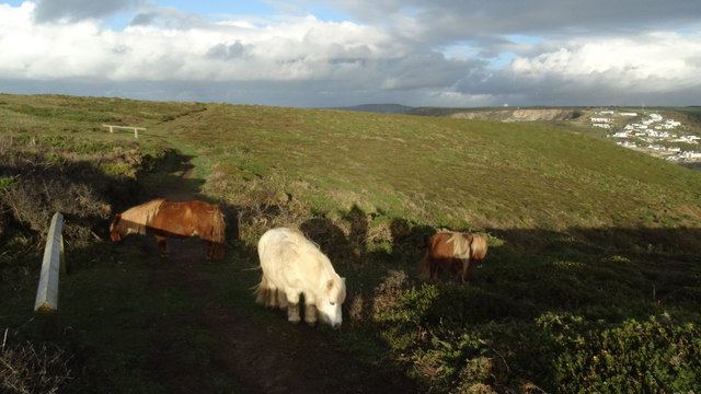
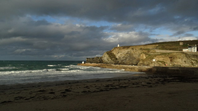
The village is surrounded by lush green fields and rolling hills, offering breathtaking views of the countryside. It is also close to the coast, allowing residents and visitors to enjoy the beauty of the nearby beaches, such as Swanpool and Maenporth.

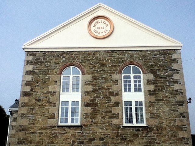
Nance boasts a rich history, evident in its charming architecture and landmarks. The village church, St. Mary's Church, is a notable feature with its historic stone structure dating back several centuries. The church serves as a gathering place for the local community and hosts various cultural and religious events throughout the year.

Despite its small size, Nance offers a range of amenities for its residents. There is a local primary school, providing education for children in the area. Additionally, the village has a few shops and businesses catering to the daily needs of its inhabitants.

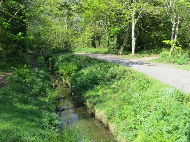
Nature lovers will find plenty to explore in and around Nance. The village is surrounded by beautiful walking trails, offering opportunities for outdoor activities. The nearby coast provides ample opportunities for water sports, including sailing, kayaking, and swimming.

Overall, Nance is a charming village that offers a peaceful and idyllic setting for its residents. Its natural beauty, rich history, and community spirit make it a truly special place in Cornwall.

If you have any feedback on the listing, please let us know in the comments section below.
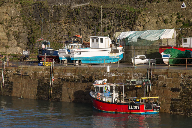
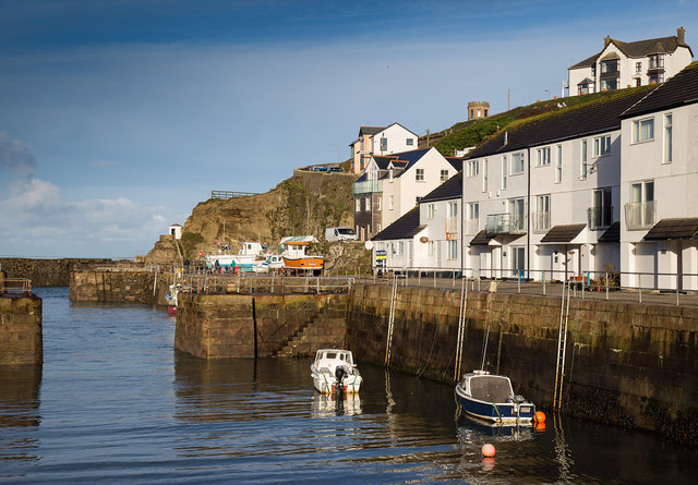
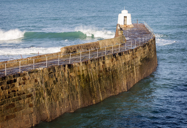
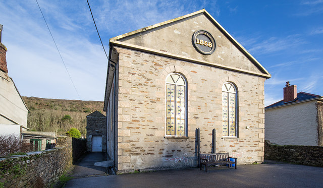
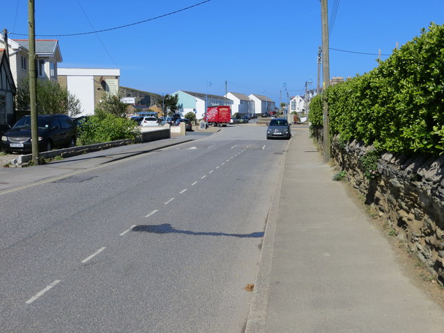
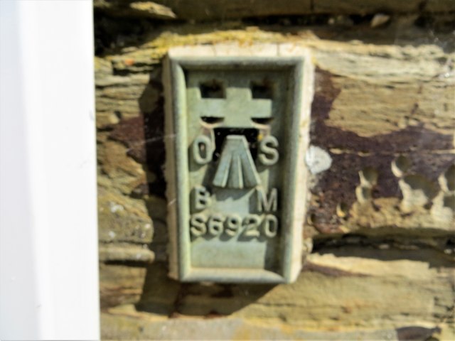
Nance Images

Images are sourced within 2km of 50.249543/-5.2836967 or Grid Reference SW6644. Thanks to Geograph Open Source API. All images are credited.

Illogan Downs former church Wesleyan
Illogan Downs former church
Wesleyan
Dawn at Portreath The harbour wall from the beach early in the morning.
Dawn at Portreath
The harbour wall from the beach early in the morning.
Waves breaking over the harbour wall, Portreath Taken from the beach.
Waves breaking over the harbour wall, Portreath
Taken from the beach.
Blocked off harbour entrance, Portreath This old section of harbour has been blocked off by a concrete barrier.
Blocked off harbour entrance, Portreath
This old section of harbour has been blocked off by a concrete barrier.
The harbour, Portreath A fishing boat, LL307 Early Dawn, in Portreath harbour.
The harbour, Portreath
A fishing boat, LL307 Early Dawn, in Portreath harbour.
The harbour Portreath The harbour and harbour side apartments, in the early morning winter sunshine.
The harbour Portreath
The harbour and harbour side apartments, in the early morning winter sunshine.
The harbour wall, Portreath
Portreath Millennium Hall A former Methodist church, now a community hall.
Portreath Millennium Hall
A former Methodist church, now a community hall.
Cottages on Basset Terrace A row of cottages on the B3300 heading east out of Portreath.
Cottages on Basset Terrace
A row of cottages on the B3300 heading east out of Portreath.
Evening view westward from above Portreath Beach, 1995 View WNW to Gull Rock from B3301 road from Hayle.
Evening view westward from above Portreath Beach, 1995
View WNW to Gull Rock from B3301 road from Hayle.
Evening over Portreath, 1995 View northward descending on the B3301 road from Hayle. The harbour and its mole are seen clearly on the left, while Lighthouse Hill is seen zig-zagging up the hill from the town on the right.
Evening over Portreath, 1995
View northward descending on the B3301 road from Hayle. The harbour and its mole are seen clearly on the left, while Lighthouse Hill is seen zig-zagging up the hill from the town on the right.
Portreath: harbour, beach and Gull Rock, 1995 Northward view from Benson's B&B on the B3301 road from Hayle, for comparison the following morning with the view taken the evening before (my <a href="https://www.geograph.org.uk/photo/5003633">SW6545 : Evening view westward from above Portreath Beach, 1995</a>).
Portreath: harbour, beach and Gull Rock, 1995
Northward view from Benson's B&B on the B3301 road from Hayle, for comparison the following morning with the view taken the evening before (my SW6545 : Evening view westward from above Portreath Beach, 1995).
Shetland ponies above Western Cove, Portreath
The beach at Portreath
South Drive at Tehidy Country Park Looking north-westward.
South Drive at Tehidy Country Park
Looking north-westward.
Woodland path through Tehidy Country Park Looking westward.
Woodland path through Tehidy Country Park
Looking westward.
Penberthy Road in Portreath Looking westward.
Penberthy Road in Portreath
Looking westward.
Ordnance Survey Flush Bracket S6920 This bracket can be found on the wall of Portreath Pre-School in Penberthy Road. The benchmark height is recorded as  being 6.605 metres above sea level.
For more detail see : <span class="nowrap"><a title="http://www.bench-marks.org.uk/bm11684" rel="nofollow ugc noopener" href="http://www.bench-marks.org.uk/bm11684">Link</a><img style="margin-left:2px;" alt="External link" title="External link - shift click to open in new window" src="https://s1.geograph.org.uk/img/external.png" width="10" height="10"/></span>
Ordnance Survey Flush Bracket S6920
This bracket can be found on the wall of Portreath Pre-School in Penberthy Road. The benchmark height is recorded as being 6.605 metres above sea level. For more detail see : LinkExternal link
Show me another place!

Nance is located at Grid Ref: SW6644 (Lat: 50.249543, Lng: -5.2836967)

Unitary Authority: Cornwall

Police Authority: Devon and Cornwall

What 3 Words

///difficult.booms.jeering. Near Camborne, Cornwall

Related Wikis

Nance Wood

Nance Wood is a woodland Site of Special Scientific Interest (SSSI) near Portreath, west Cornwall. The site was first notified in 1951 for its almost pure...

Illogan

Illogan (pronounced il'luggan, Cornish: Egloshalow) is a village and civil parish in west Cornwall, England, United Kingdom, two miles (3 km) northwest...

Portreath

Portreath (Cornish: Porthtreth or Porth Treth) is a civil parish, village and fishing port on the north coast of Cornwall, England, United Kingdom. The...

Porteath

Porteath is a hamlet in the parish of St Minver, Cornwall, England. == References ==

Nearby Amenities

Located within 500m of 50.249543,-5.2836967
Bus Stop
Eastern Lodge Tehidy Country Park
Bus: yes
Naptan AtcoCode: 0800COD41137
Naptan Bearing: NW
Naptan CommonName: Eastern Lodge Tehidy Country Park
Naptan Crossing: Cot Road
Naptan Indicator: Opp
Naptan NaptanCode: corajtjg
Naptan PlusbusZoneRef: CBORNE
Naptan Street: Alexandra Road
Naptan Verified: no
Public Transport: platform
Source: naptan_import
Lat/Long: 50.2481301/-5.285008
Bus Stop
Eastern Lodge Tehidy Country Park
Bus: yes
Naptan AtcoCode: 0800COD41138
Naptan Bearing: SE
Naptan CommonName: Eastern Lodge Tehidy Country Park
Naptan Crossing: Cot Road
Naptan Indicator: Opp
Naptan NaptanCode: corajtjm
Naptan PlusbusZoneRef: CBORNE
Naptan Street: Alexandra Road
Naptan Verified: no
Public Transport: platform
Source: naptan_import
Lat/Long: 50.2482241/-5.2847922
Post Box
Brand: Royal Mail
Brand Wikidata: Q638098
Collection Times: Mo-Fr 09:00; Sa 07:00; Su off
Drive Through: no
Operator: Royal Mail
Operator Wikidata: Q638098
Post Box Design: type_b
Post Box Mounting: brick_pillar
Post Box Type: wall
Ref: TR16 58D
Royal Cypher: GR
Royal Cypher Wikidata: Q33102273
Source: survey;streetlevel imagery;aerial imagery
Lat/Long: 50.2480834/-5.2842258
Trengrove Farm
Lat/Long: 50.2524718/-5.2798812
Generator Method: photovoltaic
Generator Output Electricity: small_installation
Generator Source: solar
Generator Type: solar_photovoltaic_panel
Location: roof
Power: generator
Source: bing
Lat/Long: 50.2473443/-5.2828011
Information: guidepost
Tourism: information
Lat/Long: 50.2475479/-5.2780422
Information: guidepost
Tourism: information
Lat/Long: 50.2481114/-5.2848758
Information: guidepost
Tourism: information
Lat/Long: 50.2482031/-5.2884203
Information: guidepost
Tourism: information
Lat/Long: 50.2523022/-5.2790393
Power: pole
Lat/Long: 50.2484184/-5.2834824
Power: pole
Lat/Long: 50.2483412/-5.2829003
Power: pole
Lat/Long: 50.249315/-5.2817617
Power: pole
Lat/Long: 50.2492725/-5.2814882
Power: pole
Lat/Long: 50.2482829/-5.2824343
Man Made: tower
Tower Construction: freestanding
Tower Type: communication
Lat/Long: 50.2501413/-5.2864033
Barrier: cycle_barrier
Lat/Long: 50.2497893/-5.2865705
Generator Method: wind_turbine
Generator Source: wind
Generator Type: horizontal_axis
Power: generator
Lat/Long: 50.2523194/-5.2835307
Power: pole
Lat/Long: 50.2466363/-5.2783674
Bench
Lat/Long: 50.2481945/-5.2897925
Golf: tee
Surface: grass
Tee: white
Lat/Long: 50.2466684/-5.284451
Golf: tee
Surface: grass
Tee: white
Lat/Long: 50.2473411/-5.2849264
Golf: tee
Tee: white
Lat/Long: 50.2477254/-5.2851147
Golf: tee
Surface: grass
Tee: white
Lat/Long: 50.2480555/-5.2890025
The data included in this document is from www.openstreetmap.org. The data is made available under ODbL.

Have you been to Nance?

Leave your review of Nance below (or comments, questions and feedback).