Myton

Settlement in Warwickshire Warwick

England

Myton

Midsummer Meadow, Myton Meadow once: another estate recently built on the small farms in Myton, Warwick. The road lined with concrete balls is Fusiliers Way; new residents enjoyed speeding on it – or was it just the school run?
Midsummer Meadow, Myton Credit: Robin Stott

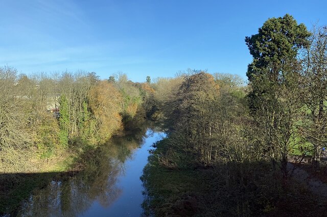
Myton is a small village located in the county of Warwickshire, England. It lies approximately 1.5 miles east of the historic town of Warwick, and is situated on the banks of the River Avon. With a population of around 700 people, Myton offers a tranquil and picturesque setting for residents and visitors alike.

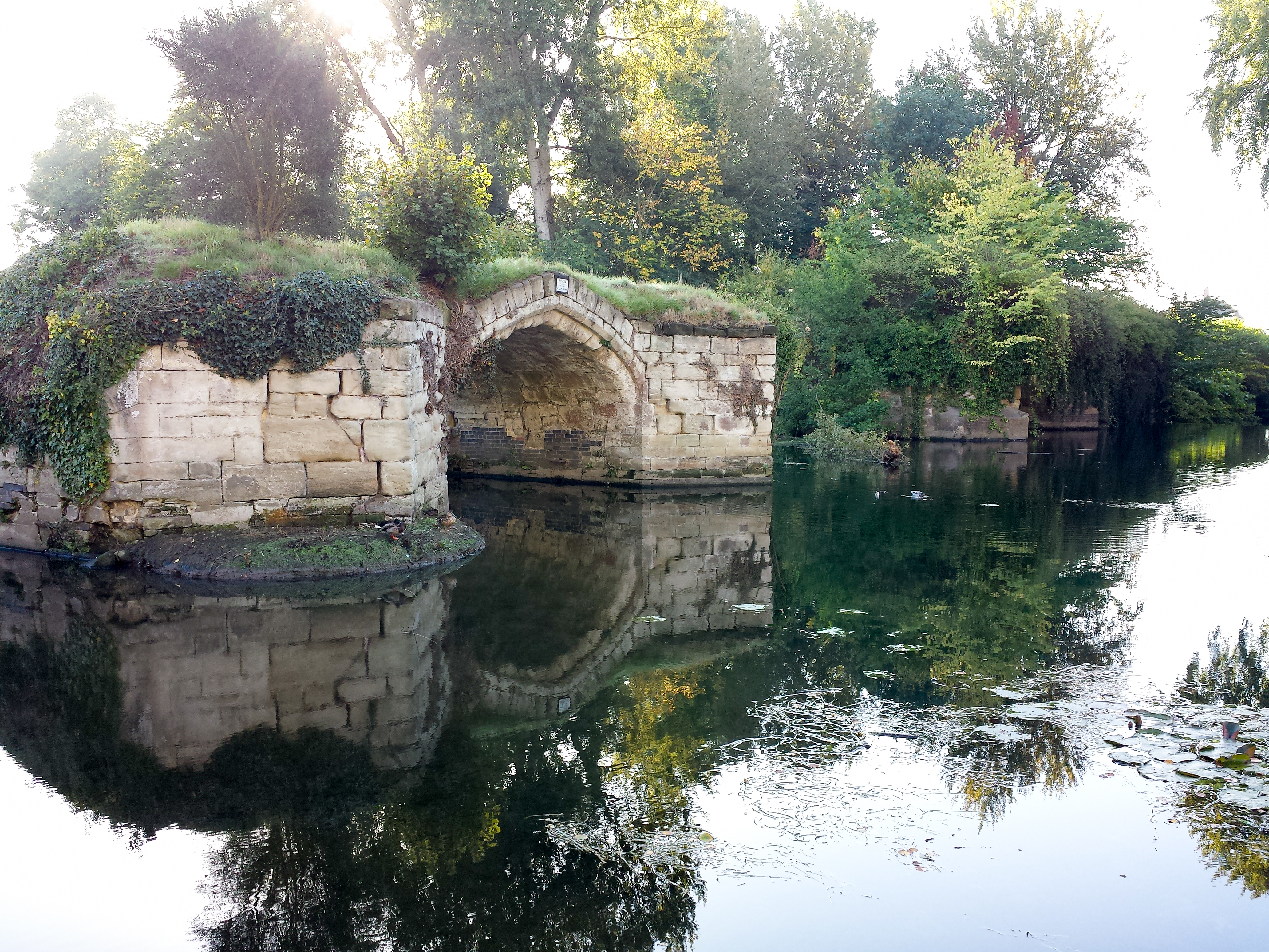
The village is known for its rich history, dating back to the medieval period. It was mentioned in the Domesday Book of 1086, where it was referred to as "Mintone." In the 14th century, Myton became renowned for its annual horse fair, attracting traders from far and wide.

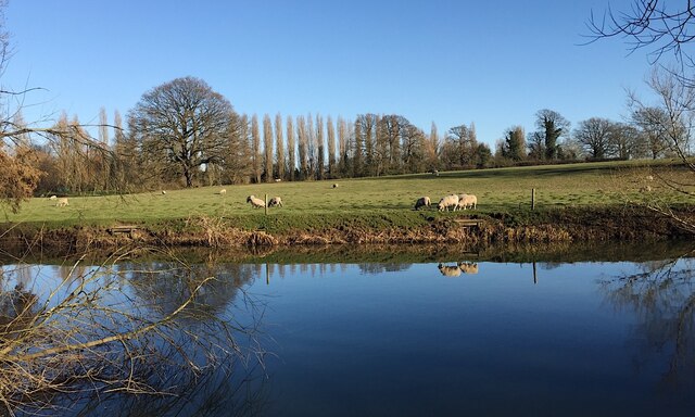
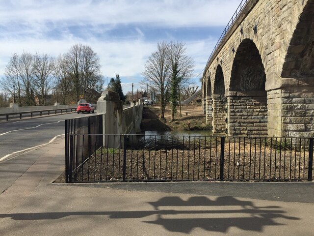
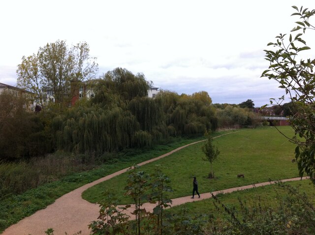
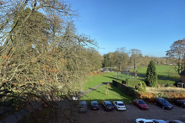
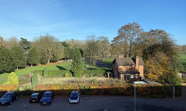
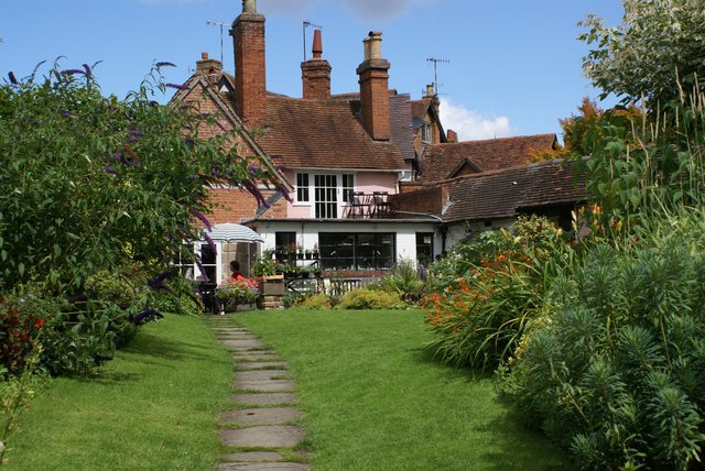
Today, Myton maintains its rural charm, with many traditional thatched cottages and historic buildings still standing. The village is surrounded by beautiful countryside, making it a popular destination for outdoor enthusiasts. The River Avon provides opportunities for boating, fishing, and riverside walks.

Despite its small size, Myton has a strong sense of community. It boasts a village hall, a local pub, and a primary school, which serves the surrounding area. The village also hosts various events throughout the year, including a summer fete and a Christmas market.

Myton's proximity to Warwick means that residents have easy access to a wider range of amenities, including shops, restaurants, and cultural attractions. The nearby Warwick Castle, a well-preserved medieval fortress, is a popular tourist destination.

In conclusion, Myton offers a charming and idyllic retreat in the heart of Warwickshire. With its rich history, stunning natural surroundings, and strong community spirit, it continues to be a sought-after place to live and visit.

If you have any feedback on the listing, please let us know in the comments section below.
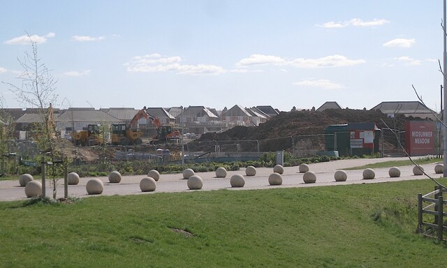
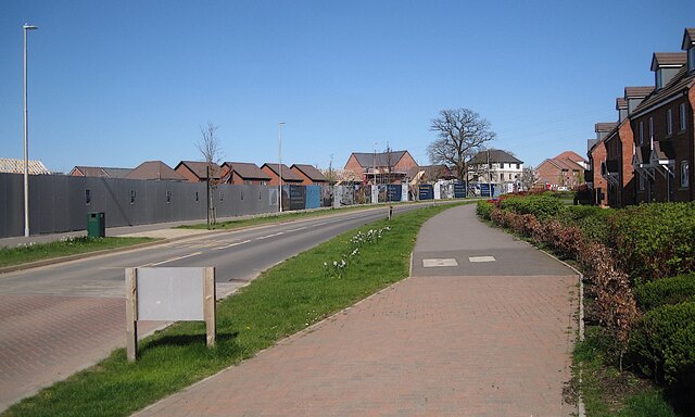
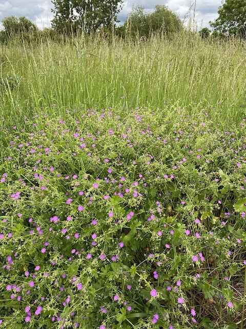
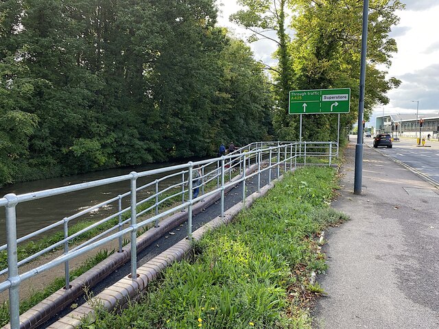
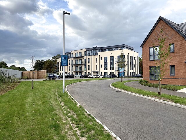
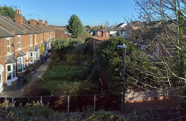
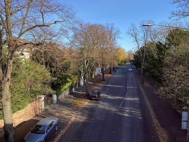
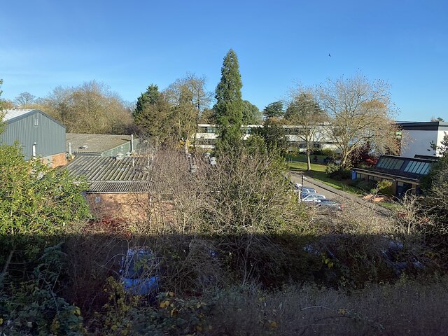
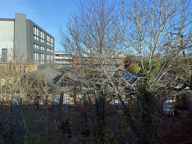
Myton Images

Images are sourced within 2km of 52.280172/-1.571218 or Grid Reference SP2964. Thanks to Geograph Open Source API. All images are credited.

Midsummer Meadow, Myton Meadow once: another estate recently built on the small farms in Myton, Warwick. The road lined with concrete balls is Fusiliers Way; new residents enjoyed speeding on it – or was it just the school run?
Midsummer Meadow, Myton
Meadow once: another estate recently built on the small farms in Myton, Warwick. The road lined with concrete balls is Fusiliers Way; new residents enjoyed speeding on it – or was it just the school run?
Fusiliers Way, Myton Behind the site hoarding is Regency Grange by Bovis Homes. A fine oak only serves as a reminder of the little farms that escaped development for so long.
Fusiliers Way, Myton
Behind the site hoarding is Regency Grange by Bovis Homes. A fine oak only serves as a reminder of the little farms that escaped development for so long.
Cranesbill by Portobello Way, Warwick What a sweetie! A jumble of soft leaves and intensely pink little flowers that gladdened the heart. Thought to be Hedgerow Cranesbill (Geranium pyrenaicum), it flowered for only a day or two.
Cranesbill by Portobello Way, Warwick
What a sweetie! A jumble of soft leaves and intensely pink little flowers that gladdened the heart. Thought to be Hedgerow Cranesbill (Geranium pyrenaicum), it flowered for only a day or two.
Sheep on Jephson's Farm across the Avon, Myton, Warwick The Lombardy Poplars follow the course of the River Leam <a href="https://www.geograph.org.uk/photo/1229733">SP3065 : Poplars on the Leam</a>. Its confluence with the Avon is out-of-shot left. The farm is bordered by rivers, housing estates and a railway, and is crossed by power lines and the canal. It produces a crop of lambs every year and nothing else.
Sheep on Jephson's Farm across the Avon, Myton, Warwick
The Lombardy Poplars follow the course of the River Leam SP3065 : Poplars on the Leam. Its confluence with the Avon is out-of-shot left. The farm is bordered by rivers, housing estates and a railway, and is crossed by power lines and the canal. It produces a crop of lambs every year and nothing else.
Banks of the River Leam between two bridges, Royal Leamington Spa Vegetation has been removed though it's not clear why or by whom. Environment Agency has been known to remove trees overhanging a river; the land is probably Warwick District Council's. Network Rail, too, has been removing or cutting back trees on the embankment parallel to Princes Drive.
Banks of the River Leam between two bridges, Royal Leamington Spa
Vegetation has been removed though it's not clear why or by whom. Environment Agency has been known to remove trees overhanging a river; the land is probably Warwick District Council's. Network Rail, too, has been removing or cutting back trees on the embankment parallel to Princes Drive.
Footpaths by Rock Mill Lane, Milverton The paths are seen looking north from the Portobello Bridge that takes Emscote Road over the River Avon, which runs among the trees on the left hand side of the picture. In the distance, to the right, can be seen the new bridge that carries Sir Anthony Eden Way over the river and, behind it, the 18th century Rock Mill building, now converted to housing.
Footpaths by Rock Mill Lane, Milverton
The paths are seen looking north from the Portobello Bridge that takes Emscote Road over the River Avon, which runs among the trees on the left hand side of the picture. In the distance, to the right, can be seen the new bridge that carries Sir Anthony Eden Way over the river and, behind it, the 18th century Rock Mill building, now converted to housing.
Vitsœ factory and offices, Old Warwick Road, Royal Leamington Spa Vitsœ makes and sells furniture, much of it to the designs of Dieter Rams. <span class="nowrap"><a title="https://www.vitsoe.com/gb" rel="nofollow ugc noopener" href="https://www.vitsoe.com/gb">Link</a><img style="margin-left:2px;" alt="External link" title="External link - shift click to open in new window" src="https://s1.geograph.org.uk/img/external.png" width="10" height="10"/></span> 
Vitsœ moved to Leamington from London, their modular building being one of two developments on the site of Ford's Foundry: <a href="https://www.geograph.org.uk/photo/2783458">SP3165 : Ford's Foundry 17 January 2012 (3)</a>. The other development was a Morrisons supermarket <a href="https://www.geograph.org.uk/photo/3924104">SP3165 : Morrisons supermarket nearing completion, Old Warwick Road, Leamington</a>.
Vitsœ factory and offices, Old Warwick Road, Royal Leamington Spa
Vitsœ makes and sells furniture, much of it to the designs of Dieter Rams. LinkExternal link Vitsœ moved to Leamington from London, their modular building being one of two developments on the site of Ford's Foundry: SP3165 : Ford's Foundry 17 January 2012 (3). The other development was a Morrisons supermarket SP3165 : Morrisons supermarket nearing completion, Old Warwick Road, Leamington.
Turn for Morrisons and Costa, Old Warwick Road, Royal Leamington Spa In the distance, on the other side of the railway, are new houses on De Normanville Avenue.
Turn for Morrisons and Costa, Old Warwick Road, Royal Leamington Spa
In the distance, on the other side of the railway, are new houses on De Normanville Avenue.
Ramp between canal towpath and Old Warwick Road, Royal Leamington Spa Along the road on the left is the superstore: Morrisons.
Ramp between canal towpath and Old Warwick Road, Royal Leamington Spa
Along the road on the left is the superstore: Morrisons.
Western end of De Normanville Avenue, Royal Leamington Spa
Rear gardens, Milverton, Royal Leamington Spa On the left, small private gardens are across a common footpath access to their corresponding front doors, an unusual arrangement in the area. The rear of this terrace faces Rugby Road. The common access is thought to be off the footpath in the foreground, which runs between Rugby Road and Warwick New Road at the foot of the railway embankment; in the past it may have related to Milverton station, long gone. In shadow on the right of the photo are properties in unadopted Conway Road and the rear of villas in Warwick New Road.
Rear gardens, Milverton, Royal Leamington Spa
On the left, small private gardens are across a common footpath access to their corresponding front doors, an unusual arrangement in the area. The rear of this terrace faces Rugby Road. The common access is thought to be off the footpath in the foreground, which runs between Rugby Road and Warwick New Road at the foot of the railway embankment; in the past it may have related to Milverton station, long gone. In shadow on the right of the photo are properties in unadopted Conway Road and the rear of villas in Warwick New Road.
East towards Leamington on Warwick New Road, Milverton, Royal Leamington Spa From the early 1820s two landowners, Edward Willes and the Earl of Warwick, created a new direct toll-free road between Leamington's growing New Town and Warwick. The stone bridge across the Avon at Portobello was completed in the late 1820s <a href="https://www.geograph.org.uk/photo/3230">SP3065 : Portobello Bridge, Milverton</a>. The road stimulated residential development in Milverton, west of Leamington. Warwick New Road, seen here from a Coventry-Leamington Spa train, is lined with big villas <a href="https://www.geograph.org.uk/photo/6002122">SP3065 : Victorian Housing, Warwick New Road</a>. The first railway connection to the area opened in 1844 between Coventry and Milverton, midway between the town centres, extended around 1850 <a href="https://www.geograph.org.uk/photo/1670005">SP3065 : Looking east at the three-arch railway viaduct on Warwick New Road</a>.
East towards Leamington on Warwick New Road, Milverton, Royal Leamington Spa
From the early 1820s two landowners, Edward Willes and the Earl of Warwick, created a new direct toll-free road between Leamington's growing New Town and Warwick. The stone bridge across the Avon at Portobello was completed in the late 1820s SP3065 : Portobello Bridge, Milverton. The road stimulated residential development in Milverton, west of Leamington. Warwick New Road, seen here from a Coventry-Leamington Spa train, is lined with big villas SP3065 : Victorian Housing, Warwick New Road. The first railway connection to the area opened in 1844 between Coventry and Milverton, midway between the town centres, extended around 1850 SP3065 : Looking east at the three-arch railway viaduct on Warwick New Road.
Warwickshire College of Further Education The mature conifers are a sure sign that decades ago there were Victorian villas and gardens here.
Warwickshire College of Further Education
The mature conifers are a sure sign that decades ago there were Victorian villas and gardens here.
Warwickshire College of Further Education
River Leam, Milverton, Royal Leamington Spa On the left, the Warwickshire College site <a href="https://www.geograph.org.uk/photo/7041106">SP3065 : Warwickshire College of Further Education</a>. On the right, Victoria Park and a Giant Redwood (truncated perhaps by a lightning strike). The view is from a Coventry-Leamington Spa train on the Milverton Viaduct <a href="https://www.geograph.org.uk/photo/1632971">SP3065 : Milverton railway viaduct</a>.
River Leam, Milverton, Royal Leamington Spa
On the left, the Warwickshire College site SP3065 : Warwickshire College of Further Education. On the right, Victoria Park and a Giant Redwood (truncated perhaps by a lightning strike). The view is from a Coventry-Leamington Spa train on the Milverton Viaduct SP3065 : Milverton railway viaduct.
West end of Victoria Park, Royal Leamington Spa The trees follow the line of the River Leam. On the right is the garden of the lodge. Further away is some fitness equipment and a skate park. The park is the venue for some major bowls tournaments <a href="https://www.geograph.org.uk/photo/3594882">SP3165 : Watching championship bowls matches, Victoria Park</a>. It was laid out in 1897 to mark Queen Victoria's Diamond Jubilee.
West end of Victoria Park, Royal Leamington Spa
The trees follow the line of the River Leam. On the right is the garden of the lodge. Further away is some fitness equipment and a skate park. The park is the venue for some major bowls tournaments SP3165 : Watching championship bowls matches, Victoria Park. It was laid out in 1897 to mark Queen Victoria's Diamond Jubilee.
Lodge, Victoria Park, Royal Leamington Spa The park was laid out in 1897 to mark Queen Victoria's Diamond Jubilee. At one time the lodge would have been occupied by the superintendent of the park. The trees follow the line of the River Leam. The park is the venue for some major bowls tournaments <a href="https://www.geograph.org.uk/photo/3594882">SP3165 : Watching championship bowls matches, Victoria Park</a>.
Lodge, Victoria Park, Royal Leamington Spa
The park was laid out in 1897 to mark Queen Victoria's Diamond Jubilee. At one time the lodge would have been occupied by the superintendent of the park. The trees follow the line of the River Leam. The park is the venue for some major bowls tournaments SP3165 : Watching championship bowls matches, Victoria Park.
Westernmost block of flats, De Normanville Avenue, Royal Leamington Spa The distant block in <a href="https://www.geograph.org.uk/photo/7012280">SP3165 : Western end of De Normanville Avenue, Royal Leamington Spa</a>.
Westernmost block of flats, De Normanville Avenue, Royal Leamington Spa
Show me another place!

Myton is located at Grid Ref: SP2964 (Lat: 52.280172, Lng: -1.571218)

Administrative County: Warwickshire

District: Warwick

Police Authority: Warwickshire

What 3 Words

///drain.galaxy.usual. Near Warwick, Warwickshire

Nearby Locations

Myton

Related Wikis

Nearby Amenities

Located within 500m of 52.280172,-1.571218
Noexit: yes
Lat/Long: 52.2816393/-1.5670613
School
Warwick Preparatory School
Addr City: Warwick
Addr Postcode: CV34 6PL
Addr Street: Banbury Road
Capacity: 520
Fhrs Id: 242486
Isced Level: 0;1
Max Age: 11
Min Age: 3
Operator: Warwick Schools Foundation
Operator Type: private
Phone: +44 1926 491545
Ref GB Uprn: 10013182419
Ref Edubase: 125780
Religion: none
School Boarding: no
School Gender: mixed
School Selective: no
School Trust: no
School Type: independent
Website: https://www.warwickprep.com/
Lat/Long: 52.278224/-1.5763229
Barrier: bollard
Bollard: fixed
Material: metal
Lat/Long: 52.2830757/-1.5714637
Barrier: bollard
Bollard: fixed
Material: metal
Lat/Long: 52.282774/-1.5713106
Bench
Backrest: yes
Lat/Long: 52.2811358/-1.5743397
Bench
Backrest: yes
Lat/Long: 52.2808808/-1.5746026
Bench
Backrest: yes
Lat/Long: 52.2806966/-1.5748987
Bench
Backrest: yes
Lat/Long: 52.2805874/-1.5752373
Bench
Backrest: yes
Lat/Long: 52.2804974/-1.5757632
Bench
Backrest: yes
Lat/Long: 52.2804242/-1.5763438
Bench
Backrest: yes
Lat/Long: 52.2803956/-1.576674
Bench
Backrest: yes
Lat/Long: 52.2803782/-1.5771006
Bench
Backrest: yes
Lat/Long: 52.2809667/-1.5780797
Bench
Backrest: yes
Lat/Long: 52.2807041/-1.5778067
Bench
Backrest: yes
Lat/Long: 52.2805947/-1.5776475
Bus Stop
Bridge End
Bench: no
Bin: no
Bus: yes
Covered: no
Lit: yes
Naptan AtcoCode: 4200F132322
Naptan Bearing: SE
Naptan CommonName: Bridge End
Naptan Crossing: Bridge End
Naptan Indicator: Opp
Naptan Landmark: Squirells
Naptan NaptanCode: waramaga
Naptan PlusbusZoneRef: LMNGTNS
Naptan Street: Banbury Road
Naptan Verified: no
Passenger Information Display: no
Public Transport: platform
Source: naptan_import
Tactile Paving: no
Lat/Long: 52.2776073/-1.5772518
Bus Stop
Myton School
Bench: no
Bin: no
Bus: yes
Covered: no
Lit: yes
Naptan AtcoCode: 4200F145302
Naptan Bearing: SW
Naptan CommonName: Myton School
Naptan Indicator: Adj
Naptan Landmark: Myton School
Naptan NaptanCode: waraptjm
Naptan PlusbusZoneRef: LMNGTNS
Naptan Street: Myton Road
Naptan Verified: no
Passenger Information Display: no
Physically Present: yes
Public Transport: platform
Shelter: no
Source: naptan_import
Tactile Paving: no
Lat/Long: 52.281077/-1.5647004
Bus Stop
Myton School
Bench: no
Bin: no
Bus: yes
Covered: no
Lit: yes
Naptan AtcoCode: 4200F145401
Naptan Bearing: NE
Naptan CommonName: Myton School
Naptan Indicator: Opp
Naptan Landmark: Myton School
Naptan NaptanCode: waraptjp
Naptan PlusbusZoneRef: LMNGTNS
Naptan Street: Myton Road
Passenger Information Display: no
Physically Present: yes
Public Transport: platform
Shelter: no
Source: naptan_import
Tactile Paving: no
Lat/Long: 52.2807961/-1.567705
Bus Stop
Warwick School
Bench: no
Bin: no
Bus: yes
Covered: no
Lit: yes
Naptan AtcoCode: 4200F145402
Naptan Bearing: SW
Naptan CommonName: Warwick School
Naptan Indicator: Adj
Naptan Landmark: Warwick School
Naptan NaptanCode: waraptjt
Naptan PlusbusZoneRef: LMNGTNS
Naptan Street: Myton Road
Passenger Information Display: no
Physically Present: yes
Public Transport: platform
Shelter: no
Source: naptan_import
Tactile Paving: no
Lat/Long: 52.2801264/-1.5713163
Bus Stop
Banbury Road
Bench: no
Bin: no
Bus: yes
Covered: no
Lit: yes
Naptan AtcoCode: 4200F145501
Naptan Bearing: SW
Naptan CommonName: Banbury Road
Naptan Crossing: Banbury Road
Naptan Indicator: Adj
Naptan NaptanCode: waragamg
Naptan PlusbusZoneRef: LMNGTNS
Naptan Street: Myton Road
Naptan Verified: no
Passenger Information Display: no
Public Transport: platform
Shelter: no
Source: naptan_import
Tactile Paving: no
Lat/Long: 52.2789585/-1.5779865
Bus Stop
Warwick School
Bench: no
Bin: no
Bus: yes
Covered: no
Lit: yes
Naptan AtcoCode: 4200F145502
Naptan Bearing: E
Naptan CommonName: Warwick School
Naptan Indicator: Opp
Naptan Landmark: Warwick School
Naptan NaptanCode: waragamj
Naptan PlusbusZoneRef: LMNGTNS
Naptan Street: Myton Road
Naptan Verified: no
Passenger Information Display: no
Public Transport: platform
Shelter: no
Source: naptan_import
Tactile Paving: yes
Lat/Long: 52.279636/-1.5750206
School
Warwick School (Junior)
Operator: Warwick Schools Foundation
Lat/Long: 52.279561/-1.5719501
Parking
Myton Fields
Access: yes
Capacity Disabled: no
Fee: yes
Parking: surface
Lat/Long: 52.2795799/-1.576615
Theatre
Bridge House Theatre
Lat/Long: 52.2786924/-1.5761732
Post Box
Brand: Royal Mail
Brand Wikidata: Q638098
Brand Wikipedia: en:Royal Mail
Collection Times: Mo-Fr 09:00; Sa 07:00
Operator: Royal Mail
Operator Wikidata: Q638098
Post Box Type: lamp
Ref: CV34 6D
Royal Cypher: EIIR
Royal Cypher Wikidata: Q33102113
Source: survey
Lat/Long: 52.2812497/-1.5644851
Crossing
Button Operated: yes
Crossing: traffic_signals
Crossing Island: no
Crossing Markings: dots
Crossing Ref: toucan
Kerb: lowered
Tactile Paving: yes
Traffic Signals Sound: yes
Traffic Signals Vibration: yes
Lat/Long: 52.2804855/-1.569515
Barrier: kerb
Kerb: lowered
Tactile Paving: yes
Lat/Long: 52.2807742/-1.5670784
Crossing
Crossing: unmarked
Crossing Island: no
Crossing Markings: no
Kerb: lowered
Tactile Paving: yes
Lat/Long: 52.281135/-1.5642266
Barrier: kerb
Kerb: lowered
Tactile Paving: yes
Lat/Long: 52.28112/-1.5643339
Barrier: kerb
Kerb: lowered
Tactile Paving: yes
Lat/Long: 52.2811466/-1.564169
Barrier: kerb
Kerb: lowered
Tactile Paving: yes
Lat/Long: 52.2811613/-1.5641032
Crossing
Crossing: unmarked
Crossing Island: no
Crossing Markings: no
Kerb: lowered
Tactile Paving: yes
Lat/Long: 52.2811723/-1.5640491
Barrier: height_restrictor
Maxheight: 1.8
Lat/Long: 52.2802787/-1.5667602
Traffic Calming: bump
Lat/Long: 52.2795801/-1.566123
Traffic Calming: bump
Lat/Long: 52.2792137/-1.5657573
Barrier: height_restrictor
Maxheight: 2.1
Lat/Long: 52.2813557/-1.5641946
Crossing
Crossing: unmarked
Crossing Island: yes
Crossing Markings: no
Kerb: lowered
Tactile Paving: yes
Traffic Calming: island
Lat/Long: 52.2810461/-1.5655861
Barrier: swing_gate
Locked: yes
Lat/Long: 52.2835078/-1.5717601
Barrier: swing_gate
Swing Gate Type: single
Lat/Long: 52.2843719/-1.572606
Warwick School Swimming Pool
Covered: yes
Leisure: swimming_pool
Operator: Warwick School
Source: Local knowledge
Sport: swimming
Lat/Long: 52.2791221/-1.5715711
Crossing
Lat/Long: 52.2790798/-1.5760433
Post Box
Brand: Royal Mail
Brand Wikidata: Q638098
Brand Wikipedia: en:Royal Mail
Collection Times: Mo-Fr 09:00, Sa 07:00
Operator: Royal Mail
Operator Wikidata: Q638098
Post Box Mounting: brick_pillar
Post Box Type: wall
Ref: CV34 150
Royal Cypher: EIIR
Royal Cypher Wikidata: Q33102113
Source: survey
Lat/Long: 52.2798074/-1.5739706
Historic: memorial
Inscription: Kingfisher Pool - For the yound and disabled - Junior angling committee of Warwick & District
Material: stone
Memorial: plaque
Noname: yes
Lat/Long: 52.28244/-1.5702846
Bicycle Parking
Bicycle Parking: stands
Capacity: 6
Check Date Capacity: 2020-12-16
Covered: no
Lit: yes
Stands: 3
Lat/Long: 52.2834912/-1.5719671
Fire Hydrant
Emergency: fire_hydrant
Fire Hydrant Diameter: 150
Fire Hydrant Position: sidewalk
Fire Hydrant Type: underground
Operator: Severn Trent Water
Water Source: main
Lat/Long: 52.2811611/-1.5650882
Bench
Backrest: yes
Check Date: 2021-04-24
Material: wood
Note: Im memory of boxer Mosh Mancini born Pickard Street 192702007
Seats: 4
Source: survey
Lat/Long: 52.2832358/-1.5707838
Entrance: main
Lat/Long: 52.2828674/-1.577086
Operator: 2nd Warwick Sea Scouts
Waterway: boatyard
Lat/Long: 52.2831379/-1.5719072
Barrier: height_restrictor
Maxheight: 2.1
Lat/Long: 52.2795927/-1.576257
Crossing
Lat/Long: 52.279272/-1.5761279
Barrier: bollard
Lat/Long: 52.2804752/-1.5740401
Barrier: bollard
Lat/Long: 52.2804609/-1.5740307
Barrier: bollard
Lat/Long: 52.2804469/-1.5740213
Barrier: bollard
Lat/Long: 52.2804353/-1.5740125
Generator Method: photovoltaic
Generator Output Electricity: yes
Generator Source: solar
Generator Type: solar_photovoltaic_panel
Location: roof
Power: generator
Lat/Long: 52.2806582/-1.5659185
Generator Method: photovoltaic
Generator Output Electricity: yes
Generator Source: solar
Generator Type: solar_photovoltaic_panel
Location: roof
Power: generator
Lat/Long: 52.2802091/-1.5731957
Generator Method: photovoltaic
Generator Output Electricity: yes
Generator Source: solar
Generator Type: solar_photovoltaic_panel
Location: roof
Power: generator
Lat/Long: 52.2802459/-1.5730152
Give Way
Direction: backward
Lat/Long: 52.2810787/-1.5640793
Give Way
Direction: forward
Lat/Long: 52.2803879/-1.5698737
Generator Method: photovoltaic
Generator Output Electricity: yes
Generator Source: solar
Generator Type: solar_photovoltaic_panel
Location: roof
Power: generator
Lat/Long: 52.2790845/-1.5715405
Generator Method: photovoltaic
Generator Output Electricity: yes
Generator Source: solar
Generator Type: solar_photovoltaic_panel
Location: roof
Power: generator
Lat/Long: 52.2793274/-1.5718905
Generator Method: photovoltaic
Generator Output Electricity: yes
Generator Source: solar
Generator Type: solar_photovoltaic_panel
Location: roof
Power: generator
Lat/Long: 52.2841973/-1.5698761
Traffic Signals
Crossing Markings: no
Traffic Signals: signal
Traffic Signals Direction: forward
Lat/Long: 52.2804747/-1.5695809
Traffic Signals
Crossing Markings: no
Traffic Signals: signal
Traffic Signals Direction: backward
Lat/Long: 52.2804937/-1.5694615
Barrier: kerb
Kerb: lowered
Tactile Paving: yes
Lat/Long: 52.2805165/-1.5695271
Barrier: kerb
Kerb: lowered
Tactile Paving: yes
Lat/Long: 52.2804545/-1.5695029
Crossing
Bicycle: yes
Button Operated: yes
Crossing: traffic_signals
Crossing Island: no
Crossing Markings: dots
Crossing Ref: toucan
Tactile Paving: yes
Traffic Signals Sound: yes
Traffic Signals Vibration: yes
Lat/Long: 52.2792764/-1.5768293
Traffic Signals
Crossing Markings: no
Traffic Signals: signal
Traffic Signals Direction: backward
Lat/Long: 52.2792882/-1.5767584
Traffic Signals
Crossing Markings: no
Traffic Signals: signal
Traffic Signals Direction: forward
Lat/Long: 52.2792643/-1.576902
Street Lamp
Lamp Mount: straight_mast
Lamp Type: led
Ref: 15
Lat/Long: 52.2834682/-1.5719242
Street Lamp
Lamp Mount: straight_mast
Lamp Type: led
Ref: 17
Lat/Long: 52.2835382/-1.5727155
Street Lamp
Lamp Mount: straight_mast
Lamp Type: led
Lat/Long: 52.2833177/-1.5712866
Street Lamp
Lamp Mount: straight_mast
Lamp Type: led
Ref: 14
Lat/Long: 52.2832925/-1.5716284
Street Lamp
Lamp Mount: straight_mast
Lamp Type: led
Ref: 19
Lat/Long: 52.2836581/-1.5734776
Street Lamp
Lamp Mount: straight_mast
Lamp Type: led
Ref: 18
Lat/Long: 52.2835744/-1.5731076
Street Lamp
Lamp Mount: straight_mast
Lamp Type: led
Ref: 13
Lat/Long: 52.2831022/-1.5714339
Street Lamp
Lamp Mount: straight_mast
Lamp Type: led
Ref: 16
Lat/Long: 52.2835457/-1.5723091
Street Lamp
Lamp Mount: straight_mast
Lamp Type: led
Ref: 6
Lat/Long: 52.2835703/-1.574258
Street Lamp
Lamp Mount: straight_mast
Lamp Type: metal-halide
Ref: 25
Lat/Long: 52.2822943/-1.5775166
Street Lamp
Lamp Mount: straight_mast
Lamp Type: led
Ref: 11
Lat/Long: 52.2826303/-1.5767389
Street Lamp
Lamp Mount: straight_mast
Lamp Type: led
Ref: 10
Lat/Long: 52.2828208/-1.5761556
Street Lamp
Lamp Mount: straight_mast
Lamp Type: metal-halide
Ref: 4
Lat/Long: 52.2840122/-1.5742114
Street Lamp
Lamp Mount: straight_mast
Lamp Type: metal-halide
Ref: 5
Lat/Long: 52.2836861/-1.5738781
Street Lamp
Lamp Mount: straight_mast
Lamp Type: metal-halide
Ref: 8
Lat/Long: 52.2832305/-1.5753466
Street Lamp
Lamp Mount: straight_mast
Lamp Type: metal-halide
Ref: 24
Lat/Long: 52.2825068/-1.5770498
Street Lamp
Lamp Mount: straight_mast
Lamp Type: metal-halide
Ref: 7
Lat/Long: 52.2834462/-1.5746882
Street Lamp
Lamp Mount: straight_mast
Lamp Type: led
Ref: 9
Lat/Long: 52.2830482/-1.5757432
Street Lamp
Lamp Mount: straight_mast
Lamp Type: led
Ref: 20
Lat/Long: 52.283799/-1.5737953
Street Lamp
Lamp Mount: straight_mast
Lamp Type: led
Ref: 4
Lat/Long: 52.2811568/-1.570719
Street Lamp
Lamp Mount: straight_mast
Lamp Type: led
Ref: 6
Lat/Long: 52.2814598/-1.571359
Street Lamp
Lamp Mount: straight_mast
Lamp Type: led
Ref: 2
Lat/Long: 52.2808091/-1.5701414
Street Lamp
Lamp Mount: straight_mast
Lamp Type: led
Ref: 5
Lat/Long: 52.2813108/-1.5710356
Street Lamp
Lamp Mount: straight_mast
Lamp Type: led
Ref: 1
Lat/Long: 52.2806166/-1.5698914
Street Lamp
Lamp Mount: straight_mast
Lamp Type: led
Ref: 12
Lat/Long: 52.2827665/-1.5713765
Street Lamp
Lamp Mount: straight_mast
Lamp Type: led
Ref: 8
Lat/Long: 52.2818781/-1.5717833
Street Lamp
Lamp Mount: straight_mast
Lamp Type: led
Ref: 7
Lat/Long: 52.2816252/-1.5716774
Street Lamp
Lamp Mount: straight_mast
Lamp Type: led
Ref: 9
Lat/Long: 52.2821288/-1.5716768
Crossing
Crossing: unmarked
Crossing Markings: no
Tactile Paving: yes
Lat/Long: 52.279438/-1.5761431
Crossing
Crossing: unmarked
Crossing Island: no
Tactile Paving: yes
Lat/Long: 52.2799164/-1.5732547
Crossing
Crossing: unmarked
Crossing Island: no
Crossing Markings: no
Tactile Paving: yes
Lat/Long: 52.2803603/-1.5705956
Bicycle Parking
Bicycle Parking: stands
Capacity: 6
Covered: no
Lat/Long: 52.27949/-1.5762458
Street Lamp
Lamp Mount: bent_mast
Lamp Type: led
Ref: 30
Lat/Long: 52.2812239/-1.5645158
Street Lamp
Lamp Mount: bent_mast
Lamp Type: led
Ref: 29
Lat/Long: 52.2810764/-1.5650396
Street Lamp
Lamp Mount: straight_mast
Lamp Type: led
Ref: 28
Lat/Long: 52.281107/-1.5654513
Street Lamp
Lamp Mount: bent_mast
Lamp Type: led
Ref: 27
Lat/Long: 52.2809327/-1.566123
Street Lamp
Lamp Mount: bent_mast
Lamp Type: led
Ref: 26
Lat/Long: 52.2809504/-1.5666443
Street Lamp
Lamp Mount: straight_mast
Lamp Type: led
Ref: 25
Lat/Long: 52.2807842/-1.5672236
Street Lamp
Lamp Mount: bent_mast
Lamp Type: led
Ref: 24
Lat/Long: 52.2807942/-1.5677089
Street Lamp
Lamp Mount: bent_mast
Lamp Type: led
Ref: 23
Lat/Long: 52.2806354/-1.5682468
Street Lamp
Lamp Mount: bent_mast
Lamp Type: led
Ref: 22
Lat/Long: 52.2806406/-1.5687615
Street Lamp
Lamp Mount: bent_mast
Lamp Type: led
Ref: 21
Lat/Long: 52.2804455/-1.5693472
Street Lamp
Lamp Mount: bent_mast
Lamp Type: led
Ref: 20
Lat/Long: 52.2804842/-1.5699299
Street Lamp
Lamp Mount: bent_mast
Lamp Type: led
Ref: 19
Lat/Long: 52.2804412/-1.5703157
Street Lamp
Lamp Mount: bent_mast
Lamp Type: led
Lat/Long: 52.2803021/-1.570846
Street Lamp
Lamp Mount: bent_mast
Lamp Type: led
Ref: 17
Lat/Long: 52.2801029/-1.5713138
Street Lamp
Lamp Mount: bent_mast
Lamp Type: led
Lat/Long: 52.2801373/-1.5718848
Street Lamp
Lamp Mount: bent_mast
Lamp Type: led
Ref: 15
Lat/Long: 52.2799672/-1.5723698
Street Lamp
Lamp Mount: bent_mast
Lamp Type: led
Lat/Long: 52.2799662/-1.5729157
Street Lamp
Lamp Mount: bent_mast
Lamp Type: led
Ref: 13
Lat/Long: 52.2797942/-1.5733734
Street Lamp
Lamp Mount: bent_mast
Lamp Type: led
Ref: 12
Lat/Long: 52.2797187/-1.573899
Street Lamp
Lamp Mount: bent_mast
Lamp Type: led
Ref: 11
Lat/Long: 52.2796227/-1.5744691
Street Lamp
Lamp Mount: bent_mast
Lamp Type: led
Ref: 10
Lat/Long: 52.2795309/-1.5749823
Street Lamp
Lamp Mount: bent_mast
Lamp Type: led
Ref: 9
Lat/Long: 52.2794492/-1.5755258
Street Lamp
Lamp Mount: bent_mast
Lamp Type: led
Ref: 8
Lat/Long: 52.2793565/-1.5760585
Street Lamp
Lamp Mount: bent_mast
Lamp Type: led
Ref: 7
Lat/Long: 52.2792428/-1.5765732
Street Lamp
Lamp Mount: straight_mast
Lamp Type: led
Ref: 6
Lat/Long: 52.2793484/-1.5768692
Street Lamp
Lamp Mount: straight_mast
Lamp Type: led
Ref: 5
Lat/Long: 52.2791988/-1.576795
Street Lamp
Lamp Mount: bent_mast
Lamp Type: led
Ref: 4
Lat/Long: 52.2791831/-1.5770918
Street Lamp
Lamp Mount: bent_mast
Lamp Type: led
Ref: 3
Lat/Long: 52.2790975/-1.5776112
Street Lamp
Lamp Mount: bent_mast
Lamp Type: led
Ref: 2
Lat/Long: 52.2791284/-1.5779583
Street Lamp
Lamp Mount: bent_mast
Lamp Type: led
Ref: 22
Lat/Long: 52.277636/-1.5772662
Give Way
Direction: forward
Lat/Long: 52.2842033/-1.5695641
Board Type: notice
Information: board
Tourism: information
Lat/Long: 52.2805508/-1.5697207
Street Lamp
Lamp Mount: straight_mast
Lamp Type: led
Ref: 10
Lat/Long: 52.2823215/-1.5714218
Bench
Backrest: yes
Material: wood
Seats: 3
Lat/Long: 52.2835535/-1.5729021
Street Lamp
Lamp Mount: straight_mast
Lamp Type: led
Ref: 11
Lat/Long: 52.2825125/-1.5712561
Grit Bin
Seasonal: no
Lat/Long: 52.2811288/-1.5706607
Barrier: bollard
Bollard: fixed
Material: wood
Lat/Long: 52.280537/-1.569753
Barrier: bollard
Bollard: fixed
Material: wood
Lat/Long: 52.280535/-1.5697763
Camera Mount: pole
Camera Type: dome
Man Made: surveillance
Operator: Warwick District Council
Surveillance: public
Surveillance Type: camera
Lat/Long: 52.2836951/-1.5738601
Waste Basket
Operator: Warwick District Council
Waste: trash
Lat/Long: 52.2811219/-1.5708252
Street Lamp
Lamp Mount: straight_mast
Lamp Type: led
Ref: 4
Lat/Long: 52.2804183/-1.5694874
Waste Basket
Operator: Warwick District Council
Waste: trash;cigarettes;dog_excrement
Lat/Long: 52.2816557/-1.5716056
Waste Basket
Operator: Warwick District Council
Waste: trash;cigarettes
Lat/Long: 52.2837386/-1.5738108
Waste Basket
Operator: Warwick District Council
Waste: trash
Lat/Long: 52.2809671/-1.5702655
Generator Source: solar
Location: roof
Power: generator
Lat/Long: 52.2844356/-1.5721962
Street Lamp
Lamp Mount: straight_mast
Lamp Type: led
Ref: 3
Lat/Long: 52.2809919/-1.5704192
Generator Source: solar
Location: roof
Power: generator
Lat/Long: 52.2843563/-1.5721003
Barrier: bollard
Bollard: fixed
Material: wood
Lat/Long: 52.2805414/-1.5697263
Generator Source: solar
Location: roof
Power: generator
Lat/Long: 52.2844016/-1.5721554
Bench
Backrest: yes
Material: metal
Seats: 3
Lat/Long: 52.2835473/-1.5724407
Camera Mount: pole
Camera Type: dome
Man Made: surveillance
Surveillance: public
Surveillance Type: camera
Lat/Long: 52.2835113/-1.5718777
Waste Basket
Operator: Warwick District Council
Waste: trash
Lat/Long: 52.2827075/-1.5712271
Street Lamp
Lamp Mount: straight_mast
Lamp Type: led
Ref: 5
Lat/Long: 52.2805479/-1.5695463
Bench
Backrest: yes
Material: wood
Seats: 3
Lat/Long: 52.2836137/-1.5733044
Waste Basket
Waste: trash;cigarettes
Lat/Long: 52.280556/-1.5697269
Historic: memorial
Inscription: IN MEMORY OF RICHARD LEAHY YOUNG ANGLER 1979-1996
Material: wood
Memorial: plaque
Noname: yes
Lat/Long: 52.2824498/-1.5702427
Waste Basket
Waste: trash;cigarettes
Lat/Long: 52.2835791/-1.571043
Entrance: main
Lat/Long: 52.283101/-1.5757428
Entrance: yes
Lat/Long: 52.283269/-1.5718196
Myton School
Bus: yes
Public Transport: stop_position
Traffic Sign: GB:970
Lat/Long: 52.2807597/-1.5676953
Warwick School
Bus: yes
Public Transport: stop_position
Traffic Sign: GB:970
Lat/Long: 52.2801894/-1.5713498
Bus: yes
Public Transport: stop_position
Traffic Sign: GB:970
Lat/Long: 52.2795822/-1.5749998
Bus: yes
Public Transport: stop_position
Traffic Sign: GB:970
Lat/Long: 52.2790747/-1.5780278
Myton School
Bus: yes
Public Transport: stop_position
Traffic Sign: GB:970
Lat/Long: 52.2811571/-1.5647265
Street Lamp
Lamp Mount: straight_mast
Lamp Type: led
Ref: 1
Lat/Long: 52.2802383/-1.5697037
Street Lamp
Lamp Mount: straight_mast
Lamp Type: led
Ref: 2
Lat/Long: 52.279908/-1.5695112
Street Lamp
Lamp Mount: straight_mast
Lamp Type: led
Ref: 3
Lat/Long: 52.2796096/-1.5695544
Street Lamp
Lamp Mount: straight_mast
Lamp Type: led
Ref: 4
Lat/Long: 52.2793389/-1.5695225
Street Lamp
Lamp Mount: straight_mast
Lamp Type: led
Ref: 5
Lat/Long: 52.2790834/-1.5692756
Street Lamp
Lamp Mount: straight_mast
Lamp Type: led
Ref: 6
Lat/Long: 52.2790807/-1.5687793
Give Way
Direction: forward
Lat/Long: 52.2811751/-1.5642985
Street Lamp
Lamp Mount: straight_mast
Lamp Type: metal-halide
Ref: 15
Lat/Long: 52.2810983/-1.5642264
Street Lamp
Lamp Mount: straight_mast
Lamp Type: led
Ref: 1
Lat/Long: 52.2809623/-1.5674325
Street Lamp
Lamp Mount: straight_mast
Lamp Type: led
Ref: 2
Lat/Long: 52.2811607/-1.5675444
Street Lamp
Lamp Mount: straight_mast
Lamp Type: led
Ref: 3
Lat/Long: 52.2813515/-1.5675342
Street Lamp
Lamp Mount: straight_mast
Lamp Type: led
Ref: 4
Lat/Long: 52.2815363/-1.5676584
Street Lamp
Lamp Mount: straight_mast
Lamp Type: led
Ref: 5
Lat/Long: 52.2815147/-1.5681138
Street Lamp
Lamp Mount: straight_mast
Lamp Type: led
Ref: 6
Lat/Long: 52.2814455/-1.5685485
Street Lamp
Lamp Mount: straight_mast
Lamp Type: led
Ref: 7
Lat/Long: 52.2815149/-1.5690279
Street Lamp
Lamp Mount: straight_mast
Lamp Type: led
Ref: 1
Lat/Long: 52.281251/-1.5653487
Street Lamp
Lamp Mount: straight_mast
Lamp Type: led
Ref: 2
Lat/Long: 52.28146/-1.5652638
Street Lamp
Lamp Mount: straight_mast
Lamp Type: led
Ref: 3
Lat/Long: 52.2817923/-1.5653885
Street Lamp
Lamp Mount: straight_mast
Lamp Type: led
Lat/Long: 52.2819367/-1.5659618
Street Lamp
Lamp Mount: straight_mast
Lamp Type: led
Ref: 5
Lat/Long: 52.2817628/-1.566353
Street Lamp
Lamp Mount: straight_mast
Lamp Type: led
Ref: 6
Lat/Long: 52.2817096/-1.5669477
Generator Method: photovoltaic
Generator Output Electricity: yes
Generator Source: solar
Generator Type: solar_photovoltaic_panel
Location: roof
Power: generator
Lat/Long: 52.2809132/-1.5688696
Traffic Calming: bump
Lat/Long: 52.2804029/-1.566844
Traffic Calming: bump
Lat/Long: 52.2799883/-1.5665176
Street Lamp
Lamp Mount: bent_mast
Lamp Type: led
Lat/Long: 52.284331/-1.5709723
Street Lamp
Lamp Mount: straight_mast
Lamp Type: led
Ref: 7
Lat/Long: 52.2839446/-1.5704784
Street Lamp
Lamp Mount: straight_mast
Lamp Type: led
Ref: 6
Lat/Long: 52.2841624/-1.5706238
Street Lamp
Lamp Mount: straight_mast
Lamp Type: led
Ref: 8
Lat/Long: 52.2838289/-1.5701889
Street Lamp
Lamp Mount: straight_mast
Lamp Type: led
Ref: 1
Lat/Long: 52.2840621/-1.5699519
Street Lamp
Lamp Mount: straight_mast
Lamp Type: led
Ref: 2
Lat/Long: 52.2841524/-1.5695193
Street Lamp
Lamp Mount: straight_mast
Lamp Type: led
Ref: 3
Lat/Long: 52.2843249/-1.5690652
Street Lamp
Lamp Mount: straight_mast
Lamp Type: led
Lat/Long: 52.2843957/-1.5698665
Street Lamp
Lamp Mount: straight_mast
Lamp Type: led
Ref: 10
Lat/Long: 52.2845621/-1.5718682
Street Lamp
Lamp Mount: straight_mast
Lamp Type: led
Ref: 11
Lat/Long: 52.2845115/-1.5723446
Street Lamp
Lamp Mount: straight_mast
Lamp Type: led
Ref: 12
Lat/Long: 52.2841453/-1.5720046
Street Lamp
Lamp Mount: straight_mast
Lamp Type: led
Ref: 14
Lat/Long: 52.2838606/-1.5717027
Street Lamp
Lamp Mount: straight_mast
Lamp Type: led
Ref: 17
Lat/Long: 52.2837294/-1.5713358
Street Lamp
Lamp Mount: straight_mast
Lamp Type: led
Ref: 18
Lat/Long: 52.2835086/-1.5711737
Street Lamp
Lamp Mount: straight_mast
Lamp Type: led
Ref: 1
Lat/Long: 52.2835438/-1.5717652
Street Lamp
Lamp Mount: straight_mast
Lamp Type: led
Ref: 19
Lat/Long: 52.2836779/-1.5706609
Street Lamp
Lamp Mount: straight_mast
Lat/Long: 52.2843666/-1.5734908
Street Lamp
Lamp Mount: straight_mast
Lat/Long: 52.2841526/-1.5738918
Give Way
Direction: forward
Lat/Long: 52.2808192/-1.5670167
Give Way
Direction: forward
Lat/Long: 52.2811307/-1.5652105
Give Way
Direction: backward
Lat/Long: 52.2808563/-1.5672883
Man Made: utility_pole
Material: wood
Operator: Openreach
Utility: telecom
Lat/Long: 52.2805984/-1.5659728
Myton High School
Brand: National Grid
Brand Wikidata: Q1465461
Frequency: 50
Operator: National Grid Electricity Distribution
Operator Old: Western Power Distribution
Operator Wikidata: Q7988183
Owner: National Grid Electricity Distribution (East Midlands) Plc
Owner Wikidata: Q114348127
Power: substation
Ref: 42D 4057/932257
Substation: minor_distribution
Voltage: 11000
Lat/Long: 52.2805735/-1.5659699
Man Made: utility_pole
Material: wood
Operator: Openreach
Utility: telecom
Lat/Long: 52.2808888/-1.5661544
Fire Hydrant
Emergency: fire_hydrant
Fire Hydrant Diameter Signed: no
Fire Hydrant Position: sidewalk
Fire Hydrant Type: underground
Operator: Severn Trent Water
Water Source: main
Lat/Long: 52.2814092/-1.5692034
Street Lamp
Lamp Mount: straight_mast
Lamp Type: electric
Lat/Long: 52.2816823/-1.5675356
Grit Bin
Seasonal: no
Lat/Long: 52.2815402/-1.5676818
Man Made: utility_pole
Material: wood
Operator: Openreach
Utility: telecom
Lat/Long: 52.280934/-1.5658321
Man Made: flagpole
Lat/Long: 52.2800068/-1.566394
Man Made: utility_pole
Material: wood
Operator: Openreach
Utility: telecom
Lat/Long: 52.2810284/-1.5651081
Man Made: utility_pole
Material: wood
Operator: Openreach
Utility: telecom
Lat/Long: 52.2811352/-1.5644289
Man Made: utility_pole
Material: wood
Operator: Openreach
Utility: telecom
Lat/Long: 52.2812392/-1.5645538
Man Made: utility_pole
Material: wood
Operator: Openreach
Utility: telecom
Lat/Long: 52.2810636/-1.5660767
Man Made: utility_pole
Material: wood
Operator: Openreach
Utility: telecom
Lat/Long: 52.2799292/-1.5724367
Man Made: utility_pole
Material: wood
Operator: Openreach
Utility: telecom
Lat/Long: 52.2804506/-1.5701936
Man Made: utility_pole
Material: wood
Operator: Openreach
Utility: telecom
Lat/Long: 52.2800333/-1.5718585
Man Made: utility_pole
Material: wood
Operator: Openreach
Utility: telecom
Lat/Long: 52.2801937/-1.570892
Generator Method: photovoltaic
Generator Output Electricity: yes
Generator Source: solar
Generator Type: solar_photovoltaic_panel
Location: roof
Power: generator
Lat/Long: 52.2801342/-1.5700061
Barrier: kerb
Check Date Tactile Paving: 2023-11-11
Kerb: flush
Tactile Paving: yes
Lat/Long: 52.2799044/-1.5733297
Board Type: notice
Information: board
Tourism: information
Lat/Long: 52.2807213/-1.570019
Man Made: utility_pole
Material: wood
Operator: Openreach
Utility: telecom
Lat/Long: 52.2799608/-1.5731283
Barrier: kerb
Kerb: lowered
Tactile Paving: yes
Lat/Long: 52.2803677/-1.5705443
Barrier: kerb
Kerb: lowered
Tactile Paving: yes
Lat/Long: 52.2803514/-1.5706567
Man Made: utility_pole
Material: wood
Operator: Openreach
Utility: telecom
Lat/Long: 52.280151/-1.5717851
Man Made: utility_pole
Material: wood
Operator: Openreach
Utility: telecom
Lat/Long: 52.2804607/-1.5691915
Man Made: utility_pole
Material: wood
Operator: Openreach
Utility: telecom
Lat/Long: 52.2805931/-1.5682774
Man Made: utility_pole
Material: wood
Operator: Openreach
Utility: telecom
Lat/Long: 52.2808133/-1.5680002
Man Made: flagpole
Lat/Long: 52.279654/-1.5735229
Barrier: kerb
Kerb: flush
Tactile Paving: yes
Lat/Long: 52.2799314/-1.5731599
Generator Method: photovoltaic
Generator Output Electricity: yes
Generator Source: solar
Generator Type: solar_photovoltaic_panel
Location: roof
Power: generator
Lat/Long: 52.2801998/-1.5700563
Street Lamp
Lamp Mount: straight_mast
Lamp Type: led
Lat/Long: 52.2792949/-1.5759926
Barrier: kerb
Kerb: lowered
Tactile Paving: yes
Lat/Long: 52.2794547/-1.5760385
Barrier: lift_gate
Lat/Long: 52.2792927/-1.57524
Street Lamp
Lamp Mount: straight_mast
Lamp Type: led
Lat/Long: 52.2793179/-1.5756925
Man Made: utility_pole
Material: wood
Operator: Openreach
Utility: telecom
Lat/Long: 52.2791364/-1.5772133
Grit Bin
Seasonal: no
Lat/Long: 52.2789459/-1.5760363
Board Type: history
Information: board
Tourism: information
Lat/Long: 52.2793462/-1.577157
Barrier: kerb
Kerb: lowered
Tactile Paving: yes
Lat/Long: 52.2792425/-1.5768138
Barrier: kerb
Kerb: lowered
Tactile Paving: yes
Lat/Long: 52.2794254/-1.5762228
Street Lamp
Lamp Mount: straight_mast
Lamp Type: led
Lat/Long: 52.2791208/-1.5757757
Fire Hydrant
Emergency: fire_hydrant
Fire Hydrant Diameter: 100
Fire Hydrant Position: sidewalk
Fire Hydrant Type: underground
Operator: Severn Trent Water
Water Source: main
Lat/Long: 52.2795043/-1.5756839
Street Lamp
Lamp Mount: straight_mast
Lamp Type: led
Lat/Long: 52.2792096/-1.5762007
Barrier: kerb
Kerb: lowered
Tactile Paving: yes
Lat/Long: 52.2793064/-1.5768429
Man Made: utility_pole
Material: wood
Operator: Openreach
Utility: telecom
Lat/Long: 52.2841153/-1.5719747
Man Made: utility_pole
Material: wood
Operator: Openreach
Utility: telecom
Lat/Long: 52.2844571/-1.5710031
Man Made: utility_pole
Material: wood
Operator: Openreach
Utility: telecom
Lat/Long: 52.2845599/-1.5719009
Man Made: utility_pole
Material: wood
Operator: Openreach
Utility: telecom
Lat/Long: 52.2843/-1.5697675
Man Made: utility_pole
Material: wood
Operator: Openreach
Utility: telecom
Lat/Long: 52.2837228/-1.5714951
Man Made: utility_pole
Material: wood
Operator: Openreach
Utility: telecom
Lat/Long: 52.2840543/-1.5704858
Man Made: utility_pole
Material: wood
Operator: Openreach
Utility: telecom
Lat/Long: 52.2810095/-1.566534
Man Made: utility_pole
Material: wood
Operator: Openreach
Utility: telecom
Lat/Long: 52.2839703/-1.5701446
Man Made: utility_pole
Material: wood
Operator: Openreach
Utility: telecom
Lat/Long: 52.2843966/-1.5690688
Board Type: notice
Information: board
Tourism: information
Lat/Long: 52.2837754/-1.5739185
Community Centre
Pickard Street Community Centre
Building: yes
Check Date Opening Hours: 2023-06-24
Opening Hours Signed: no
Wheelchair: yes
Lat/Long: 52.2834532/-1.5712798
Fire Hydrant
Emergency: fire_hydrant
Fire Hydrant Diameter Signed: no
Fire Hydrant Position: sidewalk
Fire Hydrant Type: underground
Operator: Severn Trent Water
Water Source: main
Lat/Long: 52.2843578/-1.5689953
Generator Method: photovoltaic
Generator Output Electricity: yes
Generator Source: solar
Generator Type: solar_photovoltaic_panel
Location: roof
Power: generator
Lat/Long: 52.2801639/-1.5701011
Board Type: notice
Information: board
Tourism: information
Lat/Long: 52.2825989/-1.5711556
Man Made: utility_pole
Material: wood
Operator: Openreach
Utility: telecom
Lat/Long: 52.2811344/-1.5700171
Fire Hydrant
Emergency: fire_hydrant
Fire Hydrant Diameter Signed: no
Fire Hydrant Position: sidewalk
Fire Hydrant Type: underground
Operator: Severn Trent Water
Water Source: main
Lat/Long: 52.2845146/-1.5731378
Meadow Road
Brand: National Grid
Brand Wikidata: Q1465461
Frequency: 50
Location: indoor
Operator: National Grid Electricity Distribution
Operator Old: Western Power Distribution
Operator Wikidata: Q7988183
Owner: National Grid Electricity Distribution (East Midlands) Plc
Owner Wikidata: Q114348127
Power: substation
Ref: 42D 4143
Substation: minor_distribution
Voltage: 11000
Lat/Long: 52.2843803/-1.5737821
Information: guidepost
Tourism: information
Lat/Long: 52.2803081/-1.5775706
Barrier: height_restrictor
Maxheight: 2.1
Lat/Long: 52.2796023/-1.5761764
Barrier: height_restrictor
Maxheight: 2.1
Lat/Long: 52.2796522/-1.575192
Waste Basket
Operator: Warwick District Council
Lat/Long: 52.2796641/-1.5752274
Barrier: lift_gate
Lat/Long: 52.2797409/-1.5730577
Crossing
Crossing: unmarked
Crossing Island: yes
Crossing Markings: no
Tactile Paving: yes
Lat/Long: 52.279987/-1.5725449
Warwick School
Brand: National Grid
Brand Wikidata: Q1465461
Frequency: 50
Location: indoor
Operator: National Grid Electricity Distribution
Operator Old: Western Power Distribution
Operator Wikidata: Q7988183
Owner: National Grid Electricity Distribution (East Midlands) Plc
Owner Wikidata: Q114348127
Power: substation
Ref: 42D 3210
Substation: minor_distribution
Voltage: 11000
Lat/Long: 52.2800123/-1.5710146
Crossing
Lat/Long: 52.2801842/-1.5666933
Generator Method: photovoltaic
Generator Output Electricity: yes
Generator Source: solar
Generator Type: solar_photovoltaic_panel
Location: roof
Power: generator
Lat/Long: 52.2761257/-1.5726717
Bicycle Parking
Bicycle Parking: wall_loops
Capacity: 4
Covered: no
Fee: no
Indoor: no
Lit: yes
Lat/Long: 52.2832538/-1.5719253
Bicycle Parking
Bicycle Parking: stands
Capacity: 12
Covered: no
Fee: no
Indoor: no
Lit: yes
Lat/Long: 52.2828155/-1.5763742
Give Way
Direction: forward
Lat/Long: 52.2787686/-1.5771358
Give Way
Direction: forward
Lat/Long: 52.2772052/-1.5762353
Crossing
Lat/Long: 52.2791414/-1.5761478
Give Way
Direction: forward
Lat/Long: 52.2792109/-1.5760657
Give Way
Direction: forward
Lat/Long: 52.2770281/-1.5762172
Give Way
Direction: forward
Lat/Long: 52.2790584/-1.5761384
Give Way
Direction: forward
Lat/Long: 52.2774257/-1.5766127
Give Way
Direction: forward
Lat/Long: 52.278514/-1.5776341
Street Lamp
Lamp Mount: straight_mast
Lamp Type: led
Lat/Long: 52.2770577/-1.5764421
Generator Method: photovoltaic
Generator Output Electricity: yes
Generator Source: solar
Generator Type: solar_photovoltaic_panel
Location: roof
Power: generator
Lat/Long: 52.2806992/-1.5656445
Fire Hydrant
Emergency: fire_hydrant
Fire Hydrant Diameter Signed: no
Fire Hydrant Position: lane
Fire Hydrant Type: underground
Water Source: main
Lat/Long: 52.2837406/-1.5713991
Grit Bin
Seasonal: no
Lat/Long: 52.2839874/-1.5718354
Generator Method: photovoltaic
Generator Output Electricity: yes
Generator Source: solar
Generator Type: solar_photovoltaic_panel
Location: roof
Power: generator
Lat/Long: 52.284017/-1.570318
Fire Hydrant
Emergency: fire_hydrant
Fire Hydrant Diameter Signed: no
Fire Hydrant Position: sidewalk
Fire Hydrant Type: underground
Water Source: main
Lat/Long: 52.2839046/-1.5703982
Crossing
Crossing Island: no
Crossing Markings: yes
Crossing Signals: no
Tactile Paving: yes
Lat/Long: 52.2803368/-1.5698417
Barrier: kerb
Kerb: lowered
Tactile Paving: yes
Lat/Long: 52.2803461/-1.5697857
Crossing
Crossing Markings: no
Tactile Paving: no
Lat/Long: 52.2800398/-1.5719088
Crossing
Lat/Long: 52.2812869/-1.5641226
Crossing
Crossing Island: no
Crossing Markings: no
Crossing Signals: no
Lat/Long: 52.2811482/-1.5652192
Crossing
Crossing Island: no
Crossing Markings: no
Crossing Signals: no
Tactile Paving: no
Lat/Long: 52.2808722/-1.567294
Barrier: kerb
Kerb: lowered
Tactile Paving: yes
Lat/Long: 52.280328/-1.5698911
Barrier: kerb
Kerb: lowered
Tactile Paving: yes
Lat/Long: 52.2808031/-1.5669404
Barrier: kerb
Kerb: lowered
Tactile Paving: no
Lat/Long: 52.2800298/-1.5719659
Barrier: kerb
Kerb: raised
Tactile Paving: no
Lat/Long: 52.2794412/-1.5754682
Barrier: kerb
Kerb: lowered
Tactile Paving: no
Lat/Long: 52.2800501/-1.5718454
Barrier: kerb
Kerb: raised
Tactile Paving: no
Lat/Long: 52.2794676/-1.5753075
Crossing
Lat/Long: 52.2809745/-1.567316
Crossing
Crossing Signals: no
Lat/Long: 52.2815481/-1.567517
Crossing
Crossing Island: no
Crossing Markings: no
Crossing Signals: no
Lat/Long: 52.2812511/-1.5651764
Barrier: bollard
Bollard: removable
Lat/Long: 52.2806376/-1.5668692
Barrier: bollard
Bollard: removable
Lat/Long: 52.2806056/-1.5668561
Barrier: bollard
Bollard: removable
Lat/Long: 52.2805839/-1.5668449
Barrier: bollard
Bollard: removable
Lat/Long: 52.280565/-1.5668365
Barrier: bollard
Bollard: removable
Lat/Long: 52.2805445/-1.5668253
Barrier: bollard
Bollard: removable
Lat/Long: 52.2805267/-1.5668169
Barrier: bollard
Bollard: removable
Lat/Long: 52.2805085/-1.5668048
Barrier: bollard
Bollard: removable
Lat/Long: 52.2804936/-1.5667936
Barrier: bollard
Bollard: removable
Lat/Long: 52.2804719/-1.5667861
The data included in this document is from www.openstreetmap.org. The data is made available under ODbL.

Have you been to Myton?

Leave your review of Myton below (or comments, questions and feedback).