Achreamie

Settlement in Caithness

Scotland

Achreamie

Grazing Land Rough grazing near Skail. The island of Hoy may be seen in the far distance.
Grazing Land Credit: John MacKenzie

Achreamie is a small hamlet located in the county of Caithness, in the northernmost part of mainland Scotland. Situated in the Highland region, this rural community is nestled amidst stunning natural landscapes, offering residents and visitors breathtaking views of the surrounding countryside.

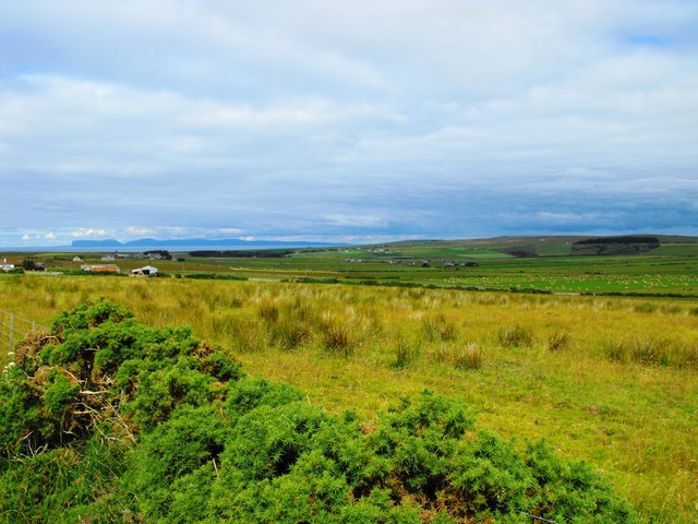
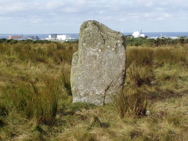
The hamlet of Achreamie is characterized by its tranquil and peaceful atmosphere, making it an ideal retreat for those seeking to escape the hustle and bustle of city life. The area is known for its picturesque rolling hills, lush green fields, and meandering streams, creating a picturesque backdrop for outdoor activities such as hiking, fishing, and birdwatching.

Despite its small size, Achreamie is home to a close-knit community that takes pride in preserving its local heritage. Traditional stone-built cottages can be found scattered throughout the hamlet, showcasing the area's architectural charm and historical significance.

For amenities and services, residents typically rely on nearby towns such as Thurso and Wick, where they can find shops, schools, healthcare facilities, and other essential infrastructure. The proximity to these larger towns allows Achreamie to maintain its rural charm while still providing access to essential resources.

Overall, Achreamie offers a tranquil and idyllic setting for those seeking a peaceful retreat in the stunning Scottish Highlands. Its natural beauty and close-knit community make it an attractive destination for nature enthusiasts and those looking to experience the authentic charm of rural Scotland.

If you have any feedback on the listing, please let us know in the comments section below.

Achreamie Images

Images are sourced within 2km of 58.576758/-3.690381 or Grid Reference ND0166. Thanks to Geograph Open Source API. All images are credited.

Grazing Land Rough grazing near Skail. The island of Hoy may be seen in the far distance.
Grazing Land
Rough grazing near Skail. The island of Hoy may be seen in the far distance.
Cnoc Freiceadain Long Cairn Over 5000 years old.
Cnoc Freiceadain Long Cairn
Over 5000 years old.
Ruin in ploughed field
Heading toward Dounreay On A836
Heading toward Dounreay
On A836
Road northeast at Hallam
Too much wind or too many drams? A836 junction with road to Shebster
Too much wind or too many drams?
A836 junction with road to Shebster
Road to Shebster
Road to Shebster
Grazing land near Achreamie A view looking to the northeast over grazing land near Achreamie. The field boundary is formed of local flagstones.
Grazing land near Achreamie
A view looking to the northeast over grazing land near Achreamie. The field boundary is formed of local flagstones.
Approaching Achreamie A view looking to the southeast along the lane approaching Achreamie.
Approaching Achreamie
A view looking to the southeast along the lane approaching Achreamie.
Approaching Cnoc Freiceadain A view looking to the south towards the chambered cairns on Cnoc Freiceadain.
Approaching Cnoc Freiceadain
A view looking to the south towards the chambered cairns on Cnoc Freiceadain.
Footpath to Cnoc Freiceadain A view looking to the west towards the stile at the start of the footpath to the chambered cairns on Cnoc Freiceadain.
Footpath to Cnoc Freiceadain
A view looking to the west towards the stile at the start of the footpath to the chambered cairns on Cnoc Freiceadain.
Dounreay: Downreay Post Office and postbox № KW14 30 This post office uses a spelling seen hardly anywhere else now. It is certainly not a mistake; the spelling of Downreay on the sign is replicated on the office's counter date-stamp and also on the Post Office branch finder on its website.
Dounreay: Downreay Post Office and postbox № KW14 30
This post office uses a spelling seen hardly anywhere else now. It is certainly not a mistake; the spelling of Downreay on the sign is replicated on the office's counter date-stamp and also on the Post Office branch finder on its website.
Farmhouse and buildings at Skiall
Cattle at Skiall
Cattle at Skiall
View along Cnoc Freicheadain
View along cairn with Dounreay behind.
Upper Dounreay Standing Stone with reactor behind.
Farm track to Stemster Hill
Show me another place!

Achreamie is located at Grid Ref: ND0166 (Lat: 58.576758, Lng: -3.690381)

Unitary Authority: Highland

Police Authority: Highlands and Islands

What 3 Words

///intelligible.flamenco.piglets. Near Reay, Highland

Nearby Locations

Achreamie

Related Wikis

Achreamie

Achreamie is a village in the Scottish council area of Highland. Achreamie is about 6 miles (9.7 km) west of Thurso and is less than two miles from the...

Buldoo

Buldoo (Scottish Gaelic:) in the far north of Scotland, is a small hamlet 0.5 miles south of Dounreay in Thurso, Caithness, Scottish Highlands and is...

RAF Dounreay

RAF Dounreay was built for RAF Coastal Command in 1944, but not used by them. It was transferred to the Royal Navy as HMS Tern II, but not commissioned...

Forss, Highland

Forss is a small hamlet, situated 3 miles west of Thurso, in Caithness, Scottish Highlands and is in the Scottish council area of Highland. Brims Castle...

Nearby Amenities

Located within 500m of 58.576758,-3.690381
Power: pole
Lat/Long: 58.5754352/-3.6844981
Power: pole
Lat/Long: 58.5771709/-3.6947221
Achreamie
Place: hamlet
Lat/Long: 58.5772152/-3.6978221
Power: pole
Lat/Long: 58.579301/-3.6964675
Power: pole
Lat/Long: 58.5794017/-3.6952846
Power: pole
Lat/Long: 58.5794747/-3.6941065
Power: pole
Lat/Long: 58.5795351/-3.6928656
Power: pole
Lat/Long: 58.579588/-3.6916778
Power: pole
Lat/Long: 58.5796232/-3.6904852
Power: pole
Lat/Long: 58.5802273/-3.6898769
Power: pole
Lat/Long: 58.5808188/-3.6893023
Power: pole
Lat/Long: 58.5777034/-3.6978892
Power: pole
Lat/Long: 58.5774476/-3.6963681
Power: pole
Lat/Long: 58.5766546/-3.6917211
Power: pole
Lat/Long: 58.5763499/-3.6899502
Power: pole
Lat/Long: 58.5760415/-3.6881574
Power: pole
Lat/Long: 58.5757314/-3.6863546
Power: pole
Lat/Long: 58.5762886/-3.6836134
Power: pole
Lat/Long: 58.5771934/-3.6826754
Power: pole
Lat/Long: 58.5771105/-3.6946352
Power: pole
Lat/Long: 58.5766989/-3.6941741
Power: pole
Lat/Long: 58.5764195/-3.6933364
Power: pole
Lat/Long: 58.5761501/-3.6925518
Power: pole
Lat/Long: 58.5758997/-3.6918034
Power: pole
Lat/Long: 58.5756668/-3.6910767
Power: pole
Lat/Long: 58.57541/-3.6903573
Power: pole
Lat/Long: 58.5782999/-3.6829482
Power: pole
Lat/Long: 58.5785264/-3.6841939
Power: pole
Lat/Long: 58.5787353/-3.68543
Power: pole
Lat/Long: 58.5789367/-3.6866033
The data included in this document is from www.openstreetmap.org. The data is made available under ODbL.

Have you been to Achreamie?

Leave your review of Achreamie below (or comments, questions and feedback).