Bennacott

Settlement in Cornwall

England

Bennacott

Trees screening the farm buildings at Langdon Farm
Trees screening the farm buildings at Langdon Farm Credit: David Smith

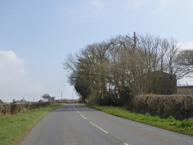
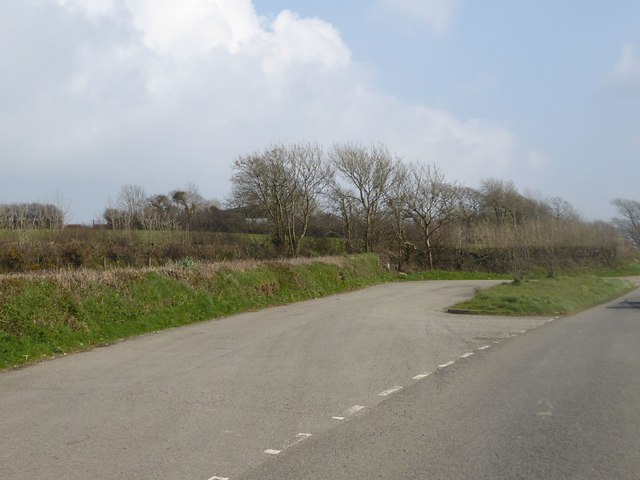
Bennacott is a small village located in the county of Cornwall, England. Situated in the southwest region of the country, it is nestled amidst the picturesque countryside, offering residents and visitors alike a tranquil and idyllic setting.

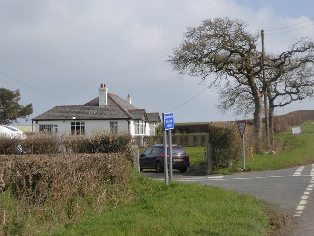
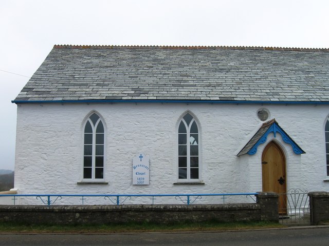
The village is known for its charming and traditional architecture, with many of the buildings dating back to the 18th century. The local stone cottages and thatched roofs add to the village's aesthetic appeal and create a sense of historical charm.

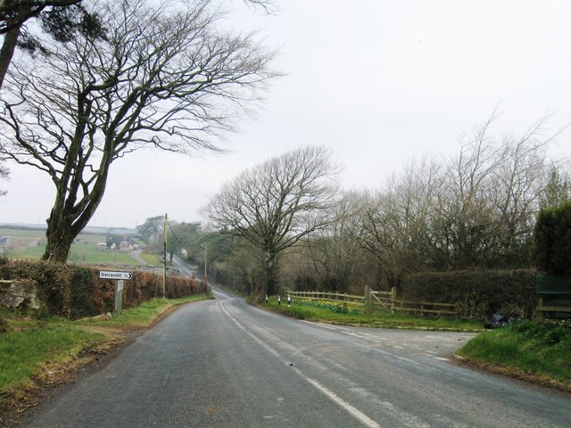
Bennacott is surrounded by lush green fields and rolling hills, providing stunning views of the countryside. The village is also close to the rugged and dramatic coastline that Cornwall is famous for, offering easy access to beautiful beaches and coastal walks.

Despite its small size, Bennacott has a tight-knit community with a strong sense of community spirit. The village boasts a local pub, a small convenience store, and a primary school, catering to the needs of its residents.

For those seeking outdoor activities, the surrounding area offers ample opportunities for hiking, cycling, and exploring the natural beauty of Cornwall. Additionally, the village is within driving distance of popular tourist destinations such as Tintagel Castle and Boscastle Harbour.

Overall, Bennacott offers a peaceful and picturesque escape from the hustle and bustle of city life, making it an ideal location for nature lovers and those seeking a slower pace of life.

If you have any feedback on the listing, please let us know in the comments section below.

Bennacott Images

Images are sourced within 2km of 50.70324/-4.411431 or Grid Reference SX2992. Thanks to Geograph Open Source API. All images are credited.

Trees screening the farm buildings at Langdon Farm
The road junction south of Langdon Farm A solitary bungalow marks this junction
The road junction south of Langdon Farm
A solitary bungalow marks this junction
Valley south of Hillside on B3254
Old Direction Sign - Signpost in Boyton Pyramid spear finial - 3 arms; Cornwall CC iron spear by the UC road, in parish of Boyton (North Cornwall District), in front of terraced houses, on verge, West side of road.

Cornwall & Scilly HER.
HER Number: MCO57744 <span class="nowrap"><a title="https://www.heritagegateway.org.uk/Gateway/Results_Single.aspx?uid=MCO57744&resourceID=1020" rel="nofollow ugc noopener" href="https://www.heritagegateway.org.uk/Gateway/Results_Single.aspx?uid=MCO57744&resourceID=1020">Link</a><img style="margin-left:2px;" alt="External link" title="External link - shift click to open in new window" src="https://s1.geograph.org.uk/img/external.png" width="10" height="10"/></span>

Surveyed

Milestone Society National ID: CW_SX3191
Old Direction Sign - Signpost in Boyton
Pyramid spear finial - 3 arms; Cornwall CC iron spear by the UC road, in parish of Boyton (North Cornwall District), in front of terraced houses, on verge, West side of road. Cornwall & Scilly HER. HER Number: MCO57744 LinkExternal link Surveyed Milestone Society National ID: CW_SX3191
Ordnance Survey Flush Bracket S5212 This can be found on the wall of a building at Bennacott.
For more detail see : <span class="nowrap"><a title="http://www.bench-marks.org.uk/bm20815" rel="nofollow ugc noopener" href="http://www.bench-marks.org.uk/bm20815">Link</a><img style="margin-left:2px;" alt="External link" title="External link - shift click to open in new window" src="https://s1.geograph.org.uk/img/external.png" width="10" height="10"/></span>
Ordnance Survey Flush Bracket S5212
This can be found on the wall of a building at Bennacott. For more detail see : LinkExternal link
Lay-by near Curry Lane This lay-by was created as a result of road realignment; formerly the road had two moderately sharp bends, now it has moderate bends
Lay-by near Curry Lane
This lay-by was created as a result of road realignment; formerly the road had two moderately sharp bends, now it has moderate bends
Old Milestone by the B3254, north of Bennacott Carved stone post by the B3254, in parish of BOYTON (NORTH CORNWALL District), The Grange, 100m North West of Daracott cottage, in hedge on narrow section of road, on East side of road. Kilkhampton County stone, erected by the Local Highways Board in the 19th century. 

Inscription reads:-
LAUNCESTON
6
BUDE
13
KILKHAMPTON
13   

Grade II Listed. List Entry Number: 1142940
<span class="nowrap"><a title="https://historicengland.org.uk/listing/the-list/list-entry/1142940" rel="nofollow ugc noopener" href="https://historicengland.org.uk/listing/the-list/list-entry/1142940">Link</a><img style="margin-left:2px;" alt="External link" title="External link - shift click to open in new window" src="https://s1.geograph.org.uk/img/external.png" width="10" height="10"/></span>

Milestone Society National ID: CW_KHLA13.
Old Milestone by the B3254, north of Bennacott
Carved stone post by the B3254, in parish of BOYTON (NORTH CORNWALL District), The Grange, 100m North West of Daracott cottage, in hedge on narrow section of road, on East side of road. Kilkhampton County stone, erected by the Local Highways Board in the 19th century. Inscription reads:- LAUNCESTON 6 BUDE 13 KILKHAMPTON 13 Grade II Listed. List Entry Number: 1142940 LinkExternal link Milestone Society National ID: CW_KHLA13.
Old Milestone by the B3254, south of Bennacott Carved stone post by the B3254, in parish of BOYTON (NORTH CORNWALL District), Bennacott; opposite Bennacott Kennels and Cattery, by the road, on East side of road. Kilkhampton County stone, erected by the Launceston turnpike trust in the 18th century. 

Inscription reads:-
L
5
BUDE
14
KILK
14
HAMPTON   

Grade II Listed. List Entry Number: 1328013
<span class="nowrap"><a title="https://historicengland.org.uk/listing/the-list/list-entry/1328013" rel="nofollow ugc noopener" href="https://historicengland.org.uk/listing/the-list/list-entry/1328013">Link</a><img style="margin-left:2px;" alt="External link" title="External link - shift click to open in new window" src="https://s1.geograph.org.uk/img/external.png" width="10" height="10"/></span>

Milestone Society National ID: CW_KHLA14.
Old Milestone by the B3254, south of Bennacott
Carved stone post by the B3254, in parish of BOYTON (NORTH CORNWALL District), Bennacott; opposite Bennacott Kennels and Cattery, by the road, on East side of road. Kilkhampton County stone, erected by the Launceston turnpike trust in the 18th century. Inscription reads:- L 5 BUDE 14 KILK 14 HAMPTON Grade II Listed. List Entry Number: 1328013 LinkExternal link Milestone Society National ID: CW_KHLA14.
Old Milestone by the B3254 south of Bennacott Carved stone post by the B3254, in parish of BOYTON (NORTH CORNWALL District), Bennacott; opposite Bennacott Kennels and Cattery, by the road, on East side of road. Kilkhampton County stone, erected by the Launceston turnpike trust in the 18th century. 

Inscription reads:-
L
5
BUDE
14
KILK
14
HAMPTON 

Grade II listed.
List Entry Number: 1328013 <span class="nowrap"><a title="https://historicengland.org.uk/listing/the-list/list-entry/1328013" rel="nofollow ugc noopener" href="https://historicengland.org.uk/listing/the-list/list-entry/1328013">Link</a><img style="margin-left:2px;" alt="External link" title="External link - shift click to open in new window" src="https://s1.geograph.org.uk/img/external.png" width="10" height="10"/></span>
  
Milestone Society National ID: CW_KHLA14.
Old Milestone by the B3254 south of Bennacott
Carved stone post by the B3254, in parish of BOYTON (NORTH CORNWALL District), Bennacott; opposite Bennacott Kennels and Cattery, by the road, on East side of road. Kilkhampton County stone, erected by the Launceston turnpike trust in the 18th century. Inscription reads:- L 5 BUDE 14 KILK 14 HAMPTON Grade II listed. List Entry Number: 1328013 LinkExternal link Milestone Society National ID: CW_KHLA14.
Old Milestone by the B3254, north of Bennacott Carved stone post by the B3254, in parish of BOYTON (NORTH CORNWALL District), The Grange, 100m Northwest of Daracott Cottage, in hedge on narrow section of road, on East side of road. Kilkhampton County stone, erected by the Local Highways Board in the 19th century. 

Inscription reads:-
LAUNCESTON
6
BUDE
13
KILKHAMPTON
13 

Grade II listed.
List Entry Number: 1142940 <span class="nowrap"><a title="https://historicengland.org.uk/listing/the-list/list-entry/1142940" rel="nofollow ugc noopener" href="https://historicengland.org.uk/listing/the-list/list-entry/1142940">Link</a><img style="margin-left:2px;" alt="External link" title="External link - shift click to open in new window" src="https://s1.geograph.org.uk/img/external.png" width="10" height="10"/></span>

Milestone Society National ID: CW_KHLA13.
Old Milestone by the B3254, north of Bennacott
Carved stone post by the B3254, in parish of BOYTON (NORTH CORNWALL District), The Grange, 100m Northwest of Daracott Cottage, in hedge on narrow section of road, on East side of road. Kilkhampton County stone, erected by the Local Highways Board in the 19th century. Inscription reads:- LAUNCESTON 6 BUDE 13 KILKHAMPTON 13 Grade II listed. List Entry Number: 1142940 LinkExternal link Milestone Society National ID: CW_KHLA13.
Bennacott Chapel
Bennacott Chapel
B3254 northbound
B3254 northbound
Field near Nescott From the lane which shaves across the south-west corner of the square, with one of the wind turbines that are now a feature of this part of Cornwall.
Field near Nescott
From the lane which shaves across the south-west corner of the square, with one of the wind turbines that are now a feature of this part of Cornwall.
Farm lane to Youngcott From the junction with the Langdon - Clubworthy lane. The farm lane is followed by footpath 529 2/1. On the right is a wind turbine across the Bolesbridge Water valley.
Farm lane to Youngcott
From the junction with the Langdon - Clubworthy lane. The farm lane is followed by footpath 529 2/1. On the right is a wind turbine across the Bolesbridge Water valley.
Lane near Godcott Farm A line of oaks beside the lane as it approaches the farm.
Lane near Godcott Farm
A line of oaks beside the lane as it approaches the farm.
Lane near Godcott Farm Dropping between banks and trees to cross the Bolesbridge Water.
Lane near Godcott Farm
Dropping between banks and trees to cross the Bolesbridge Water.
Lane past Forda At the junction with the entrance to Forda Cottage (right). The farmhouse at Forda, ahead, has fine chimney stacks. "1844 ...  Vestigial Gothic style" <span class="nowrap"><a title="http://list.historicengland.org.uk/resultsingle.aspx?uid=1160350&searchtype=mapsearch" rel="nofollow ugc noopener" href="http://list.historicengland.org.uk/resultsingle.aspx?uid=1160350&searchtype=mapsearch">Link</a><img style="margin-left:2px;" alt="External link" title="External link - shift click to open in new window" src="https://s1.geograph.org.uk/img/external.png" width="10" height="10"/></span> .
Lane past Forda
At the junction with the entrance to Forda Cottage (right). The farmhouse at Forda, ahead, has fine chimney stacks. "1844 ... Vestigial Gothic style" LinkExternal link .
Lane southeast of Clubworthy The lane close to the scene in <a href="https://www.geograph.org.uk/photo/4391301">SX2892 : Field near Nescott</a>.
Lane southeast of Clubworthy
The lane close to the scene in SX2892 : Field near Nescott.
Show me another place!

Bennacott is located at Grid Ref: SX2992 (Lat: 50.70324, Lng: -4.411431)

Unitary Authority: Cornwall

Police Authority: Devon and Cornwall

What 3 Words

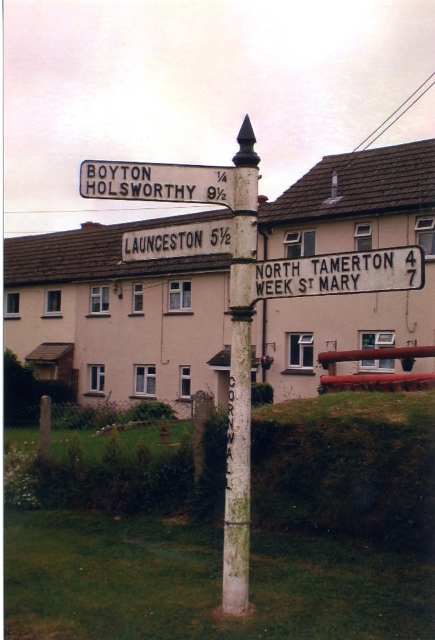
///elevate.quitter.range. Near Boyton, Cornwall

Nearby Locations

Bennacott

Related Wikis

Bennacott

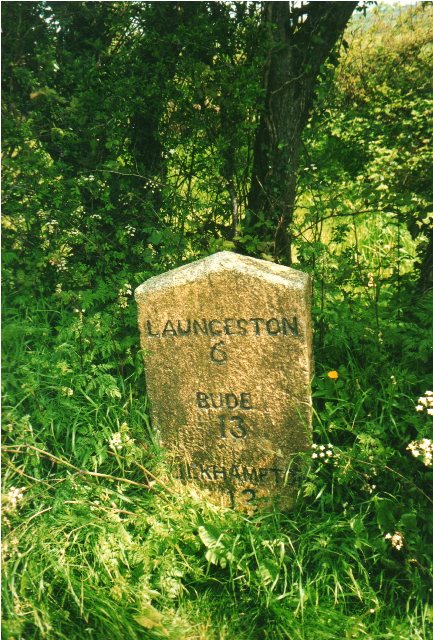
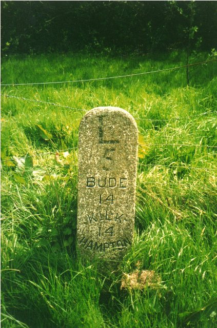
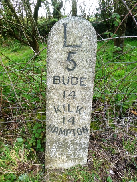
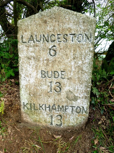
Bennacott is a village in east Cornwall, England, in the United Kingdom. It is five miles (8 km) north of Launceston and in the parish of Boyton. ��2...

North Beer

North Beer is a hamlet in the parish of Boyton in north Cornwall, England. North Beer is west of Boyton. == References ==

Curry Lane

Curry Lane is a hamlet in the parish of Boyton Cornwall, England. == References ==

Bodgate

Bodgate is a farmstead in east Cornwall, England, United Kingdom. It is situated in North Petherwin civil parish about 0.5 miles (0.80 km) south of North...

West Curry

West Curry is a farm north of Bennacott in north Cornwall, England, UK.It appears in the Domesday Book (1086) as Chori, where in 1086 Iovin the Craftsman...

Boyton, Cornwall

Boyton (Cornish: Trevoya) is a civil parish and village in Cornwall, England, United Kingdom. It is situated close to the River Tamar and the border with...

Langdon, Cornwall

Langdon is a hamlet in north Cornwall approximately five miles north of Launceston; it is west of Canworthy. Langdon sits at 50.6839’ latitude and -4.40239954...

Clubworthy

Clubworthy is a hamlet in east Cornwall, England, United Kingdom. It is located six miles (8.5 km) north-northwest of Launceston . == References ==

Nearby Amenities

Located within 500m of 50.70324,-4.411431
Bennacott
Is In: Cornwall, England, UK
Name En: Bennacott
Name Kw: Bosvynna
Place: hamlet
Wikidata: Q4889607
Lat/Long: 50.7037574/-4.4122965
Give Way
Lat/Long: 50.7032816/-4.411225
Power: pole
Lat/Long: 50.7073741/-4.4122446
Power: pole
Lat/Long: 50.7066182/-4.4114587
Power: pole
Lat/Long: 50.7057774/-4.4105789
Power: pole
Lat/Long: 50.7049875/-4.409726
Power: pole
Lat/Long: 50.7041585/-4.4088596
Power: pole
Lat/Long: 50.7038714/-4.4086853
Power: pole
Lat/Long: 50.7035096/-4.4085002
Power: pole
Lat/Long: 50.701996/-4.4047853
Power: pole
Lat/Long: 50.7019535/-4.4059682
Power: pole
Lat/Long: 50.7019043/-4.4072315
Power: pole
Lat/Long: 50.7018618/-4.408291
Power: pole
Lat/Long: 50.7018142/-4.4096401
Power: pole
Lat/Long: 50.7030832/-4.4082642
Power: pole
Lat/Long: 50.7022627/-4.4078028
Power: pole
Lat/Long: 50.7014626/-4.40732
Power: pole
Lat/Long: 50.7004399/-4.4067675
Barrier: yes
Lat/Long: 50.7033285/-4.412017
Post Box
Mapillary: 2340584096122288
Operator: Royal Mail
Operator Wikidata: Q638098
Post Box Mounting: brick_wall
Post Box Type: wall
Lat/Long: 50.7031607/-4.4112997
The data included in this document is from www.openstreetmap.org. The data is made available under ODbL.

Have you been to Bennacott?

Leave your review of Bennacott below (or comments, questions and feedback).