Bendish

Settlement in Hertfordshire North Hertfordshire

England

Bendish

Houses on High Street Whitwell
Houses on High Street Whitwell Credit: David Howard

Bendish is a small village located in Hertfordshire, England. Situated approximately 5 miles east of Hitchin, Bendish is nestled within the picturesque countryside of this county. The village is part of the civil parish of Offley and is home to a close-knit community.

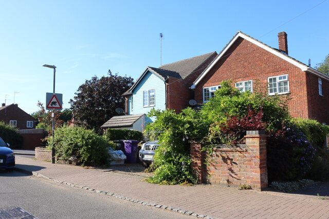
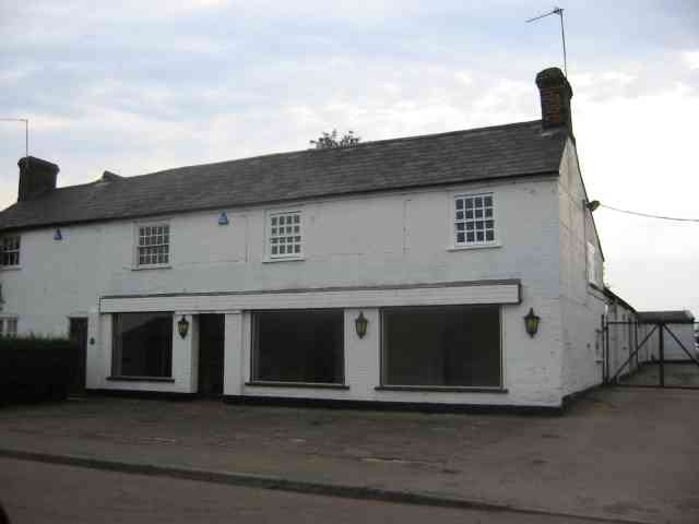
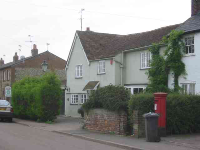
Bendish boasts a rich history, with evidence of settlements dating back to the medieval period. The village is known for its charming architecture, featuring old cottages and traditional houses that add to its rustic appeal. The parish church of St. Margaret, dating back to the 13th century, stands as a prominent landmark in the village.

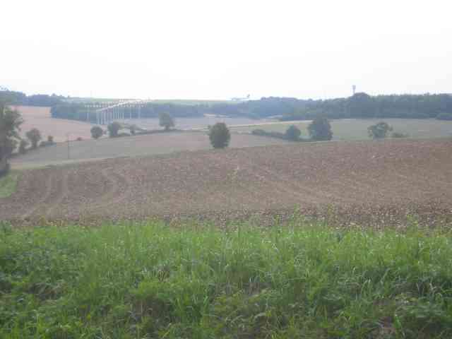
Being surrounded by rolling hills and lush green fields, Bendish offers a tranquil and idyllic setting for residents and visitors alike. The local countryside provides ample opportunities for outdoor activities such as walking, cycling, and horse riding. Additionally, the nearby Offley Holes Woods offers a beautiful woodland area to explore.

While Bendish is primarily a residential area, it benefits from its proximity to larger towns and cities. The village is conveniently located near the A505 road, ensuring easy access to nearby Hitchin and Luton, which offer a wider range of amenities and services.

Overall, Bendish is a charming and peaceful village that offers a perfect escape from the hustle and bustle of city life. With its rich history, beautiful surroundings, and close-knit community, Bendish is a hidden gem within the Hertfordshire countryside.

If you have any feedback on the listing, please let us know in the comments section below.
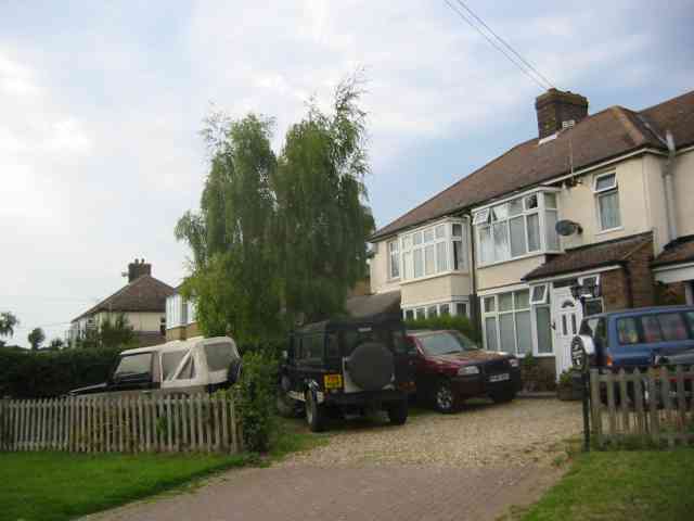
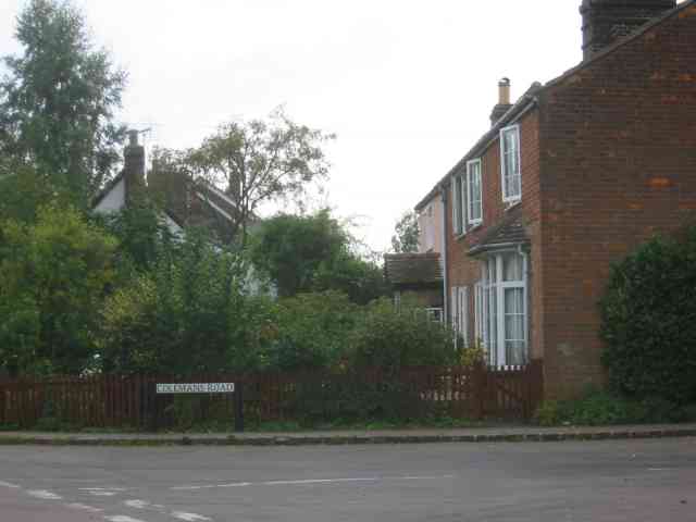
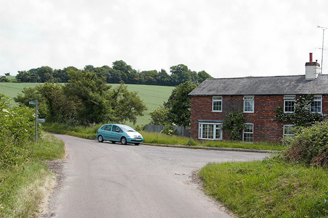
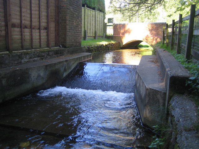
Bendish Images

Images are sourced within 2km of 51.879413/-0.309211 or Grid Reference TL1621. Thanks to Geograph Open Source API. All images are credited.

Houses on High Street Whitwell
Cockfosters Named "Cockfosters" on OS 25K map.
Cockfosters
Named "Cockfosters" on OS 25K map.
The Holt Farm & Livery Centre Holt Farm website - <span class="nowrap"><a title="http://www.holtfarm.co.uk/index.htm" rel="nofollow ugc noopener" href="http://www.holtfarm.co.uk/index.htm">Link</a><img style="margin-left:2px;" alt="External link" title="External link - shift click to open in new window" src="https://s1.geograph.org.uk/img/external.png" width="10" height="10"/></span>
The Holt Farm & Livery Centre
Holt Farm website - LinkExternal link
The Bull Inn   Whitwell Looks to be a successful pub
The Bull Inn Whitwell
Looks to be a successful pub
Road off Horn Hill  Whitwell Just at the other extreme of the block
Road off Horn Hill Whitwell
Just at the other extreme of the block
Water Tower at Whitwell The tower is located at the sharp left hand corner
Note the mobile phone antennae
Water Tower at Whitwell
The tower is located at the sharp left hand corner Note the mobile phone antennae
Empty showrooms at Breachwood  Green Was this once a car sales emporium?
Yes it used to sell SAAB cars.
Empty showrooms at Breachwood Green
Was this once a car sales emporium? Yes it used to sell SAAB cars.
House next door to the showrooms House and showrooms <a title="https://www.geograph.org.uk/photo/47777" href="https://www.geograph.org.uk/photo/47777">Link</a> would seem to have a relationship of owner perhaps.
House next door to the showrooms
House and showrooms Link would seem to have a relationship of owner perhaps.
End of runway lights seen from Lye Hill Breachwood Green At least the planes are on the landing approach so are relatively quiet.
End of runway lights seen from Lye Hill Breachwood Green
At least the planes are on the landing approach so are relatively quiet.
Houses in Lye Hill  Breachwood Green These houses look as if they were once local authority owned before the right to purchase was introduced. They are right in line for the airport approach.
Houses in Lye Hill Breachwood Green
These houses look as if they were once local authority owned before the right to purchase was introduced. They are right in line for the airport approach.
Houses in Colemans Road Breachwood Green These houses date from turn of the 19th century
Houses in Colemans Road Breachwood Green
These houses date from turn of the 19th century
Village Green and Sign at Bendish The village Green in the hamlet of Bendish. The wooden sign to the right of the shot shows the name of Bendish.
Village Green and Sign at Bendish
The village Green in the hamlet of Bendish. The wooden sign to the right of the shot shows the name of Bendish.
Whiteway Bottom Just about the only habitation in this grid square are the cottages at Whiteway Bottom.
Whiteway Bottom
Just about the only habitation in this grid square are the cottages at Whiteway Bottom.
Frogmore Frogmore is a tiny village of a few houses and a livery stable. This is looking East along the road. A duckpond is just out of shot to the right.
Frogmore
Frogmore is a tiny village of a few houses and a livery stable. This is looking East along the road. A duckpond is just out of shot to the right.
Frogmore stables dovecote Standing in the road looking North, one of the buildings of the Frogmore livery stables has a dovecote built into its roof.
Frogmore stables dovecote
Standing in the road looking North, one of the buildings of the Frogmore livery stables has a dovecote built into its roof.
West End of Frogmore House at the Western end of Frogmore. Following the road to the right takes you North up the hill toward Whitehall Farm.
West End of Frogmore
House at the Western end of Frogmore. Following the road to the right takes you North up the hill toward Whitehall Farm.
White house The house at about TL176224, on the right hand side of the road when going from Whitwell to Frogmore. The woods visible in the background beyond the field are in the grid square to the East or North East. The track branching off to the right carries a public footpath to Stagenhoe in the East.
White house
The house at about TL176224, on the right hand side of the road when going from Whitwell to Frogmore. The woods visible in the background beyond the field are in the grid square to the East or North East. The track branching off to the right carries a public footpath to Stagenhoe in the East.
'Road' across the field. This 'road used as public path' heads quite steeply downhill across a field from Bendish. Beyond the trees at the bottom of the hill it joins the metalled road.
'Road' across the field.
This 'road used as public path' heads quite steeply downhill across a field from Bendish. Beyond the trees at the bottom of the hill it joins the metalled road.
Show me another place!

Bendish is located at Grid Ref: TL1621 (Lat: 51.879413, Lng: -0.309211)

Administrative County: Hertfordshire

District: North Hertfordshire

Police Authority: Hertfordshire

What 3 Words

///missions.thatched.informs. Near Kimpton, Hertfordshire

Nearby Locations

Bendish

Related Wikis

Bendish

Bendish is a hamlet located in the parish of St Paul's Walden in Hertfordshire. In the 18th century, Bendish was a small town. It is about 3 miles east...

King's Walden

King's Walden is a civil parish in the English county of Hertfordshire. The name includes an apostrophe, but this is often omitted. The main settlement...

Whitwell, Hertfordshire

Whitwell is a village in the parish of St Paul's Walden about six miles south of Hitchin in Hertfordshire, England. Situated on a tableland, a spur of...

St Paul's Walden Bury

St. Paul's Walden Bury is an English country house and surrounding gardens in the village of St Paul's Walden in Hertfordshire. The house is a Grade II...

Stagenhoe

Stagenhoe is a Grade II listed stately home and surrounding gardens located in the village of St Paul's Walden in Hertfordshire. It is approximately 6...

Breachwood Green Mill, King's Walden

Breachwood Green Mill is a Grade II listed tower mill at King's Walden, Hertfordshire, England which has been converted to residential accommodation....

Ansells End

Ansells End is a hamlet of four historic homes in Hertfordshire, England. The population of the hamlet at the 2011 Census was included in the civil parish...

St Paul's Walden

St Paul's Walden is a village about 5 miles (8 km) south of Hitchin in Hertfordshire, England. The civil parish of St Paul's Walden also includes the village...

Nearby Amenities

Located within 500m of 51.879413,-0.309211
Odbl: clean
Lat/Long: 51.8818532/-0.3053489
Odbl: clean
Lat/Long: 51.8816052/-0.3054972
Odbl: clean
Lat/Long: 51.8806476/-0.3149495
Odbl: clean
Lat/Long: 51.8803406/-0.3160901
Odbl: clean
Lat/Long: 51.8778366/-0.3122287
Odbl: clean
Lat/Long: 51.8779553/-0.3036688
Odbl: clean
Lat/Long: 51.8826663/-0.3073575
Odbl: clean
Lat/Long: 51.8836526/-0.3074297
Odbl: clean
Lat/Long: 51.8834285/-0.3076004
Odbl: clean
Lat/Long: 51.8832385/-0.3076064
Odbl: clean
Lat/Long: 51.8830609/-0.3076349
Odbl: clean
Lat/Long: 51.8824741/-0.3080341
Odbl: clean
Lat/Long: 51.8788992/-0.311031
Odbl: clean
Lat/Long: 51.881742/-0.3053857
Odbl: clean
Lat/Long: 51.8776339/-0.3137501
Bendish House
Building: house
Lat/Long: 51.8816935/-0.3039579
Odbl: clean
Lat/Long: 51.8770304/-0.312748
Odbl: clean
Lat/Long: 51.8802514/-0.3163668
Odbl: clean
Lat/Long: 51.8769252/-0.314589
Odbl: clean
Lat/Long: 51.8769994/-0.3141341
Odbl: clean
Lat/Long: 51.8770485/-0.3136148
Odbl: clean
Lat/Long: 51.8799931/-0.3133359
Odbl: clean
Lat/Long: 51.8769886/-0.3142859
West End Farm
Place: farm
Source: OS_OpenData_StreetView
Lat/Long: 51.8830025/-0.3087403
Odbl: clean
Lat/Long: 51.8820966/-0.305672
Odbl: clean
Lat/Long: 51.8820213/-0.3054334
Old Phone: +44 1438 871391
Removed Amenity: telephone
Lat/Long: 51.8799017/-0.3103976
Post Box
Collection Times: Mo-Fr 16:00; Sa 11:00
Post Box Type: lamp
Ref: SG4 128
Royal Cypher: EIIR
Royal Cypher Wikidata: Q33102113
Lat/Long: 51.8799095/-0.3103945
Odbl: clean
Lat/Long: 51.8835538/-0.3075397
Odbl: clean
Lat/Long: 51.8770463/-0.3132835
Note: Signpost "Public Hyway, Long Lane 680yds"
Lat/Long: 51.8803891/-0.3037175
Odbl: clean
Lat/Long: 51.880361/-0.3036401
Odbl: clean
Lat/Long: 51.881968/-0.3054056
Odbl: clean
Lat/Long: 51.8817971/-0.3053558
Odbl: clean
Lat/Long: 51.8803748/-0.3159654
Odbl: clean
Lat/Long: 51.8789663/-0.3043635
Barrier: entrance
Lat/Long: 51.8776705/-0.3137405
Odbl: clean
Lat/Long: 51.8776981/-0.3137339
Fire Hydrant
Emergency: fire_hydrant
Lat/Long: 51.8798162/-0.3106088
Fire Hydrant
Emergency: fire_hydrant
Lat/Long: 51.8808188/-0.3098723
Waste Basket
Lat/Long: 51.8798991/-0.3104091
Waste Basket
Waste: dog_excrement
Lat/Long: 51.8812659/-0.3097551
Mill House Window Workshop
Man Made: works
Lat/Long: 51.879103/-0.3079575
Public Bookcase
Public Bookcase Type: reading_box
Lat/Long: 51.8799313/-0.3103399
Apps Cycle Works
Addr City: Bendish
Addr Housename: Bendish Farm
Addr Postcode: SG4 8JD
Addr Street: Bendish Lane
Opening Hours: Mo-Fr 10:00-17:00
Operator: Apps Cycle Works
Payment American Express: yes
Payment Apple Pay: yes
Payment Cash: yes
Payment Coins: yes
Payment Contactless: yes
Payment Credit Cards: yes
Payment Debit Cards: yes
Payment Mastercard: yes
Payment Notes: yes
Payment Paypal: yes
Payment Visa: yes
Payment Visa Debit: yes
Payment Visa Electron: yes
Phone: +441438871395
Service Bicycle Bicycle: yes
Service Bicycle Cleaning: yes
Service Bicycle Mtb: yes
Service Bicycle Parts: yes
Service Bicycle Pump: yes
Service Bicycle Repair: yes
Service Bicycle Retail: yes
Service Bicycle Second Hand: yes
Service Bicycle Service: yes
Shop: bicycle
Start Date: 2018-04-01
Lat/Long: 51.8796858/-0.3076933
The data included in this document is from www.openstreetmap.org. The data is made available under ODbL.

Have you been to Bendish?

Leave your review of Bendish below (or comments, questions and feedback).