Mount Hawke

Settlement in Cornwall

England

Mount Hawke

Chimney, Porthtowan Valley This apparently isolated chimney is behind some houses on a bridleway and is in the vicinity of Tywarnhayle Mine but not necessarily connected.
Chimney, Porthtowan Valley Credit: Chris Allen

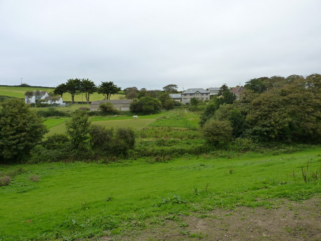
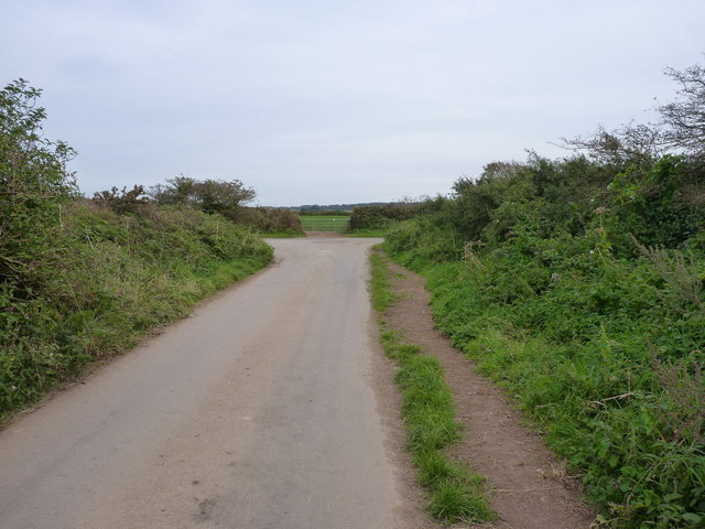
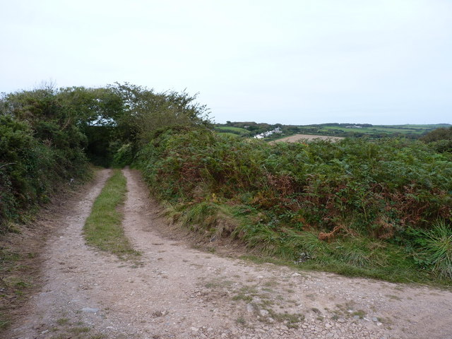
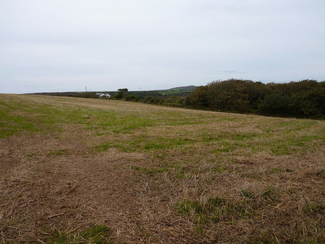
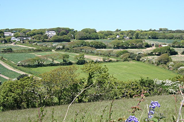
Mount Hawke is a small village located in the county of Cornwall, England. Situated approximately five miles southwest of the town of Redruth, it lies within the civil parish of St Agnes. The village is nestled amid picturesque countryside and is surrounded by rolling hills and farmland, offering stunning views of the surrounding landscape.

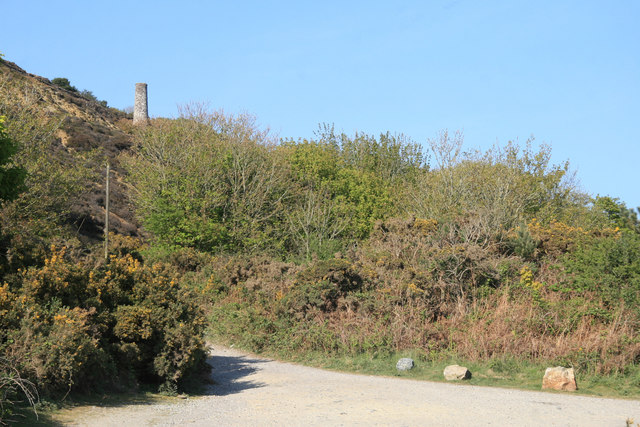
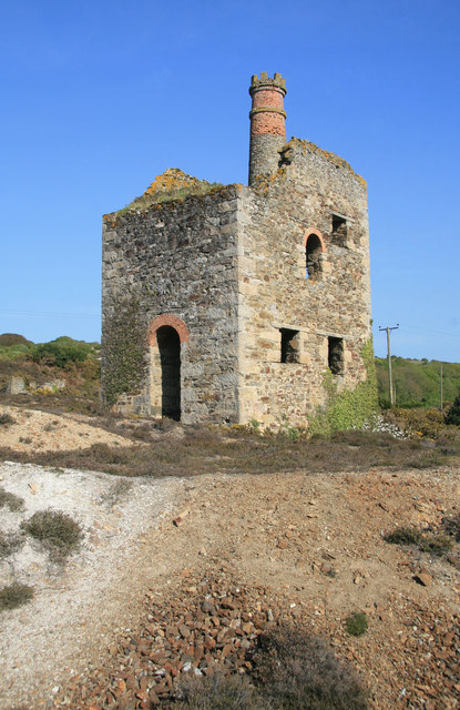
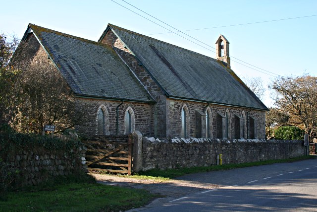
Historically, Mount Hawke was known for its mining industry, particularly in the 19th century when it thrived as a tin mining community. Today, remnants of this industrial past can still be seen in the form of disused mine shafts and engine houses scattered throughout the area.

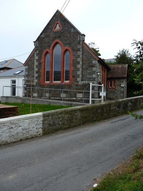
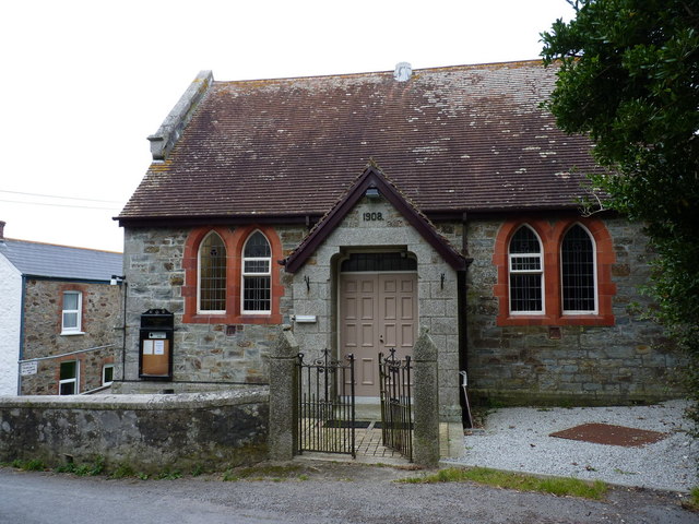
Despite its small size, Mount Hawke boasts a strong community spirit and offers a range of amenities and facilities for residents and visitors alike. The village is home to a primary school, a village hall, a post office, and a handful of local shops and businesses. Additionally, there are a number of traditional pubs and eateries, providing a warm and welcoming atmosphere for visitors to enjoy.

For outdoor enthusiasts, Mount Hawke offers plenty of opportunities to explore the natural beauty of the surrounding area. The nearby coastal path provides access to breathtaking cliff-top walks, while the rugged beaches of St Agnes and Porthtowan are just a short drive away. Additionally, the area is popular for surfing, with surf schools and equipment hire readily available.

In summary, Mount Hawke is a charming village in Cornwall, rich in history and natural beauty. It offers a peaceful and idyllic setting for those seeking a tranquil retreat or a base from which to explore the stunning Cornish countryside.

If you have any feedback on the listing, please let us know in the comments section below.

Mount Hawke Images

Images are sourced within 2km of 50.282547/-5.210947 or Grid Reference SW7147. Thanks to Geograph Open Source API. All images are credited.

Chimney, Porthtowan Valley This apparently isolated chimney is behind some houses on a bridleway and is in the vicinity of Tywarnhayle Mine but not necessarily connected.
Chimney, Porthtowan Valley
This apparently isolated chimney is behind some houses on a bridleway and is in the vicinity of Tywarnhayle Mine but not necessarily connected.
Wheal Ellen This engine house is on the site of Wheal Ellen (1834-1862) and was built in 1866 to house a 70 inch pumping engine but the venture failed before it was ever installed. The castellated chimney is unusual if not unique in Cornwall.
Wheal Ellen
This engine house is on the site of Wheal Ellen (1834-1862) and was built in 1866 to house a 70 inch pumping engine but the venture failed before it was ever installed. The castellated chimney is unusual if not unique in Cornwall.
Field at Tywarnhale Farm Looking towards Mingoose Plantation.
Field at Tywarnhale Farm
Looking towards Mingoose Plantation.
Kneehigh Theatre's 'Asylum' The Asylum is a temporary structure in which the Cornwall-based theatre company, Kneehigh stage their summer productions at Tywarnhale Farm.
Kneehigh Theatre's 'Asylum'
The Asylum is a temporary structure in which the Cornwall-based theatre company, Kneehigh stage their summer productions at Tywarnhale Farm.
The performance space in the Asylum See <a href="https://www.geograph.org.uk/photo/2565129">SW7247 : Kneehigh Theatre's 'Asylum'</a>.
The performance space in the Asylum
The audience at the Asylum Waiting for the commencement of Kneehigh Theatre's 'The Wild Bride'. See also <a href="https://www.geograph.org.uk/photo/2565129">SW7247 : Kneehigh Theatre's 'Asylum'</a>.
The audience at the Asylum
Waiting for the commencement of Kneehigh Theatre's 'The Wild Bride'. See also SW7247 : Kneehigh Theatre's 'Asylum'.
Mawla from the southwest
Mawla Methodist Church A small church in the village, built in 1908.
Mawla Methodist Church
A small church in the village, built in 1908.
Mawla Methodist Church The main entrance and eastern elevation of the small church.
Mawla Methodist Church
The main entrance and eastern elevation of the small church.
Road junction at Mawla Lane End
Track towards Manor Parsley Farm
Farmland above Manor Parsley
Southwards on the road to Wheal Rose outside Glyn Crest Farm The farm keeps Jersey cows, and supplies milk to the Rodda's Dairy operation for clotted cream making. Lovely!
Southwards on the road to Wheal Rose outside Glyn Crest Farm
The farm keeps Jersey cows, and supplies milk to the Rodda's Dairy operation for clotted cream making. Lovely!
Cottage south of Menagissey Accessed via this unsurfaced farm track that runs SSE out of Menagissey.
Cottage south of Menagissey
Accessed via this unsurfaced farm track that runs SSE out of Menagissey.
Creepy trees by the Porthtowan River Trees in the deep valley of the river that flows down to Porthtowan.
Creepy trees by the Porthtowan River
Trees in the deep valley of the river that flows down to Porthtowan.
Track to Menagissey Farm The track is not a right of way (according to the maps, at any rate) but there seems to be no problem with walkers, horses or cyclists using it.
Track to Menagissey Farm
The track is not a right of way (according to the maps, at any rate) but there seems to be no problem with walkers, horses or cyclists using it.
Mount Hawke village stores
Mount Hawke Methodist Church
Show me another place!

Mount Hawke is located at Grid Ref: SW7147 (Lat: 50.282547, Lng: -5.210947)

Unitary Authority: Cornwall

Police Authority: Devon and Cornwall

What 3 Words

///curiosity.overheat.reason. Near Mount Hawke, Cornwall

Nearby Locations

Mount Hawke St. Agnes

Related Wikis

Mount Hawke

Mount Hawke is a village in Cornwall, United Kingdom. It is situated approximately eight miles (13 km) west-northwest of Truro, five miles (8.0 km) north...

Banns, Cornwall

Banns is a hamlet in west Cornwall, England, United Kingdom situated between Mount Hawke and Porthtowan at grid reference SW 710 480 in the civil parish...

Menagissey

Menagissey is a hamlet in Cornwall, England, United Kingdom. It is half-a-mile south of Mount Hawke about three miles (5 km) north-northeast of Redruth...

Manor Parsley

Manor Parsley is a hamlet near Mount Hawke in Cornwall, England, UK. Manor Parsley is approximately 2 miles (3.2 km) north of Redruth. == References ==

Nearby Amenities

Located within 500m of 50.282547,-5.210947
Mount Hawke
Is In: Cornwall, England, UK
Is In Country: England
Is In Country Code: GB
Is In County: Cornwall
Name Kw: Mont Hawk
Place: village
Source: npe
Wikidata: Q6921088
Lat/Long: 50.2829915/-5.2081715
Bus Stop
Old School
Bus: yes
Naptan AtcoCode: 0800COC04306
Naptan Bearing: NE
Naptan CommonName: Old School
Naptan NaptanCode: corgapwd
Naptan Street: Rodda's Road
Naptan Verified: no
Public Transport: platform
Source: naptan_import
Lat/Long: 50.2833927/-5.2062567
Bus Stop
Village Stores
Bus: yes
Naptan AtcoCode: 0800COD41240
Naptan Bearing: W
Naptan CommonName: Village Stores
Naptan NaptanCode: corapadg
Naptan Street: Unclassified
Naptan Verified: no
Public Transport: platform
Source: naptan_import
Lat/Long: 50.2798238/-5.2054969
Bus Stop
Village Stores
Bus: yes
Naptan AtcoCode: 0800COD41241
Naptan Bearing: E
Naptan CommonName: Village Stores
Naptan NaptanCode: corapadj
Naptan Street: Unclassified
Naptan Verified: no
Public Transport: platform
Source: naptan_import
Lat/Long: 50.2799094/-5.2055398
Bus Stop
Henley Drive
Bus: yes
Naptan AtcoCode: 0800COC30126
Naptan Bearing: NE
Naptan CommonName: Henley Drive
Naptan Crossing: Short Cross Mews
Naptan Indicator: NE-bound
Naptan NaptanCode: coramwmw
Naptan Street: Short Cross Road
Naptan Verified: no
Public Transport: platform
Source: naptan;bing
Lat/Long: 50.2805677/-5.2098433
Bus Stop
Henley Drive
Bus: yes
Naptan AtcoCode: 0800COC30127
Naptan Bearing: SW
Naptan CommonName: Henley Drive
Naptan Crossing: Short Cross Mews
Naptan Indicator: opp
Naptan NaptanCode: coramwpd
Naptan Street: Short Cross Road
Naptan Verified: no
Public Transport: platform
Source: naptan;bing
Lat/Long: 50.2804264/-5.2097496
Bus Stop
Village Centre
Naptan AtcoCode: 0800COD41244
Naptan Bearing: N
Naptan CommonName: Spar Shop
Naptan NaptanCode: coramwtg
Naptan Street: Fore Street
Naptan Verified: no
Source: naptan_import
Lat/Long: 50.2829921/-5.208055
Bus Stop
Village Centre
Naptan AtcoCode: 0800COD41245
Naptan Bearing: S
Naptan CommonName: Spar Shop
Naptan Indicator: Opp
Naptan NaptanCode: coramwtm
Naptan Street: Fore Street
Naptan Verified: no
Source: naptan_import
Lat/Long: 50.2831956/-5.2078426
Post Box
Brand: Royal Mail
Brand Wikidata: Q638098
Collection Times: Mo-Fr 09:00; Sa 07:00; Su off
Drive Through: no
Operator: Royal Mail
Operator Wikidata: Q638098
Post Box Mounting: pier
Post Box Type: lamp
Ref: TR4 72D
Royal Cypher: EIIR
Royal Cypher Wikidata: Q33102113
Source: survey;aerial imagery
Lat/Long: 50.2805676/-5.204821
Telephone
Booth: K6
Covered: booth
Lat/Long: 50.2838001/-5.2077714
Hospital
Mount Hawke Surgery
No
Addr City: Truro
Addr Country: GB
Addr Place: Mount Hawke
Addr Postcode: TR4 8UE
Addr Street: Short Cross Road
Emergency: no
Lat/Long: 50.2807544/-5.2098874
Flowers By Diane
Addr Housename: Flowers By Diane
Shop: florist
Lat/Long: 50.2832071/-5.2076695
War Memorial
Historic: memorial
Memorial: war_memorial
Lat/Long: 50.2797485/-5.2077231
Londis
Brand: Londis
Brand Wikidata: Q21008564
Shop: convenience
Lat/Long: 50.2802293/-5.2060239
Millenium Green
Leisure: playground
Lat/Long: 50.2831551/-5.2088731
Mount Hawke Village Stores
Addr City: Truro
Addr Housename: The Village Stores
Addr Place: Mount Hawke
Addr Postcode: TR4 8DU
Addr Street: Short Cross Road
Fhrs Id: 571170
Shop: convenience
Lat/Long: 50.2831125/-5.2077283
Recycling
Lat/Long: 50.283238/-5.2057544
Restaurant
Old School Bar and Kitchen
Addr City: Truro
Addr Country: GB
Addr Housename: The Old School
Addr Place: Mount Hawke
Addr Postcode: TR4 8BA
Fhrs Id: 1149476
Source Addr: FHRS Open Data
Lat/Long: 50.2835572/-5.2066181
Post Box
Brand: Royal Mail
Brand Wikidata: Q638098
Collection Times: Mo-Fr 09:00; Sa 07:00; Su off
Drive Through: no
Operator: Royal Mail
Operator Wikidata: Q638098
Post Box Mounting: pier
Post Box Type: lamp
Ref: TR4 230D
Royal Cypher: EIIR
Royal Cypher Wikidata: Q33102113
Source: survey;aerial imagery
Lat/Long: 50.2800786/-5.2103781
Post Office
Mount Hawke Stores Post Office
Addr City: Truro
Addr Postcode: TR4 8DU
Addr Street: Short Cross Road
Addr Village: Mount Hawke
Brand: Post Office
Brand Wikidata: Q1783168
Opening Hours: Mo-Su 07:00-19:00
Operator: Mount Hawke Village Stores
Ref Pol Id: 123277
Source: survey;pol_branch_list_2022‑05‑27
Lat/Long: 50.2831572/-5.2077151
Post Box
Brand: Royal Mail
Brand Wikidata: Q638098
Collection Times: Mo-Fr 16:30; Sa 11:30; Su off
Drive Through: no
Operator: Royal Mail
Operator Wikidata: Q638098
Post Box Design: type_a
Post Box Type: pillar
Ref: TR4 131
Royal Cypher: EIIR
Royal Cypher Wikidata: Q33102113
Source: survey;aerial imagery
Lat/Long: 50.2831928/-5.2078015
Generator Method: photovoltaic
Generator Output Electricity: yes
Generator Source: solar
Generator Type: solar_photovoltaic_panel
Location: roof
Power: generator
Lat/Long: 50.2842836/-5.2057171
Generator Method: photovoltaic
Generator Output Electricity: yes
Generator Source: solar
Generator Type: solar_photovoltaic_panel
Location: roof
Power: generator
Lat/Long: 50.2842767/-5.205642
Generator Method: photovoltaic
Generator Output Electricity: yes
Generator Source: solar
Generator Type: solar_photovoltaic_panel
Location: roof
Power: generator
Lat/Long: 50.2842665/-5.2054757
Generator Method: photovoltaic
Generator Output Electricity: yes
Generator Source: solar
Generator Type: solar_photovoltaic_panel
Location: roof
Power: generator
Lat/Long: 50.2842545/-5.2053925
Generator Method: photovoltaic
Generator Output Electricity: yes
Generator Source: solar
Generator Type: solar_photovoltaic_panel
Location: roof
Power: generator
Lat/Long: 50.2839785/-5.205355
Generator Method: photovoltaic
Generator Output Electricity: yes
Generator Source: solar
Generator Type: solar_photovoltaic_panel
Location: roof
Power: generator
Lat/Long: 50.2839288/-5.2054381
Generator Method: photovoltaic
Generator Output Electricity: yes
Generator Source: solar
Generator Type: solar_photovoltaic_panel
Location: roof
Power: generator
Lat/Long: 50.2842287/-5.2058512
Generator Method: photovoltaic
Generator Output Electricity: yes
Generator Source: solar
Generator Type: solar_photovoltaic_panel
Location: roof
Power: generator
Lat/Long: 50.2842065/-5.2059424
Generator Method: photovoltaic
Generator Output Electricity: yes
Generator Source: solar
Generator Type: solar_photovoltaic_panel
Location: roof
Power: generator
Lat/Long: 50.284191/-5.2060041
Generator Method: photovoltaic
Generator Output Electricity: yes
Generator Source: solar
Generator Type: solar_photovoltaic_panel
Location: roof
Power: generator
Lat/Long: 50.2832433/-5.2080694
Generator Method: photovoltaic
Generator Output Electricity: yes
Generator Source: solar
Generator Type: solar_photovoltaic_panel
Location: roof
Power: generator
Lat/Long: 50.2842236/-5.2095607
Generator Method: photovoltaic
Generator Output Electricity: yes
Generator Source: solar
Generator Type: solar_photovoltaic_panel
Location: roof
Power: generator
Lat/Long: 50.2826023/-5.2093032
Generator Method: photovoltaic
Generator Output Electricity: yes
Generator Source: solar
Generator Type: solar_photovoltaic_panel
Location: roof
Power: generator
Lat/Long: 50.2813134/-5.2111083
Generator Method: photovoltaic
Generator Output Electricity: yes
Generator Source: solar
Generator Type: solar_photovoltaic_panel
Location: roof
Power: generator
Lat/Long: 50.2809946/-5.2109152
Generator Method: photovoltaic
Generator Output Electricity: yes
Generator Source: solar
Generator Type: solar_photovoltaic_panel
Location: roof
Power: generator
Lat/Long: 50.2808471/-5.2108616
Generator Method: photovoltaic
Generator Output Electricity: yes
Generator Source: solar
Generator Type: solar_photovoltaic_panel
Location: roof
Power: generator
Lat/Long: 50.2805489/-5.2101454
Generator Method: photovoltaic
Generator Output Electricity: yes
Generator Source: solar
Generator Type: solar_photovoltaic_panel
Location: roof
Power: generator
Lat/Long: 50.2817076/-5.2099228
Generator Method: photovoltaic
Generator Output Electricity: yes
Generator Source: solar
Generator Type: solar_photovoltaic_panel
Location: roof
Power: generator
Lat/Long: 50.2813613/-5.2101052
Generator Method: photovoltaic
Generator Output Electricity: yes
Generator Source: solar
Generator Type: solar_photovoltaic_panel
Location: roof
Power: generator
Lat/Long: 50.280806/-5.207946
Generator Method: photovoltaic
Generator Output Electricity: yes
Generator Source: solar
Generator Type: solar_photovoltaic_panel
Location: roof
Power: generator
Lat/Long: 50.2800227/-5.2077502
Generator Method: photovoltaic
Generator Output Electricity: yes
Generator Source: solar
Generator Type: solar_photovoltaic_panel
Location: roof
Power: generator
Lat/Long: 50.2804838/-5.2078682
Generator Method: photovoltaic
Generator Output Electricity: yes
Generator Source: solar
Generator Type: solar_photovoltaic_panel
Location: roof
Power: generator
Lat/Long: 50.2837866/-5.2084985
Generator Method: photovoltaic
Generator Output Electricity: yes
Generator Source: solar
Generator Type: solar_photovoltaic_panel
Location: roof
Power: generator
Lat/Long: 50.2839802/-5.2114436
Generator Method: photovoltaic
Generator Output Electricity: yes
Generator Source: solar
Generator Type: solar_photovoltaic_panel
Location: roof
Power: generator
Lat/Long: 50.281759/-5.2117038
Generator Method: photovoltaic
Generator Output Electricity: yes
Generator Source: solar
Generator Type: solar_photovoltaic_panel
Location: roof
Power: generator
Lat/Long: 50.2817504/-5.2091557
Generator Method: photovoltaic
Generator Output Electricity: yes
Generator Source: solar
Generator Type: solar_photovoltaic_panel
Location: roof
Power: generator
Lat/Long: 50.2807666/-5.2068222
Generator Method: photovoltaic
Generator Output Electricity: yes
Generator Source: solar
Generator Type: solar_photovoltaic_panel
Location: roof
Power: generator
Lat/Long: 50.2806895/-5.2050519
Generator Method: photovoltaic
Generator Output Electricity: yes
Generator Source: solar
Generator Type: solar_photovoltaic_panel
Location: roof
Power: generator
Lat/Long: 50.2804358/-5.2073211
Generator Method: photovoltaic
Generator Output Electricity: yes
Generator Source: solar
Generator Type: solar_photovoltaic_panel
Location: roof
Power: generator
Lat/Long: 50.2810203/-5.2063796
Generator Method: photovoltaic
Generator Output Electricity: yes
Generator Source: solar
Generator Type: solar_photovoltaic_panel
Location: roof
Power: generator
Lat/Long: 50.2809757/-5.2061436
Generator Method: photovoltaic
Generator Output Electricity: yes
Generator Source: solar
Generator Type: solar_photovoltaic_panel
Location: roof
Power: generator
Lat/Long: 50.2808626/-5.2044296
Community Centre
Church Hall
Operator: Church of England
Lat/Long: 50.279599/-5.2067627
Barrier: stile
Foot: yes
Material: stone
Stile: stepover
Lat/Long: 50.2844534/-5.2135103
Barrier: stile
Material: wood
Stile: ladder
Lat/Long: 50.2838524/-5.2134575
Barrier: stile
Foot: yes
Material: stone
Stile: stepover
Lat/Long: 50.2855518/-5.2135577
Barrier: stile
Foot: yes
Material: wood
Stile: ladder
Lat/Long: 50.2833804/-5.213489
Barrier: kissing_gate
Foot: yes
Material: wood
Lat/Long: 50.2816811/-5.2151632
Bench
Backrest: yes
Lat/Long: 50.2801023/-5.2103505
The data included in this document is from www.openstreetmap.org. The data is made available under ODbL.

Have you been to Mount Hawke?

Leave your review of Mount Hawke below (or comments, questions and feedback).