Mosborough

Settlement in Derbyshire

England

Mosborough

A6135 Moor Valley, at Moor Valley Close
A6135 Moor Valley, at Moor Valley Close Credit: Colin Pyle

Mosborough is a village located in the county of Derbyshire, England. Situated about 7 miles southeast of the city of Sheffield, it falls within the boundaries of the Sheffield City Council. With a population of approximately 8,000 residents, Mosborough retains its rural charm while offering easy access to urban amenities.

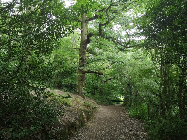
The village is surrounded by picturesque countryside, and its location near the Peak District National Park makes it an attractive destination for outdoor enthusiasts. The area is known for its rolling hills, woodlands, and scenic walking trails, providing ample opportunities for hiking, cycling, and exploring nature.

Mosborough has a rich history, dating back to the medieval period. The village is home to several historic buildings, such as the 12th-century St. Mark's Church, which serves as a focal point for the community. Additionally, remnants of a Roman road have been discovered in the area, highlighting its significance as a crossroad in ancient times.

Despite its rural setting, Mosborough offers a range of amenities to its residents. The village has a primary school, a medical center, and a variety of local shops and services. It also benefits from a strong sense of community, with various social and sporting clubs catering to different interests.

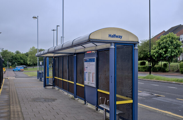
Transport links are readily available, with bus services connecting Mosborough to Sheffield city center and surrounding towns. The nearby M1 motorway allows for easy access to other parts of the country.

Overall, Mosborough is a peaceful and idyllic village that combines the tranquility of rural living with the convenience of nearby urban centers. Its natural beauty, historical significance, and close-knit community make it an attractive place to live or visit.

If you have any feedback on the listing, please let us know in the comments section below.
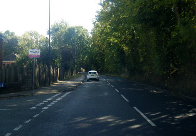
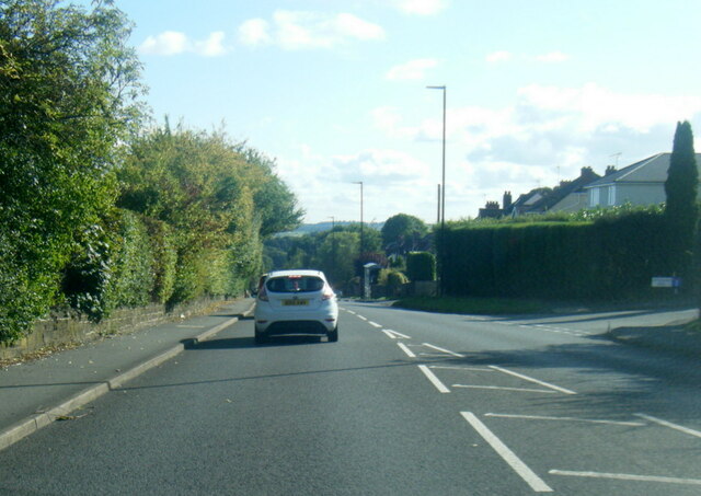
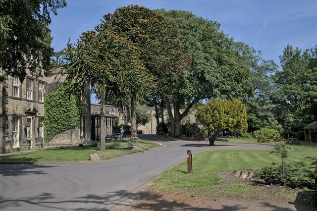
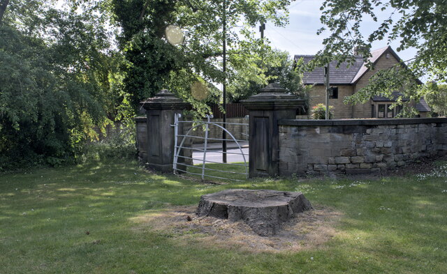
Mosborough Images

Images are sourced within 2km of 53.327078/-1.361851 or Grid Reference SK4281. Thanks to Geograph Open Source API. All images are credited.

A6135 Moor Valley, at Moor Valley Close
A6135 at Owlthorpe Rise
Mosborough Hall Hotel A 17th century house, now a hotel.  There is another building nearby called Mosborough Hall, confusion is easy.  This one is the hotel.

This is a grade II listed building - see <span class="nowrap"><a title="https://historicengland.org.uk/listing/the-list/list-entry/1255139?section=official-list-entry" rel="nofollow ugc noopener" href="https://historicengland.org.uk/listing/the-list/list-entry/1255139?section=official-list-entry">Link</a><img style="margin-left:2px;" alt="External link" title="External link - shift click to open in new window" src="https://s1.geograph.org.uk/img/external.png" width="10" height="10"/></span>.  The hotel's own web site traces the history back to the 12th century, but not in this building. - <span class="nowrap"><a title="https://www.mosboroughhall.co.uk/about-us/our-history" rel="nofollow ugc noopener" href="https://www.mosboroughhall.co.uk/about-us/our-history">Link</a><img style="margin-left:2px;" alt="External link" title="External link - shift click to open in new window" src="https://s1.geograph.org.uk/img/external.png" width="10" height="10"/></span>
Mosborough Hall Hotel
A 17th century house, now a hotel. There is another building nearby called Mosborough Hall, confusion is easy. This one is the hotel. This is a grade II listed building - see LinkExternal link. The hotel's own web site traces the history back to the 12th century, but not in this building. - LinkExternal link
The South Frontage The south frontage of Mosborough Hall Hotel, as described in the Historic England listing.  This is a grade II listed building - see <span class="nowrap"><a title="https://historicengland.org.uk/listing/the-list/list-entry/1255139?section=official-list-entry" rel="nofollow ugc noopener" href="https://historicengland.org.uk/listing/the-list/list-entry/1255139?section=official-list-entry">Link</a><img style="margin-left:2px;" alt="External link" title="External link - shift click to open in new window" src="https://s1.geograph.org.uk/img/external.png" width="10" height="10"/></span>.  

The hotel's own web site traces the history back to the 12th century, but not in this building. - <span class="nowrap"><a title="https://www.mosboroughhall.co.uk/about-us/our-history" rel="nofollow ugc noopener" href="https://www.mosboroughhall.co.uk/about-us/our-history">Link</a><img style="margin-left:2px;" alt="External link" title="External link - shift click to open in new window" src="https://s1.geograph.org.uk/img/external.png" width="10" height="10"/></span>
The South Frontage
The south frontage of Mosborough Hall Hotel, as described in the Historic England listing. This is a grade II listed building - see LinkExternal link. The hotel's own web site traces the history back to the 12th century, but not in this building. - LinkExternal link
The crest over the door This is the heraldic device above the french windows in <a href="https://www.geograph.org.uk/photo/7503378">SK4280 : The South Frontage</a>, at Mosborough Hall Hotel.  I have been unable to identify the attribution of this badge.
The crest over the door
This is the heraldic device above the french windows in SK4280 : The South Frontage, at Mosborough Hall Hotel. I have been unable to identify the attribution of this badge.
Mosborough Hall Hotel This is a grade II listed building - see <span class="nowrap"><a title="https://historicengland.org.uk/listing/the-list/list-entry/1255139?section=official-list-entry" rel="nofollow ugc noopener" href="https://historicengland.org.uk/listing/the-list/list-entry/1255139?section=official-list-entry">Link</a><img style="margin-left:2px;" alt="External link" title="External link - shift click to open in new window" src="https://s1.geograph.org.uk/img/external.png" width="10" height="10"/></span>.
Mosborough Hall Hotel
This is a grade II listed building - see LinkExternal link.
Entrance gateway No longer in use, this gateway is grade II listed in its own right - see <span class="nowrap"><a title="https://historicengland.org.uk/listing/the-list/list-entry/1255082" rel="nofollow ugc noopener" href="https://historicengland.org.uk/listing/the-list/list-entry/1255082">Link</a><img style="margin-left:2px;" alt="External link" title="External link - shift click to open in new window" src="https://s1.geograph.org.uk/img/external.png" width="10" height="10"/></span> .
Entrance gateway
No longer in use, this gateway is grade II listed in its own right - see LinkExternal link .
Tram Shelter The tram shelter at Halfway Park and Ride
Tram Shelter
The tram shelter at Halfway Park and Ride
Pink tram Boarding the tram at Halfway
Pink tram
Boarding the tram at Halfway
Bus in Eckington bus station Stagecoach Chesterfield 15696, a Scania N230/Alexander Dennis Enviro 400, pauses in Eckington's small bus station on its way from Chesterfield to Sheffield.
Bus in Eckington bus station
Stagecoach Chesterfield 15696, a Scania N230/Alexander Dennis Enviro 400, pauses in Eckington's small bus station on its way from Chesterfield to Sheffield.
Church Street, Eckington Leading from the town centre towards the main road to Sheffield.
Church Street, Eckington
Leading from the town centre towards the main road to Sheffield.
Large house on Church Street, Eckington
Angel Hotel, Eckington Now apparently converted into flats.
Angel Hotel, Eckington
Now apparently converted into flats.
Footpath to Eckington bus station Leading up the slight hill from Market Street.
Footpath to Eckington bus station
Leading up the slight hill from Market Street.
Disused toilets, Eckington bus station This apparently long disused toilet block elevates the bus station from merely basic firmly into the depressing category.
Disused toilets, Eckington bus station
This apparently long disused toilet block elevates the bus station from merely basic firmly into the depressing category.
Eckington bus station Simply four bus shelters along a large turning circle, seen under a gradually clearing winter sky.
Eckington bus station
Simply four bus shelters along a large turning circle, seen under a gradually clearing winter sky.
Eckington Church
Eckington Church
Sheffield Country Walk Woodland path approaching Eckington on the Sheffield Country Walk
Sheffield Country Walk
Woodland path approaching Eckington on the Sheffield Country Walk
Show me another place!

Mosborough is located at Grid Ref: SK4281 (Lat: 53.327078, Lng: -1.361851)

Unitary Authority: Sheffield

Police Authority: South Yorkshire

What 3 Words

///classed.protects.voltages. Near Beighton, South Yorkshire

Nearby Locations

Mosborough

Related Wikis

Mosborough (ward)

Mosborough is an electoral ward of the City of Sheffield, England, in the eastern part of the city, on the border with North East Derbyshire District....

Mosborough

Mosborough is a village in the City of Sheffield in South Yorkshire, England. Historically part of Derbyshire, the village was named after The Moss river...
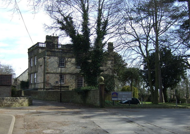
Mosborough Hall

Mosborough Hall is a 17th-century Grade II-listed building in Mosborough, Sheffield, England. The building was originally a manor house in what was then...

Eckington Cemetery

Eckington Cemetery is a cemetery in Eckington, Derbyshire, England. The cemetery serves Eckington itself, as well as nearby villages such as Mosborough...

Nearby Amenities

Located within 500m of 53.327078,-1.361851
Mosborough
Is In: Sheffield, South Yorkshire, England, UK
Place: suburb
Source: npe
Lat/Long: 53.3249858/-1.3629543
Traffic Signals
Crossing: no
Traffic Signals Direction: backward
Lat/Long: 53.3262285/-1.3633373
Turning Circle
Lat/Long: 53.3281913/-1.355348
Barrier: bollard
Bicycle: yes
Foot: yes
Lat/Long: 53.3241079/-1.3612669
Traffic Calming: table
Lat/Long: 53.3276602/-1.364303
Traffic Calming: table
Lat/Long: 53.3281878/-1.3641465
Bus Stop
High Street/The George and Dragon
Alt Name: High Street/The George and Dragon
Bus: yes
Naptan AltCommonName: High Street/The George and Dragon
Naptan AtcoCode: 370021652
Naptan Bearing: SE
Naptan CommonName: High Street/The George and Dragon
Naptan Indicator: 21652
Naptan Landmark: OPPO GEORGE AND DRAGON P.H
Naptan PlusbusZoneRef: ROTHCEN
Naptan Street: High Street
Naptan Verified: no
Public Transport: platform
Source: naptan_import
Lat/Long: 53.3228132/-1.3596465
Bus Stop
High Street/Duke Street
Bus: yes
Naptan AtcoCode: 370021653
Naptan Bearing: NE
Naptan CommonName: High Street/Duke Street
Naptan Indicator: 21653
Naptan Landmark: Opposite Moss House
Naptan PlusbusZoneRef: ROTHCEN
Naptan Street: High Street
Naptan Verified: no
Public Transport: platform
Source: naptan_import
Lat/Long: 53.3229804/-1.3601987
Bus Stop
Westfield Crescent/Elm Crescent
Alt Name: Westfield Crescent/Elm Crescent
Bus: yes
Naptan AltCommonName: Westfield Crescent/Elm Crescent
Naptan AtcoCode: 370021679
Naptan Bearing: SW
Naptan CommonName: Westfield Crescent/Elm Crescent
Naptan Indicator: 21679
Naptan Landmark: OPPOSITE OAK STREET
Naptan PlusbusZoneRef: ROTHCEN
Naptan Street: Elm Crescent
Naptan Verified: no
Public Transport: platform
Source: naptan_import
Lat/Long: 53.3295472/-1.364455
Bus Stop
Elm Crescent/Westfield Crescent
Alt Name: Elm Crescent/Westfield Crescent
Bus: yes
Naptan AltCommonName: Elm Crescent/Westfield Crescent
Naptan AtcoCode: 370021680
Naptan Bearing: N
Naptan CommonName: Elm Crescent/Westfield Crescent
Naptan Indicator: 21680
Naptan Landmark: OPPOSITE 62
Naptan PlusbusZoneRef: ROTHCEN
Naptan Street: Westfield Crescent
Naptan Verified: no
Public Transport: platform
Source: naptan_import
Lat/Long: 53.3299793/-1.3628869
Bus Stop
Elm Crescent
Bus: yes
Naptan AtcoCode: 370021681
Naptan Bearing: N
Naptan CommonName: Elm Crescent
Naptan Indicator: 21681
Naptan Landmark: OPPOSITE NUMBER 42
Naptan PlusbusZoneRef: ROTHCEN
Naptan Street: Elm Crescent
Naptan Verified: no
Public Transport: platform
Source: naptan_import
Lat/Long: 53.3306057/-1.3640338
Bus Stop
Elm Crescent/Sycamore Street
Bus: yes
Naptan AtcoCode: 370021682
Naptan Bearing: N
Naptan CommonName: Elm Crescent/Sycamore Street
Naptan Indicator: 21682
Naptan Landmark: OPPOSITE OAK STREET
Naptan PlusbusZoneRef: ROTHCEN
Naptan Street: Elm Crescent
Naptan Verified: no
Public Transport: platform
Source: naptan_import
Lat/Long: 53.3304796/-1.3656724
Bus Stop
Elm Crescent/Westfield Crescent
Alt Name: Elm Crescent/Westfield Crescent
Bus: yes
Naptan AltCommonName: Elm Crescent/Westfield Crescent
Naptan AtcoCode: 370021683
Naptan Bearing: NE
Naptan CommonName: Elm Crescent/Westfield Crescent
Naptan Indicator: 21683
Naptan Landmark: 21683
Naptan PlusbusZoneRef: ROTHCEN
Naptan Street: Elm Crescent
Naptan Verified: no
Public Transport: platform
Source: naptan_import
Lat/Long: 53.3291818/-1.3667278
Bus Stop
Station Road/School Street
Bus: yes
Naptan AtcoCode: 370021687
Naptan Bearing: W
Naptan CommonName: Station Road/School Street
Naptan Indicator: 21687
Naptan Landmark: OPPOSITE 15
Naptan PlusbusZoneRef: ROTHCEN
Naptan Street: Station Road
Naptan Verified: no
Public Transport: platform
Source: naptan_import
Lat/Long: 53.3264695/-1.3604468
Bus Stop
Station Road/School Street
Bus: yes
Naptan AtcoCode: 370021688
Naptan Bearing: E
Naptan CommonName: Station Road/School Street
Naptan Indicator: 21688
Naptan Landmark: Opposite School Road
Naptan PlusbusZoneRef: ROTHCEN
Naptan Street: Station Road
Naptan Verified: no
Public Transport: platform
Source: naptan_import
Lat/Long: 53.3266141/-1.3605798
Bus Stop
Station Road/High Street
Bus: yes
Naptan AtcoCode: 370021689
Naptan Bearing: N
Naptan CommonName: Station Road/High Street
Naptan Indicator: 21689
Naptan Landmark: Traffic Lights
Naptan PlusbusZoneRef: ROTHCEN
Naptan Street: Station Road
Naptan Verified: no
Public Transport: platform
Source: naptan_import
Lat/Long: 53.3265787/-1.362367
Bus Stop
High Street/Ferncroft Avenue
Bus: yes
Naptan AtcoCode: 370021691
Naptan Bearing: NW
Naptan CommonName: High Street/Ferncroft Avenue
Naptan Indicator: 21691
Naptan Landmark: Opposite 158
Naptan PlusbusZoneRef: ROTHCEN
Naptan Street: High Street
Naptan Verified: no
Public Transport: platform
Shelter: yes
Source: naptan_import
Lat/Long: 53.3284495/-1.3676395
Bus Stop
High Street/Westfield Crescent
Alt Name: High Street/Westfield Crescent
Bench: no
Bus: yes
Naptan AltCommonName: High Street/Westfield Crescent
Naptan AtcoCode: 370021692
Naptan Bearing: SE
Naptan CommonName: High Street/Westfield Crescent
Naptan Indicator: 21692
Naptan Landmark: OUTSIDE GATE TO NO. 150
Naptan PlusbusZoneRef: ROTHCEN
Naptan Street: High Street
Naptan Verified: no
Public Transport: platform
Shelter: no
Source: naptan_import
Tactile Paving: no
Lat/Long: 53.3285556/-1.3673076
Bus Stop
High Street/Station Road
Bus: yes
Naptan AtcoCode: 370021693
Naptan Bearing: SE
Naptan CommonName: High Street/Station Road
Naptan Indicator: 21693
Naptan Landmark: Traffic Lights
Naptan PlusbusZoneRef: ROTHCEN
Naptan Street: High Street
Naptan Verified: no
Public Transport: platform
Source: naptan_import
Lat/Long: 53.3272721/-1.3642936
Bus Stop
High Street/Queen Street
Alt Name: High Street/Queen Street
Bus: yes
Naptan AltCommonName: High Street/Queen Street
Naptan AtcoCode: 370021694
Naptan Bearing: NW
Naptan CommonName: High Street/Queen Street
Naptan Indicator: 21694
Naptan Landmark: TRAFFIC LIGHTS
Naptan PlusbusZoneRef: ROTHCEN
Naptan Street: High Street
Naptan Verified: no
Public Transport: platform
Source: naptan_import
Lat/Long: 53.3266049/-1.3639131
Bus Stop
High Street/Cadman Street
Bus: yes
Naptan AtcoCode: 370021695
Naptan Bearing: NW
Naptan CommonName: High Street/Cadman Street
Naptan Indicator: 21695
Naptan Landmark: Opposite Parish Church
Naptan PlusbusZoneRef: ROTHCEN
Naptan Street: High Street
Naptan Verified: no
Public Transport: platform
Source: naptan_import
Lat/Long: 53.3248881/-1.3622571
Bus Stop
High Street/Cadman Street
Bus: yes
Naptan AtcoCode: 370021696
Naptan Bearing: SE
Naptan CommonName: High Street/Cadman Street
Naptan Indicator: 21696
Naptan Landmark: Opposite Cadman Street/Church
Naptan PlusbusZoneRef: ROTHCEN
Naptan Street: High Street
Naptan Verified: no
Public Transport: platform
Source: naptan_import
Lat/Long: 53.3246429/-1.3617803
Bus Stop
Queen Street/Chapel Street
Alt Name: Queen Street/Chapel Street
Bus: yes
Naptan AltCommonName: Queen Street/Chapel Street
Naptan AtcoCode: 370021697
Naptan Bearing: SW
Naptan CommonName: Queen Street/Chapel Street
Naptan Indicator: 21697
Naptan Landmark: SALVATION ARMY
Naptan PlusbusZoneRef: ROTHCEN
Naptan Street: Queens Street
Naptan Verified: no
Public Transport: platform
Source: naptan_import
Lat/Long: 53.3249278/-1.3646287
Bus Stop
Queen Street/Chapel Street
Bus: yes
Naptan AtcoCode: 370023845
Naptan Bearing: NE
Naptan CommonName: Queen Street/Chapel Street
Naptan Indicator: 23845
Naptan Landmark: 23845
Naptan PlusbusZoneRef: ROTHCEN
Naptan Street: Queen Street
Naptan Verified: no
Public Transport: platform
Source: naptan_import
Lat/Long: 53.3247947/-1.364961
Bicycle Parking
Capacity: 4
Note: approx
Lat/Long: 53.3259989/-1.3629359
Turning Circle
Lat/Long: 53.3278757/-1.367564
Turning Circle
Lat/Long: 53.3252971/-1.3636533
Turning Circle
Lat/Long: 53.3238211/-1.3604963
Turning Circle
Lat/Long: 53.3238038/-1.366567
Turning Circle
Lat/Long: 53.3228425/-1.3608958
Turning Circle
Lat/Long: 53.3276477/-1.3589051
Turning Circle
Lat/Long: 53.3271351/-1.3600826
Turning Circle
Lat/Long: 53.3271768/-1.3589028
Turning Circle
Lat/Long: 53.3259836/-1.3558717
Turning Circle
Lat/Long: 53.3244086/-1.3565569
Turning Circle
Lat/Long: 53.3249969/-1.3564477
Turning Circle
Lat/Long: 53.3237905/-1.3575661
Crossing
Button Operated: yes
Crossing: traffic_signals
Crossing Island: no
Tactile Paving: yes
Lat/Long: 53.3264794/-1.3633049
Traffic Signals
Crossing: no
Traffic Signals Direction: forward
Lat/Long: 53.3263672/-1.3637166
Turning Circle
Source: Bing
Lat/Long: 53.3257055/-1.3639056
Barrier: cycle_barrier
Bicycle: yes
Foot: yes
Lat/Long: 53.3270752/-1.3629373
Barrier: entrance
Bicycle: yes
Foot: yes
Lat/Long: 53.3246177/-1.3670178
Barrier: entrance
Bicycle: yes
Foot: yes
Lat/Long: 53.3258431/-1.365842
Restaurant
The Admiral 2
Addr City: Sheffield
Addr Country: GB
Addr Housenumber: 69
Addr Postcode: S20 5AF
Addr Street: High Street
Cuisine: fish_and_chips
Fhrs Id: 435966
Lat/Long: 53.3242561/-1.361733
Fast Food
Tony's
Addr City: Sheffield
Addr Country: GB
Addr Housenumber: 21
Addr Postcode: S20 5BT
Addr Street: Chapel Street
Cuisine: fish_and_chips
Fhrs Id: 435409
Lat/Long: 53.323014/-1.3635123
Barrier: entrance
Bicycle: yes
Foot: yes
Motorcar: yes
Motorcycle: yes
Lat/Long: 53.3258962/-1.366042
Turning Circle
Lat/Long: 53.324764/-1.3587726
Turning Circle
Lat/Long: 53.3259278/-1.3614884
Barrier: cycle_barrier
Bicycle: yes
Foot: yes
Lat/Long: 53.3259648/-1.3605609
Barrier: cycle_barrier
Bicycle: yes
Foot: yes
Lat/Long: 53.3259646/-1.3611347
Barrier: cycle_barrier
Bicycle: yes
Foot: yes
Lat/Long: 53.3265725/-1.3630675
Crossing
Button Operated: yes
Crossing: traffic_signals
Crossing Island: no
Crossing Ref: pelican
Tactile Paving: yes
Lat/Long: 53.3270141/-1.3641564
Traffic Calming: table
Lat/Long: 53.32752/-1.3629932
Traffic Calming: yes
Lat/Long: 53.3281554/-1.3628217
Traffic Calming: table
Lat/Long: 53.3284008/-1.3633878
Traffic Calming: table
Lat/Long: 53.3287129/-1.3626721
Barrier: cycle_barrier
Bicycle: yes
Foot: yes
Lat/Long: 53.3242959/-1.356736
Turning Circle
Lat/Long: 53.325326/-1.3562935
Turning Circle
Lat/Long: 53.3256592/-1.3547145
Turning Circle
Lat/Long: 53.3261692/-1.3546566
Turning Circle
Lat/Long: 53.3282114/-1.3655383
Barrier: cycle_barrier
Lat/Long: 53.3288986/-1.3683949
Turning Circle
Lat/Long: 53.3287034/-1.355131
Post Box
Collection Times: Mo-Fr 09:00; Sa 07:00
Post Box Type: lamp
Ref: S20 725D
Royal Cypher: EIIR
Royal Cypher Wikidata: Q33102113
Lat/Long: 53.3267301/-1.3591851
Post Box
Collection Times: Mo-Fr 09:00; Sa 07:00
Post Box Type: lamp
Ref: S20 703
Royal Cypher: EIIR
Royal Cypher Wikidata: Q33102113
Lat/Long: 53.3290391/-1.3659334
Post Box
Collection Times: Mo-Fr 09:00; Sa 07:00
Post Box Type: pillar
Ref: S20 251D
Royal Cypher: EIIR
Royal Cypher Wikidata: Q33102113
Lat/Long: 53.3246321/-1.3648236
Post Box
Collection Times: Mo-Fr 16:45; Sa 11:15
Post Box Type: pillar
Ref: S20 588
Royal Cypher: EIIR
Royal Cypher Wikidata: Q33102113
Lat/Long: 53.3257486/-1.3628122
Post Box
Collection Times: Mo-Fr 16:45; Sa 11:15
Post Box Type: pillar
Ref: S20 5889
Royal Cypher: EIIR
Royal Cypher Wikidata: Q33102113
Lat/Long: 53.3257262/-1.3627916
Fast Food
Cuisine: chinese
Lat/Long: 53.3269974/-1.3640079
Defibrillator
Access: yes
Check Date: 2023-03-09
Defibrillator Location: On outside wall.
Emergency: defibrillator
Indoor: no
Opening Hours: 24/7
Lat/Long: 53.3235907/-1.3646643
Defibrillator
Access: yes
Check Date: 2023-03-09
Defibrillator Location En: On outside wall.
Emergency: defibrillator
Indoor: no
Lat/Long: 53.326838/-1.3617058
Generator Method: photovoltaic
Generator Output Electricity: yes
Generator Source: solar
Generator Type: solar_photovoltaic_panel
Location: roof
Power: generator
Lat/Long: 53.3248899/-1.3625005
Generator Method: photovoltaic
Generator Output Electricity: yes
Generator Source: solar
Generator Type: solar_photovoltaic_panel
Location: roof
Power: generator
Lat/Long: 53.3259312/-1.3633642
Generator Method: photovoltaic
Generator Output Electricity: yes
Generator Source: solar
Generator Type: solar_photovoltaic_panel
Location: roof
Power: generator
Lat/Long: 53.3257405/-1.3631576
Generator Method: photovoltaic
Generator Output Electricity: yes
Generator Source: solar
Generator Type: solar_photovoltaic_panel
Location: roof
Power: generator
Lat/Long: 53.3260177/-1.3622215
Generator Method: photovoltaic
Generator Output Electricity: yes
Generator Source: solar
Generator Type: solar_photovoltaic_panel
Location: roof
Power: generator
Lat/Long: 53.3260225/-1.3620392
Generator Method: photovoltaic
Generator Output Electricity: yes
Generator Source: solar
Generator Type: solar_photovoltaic_panel
Location: roof
Power: generator
Lat/Long: 53.3263525/-1.3621652
Generator Method: photovoltaic
Generator Output Electricity: yes
Generator Source: solar
Generator Type: solar_photovoltaic_panel
Location: roof
Power: generator
Lat/Long: 53.3263541/-1.361948
Generator Method: photovoltaic
Generator Output Electricity: yes
Generator Source: solar
Generator Type: solar_photovoltaic_panel
Location: roof
Power: generator
Lat/Long: 53.3263653/-1.361154
Generator Method: photovoltaic
Generator Output Electricity: yes
Generator Source: solar
Generator Type: solar_photovoltaic_panel
Location: roof
Power: generator
Lat/Long: 53.3263637/-1.3610092
Generator Method: photovoltaic
Generator Output Electricity: yes
Generator Source: solar
Generator Type: solar_photovoltaic_panel
Location: roof
Power: generator
Lat/Long: 53.3255851/-1.3601723
Generator Method: photovoltaic
Generator Output Electricity: yes
Generator Source: solar
Generator Type: solar_photovoltaic_panel
Location: roof
Power: generator
Lat/Long: 53.3249315/-1.3607517
Generator Method: photovoltaic
Generator Output Electricity: yes
Generator Source: solar
Generator Type: solar_photovoltaic_panel
Location: roof
Power: generator
Lat/Long: 53.3249299/-1.3604674
Generator Method: photovoltaic
Generator Output Electricity: yes
Generator Source: solar
Generator Type: solar_photovoltaic_panel
Location: roof
Power: generator
Lat/Long: 53.3249251/-1.3603172
Generator Method: photovoltaic
Generator Output Electricity: yes
Generator Source: solar
Generator Type: solar_photovoltaic_panel
Location: roof
Power: generator
Lat/Long: 53.3253224/-1.3556045
Generator Method: photovoltaic
Generator Output Electricity: yes
Generator Source: solar
Generator Type: solar_photovoltaic_panel
Location: roof
Power: generator
Lat/Long: 53.3260385/-1.354588
Generator Method: photovoltaic
Generator Output Electricity: yes
Generator Source: solar
Generator Type: solar_photovoltaic_panel
Location: roof
Power: generator
Lat/Long: 53.3239671/-1.3573721
Generator Method: photovoltaic
Generator Output Electricity: yes
Generator Source: solar
Generator Type: solar_photovoltaic_panel
Location: roof
Power: generator
Lat/Long: 53.3239286/-1.3568705
Generator Method: photovoltaic
Generator Output Electricity: yes
Generator Source: solar
Generator Type: solar_photovoltaic_panel
Location: roof
Power: generator
Lat/Long: 53.3239334/-1.3567901
Generator Method: photovoltaic
Generator Output Electricity: yes
Generator Source: solar
Generator Type: solar_photovoltaic_panel
Location: roof
Power: generator
Lat/Long: 53.3237043/-1.3571817
Generator Method: photovoltaic
Generator Output Electricity: yes
Generator Source: solar
Generator Type: solar_photovoltaic_panel
Location: roof
Power: generator
Lat/Long: 53.3237108/-1.3571039
Generator Method: photovoltaic
Generator Output Electricity: yes
Generator Source: solar
Generator Type: solar_photovoltaic_panel
Location: roof
Power: generator
Lat/Long: 53.3236883/-1.3602367
Crossing
Crossing: unmarked
Crossing Island: no
Tactile Paving: yes
Lat/Long: 53.3263829/-1.3636719
Crossing
Button Operated: yes
Crossing: traffic_signals
Crossing Island: no
Tactile Paving: yes
Lat/Long: 53.3262744/-1.3633769
Traffic Signals
Crossing: no
Traffic Signals Direction: forward
Lat/Long: 53.3265391/-1.3636257
Traffic Signals
Crossing: no
Traffic Signals Direction: backward
Lat/Long: 53.3264838/-1.3632341
Traffic Signals
Crossing: no
Traffic Signals Direction: forward
Lat/Long: 53.3270445/-1.3641903
Traffic Signals
Crossing: no
Traffic Signals Direction: backward
Lat/Long: 53.3269824/-1.3641232
Grit Bin
Operator: Sheffield City Council
Operator Type: government
Operator Wikidata: Q7492609
Seasonal: no
Lat/Long: 53.3230744/-1.3619477
Grit Bin
Operator: Sheffield City Council
Operator Type: government
Operator Wikidata: Q7492609
Seasonal: no
Lat/Long: 53.3262563/-1.3669599
Grit Bin
Operator: Sheffield City Council
Operator Type: government
Operator Wikidata: Q7492609
Seasonal: no
Lat/Long: 53.3297301/-1.3626893
Grit Bin
Operator: Sheffield City Council
Operator Type: government
Operator Wikidata: Q7492609
Seasonal: no
Lat/Long: 53.3246672/-1.3589365
Grit Bin
Operator: Sheffield City Council
Operator Type: government
Operator Wikidata: Q7492609
Seasonal: no
Lat/Long: 53.3247006/-1.360137
Grit Bin
Operator: Sheffield City Council
Operator Type: government
Operator Wikidata: Q7492609
Seasonal: no
Lat/Long: 53.3290653/-1.3627593
Grit Bin
Operator: Sheffield City Council
Operator Type: government
Operator Wikidata: Q7492609
Seasonal: no
Lat/Long: 53.3276469/-1.3597626
Grit Bin
Operator: Sheffield City Council
Operator Type: government
Operator Wikidata: Q7492609
Seasonal: no
Lat/Long: 53.328298/-1.3655183
Grit Bin
Operator: Sheffield City Council
Operator Type: government
Operator Wikidata: Q7492609
Seasonal: no
Lat/Long: 53.3290375/-1.3659578
Grit Bin
Operator: Sheffield City Council
Operator Type: government
Operator Wikidata: Q7492609
Seasonal: no
Lat/Long: 53.3259647/-1.3628656
Defibrillator
Access: yes
Defibrillator Location: On the outside wall of the shop.
Emergency: defibrillator
Indoor: no
Lat/Long: 53.3251979/-1.3622786
Defibrillator
Access: yes
Defibrillator Location: On the outside wall of the community centre.
Emergency: defibrillator
Indoor: no
Lat/Long: 53.3251916/-1.3610945
Post Office
Mosborough Post Office
Addr City: Sheffield
Addr Housenumber: 36
Addr Postcode: S20 5BQ
Addr Street: Queen Street
Branch: 6573401
Brand: Post Office
Brand Wikidata: Q1783168
Opening Hours: Mo-Fr 09:00-13:00,14:15-18:00; Sa 09:00-12:30
Lat/Long: 53.3253147/-1.3647612
The data included in this document is from www.openstreetmap.org. The data is made available under ODbL.

Have you been to Mosborough?

Leave your review of Mosborough below (or comments, questions and feedback).