Morgan's Vale

Settlement in Wiltshire

England

Morgan's Vale

Vicarage Road, Lover
Vicarage Road, Lover Credit: David Martin

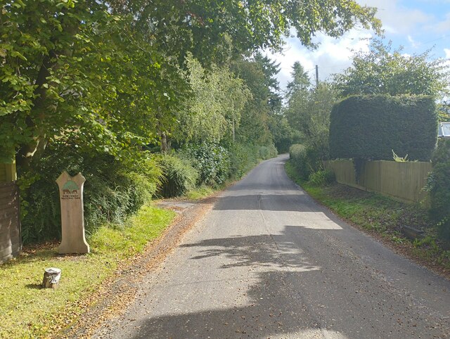
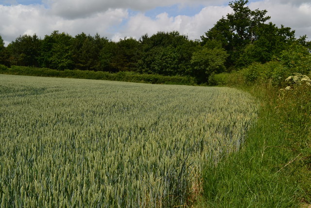
Morgan's Vale is a small village located in the county of Wiltshire, England. Situated in the picturesque Woodford Valley, the village is surrounded by lush green countryside and is renowned for its natural beauty. The village is positioned on the edge of the Cranborne Chase and West Wiltshire Downs Area of Outstanding Natural Beauty, making it a popular destination for walkers, hikers, and nature enthusiasts.

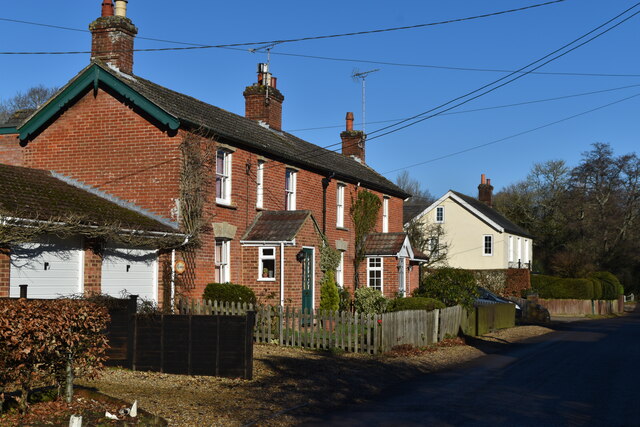
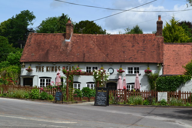
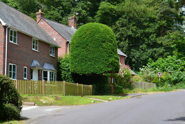
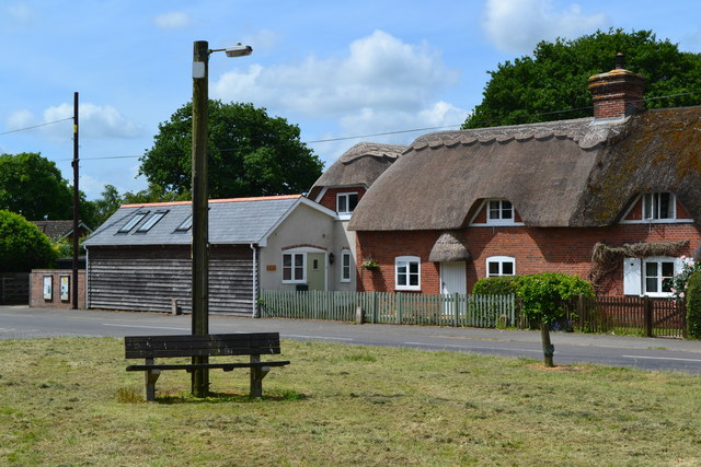
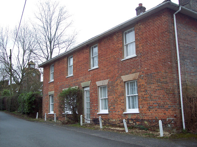
Morgan's Vale itself is a quiet and close-knit community, with a population of around 500 residents. The village is characterized by its charming thatched cottages, historic buildings, and a traditional village green. The local pub, The Churchill Arms, is a focal point of the village and provides a warm and welcoming atmosphere for both locals and visitors.

The village is well-connected to nearby towns, with the market town of Salisbury just a short drive away. This provides residents with access to a range of amenities, including shops, schools, and healthcare facilities. Additionally, the village benefits from good transport links, with regular bus services connecting it to surrounding areas.

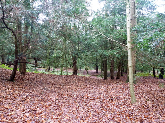
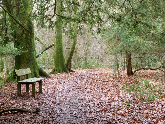
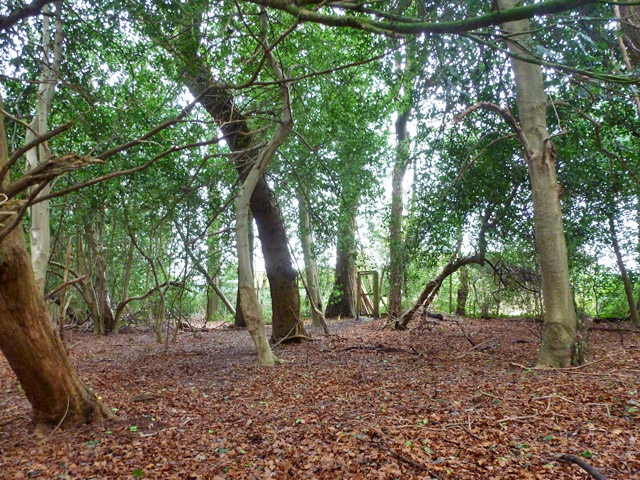
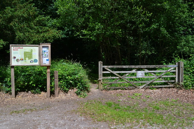
One of the main attractions in Morgan's Vale is its proximity to the ancient woodland of Bentley Wood. This expansive forest is home to a diverse range of flora and fauna, including rare species such as the purple emperor butterfly. The wood offers numerous walking trails and is particularly popular during the spring when it becomes a stunning carpet of bluebells.

Overall, Morgan's Vale is a tranquil and picturesque village, offering residents and visitors a peaceful retreat in the heart of the Wiltshire countryside.

If you have any feedback on the listing, please let us know in the comments section below.

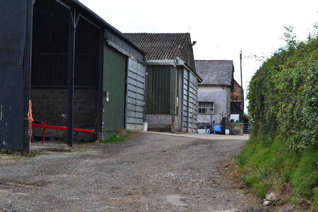
Morgan's Vale Images

Images are sourced within 2km of 50.986665/-1.723577 or Grid Reference SU1920. Thanks to Geograph Open Source API. All images are credited.

Vicarage Road, Lover
Princes Hill Boundary sign for entering the New Forest.

Web : <span class="nowrap"><a title="https://en.wikipedia.org/wiki/New_Forest" rel="nofollow ugc noopener" href="https://en.wikipedia.org/wiki/New_Forest">Link</a><img style="margin-left:2px;" alt="External link" title="External link - shift click to open in new window" src="https://s1.geograph.org.uk/img/external.png" width="10" height="10"/></span>
Princes Hill
Boundary sign for entering the New Forest. Web : LinkExternal link
Lover road junction Rural village with old cast iron sign post.
Lover road junction
Rural village with old cast iron sign post.
Redlynch church St. Mary's is just a Victorian structure from 1837 and it actually at the settlement of Lover.
Redlynch church
St. Mary's is just a Victorian structure from 1837 and it actually at the settlement of Lover.
In Tinney's Firs A Woodland Trust wood. The northern part of the wood is quite undulating, and looks as if some delving had been going on a long time ago.
In Tinney's Firs
A Woodland Trust wood. The northern part of the wood is quite undulating, and looks as if some delving had been going on a long time ago.
The Book Box Former telephone box at Lover.
The Book Box
Former telephone box at Lover.
St Mary's Church, Redlynch
Field edge near Lover
Quavey Well The sign says that the well was dug in 1900 and was still in regular use until the early 1950s.  It was last refurbished in 2004.
Quavey Well
The sign says that the well was dug in 1900 and was still in regular use until the early 1950s. It was last refurbished in 2004.
The King's Head public house, Redlynch
Bus stop under tree
Bus stop under tree
Langford Lane passing through Templeman Farm
North Charford The B3080 heading north into Wiltshire from Hampshire.
North Charford
The B3080 heading north into Wiltshire from Hampshire.
In Tinney's Firs A Woodland Trust wood, which is far from being all firs. Here are some beeches.
In Tinney's Firs
A Woodland Trust wood, which is far from being all firs. Here are some beeches.
In Tinney's Firs The Woodland Trust wood has back gardens of houses along its western border. A private gate into the wood may be glimpsed.
In Tinney's Firs
The Woodland Trust wood has back gardens of houses along its western border. A private gate into the wood may be glimpsed.
Thatched cottage beside triangular green
Play area at Redlynch playing fields
Entrance to woodland at Tinney's Firs
Show me another place!

Morgan's Vale is located at Grid Ref: SU1920 (Lat: 50.986665, Lng: -1.723577)

Unitary Authority: Wiltshire

Police Authority: Wiltshire

What 3 Words

///loopholes.export.doted. Near Downton, Wiltshire

Nearby Locations

Morgan's Vale

Related Wikis

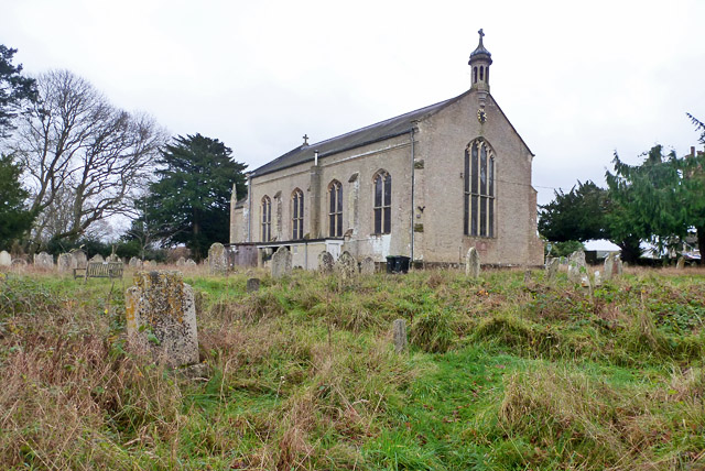
Church of St Birinus, Morgan's Vale

The Church of St Birinus is a Church of England church in Morgan's Vale, Wiltshire, England. It was designed by Charles Ponting and constructed in 1894...

Redlynch, Wiltshire

Redlynch is a village and civil parish about 6.5 miles (10.5 km) southeast of Salisbury in Wiltshire, England. The parish includes the villages of Morgan...

Downton railway station

Downton was a railway station serving Downton, a village in Wiltshire. The village contained a large tanning mill on the River Avon, which has now closed...

Downton, Wiltshire

Downton is a village and civil parish on the River Avon in southern Wiltshire, England, about 6 miles (10 km) southeast of the city of Salisbury. The parish...

Nearby Amenities

Located within 500m of 50.986665,-1.723577
Barrier: cycle_barrier
Foot: yes
Lat/Long: 50.9867859/-1.7176943
Barrier: cycle_barrier
Foot: yes
Lat/Long: 50.9870844/-1.7182231
Post Box
Ref: SP5 140
Lat/Long: 50.9854226/-1.7231388
Morgan's Vale
Place: locality
Lat/Long: 50.9874607/-1.7222161
Power: pole
Lat/Long: 50.9866448/-1.7251351
Power: pole
Lat/Long: 50.9868214/-1.7244074
Power: pole
Lat/Long: 50.9870696/-1.7233585
Power: pole
Lat/Long: 50.9866115/-1.7224966
Power: pole
Lat/Long: 50.9873306/-1.7223665
Power: pole
Lat/Long: 50.9864388/-1.7259717
Power: pole
Lat/Long: 50.9883143/-1.7252478
Power: pole
Lat/Long: 50.9893079/-1.7248602
Power: pole
Lat/Long: 50.9867337/-1.728397
Power: pole
Lat/Long: 50.9874863/-1.7295247
Power: pole
Lat/Long: 50.9861067/-1.727522
Power: pole
Lat/Long: 50.9863953/-1.7261558
Power: pole
Lat/Long: 50.9860866/-1.7215912
Addr Housename: Buttercup Cottage
Addr Street: Morgans Vale Road
Lat/Long: 50.9866853/-1.7213105
Addr Housename: Cherry Lodge
Addr Street: Morgans Vale Road
Lat/Long: 50.9865266/-1.7210067
Addr Housename: Sawmill House
Addr Street: Greens Meade
Lat/Long: 50.9834955/-1.7198146
Addr Housename: Jessamine Cottage
Addr Street: Morgans Vale Road
Entrance: yes
Lat/Long: 50.9873847/-1.7197258
Addr Housename: Sawmills Cottage
Addr Street: Vale Road
Lat/Long: 50.9835617/-1.7198952
Addr Housename: Wren Cottage
Addr Street: Morgans Vale Road
Lat/Long: 50.9878779/-1.718612
Addr Housename: Bramble Cottage
Addr Street: Morgans Vale Road
Lat/Long: 50.9879147/-1.7185678
Addr Housename: Penwith House
Addr Housenumber: 15
Addr Street: Vicarage Park
Lat/Long: 50.9871854/-1.7180519
Addr Housenumber: 8
Addr Street: Vicarage Park
Lat/Long: 50.9870237/-1.7190367
Addr Housenumber: 2
Addr Street: Vicarage Park
Lat/Long: 50.9874716/-1.719279
Addr Housenumber: 1
Addr Street: Vicarage Park
Lat/Long: 50.9877151/-1.7189746
Addr Housenumber: 6
Addr Street: Vicarage Park
Lat/Long: 50.9871766/-1.7190486
Addr Housenumber: 4
Addr Street: Vicarage Park
Lat/Long: 50.9873322/-1.7191218
Addr Housenumber: 10
Addr Street: Vicarage Park
Lat/Long: 50.9868859/-1.7190896
Addr Housename: Old Vicarage
Addr Street: Vicarage Park
Lat/Long: 50.9875547/-1.718543
Addr Housenumber: 3
Addr Street: Vicarage Park
Lat/Long: 50.9876046/-1.7188368
Addr Housename: Ashcroft
Addr Street: Morgans Vale Road
Lat/Long: 50.986059/-1.7210137
Addr Housenumber: 7
Addr Street: Vicarage Park
Lat/Long: 50.9872712/-1.7184217
Addr Housenumber: 19
Addr Street: Vicarage Park
Lat/Long: 50.9867511/-1.718339
Addr Housenumber: 14
Addr Street: Vicarage Park
Lat/Long: 50.986592/-1.7197976
Addr Housename: The Leys
Addr Housenumber: 12
Addr Street: Vicarage Park
Lat/Long: 50.9867456/-1.7194274
Addr Housenumber: 23
Addr Street: Vicarage Park
Lat/Long: 50.9865042/-1.718832
Addr Housenumber: 21
Addr Street: Vicarage Park
Lat/Long: 50.986597/-1.7185316
Addr Housenumber: 17
Addr Street: Vicarage Park
Lat/Long: 50.9870546/-1.7185128
Addr Housenumber: 13
Addr Street: Vicarage Park
Lat/Long: 50.9873805/-1.7178959
Addr Housenumber: 11
Addr Street: Vicarage Park
Lat/Long: 50.9875375/-1.7177779
Addr Housenumber: 9
Addr Street: Vicarage Park
Lat/Long: 50.9875442/-1.7181829
Material: wood
Power: pole
Lat/Long: 50.984769/-1.7174169
Addr Housename: Tanners
Addr Street: Morgans Vale Road
Lat/Long: 50.9857546/-1.7216016
Addr Housename: Dogwood
Addr Street: Morgans Vale Road
Nohousenumber: yes
Lat/Long: 50.9867377/-1.7214874
Addr Housename: Val Dene
Addr Street: Morgans Vale Road
Lat/Long: 50.9858452/-1.7217945
Morgan's Vale
Place: hamlet
Lat/Long: 50.9897162/-1.7213988
The data included in this document is from www.openstreetmap.org. The data is made available under ODbL.

Have you been to Morgan's Vale?

Leave your review of Morgan's Vale below (or comments, questions and feedback).