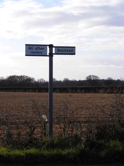
Belstead

Settlement in Suffolk Babergh

England

Belstead

Four Trees Four trees in a field near to Blacksmiths Corner Belstead Suffolk.
Four Trees Credit: Keith Evans

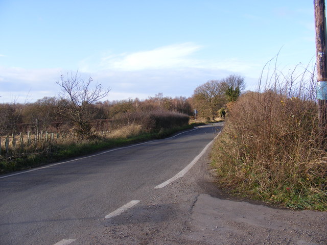
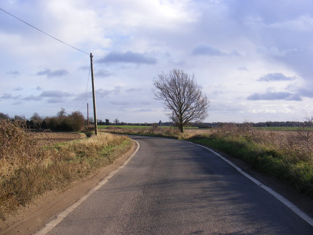
Belstead is a small village located in the county of Suffolk, England. Situated just two miles south of the town of Ipswich, it is a part of the Babergh district. Belstead is surrounded by picturesque countryside, with the River Orwell flowing nearby.

The village has a rich history, dating back to the Domesday Book of 1086, where it was listed as "Belsteda." Over the centuries, Belstead has remained a peaceful and close-knit community, known for its tranquil atmosphere and natural beauty.

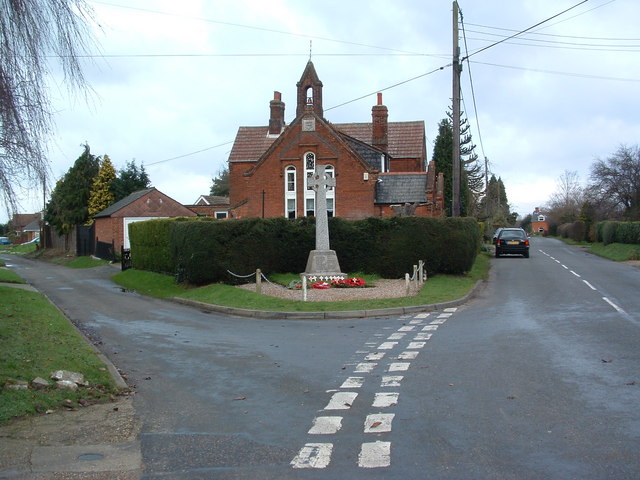
One of the notable landmarks in Belstead is the 12th-century St. Mary's Church, which showcases stunning architectural features and a serene churchyard. The church is still active and holds regular services for the local community.

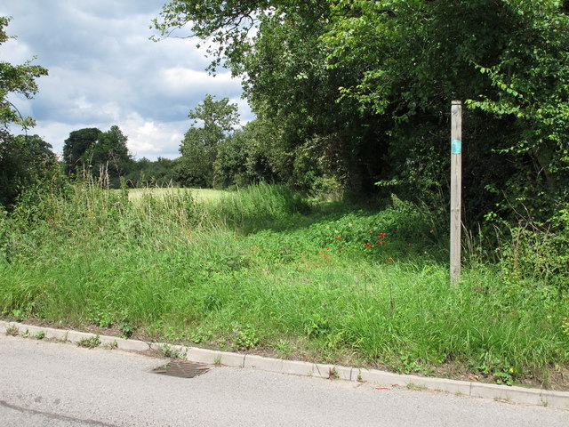
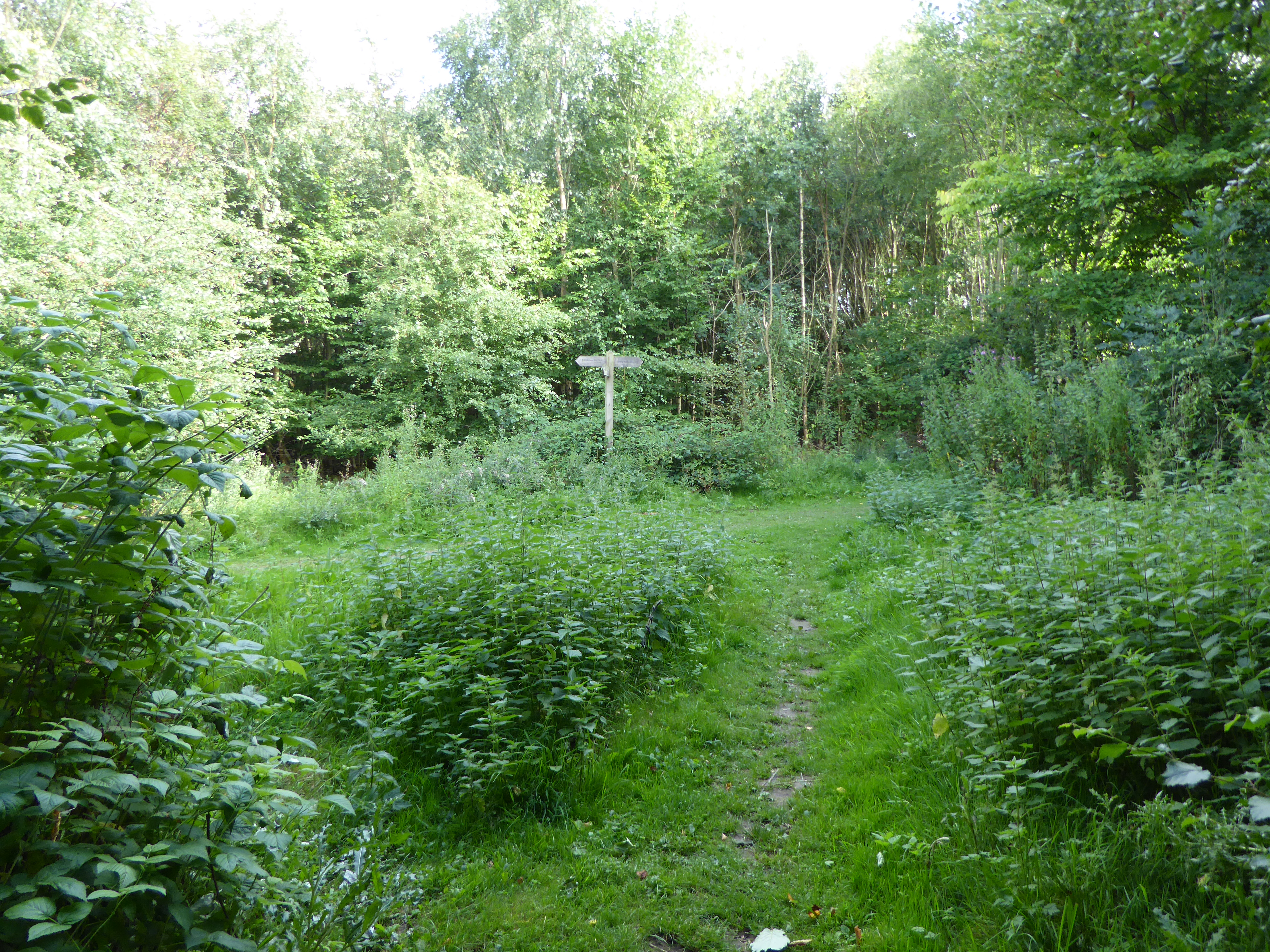
Belstead also offers a range of outdoor recreational activities, with several footpaths and nature trails that allow residents and visitors to explore the surrounding countryside. The nearby Orwell Country Park provides opportunities for leisurely walks, picnics, and wildlife spotting, attracting nature enthusiasts and families alike.

In terms of amenities, Belstead has a primary school, providing education for the village's younger residents. For other necessities, such as shopping and healthcare, the town of Ipswich is easily accessible.

Overall, Belstead is a charming village that offers a peaceful and idyllic setting, perfect for those seeking a rural lifestyle while still being within reach of urban conveniences. With its historical heritage and natural surroundings, it continues to be a cherished community in Suffolk.

If you have any feedback on the listing, please let us know in the comments section below.

Belstead Images

Images are sourced within 2km of 52.028756/1.108445 or Grid Reference TM1341. Thanks to Geograph Open Source API. All images are credited.

Four Trees Four trees in a field near to Blacksmiths Corner Belstead Suffolk.
Four Trees
Four trees in a field near to Blacksmiths Corner Belstead Suffolk.
A14 eastbound at junction 55 for Ipswich
Railway bridge over the A14 westbound near Ipswich
A14 westbound near Ipswich
A14 westbound approaching junction 55
Leaving the A14 westbound at junction 55
Pizza Hut on London Road, Ipswich
The A12, Belstead
The A12, Belstead
Ipswich Veterinary Centre on Scrivener Road
Scrivener Drive from London Road Ipswich
The A12, Belstead
The A12, Belstead
A14 The A14 is a major road running 127 miles from Felixstowe to the Catthorpe Interchange, the junction of the M1 and M6 motorways near Rugby. The road connects East Anglia with the West Midlands and The North.
Wikipedia: <span class="nowrap"><a title="http://en.wikipedia.org/wiki/A14_road_(England)" rel="nofollow ugc noopener" href="http://en.wikipedia.org/wiki/A14_road_(England)">Link</a><img style="margin-left:2px;" alt="External link" title="External link - shift click to open in new window" src="https://s1.geograph.org.uk/img/external.png" width="10" height="10"/></span>
A14
The A14 is a major road running 127 miles from Felixstowe to the Catthorpe Interchange, the junction of the M1 and M6 motorways near Rugby. The road connects East Anglia with the West Midlands and The North. Wikipedia: LinkExternal link
Entrance to public footpath Near Bluegate Farm. Note footpath sign.
Entrance to public footpath
Near Bluegate Farm. Note footpath sign.
The Street Looking towards Blacksmith's Corner at the exit to Pannington Hall Farm (Jimmys Farm).
The Street
Looking towards Blacksmith's Corner at the exit to Pannington Hall Farm (Jimmys Farm).
The Street Looking towards the A137 at the exit to Pannington Hall Farm (Jimmys Farm).
The Street
Looking towards the A137 at the exit to Pannington Hall Farm (Jimmys Farm).
Roadsign on The Street At the exit to Pannington Hall Farm (Jimmys Farm).
Roadsign on The Street
At the exit to Pannington Hall Farm (Jimmys Farm).
Through Old Hall Wood on Bentley Lane, Belstead The path is called Bentley Lane and appears to be an old cart track. Now a public bridleway, it leads from the village of Belstead through Old Hall Wood, further to the south. The woodland on the other side of the lane is marked as being private.
Through Old Hall Wood on Bentley Lane, Belstead
The path is called Bentley Lane and appears to be an old cart track. Now a public bridleway, it leads from the village of Belstead through Old Hall Wood, further to the south. The woodland on the other side of the lane is marked as being private.
The private section of Old Hall Wood, Belstead The path seen in the foreground is called Bentley Lane and appears to be an old cart track. Now a public bridleway, it leads from the village of Belstead through Old Hall Wood, further to the south. The woodland on the other side of the lane is marked as being private > <a title="https://www.geograph.org.uk/photo/2747423" href="https://www.geograph.org.uk/photo/2747423">Link</a>.
The private section of Old Hall Wood, Belstead
The path seen in the foreground is called Bentley Lane and appears to be an old cart track. Now a public bridleway, it leads from the village of Belstead through Old Hall Wood, further to the south. The woodland on the other side of the lane is marked as being private > Link.
Show me another place!

Belstead is located at Grid Ref: TM1341 (Lat: 52.028756, Lng: 1.108445)

Administrative County: Suffolk

District: Babergh

Police Authority: Suffolk

What 3 Words

///allergy.bids.whirlpool. Near Ipswich, Suffolk

Nearby Locations

Belstead

Related Wikis

Belstead

Belstead is a village and civil parish in the Babergh district of the English county of Suffolk. Located on the southern edge of Ipswich, around 3 miles...

Ipswich Hoard

There are two notable Ipswich Hoards (which is to say, ancient hoards found in Ipswich, the county town of Suffolk, England). The first was a hoard of...

Belstead House

Belstead House is a Grade II listed 16th/17th century house in Sprites Lane, Pinewood, Suffolk. It was bought by Major Quilter in 1901. Until 1920 it was...

Pinewood, Suffolk

Pinewood is a civil parish and electoral ward in the Babergh district of the English county of Suffolk. Whilst not part of the borough, it forms part of...

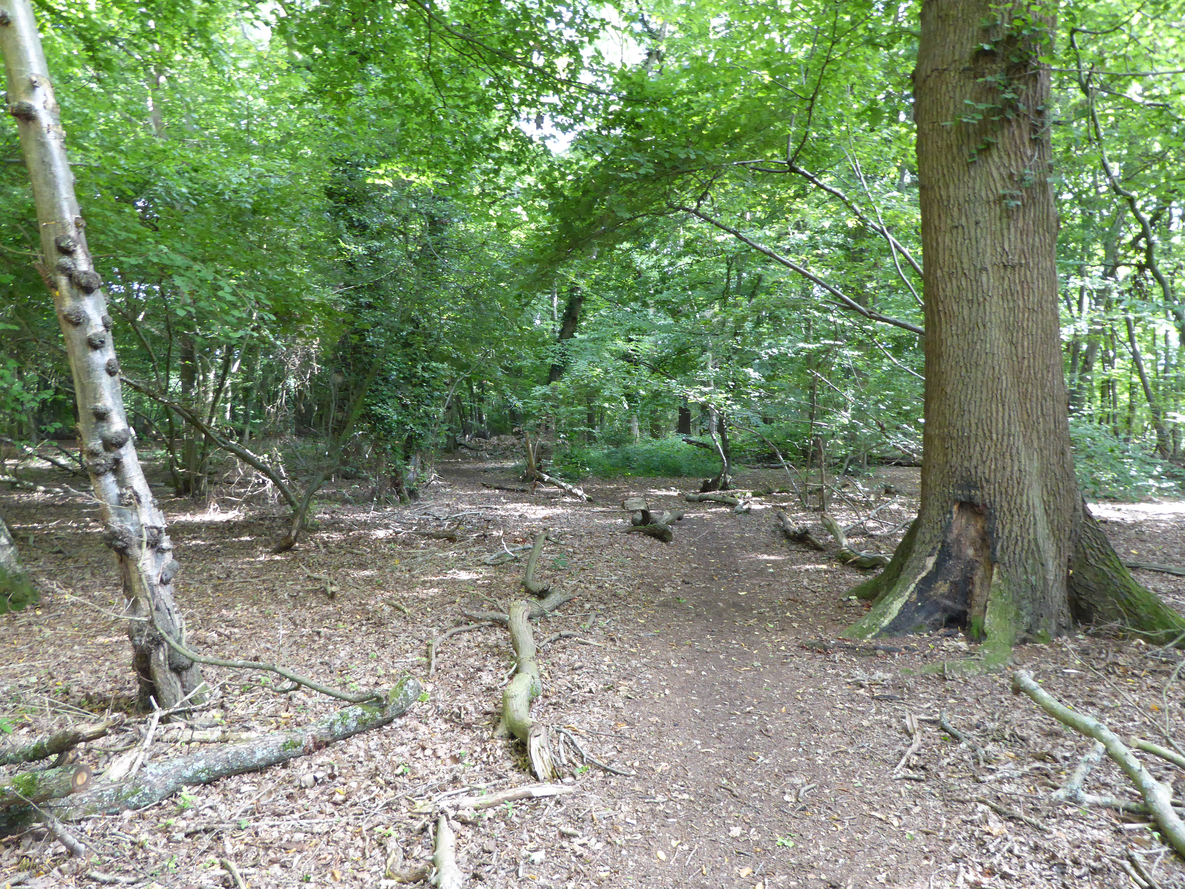
Spring Wood, Belstead

Spring Wood is a 5.5 hectare Local Nature Reserve east of Belstead, on the southern outskirts of Ipswich in Suffolk. It is owned and managed by Ipswich...

Millennium Wood, Ipswich

Millennium Wood is a 3.8 hectare Local Nature Reserve on the southern outskirts of Ipswich in Suffolk. It is owned by Suffolk County Council and managed...

The Bridge School, Ipswich

The Bridge School is a coeducational special school located in Ipswich in the English county of Suffolk. The school was formed in 2010 as a result of the...

Belstead Brook Hotel

The Belstead Brook Hotel in Ipswich, Suffolk is a building of historical significance. It was originally a 16th-century hunting lodge but was used later...

Nearby Amenities

Located within 500m of 52.028756,1.108445
Motorway Junction
Copdock Interchange
Ref: 55
Lat/Long: 52.032867/1.1060733
Belstead
Place: village
Wikidata: Q816190
Wikipedia: en:Belstead
Lat/Long: 52.0278868/1.1063746
Power: tower
Lat/Long: 52.0327914/1.1114351
Memorial
Local Ref: adj
Naptan AtcoCode: 390010539
Naptan Bearing: N
Naptan BusStopType: CUS
Naptan CommonName: Memorial
Naptan Landmark: Memorial
Naptan NaptanCode: sufagmwt
Naptan Street: Chapel Lane
Naptan Verified: no
Source: naptan_import
Lat/Long: 52.0267682/1.1053969
Memorial
Local Ref: opp
Naptan AtcoCode: 390010540
Naptan Bearing: SW
Naptan BusStopType: CUS
Naptan CommonName: Memorial
Naptan Landmark: Memorial
Naptan NaptanCode: sufagpad
Naptan Street: Chapel Lane
Naptan Verified: no
Source: naptan_import
Lat/Long: 52.026641/1.1054464
Post Box
Operator: Royal Mail
Operator Wikidata: Q638098
Post Box Mounting: pier
Post Box Type: lamp
Ref: IP8 1042
Lat/Long: 52.0274362/1.1067763
Man Made: village_sign
Lat/Long: 52.0253052/1.1052469
Defibrillator
Access: yes
Defibrillator Location: outside Belstead Village Hall
Emergency: defibrillator
Indoor: no
Ref GB The Circuit: 5579E302-200B-45CC-A2C1-B11B00BD3F52
Lat/Long: 52.0254944/1.1054032
Entrance: yes
Lat/Long: 52.0254712/1.1054015
Historic: memorial
Memorial: war_memorial
Lat/Long: 52.0267278/1.1054418
The data included in this document is from www.openstreetmap.org. The data is made available under ODbL.

Have you been to Belstead?

Leave your review of Belstead below (or comments, questions and feedback).