Moortown
Settlement in Lincolnshire West Lindsey
England
Moortown
Moortown is a small village located in the county of Lincolnshire, England. Situated approximately 6 miles northwest of the city of Lincoln, it falls within the West Lindsey district. The village occupies a rural setting with picturesque countryside surroundings, making it an idyllic location for those seeking a peaceful and tranquil lifestyle.
Moortown is characterized by its charming and traditional architecture, with many stone-built houses and cottages dating back several centuries. The village's population is relatively small, with a close-knit community that takes pride in its strong community spirit. The residents of Moortown benefit from a range of local amenities, including a village hall, a primary school, a post office, and a local pub, which serves as a social hub for both villagers and visitors.
The surrounding landscape offers ample opportunities for outdoor activities, with numerous walking trails and cycling routes available for residents and visitors to explore. Moortown is also conveniently situated near several larger towns and cities, with the historic city of Lincoln just a short drive away. This provides residents with access to a wider range of amenities, including shopping centers, leisure facilities, and cultural attractions.
Overall, Moortown is a peaceful and picturesque village that offers a close community, rural charm, and easy access to nearby urban areas. It provides a perfect balance between a quiet countryside lifestyle and the conveniences of modern living.
If you have any feedback on the listing, please let us know in the comments section below.
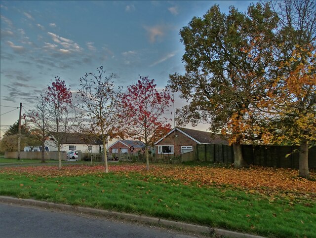
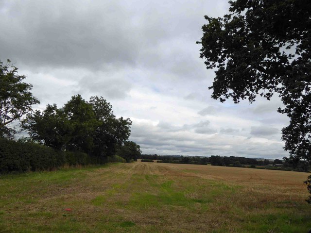
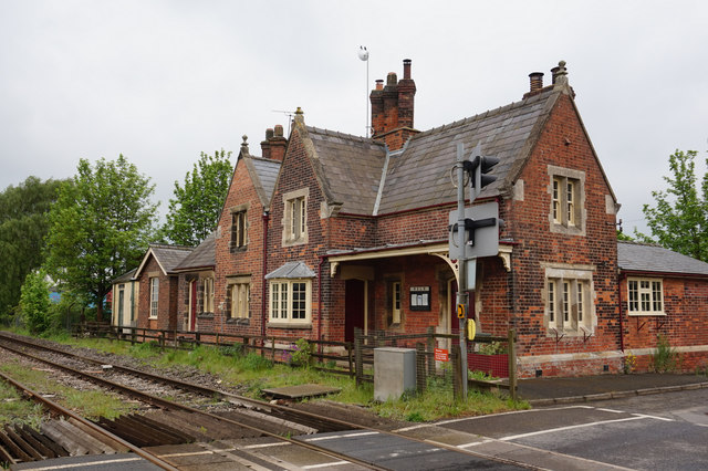
Moortown Images
Images are sourced within 2km of 53.478207/-0.38329 or Grid Reference TF0799. Thanks to Geograph Open Source API. All images are credited.


Moortown is located at Grid Ref: TF0799 (Lat: 53.478207, Lng: -0.38329)
Division: Parts of Lindsey
Administrative County: Lincolnshire
District: West Lindsey
Police Authority: Lincolnshire
What 3 Words
///tinsel.commoners.things. Near Caistor, Lincolnshire
Nearby Locations
Related Wikis

Moortown, Lincolnshire
Moortown is a hamlet in the civil parish of South Kelsey, and in the West Lindsey district of Lincolnshire, England. It is at the crossroads of the B1205...
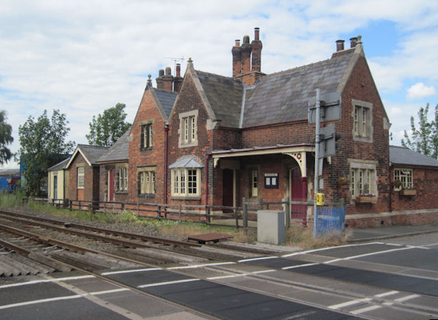
Moortown railway station
Moortown railway station was a railway station serving both the village of Moortown and town of Caistor in Lincolnshire, England on the line between Grimsby...

Holton le Moor
Holton le Moor is a small village and civil parish in the West Lindsey district of Lincolnshire, England. Holton le Moor lies on the B1434 road. The nearest...

Moot Hall, Holton le Moor
The Moot Hall is a civic building in Market Rasen Road, Holton le Moor, Lincolnshire, England. The building, which continues to be used for civic meetings...
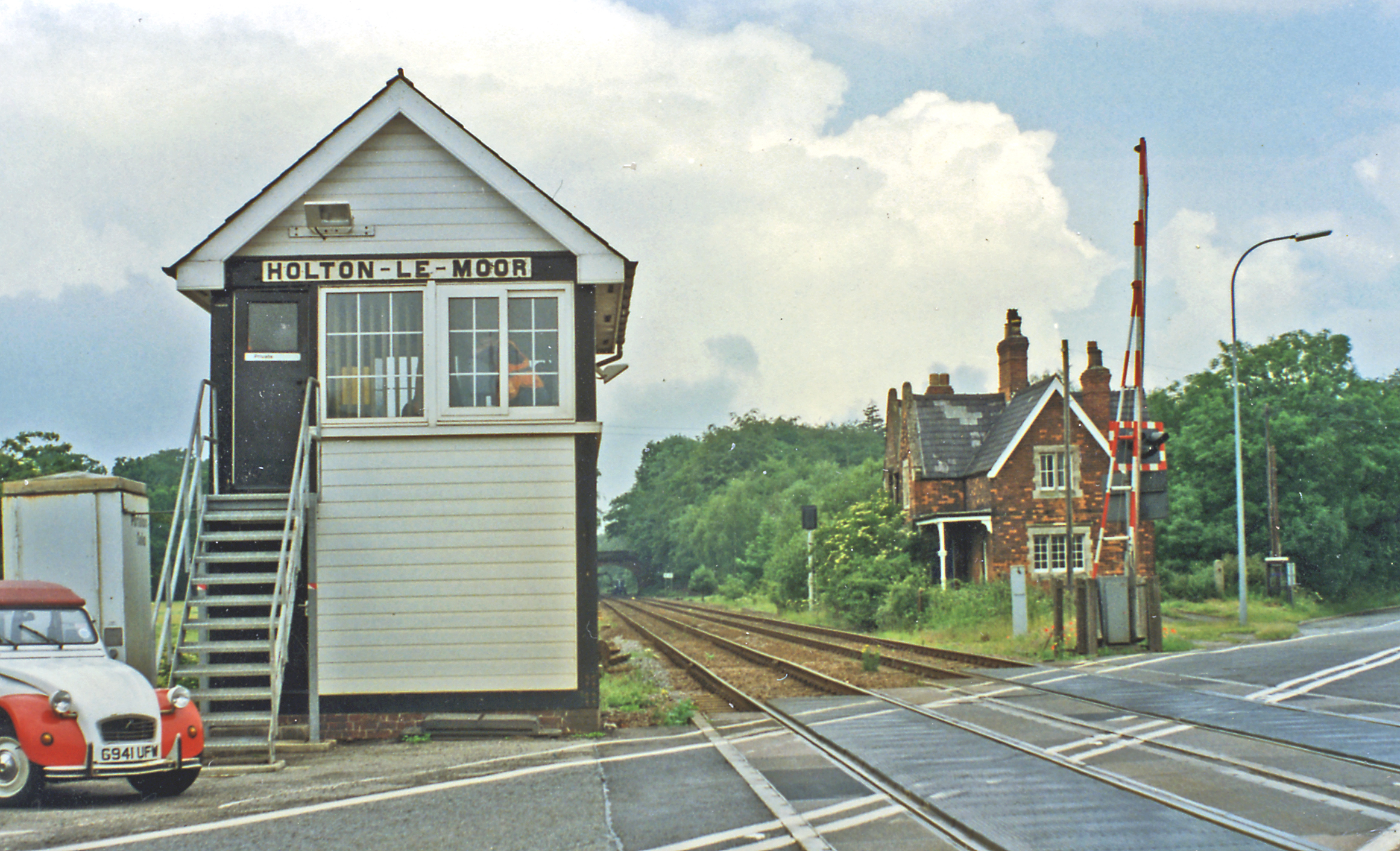
Holton Le Moor railway station
Holton Le Moor railway station was a station in Holton le Moor, Lincolnshire, England. It was opened in 1848 and closed in 1965. == References ==

North Kelsey railway station
North Kelsey railway station was a railway station serving both the village of North Kelsey and town of Caistor in Lincolnshire, England, it was opened...
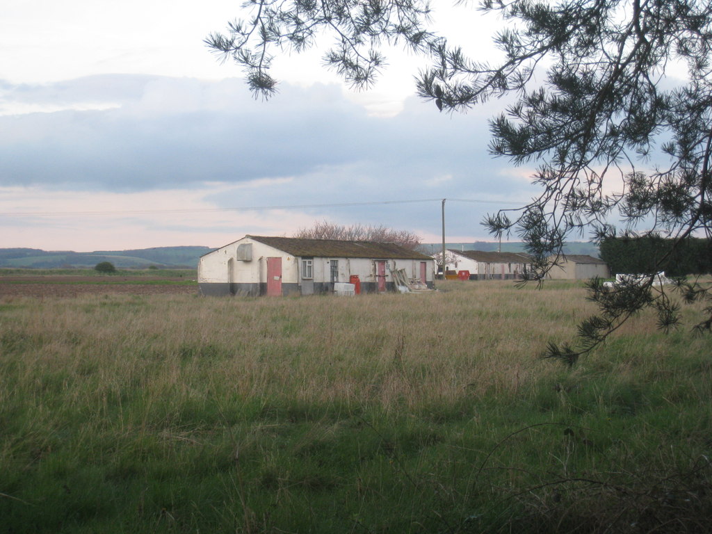
RAF Caistor
RAF Caistor is a former Royal Air Force Relief Landing Ground located 6.2 miles (10.0 km) south east of Brigg, Lincolnshire and 9.1 miles (14.6 km) north...

South Kelsey
South Kelsey is a village and civil parish in the West Lindsey district of Lincolnshire, England. It is situated on the B1205, 5 miles (8.0 km) east from...
Nearby Amenities
Located within 500m of 53.478207,-0.38329Have you been to Moortown?
Leave your review of Moortown below (or comments, questions and feedback).