Belowda

Settlement in Cornwall

England

Belowda

Restormel : Grassy Fields & Pylons Pylons travel along a field near to Belowda as seen from the A30.
Restormel : Grassy Fields & Pylons Credit: Lewis Clarke

Belowda is a quaint village located in Cornwall, England. Situated in the southwestern region of the country, Belowda is nestled amidst picturesque countryside and rolling hills. The village is part of the Cornwall Area of Outstanding Natural Beauty, renowned for its stunning landscapes and untouched beauty.

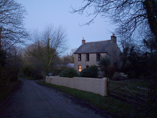
With a population of around 500 residents, Belowda offers a tranquil and close-knit community atmosphere. The village is characterized by traditional stone cottages and charming gardens, adding to its idyllic charm. The local architecture reflects the area's rich history, with some buildings dating back to the 17th century.

Nature enthusiasts will find plenty to explore in Belowda. The village is surrounded by lush greenery, providing ample opportunities for hiking, cycling, and wildlife spotting. The nearby Luxulyan Valley is a designated World Heritage Site, featuring a breathtaking viaduct and ancient woodlands.

Despite its peaceful setting, Belowda benefits from its proximity to larger towns and cities. The vibrant city of Truro is just a short drive away, offering a wide range of amenities, shopping centers, and cultural attractions. The stunning coastal towns of St. Austell and Fowey are also within easy reach, providing access to beautiful beaches and water activities.

In summary, Belowda is a charming village in Cornwall that offers a serene and picturesque environment. Its close-knit community, traditional architecture, and stunning natural surroundings make it a delightful place to visit or reside.

If you have any feedback on the listing, please let us know in the comments section below.
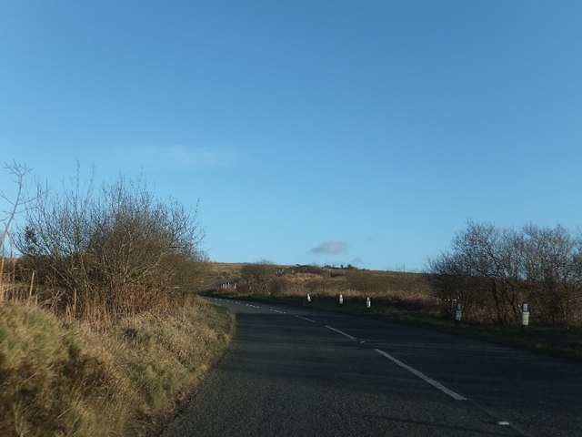
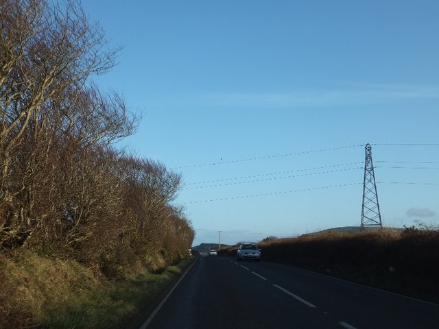
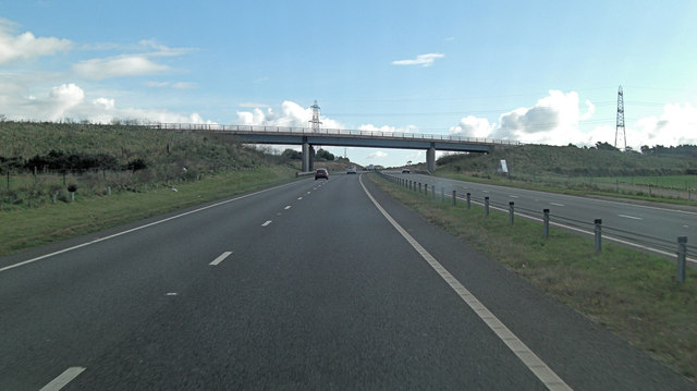
Belowda Images

Images are sourced within 2km of 50.42056/-4.862642 or Grid Reference SW9661. Thanks to Geograph Open Source API. All images are credited.

Restormel : Grassy Fields & Pylons Pylons travel along a field near to Belowda as seen from the A30.
Restormel : Grassy Fields & Pylons
Pylons travel along a field near to Belowda as seen from the A30.
B3274 on Tregonetha Downs
Junction off B3274 on Tregonetha Downs
Former mine building west of Belowda Beacon
Footpath to Belowda The skyline has some of the spoil heaps from the china clay industry
Footpath to Belowda
The skyline has some of the spoil heaps from the china clay industry
B3274 on the south slope of Belowda Beacon  Just beyond the road marking is the entrance to an abandoned mine (Beacon Mine).
B3274 on the south slope of Belowda Beacon
Just beyond the road marking is the entrance to an abandoned mine (Beacon Mine).
B3274 approaching Tregoss Moor The road is dropping to the flat moorland.  It crosses a minor road near Lane End, then under power cables before crossing the dual carriageway A30.  A landscaped china clay tip is visible on the  right horizon.
B3274 approaching Tregoss Moor
The road is dropping to the flat moorland. It crosses a minor road near Lane End, then under power cables before crossing the dual carriageway A30. A landscaped china clay tip is visible on the right horizon.
Bridge over railway line on Tregoss Moor
B3274 on southern edge of Tregoss Moor The road rises from the moor to pass Treranke Cottages behind the tall trees on the right.
B3274 on southern edge of Tregoss Moor
The road rises from the moor to pass Treranke Cottages behind the tall trees on the right.
Power cables above the B3274 north-west of Roche
Footpath leading south from the old A30 on Goss Moor The path leads to Tregoss.
Footpath leading south from the old A30 on Goss Moor
The path leads to Tregoss.
The old A30 approaching the bridge over the new A30 For many years, the A30 on Goss Moor was a bottleneck for traffic through Cornwall.  Now the new A30 by-passes the moorland and the old road crosses the new on this bridge.
The old A30 approaching the bridge over the new A30
For many years, the A30 on Goss Moor was a bottleneck for traffic through Cornwall. Now the new A30 by-passes the moorland and the old road crosses the new on this bridge.
Old A30 crossing the new A30 To the north of the roads are pylons for the National Grid
Old A30 crossing the new A30
To the north of the roads are pylons for the National Grid
A30 crossed by unnamed road east of Trenoweth
A30 crossed by B3274
Railway Bridge over the old A30 at Goss Moor
Road near Royalton
Road near Royalton
Cornwall : The A30 Heading along the A30 as it passes through Cornwall.
Cornwall : The A30
Heading along the A30 as it passes through Cornwall.
Show me another place!

Belowda is located at Grid Ref: SW9661 (Lat: 50.42056, Lng: -4.862642)

Unitary Authority: Cornwall

Police Authority: Devon and Cornwall

What 3 Words

///sensibly.thrashed.tags. Near Roche, Cornwall

Nearby Locations

Belowda

Related Wikis

Belowda

Belowda (Cornish: Boslowsa) is a village in Cornwall, England, UK. The village is just north of the A30 trunk road, about seven miles west-southwest of...

Tregoss

Tregoss is a hamlet in the parish of Roche, Cornwall, England, United Kingdom. To the east is Tregoss Moor. == References ==

Demelza

Demelza is a hamlet in the parish of St Wenn, Cornwall, England, UK. Demelza is situated 1 mile (1.6 km) south-east of St Wenn and lies at around 114...

Victoria, Cornwall

Victoria is a hamlet in Cornwall, England, UK. It is located in the civil parish of Roche, 1 mile (1.6 km) north of Roche village and 6 miles (9.7 km)...

Nearby Amenities

Located within 500m of 50.42056,-4.862642
Phone
Check Date: 2023-06-18
Emergency: phone
Source: survey
Lat/Long: 50.4181065/-4.8576686
Power: tower
Lat/Long: 50.41933/-4.867705
Power: tower
Lat/Long: 50.4194969/-4.8636866
Power: tower
Lat/Long: 50.4197229/-4.8590252
Belowda
Is In County: Cornwall
Name En: Belowda
Name Kw: Boslowsa
Place: hamlet
Source: OS_OpenData_StreetView
Wikidata: Q4884635
Lat/Long: 50.4209613/-4.8647104
Power: pole
Lat/Long: 50.4194974/-4.8562253
Power: pole
Lat/Long: 50.4194051/-4.8581564
Power: pole
Lat/Long: 50.4192753/-4.8610908
Power: pole
Lat/Long: 50.4192001/-4.8627752
Power: pole
Lat/Long: 50.4191249/-4.8644972
Power: pole
Lat/Long: 50.4189625/-4.8676729
Power: pole
Lat/Long: 50.4185763/-4.8688719
Post Box
Brand: Royal Mail
Brand Wikidata: Q638098
Collection Times: Mo-Fr 11:00; Sa 09:00
Operator: Royal Mail
Operator Wikidata: Q638098
Post Box Mounting: pier
Post Box Type: lamp
Ref: PL26 72
Royal Cypher: EIIR
Royal Cypher Wikidata: Q33102113
Survey Date: 2022-12-04
Lat/Long: 50.4202981/-4.8649014
The data included in this document is from www.openstreetmap.org. The data is made available under ODbL.

Have you been to Belowda?

Leave your review of Belowda below (or comments, questions and feedback).