Belnacraig

Settlement in Aberdeenshire

Scotland

Belnacraig

Forestry entrance in Glen Buchat
Forestry entrance in Glen Buchat Credit: Steven Brown

Belnacraig is a small village located in Aberdeenshire, Scotland. Situated in the picturesque countryside, it offers a peaceful and idyllic setting for residents and visitors alike. The village is surrounded by rolling hills, lush green fields, and stunning landscapes, making it a popular destination for nature enthusiasts and hikers.

With a population of around 300 people, Belnacraig has a tight-knit community that takes pride in its rural heritage and traditional way of life. The village is known for its friendly and welcoming atmosphere, with residents often participating in various community events and activities. The locals are known for their hospitality and are always ready to lend a helping hand to those in need.

Despite its small size, Belnacraig offers a range of amenities and services to cater to the needs of its residents. There is a village shop where locals can purchase daily essentials, as well as a post office and a small café where people can gather and socialize. Additionally, the village has a primary school, ensuring that children have access to quality education within their community.

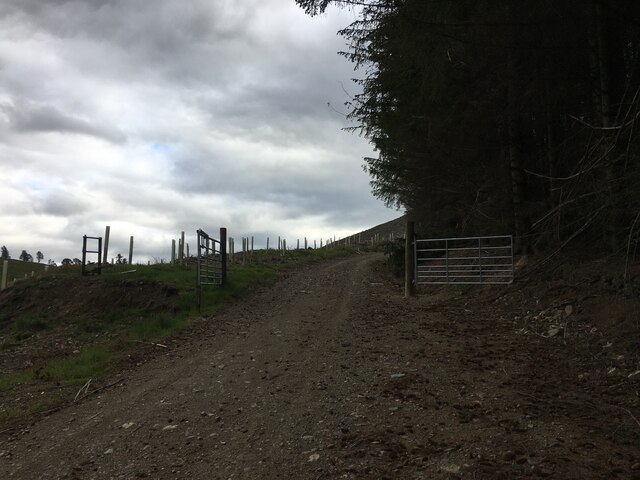
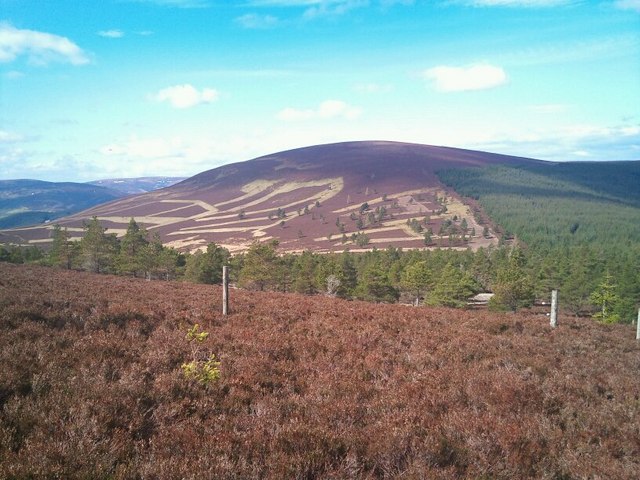
For those seeking recreational activities, Belnacraig is surrounded by numerous outdoor attractions. The nearby hills and forests provide ample opportunities for walking, hiking, and cycling. Fishing enthusiasts can also enjoy the nearby rivers and lochs, which are home to a variety of fish species.

Overall, Belnacraig is a charming and tranquil village that offers a close-knit community, stunning natural beauty, and a peaceful way of life.

If you have any feedback on the listing, please let us know in the comments section below.

Belnacraig Images

Images are sourced within 2km of 57.240327/-3.037311 or Grid Reference NJ3717. Thanks to Geograph Open Source API. All images are credited.

Forestry entrance in Glen Buchat
Water of Buchat
Water of Buchat
Minor road at Mill of Glenbuchat
Road junction in Glen Buchat
Minor road in Glen Buchat
Ladylea Hill
Ladylea Hill
Church and graveyard at Glenbuchat Glenbuchat church serves the parish of Upper Donside.
Church and graveyard at Glenbuchat
Glenbuchat church serves the parish of Upper Donside.
Farm pond at Dockington
Cairn on Clashenteple Hill Cracking view through polar air
Cairn on Clashenteple Hill
Cracking view through polar air
Croft and outbuilding at Mill of Glenbuchat Currently vacant with various old cars lying in the grounds.
Croft and outbuilding at Mill of Glenbuchat
Currently vacant with various old cars lying in the grounds.
Mill of Glenbuchat The long-abandoned meal mill lies decaying.
Mill of Glenbuchat
The long-abandoned meal mill lies decaying.
Abandoned croft house and car The croft house at Mill of Glenbuchat has been inhabited fairly recently, but the car in the undergrowth looks as though it hasn't moved for a while.
Abandoned croft house and car
The croft house at Mill of Glenbuchat has been inhabited fairly recently, but the car in the undergrowth looks as though it hasn't moved for a while.
Abandoned Cortina A Mark II Ford Cortina rusts away in the undergrowth at Mill of Glenbuchat.
Abandoned Cortina
A Mark II Ford Cortina rusts away in the undergrowth at Mill of Glenbuchat.
Abandoned grounds at Mill of Glenbuchat Part of the old meal mill is visible behind the tin-roofed outbuilding.
Abandoned grounds at Mill of Glenbuchat
Part of the old meal mill is visible behind the tin-roofed outbuilding.
Farm track at Upperton This is the track to the current day farm, next to which the remains of an old fermtoun (township) can be seen.
Farm track at Upperton
This is the track to the current day farm, next to which the remains of an old fermtoun (township) can be seen.
Old fermtoun at Upperton The tin-roofed house is the only house still standing in what was once a fermtoun (township) of at least 14 buildings.  It is now a listed building.
Old fermtoun at Upperton
The tin-roofed house is the only house still standing in what was once a fermtoun (township) of at least 14 buildings. It is now a listed building.
View down Glen Buchat from Belnacraig Taken after a thunderstorm as the sun returned and a rainbow appeared.
View down Glen Buchat from Belnacraig
Taken after a thunderstorm as the sun returned and a rainbow appeared.
Glenbuchat Hall Village hall in rural Aberdeenshire.
Glenbuchat Hall
Village hall in rural Aberdeenshire.
Show me another place!

Belnacraig is located at Grid Ref: NJ3717 (Lat: 57.240327, Lng: -3.037311)

Unitary Authority: Aberdeenshire

Police Authority: North East

What 3 Words

///bright.latest.accompany. Near Alford, Aberdeenshire

Nearby Locations

Belnacraig

Related Wikis

Peatfold Burn

Peatfold Burn is a burn which marks the boundary of the parish of Huntly, Aberdeenshire, Scotland. == References ==

Glenbuchat Castle

Glenbuchat Castle is a historic Z plan Scottish castle built in 1590 for John Gordon of Cairnbarrow to mark his wedding. It is located above the River...

Grampian

Grampian (Scottish Gaelic: Roinn a' Mhonaidh) was one of nine former local government regions of Scotland created in 1975 by the Local Government (Scotland...

Badenyon Castle

Badenyon Castle was a castle, dating from the 13th century around 7.5 miles (12.1 km) west of Kildrummy, north of Coulins Burn, in Aberdeenshire, Scotland...

Nearby Amenities

Located within 500m of 57.240327,-3.037311
Power: pole
Lat/Long: 57.2415762/-3.0448263
Power: pole
Lat/Long: 57.2412373/-3.0436407
Power: pole
Lat/Long: 57.2409792/-3.0427212
Power: pole
Lat/Long: 57.2405594/-3.0415777
Power: pole
Lat/Long: 57.2401666/-3.0405108
Power: pole
Lat/Long: 57.2398619/-3.0396795
Power: pole
Lat/Long: 57.239583/-3.038921
Power: pole
Lat/Long: 57.2392089/-3.0378676
Power: pole
Lat/Long: 57.2388596/-3.0369175
Power: pole
Lat/Long: 57.2386253/-3.0353852
Power: pole
Lat/Long: 57.236462/-3.0334965
Power: pole
Lat/Long: 57.2369057/-3.0345079
Power: pole
Lat/Long: 57.2373929/-3.0351113
Power: pole
Lat/Long: 57.2378997/-3.0357395
Power: pole
Lat/Long: 57.2391114/-3.0345903
Power: pole
Lat/Long: 57.2395364/-3.0338892
Power: pole
Lat/Long: 57.2400049/-3.0331135
Power: pole
Lat/Long: 57.2403967/-3.0324775
Power: pole
Lat/Long: 57.2407719/-3.0318684
Power: pole
Lat/Long: 57.2364817/-3.0354886
Power: pole
Lat/Long: 57.2360992/-3.0363965
Whitehillock
Place: isolated_dwelling
Lat/Long: 57.2397297/-3.0347794
Old School House
Place: isolated_dwelling
Lat/Long: 57.2393117/-3.0356592
Beltimb
Name Gd: Baile Tuim
Place: isolated_dwelling
Lat/Long: 57.2408444/-3.0314964
The data included in this document is from www.openstreetmap.org. The data is made available under ODbL.

Have you been to Belnacraig?

Leave your review of Belnacraig below (or comments, questions and feedback).