Moneystone

Settlement in Staffordshire Staffordshire Moorlands

England

Moneystone

Closed railway tunnel and former crossing keeper's cottage On the former Churnet Valley line in North Staffordshire.
Closed railway tunnel and former crossing keeper's cottage Credit: John H Darch

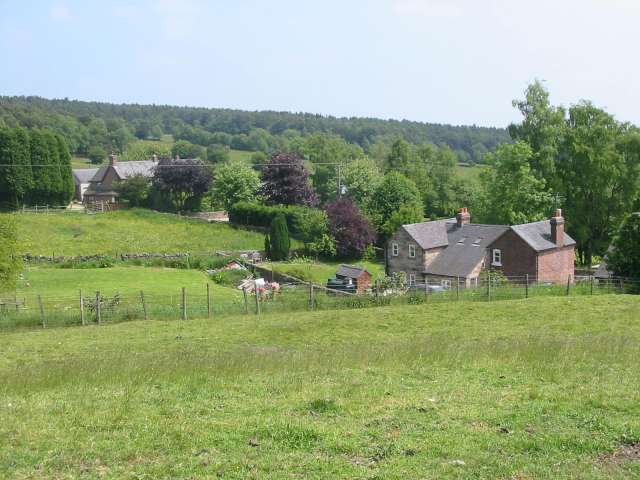
Moneystone is a small village located in the county of Staffordshire, England. Situated near the town of Leek, it is nestled in the picturesque Staffordshire Moorlands and is surrounded by beautiful countryside. The village is part of the Moorlands district and falls within the Staffordshire Moorlands parliamentary constituency.

Moneystone is primarily a residential area, consisting of a mix of traditional stone houses and newer developments. The village enjoys a peaceful and close-knit community atmosphere, with residents taking pride in maintaining its natural beauty.

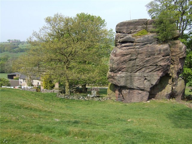
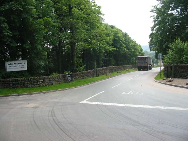
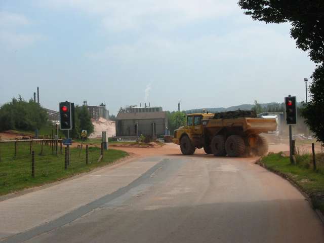
One of the notable features of Moneystone is the presence of Moneystone Quarry, which was historically an active site for limestone extraction. Today, the quarry is no longer operational, but it has been transformed into a nature reserve and is a popular destination for outdoor enthusiasts. The reserve offers a range of walking trails, providing opportunities for residents and visitors to enjoy the local flora and fauna.

In terms of amenities, Moneystone has limited facilities within the village itself. However, nearby towns such as Leek and Stoke-on-Trent offer a wider range of services, including shops, schools, healthcare facilities, and leisure activities.

Moneystone benefits from its rural location, providing residents with peace and tranquility while still having access to larger towns and cities. The village's natural surroundings and proximity to the Staffordshire Moorlands make it an attractive place for those seeking a rural lifestyle with easy access to outdoor activities and stunning landscapes.

If you have any feedback on the listing, please let us know in the comments section below.
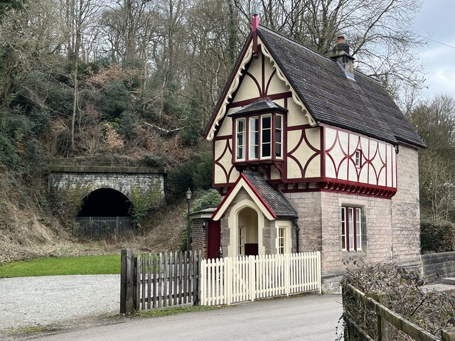
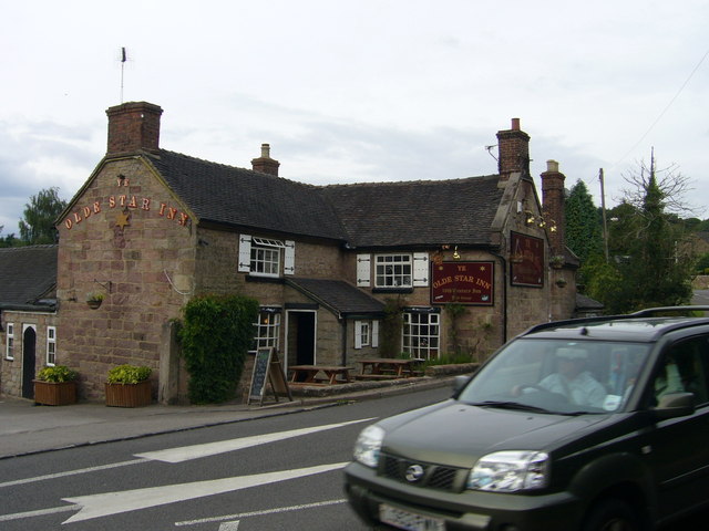
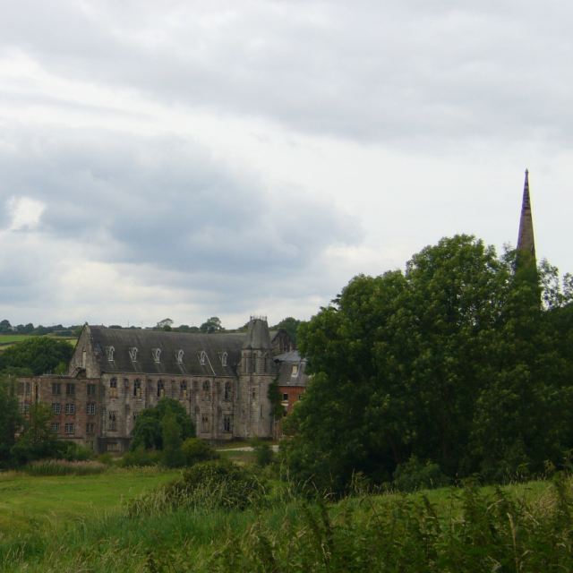
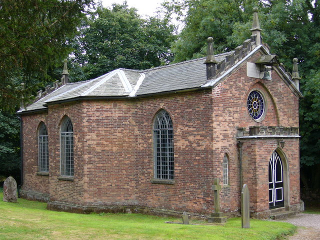
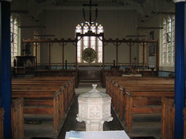
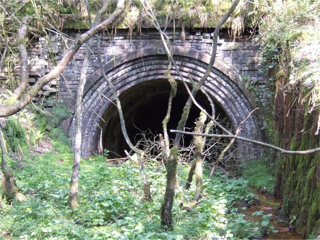
Moneystone Images

Images are sourced within 2km of 53.015491/-1.925288 or Grid Reference SK0546. Thanks to Geograph Open Source API. All images are credited.

Closed railway tunnel and former crossing keeper's cottage On the former Churnet Valley line in North Staffordshire.
Closed railway tunnel and former crossing keeper's cottage
On the former Churnet Valley line in North Staffordshire.
Whiston Methodist Church The inscription over the large window reads "Primitive Methodist Centenary Church 1907 1908". The centenary being the foundation of Primitive Methodism only 30 km away on <a href="https://www.geograph.org.uk/gridref/SJ8557">SJ8557</a> Mow Cop in 1807. Not to be confused with <a href="https://www.geograph.org.uk/photo/111780">SK4489 : Whiston Methodist Church, Nr Rotherham</a> / <a href="https://www.geograph.org.uk/photo/112012">SK4489 : Methodist Church in Whiston, Nr Rotherham.</a>.
Whiston Methodist Church
The inscription over the large window reads "Primitive Methodist Centenary Church 1907 1908". The centenary being the foundation of Primitive Methodism only 30 km away on SJ8557 Mow Cop in 1807. Not to be confused with SK4489 : Whiston Methodist Church, Nr Rotherham / SK4489 : Methodist Church in Whiston, Nr Rotherham..
Whiston Hall Hotel and golf club house, in Whiston. "This fine example of a Victorian hall was built in 1850. The residence and estate was owned, founded and lovingly restored by Mr. Tom Cooper" <span class="nowrap"><a title="http://www.whistonhall.com/introduction.htm" rel="nofollow ugc noopener" href="http://www.whistonhall.com/introduction.htm">Link</a><img style="margin-left:2px;" alt="External link" title="External link - shift click to open in new window" src="https://s1.geograph.org.uk/img/external.png" width="10" height="10"/></span>
Whiston Hall
Hotel and golf club house, in Whiston. "This fine example of a Victorian hall was built in 1850. The residence and estate was owned, founded and lovingly restored by Mr. Tom Cooper" LinkExternal link
Ye Olde Star Inn a 16th century inn in Star Bank, Cotton, Staffordshire
Ye Olde Star Inn
a 16th century inn in Star Bank, Cotton, Staffordshire
Cotton College Cotton Lane, Cotton, Staffordshire. This Roman Catholic boarding school <span class="nowrap"><a title="http://www.cottoncollege.co.uk/" rel="nofollow ugc noopener" href="http://www.cottoncollege.co.uk/">Link</a><img style="margin-left:2px;" alt="External link" title="External link - shift click to open in new window" src="https://s1.geograph.org.uk/img/external.png" width="10" height="10"/></span> closed in 1987. The buildings are derelict. The spire on the right is St Wilfred's Roman Catholic Church which is still in use.
Cotton College
Cotton Lane, Cotton, Staffordshire. This Roman Catholic boarding school LinkExternal link closed in 1987. The buildings are derelict. The spire on the right is St Wilfred's Roman Catholic Church which is still in use.
Church of St John the Baptist Cotton Lane, Cotton, Staffordshire. <span class="nowrap"><a title="http://www.genuki.org.uk/big/eng/STS/Cotton/index.html" rel="nofollow ugc noopener" href="http://www.genuki.org.uk/big/eng/STS/Cotton/index.html">Link</a><img style="margin-left:2px;" alt="External link" title="External link - shift click to open in new window" src="https://s1.geograph.org.uk/img/external.png" width="10" height="10"/></span> This charming little church built in 1795 is tucked into a corner and virtually surrounded by St Wilfred's Roman Catholic Church and <a href="https://www.geograph.org.uk/photo/224492">SK0646 : Cotton College</a>.
Church of St John the Baptist
Cotton Lane, Cotton, Staffordshire. LinkExternal link This charming little church built in 1795 is tucked into a corner and virtually surrounded by St Wilfred's Roman Catholic Church and SK0646 : Cotton College.
Interior of Oakamoor Church
Geocache stash and landscape This is a picture taken after finding a geocache, a new and fantastic hobby discovered after submitting pictures to this site. The picture shows the field and side of forest shown on the map. The tupperware box is what we found buried about 100 yards away. Get out there and get geo - "graphing" and "caching"!
Geocache stash and landscape
This is a picture taken after finding a geocache, a new and fantastic hobby discovered after submitting pictures to this site. The picture shows the field and side of forest shown on the map. The tupperware box is what we found buried about 100 yards away. Get out there and get geo - "graphing" and "caching"!
Great Marquess steam locomotive on Churnet Valley Railway Great Marquess steam locomotive on Churnet Valley Railway near Oakamoor. This part of the preserved railway line is not yet open to the public
Great Marquess steam locomotive on Churnet Valley Railway
Great Marquess steam locomotive on Churnet Valley Railway near Oakamoor. This part of the preserved railway line is not yet open to the public
Abandoned Canal Milepost and Railway This milepost stands on a section of the former Uttoxeter Canal in the Churnet Valley. The canal was closed in 1849 to make way for the North Staffordshire Railway, pictured in the background. The railway took a straighter route, leaving isolated loops of canal at various points down the valley.
Abandoned Canal Milepost and Railway
This milepost stands on a section of the former Uttoxeter Canal in the Churnet Valley. The canal was closed in 1849 to make way for the North Staffordshire Railway, pictured in the background. The railway took a straighter route, leaving isolated loops of canal at various points down the valley.
California Lock California (or Morris's) Lock was on the Uttoxeter Canal, closed in 1849 to make way for the North Staffordshire Railway. Nearby, there were wharves for loading coal, brought by the Woodhead Tramroad from the mines around Cheadle.
California Lock
California (or Morris's) Lock was on the Uttoxeter Canal, closed in 1849 to make way for the North Staffordshire Railway. Nearby, there were wharves for loading coal, brought by the Woodhead Tramroad from the mines around Cheadle.
Morris's Bridge Morris's Bridge was on the Uttoxeter Canal, closed in 1849 to make way for the North Staffordshire Railway. It has been partially demolished or collapsed. The bolt sticking out of the stone at the top probably held a plank of wood in place to prevent damage from towing ropes.
Morris's Bridge
Morris's Bridge was on the Uttoxeter Canal, closed in 1849 to make way for the North Staffordshire Railway. It has been partially demolished or collapsed. The bolt sticking out of the stone at the top probably held a plank of wood in place to prevent damage from towing ropes.
Entrance to Trubshaw's Tunnel Trubshaw's Tunnel was dug for the 1847 Caldon Low railway. The railway was a self-acting inclined plane, where empty wagons travelling upward were attached by a cable via a brake drum at the top of the plane to wagons loaded with limestone travelling downwards.
Entrance to Trubshaw's Tunnel
Trubshaw's Tunnel was dug for the 1847 Caldon Low railway. The railway was a self-acting inclined plane, where empty wagons travelling upward were attached by a cable via a brake drum at the top of the plane to wagons loaded with limestone travelling downwards.
Oldridge Oldridge / Oldridge Farm
Oldridge
Oldridge / Oldridge Farm
Whiston Village Hall The village hall looks to be quite new and has extensive views from its high location overlooking the Staffordshire moorlands towards Cheadle.
Whiston Village Hall
The village hall looks to be quite new and has extensive views from its high location overlooking the Staffordshire moorlands towards Cheadle.
Moneystone Quarry Moneystone quarry is in the process of being extended and is very busy with trucks coming and going every few seconds.
Moneystone Quarry
Moneystone quarry is in the process of being extended and is very busy with trucks coming and going every few seconds.
Moneystone Quarry Moneystone sandstone quarry is extremely busy and traffic lights control trucks and quarry vehicles crossing this access road.  All of the stone is taken out by road, and lorries thunder in and out every few seconds.  The map shows a link to the railway line in the valley below, which is now the Churnet Valley preserved railway.  This is no longer used to transport quarry goods but it would seem to be a much better way of shifting large loads of stone around.
Moneystone Quarry
Moneystone sandstone quarry is extremely busy and traffic lights control trucks and quarry vehicles crossing this access road. All of the stone is taken out by road, and lorries thunder in and out every few seconds. The map shows a link to the railway line in the valley below, which is now the Churnet Valley preserved railway. This is no longer used to transport quarry goods but it would seem to be a much better way of shifting large loads of stone around.
Moneystone Moneystone is a quiet hamlet high up on the moors near Oakamoor.  This view looks idyllic and it is hard to believe that just a short way down the road is a massive and very busy sandstone quarry with streams of trucks thundering along the little lanes.
Moneystone
Moneystone is a quiet hamlet high up on the moors near Oakamoor. This view looks idyllic and it is hard to believe that just a short way down the road is a massive and very busy sandstone quarry with streams of trucks thundering along the little lanes.
Show me another place!

Moneystone is located at Grid Ref: SK0546 (Lat: 53.015491, Lng: -1.925288)

Administrative County: Staffordshire

District: Staffordshire Moorlands

Police Authority: Staffordshire

What 3 Words

///snooping.prefect.sweep. Near Cheadle, Staffordshire

Nearby Locations

Moneystone

Related Wikis

Cotton Dell

Cotton Dell is a nature reserve of the Staffordshire Wildlife Trust. It is a wooded valley area near the village of Cotton and about 0.5 miles (0.8 km...

Cotton College

Cotton College was a Roman Catholic boarding school in Cotton, Staffordshire, United Kingdom. It was also known as Saint Wilfrid's College. The school...

Whiston, Staffordshire Moorlands

Whiston is a village in the Staffordshire Moorlands district of Staffordshire, England. Population details as taken at the 2011 census can be found under...

Cotton, Staffordshire

Cotton is a village and civil parish in Staffordshire, England. It is about 5 miles (8.0 km) north-east of Cheadle. Cotton Hall, originally built in the...

Nearby Amenities

Located within 500m of 53.015491,-1.925288
Barrier: stile
Lat/Long: 53.0164987/-1.9241589
Moneystone
Place: hamlet
Lat/Long: 53.0162115/-1.9227243
Barrier: stile
Foot: yes
Stile: stepover
Lat/Long: 53.0172616/-1.9266893
Fixme: stile or gate?
Lat/Long: 53.0123106/-1.9250451
Barrier: stile
Material: wood
Source: survey;gps
Stile: stepover
Lat/Long: 53.0186512/-1.9247715
Barrier: stile
Foot: yes
Stile: stepover
Lat/Long: 53.017464/-1.9255898
Barrier: stile
Foot: yes
Stile: stepover
Lat/Long: 53.0171316/-1.9277996
Barrier: stile
Foot: yes
Stile: stepover
Lat/Long: 53.0171553/-1.9280403
Barrier: stile
Foot: yes
Stile: stepover
Lat/Long: 53.0177589/-1.9296271
Booth: K6
Covered: booth
Disused Amenity: telephone
Man Made: telephone_box
Old Phone: +44 1538 702413
Lat/Long: 53.0141825/-1.924335
Barrier: stile
Material: stone
Source: survey;gps
Stile: stepover
Lat/Long: 53.0190999/-1.9249884
Barrier: stile
Material: wood
Source: survey;gps
Stile: stepover
Lat/Long: 53.019277/-1.926308
Barrier: stile
Material: wood
Source: survey;gps
Stile: stepover
Lat/Long: 53.0189716/-1.9270506
Barrier: stile
Material: stone
Source: survey;gps
Stile: stepover
Lat/Long: 53.0180034/-1.9302103
The data included in this document is from www.openstreetmap.org. The data is made available under ODbL.

Have you been to Moneystone?

Leave your review of Moneystone below (or comments, questions and feedback).