Molesworth

Settlement in Huntingdonshire Huntingdonshire

England

Molesworth

Main Street
Main Street Credit: P Gaskell

Molesworth is a small village located in Huntingdonshire, a historic county in the eastern part of England. Situated approximately 15 miles northwest of the county town of Huntingdon, Molesworth is nestled amidst picturesque countryside and offers a tranquil and idyllic setting.

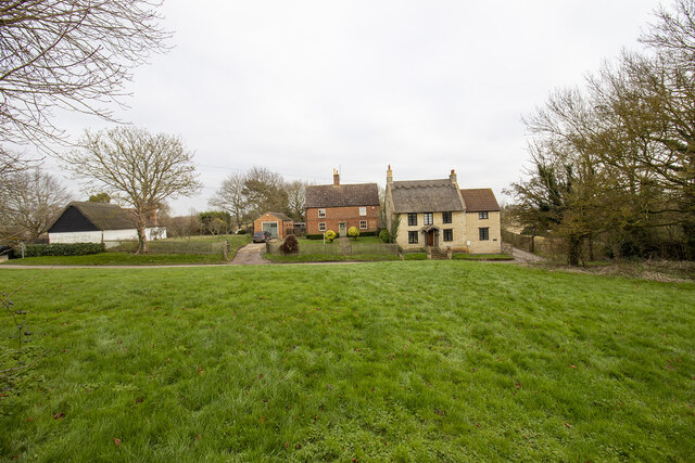
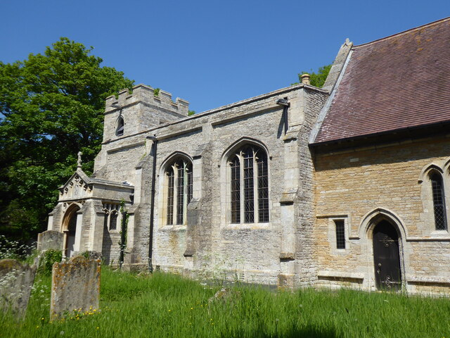
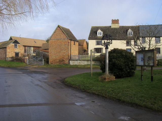
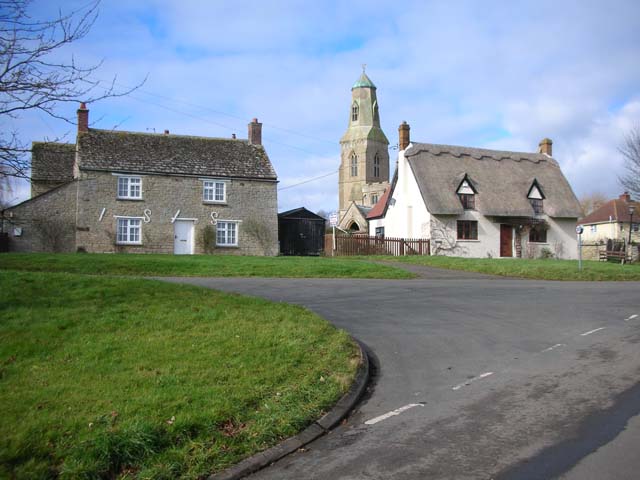
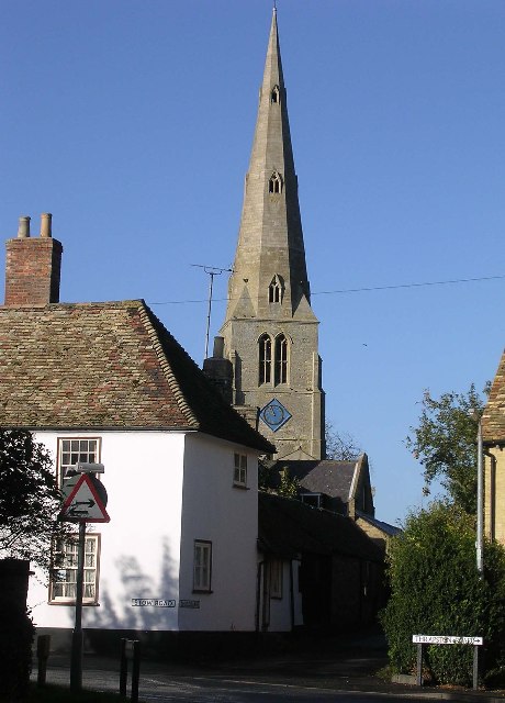
The village itself is home to a close-knit community, with a population of around 300 residents. Molesworth is characterized by its charming thatched-roof cottages, which give the village a quintessentially English feel. The village boasts a rich history, with records dating back to the Domesday Book in 1086.

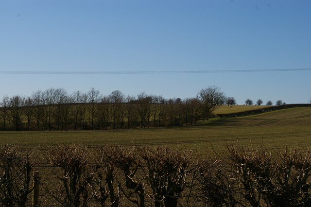
Surrounded by verdant fields and meadows, Molesworth provides ample opportunities for outdoor pursuits. The village is blessed with beautiful walking trails, allowing residents and visitors alike to explore the scenic countryside. Additionally, the nearby Molesworth Reservoir is a popular spot for fishing, birdwatching, and nature enthusiasts.

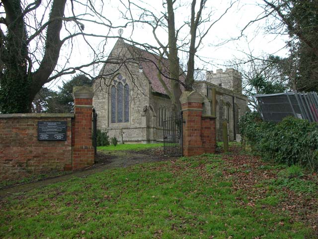
Despite its small size, Molesworth offers a range of amenities to cater to its residents' needs. These include a village hall, a primary school, and a church. For further amenities, the nearby town of Thrapston provides shopping facilities, restaurants, and other services.

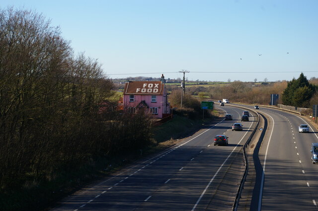
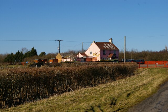
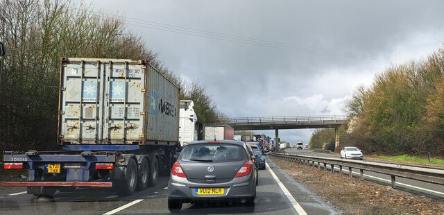
Molesworth's close proximity to major road networks, including the A14 and A1, makes it easily accessible for commuters. The village's peaceful atmosphere and charming surroundings make it an attractive place to reside for those seeking a tranquil rural lifestyle in the heart of the English countryside.

If you have any feedback on the listing, please let us know in the comments section below.
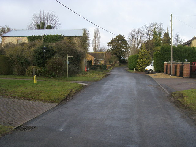
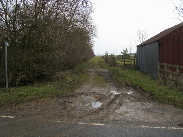
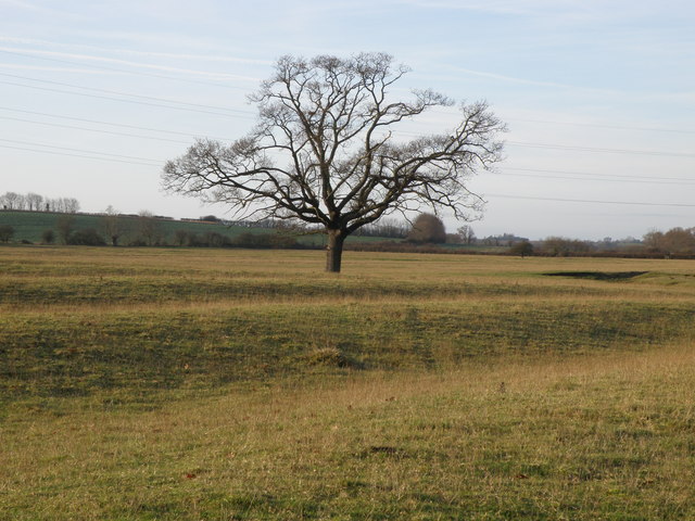
Molesworth Images

Images are sourced within 2km of 52.371819/-0.42607 or Grid Reference TL0776. Thanks to Geograph Open Source API. All images are credited.

Main Street
Main Street
The former Fox pub, next to the A14 near Brington
The former Fox pub, next to the A14 near Brington Seen from the truncated stub of Fox Road, which used to lead to a crossing of the A14 but is now superseded by a new road and bridge.
The former Fox pub, next to the A14 near Brington
Seen from the truncated stub of Fox Road, which used to lead to a crossing of the A14 but is now superseded by a new road and bridge.
Looking west near the former Fox pub Seen from the stub of Fox Road that leads to the former pub and formerly to a crossing of the road that is now the A14.
Looking west near the former Fox pub
Seen from the stub of Fox Road that leads to the former pub and formerly to a crossing of the road that is now the A14.
Molesworth, St Peter
Fox Road Interchange, Brington Connecting to the A14
Fox Road Interchange, Brington
Connecting to the A14
Stationary traffic on the A14 westbound at Bythorn Traffic was moving extremely slowly past the junction with the B663 at the top of the hill, where a collision between two lorries had closed one lane.
Stationary traffic on the A14 westbound at Bythorn
Traffic was moving extremely slowly past the junction with the B663 at the top of the hill, where a collision between two lorries had closed one lane.
Old Milestone by the A14 Carved stone post by the A14, in parish of CATWORTH (HUNTINGDONSHIRE District), on slip road, near junction with B660, on the verge (DC reinstated close to original place), on Northwest side of road. Huntingdon stone, erected by the Market Harborough & Brampton turnpike trust in the 19th century. An earlier photograph can be found here <a title="https://www.geograph.org.uk/photo/6038244" href="https://www.geograph.org.uk/photo/6038244">Link</a>.

Inscription reads:-
: TO / THRAPSTON / 7 / MILES : : TO / HUNTINGDON / 10 / MILES : 

Milestone Society National ID: HU_HUTH10.
Old Milestone by the A14
Carved stone post by the A14, in parish of CATWORTH (HUNTINGDONSHIRE District), on slip road, near junction with B660, on the verge (DC reinstated close to original place), on Northwest side of road. Huntingdon stone, erected by the Market Harborough & Brampton turnpike trust in the 19th century. An earlier photograph can be found here Link. Inscription reads:- : TO / THRAPSTON / 7 / MILES : : TO / HUNTINGDON / 10 / MILES : Milestone Society National ID: HU_HUTH10.
The A14, Bythorn The A14 is a major road which runs for 129 miles from the Port of Felixstowe to the Catthorpe Interchange, the junction of the M1 and M6 motorways near Rugby.

The route linking Rugby (and therefore the West Midlands and the north of England via the motorway network) to East Anglia and the ports of Felixstowe and Harwich is incredibly important and incredibly busy (Felixstowe is the UK's principal container port and the A14 is the road between Felixstowe and everywhere else) but it didn't exist in any coherent form until about 1992.

Prior to the current A14 the main route from Birmingham to the Haven ports followed the old A45 road via Coventry, Rugby, Northampton, St Neots, Cambridge and then through all the towns on the A14, from there to Ipswich where it ended on the A12 – not the fast route required for transporting goods across the country with the sudden rise in container shipping during the latter part of the twentieth century.

Most of the current A14 route is a collection of bits of dual carriageway acquired from other roads (most notably the A45) with occasional stretches of new road to bolt it all together. Because of its importance to the country’s economy, there are plans to upgrade it further.

Prior to its use for the current route the A14 designation had been used for a section of road between the A10 at Royston and the A1 at Alconbury following part of the route of the Roman road, Ermine Street, which is now mostly designated as the A1198. The only bit of the current A14 that follows that number's original route is the spur linking junction 23 to the A1.

<span class="nowrap"><a title="http://www.cbrd.co.uk/motorway/a14" rel="nofollow ugc noopener" href="http://www.cbrd.co.uk/motorway/a14">Link</a><img style="margin-left:2px;" alt="External link" title="External link - shift click to open in new window" src="https://s1.geograph.org.uk/img/external.png" width="10" height="10"/></span> Chris's British Road Directory
<span class="nowrap"><a title="http://en.wikipedia.org/wiki/A14_road_(England)" rel="nofollow ugc noopener" href="http://en.wikipedia.org/wiki/A14_road_(England)">Link</a><img style="margin-left:2px;" alt="External link" title="External link - shift click to open in new window" src="https://s1.geograph.org.uk/img/external.png" width="10" height="10"/></span>  Wikipedia
The A14, Bythorn
The A14 is a major road which runs for 129 miles from the Port of Felixstowe to the Catthorpe Interchange, the junction of the M1 and M6 motorways near Rugby. The route linking Rugby (and therefore the West Midlands and the north of England via the motorway network) to East Anglia and the ports of Felixstowe and Harwich is incredibly important and incredibly busy (Felixstowe is the UK's principal container port and the A14 is the road between Felixstowe and everywhere else) but it didn't exist in any coherent form until about 1992. Prior to the current A14 the main route from Birmingham to the Haven ports followed the old A45 road via Coventry, Rugby, Northampton, St Neots, Cambridge and then through all the towns on the A14, from there to Ipswich where it ended on the A12 – not the fast route required for transporting goods across the country with the sudden rise in container shipping during the latter part of the twentieth century. Most of the current A14 route is a collection of bits of dual carriageway acquired from other roads (most notably the A45) with occasional stretches of new road to bolt it all together. Because of its importance to the country’s economy, there are plans to upgrade it further. Prior to its use for the current route the A14 designation had been used for a section of road between the A10 at Royston and the A1 at Alconbury following part of the route of the Roman road, Ermine Street, which is now mostly designated as the A1198. The only bit of the current A14 that follows that number's original route is the spur linking junction 23 to the A1. LinkExternal link Chris's British Road Directory LinkExternal link Wikipedia
Fields by the A14, Bythorn
B660 at the A14 junction Fox Road B660 at the A14 junction
B660 at the A14 junction
Fox Road B660 at the A14 junction
Molesworth village Molesworth village with the village sign by the bridleway to Brington
Molesworth village
Molesworth village with the village sign by the bridleway to Brington
Church Lane Brington Church Lane Brington by the footpath to Molesworth
Church Lane Brington
Church Lane Brington by the footpath to Molesworth
Bridleway by Glebe Farm From the road to Brington the bridleway by Glebe Farm
Bridleway by Glebe Farm
From the road to Brington the bridleway by Glebe Farm
Sheep feeders by Clack Lane A large acreage of Ridge and Furrow land lies by the A14 to the south of Bythorn therefore making good sheep grazing pastures.
Sheep feeders by Clack Lane
A large acreage of Ridge and Furrow land lies by the A14 to the south of Bythorn therefore making good sheep grazing pastures.
A solitary Oak tree in the ridge and furrow Farm land to the south of Bythorn has a good show of the historical ridge and furrow farming system. Next time your passing Bythorn west bound on the A14 look to your left and you'll see it, passengers only please.
A solitary Oak tree in the ridge and furrow
Farm land to the south of Bythorn has a good show of the historical ridge and furrow farming system. Next time your passing Bythorn west bound on the A14 look to your left and you'll see it, passengers only please.
Show me another place!

Molesworth is located at Grid Ref: TL0776 (Lat: 52.371819, Lng: -0.42607)

Administrative County: Cambridgeshire

District: Huntingdonshire

Police Authority: Cambridgeshire

What 3 Words

///berated.sloping.signed. Near Raunds, Northamptonshire

Related Wikis

Molesworth, Cambridgeshire

Molesworth is a village and former civil parish, now in the parish of Brington and Molesworth in Cambridgeshire, England. Molesworth is 10 miles (16 km...

Bythorn and Keyston

Bythorn and Keyston is a civil parish in the Huntingdonshire district of Cambridgeshire, England. According to the 2001 census the parish had a population...

Bythorn

Bythorn is a village and former civil parish, now in the parish of Bythorn and Keyston, in Cambridgeshire, England. Bythorn lies approximately 11 miles...

Brington, Cambridgeshire

Brington is a village and former civil parish, now in the parish of Brington and Molesworth, in Cambridgeshire, England. Brington lies approximately 9...

RAF Molesworth

Royal Air Force Molesworth or more simply RAF Molesworth is a Royal Air Force station located near Molesworth, Cambridgeshire, England with a history dating...

Catworth

Catworth is a village and civil parish in Cambridgeshire, England. Catworth lies approximately 9 miles (14 km) west of Huntingdon. The civil parish covers...

Old Weston

Old Weston – in Huntingdonshire (now part of Cambridgeshire), England – is a village near Molesworth west of Huntingdon.In 1870–1872, John Wilson, who...

Keyston

Keyston is a village and former civil parish, now in the parish of Bythorn and Keyston, in Cambridgeshire, England. Keyston lies approximately 12 miles...

Nearby Amenities

Located within 500m of 52.371819,-0.42607
Created By: Merkaartor 0.12
Lat/Long: 52.3688489/-0.422626
Created By: Merkaartor 0.12
Lat/Long: 52.369225/-0.422803
Created By: Merkaartor 0.12
Lat/Long: 52.3695679/-0.42309
Created By: Merkaartor 0.12
Lat/Long: 52.3698829/-0.423377
Created By: Merkaartor 0.12
Lat/Long: 52.3701109/-0.4235139
Created By: Merkaartor 0.12
Lat/Long: 52.3729579/-0.4286489
Created By: Merkaartor 0.12
Lat/Long: 52.373299/-0.429161
Created By: Merkaartor 0.12
Lat/Long: 52.3711123/-0.4277693
Created By: Merkaartor 0.12
Lat/Long: 52.3682497/-0.4291212
Pub
The Cross Keys
Addr Postcode: PE28 0QF
Phone: +44 1832 710283
Lat/Long: 52.3694509/-0.4227081
Public Bookcase
Defibrillator
Booth: K6
Defibrillator Location: inside red phone box (that is now used as book exchange) Brookside, Molesworth
Disused Amenity: telephone
Emergency: defibrillator
Listed Status: Grade II
Man Made: telephone_box
Public Bookcase Type: phone_box
Lat/Long: 52.3703815/-0.4234835
Post Box
Post Box Design: type_m
Post Box Type: lamp
Ref: PE28 68
Royal Cypher: EIIR
Royal Cypher Wikidata: Q33102113
Lat/Long: 52.3703773/-0.4235511
Molesworth
Place: village
Wikidata: Q6896119
Lat/Long: 52.3704941/-0.4269704
Bus Stop
Cross Keys PH
Bus: yes
Naptan AtcoCode: 0500HBRIM001
Naptan Bearing: S
Naptan BusStopType: CUS
Naptan CommonName: Cross Keys PH
Naptan Indicator: near
Naptan Landmark: Cross Keys PH
Naptan NaptanCode: cmbdmtjm
Naptan ShortCommonName: Cross Keys PH
Naptan Street: High Street
Naptan Verified: no
Public Transport: platform
Source: naptan_import
Lat/Long: 52.3693514/-0.4228288
Shelter
Lat/Long: 52.3721756/-0.4262627
Jolly Hills Farm
Landuse: farm
Note Retag: CS #48756035
Lat/Long: 52.3737519/-0.4289239
Power: pole
Lat/Long: 52.3684439/-0.4227267
Power: pole
Lat/Long: 52.3684381/-0.4245535
Power: pole
Lat/Long: 52.3684184/-0.4277131
Power: pole
Lat/Long: 52.368425/-0.4263748
Power: pole
Lat/Long: 52.3684235/-0.4290571
Power: pole
Lat/Long: 52.3683977/-0.4304435
Stile: yes
Lat/Long: 52.3701834/-0.4309699
Man Made: village_sign
Lat/Long: 52.3704292/-0.4235787
Information: board
Tourism: information
Lat/Long: 52.3704047/-0.4235613
The data included in this document is from www.openstreetmap.org. The data is made available under ODbL.

Have you been to Molesworth?

Leave your review of Molesworth below (or comments, questions and feedback).