Bellsmyre

Settlement in Dunbartonshire

Scotland

Bellsmyre

Co-op Funeralcare, Dumbarton Funeral directors located in Bonhill Road, on the corner of Poindfauld Terrace.
Co-op Funeralcare, Dumbarton Credit: Richard Dorrell

Bellsmyre is a residential area located in the town of Dumbarton, within the region of Dunbartonshire, Scotland. Situated on the north bank of the River Clyde, Bellsmyre is approximately one mile northeast of Dumbarton town center.

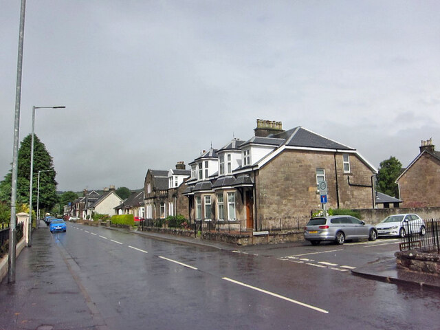
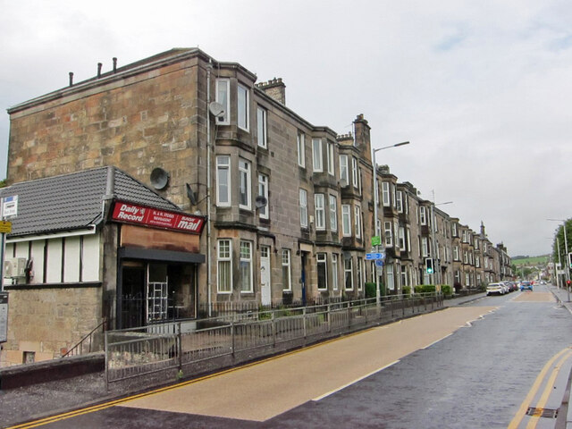
The area is predominantly made up of social housing, consisting of both high-rise and low-rise flats, as well as some private housing. Bellsmyre has undergone significant development and regeneration over the years, with the construction of new housing and improved amenities. The community is known for its strong sense of community spirit and vibrant social activities.

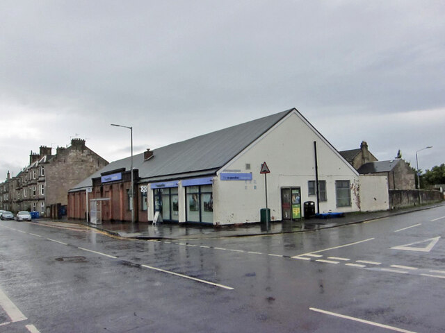
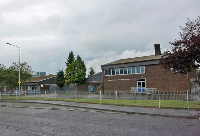
Residents of Bellsmyre benefit from a range of amenities and services, including a local shopping center, schools, healthcare facilities, and public parks. The area is well-connected, with regular bus services linking it to Dumbarton town center and other nearby towns.

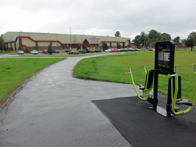
Bellsmyre offers its residents a variety of recreational opportunities. Levengrove Park, a popular green space located nearby, provides beautiful views of the River Clyde and offers playgrounds, sports facilities, and walking paths. There are also several local community groups and organizations that provide activities and support for residents of all ages.

Overall, Bellsmyre is a close-knit community with a strong sense of identity and a range of amenities and services to meet the needs of its residents.

If you have any feedback on the listing, please let us know in the comments section below.
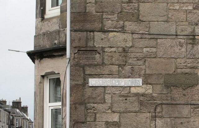
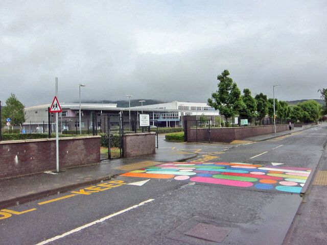
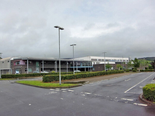
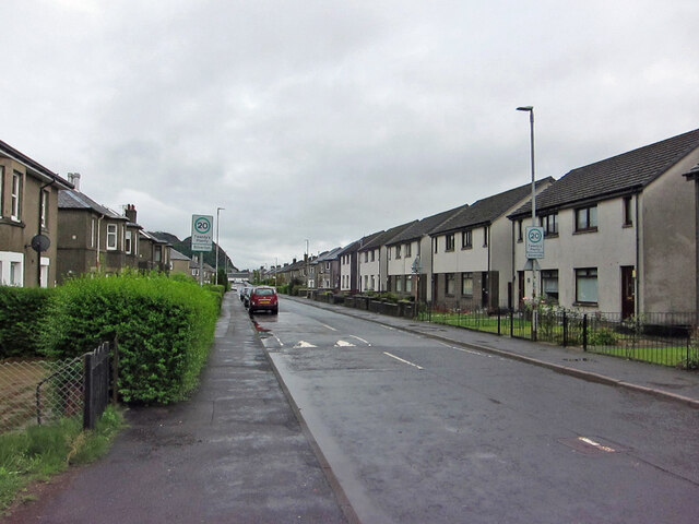
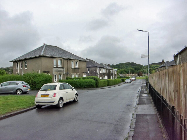
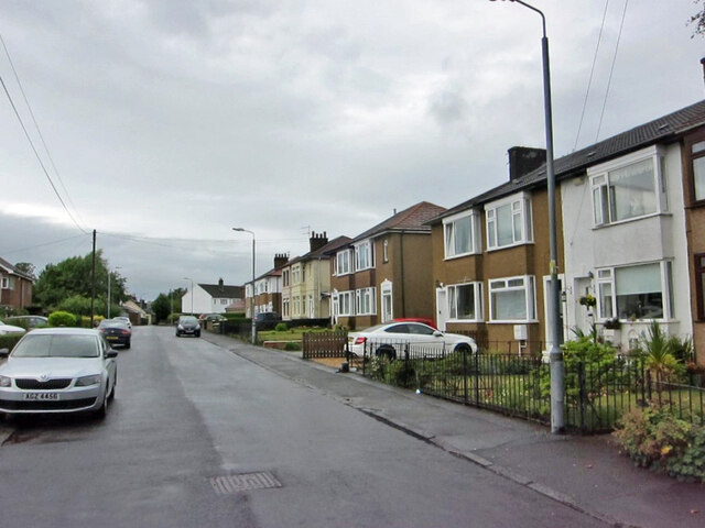
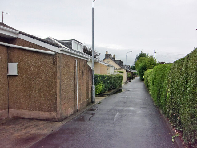
Bellsmyre Images

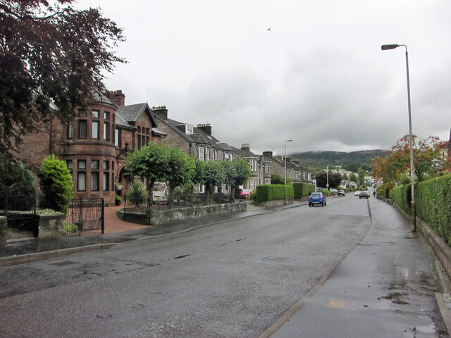
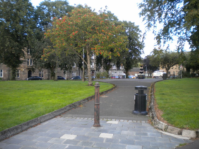
Images are sourced within 2km of 55.955917/-4.556009 or Grid Reference NS4076. Thanks to Geograph Open Source API. All images are credited.

Co-op Funeralcare, Dumbarton Funeral directors located in Bonhill Road, on the corner of Poindfauld Terrace.
Co-op Funeralcare, Dumbarton
Funeral directors located in Bonhill Road, on the corner of Poindfauld Terrace.
Bonhill Road, Dumbarton Looking north, with junction with Alexander Street on the right.
Bonhill Road, Dumbarton
Looking north, with junction with Alexander Street on the right.
Meadow Park, Dumbarton Formerly the home ground of Dumbarton Harp Football Club, now a public park featuring a variety of fitness machines, an example of which can be seen on the right here.
In the background is the Meadow Centre, a leisure centre with swimming pool, sports hall and health suites.
Meadow Park, Dumbarton
Formerly the home ground of Dumbarton Harp Football Club, now a public park featuring a variety of fitness machines, an example of which can be seen on the right here. In the background is the Meadow Centre, a leisure centre with swimming pool, sports hall and health suites.
Housing in Bonhill Road, Dumbarton Looking north from close to the junction with Crosslet Road.
The small shop on the end of the terrace is currently being completely refurbished.
Housing in Bonhill Road, Dumbarton
Looking north from close to the junction with Crosslet Road. The small shop on the end of the terrace is currently being completely refurbished.
Hartfield Gardens or Crosslet Road? It appears from the engraved road name in the wall, that when the houses were built, the road here was named Hartfield Gardens, and some maps still show the western end of Crosslet Road as having that name. The very faded more modern name sign reads Crosslet Road.
Hartfield Gardens or Crosslet Road?
It appears from the engraved road name in the wall, that when the houses were built, the road here was named Hartfield Gardens, and some maps still show the western end of Crosslet Road as having that name. The very faded more modern name sign reads Crosslet Road.
Colourful speed hump Located outside an entrance to Dumbarton Academy, this speed hump in Crosslet Road doubles as a crossing place for pedestrians.
Colourful speed hump
Located outside an entrance to Dumbarton Academy, this speed hump in Crosslet Road doubles as a crossing place for pedestrians.
Dumbarton Academy Viewed from just inside the vehicle entrance from Crosslet Road. 
The Academy is a West Dunbartonshire Council non-denominational secondary school with a roll of approximately 600 pupils.
Dumbarton Academy
Viewed from just inside the vehicle entrance from Crosslet Road. The Academy is a West Dunbartonshire Council non-denominational secondary school with a roll of approximately 600 pupils.
St Patrick's Primary School, Dumbarton Located adjacent to Dumbarton Academy in Crosslet Road, St Patrick's is a West Dunbartonshire Council Roman Catholic primary school with a current roll of approximately 360 pupils.
St Patrick's Primary School, Dumbarton
Located adjacent to Dumbarton Academy in Crosslet Road, St Patrick's is a West Dunbartonshire Council Roman Catholic primary school with a current roll of approximately 360 pupils.
Crosslet Road, Dumbarton Housing towards the eastern end of the road.
Crosslet Road, Dumbarton
Housing towards the eastern end of the road.
Millburn Road, Dumbarton Looking east. Junction with Boghead Avenue on the left.
Millburn Road, Dumbarton
Looking east. Junction with Boghead Avenue on the left.
Eastern end of Boghead Road Looking north-west from the cul-de-sac end of this residential road in suburban Dumbarton.
Eastern end of Boghead Road
Looking north-west from the cul-de-sac end of this residential road in suburban Dumbarton.
Boghead Road, Dumbarton This stretch of Boghead Road in suburban Dumbarton is very narrow and has no pedestrian pavement. Nevertheless, the road is the sole access to a number of residential properties.
Boghead Road, Dumbarton
This stretch of Boghead Road in suburban Dumbarton is very narrow and has no pedestrian pavement. Nevertheless, the road is the sole access to a number of residential properties.
Round Riding Road, Dumbarton Looking east from close to the junction with Boghead Road.
Round Riding Road, Dumbarton
Looking east from close to the junction with Boghead Road.
Knoxland Street, Dumbarton Off Bruce Street.
Knoxland Street, Dumbarton
Off Bruce Street.
Bruce Street, Dumbarton Seen from its southern junction with Knoxland Square.
Bruce Street, Dumbarton
Seen from its southern junction with Knoxland Square.
Footpath across Knoxland Square, Dumbarton Looking from Victoria Street towards Bruce Street.
Footpath across Knoxland Square, Dumbarton
Looking from Victoria Street towards Bruce Street.
Entrance to Dumbarton East railway station Beneath the bridge that carries the railway across Glasgow Road. An uninviting entrance to a somewhat desolate station.
Entrance to Dumbarton East railway station
Beneath the bridge that carries the railway across Glasgow Road. An uninviting entrance to a somewhat desolate station.
Footpath into East End Park, Dumbarton Off Glasgow Road.
Footpath into East End Park, Dumbarton
Off Glasgow Road.
Show me another place!

Bellsmyre is located at Grid Ref: NS4076 (Lat: 55.955917, Lng: -4.556009)

Unitary Authority: West Dunbartonshire

Police Authority: Argyll and West Dunbartonshire

What 3 Words

///harder.level.enter. Near Dumbarton, West Dunbartonshire

Nearby Locations

Bellsmyre Townend

Related Wikis

Bellsmyre

Bellsmyre is a large housing estate in the town of Dumbarton in West Dunbartonshire, Scotland. Located on the edge of the Kilpatrick Hills in the northeast...

Our Lady and St Patrick's High School

Our Lady & St Patrick's High School is a six-year co-educational comprehensive Roman Catholic school, situated in the Bellsmyre area of Dumbarton, Scotland...

Ian Napier

Captain Ian Patrick Robert Napier (24 June 1895 – 9 May 1977) was a Scottish World War I flying ace credited with twelve aerial victories. == Biography... ==

Townend, Dumbarton

Townend is a moderate to large housing suburb (area) in Dumbarton, Scotland. It stretches from Dumbarton Central Station to Barloan Toll, and to Round...

Nearby Amenities

Located within 500m of 55.955917,-4.556009
Created By: Merkaartor 0.12
Lat/Long: 55.9535039/-4.554997
Created By: Merkaartor 0.12
Lat/Long: 55.953606/-4.5547771
Created By: Merkaartor 0.12
Lat/Long: 55.9534708/-4.5549112
Created By: Merkaartor 0.12
Lat/Long: 55.9537081/-4.5546751
Created By: Merkaartor 0.12
Lat/Long: 55.9538552/-4.5546376
Created By: Merkaartor 0.12
Lat/Long: 55.9529497/-4.5560672
Created By: Merkaartor 0.12
Lat/Long: 55.9529152/-4.5564105
Created By: Merkaartor 0.12
Lat/Long: 55.9530128/-4.5561209
Created By: Merkaartor 0.12
Lat/Long: 55.9528206/-4.5568504
Created By: Merkaartor 0.12
Lat/Long: 55.9526944/-4.5572662
Created By: Merkaartor 0.12
Lat/Long: 55.9524706/-4.5579394
Crossing
Crossing: traffic_signals
Source: survey
Lat/Long: 55.9523256/-4.5583752
Traffic Signals
Traffic Signals: signal
Lat/Long: 55.95691/-4.5631445
Crossing
Crossing: traffic_signals
Crossing Ref: toucan
Lat/Long: 55.9565555/-4.5621489
Created By: Merkaartor 0.13
Lat/Long: 55.9551419/-4.5636828
Created By: Merkaartor 0.13
Lat/Long: 55.9552481/-4.5634053
Crossing
Crossing: uncontrolled
Source: survey
Lat/Long: 55.9574869/-4.5499371
Post Box
Source: survey
Lat/Long: 55.9526058/-4.5570631
Crossing
Crossing: traffic_signals
Crossing Ref: toucan
Lat/Long: 55.9565804/-4.5614708
Restaurant
Brewers Fayre
Brand: Brewers Fayre
Brand Wikidata: Q4962678
Brand Wikipedia: en:Brewers Fayre
Cuisine: british
Opening Hours: Mo-Fr 06:30-11:00,12:00-23:00; Sa 07:00-11:00,12:00-23:00; Su 07:00-11:00,12:00-10:30
Wheelchair: yes
Lat/Long: 55.9568241/-4.5595859
Premier Inn Dumbarton Loch Lomond
Addr City: Dumbarton
Addr Postcode: G82 2QU
Addr Street: Lomondgate Drive
Brand: Premier Inn
Brand Wikidata: Q2108626
Brand Wikipedia: en:Premier Inn
Phone: +44 871 527 9274
Tourism: hotel
Website: https://www.premierinn.com/gb/en/hotels/scotland/strathclyde/dumbarton/dumbartonloch-lomond.html
Lat/Long: 55.9563976/-4.5591782
Fuel
Esso
Brand: Esso
Check Date: 2023-01-15
Compressed Air: yes
Fuel Adblue: yes
Fuel Diesel: yes
Fuel E10: yes
Fuel Petrol: yes
Opening Hours: 24/7
Payment Mastercard: yes
Payment Visa: yes
Self Service: yes
Lat/Long: 55.957166/-4.5615411
Bellsmyre
Place: suburb
Wikidata: Q4884174
Wikipedia: en:Bellsmyre
Lat/Long: 55.9566132/-4.5526113
Bus Stop
Bus: yes
Public Transport: platform
Lat/Long: 55.9524219/-4.5582706
Generator Method: photovoltaic
Generator Output Electricity: yes
Generator Source: solar
Generator Type: solar_photovoltaic_panel
Location: roof
Power: generator
Lat/Long: 55.9575206/-4.5537209
Generator Method: photovoltaic
Generator Output Electricity: yes
Generator Source: solar
Generator Type: solar_photovoltaic_panel
Location: roof
Power: generator
Lat/Long: 55.9571182/-4.5525997
Generator Method: photovoltaic
Generator Output Electricity: yes
Generator Source: solar
Generator Type: solar_photovoltaic_panel
Location: roof
Power: generator
Lat/Long: 55.9571617/-4.5525031
Generator Method: photovoltaic
Generator Output Electricity: yes
Generator Source: solar
Generator Type: solar_photovoltaic_panel
Location: roof
Power: generator
Lat/Long: 55.9575056/-4.5513149
Generator Method: photovoltaic
Generator Output Electricity: yes
Generator Source: solar
Generator Type: solar_photovoltaic_panel
Location: roof
Power: generator
Lat/Long: 55.9575551/-4.550403
Generator Method: photovoltaic
Generator Output Electricity: yes
Generator Source: solar
Generator Type: solar_photovoltaic_panel
Location: roof
Power: generator
Lat/Long: 55.9572819/-4.5500087
Generator Method: photovoltaic
Generator Output Electricity: yes
Generator Source: solar
Generator Type: solar_photovoltaic_panel
Location: roof
Power: generator
Lat/Long: 55.9559049/-4.552361
Generator Method: photovoltaic
Generator Output Electricity: yes
Generator Source: solar
Generator Type: solar_photovoltaic_panel
Location: roof
Power: generator
Lat/Long: 55.9558329/-4.5524763
Generator Method: photovoltaic
Generator Output Electricity: yes
Generator Source: solar
Generator Type: solar_photovoltaic_panel
Location: roof
Power: generator
Lat/Long: 55.9561227/-4.5524039
Generator Method: photovoltaic
Generator Output Electricity: yes
Generator Source: solar
Generator Type: solar_photovoltaic_panel
Location: roof
Power: generator
Lat/Long: 55.9561978/-4.5525675
Generator Method: photovoltaic
Generator Output Electricity: yes
Generator Source: solar
Generator Type: solar_photovoltaic_panel
Location: roof
Power: generator
Lat/Long: 55.9560491/-4.5532408
Generator Method: photovoltaic
Generator Output Electricity: yes
Generator Source: solar
Generator Type: solar_photovoltaic_panel
Location: roof
Power: generator
Lat/Long: 55.9560416/-4.5541527
Generator Method: photovoltaic
Generator Output Electricity: yes
Generator Source: solar
Generator Type: solar_photovoltaic_panel
Location: roof
Power: generator
Lat/Long: 55.955941/-4.5539167
Generator Method: photovoltaic
Generator Output Electricity: yes
Generator Source: solar
Generator Type: solar_photovoltaic_panel
Location: roof
Power: generator
Lat/Long: 55.9561017/-4.5542573
Generator Method: photovoltaic
Generator Output Electricity: yes
Generator Source: solar
Generator Type: solar_photovoltaic_panel
Location: roof
Power: generator
Lat/Long: 55.9561287/-4.5543592
Generator Method: photovoltaic
Generator Output Electricity: yes
Generator Source: solar
Generator Type: solar_photovoltaic_panel
Location: roof
Power: generator
Lat/Long: 55.9561662/-4.5548474
Generator Method: photovoltaic
Generator Output Electricity: yes
Generator Source: solar
Generator Type: solar_photovoltaic_panel
Location: roof
Power: generator
Lat/Long: 55.9558539/-4.5547213
Generator Method: photovoltaic
Generator Output Electricity: yes
Generator Source: solar
Generator Type: solar_photovoltaic_panel
Location: roof
Power: generator
Lat/Long: 55.9556271/-4.5540427
Generator Method: photovoltaic
Generator Output Electricity: yes
Generator Source: solar
Generator Type: solar_photovoltaic_panel
Location: roof
Power: generator
Lat/Long: 55.9555896/-4.5531764
Generator Method: photovoltaic
Generator Output Electricity: yes
Generator Source: solar
Generator Type: solar_photovoltaic_panel
Location: roof
Power: generator
Lat/Long: 55.9549965/-4.5537557
Generator Method: photovoltaic
Generator Output Electricity: yes
Generator Source: solar
Generator Type: solar_photovoltaic_panel
Location: roof
Power: generator
Lat/Long: 55.9546826/-4.5513578
Generator Method: photovoltaic
Generator Output Electricity: yes
Generator Source: solar
Generator Type: solar_photovoltaic_panel
Location: roof
Power: generator
Lat/Long: 55.9567728/-4.5556279
Generator Method: photovoltaic
Generator Output Electricity: yes
Generator Source: solar
Generator Type: solar_photovoltaic_panel
Location: roof
Power: generator
Lat/Long: 55.9567188/-4.5555314
Generator Method: photovoltaic
Generator Output Electricity: yes
Generator Source: solar
Generator Type: solar_photovoltaic_panel
Location: roof
Power: generator
Lat/Long: 55.9566197/-4.5562287
Generator Method: photovoltaic
Generator Output Electricity: yes
Generator Source: solar
Generator Type: solar_photovoltaic_panel
Location: roof
Power: generator
Lat/Long: 55.9567984/-4.5562958
Generator Method: photovoltaic
Generator Output Electricity: yes
Generator Source: solar
Generator Type: solar_photovoltaic_panel
Location: roof
Power: generator
Lat/Long: 55.9572676/-4.5567028
Generator Method: photovoltaic
Generator Output Electricity: yes
Generator Source: solar
Generator Type: solar_photovoltaic_panel
Location: roof
Power: generator
Lat/Long: 55.9577135/-4.555939
Generator Method: photovoltaic
Generator Output Electricity: yes
Generator Source: solar
Generator Type: solar_photovoltaic_panel
Location: roof
Power: generator
Lat/Long: 55.9576384/-4.5558639
Generator Method: photovoltaic
Generator Output Electricity: yes
Generator Source: solar
Generator Type: solar_photovoltaic_panel
Location: roof
Power: generator
Lat/Long: 55.957721/-4.5553436
Generator Method: photovoltaic
Generator Output Electricity: yes
Generator Source: solar
Generator Type: solar_photovoltaic_panel
Location: roof
Power: generator
Lat/Long: 55.9581549/-4.5561644
Generator Method: photovoltaic
Generator Output Electricity: yes
Generator Source: solar
Generator Type: solar_photovoltaic_panel
Location: roof
Power: generator
Lat/Long: 55.9581459/-4.5562153
Generator Method: photovoltaic
Generator Output Electricity: yes
Generator Source: solar
Generator Type: solar_photovoltaic_panel
Location: roof
Power: generator
Lat/Long: 55.9583276/-4.5562958
Generator Method: photovoltaic
Generator Output Electricity: yes
Generator Source: solar
Generator Type: solar_photovoltaic_panel
Location: roof
Power: generator
Lat/Long: 55.9583336/-4.5562502
Generator Method: photovoltaic
Generator Output Electricity: yes
Generator Source: solar
Generator Type: solar_photovoltaic_panel
Location: roof
Power: generator
Lat/Long: 55.9583952/-4.5562797
Generator Method: photovoltaic
Generator Output Electricity: yes
Generator Source: solar
Generator Type: solar_photovoltaic_panel
Location: roof
Power: generator
Lat/Long: 55.9583982/-4.5563441
Generator Method: photovoltaic
Generator Output Electricity: yes
Generator Source: solar
Generator Type: solar_photovoltaic_panel
Location: roof
Power: generator
Lat/Long: 55.9584447/-4.556623
Generator Method: photovoltaic
Generator Output Electricity: yes
Generator Source: solar
Generator Type: solar_photovoltaic_panel
Location: roof
Power: generator
Lat/Long: 55.9583712/-4.5567598
Generator Method: photovoltaic
Generator Output Electricity: yes
Generator Source: solar
Generator Type: solar_photovoltaic_panel
Location: roof
Power: generator
Lat/Long: 55.9590724/-4.5576476
Generator Method: photovoltaic
Generator Output Electricity: yes
Generator Source: solar
Generator Type: solar_photovoltaic_panel
Location: roof
Power: generator
Lat/Long: 55.9587255/-4.5571863
Generator Method: photovoltaic
Generator Output Electricity: yes
Generator Source: solar
Generator Type: solar_photovoltaic_panel
Location: roof
Power: generator
Lat/Long: 55.9561429/-4.548909
Generator Method: photovoltaic
Generator Output Electricity: yes
Generator Source: solar
Generator Type: solar_photovoltaic_panel
Location: roof
Power: generator
Lat/Long: 55.9551578/-4.5499014
Turning Circle
Lat/Long: 55.9554221/-4.5542775
Noexit: yes
Lat/Long: 55.9532971/-4.5621236
Noexit: yes
Lat/Long: 55.9533224/-4.5620049
Crossing
Crossing: traffic_signals
Tactile Paving: yes
Lat/Long: 55.9590047/-4.5522513
Generator Method: photovoltaic
Generator Output Electricity: yes
Generator Source: solar
Generator Type: solar_photovoltaic_panel
Power: generator
Lat/Long: 55.9536408/-4.5528951
Generator Method: photovoltaic
Generator Output Electricity: yes
Generator Source: solar
Generator Type: solar_photovoltaic_panel
Power: generator
Lat/Long: 55.9533586/-4.5532589
Generator Method: photovoltaic
Generator Output Electricity: yes
Generator Source: solar
Generator Type: solar_photovoltaic_panel
Power: generator
Lat/Long: 55.9534428/-4.5524804
Give Way
Direction: backward
Lat/Long: 55.9599847/-4.5559798
Fast Food
Subway
Brand: Subway
Brand Wikidata: Q244457
Cuisine: sandwich
Takeaway: yes
Lat/Long: 55.9571792/-4.5611418
Fast Food
Greggs
Brand: Greggs
Brand Wikidata: Q3403981
Contact Website: https://www.greggs.co.uk/shop-finder?shop-code=2414
Cuisine: sandwich;bakery
Opening Hours: Mo-Sa 05:30-18:00; Su 06:30-17:00
Takeaway: yes
Lat/Long: 55.9571991/-4.5612408
Cafe
Starbucks
Brand: Starbucks
Brand Wikidata: Q37158
Cuisine: coffee_shop
Drive Through: yes
Official Name: Starbucks Coffee
Takeaway: yes
Website: https://www.starbucks.com/store-locator/store/1029347/dumbarton-lomondgate-dr-dt-a-82-lomondgate-services-dumbarton-sct-g-83-3-bn-g
Lat/Long: 55.9572339/-4.5605506
Asda Express
Addr City: West Dunbartonshire
Addr Country: GB
Addr Street: Lomondgate Drive
Branch: Lomondgate
Brand: Asda Express
Brand Wikidata: Q114826023
Shop: convenience
Website: https://storelocator.asda.com/scotland/west-dunbartonshire/lomondgate-drive
Lat/Long: 55.9570803/-4.5612929
Traffic Signals
Traffic Signals: signal
Lat/Long: 55.9565458/-4.5620904
Traffic Signals
Traffic Signals: crossing
Lat/Long: 55.9565922/-4.561523
Traffic Signals
Traffic Signals: signal
Lat/Long: 55.9570746/-4.5623422
Traffic Signals
Traffic Signals: signal
Lat/Long: 55.9569943/-4.5632368
Traffic Signals
Traffic Signals: signal
Lat/Long: 55.957031/-4.5624889
Traffic Signals
Traffic Signals: signal
Lat/Long: 55.9566353/-4.5622548
Post Box
Operator: Royal Mail
Operator Wikidata: Q638098
Post Box Type: lamp
Royal Cypher: scottish_crown
Lat/Long: 55.9554726/-4.56323
Waste Basket
Lat/Long: 55.9555057/-4.5632367
The data included in this document is from www.openstreetmap.org. The data is made available under ODbL.

Have you been to Bellsmyre?

Leave your review of Bellsmyre below (or comments, questions and feedback).