Bellsbank

Settlement in Ayrshire

Scotland

Bellsbank

Ness Glen Walk, River Doon The Ness Glen Walk is a path through the gorge of the River Doon after it emerges from Loch Doon. It mostly follows the base of the gorge, close to the river, sometimes using artificial walkways. It was originally laid out in Victorian times. It continues along the gorge to the footbridge near Broad Dub and then returns back to the loch through the woods above the gorge.
Ness Glen Walk, River Doon Credit: habiloid

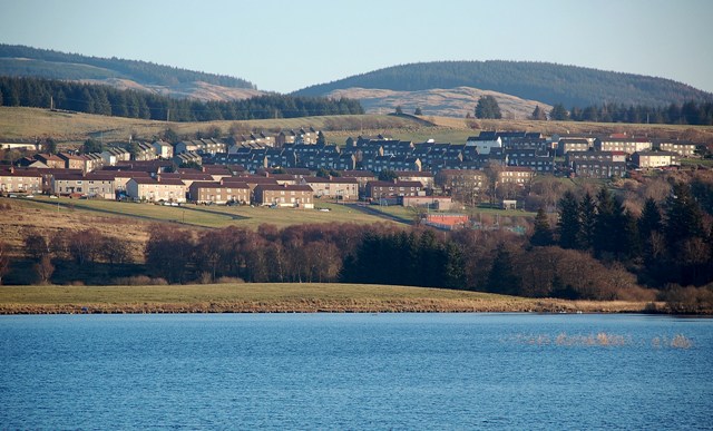
Bellsbank is a small village situated in East Ayrshire, Scotland. It lies approximately 4 miles southeast of the town of Ayr and is nestled within the picturesque countryside of the area. Bellsbank is part of the wider community council area of Dalmellington, where it is located to the east of the main settlement.

The village is primarily residential, consisting of a mix of housing types including detached and semi-detached houses, as well as some bungalows and flats. The community is known for its close-knit atmosphere and friendly residents, with a strong sense of community spirit.

Bellsbank benefits from its proximity to the larger town of Ayr, where residents can access a range of amenities including shops, supermarkets, schools, and healthcare facilities. There are also several public transportation options available, allowing for easy commuting and travel to nearby areas.

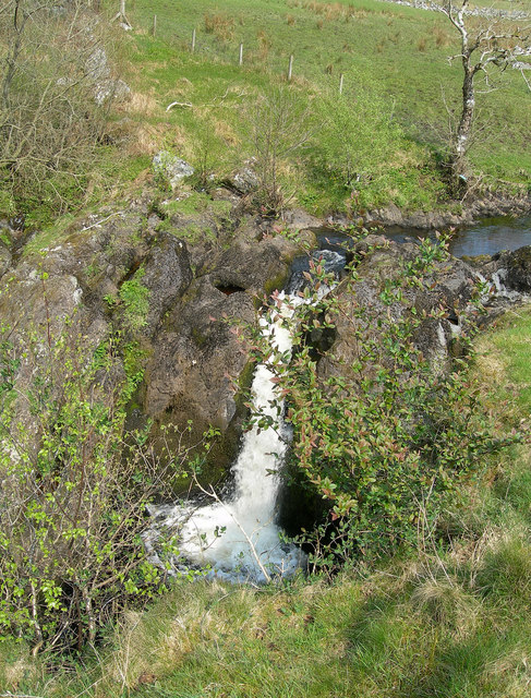
Surrounded by beautiful countryside, Bellsbank offers residents opportunities for outdoor activities such as walking, cycling, and exploring the nearby parks and nature reserves. The village is also close to the Galloway Forest Park, a designated Dark Sky Park, making it an ideal location for stargazing enthusiasts.

Overall, Bellsbank provides a peaceful and scenic place to live, with a strong sense of community and access to nearby amenities. Its charming rural location and easy access to larger towns make it an attractive place for those seeking a balance between countryside living and urban convenience.

If you have any feedback on the listing, please let us know in the comments section below.
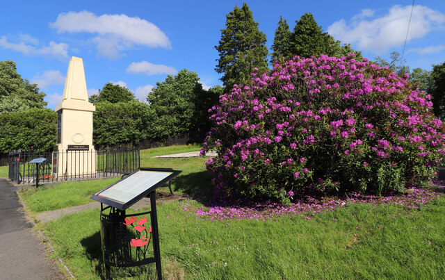
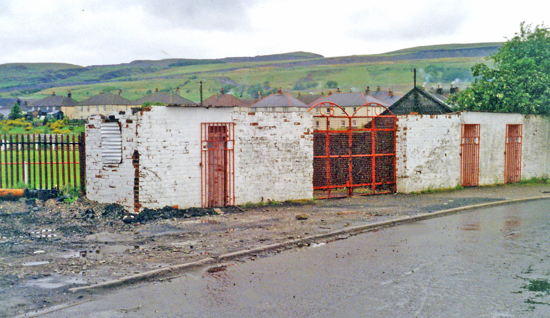
Bellsbank Images

Images are sourced within 2km of 55.311952/-4.397889 or Grid Reference NS4704. Thanks to Geograph Open Source API. All images are credited.

Ness Glen Walk, River Doon The Ness Glen Walk is a path through the gorge of the River Doon after it emerges from Loch Doon. It mostly follows the base of the gorge, close to the river, sometimes using artificial walkways. It was originally laid out in Victorian times. It continues along the gorge to the footbridge near Broad Dub and then returns back to the loch through the woods above the gorge.
Ness Glen Walk, River Doon
The Ness Glen Walk is a path through the gorge of the River Doon after it emerges from Loch Doon. It mostly follows the base of the gorge, close to the river, sometimes using artificial walkways. It was originally laid out in Victorian times. It continues along the gorge to the footbridge near Broad Dub and then returns back to the loch through the woods above the gorge.
Suspension bridge crossing the River Doon seen from Ness Glen Walk The Ness Glen Walk is a path through the gorge of the River Doon after it emerges from Loch Doon. It mostly follows the base of the gorge, close to the river, sometimes using artificial walkways. It was originally laid out in Victorian times. It continues along the gorge to the footbridge near Broad Dub and then returns back to the loch through the woods above the gorge.
Suspension bridge crossing the River Doon seen from Ness Glen Walk
The Ness Glen Walk is a path through the gorge of the River Doon after it emerges from Loch Doon. It mostly follows the base of the gorge, close to the river, sometimes using artificial walkways. It was originally laid out in Victorian times. It continues along the gorge to the footbridge near Broad Dub and then returns back to the loch through the woods above the gorge.
Ness Glen Walk The Ness Glen Walk is a path through the gorge of the River Doon after it emerges from Loch Doon. It mostly follows the base of the gorge, close to the river, sometimes using artificial walkways. It was originally laid out in Victorian times. It continues along the gorge to the footbridge near Broad Dub and then returns back to the loch through the woods above the gorge.
Ness Glen Walk
The Ness Glen Walk is a path through the gorge of the River Doon after it emerges from Loch Doon. It mostly follows the base of the gorge, close to the river, sometimes using artificial walkways. It was originally laid out in Victorian times. It continues along the gorge to the footbridge near Broad Dub and then returns back to the loch through the woods above the gorge.
Arriving at Dalmellington On the A713 from Carsphairn.
Arriving at Dalmellington
On the A713 from Carsphairn.
The Road to Carsphairn Leaving Dalmellington.
The Road to Carsphairn
Leaving Dalmellington.
Woodland at Dalmellington Viewed from the A713.
Woodland at Dalmellington
Viewed from the A713.
War Memorial, Dalmellington (1)
War Memorial, Dalmellington (2)
War Memorial, Dalmellington (3)
History of Loch Doon Aerial Gunnery School Next to the War Memorial in Dalmellington.
History of Loch Doon Aerial Gunnery School
Next to the War Memorial in Dalmellington.
War Memorial Park, Dalmellington Centenary Fields commemorating WW1.
War Memorial Park, Dalmellington
Centenary Fields commemorating WW1.
War Memorial, Dalmellington (4)
Our Glorious Dead, Dalmellington Names on the War Memorial.
Our Glorious Dead, Dalmellington
Names on the War Memorial.
Roll of Honour, Dalmellington Names on the War Memorial for WW2.
Roll of Honour, Dalmellington
Names on the War Memorial for WW2.
Silent Guard, Dalmellington Silhouette at the War Memorial.
Silent Guard, Dalmellington
Silhouette at the War Memorial.
War Memorial, Dalmellington (5) Their Name Liveth For Evermore.
War Memorial, Dalmellington (5)
Their Name Liveth For Evermore.
Silent Guard, Dalmellington At the War Memorial.
Silent Guard, Dalmellington
At the War Memorial.
Memorial to Mineworkers, Dalmellington To the mineworkers in the Doon Valley, located in front of the War Memorial.
Memorial to Mineworkers, Dalmellington
To the mineworkers in the Doon Valley, located in front of the War Memorial.
Show me another place!

Bellsbank is located at Grid Ref: NS4704 (Lat: 55.311952, Lng: -4.397889)

Unitary Authority: East Ayrshire

Police Authority: Ayrshire

What 3 Words

///widely.tasters.care. Near Bellsbank, East Ayrshire

Related Wikis

Bellsbank

Bellsbank is a village half a mile away from the market town of Dalmellington in East Ayrshire, Scotland. It is the second-highest place in East Ayrshire...

Dalmellington railway station

Dalmellington railway station served the town of Dalmellington, East Ayrshire, Scotland, from 1856 to 1964 on the Ayr and Dalmellington Railway. ��2�...

Dalmellington

Dalmellington (Scots: Dawmellinton, Scottish Gaelic: Dail M'Fhaolain) is a market town and civil parish in East Ayrshire, Scotland. In 2001 the village...

Doon Academy

Doon Academy is a secondary school in Dalmellington that caters to the local surrounding areas Dalmellington, Patna, Rankinston and Bellsbank. The current...

Waterside railway station

Waterside railway station served the village of Waterside, East Ayrshire, Scotland, from 1856 to 1964 on the Ayr and Dalmellington Railway. == History... ==

Loch Doon

Loch Doon (Scottish Gaelic: Loch Dùin, pronounced [l̪ˠɔxˈt̪uːɲ]) is a freshwater loch in Carrick, Scotland. The River Doon issues from its northern end...

Tairlaw Linn

Tairlaw Linn is a waterfall of Scotland, near Straiton, South Ayrshire. == See also == Waterfalls of Scotland == References ==

Drunmore Linn

Drunmore Linn is a waterfall of Scotland, near Straiton, South Ayrshire. == See also == Waterfalls of Scotland == References ==

Nearby Amenities

Located within 500m of 55.311952,-4.397889
Post Office
Source: OS OpenData StreetView
Lat/Long: 55.3112014/-4.3977461
Bellsbank
Place: village
Population: 1280
Lat/Long: 55.3120666/-4.397698
Power: pole
Lat/Long: 55.3137316/-4.3907412
Power: pole
Lat/Long: 55.3128279/-4.3905014
Power: pole
Lat/Long: 55.3120401/-4.3902752
Power: pole
Lat/Long: 55.3088912/-4.3923856
Power: pole
Lat/Long: 55.3088062/-4.3938672
Power: pole
Lat/Long: 55.3087496/-4.3949281
Power: pole
Lat/Long: 55.3086994/-4.395937
Power: pole
Lat/Long: 55.3099275/-4.4047204
Power: pole
Lat/Long: 55.3102095/-4.4032184
Power: pole
Lat/Long: 55.3103923/-4.4022412
Power: pole
Lat/Long: 55.3105815/-4.4013206
Noexit: yes
Lat/Long: 55.3148046/-4.3993753
Noexit: yes
Lat/Long: 55.3146707/-4.3994316
Noexit: yes
Lat/Long: 55.3147016/-4.3997086
The data included in this document is from www.openstreetmap.org. The data is made available under ODbL.

Have you been to Bellsbank?

Leave your review of Bellsbank below (or comments, questions and feedback).