Milton Keynes Village

Settlement in Buckinghamshire

England

Milton Keynes Village

Matrix Board - M1 southbound
Matrix Board - M1 southbound Credit: Dave Thompson

Milton Keynes Village is a small village located in the county of Buckinghamshire, England. Situated about three miles to the south-east of the town of Milton Keynes, it lies in close proximity to the M1 motorway, providing easy access to London and other major cities.

The village has a rich history dating back to the medieval period, with its origins believed to date back to the 13th century. It was originally known as Middleton and was an agricultural settlement. Over the years, the village grew and evolved, witnessing various changes and developments.

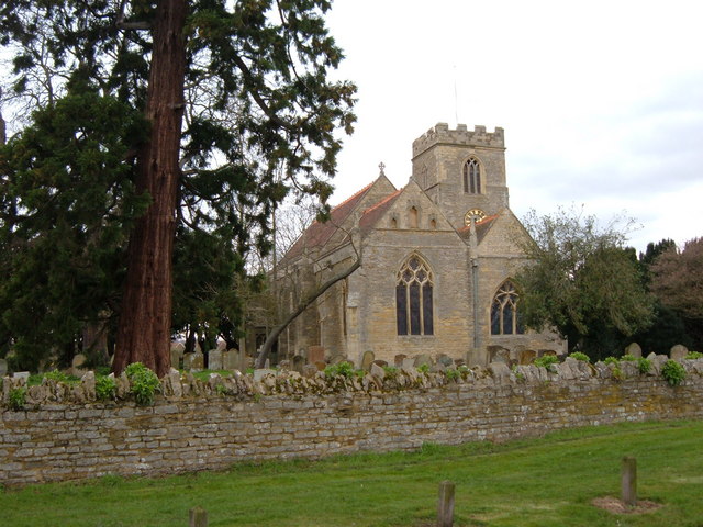
Today, Milton Keynes Village retains its traditional charm and character. It is home to a small population, with a mix of old cottages and newer, more modern houses. The village center features a picturesque village green, surrounded by a few local shops, a pub, and a church. The village is known for its peaceful atmosphere and beautiful surrounding countryside, making it an attractive location for those seeking a quieter pace of life.

Additionally, Milton Keynes Village benefits from its close proximity to various amenities and attractions. The nearby town of Milton Keynes offers a range of shopping centers, restaurants, and entertainment options, while the surrounding countryside provides ample opportunities for outdoor activities such as walking, cycling, and horse riding.

In conclusion, Milton Keynes Village is a charming and historic village in Buckinghamshire, offering a peaceful and idyllic setting while being conveniently located near major transportation routes and amenities.

If you have any feedback on the listing, please let us know in the comments section below.

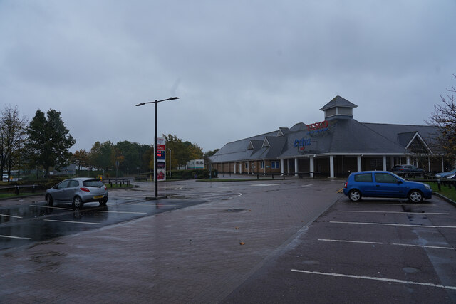
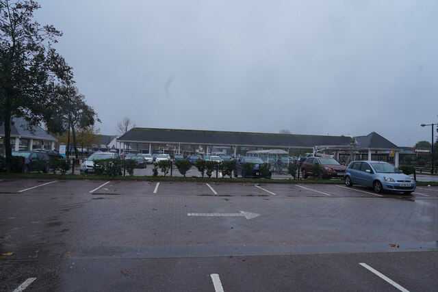
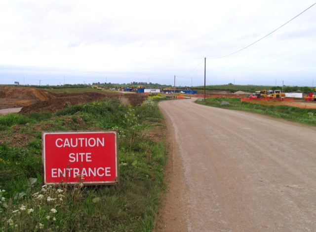
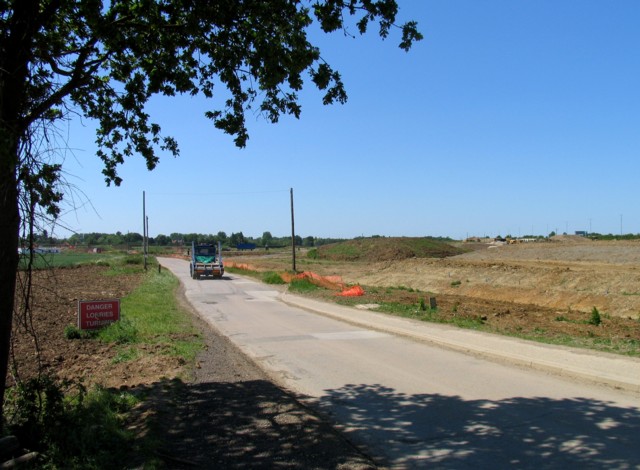
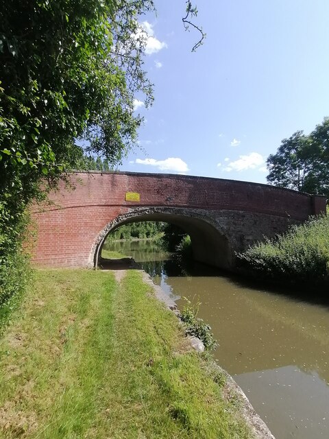
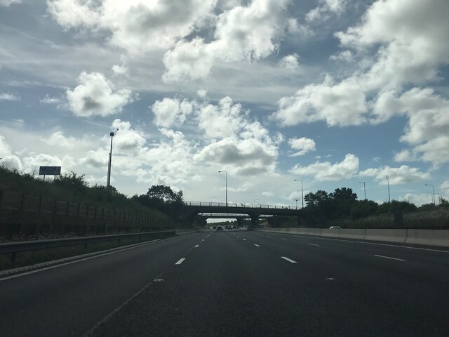
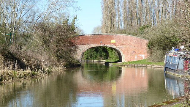
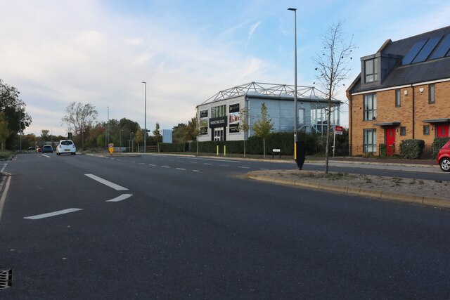
Milton Keynes Village Images

Images are sourced within 2km of 52.046797/-0.710927 or Grid Reference SP8839. Thanks to Geograph Open Source API. All images are credited.

Matrix Board - M1 southbound
Sign Gantry on the M1 at Milton Keynes The M1 is a north–south motorway connecting London to Leeds, where it joins the A1(M) near Aberford. It was the first motorway to be completed in the United Kingdom.
The motorway is 193 miles long and was constructed in four phases. Most of the motorway was opened between 1959 and 1968 but the southern end was extended in 1977 and the northern end was extended in 1999.
Sign Gantry on the M1 at Milton Keynes
The M1 is a north–south motorway connecting London to Leeds, where it joins the A1(M) near Aberford. It was the first motorway to be completed in the United Kingdom. The motorway is 193 miles long and was constructed in four phases. Most of the motorway was opened between 1959 and 1968 but the southern end was extended in 1977 and the northern end was extended in 1999.
The edge of  Tesco's The car park is empty at the moment but in the 20 minutes we waited in the rain there were large numbers of cars arriving.
The edge of Tesco's
The car park is empty at the moment but in the 20 minutes we waited in the rain there were large numbers of cars arriving.
Nearly empty car park The rain is only heavy at the moment, soon it becomes very heavy and a little later it stops.
Nearly empty car park
The rain is only heavy at the moment, soon it becomes very heavy and a little later it stops.
Bikes in Bodmin Place Looks like electric scooters are the preferred mode of transport these days
Bikes in Bodmin Place
Looks like electric scooters are the preferred mode of transport these days
New houses on Fen Street, Broughton These have just been finished and at least have some front gardens.
New houses on Fen Street, Broughton
These have just been finished and at least have some front gardens.
Road and culvert A chunk of land between the M1 and the Broughton area of Milton Keynes which is perhaps for commercial property development. Very little building activity visible in June 2009 but perhaps they are still busy getting the infrastructure in place. Perhaps a return visit in 2010 to see what has happened in a year?
Road and culvert
A chunk of land between the M1 and the Broughton area of Milton Keynes which is perhaps for commercial property development. Very little building activity visible in June 2009 but perhaps they are still busy getting the infrastructure in place. Perhaps a return visit in 2010 to see what has happened in a year?
Former country lane in a building site The only activity on this building site near to the Broughton area of Milton Keynes was from some earth moving equipment.
Former country lane in a building site
The only activity on this building site near to the Broughton area of Milton Keynes was from some earth moving equipment.
Broughton Grounds Lane A view of the site being cleared near to the Broughton area of Milton Keynes.
Broughton Grounds Lane
A view of the site being cleared near to the Broughton area of Milton Keynes.
Borough of Milton Keynes : M1 Motorway The M1 Motorway between Junction 14 (Broughton) and Junction 13 (Ridgmont).
Borough of Milton Keynes : M1 Motorway
The M1 Motorway between Junction 14 (Broughton) and Junction 13 (Ridgmont).
Bridge 81 (Grand Union Canal)  Bridge 81 carries pedestrian crossing over the canal
Bridge 81 (Grand Union Canal)
Bridge 81 carries pedestrian crossing over the canal
Grand Union Canal (Milton Keynes)  Grand Union Canal near Willen Milton Keynes facing towards bridge 81
Grand Union Canal (Milton Keynes)
Grand Union Canal near Willen Milton Keynes facing towards bridge 81
A509 crossing M1 southbound
Grand Union Canal bridge 81 The bridge seems not to be in the best condition, with deep cracks evident in the parapet.
Grand Union Canal bridge 81
The bridge seems not to be in the best condition, with deep cracks evident in the parapet.
Fen Street, Broughton
Moulsoe Road, Milton Keynes Just north of the new town.
Moulsoe Road, Milton Keynes
Just north of the new town.
Building site off Moulsoe Road, Milton Keynes This is open fields but appears to be ready for a new housing estate.
Building site off Moulsoe Road, Milton Keynes
This is open fields but appears to be ready for a new housing estate.
Newport Pagnell Services South, M1
Show me another place!

Milton Keynes Village is located at Grid Ref: SP8839 (Lat: 52.046797, Lng: -0.710927)

Unitary Authority: Milton Keynes

Police Authority: Thames Valley

What 3 Words

///outright.limits.wicket. Near Broughton, Buckinghamshire

Related Wikis

Middleton, Milton Keynes

Middleton is an area of Milton Keynes, a city in Buckinghamshire, England, and part of the civil parish of Milton Keynes. Its historic centre is Milton...

Broughton and Milton Keynes Parish Council

Broughton and Milton Keynes Parish Council is a joint parish council for Milton Keynes and Broughton civil parishes in the City of Milton Keynes unitary...

Oakgrove School

Oakgrove School is a coeducational, nursery, primary school, secondary school and sixth form with academy status, located in the Middleton (Oakgrove Secondary...

Oakgrove, Milton Keynes

Oakgrove is a district of Milton Keynes in Buckinghamshire, England, in the civil parish of Milton Keynes. The district includes a small retail centre...

St Lawrence's Church, Broughton

St Lawrence's Church is a redundant Anglican church in Broughton, Milton Keynes, Buckinghamshire, England. The church is recorded in the National Heritage...

Woolstone, Milton Keynes

Great Woolstone and Little Woolstone are two historic villages in modern Milton Keynes, Buckinghamshire that are now called jointly Woolstone or The Woolstones...

Willen Lake

Willen Lake is a visitor attraction and public park in Milton Keynes, Buckinghamshire The site is owned by The Parks Trust, an independent, self-funded...

Broughton, Milton Keynes

Broughton (, BRAW-tən) is a historic village, modern district and civil parish in Milton Keynes, Buckinghamshire, England, situated approximately 3 miles...

Nearby Amenities

Located within 500m of 52.046797,-0.710927
Traffic Signals
Lat/Long: 52.0484597/-0.707168
Traffic Signals
Lat/Long: 52.0488419/-0.70771
Direction: backward
Traffic Calming: table
Lat/Long: 52.0431205/-0.7134675
Traffic Calming: table
Lat/Long: 52.0430975/-0.7125045
Direction: forward
Traffic Calming: table
Lat/Long: 52.0455028/-0.709315
Traffic Calming: table
Lat/Long: 52.0468101/-0.7085466
Motorway Junction
Lat/Long: 52.048017/-0.7092359
Fox Milne
Place: suburb
Lat/Long: 52.0501991/-0.7129552
Historic: ruins
Lat/Long: 52.044357/-0.7091118
Traffic Calming: table
Lat/Long: 52.0464894/-0.7046316
Fuel
Shell Broughton
Addr City: Milton Keynes
Addr Postcode: MK10 9AB
Addr Street: H6 Childs Way
Atm: yes
Brand: Shell
Brand Wikidata: Q110716465
Brand Wikipedia: en:Royal Dutch Shell
Designation: 2324
Fhrs Authority: Milton Keynes
Fhrs Id: 199171
Fhrs Local Authority Id: 8992
Fuel Diesel: yes
Fuel Octane 95: yes
Opening Hours: 24/7
Ref Navads: NVDS353_12038450
Website: https://find.shell.com/gb/fuel/12038450-shell-budgens-broughton
Lat/Long: 52.0485733/-0.7062282
Budgens
Addr City: Milton Keynes
Addr Country: GB
Addr Postcode: MK10 9AB
Addr Street: Childs Way
Addr Suburb: Broughton
Atm: yes
Brand: Budgens
Brand Wikidata: Q4985016
Brand Wikipedia: en:Budgens
Shop: convenience
Lat/Long: 52.0486386/-0.7059541
Bus Stop
Fox Milne Roundabout West
Bench: yes
Bin: no
Bus: yes
Naptan AtcoCode: 049004485430
Naptan Bearing: NE
Naptan CommonName: Fox Milne Roundabout West
Naptan Indicator: Eastbound
Naptan Landmark: Broughton Fire Station
Naptan NaptanCode: mltgaga
Naptan PlusbusZoneRef: MKNSCEN
Naptan Street: Childs Way H6
Naptan Verified: no
Public Transport: platform
Shelter: yes
Source: naptan_import
Lat/Long: 52.0481831/-0.7093495
Bus Stop
Fox Milne Roundabout West
Bus: yes
Naptan AtcoCode: 049004485431
Naptan Bearing: SW
Naptan CommonName: Fox Milne Roundabout West
Naptan Indicator: Westbound
Naptan Landmark: Broughton Fire Station
Naptan NaptanCode: mltgagd
Naptan PlusbusZoneRef: MKNSCEN
Naptan Street: Childs Way H6
Naptan Verified: no
Public Transport: platform
Shelter: yes
Source: naptan_import
Lat/Long: 52.0480252/-0.7088873
Bus Stop
Bressingham Gate
Bus: yes
Naptan AtcoCode: 049010035437
Naptan Bearing: SW
Naptan CommonName: Bressingham Gate
Naptan Indicator: South Westbound
Naptan Landmark: Tongwell Street V11
Naptan NaptanCode: mltgtwm
Naptan PlusbusZoneRef: MKNSCEN
Naptan Street: Childs Way H6
Naptan Verified: no
Public Transport: platform
Source: naptan_import
Lat/Long: 52.0495765/-0.7052259
Traffic Signals
Lat/Long: 52.0489817/-0.7076946
Traffic Calming: table
Lat/Long: 52.0449276/-0.7110669
Direction: backward
Traffic Calming: table
Lat/Long: 52.046377/-0.7099488
Direction: backward
Traffic Calming: table
Lat/Long: 52.0456564/-0.7090494
Post Box
Brand: Royal Mail
Brand Wikidata: Q638098
Brand Wikipedia: en:Royal Mail
Collection Times: Mo-Fr 17:30; Sa 12:00
Operator: Royal Mail
Operator Wikidata: Q638098
Ref: MK10 533
Source: survey
Lat/Long: 52.0455147/-0.7091863
Post Box
Brand: Royal Mail
Brand Wikidata: Q638098
Brand Wikipedia: en:Royal Mail
Collection Times: Mo-Fr 18:30
Note: Franked mail only
Operator: Royal Mail
Operator Wikidata: Q638098
Post Box Type: pillar
Ref: MK15 624
Royal Cypher: EIIR
Royal Cypher Wikidata: Q33102113
Source: survey
Lat/Long: 52.0497868/-0.711301
Traffic Signals
Lat/Long: 52.0483343/-0.7071262
Noon Layer Drive West
Brand: National Grid
Brand Wikidata: Q1465461
Operator: National Grid Electricity Distribution
Operator Old: Western Power Distribution
Operator Wikidata: Q7988183
Owner: National Grid Electricity Distribution (East Midlands) Plc
Owner Wikidata: Q114348127
Power: substation
Ref: 945237
Substation: minor_distribution
Voltage: 11000
Lat/Long: 52.043919/-0.7151058
Source: bing
Traffic Calming: choker
Lat/Long: 52.0472869/-0.7078495
Entrance: yes
Lat/Long: 52.0427605/-0.7120453
Entrance: yes
Lat/Long: 52.042732/-0.713057
Bicycle Rental
Santander Cycles MK D/S #8838
Bicycle Rental: docking_station
Brand: Santander Cycles MK
Brand Wikidata: Q807961
Capacity: 8
Network: Santander Cycles MK
Operator: nextbike
Operator Wikidata: Q2351279
Lat/Long: 52.0431466/-0.7138422
Traffic Signals
Traffic Signals: signal
Lat/Long: 52.0494307/-0.7056426
Traffic Signals
Traffic Signals: signal
Lat/Long: 52.0482191/-0.708891
Traffic Signals
Traffic Signals: signal
Lat/Long: 52.0482622/-0.7089309
Barrier: lift_gate
Lat/Long: 52.0430348/-0.7137426
Parking
Lat/Long: 52.0465136/-0.7061118
Noexit: yes
Lat/Long: 52.043571/-0.7156938
Give Way
Lat/Long: 52.0505375/-0.7098439
Traffic Calming: island
Lat/Long: 52.0503419/-0.7093031
Entrance: yes
Lat/Long: 52.0429005/-0.7123199
Give Way
Lat/Long: 52.0503083/-0.7091708
Give Way
Lat/Long: 52.0506251/-0.7097068
Noon Layer Drive
Brand: National Grid
Brand Wikidata: Q1465461
Operator: National Grid Electricity Distribution
Operator Old: Western Power Distribution
Operator Wikidata: Q7988183
Owner: National Grid Electricity Distribution (East Midlands) Plc
Owner Wikidata: Q114348127
Power: substation
Ref: 945113
Substation: minor_distribution
Voltage: 11000
Lat/Long: 52.0456905/-0.7087723
Defibrillator
Addr Postcode: MK10 9AP
Defibrillator Location: On outside wall, Next to Reception Entrance
Emergency: defibrillator
Operator: Martek Lifecare
Ref: DFS_16_2293
Lat/Long: 52.0475013/-0.7082239
Entrance: yes
Lat/Long: 52.0475081/-0.7082478
Direction: 190
Fixme: survey for panel count
Generator Method: photovoltaic
Generator Output Electricity: yes
Generator Solar Modules: 15
Generator Source: solar
Generator Type: solar_photovoltaic_panel
Location: roof
Power: generator
Lat/Long: 52.0446182/-0.7081551
Direction: 170
Generator Method: photovoltaic
Generator Output Electricity: yes
Generator Solar Modules: 15
Generator Source: solar
Generator Type: solar_photovoltaic_panel
Location: roof
Power: generator
Lat/Long: 52.0446593/-0.7088458
Direction: 240
Generator Method: photovoltaic
Generator Output Electricity: yes
Generator Solar Modules: 8
Generator Source: solar
Generator Type: solar_photovoltaic_panel
Location: roof
Power: generator
Lat/Long: 52.0453998/-0.7108841
Direction: 180
Fixme: survey for panel count
Generator Method: photovoltaic
Generator Output Electricity: yes
Generator Solar Modules: 15
Generator Source: solar
Generator Type: solar_photovoltaic_panel
Location: roof
Power: generator
Lat/Long: 52.0445818/-0.711529
Traffic Calming: table
Lat/Long: 52.0439199/-0.7111918
Direction: 165
Generator Method: photovoltaic
Generator Output Electricity: yes
Generator Solar Modules: 18
Generator Source: solar
Generator Type: solar_photovoltaic_panel
Location: roof
Power: generator
Lat/Long: 52.0448555/-0.7059167
Direction: 165
Generator Method: photovoltaic
Generator Output Electricity: yes
Generator Solar Modules: 16
Generator Source: solar
Generator Type: solar_photovoltaic_panel
Location: roof
Power: generator
Lat/Long: 52.0453347/-0.7054859
Direction: 165
Generator Method: photovoltaic
Generator Output Electricity: yes
Generator Solar Modules: 17
Generator Source: solar
Generator Type: solar_photovoltaic_panel
Location: roof
Power: generator
Lat/Long: 52.0458468/-0.7057686
Direction: 155
Generator Method: photovoltaic
Generator Output Electricity: yes
Generator Solar Modules: 16
Generator Source: solar
Generator Type: solar_photovoltaic_panel
Location: roof
Power: generator
Lat/Long: 52.0472849/-0.7088233
Direction: 155
Generator Method: photovoltaic
Generator Output Electricity: yes
Generator Solar Modules: 82
Generator Source: solar
Generator Type: solar_photovoltaic_panel
Location: roof
Power: generator
Lat/Long: 52.0473796/-0.7084961
Give Way
Direction: backward
Lat/Long: 52.0465234/-0.7046285
Direction: forward
Traffic Calming: table
Lat/Long: 52.0462659/-0.7094479
Direction: backward
Traffic Calming: table
Lat/Long: 52.0464401/-0.7097385
Direction: backward
Traffic Calming: table
Lat/Long: 52.0462115/-0.7096377
Direction: 150
Fixme: survey for panel count
Generator Method: photovoltaic
Generator Output Electricity: yes
Generator Solar Modules: 12
Generator Source: solar
Generator Type: solar_photovoltaic_panel
Location: roof
Power: generator
Lat/Long: 52.0462411/-0.7104583
Direction: 190
Generator Method: photovoltaic
Generator Output Electricity: yes
Generator Solar Modules: 10
Generator Source: solar
Generator Type: solar_photovoltaic_panel
Location: roof
Power: generator
Lat/Long: 52.0465032/-0.7124287
Direction: 150
Generator Method: photovoltaic
Generator Output Electricity: yes
Generator Solar Modules: 16
Generator Source: solar
Generator Type: solar_photovoltaic_panel
Location: roof
Power: generator
Lat/Long: 52.0458158/-0.7108109
Direction: 140
Fixme: survey for panel count
Generator Method: photovoltaic
Generator Output Electricity: yes
Generator Solar Modules: 16
Generator Source: solar
Generator Type: solar_photovoltaic_panel
Location: roof
Power: generator
Lat/Long: 52.0454855/-0.711555
Direction: 180
Fixme: survey for panel count
Generator Method: photovoltaic
Generator Output Electricity: yes
Generator Solar Modules: 15
Generator Source: solar
Generator Type: solar_photovoltaic_panel
Location: roof
Power: generator
Lat/Long: 52.0447842/-0.7116056
Direction: 200
Generator Method: photovoltaic
Generator Output Electricity: yes
Generator Solar Modules: 16
Generator Source: solar
Generator Type: solar_photovoltaic_panel
Location: roof
Power: generator
Lat/Long: 52.0450284/-0.7119633
Direction: 200
Generator Method: photovoltaic
Generator Output Electricity: yes
Generator Solar Modules: 16
Generator Source: solar
Generator Type: solar_photovoltaic_panel
Location: roof
Power: generator
Lat/Long: 52.0450705/-0.7121639
Direction: 275
Generator Method: photovoltaic
Generator Output Electricity: yes
Generator Solar Modules: 16
Generator Source: solar
Generator Type: solar_photovoltaic_panel
Location: roof
Power: generator
Lat/Long: 52.0444863/-0.7127807
Direction: 195
Generator Method: photovoltaic
Generator Output Electricity: yes
Generator Solar Modules: 16
Generator Source: solar
Generator Type: solar_photovoltaic_panel
Location: roof
Power: generator
Lat/Long: 52.0456344/-0.713018
Direction: 135
Generator Method: photovoltaic
Generator Output Electricity: yes
Generator Solar Modules: 18
Generator Source: solar
Generator Type: solar_photovoltaic_panel
Location: roof
Power: generator
Lat/Long: 52.0455115/-0.7139123
Direction: 160
Generator Method: photovoltaic
Generator Output Electricity: yes
Generator Solar Modules: 16
Generator Source: solar
Generator Type: solar_photovoltaic_panel
Location: roof
Power: generator
Lat/Long: 52.0450769/-0.7134568
Direction: forward
Traffic Calming: table
Lat/Long: 52.0432777/-0.7140063
Direction: backward
Traffic Calming: table
Lat/Long: 52.0430582/-0.7137256
Direction: 120
Generator Method: photovoltaic
Generator Output Electricity: yes
Generator Solar Modules: 10
Generator Source: solar
Generator Type: solar_photovoltaic_panel
Location: roof
Power: generator
Lat/Long: 52.0430604/-0.7139289
Direction: 210
Generator Method: photovoltaic
Generator Output Electricity: yes
Generator Solar Modules: 3
Generator Source: solar
Generator Type: solar_photovoltaic_panel
Location: roof
Power: generator
Lat/Long: 52.0431529/-0.7141922
Direction: 210
Generator Method: photovoltaic
Generator Output Electricity: yes
Generator Solar Modules: 3
Generator Source: solar
Generator Type: solar_photovoltaic_panel
Location: roof
Power: generator
Lat/Long: 52.0431777/-0.7142627
Direction: 210
Generator Method: photovoltaic
Generator Output Electricity: yes
Generator Solar Modules: 3
Generator Source: solar
Generator Type: solar_photovoltaic_panel
Location: roof
Power: generator
Lat/Long: 52.0432014/-0.7143237
Direction: 210
Generator Method: photovoltaic
Generator Output Electricity: yes
Generator Solar Modules: 3
Generator Source: solar
Generator Type: solar_photovoltaic_panel
Location: roof
Power: generator
Lat/Long: 52.0432899/-0.7145971
Direction: 210
Generator Method: photovoltaic
Generator Output Electricity: yes
Generator Solar Modules: 3
Generator Source: solar
Generator Type: solar_photovoltaic_panel
Location: roof
Power: generator
Lat/Long: 52.0433119/-0.714663
Direction: 210
Generator Method: photovoltaic
Generator Output Electricity: yes
Generator Solar Modules: 3
Generator Source: solar
Generator Type: solar_photovoltaic_panel
Location: roof
Power: generator
Lat/Long: 52.0433339/-0.7147242
Direction: 210
Generator Method: photovoltaic
Generator Output Electricity: yes
Generator Solar Modules: 5
Generator Source: solar
Generator Type: solar_photovoltaic_panel
Location: roof
Power: generator
Lat/Long: 52.0434479/-0.7149678
Direction: 210
Generator Method: photovoltaic
Generator Output Electricity: yes
Generator Solar Modules: 3
Generator Source: solar
Generator Type: solar_photovoltaic_panel
Location: roof
Power: generator
Lat/Long: 52.0430824/-0.7150317
Direction: 210
Generator Method: photovoltaic
Generator Output Electricity: yes
Generator Solar Modules: 3
Generator Source: solar
Generator Type: solar_photovoltaic_panel
Location: roof
Power: generator
Lat/Long: 52.0429831/-0.7145527
Direction: 210
Generator Method: photovoltaic
Generator Output Electricity: yes
Generator Solar Modules: 3
Generator Source: solar
Generator Type: solar_photovoltaic_panel
Location: roof
Power: generator
Lat/Long: 52.0429383/-0.714598
Direction: 300
Generator Method: photovoltaic
Generator Output Electricity: yes
Generator Solar Modules: 5
Generator Source: solar
Generator Type: solar_photovoltaic_panel
Location: roof
Power: generator
Lat/Long: 52.0433514/-0.7154127
Direction: 250
Generator Method: photovoltaic
Generator Output Electricity: yes
Generator Solar Modules: 5
Generator Source: solar
Generator Type: solar_photovoltaic_panel
Location: roof
Power: generator
Lat/Long: 52.0433505/-0.715068
Direction: 250
Generator Method: photovoltaic
Generator Output Electricity: yes
Generator Solar Modules: 3
Generator Source: solar
Generator Type: solar_photovoltaic_panel
Location: roof
Power: generator
Lat/Long: 52.0433285/-0.7152297
Direction: 155
Generator Method: photovoltaic
Generator Output Electricity: yes
Generator Solar Modules: 10
Generator Source: solar
Generator Type: solar_photovoltaic_panel
Location: roof
Power: generator
Lat/Long: 52.0445026/-0.7170302
Fixme: solar panels?
Lat/Long: 52.0440172/-0.7158819
Barrier: bollard
Lat/Long: 52.0447464/-0.7128461
Barrier: bollard
Lat/Long: 52.0447691/-0.7128512
Barrier: bollard
Lat/Long: 52.0457357/-0.7118873
Bench
Lat/Long: 52.0435468/-0.7062611
Traffic Calming: table
Lat/Long: 52.0470108/-0.7062866
The data included in this document is from www.openstreetmap.org. The data is made available under ODbL.

Have you been to Milton Keynes Village?

Leave your review of Milton Keynes Village below (or comments, questions and feedback).