Bellfield

Settlement in Ayrshire

Scotland

Bellfield

Part of Old Street, Kilmarnock Apart from the fact that the buildings have most probably been here since the late 1800s I haven't been able to find out anything else about them. The letter M above the door of the rightmost one would probably provide a clue to those more experienced in this kind of detective work.
My dead-end research did unearth the fact that this is one of 26 Old Streets in Britain. There are, on the other hand, over 500 New Streets. Thinking about it this makes perfect sense, as if a road has been around for long enough to be referred to as an old street, the likelihood is that it will have picked up another name in the meantime.
It is an old-style scrapyard with cars stripped of their wheels piled on top of one another, usually three high. I rather like the fact that the top car on one of these piles has been utilised as an advertising sign.
Part of Old Street, Kilmarnock Credit: Ian Dodds

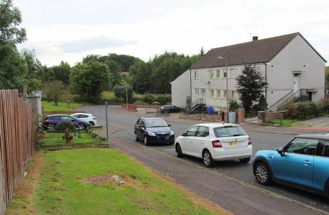
Bellfield is a residential area located in the town of Kilmarnock, Ayrshire, on the west coast of Scotland. It is situated about 3 miles east of the town center and is bordered by the areas of Shortlees, Knockinlaw, and Riccarton.

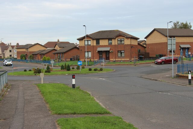
Bellfield is primarily a housing estate consisting of a mix of privately owned and council houses. The architecture of the area is predominantly mid-20th century with a combination of semi-detached and terraced houses. The estate also includes a number of newer build properties.

The community in Bellfield benefits from various amenities within close proximity. These include Bellfield Primary School, which serves the local children, as well as a local shopping center with a range of convenience stores and small businesses. In addition, there are several green spaces and parks nearby, offering recreational opportunities for residents.

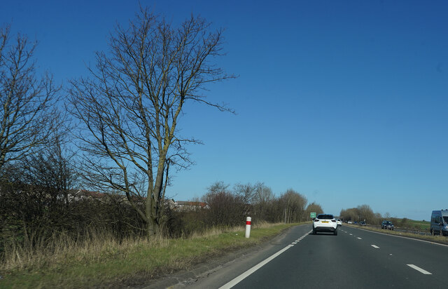
Transportation in Bellfield is convenient, with regular bus services connecting the area to Kilmarnock town center and surrounding areas. The nearby A77 road provides easy access to other parts of Ayrshire and beyond.

Overall, Bellfield offers a peaceful residential environment with a strong sense of community. Its location near Kilmarnock provides access to a wider range of amenities and services, while still maintaining a suburban feel.

If you have any feedback on the listing, please let us know in the comments section below.
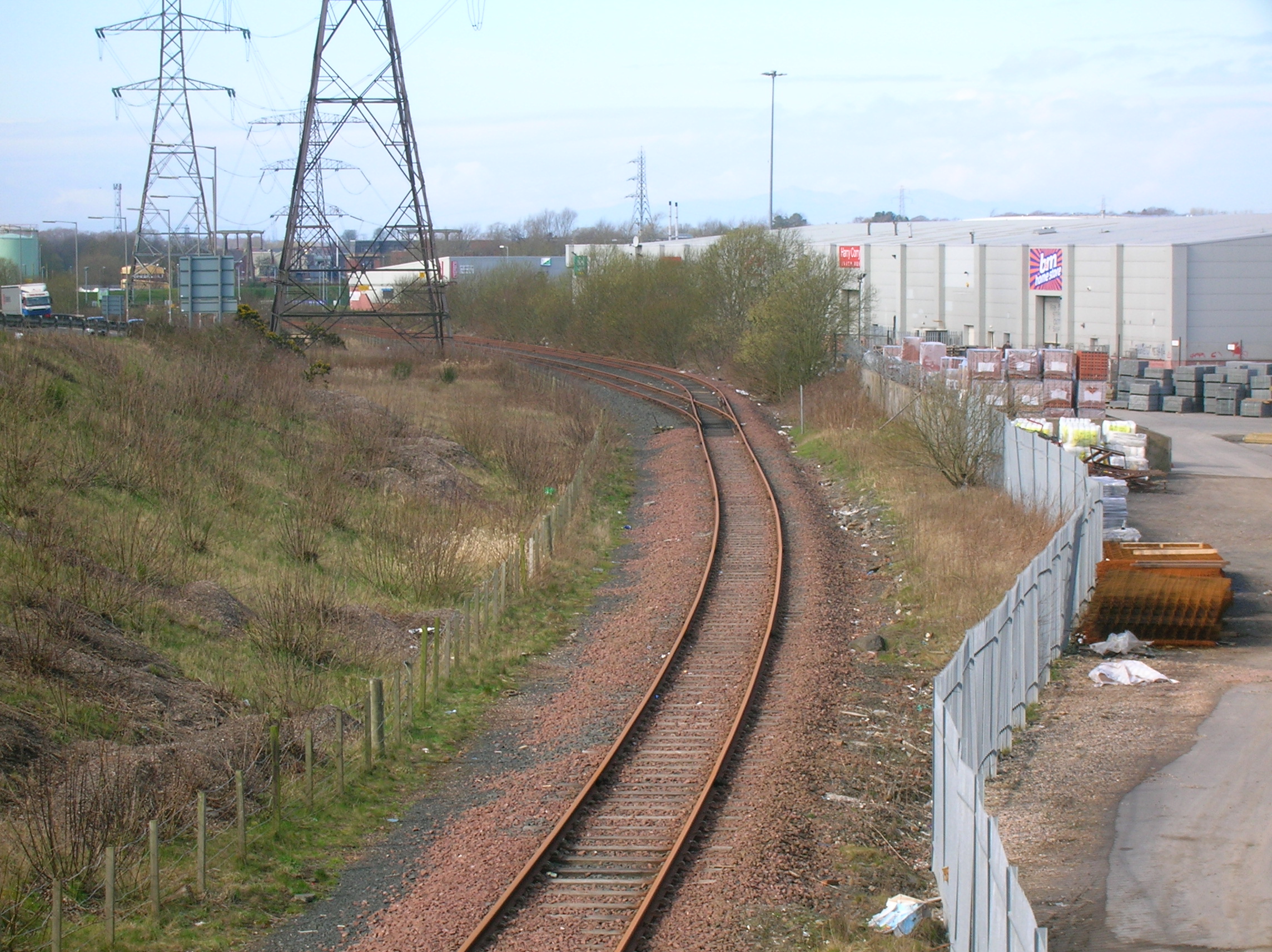
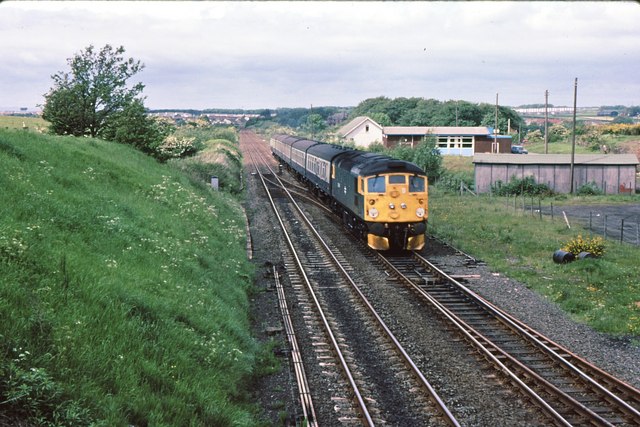
Bellfield Images

Images are sourced within 2km of 55.588526/-4.483262 or Grid Reference NS4335. Thanks to Geograph Open Source API. All images are credited.

Part of Old Street, Kilmarnock Apart from the fact that the buildings have most probably been here since the late 1800s I haven't been able to find out anything else about them. The letter M above the door of the rightmost one would probably provide a clue to those more experienced in this kind of detective work.
My dead-end research did unearth the fact that this is one of 26 Old Streets in Britain. There are, on the other hand, over 500 New Streets. Thinking about it this makes perfect sense, as if a road has been around for long enough to be referred to as an old street, the likelihood is that it will have picked up another name in the meantime.
It is an old-style scrapyard with cars stripped of their wheels piled on top of one another, usually three high. I rather like the fact that the top car on one of these piles has been utilised as an advertising sign.
Part of Old Street, Kilmarnock
Apart from the fact that the buildings have most probably been here since the late 1800s I haven't been able to find out anything else about them. The letter M above the door of the rightmost one would probably provide a clue to those more experienced in this kind of detective work. My dead-end research did unearth the fact that this is one of 26 Old Streets in Britain. There are, on the other hand, over 500 New Streets. Thinking about it this makes perfect sense, as if a road has been around for long enough to be referred to as an old street, the likelihood is that it will have picked up another name in the meantime. It is an old-style scrapyard with cars stripped of their wheels piled on top of one another, usually three high. I rather like the fact that the top car on one of these piles has been utilised as an advertising sign.
Travelodge at the Kilmarnock Bellfield Interchange A stopover by the A77
Travelodge at the Kilmarnock Bellfield Interchange
A stopover by the A77
Southern outskirts of Kilmarnock
Bridgehouse Farm, South of Kilmarnock The fence is the boundary of the built up area.
Bridgehouse Farm, South of Kilmarnock
The fence is the boundary of the built up area.
Housing in Shortlees at the southern tip of Kilmarnock
Roundabout at Shortlees
A wood by the A77 One of many small woods alongside the A77.
A wood by the A77
One of many small woods alongside the A77.
Approaching Bridgehouse Bridge In Scotland all the bridges and roundabouts appear to have names. This is not true of England.
Approaching Bridgehouse Bridge
In Scotland all the bridges and roundabouts appear to have names. This is not true of England.
Approaching Kilmarnock Our destination is the Dean Castle country park in north Kilmarnock. A good choice on this sunny day.
Approaching Kilmarnock
Our destination is the Dean Castle country park in north Kilmarnock. A good choice on this sunny day.
By Bellfield Another view along the A77.
By Bellfield
Another view along the A77.
The A77 Getting close to where we need to turn off for Dean Castle.
The A77
Getting close to where we need to turn off for Dean Castle.
Clayslap, a roadside cottage
Old road at Bridgehouse
Treeswoodhead Road
Treeswoodhead Road
Tower, Caprington According to Canmore - the public body in Scotland responsible for documenting its archaeology - this was once an engine house connected to Blacksyke Colliery. The engine powered a pump that was needed to remove water from the underground mines, so it could also be thought of as a pump house; in old mines it was common to bring, by weight, more water than coal to the surface over their lifetimes
The earliest OS map of this area, surveyed in the 1850s, has a coal pit (one of several in the vicinity) marked next to the tower, but by the 1890s the building was labelled 'Tank'. A large metal tank still sits at the top of it.
There is a far more famous Blacksyke Tower less than a mile South of here. It is now a ruin and has scheduled monument status. Considering this tower would probably have been built at the same time as that one, and that it is still in excellent condition, it's a surprise it isn't a listed building.
Both towers once sat on the Carpington Estate; in a way they still do I suppose, but the ground they both occupy is now owned by Carpington Golf Club.
Tower, Caprington
According to Canmore - the public body in Scotland responsible for documenting its archaeology - this was once an engine house connected to Blacksyke Colliery. The engine powered a pump that was needed to remove water from the underground mines, so it could also be thought of as a pump house; in old mines it was common to bring, by weight, more water than coal to the surface over their lifetimes The earliest OS map of this area, surveyed in the 1850s, has a coal pit (one of several in the vicinity) marked next to the tower, but by the 1890s the building was labelled 'Tank'. A large metal tank still sits at the top of it. There is a far more famous Blacksyke Tower less than a mile South of here. It is now a ruin and has scheduled monument status. Considering this tower would probably have been built at the same time as that one, and that it is still in excellent condition, it's a surprise it isn't a listed building. Both towers once sat on the Carpington Estate; in a way they still do I suppose, but the ground they both occupy is now owned by Carpington Golf Club.
East Ayrshire Council Headquarters
Kirkstyle Primary School Kirkstyle Primary School is a non-denomination school situated South of Kilmatnock
Kirkstyle Primary School
Kirkstyle Primary School is a non-denomination school situated South of Kilmatnock
Riccarton Parish Church Riccarton Parish Church was built starting in 1823 and finished in 1825. Robert Burns used to pass the previous Parish Church as he journeyed into Kilmarnock from Lochlea Farm, Tarbolton. Nearby is also the site of Riccarton Castle where William Wallace's Uncle Sir Richard Wallace lived and was reputedly visited by William who is said to have lived there for a time.
Riccarton Parish Church
Riccarton Parish Church was built starting in 1823 and finished in 1825. Robert Burns used to pass the previous Parish Church as he journeyed into Kilmarnock from Lochlea Farm, Tarbolton. Nearby is also the site of Riccarton Castle where William Wallace's Uncle Sir Richard Wallace lived and was reputedly visited by William who is said to have lived there for a time.
Show me another place!

Bellfield is located at Grid Ref: NS4335 (Lat: 55.588526, Lng: -4.483262)

Unitary Authority: East Ayrshire

Police Authority: Ayrshire

What 3 Words

///anguished.event.freely. Near Kilmarnock, East Ayrshire

Nearby Locations

Bellfield

Related Wikis

Bellfield, East Ayrshire

Bellfield is a council housing area in the south-east of Kilmarnock, Scotland. == Education == Bellfield is home to two primary schools Kirkstyle Primary...

Riccarton, East Ayrshire

Riccarton is a village and parish in East Ayrshire, Scotland. It lies across the River Irvine from Kilmarnock, this river forming the boundary between...

Kirklandside Hospital

Kirklandside was a community hospital in the village of Hurlford a few miles out of Kilmarnock, Scotland. It was managed by NHS Ayrshire and Arran. �...

Shortlees A.F.C.

Shortlees Amateurs Football Club is a Scottish football club based in Kilmarnock, East Ayrshire, representing the neighbourhood of Shortlees. In 2018 they...

Riccarton and Craigie railway station

Riccarton and Craigie was an unopened railway station serving the village of Riccarton and the distant hamlet of Craigie, both in East Ayrshire, Scotland...

Hurlford railway station

Hurlford railway station was a railway station serving the village of Hurlford, East Ayrshire, Scotland. The station was originally part of the Glasgow...

Bickering Bush

The Bickering bush (NS41863635) thorn grew near Caprington on the lands of Monksholm or Maxholm, Riccarton, East Ayrshire, Scotland. The old farm house...

Castle Hill, Caprington

The Castle Hill (NS 41661 35868) is a prominent wooded mound located slightly to the west of Damhead House on the Caprington Estate, Riccarton, East Ayrshire...

Nearby Amenities

Located within 500m of 55.588526,-4.483262
Mini Roundabout
Direction: clockwise
Source: Bing; Survey
Lat/Long: 55.5857854/-4.488215
Traffic Calming: hump
Lat/Long: 55.5895455/-4.4908735
Mini Roundabout
Lat/Long: 55.5902521/-4.4842265
Mini Roundabout
Direction: clockwise
Lat/Long: 55.5890331/-4.4820957
Traffic Calming: hump
Lat/Long: 55.5901816/-4.4880565
Traffic Calming: hump
Lat/Long: 55.590467/-4.488847
Bus Stop
Accuracy: 28 feet
Bus: yes
Public Transport: platform
Ref: 6180281
Tactile Paving: yes
Lat/Long: 55.5907193/-4.4854333
Traffic Calming: hump
Lat/Long: 55.5897605/-4.4869352
Accuracy: 21 feet
Traffic Calming: cushion
Lat/Long: 55.5903903/-4.4846375
Turning Circle
Lat/Long: 55.5902955/-4.4831561
Traffic Calming: hump
Lat/Long: 55.5908157/-4.4898009
Traffic Calming: hump
Lat/Long: 55.590826/-4.4858008
Bus Stop
Bus: yes
Naptan AtcoCode: 6180278
Naptan NaptanCode: 56524343
Public Transport: platform
Ref: 6180278
Lat/Long: 55.5923037/-4.4862995
Turning Circle
Lat/Long: 55.5914322/-4.4848059
Turning Circle
Lat/Long: 55.5922934/-4.4849529
Turning Circle
Lat/Long: 55.5895236/-4.4815428
Grit Bin
Lat/Long: 55.589765/-4.4818928
Turning Circle
Lat/Long: 55.591513/-4.4801093
Bus Stop
Bus: yes
Naptan AtcoCode: 6180290
Naptan NaptanCode: 56523793
Public Transport: platform
Ref: 6180290
Tactile Paving: yes
Lat/Long: 55.5875255/-4.4896913
Bus Stop
Treeswoodhead Road / Vorlich Place
Accuracy: 8 feet
Bus: yes
Public Transport: platform
Ref: 6180292
Shelter: yes
Tactile Paving: yes
Lat/Long: 55.5893401/-4.4907301
Traffic Calming: table
Lat/Long: 55.588347/-4.4901003
Mini Roundabout
Direction: clockwise
Lat/Long: 55.5890051/-4.4905482
Bus Stop
Merrick Road / Campsie Road
Accuracy: 31 feet
Bus: yes
Public Transport: platform
Ref: 6180283
Lat/Long: 55.5892546/-4.4835788
Turning Circle
Lat/Long: 55.5895676/-4.483247
Accuracy: 28 feet
Traffic Calming: cushion
Lat/Long: 55.5912459/-4.4868817
Turning Circle
Lat/Long: 55.5899781/-4.4853897
Accuracy: 26 feet
Power: substation
Lat/Long: 55.590282/-4.4861603
Lifestyle Express
Accuracy: 12 feet
Addr City: Kilmarnock
Addr Country: GB
Addr Housenumber: 61-63
Addr Postcode: KA1 3RB
Addr Street: Whatriggs Road
Brand: Lifestyle Express
Brand Wikidata: Q61994869
Shop: convenience
Lat/Long: 55.5919941/-4.4881385
Lovecuts
Accuracy: 21 feet
Shop: hairdresser
Lat/Long: 55.5921078/-4.4880356
Fast Food
Wing Wah
Accuracy: 12 feet
Addr City: Kilmarnock
Addr Country: GB
Addr Housenumber: 91
Addr Postcode: KA1 3RB
Addr Street: Whatriggs Road
Cuisine: chinese
Fhrs Id: 538847
Lat/Long: 55.591877/-4.4875262
Pharmacy
M&D Green
Accuracy: 16 feet
Addr City: Kilmarnock
Addr Country: GB
Addr Housenumber: 89
Addr Postcode: KA1 3RB
Addr Street: Whatriggs Road
Dispensing: yes
Healthcare: pharmacy
Lat/Long: 55.591907/-4.4874996
Hair by Gillian
Accuracy: 19 feet
Addr City: Kilmarnock
Addr Country: GB
Addr Housenumber: 85
Addr Postcode: KA1 3RB
Addr Street: Whatriggs Road
Shop: hairdresser
Lat/Long: 55.5919612/-4.4874279
William Luke & Son
Accuracy: 13 feet
Addr City: Kilmarnock
Addr Country: GB
Addr Housenumber: 81b
Addr Postcode: KA1 3RB
Addr Street: Whatriggs Road
Fhrs Id: 538822
Shop: butcher
Lat/Long: 55.5920451/-4.4873819
Library
Bellfield Community Library
Accuracy: 17 feet
Opening Hours: Mo,Th,Fr 10:00-13:00,14:00-17:00; Tu,We 09:00-13:00,14:00-17:00; Sa 09:00-12:00
Lat/Long: 55.5921329/-4.4874384
Post Box
Operator: Royal Mail
Post Box Type: pillar
Lat/Long: 55.5919601/-4.4881984
The Salvation Army
Accuracy: 16 feet
Brand: The Salvation Army
Brand Wikidata: Q188307
Brand Wikipedia: en:The Salvation Army
Shop: charity
Lat/Long: 55.592223/-4.4876685
Doctors
Treeswoodhead Clinic
Accuracy: 33 feet
Healthcare: doctor
Lat/Long: 55.5880931/-4.4897385
Accuracy: 35 feet
Man Made: surveillance
Lat/Long: 55.5881835/-4.4898123
Bus Stop
Wyvis Road / Treeswoodhead Road
Accuracy: 37 feet
Bus: yes
Naptan AtcoCode: 6180288
Naptan NaptanCode: 56524753
Public Transport: platform
Ref: 6180288
Route Ref: K6;K7;X76C
Lat/Long: 55.5856229/-4.4875428
Lammermuir Road
Accuracy: 19 feet
Power: substation
Lat/Long: 55.5862084/-4.4866813
Post Box
Accuracy: 12 feet
Operator: Royal Mail
Lat/Long: 55.5863606/-4.4860158
Bus Stop
Lammermuir Road / Leadhills Road
Accuracy: 10 feet
Bus: yes
Public Transport: platform
Ref: 6180287
Route Ref: K6, K7, X76C
Lat/Long: 55.5861357/-4.4858025
Bus Stop
Lammermuir Road / Merrick Road
Accuracy: 26 feet
Bus: yes
Naptan AtcoCode: 6180284
Naptan NaptanCode: 56524952
Note: Not in use.
Public Transport: platform
Ref: 6180284
Lat/Long: 55.5880208/-4.4840834
Bus Stop
Lammermuir Road / Cairngorm Road
Accuracy: 42 feet
Bus: yes
Naptan AtcoCode: 6180285
Naptan NaptanCode: 56524278
Public Transport: platform
Ref: 6180285
Route Ref: K6, K7, X76C
Lat/Long: 55.5878043/-4.4842592
Accuracy: 10 feet
Traffic Calming: hump
Lat/Long: 55.5910548/-4.4845549
Accuracy: 10 feet
Traffic Calming: hump
Lat/Long: 55.5911803/-4.484396
Accuracy: 10 feet
Traffic Calming: hump
Lat/Long: 55.5913307/-4.484224
Bellfield
Place: suburb
Lat/Long: 55.5914623/-4.489282
Power: pole
Lat/Long: 55.5848523/-4.4802149
Power: pole
Lat/Long: 55.5857268/-4.4798711
Power: pole
Lat/Long: 55.5865194/-4.4795499
Power: pole
Lat/Long: 55.5873682/-4.4792219
Power: pole
Lat/Long: 55.5879767/-4.4782741
Power: pole
Lat/Long: 55.588667/-4.4771906
Power: pole
Lat/Long: 55.5891873/-4.4763944
Turning Circle
Lat/Long: 55.5914841/-4.4886714
Noexit: yes
Lat/Long: 55.5912863/-4.4892213
Noexit: yes
Lat/Long: 55.591012/-4.488021
Noexit: yes
Lat/Long: 55.5912533/-4.4886754
Generator Method: photovoltaic
Generator Output Electricity: yes
Generator Source: solar
Generator Type: solar_photovoltaic_panel
Power: generator
Lat/Long: 55.5904538/-4.4853492
Generator Method: photovoltaic
Generator Output Electricity: yes
Generator Source: solar
Generator Type: solar_photovoltaic_panel
Power: generator
Lat/Long: 55.5896062/-4.4845169
Generator Method: photovoltaic
Generator Output Electricity: yes
Generator Source: solar
Generator Type: solar_photovoltaic_panel
Power: generator
Lat/Long: 55.5891413/-4.4823983
Generator Method: photovoltaic
Generator Output Electricity: yes
Generator Source: solar
Generator Type: solar_photovoltaic_panel
Power: generator
Lat/Long: 55.5850468/-4.4846013
Generator Method: photovoltaic
Generator Output Electricity: yes
Generator Source: solar
Generator Type: solar_photovoltaic_panel
Power: generator
Lat/Long: 55.5867016/-4.4855498
Generator Method: photovoltaic
Generator Output Electricity: yes
Generator Source: solar
Generator Type: solar_photovoltaic_panel
Power: generator
Lat/Long: 55.5873507/-4.4876837
Generator Method: photovoltaic
Generator Output Electricity: yes
Generator Source: solar
Generator Type: solar_photovoltaic_panel
Power: generator
Lat/Long: 55.5881302/-4.4882801
Generator Method: photovoltaic
Generator Output Electricity: yes
Generator Source: solar
Generator Type: solar_photovoltaic_panel
Power: generator
Lat/Long: 55.5885217/-4.4859218
Generator Method: photovoltaic
Generator Output Electricity: yes
Generator Source: solar
Generator Type: solar_photovoltaic_panel
Power: generator
Lat/Long: 55.5885008/-4.4858907
Generator Method: photovoltaic
Generator Output Electricity: yes
Generator Source: solar
Generator Type: solar_photovoltaic_panel
Power: generator
Lat/Long: 55.5875307/-4.4883766
Generator Method: photovoltaic
Generator Output Electricity: yes
Generator Source: solar
Generator Type: solar_photovoltaic_panel
Power: generator
Lat/Long: 55.5875525/-4.4883046
Generator Method: photovoltaic
Generator Output Electricity: yes
Generator Source: solar
Generator Type: solar_photovoltaic_panel
Power: generator
Lat/Long: 55.5847876/-4.4860556
Generator Method: photovoltaic
Generator Output Electricity: yes
Generator Source: solar
Generator Type: solar_photovoltaic_panel
Power: generator
Lat/Long: 55.5883691/-4.4861367
Generator Method: photovoltaic
Generator Output Electricity: yes
Generator Source: solar
Generator Type: solar_photovoltaic_panel
Power: generator
Lat/Long: 55.5867789/-4.4836516
The data included in this document is from www.openstreetmap.org. The data is made available under ODbL.

Have you been to Bellfield?

Leave your review of Bellfield below (or comments, questions and feedback).