Belleau

Settlement in Lincolnshire East Lindsey

England

Belleau

Direction Sign – Signpost at Aby village Located on the west side of a T junction in Aby in Aby with Greenfield parish. 3 arms and no finial. See also <a title="https://www.geograph.org.uk/photo/1003737" href="https://www.geograph.org.uk/photo/1003737">Link</a>.

Milestone Society National ID: LI_TF4178
Direction Sign – Signpost at Aby village Credit: A Riley

Belleau is a small village located in the East Lindsey district of Lincolnshire, England. Situated approximately 9 miles east of the market town of Louth, Belleau is nestled in the Lincolnshire Wolds, an Area of Outstanding Natural Beauty. The village is surrounded by picturesque countryside, offering stunning views and a peaceful atmosphere.

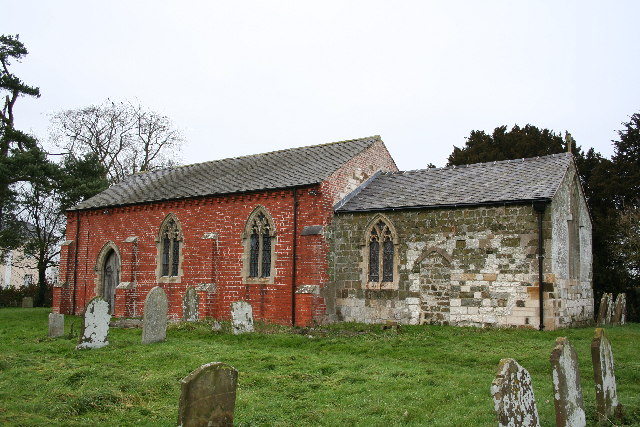
Belleau is a rural community with a population of around 200 residents. The village is known for its charming cottages and well-maintained gardens, which add to its quaint and idyllic character. The local church, St. John the Baptist, is a notable landmark, dating back to the 12th century. It features an impressive spire and beautiful stained-glass windows, attracting visitors interested in historical architecture.

The village lacks commercial amenities, with no shops or pubs within its boundaries. However, the nearby market town of Louth provides easy access to a range of amenities, including grocery stores, restaurants, and leisure facilities. Belleau offers a peaceful retreat from the hustle and bustle of city life, with residents enjoying the tranquility and natural beauty of the surrounding countryside.

Belleau is a popular destination for outdoor enthusiasts, with numerous walking trails and cycling routes in the area. The Lincolnshire Wolds provide ample opportunities for exploring nature, including the nearby Hubbard's Hills, a picturesque wooded valley with a river running through it. Additionally, the village is within close proximity to the coastal towns of Skegness and Mablethorpe, offering residents and visitors the chance to enjoy seaside activities.

If you have any feedback on the listing, please let us know in the comments section below.
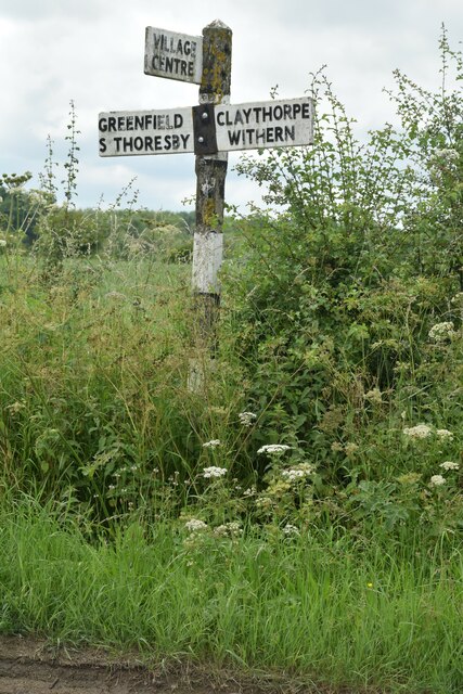
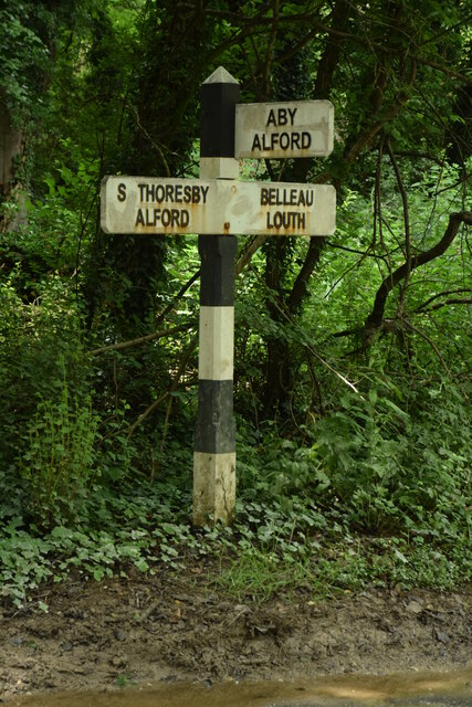
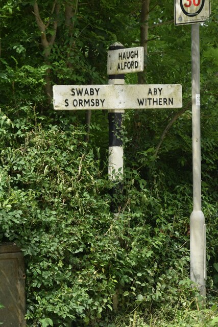
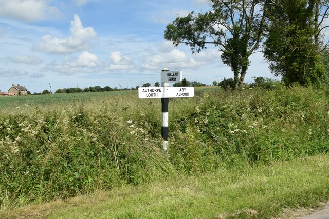
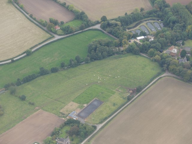
Belleau Images

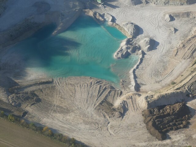
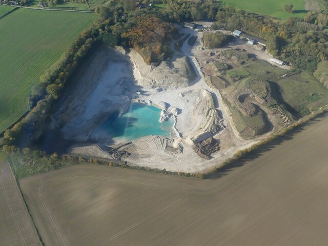
Images are sourced within 2km of 53.284557/0.096526 or Grid Reference TF3978. Thanks to Geograph Open Source API. All images are credited.
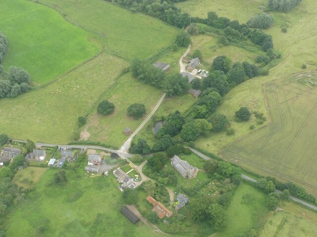
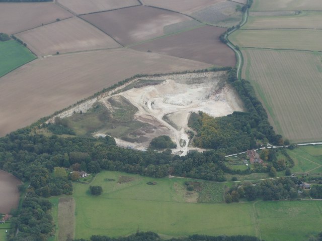
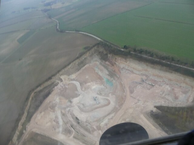
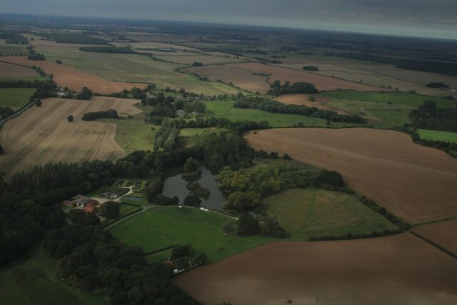
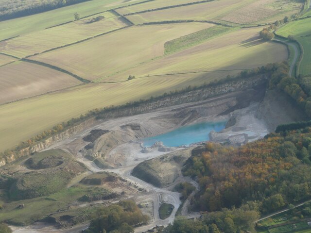
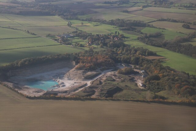
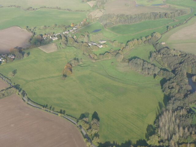
Direction Sign – Signpost at Aby village Located on the west side of a T junction in Aby in Aby with Greenfield parish. 3 arms and no finial. See also <a title="https://www.geograph.org.uk/photo/1003737" href="https://www.geograph.org.uk/photo/1003737">Link</a>.

Milestone Society National ID: LI_TF4178
Direction Sign – Signpost at Aby village
Located on the west side of a T junction in Aby in Aby with Greenfield parish. 3 arms and no finial. See also Link. Milestone Society National ID: LI_TF4178
Direction Sign – Signpost northeast of South Thoresby Located on the west side of a T junction northeast of the village in South Thoresby parish. 3 arms and no finial. See also <a title="https://www.geograph.org.uk/photo/1738562" href="https://www.geograph.org.uk/photo/1738562">Link</a>.

Milestone Society National ID: LI_TF4077
Direction Sign – Signpost northeast of South Thoresby
Located on the west side of a T junction northeast of the village in South Thoresby parish. 3 arms and no finial. See also Link. Milestone Society National ID: LI_TF4077
Direction Sign – Signpost opposite Haugh Lane in South Thoresby Located on the northwest side of a T junction opposite Haugh Lane in South Thoresby parish. 3 arms and no finial.

Milestone Society National ID: LI_TF4077A
Direction Sign – Signpost opposite Haugh Lane in South Thoresby
Located on the northwest side of a T junction opposite Haugh Lane in South Thoresby parish. 3 arms and no finial. Milestone Society National ID: LI_TF4077A
Belleau: aerial 2021
Direction Sign – Signpost between Claythorpe and Belleau Located on the northeast side of the T junction between Claythorpe and Belleau in Claythorpe parish. 3 arms and no finial. See also <a title="https://www.geograph.org.uk/photo/1740021" href="https://www.geograph.org.uk/photo/1740021">Link</a>.

Milestone Society National ID: LI_TF4079
Direction Sign – Signpost between Claythorpe and Belleau
Located on the northeast side of the T junction between Claythorpe and Belleau in Claythorpe parish. 3 arms and no finial. See also Link. Milestone Society National ID: LI_TF4079
Chalk Quarry at South Thoresby: aerial 2021 See <span class="nowrap"><a title="https://gbmsouththoresbyquarry.co.uk/" rel="nofollow ugc noopener" href="https://gbmsouththoresbyquarry.co.uk/">Link</a><img style="margin-left:2px;" alt="External link" title="External link - shift click to open in new window" src="https://s1.geograph.org.uk/img/external.png" width="10" height="10"/></span>
Chalk Quarry at South Thoresby: aerial 2021
See LinkExternal link
Claythorpe: aerial 2021
Limestone quarry at South Thorseby: aerial 2022
Trout Farm, Belleau: aerial 2022
Footpath approaching Aby The former Methodist chapel, now a house, on the left.
Footpath approaching Aby
The former Methodist chapel, now a house, on the left.
Dovecote at Belleau Dates from the early sixteenth century <span class="nowrap"><a title="https://historicengland.org.uk/listing/the-list/list-entry/1063631?section=official-list-entry" rel="nofollow ugc noopener" href="https://historicengland.org.uk/listing/the-list/list-entry/1063631?section=official-list-entry">Link</a><img style="margin-left:2px;" alt="External link" title="External link - shift click to open in new window" src="https://s1.geograph.org.uk/img/external.png" width="10" height="10"/></span>
Dovecote at Belleau
Dates from the early sixteenth century LinkExternal link
Limestone Quarry and blue lagoon, South Thoresby: aerial 2023 (1) For explanation of blue quarry lakes see <span class="nowrap"><a title="https://en.wikipedia.org/wiki/Harpur_Hill_Quarry?fbclid=IwAR1DY23Hhe8TIAJmY2HvKQ5dHJKsoxANUsRKbHyBVxfBFYG_gAuKwgvre2k" rel="nofollow ugc noopener" href="https://en.wikipedia.org/wiki/Harpur_Hill_Quarry?fbclid=IwAR1DY23Hhe8TIAJmY2HvKQ5dHJKsoxANUsRKbHyBVxfBFYG_gAuKwgvre2k">Link</a><img style="margin-left:2px;" alt="External link" title="External link - shift click to open in new window" src="https://s1.geograph.org.uk/img/external.png" width="10" height="10"/></span>
Limestone Quarry and blue lagoon, South Thoresby: aerial 2023 (1)
For explanation of blue quarry lakes see LinkExternal link
Limestone Quarry and blue lagoon, South Thoresby: aerial 2023 (2) For explanation of blue quarry lakes see <span class="nowrap"><a title="https://en.wikipedia.org/wiki/Harpur_Hill_Quarry?fbclid=IwAR1DY23Hhe8TIAJmY2HvKQ5dHJKsoxANUsRKbHyBVxfBFYG_gAuKwgvre2k" rel="nofollow ugc noopener" href="https://en.wikipedia.org/wiki/Harpur_Hill_Quarry?fbclid=IwAR1DY23Hhe8TIAJmY2HvKQ5dHJKsoxANUsRKbHyBVxfBFYG_gAuKwgvre2k">Link</a><img style="margin-left:2px;" alt="External link" title="External link - shift click to open in new window" src="https://s1.geograph.org.uk/img/external.png" width="10" height="10"/></span>
Limestone Quarry and blue lagoon, South Thoresby: aerial 2023 (2)
For explanation of blue quarry lakes see LinkExternal link
Limestone Quarry and blue lagoon, South Thoresby: aerial 2023 (3) For explanation of blue quarry lakes see <span class="nowrap"><a title="https://en.wikipedia.org/wiki/Harpur_Hill_Quarry?fbclid=IwAR1DY23Hhe8TIAJmY2HvKQ5dHJKsoxANUsRKbHyBVxfBFYG_gAuKwgvre2k" rel="nofollow ugc noopener" href="https://en.wikipedia.org/wiki/Harpur_Hill_Quarry?fbclid=IwAR1DY23Hhe8TIAJmY2HvKQ5dHJKsoxANUsRKbHyBVxfBFYG_gAuKwgvre2k">Link</a><img style="margin-left:2px;" alt="External link" title="External link - shift click to open in new window" src="https://s1.geograph.org.uk/img/external.png" width="10" height="10"/></span>
Limestone Quarry and blue lagoon, South Thoresby: aerial 2023 (3)
For explanation of blue quarry lakes see LinkExternal link
Limestone Quarry and blue lagoon, South Thoresby: aerial 2023 (4) For explanation of blue quarry lakes see <span class="nowrap"><a title="https://en.wikipedia.org/wiki/Harpur_Hill_Quarry?fbclid=IwAR1DY23Hhe8TIAJmY2HvKQ5dHJKsoxANUsRKbHyBVxfBFYG_gAuKwgvre2k" rel="nofollow ugc noopener" href="https://en.wikipedia.org/wiki/Harpur_Hill_Quarry?fbclid=IwAR1DY23Hhe8TIAJmY2HvKQ5dHJKsoxANUsRKbHyBVxfBFYG_gAuKwgvre2k">Link</a><img style="margin-left:2px;" alt="External link" title="External link - shift click to open in new window" src="https://s1.geograph.org.uk/img/external.png" width="10" height="10"/></span>
Limestone Quarry and blue lagoon, South Thoresby: aerial 2023 (4)
For explanation of blue quarry lakes see LinkExternal link
Limestone Quarry and blue lagoon, South Thoresby: aerial 2023 (4)  For explanation of blue quarry lakes see <span class="nowrap"><a title="https://en.wikipedia.org/wiki/Harpur_Hill_Quarry?fbclid=IwAR1DY23Hhe8TIAJmY2HvKQ5dHJKsoxANUsRKbHyBVxfBFYG_gAuKwgvre2k" rel="nofollow ugc noopener" href="https://en.wikipedia.org/wiki/Harpur_Hill_Quarry?fbclid=IwAR1DY23Hhe8TIAJmY2HvKQ5dHJKsoxANUsRKbHyBVxfBFYG_gAuKwgvre2k">Link</a><img style="margin-left:2px;" alt="External link" title="External link - shift click to open in new window" src="https://s1.geograph.org.uk/img/external.png" width="10" height="10"/></span>
Limestone Quarry and blue lagoon, South Thoresby: aerial 2023 (4)
For explanation of blue quarry lakes see LinkExternal link
Earthworks in field at Belleau: aerial 2023 (1) There are several features mentioned in the HER. See also  <a href="https://www.geograph.org.uk/photo/7658054">TF4078 : Earthworks in field at Belleau: aerial 2023 (2) </a>.

Medieval Village (seems to be just a cropmark, below the light-coloured trapezoidal field): <span class="nowrap"><a title="https://www.heritagegateway.org.uk/Gateway/Results_Single.aspx?uid=MLI42428&resourceID=1006" rel="nofollow ugc noopener" href="https://www.heritagegateway.org.uk/Gateway/Results_Single.aspx?uid=MLI42428&resourceID=1006">Link</a><img style="margin-left:2px;" alt="External link" title="External link - shift click to open in new window" src="https://s1.geograph.org.uk/img/external.png" width="10" height="10"/></span>

Belleau Manor moated site, which does not seem to coincide exactly with the rectangular earthworks: <span class="nowrap"><a title="https://www.heritagegateway.org.uk/Gateway/Results_Single.aspx?uid=MLI43600&resourceID=1006" rel="nofollow ugc noopener" href="https://www.heritagegateway.org.uk/Gateway/Results_Single.aspx?uid=MLI43600&resourceID=1006">Link</a><img style="margin-left:2px;" alt="External link" title="External link - shift click to open in new window" src="https://s1.geograph.org.uk/img/external.png" width="10" height="10"/></span>
Earthworks in field at Belleau: aerial 2023 (1)
There are several features mentioned in the HER. See also TF4078 : Earthworks in field at Belleau: aerial 2023 (2) . Medieval Village (seems to be just a cropmark, below the light-coloured trapezoidal field): LinkExternal link Belleau Manor moated site, which does not seem to coincide exactly with the rectangular earthworks: LinkExternal link
Earthworks in field at Belleau: aerial 2023 (2)  See <a href="https://www.geograph.org.uk/photo/7658037">TF4078 : Earthworks in field at Belleau: aerial 2023 (1)</a>]. This seems to be the site of the moated manor: <span class="nowrap"><a title="https://www.heritagegateway.org.uk/Gateway/Results_Single.aspx?uid=MLI43600&resourceID=1006" rel="nofollow ugc noopener" href="https://www.heritagegateway.org.uk/Gateway/Results_Single.aspx?uid=MLI43600&resourceID=1006">Link</a><img style="margin-left:2px;" alt="External link" title="External link - shift click to open in new window" src="https://s1.geograph.org.uk/img/external.png" width="10" height="10"/></span>
Earthworks in field at Belleau: aerial 2023 (2)
See TF4078 : Earthworks in field at Belleau: aerial 2023 (1)]. This seems to be the site of the moated manor: LinkExternal link
Show me another place!

Belleau is located at Grid Ref: TF3978 (Lat: 53.284557, Lng: 0.096526)

Division: Parts of Lindsey

Administrative County: Lincolnshire

District: East Lindsey

Police Authority: Lincolnshire

What 3 Words

///lightly.tightest.sooner. Near Burwell, Lincolnshire

Nearby Locations

Belleau

Related Wikis

Belleau, Lincolnshire

Belleau is a hamlet and civil parish in the East Lindsey district of Lincolnshire, England. It is situated approximately 7 miles (11 km) south-east of...

Beesby, East Lindsey

Beesby is a village and (as Beesby in the Marsh) a former civil parish, now in the parish of Beesby with Saleby, in the East Lindsey district of Lincolnshire...

Swaby

Swaby is a civil parish and village in the East Lindsey district of Lincolnshire, England, about 8 miles (13 km) north from Spilsby, and 6 miles (9.7 km...

Aby, Lincolnshire

Aby ( AY-bee) is a village in the East Lindsey district of Lincolnshire, England. It is approximately 30 miles (48 km) east from the city and county town...

Aby for Claythorpe railway station

Aby for Claythorpe was a railway station on the East Lincolnshire Railway which served the hamlets of Aby and Claythorpe in Lincolnshire between 1848 and...

South Thoresby

South Thoresby is a village and civil parish in the East Lindsey district of Lincolnshire, England. It is situated 10 miles (16 km) north-east from Horncastle...

Claythorpe

Claythorpe is a hamlet about 5 miles (8 km) north-west from the town of Alford, Lincolnshire, England, most notable for its water mill. The population...

Authorpe railway station

Authorpe was a railway station on the East Lincolnshire Railway, which served the village of Authorpe in Lincolnshire between 1848 and 1964. The station...

Nearby Amenities

Located within 500m of 53.284557,0.096526
Belleau
Is In: Lincolnshire, England, UK
Place: hamlet
Source: Bing
Lat/Long: 53.2855442/0.1017862
Bus Stop
St John The Baptist's Church
Naptan AtcoCode: 270000009790
Naptan Bearing: NE
Naptan BusStopType: CUS
Naptan CommonName: St John The Baptist's Church
Naptan Indicator: NE - bound
Naptan Landmark: St John The Baptist's Church
Naptan NaptanCode: linjdwjw
Naptan Street: Belleau
Naptan Verified: no
Source: naptan_import
Lat/Long: 53.2856914/0.1011252
Bus Stop
St John The Baptist's Church
Naptan AtcoCode: 2700LB003208
Naptan Bearing: SW
Naptan BusStopType: CUS
Naptan CommonName: St John The Baptist's Church
Naptan Indicator: SW - bound
Naptan Landmark: St John The Baptist's Church
Naptan NaptanCode: linawpja
Naptan Street: Belleau
Naptan Verified: no
Source: naptan_import
Lat/Long: 53.2856441/0.1012579
Brook Farm
Place: farm
Source: Bing
Lat/Long: 53.2867817/0.1029292
Manor Farm
Place: farm
Source: Bing
Lat/Long: 53.2841967/0.102096
Archaeological Site: fortification
Historic: archaeological_site
Source: Bing
Lat/Long: 53.2845316/0.1020065
The data included in this document is from www.openstreetmap.org. The data is made available under ODbL.

Have you been to Belleau?

Leave your review of Belleau below (or comments, questions and feedback).