Worcestershire

Historic County in

England

Worcestershire

River Severn at Worcester Narrowboats moored up at the National Waterways Festival in Worcester in 1999.
River Severn at Worcester Credit: David Stowell

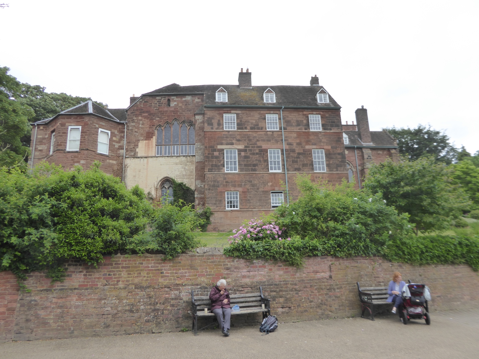
Worcestershire is a historic county located in the West Midlands region of England. It is bordered by several counties including Staffordshire, Warwickshire, Gloucestershire, and Herefordshire. The county covers an area of approximately 1,741 square kilometers and has a population of around 595,000 people.

The county is known for its rich history, dating back to Roman times when it was an important settlement along the River Severn. Worcestershire played a significant role during the English Civil War, with battles being fought in the area. The county also witnessed the birth of the famous composer Sir Edward Elgar, who drew inspiration from the region's landscapes.

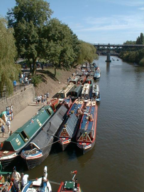
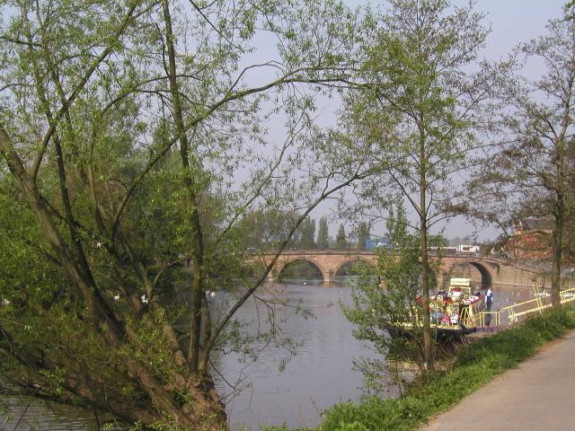
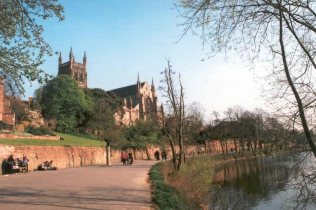
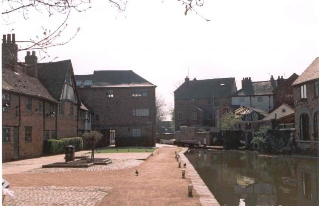
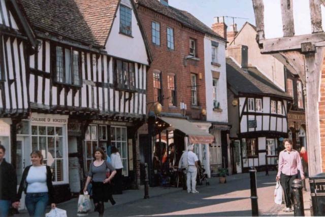
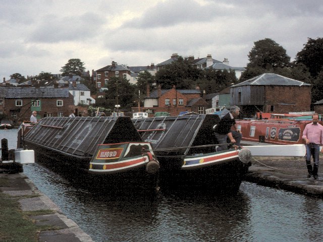
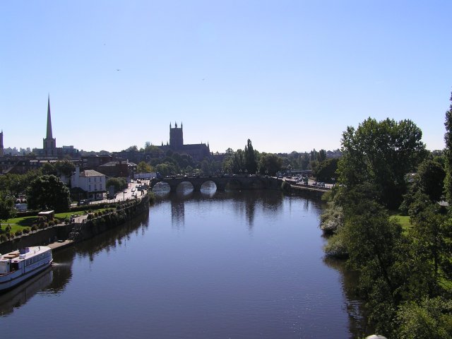
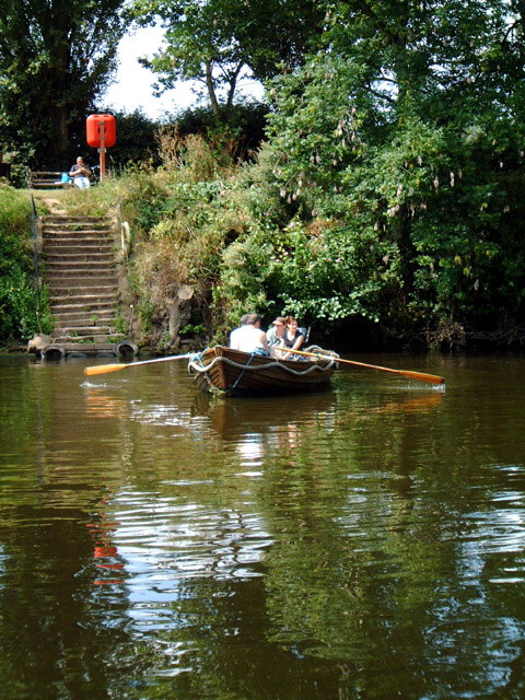
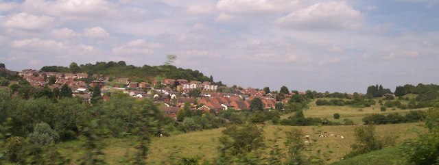
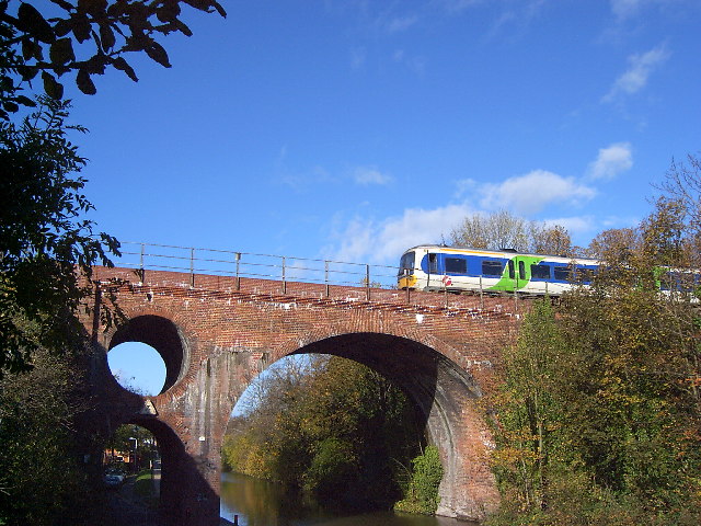
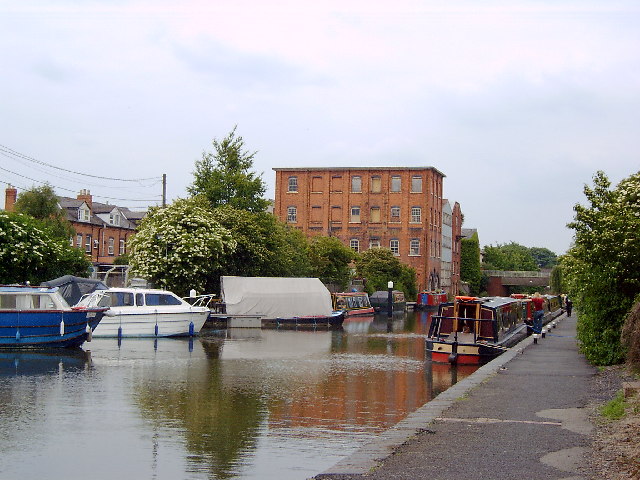
Worcestershire is renowned for its picturesque countryside, with rolling hills, meandering rivers, and charming villages. The Malvern Hills, an Area of Outstanding Natural Beauty, offer breathtaking views and are a popular destination for hiking and outdoor activities.

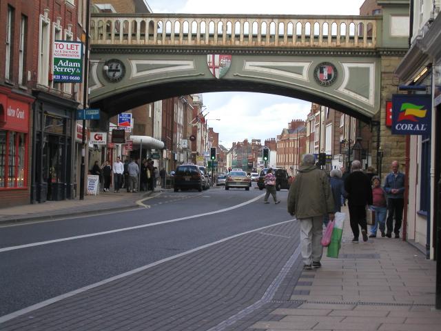
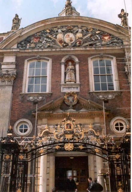
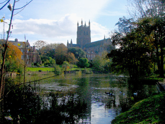
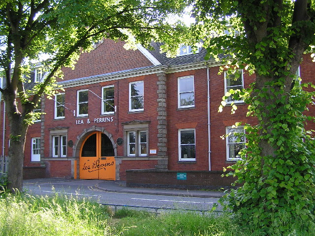
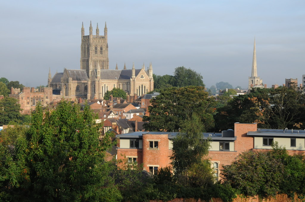
The county is also famous for its culinary contributions, most notably Worcestershire sauce, a tangy and savory condiment that is used worldwide. The city of Worcester, the county town, is home to the historic Worcester Cathedral, which dates back to the 7th century and is a prominent landmark.

Worcestershire has a diverse economy, with industries such as manufacturing, agriculture, and services playing a significant role. The county is well-connected, with excellent transport links including major motorways and railway lines.

Overall, Worcestershire combines a rich historical heritage, stunning natural landscapes, and a thriving economy, making it an attractive place to live, work, and visit.

If you have any feedback on the listing, please let us know in the comments section below.

Worcestershire Images

Images are sourced within 2km of 52.192897/-2.221105 or Grid Reference SO8454. Thanks to Geograph Open Source API. All images are credited.

River Severn at Worcester Narrowboats moored up at the National Waterways Festival in Worcester in 1999.
River Severn at Worcester
Narrowboats moored up at the National Waterways Festival in Worcester in 1999.
River Severn at Worcester Photo taken while standing next to the cathedral.
River Severn at Worcester
Photo taken while standing next to the cathedral.
Foregate Street railway bridge Looking towards The Tything
Foregate Street railway bridge
Looking towards The Tything
Worcester Cathedral From the river walkway
Worcester Cathedral
From the river walkway
The Commandery, Worcester The Commandery was a Civil War Museum in Worcester, but since 2007 has been open as an historic property, situated along Worcester and Birmingham Canal
The Commandery, Worcester
The Commandery was a Civil War Museum in Worcester, but since 2007 has been open as an historic property, situated along Worcester and Birmingham Canal
Friar Street, Worcester Medieval street front.
Friar Street, Worcester
Medieval street front.
Worcester Guildhall Tourist office in this building as well as a cafe.
Worcester Guildhall
Tourist office in this building as well as a cafe.
Worcester Entering the locks that lead down from Diglis basin to the River Severn
Worcester
Entering the locks that lead down from Diglis basin to the River Severn
Worcester Cathedral and river Severn Taken from on railway viaduct (legally I might add!)
Worcester Cathedral and river Severn
Taken from on railway viaduct (legally I might add!)
Worcester Shrub Hill Station. Array of semaphore signals at the Birmingham end of Shrub Hill station, Worcester Light maintenance depot in the background.
Worcester Shrub Hill Station.
Array of semaphore signals at the Birmingham end of Shrub Hill station, Worcester Light maintenance depot in the background.
Looking NNW from bridge over Perry Wood road towards Shrub Hill Station.
Cathedral Ferry, Worcester Still operated by volunteers during the summer months, it takes passengers across the River Severn behind the Cathedral.
Cathedral Ferry, Worcester
Still operated by volunteers during the summer months, it takes passengers across the River Severn behind the Cathedral.
Worcester Cathedral from the River Severn
Lea & Perrins factory,  Worcester The home of "Worcestershire Sauce"
Lea & Perrins factory, Worcester
The home of "Worcestershire Sauce"
Ronkswood An open green space in Worcester.
Ronkswood
An open green space in Worcester.
Winter in Fort Royal Park Fort Royal's moment of fame came in September 1651, when the Royal Standard of King Charles II was raised here, in an attempt to regain power from Oliver Cromwell. The Battle of Worcester was the last military action of the post Civil War period, with "crowning glory" for Cromwell and a long flight for Charles to Shropshire, then in a circuitous route to the South coast and escape to France. Fort Royal is now a public park and a favourite with photographers for its excellent view of Worcester Cathedral.
Winter in Fort Royal Park
Fort Royal's moment of fame came in September 1651, when the Royal Standard of King Charles II was raised here, in an attempt to regain power from Oliver Cromwell. The Battle of Worcester was the last military action of the post Civil War period, with "crowning glory" for Cromwell and a long flight for Charles to Shropshire, then in a circuitous route to the South coast and escape to France. Fort Royal is now a public park and a favourite with photographers for its excellent view of Worcester Cathedral.
Westbury Street Bridge, Worcester The bridge takes the Birmingham to Hereford railway over the Worcester and Birmingham Canal and Westbury Street, near the centre of Worcester. The bridge featured on a postage stamp for the 150 years of railways celebration. Various stories exist about the hole in the bridge, from dragon nests (fanciful) and civil war cannonballs (implausible) to engineering considerations (possible) and saving bricks (boring).
Westbury Street Bridge, Worcester
The bridge takes the Birmingham to Hereford railway over the Worcester and Birmingham Canal and Westbury Street, near the centre of Worcester. The bridge featured on a postage stamp for the 150 years of railways celebration. Various stories exist about the hole in the bridge, from dragon nests (fanciful) and civil war cannonballs (implausible) to engineering considerations (possible) and saving bricks (boring).
Diglis, Worcester and Birmingham Canal The towpath here is closed at present (Jul 2005) while work goes on to redevelop the canalside. It will completely change the character of Diglis. Though I quite liked its neglected state.
Diglis, Worcester and Birmingham Canal
The towpath here is closed at present (Jul 2005) while work goes on to redevelop the canalside. It will completely change the character of Diglis. Though I quite liked its neglected state.
Show me another place!

Worcestershire is located at Grid Ref: SO8454 (Lat: 52.192897, Lng: -2.221105)

What 3 Words

///punt.glee.dress. Near Worcester, Worcestershire

Related Wikis

St Swithun's Church, Worcester

St Swithun's Church is a redundant Anglican church in the city of Worcester, Worcestershire, England (grid reference SO850549). It is recorded in the...

Corn Exchange, Worcester

The Corn Exchange is a commercial building in Angel Street, Worcester, Worcestershire, England. The structure, which is currently vacant, is a Grade II...

Huntingdon Hall

Huntingdon Hall is a Grade II* listed theatre and concert venue located in Worcester, England. It was built in 1773 and opened on the 31st of October...

Crowngate Shopping Centre

Crowngate Worcester is a shopping centre in Worcester, England, built in part on the historic site of the Worcester Blackfriars monastery, and replacing...

Worcester Blackfriars

The Worcester Blackfriars was a monastery in England, belonging to the Dominican Order. It was founded in 1347 by William Beauchamp, Lord of Elmley. The...

Worcester Guildhall

The Worcester Guildhall is a municipal building in the High Street, Worcester, England. It is a Grade I listed building. == History == The first guildhall...

Worcester, England

Worcester ( WUUST-ər) is a cathedral city in Worcestershire, England, of which it is the county town. It is 30 mi (48 km) south-west of Birmingham, 27...

The Old Palace, Worcester

The Old Palace, Worcester is an English listed historic building, built c.1200, adjacent to Worcester Cathedral in the Church of England Diocese of Worcester...

Nearby Amenities

Located within 500m of 52.192897,-2.221105
Traffic Signals
Lat/Long: 52.1908553/-2.2221347
Crossing
Button Operated: yes
Crossing: traffic_signals
Tactile Paving: yes
Traffic Signals Sound: no
Lat/Long: 52.1923921/-2.2274222
Kerb: raised
Lat/Long: 52.1913569/-2.2257371
Crossing
Button Operated: yes
Crossing: traffic_signals
Crossing Island: yes
Tactile Paving: yes
Traffic Signals Sound: yes
Lat/Long: 52.1931769/-2.2149502
Tactile Paving: yes
Lat/Long: 52.191885/-2.2186114
Mini Roundabout
Direction: clockwise
Lat/Long: 52.1955441/-2.2155687
Worcester
Is In: Worcestershire
Is In Country: United Kingdom
Is In Country Code: GB
Is In County: Worcestershire
Name Cy: Caerwrangon
Name En: Worcester
Name Hu: Worcester
Name Ko: 우스터
Name Lt: Vusteris
Name Mk: Вустер
Name Ru: Вустер
Name Sr: Вустер
Name Uk: Вустер
Name Ur: وورچیسٹر
Note: City centre street names largely done from memory and ooc maps
Place: city
Population: 94000
Wikidata: Q1646181
Wikipedia: en:Worcester
Lat/Long: 52.1911849/-2.2206585
Crossing
Crossing: traffic_signals
Crossing Ref: toucan
Lat/Long: 52.1906772/-2.2264481
Crossing
Button Operated: yes
Crossing: traffic_signals
Crossing Ref: pelican
Tactile Paving: yes
Traffic Signals Sound: yes
Traffic Signals Vibration: yes
Lat/Long: 52.1929769/-2.2180153
Crossing
Button Operated: yes
Crossing: traffic_signals
Crossing Ref: pelican
Tactile Paving: yes
Traffic Signals Sound: no
Traffic Signals Vibration: yes
Lat/Long: 52.1930762/-2.2179414
Recycling
Recycling Glass: yes
Lat/Long: 52.18987/-2.2227807
Traffic Signals
Traffic Signals: signal
Traffic Signals Direction: forward
Lat/Long: 52.1941089/-2.2193146
Fountain
South Quay Fountains
Drinking Water: no
Tourism: attraction
Lat/Long: 52.1907787/-2.2241121
Viking Afloat
Waterway: boatyard
Lat/Long: 52.196259/-2.2170235
Bus Stop
Crowngate Bus Station
Bus: yes
Naptan AtcoCode: 2000G000100
Naptan Bearing: W
Naptan CommonName: Crowngate Bus Station
Naptan NaptanCode: wocdwpwg
Naptan PlusbusZoneRef: WORCSFS
Naptan Street: Crowngate Centre
Naptan Verified: no
Public Transport: platform
Shelter: yes
Source: naptan_import
Lat/Long: 52.1928863/-2.2248822
Bus Stop
Crowngate Bus Station Stand A
Bus: yes
Naptan AtcoCode: 2000G000101
Naptan Bearing: W
Naptan CommonName: Crowngate Bus Station Stand A
Naptan NaptanCode: wocgpdgj
Naptan Street: Crowngate Centre
Naptan Verified: no
Public Transport: platform
Shelter: yes
Source: naptan_import
Lat/Long: 52.1929621/-2.2254083
Bus Stop
Crowngate Bus Station Stand B
Bus: yes
Naptan AtcoCode: 2000G000102
Naptan Bearing: W
Naptan CommonName: Crowngate Bus Station Stand B
Naptan Indicator: Adj
Naptan NaptanCode: wocdwpwj
Naptan Verified: no
Public Transport: platform
Shelter: yes
Source: naptan_import
Lat/Long: 52.1930003/-2.2252082
Bus Stop
Crowngate Bus Station Stand C
Bus: yes
Naptan AtcoCode: 2000G000103
Naptan Bearing: W
Naptan CommonName: Crowngate Bus Station Stand C
Naptan NaptanCode: wocdwpwm
Naptan Street: Crowngate Centre
Naptan Verified: no
Public Transport: platform
Shelter: yes
Source: naptan_import
Lat/Long: 52.1930437/-2.2250088
Bus Stop
Crowngate Bus Station Stand D
Bus: yes
Naptan AtcoCode: 2000G000104
Naptan Bearing: W
Naptan CommonName: Crowngate Bus Station Stand D
Naptan Indicator: Adj
Naptan NaptanCode: wocdwpwp
Naptan Street: Crowngate Centre
Naptan Verified: no
Public Transport: platform
Shelter: yes
Source: naptan_import
Lat/Long: 52.1930974/-2.2247851
Bus Stop
Crowngate Bus Station Stand E
Bus: yes
Naptan AtcoCode: 2000G000105
Naptan Bearing: W
Naptan CommonName: Crowngate Bus Station Stand E
Naptan Indicator: Adj
Naptan NaptanCode: wocdwpwt
Naptan Street: Crowngate Centre
Naptan Verified: no
Public Transport: platform
Source: naptan_import
Lat/Long: 52.1931438/-2.2245952
Bus Stop
Crowngate Bus Station Stand F
Bus: yes
Naptan AtcoCode: 2000G000106
Naptan Bearing: W
Naptan CommonName: Crowngate Bus Station Stand F
Naptan Indicator: Adj
Naptan NaptanCode: wocdwtad
Naptan Street: Crowngate Centre
Naptan Verified: yes
Public Transport: platform
Source: naptan_import;survey
Lat/Long: 52.1932483/-2.2240896
Bus Stop
Crowngate Bus Station Stand G
Bus: yes
Naptan AtcoCode: 2000G000107
Naptan Bearing: W
Naptan CommonName: Crowngate Bus Station Stand G
Naptan Indicator: Adj
Naptan NaptanCode: wocdwtag
Naptan Street: Crowngate Centre
Naptan Verified: yes
Public Transport: platform
Source: naptan_import;survey
Lat/Long: 52.1932886/-2.2239071
Bus Stop
Crowngate Bus Station Stand H
Bus: yes
Naptan AtcoCode: 2000G000108
Naptan Bearing: W
Naptan CommonName: Crowngate Bus Station Stand H
Naptan Indicator: adj
Naptan NaptanCode: wocdwtaj
Naptan Street: Crowngate Centre
Naptan Verified: yes
Public Transport: platform
Source: naptan_import;survey
Lat/Long: 52.1933327/-2.2237132
Bus Stop
Crowngate Bus Station Stand J
Bus: yes
Naptan AtcoCode: 2000G000110
Naptan Bearing: W
Naptan CommonName: Crowngate Bus Station Stand J
Naptan Indicator: Adj
Naptan NaptanCode: wocdwtap
Naptan Street: Crowngate Centre
Naptan Verified: yes
Public Transport: platform
Source: naptan_import;survey
Lat/Long: 52.1933735/-2.223531
Bus Stop
Crowngate Bus Station Stand L
Bus: yes
Naptan AtcoCode: 2000G000112
Naptan Bearing: W
Naptan CommonName: Crowngate Bus Station Stand L
Naptan Indicator: Adj
Naptan NaptanCode: wocdwtat
Naptan Street: Crowngate Centre
Naptan Verified: no
Public Transport: platform
Source: naptan_import
Lat/Long: 52.1933468/-2.2242592
Bus Stop
Crowngate Bus Station Stand M
Bus: yes
Naptan AtcoCode: 2000G000113
Naptan Bearing: W
Naptan CommonName: Crowngate Bus Station Stand M
Naptan NaptanCode: wocdwtaw
Naptan Street: Crowngate Centre
Naptan Verified: no
Public Transport: platform
Source: naptan_import
Lat/Long: 52.1932783/-2.2247232
Bus Stop
Crowngate Bus Station Stand N
Bus: yes
Naptan AtcoCode: 2000G000114
Naptan Bearing: W
Naptan CommonName: Crowngate Bus Station Stand N
Naptan Indicator: Adj
Naptan NaptanCode: wocdwtda
Naptan Street: Crowngate Centre
Naptan Verified: no
Public Transport: platform
Shelter: yes
Source: naptan_import
Lat/Long: 52.193215/-2.2249458
Bus Stop
Crowngate Bus Station Stand O
Bus: yes
Naptan AtcoCode: 2000G000115
Naptan Bearing: W
Naptan CommonName: Crowngate Bus Station Stand O
Naptan Indicator: Adj
Naptan NaptanCode: wocdwtdg
Naptan Verified: no
Public Transport: platform
Shelter: yes
Source: naptan_import
Lat/Long: 52.1931504/-2.2252352
Bus Stop
Crowngate Bus Station Stand P
Bus: yes
Naptan AtcoCode: 2000G000116
Naptan Bearing: W
Naptan CommonName: Crowngate Bus Station Stand P
Naptan Indicator: Adj
Naptan NaptanCode: wocdwtdj
Naptan Street: Crowngate Centre
Naptan Verified: no
Public Transport: platform
Shelter: yes
Source: naptan_import
Lat/Long: 52.1931026/-2.2254432
Bus Stop
Crowngate Bus Station Stand K
Bus: yes
Naptan AtcoCode: 2000G000117
Naptan Bearing: W
Naptan CommonName: Crowngate Bus Station Stand K
Naptan NaptanCode: wocdwtdm
Naptan Street: Crowngate Centre
Naptan Verified: no
Public Transport: platform
Source: naptan_import
Lat/Long: 52.1933344/-2.2241251
Newport Street Car Park
Naptan AtcoCode: 2000G000119
Naptan Bearing: W
Naptan BusStopType: CUS
Naptan CommonName: Newport Street Car Park
Naptan Indicator: Adj
Naptan Landmark: Car Park
Naptan NaptanCode: wocgdpdg
Naptan PlusbusZoneRef: WORCSFS
Naptan Street: Newport Street
Naptan Verified: no
Source: naptan_import
Lat/Long: 52.1920277/-2.2260248
Bus Stop
Cathedral
Bench: yes
Bin: yes
Bus: yes
Lit: yes
Naptan AtcoCode: 2000G002700
Naptan Bearing: SE
Naptan CommonName: Cathedral
Naptan Indicator: Opp
Naptan Landmark: Cathedral
Naptan NaptanCode: wocdagda
Naptan PlusbusZoneRef: WORCSFS
Naptan Street: Cathedral Island
Naptan Verified: no
Public Transport: platform
Shelter: yes
Source: naptan_import
Tactile Paving: yes
Lat/Long: 52.1895156/-2.2200521
Bus Stop
Lowesmoor
Bus: yes
Local Ref: 1
Naptan AtcoCode: 2000G005818
Naptan Bearing: NE
Naptan CommonName: Lowesmoor
Naptan Indicator: Stop 1
Naptan Landmark: Lowesmoor Terrace
Naptan NaptanCode: wocgpgwp
Naptan Street: Lowesmoor
Naptan Verified: no
Public Transport: platform
Source: naptan_import
Lat/Long: 52.1952818/-2.2161329
Bus Stop
Lowesmoor
Bus: yes
Local Ref: 2
Naptan AtcoCode: 2000G005819
Naptan Bearing: N
Naptan CommonName: Lowesmoor
Naptan Indicator: Stop 2
Naptan Landmark: Lowesmoor Terrace
Naptan NaptanCode: wocgdmgm
Naptan PlusbusZoneRef: WORCSFS
Naptan Street: Lowesmoor
Naptan Verified: no
Public Transport: platform
Source: naptan_import
Lat/Long: 52.195381/-2.2159871
Bus Stop
St. Nicholas Street
Bench: no
Bin: no
Bus: yes
Lit: yes
Mapillary: 257372039469105
Naptan AtcoCode: 2000G006698
Naptan Bearing: W
Naptan CommonName: St. Nicholas Street
Naptan Indicator: adj
Naptan NaptanCode: wocgatmg
Naptan PlusbusZoneRef: WORCSFS
Naptan Street: St. Nicholas Street
Naptan Verified: no
Public Transport: platform
Shelter: no
Source: naptan_import
Survey Date: 2020-07-04
Tactile Paving: no
Lat/Long: 52.1937091/-2.2209474
Bus Stop
City Walls Road
Bench: no
Bin: no
Bus: yes
Lit: yes
Mapillary: 347858066747420
Naptan AtcoCode: 2000G006699
Naptan Bearing: N
Naptan CommonName: City Walls Road
Naptan Indicator: adj
Naptan NaptanCode: wocgatmj
Naptan PlusbusZoneRef: WORCSFS
Naptan Street: City Walls Road
Public Transport: platform
Shelter: no
Source: naptan_import;survey
Survey Date: 2020-07-04
Tactile Paving: no
Lat/Long: 52.1905308/-2.2179009
Bus Stop
Foregate Street Station
Bench: no
Bin: no
Bus: yes
Mapillary: 176732904346842
Naptan AtcoCode: 2000G202501
Naptan Bearing: N
Naptan CommonName: Foregate Street Station
Naptan Indicator: opp
Naptan Landmark: Railway Station
Naptan NaptanCode: wocdgtjt
Naptan PlusbusZoneRef: WORCSFS
Naptan Street: Foregate Street
Naptan Verified: no
Public Transport: platform
Shelter: no
Source: naptan_import
Survey Date: 2020-07-04
Lat/Long: 52.1950501/-2.2219803
Bus Stop
Foregate Street Station
Bench: no
Bin: no
Bus: yes
Image: https://storage13.openstreetcam.org/files/photo/2021/5/19/lth/3602521_676817cc88f692df6081cda785582b30.jpg
Naptan AtcoCode: 2000G202503
Naptan Bearing: S
Naptan CommonName: Foregate Street Station
Naptan Indicator: adj
Naptan Landmark: Railway Station
Naptan NaptanCode: wocdgtma
Naptan PlusbusZoneRef: WORCSFS
Naptan Street: Foregate Street
Naptan Verified: no
Public Transport: platform
Shelter: no
Source: naptan_import
Survey Date: 2021-05-19
Lat/Long: 52.1950062/-2.2218151
Bus Stop
Sansome Street
Bench: yes
Bin: yes
Bus: yes
Naptan AtcoCode: 2000G202504
Naptan Bearing: E
Naptan CommonName: Sansome Street
Naptan Indicator: adj
Naptan NaptanCode: wocdgtmd
Naptan PlusbusZoneRef: WORCSFS
Naptan Street: Sansome Street
Naptan Verified: no
Public Transport: platform
Shelter: yes
Source: naptan_import
Tactile Paving: no
Lat/Long: 52.1945545/-2.2205037
Bus Stop
Angel Place
Bus: yes
Naptan AtcoCode: 2000G241205
Naptan CommonName: Angel Place
Naptan Indicator: adj
Naptan Landmark: Angel Chef
Naptan NaptanCode: wocgampj
Naptan PlusbusZoneRef: WORCSFS
Naptan Street: Angel Place
Naptan Verified: no
Public Transport: platform
Source: naptan_import
Lat/Long: 52.193642/-2.22284
Bus Stop
Sansome Walk
Bus: yes
Naptan AtcoCode: 2000G502008
Naptan Bearing: SE
Naptan CommonName: Sansome Walk
Naptan Indicator: Adj
Naptan NaptanCode: wocdpmtd
Naptan PlusbusZoneRef: WORCSFS
Naptan Street: Sansome Walk
Naptan Verified: no
Public Transport: platform
Source: naptan_import
Lat/Long: 52.1968016/-2.2208221
Bus Stop
Lowesmoor
Bench: no
Bin: no
Bus: yes
Lit: yes
Naptan AtcoCode: 2000G590009
Naptan Bearing: S
Naptan CommonName: Lowesmoor
Naptan Indicator: opp
Naptan Landmark: Lowesmoor Terrace
Naptan NaptanCode: wocdgamw
Naptan PlusbusZoneRef: WORCSFS
Naptan Street: Lowesmoor
Naptan Verified: no
Public Transport: platform
Shelter: no
Source: naptan_import
Tactile Paving: no
Lat/Long: 52.1951564/-2.2159128
Bus Stop
Deansway
Bus: yes
Naptan AtcoCode: 2000G600010
Naptan Bearing: N
Naptan CommonName: Deansway
Naptan Indicator: Adj
Naptan Landmark: College Of Technology
Naptan NaptanCode: wocdpmaw
Naptan PlusbusZoneRef: WORCSFS
Naptan Street: Deansway
Naptan Verified: no
Public Transport: platform
Source: naptan_import
Lat/Long: 52.1910895/-2.222403
Bus Stop
College of Technology
Bus: yes
Naptan AtcoCode: 2000G6123328
Naptan Bearing: NW
Naptan CommonName: College of Technology
Naptan Indicator: Adj
Naptan Landmark: College of Technology
Naptan NaptanCode: wocgjwpg
Naptan PlusbusZoneRef: WORCSFS
Naptan Street: Newport Street
Naptan Verified: no
Public Transport: platform
Source: naptan_import
Lat/Long: 52.1920093/-2.2257998
Barrier: bollard
Bollard: fixed
Lat/Long: 52.1965318/-2.2209001
Crossing
Bicycle: yes
Button Operated: yes
Crossing: traffic_signals
Crossing Island: no
Tactile Paving: yes
Traffic Signals Sound: yes
Traffic Signals Vibration: yes
Lat/Long: 52.1942235/-2.2275951
Barrier: bollard
Bollard: fixed
Vehicle: no
Lat/Long: 52.1954246/-2.2250409
Traffic Signals
Button Operated: yes
Lat/Long: 52.1940898/-2.2233299
Kerb: raised
Lat/Long: 52.1927327/-2.2277516
Post Box
Collection Times: Mo-Fr 17:00; Sa 11:30
Operator: Royal Mail
Operator Wikidata: Q638098
Post Box Type: pillar
Ref: WR1 18
Royal Cypher: EIIR
Royal Cypher Wikidata: Q33102113
Source: survey
Lat/Long: 52.1930791/-2.2210761
Pub
The Eagle Vaults
Addr City: Worcester
Addr Housenumber: 2
Addr Postcode: WR1 2LZ
Addr Street: Friar Street
Fhrs Id: 738057
Smoking: outside
Source Addr: FHRS Open Data
Wheelchair: yes
Wikidata: Q26669259
Lat/Long: 52.1908062/-2.2189844
Post Box
Post Box Type: pillar
Ref: WR1 516
Lat/Long: 52.1930864/-2.224425
Parking Entrance
Lat/Long: 52.19266/-2.2160966
War Memorial
Historic: memorial
Memorial: statue
Lat/Long: 52.1892449/-2.2204753
Post Box
Post Box Type: pillar
Ref: WR1 17
Lat/Long: 52.1927303/-2.2181621
Post Office
Worcester Post Office
Addr Country: GB
Addr Postcode: WR1 2EH
Brand: Post Office
Brand Wikidata: Q1783168
Contact Website: https://www.postoffice.co.uk/branch-finder/3122476/worcester
Ref Pol Id: 95571
Wheelchair: yes
Lat/Long: 52.1925401/-2.2212044
Traffic Signals
Traffic Signals: signal
Traffic Signals Direction: forward
Lat/Long: 52.1939704/-2.2189564
Post Box
Collection Plate: CP15
Collection Times: Mo-Fr 17:00; Sa 11:30
Description: Two postboxes inside WH Smith, one on each floor. WR1 1002 is on top floor, which accommodates the PO
Fixme: check collection times
Indoor: yes
Layer: 0
Post Box Design: off_street_box
Post Box Type: pillar
Ref: WR1 1001
Royal Cypher: EIIR
Royal Cypher Wikidata: Q33102113
Lat/Long: 52.1925312/-2.2212734
War Memorial
Historic: memorial
Memorial: war_memorial
Lat/Long: 52.1891217/-2.2201011
Post Box
Collection Times: Mo-Fr 18:15; Sa 11:30
Description: In the white wall, to the left of the One-Stop Shop.
Operator: Royal Mail
Operator Wikidata: Q638098
Post Box Type: wall
Ref: WR1 12
Lat/Long: 52.1944878/-2.217505
Post Box
Collection Plate: CP2
Collection Times: Mo-Fr 18:00; Sa 11:30
Historic Operator: Post Office
Post Box Type: pillar
Ref: WR1 24
Royal Cypher: VR
Royal Cypher Wikidata: Q33102356
Source: survey;gps;bing
Lat/Long: 52.1953907/-2.2159764
Post Box
Post Box Type: pillar
Ref: WR1 480
Royal Cypher: EIIR
Royal Cypher Wikidata: Q33102113
Lat/Long: 52.1935716/-2.2227827
Parking Entrance
Lat/Long: 52.1925318/-2.2160147
Parking Entrance
Lat/Long: 52.1920424/-2.2164191
Post Box
Collection Times: Mo-Fr 09:00; Sa 07:00
Post Box Type: lamp
Ref: WR1 194
Royal Cypher: EIIR
Royal Cypher Wikidata: Q33102113
Lat/Long: 52.1921514/-2.2149728
Toilets
Changing Table: yes
Fee: yes
Wheelchair: yes
Lat/Long: 52.1930508/-2.2183504
Pub
The Old Rectifying House
Addr City: Worcester
Addr Postcode: WR1 3NN
Addr Street: North Parade
Fhrs Id: 674566
Lat/Long: 52.1916832/-2.2259331
Post Box
Collection Times: Mo-Fr 09:00; Sa 07:00
Post Box Type: wall
Ref: WR1 21
Royal Cypher: GVIR
Royal Cypher Wikidata: Q33102169
Lat/Long: 52.1959031/-2.2261598
Post Box
Collection Times: Mo-Fr 09:00; Sa 07:00
Post Box Type: pillar
Ref: WR1 25
Royal Cypher: EIIR
Lat/Long: 52.1909335/-2.2205307
Post Box
Brand: Royal Mail
Brand Wikidata: Q638098
Brand Wikipedia: en:Royal Mail
Collection Plate: CP6D
Collection Times: Mo-Fr 09:00; Sa 07:00
Drive Through: no
Historic Operator: Post Office
Operator: Royal Mail
Operator Wikidata: Q638098
Post Box Design: penfold
Post Box Type: pillar
Ref: WR1 14D
Royal Cypher: VR
Royal Cypher Wikidata: Q33102356
Lat/Long: 52.1892964/-2.2203754
Worcester Foregate Street
Public Transport: stop_position
Railway: stop
Train: yes
Lat/Long: 52.1951758/-2.221434
Public Transport: stop_position
Lat/Long: 52.1951987/-2.221441
Worcester Foregate Street
Public Transport: stop_position
Railway: stop
Train: yes
Lat/Long: 52.1957206/-2.2196461
Fire Hydrant
Emergency: fire_hydrant
Fire Hydrant Diameter: fixme
Fire Hydrant Position: sl
Fire Hydrant Type: underground
Lat/Long: 52.1908657/-2.224116
Restaurant
Browns At The Quay
Addr City: Worcester
Addr Housenumber: 24
Addr Postcode: WR1 2JJ
Addr Street: Quay Street
Indoor Seating: yes
Internet Access: yes
Internet Access Fee: no
Not Brand Wikidata: Q4976672
Opening Hours: Tu-Sa 12:00-23:00; Su 12:00-20:00
Outdoor Seating: yes
Website: https://brownsworcester.co.uk/
Lat/Long: 52.1908989/-2.2242225
Barrier: bollard
Bicycle: yes
Bollard: fixed
Foot: yes
Lat/Long: 52.191145/-2.2248662
Barrier: bollard
Bicycle: yes
Bollard: fixed
Foot: yes
Lat/Long: 52.1908449/-2.2240993
Barrier: bollard
Bicycle: yes
Bollard: fixed
Foot: yes
Lat/Long: 52.1906861/-2.2237448
Parking
Capacity: 2
Capacity Disabled: 2
Parking: surface
Lat/Long: 52.1906129/-2.2260576
Bench
Backrest: yes
Colour: black
Material: metal
Seats: 3
Lat/Long: 52.1906626/-2.2238534
Recycling
Recycling Cans: yes
Recycling Glass: yes
Recycling Paper: yes
Lat/Long: 52.1906744/-2.2270632
Cripplegate Park
Board Type: board
Information: board
Tourism: information
Lat/Long: 52.1906548/-2.2271051
Bench
Backrest: yes
Colour: black
Material: metal
Seats: 3
Lat/Long: 52.1905152/-2.2271727
Bench
Backrest: yes
Source: GPS Photo sequence P150-0443 to 0513 [22 benches] 2011-05-04
Lat/Long: 52.1903905/-2.2256694
Bench
Backrest: yes
Colour: black
Material: metal
Seats: 3
Source: GPS Photo sequence P150-0443 to 0513 [22 benches] 2011-05-04
Lat/Long: 52.1899852/-2.2248547
Bench
Backrest: yes
Colour: black
Material: metal
Seats: 3
Source: GPS Photo sequence P150-0443 to 0513 [22 benches] 2011-05-04
Lat/Long: 52.1905848/-2.2259702
Bench
Backrest: yes
Bench: yes
Colour: brown
Material: metal
Seats: 3
Lat/Long: 52.1902215/-2.2252912
Bench
Backrest: yes
Colour: black
Material: metal
Seats: 3
Source: GPS Photo sequence P150-0443 to 0513 [22 benches] 2011-05-04
Lat/Long: 52.1890526/-2.2235878
Bench
Backrest: yes
Check Date: 2023-10-02
Colour: black
Material: metal
Seats: 3
Source: GPS Photo sequence P150-0443 to 0513 [22 benches] 2011-05-04
Lat/Long: 52.1886979/-2.2234548
Rescue Equipment
Emergency: rescue_equipment
Rescue Equipment: lifering
Lat/Long: 52.1895698/-2.2240882
Rescue Equipment
Emergency: rescue_equipment
Rescue Equipment: lifering
Lat/Long: 52.1894001/-2.2225706
Rescue Equipment
Emergency: rescue_equipment
Rescue Equipment: lifering
Lat/Long: 52.1907072/-2.2261758
Rescue Equipment
Emergency: rescue_equipment
Rescue Equipment: lifering
Source: photo
Lat/Long: 52.1909122/-2.2246575
Rescue Equipment
Emergency: rescue_equipment
Rescue Equipment: lifering
Lat/Long: 52.1911816/-2.2253551
Rescue Equipment
Emergency: rescue_equipment
Rescue Equipment: lifering
Lat/Long: 52.1916617/-2.2264584
City Walls Road
Board Type: history
Description: Text and diagran about city walls at thisa point
Information: board
Tourism: information
Lat/Long: 52.1917735/-2.2176441
Fire Hydrant
Emergency: fire_hydrant
Fire Hydrant Diameter: 250
Fire Hydrant Position: lane
Fire Hydrant Type: underground
Source: P150-0714
Lat/Long: 52.1915569/-2.2206211
Barrier: cycle_barrier
Lat/Long: 52.1919005/-2.218232
Fire Hydrant
Emergency: fire_hydrant
Fire Hydrant Diameter: 150
Fire Hydrant Position: lane
Fire Hydrant Type: underground
Lat/Long: 52.1924683/-2.2206637
Fire Hydrant
Emergency: fire_hydrant
Fire Hydrant Diameter: fixme
Fire Hydrant Position: fixme
Fire Hydrant Type: underground
Lat/Long: 52.1922393/-2.2151588
Bicycle Parking
Bicycle Parking: wall_loops
Capacity: 6
Covered: no
Lat/Long: 52.1918311/-2.2164494
St. Pauls News
Addr City: Worcester
Addr Housenumber: 1
Addr Postcode: WR1 2BH
Addr Street: St Paul's Street
Fhrs Id: 685518
Shop: newsagent
Source Addr: FHRS Open Data
Lat/Long: 52.1918372/-2.2149866
Fire Hydrant
Emergency: fire_hydrant
Fire Hydrant Diameter: 100
Fire Hydrant Position: lane
Fire Hydrant Type: underground
Source: P150-0687
Lat/Long: 52.1919593/-2.2159578
Check Date: 2011-06-09
Disused Amenity: pharmacy
Old Name: Lloyds Pharmacy
Lat/Long: 52.1918311/-2.2163665
Fire Hydrant
Emergency: fire_hydrant
Fire Hydrant Diameter: 100
Fire Hydrant Position: lane
Fire Hydrant Type: underground
Source: P150-0729
Lat/Long: 52.1919852/-2.2169464
Community Centre
Worcester City Youth Centre
Source: P150-0695
Lat/Long: 52.1921625/-2.2170145
Crossing
Crossing: traffic_signals
Tactile Paving: yes
Lat/Long: 52.195463/-2.2221521
Bar
Marrs Bar
Addr City: Worcester
Addr Housenumber: 12
Addr Postcode: WR1 1TA
Addr Street: Pierpoint Street
Alt Name: Marrs
Fhrs Id: 685485
Source Addr: FHRS Open Data
Website: https://www.marrsbar.co.uk/
Wifi: no
Lat/Long: 52.1956457/-2.2206625
Clarks
Addr Housenumber: 30
Addr Street: High Street
Brand: Clarks
Brand Wikidata: Q1095857
Brand Wikipedia: en:C. & J. Clark
Shop: shoes
Website: https://www.clarks.com/en-gb/store-locator/UnitedKingdom/WORCESTER/5476
Wheelchair: yes
Lat/Long: 52.1911281/-2.2203708
Severn View Hotel
Addr City: Worcester
Addr Housenumber: 54
Addr Postcode: WR1 3NS
Addr Street: Newport Street
Fhrs Id: 837419
Source Addr: FHRS Open Data
Tourism: hotel
Wikidata: Q26669447
Lat/Long: 52.1922072/-2.2270816
Crossing
Crossing: traffic_signals
Crossing Ref: toucan
Lat/Long: 52.1908091/-2.2264705
Crossing
Crossing: traffic_signals
Crossing Ref: toucan
Lat/Long: 52.190703/-2.2266282
Restaurant
Nando's
Addr City: Worcester
Addr Housenumber: 55-59
Addr Postcode: WR1 2NA
Addr Street: Friar Street
Brand: Nando's
Brand Wikidata: Q3472954
Brand Wikipedia: en:Nando's
Cuisine: chicken;portuguese
Fhrs Id: 674698
Opening Hours: Mo-Th 12:00-22:30; Fr 12:00-23:00; Sa 11:30-23:00; Su 11:30-22:30
Smoking: no
Source Addr: FHRS Open Data
Website: https://www.nandos.co.uk/restaurants/worcester
Lat/Long: 52.1887983/-2.2186223
Social Facility
Home-Start Worcester & Wychavon
Lat/Long: 52.1945807/-2.217959
Restaurant
Angel Chef
Lat/Long: 52.1936553/-2.2227311
Bar
Tramps
Addr City: Worcester
Addr Postcode: WR1 3QN
Addr Street: Angel Place
Fhrs Id: 685311
Smoking: no
Source Addr: FHRS Open Data
Website: http://www.night-clubber.com/
Lat/Long: 52.1937499/-2.2233855
Entrance: main
Lat/Long: 52.1932099/-2.2230246
Parking Entrance
Lat/Long: 52.1895593/-2.2194592
Speed Camera
Maxspeed: 30 mph
Lat/Long: 52.1898014/-2.2178612
Speed Camera
Maxspeed: 30 mph
Lat/Long: 52.190718/-2.2176236
Addr City: Worcester
Addr Country: GB
Addr Housenumber: 1
Addr Street: Southfield Street
Source: P173-0737
Lat/Long: 52.1967765/-2.2190703
Pub
The Plough
Addr City: Worcester
Addr Housenumber: 23
Addr Postcode: WR1 2HN
Addr Street: Fish Street
Fhrs Id: 685577
Real Ale: yes
Real Cider: yes
Source Addr: FHRS Open Data
Wikidata: Q26669220
Lat/Long: 52.1901574/-2.2212773
Addr City: Worcester
Addr Country: GB
Addr Housenumber: 5
Addr Street: Southfield Street
Source: P173-0736
Lat/Long: 52.1969271/-2.2187397
Addr City: Worcester
Addr Country: GB
Addr Housenumber: 11a
Addr Street: Southfield Street
Source: P173-0736
Lat/Long: 52.1970848/-2.2186466
Addr City: Worcester
Addr Country: GB
Addr Housenumber: 13a & 13b
Addr Street: Southfield Street
Source: P173-0736
Lat/Long: 52.1971023/-2.2186082
Addr City: Worcester
Addr Country: GB
Addr Housenumber: 9a
Addr Street: Southfield Street
Source: P173-0736
Lat/Long: 52.1970493/-2.2187196
Check Date: 2021-07-28
Source: P173-0736
Traffic Calming: hump
Lat/Long: 52.1969752/-2.2184385
Barrier: door
Lat/Long: 52.1969687/-2.2185553
Barrier: bollard
Bicycle: no
Foot: yes
Lat/Long: 52.193255/-2.214403
Crossing
Crossing: unmarked
Crossing Markings: no
Source: P173-0721
Tactile Paving: yes
Lat/Long: 52.1932656/-2.2143325
Barrier: bollard
Bicycle: no
Foot: yes
Source: P173-0721
Lat/Long: 52.193274/-2.2142846
Barrier: entrance
Lat/Long: 52.1934891/-2.2142857
Bicycle Parking
Capacity: 28
Lat/Long: 52.1940424/-2.2256816
Barrier: bollard
Bicycle: no
Bollard: rising
Foot: yes
Lat/Long: 52.1941109/-2.2270016
Barrier: bollard
Bollard: fixed
Source: survey
Lat/Long: 52.1932606/-2.2200209
Bicycle Parking
Lat/Long: 52.1922431/-2.2241285
Bicycle Parking
Capacity: 8
Lat/Long: 52.1935548/-2.215749
Bicycle Parking
Capacity: 16
Lat/Long: 52.1943437/-2.216607
Cafe
Boston Tea Party
Addr City: Worcester
Addr Housenumber: 18
Addr Postcode: WR1 3NF
Addr Street: Broad Street
Brand: Boston Tea Party
Brand Wikidata: Q23461358
Brand Wikipedia: en:Boston Tea Party (café chain)
Cuisine: coffee_shop
Diet Vegan: yes
Diet Vegetarian: yes
Fhrs Id: 674656
Smoking: no
Source Addr: FHRS Open Data
Takeaway: yes
Wheelchair: yes
Lat/Long: 52.1927035/-2.2230319
Cash Concepts
Shop: yes
Lat/Long: 52.1924729/-2.2233602
Barbers at 49
Addr Housenumber: 49
Addr Street: Broad Street
Shop: hairdresser
Lat/Long: 52.192522/-2.2231535
Knowles Sports
Shop: sports
Lat/Long: 52.1926879/-2.2231414
Knowles Travelgoods
Addr City: Worcester
Addr Housenumber: 50
Addr Postcode: WR1 3LR
Addr Street: Broad Street
Shop: leather
Website: https://www.bagsandaccessories.co.uk/
Lat/Long: 52.1925432/-2.223064
Mothercare
Brand: Mothercare
Brand Wikidata: Q136738
Brand Wikipedia: en:Mothercare
Shop: baby_goods
Lat/Long: 52.1925922/-2.2236655
Nevitt of Worcester
Addr Housenumber: 48
Addr Street: Broad Street
Shop: lighting
Lat/Long: 52.1925064/-2.223219
New England Country Store
Addr City: Worcester
Addr Housenumber: 51
Addr Postcode: WR1 3LR
Addr Street: Broad Street
Shop: gift;homeware;fashion_accessories
Website: https://www.facebook.com/newenglandcountrystore/
Wheelchair: limited
Lat/Long: 52.1925698/-2.2229524
New Look
Brand: New Look
Brand Wikidata: Q12063852
Brand Wikipedia: en:New Look (company)
Shop: clothes
Lat/Long: 52.1926756/-2.223208
Restaurant
Côte Brasserie
Addr City: Worcester
Addr Housenumber: 101
Addr Postcode: WR1 2HW
Addr Street: High Street
Brand: Côte Brasserie
Brand Wikidata: Q48699908
Cuisine: french
Diet Vegan: no
Diet Vegetarian: yes
Smoking: no
Wheelchair: yes
Lat/Long: 52.1900407/-2.2205039
Rohan
Addr Housenumber: 52
Addr Postcode: WR1 3LR
Addr Street: Broad Street
Brand: Rohan
Brand Wikidata: Q17025822
Shop: clothes
Source: Survey
Website: https://www.rohan.co.uk/
Wheelchair: yes
Lat/Long: 52.1925908/-2.2228637
Addr Housenumber: 53-54
Addr Street: Broad Street
Check Date: 2024-04-06
Disused Shop: clothes
Fixme: What is here now?
Old Name: Store Twenty One
Lat/Long: 52.1926169/-2.2227538
Disused Shop: pastry
Fixme: What is this now?
Old Name: The Foregate Patisserie
Lat/Long: 52.1924485/-2.2234627
Toys & Games
Addr Housenumber: 47
Addr Street: Broad Street
Shop: toys
Lat/Long: 52.1924916/-2.2232815
Traffic Signals
Traffic Signals: signal
Traffic Signals Direction: forward
Lat/Long: 52.194245/-2.2191113
Barrier: bollard
Lat/Long: 52.1942794/-2.2206678
Barrier: bollard
Lat/Long: 52.1941527/-2.2214429
Barrier: kerb
Kerb: raised
Tactile Paving: no
Lat/Long: 52.1913365/-2.2256857
Crossing
Button Operated: yes
Crossing: traffic_signals
Tactile Paving: yes
Traffic Signals Sound: no
Traffic Signals Vibration: yes
Lat/Long: 52.1924841/-2.2274982
Entrance: main
Lat/Long: 52.1889287/-2.2212779
Bus Station
Crowngate Bus Station
Bus: yes
Naptan AtcoCode: 200G000001
Public Transport: station
Lat/Long: 52.1933071/-2.2243656
Marketplace
Angel Place
Wheelchair: yes
Lat/Long: 52.1929896/-2.2229394
Entrance: main
Lat/Long: 52.1926626/-2.2226686
Edward Elgar
Historic: memorial
Memorial: statue
Lat/Long: 52.1897726/-2.2203623
Barrier: bollard
Bollard: fixed
Lat/Long: 52.1903014/-2.2206847
Tourist Information
Information: office
Tourism: information
Wheelchair: yes
Lat/Long: 52.190971/-2.2206111
Barrier: bollard
Lat/Long: 52.1908769/-2.2211665
Bus: yes
Public Transport: stop_position
Lat/Long: 52.1932834/-2.2241535
Public Transport: stop_position
Lat/Long: 52.193381/-2.2237863
Crossing
Bicycle: yes
Button Operated: yes
Crossing: traffic_signals
Crossing Island: no
Lat/Long: 52.1959706/-2.2262373
Fast Food
Greggs
Addr City: Worcester
Addr Housenumber: 58
Addr Postcode: WR1 2QA
Addr Street: High Street
Brand: Greggs
Brand Wikidata: Q3403981
Brand Wikipedia: en:Greggs
Contact Website: https://www.greggs.co.uk/shop-finder?shop-code=5647
Cuisine: sandwich;bakery
Diet Vegan: yes
Diet Vegetarian: yes
Fhrs Id: 674529
Source Addr: FHRS Open Data
Takeaway: yes
Wheelchair: yes
Lat/Long: 52.1927905/-2.2208791
Pub
The Crown
Addr City: Worcester
Addr Country: GB
Addr Postcode: WR1 3LL
Addr Street: Crown Passage
Brand: Wetherspoon
Brand Wikidata: Q6109362
Brand Wikipedia: en:Wetherspoons
Contact Website: https://www.jdwetherspoon.com/pubs/all-pubs/england/worcestershire/the-crown-worcester
Fhrs Id: 685343
Internet Access: yes
Internet Access Fee: no
Smoking: outside
Source Addr: FHRS Open Data
Wheelchair: yes
Lat/Long: 52.1928706/-2.2223393
Pub
The Paul Pry
Smoking: no
Lat/Long: 52.1941163/-2.2237077
Accessorize
Shop: jewelry
Wheelchair: yes
Lat/Long: 52.1919795/-2.2210116
Ann Summers
Brand: Ann Summers
Brand Wikidata: Q579524
Brand Wikipedia: en:Ann Summers
Shop: erotic
Wheelchair: yes
Lat/Long: 52.1912955/-2.2204352
Old Name: Burton
Shop: yes
Lat/Long: 52.190538/-2.220161
Check Date: 2024-04-06
Shop: vacant
Lat/Long: 52.1918809/-2.220968
Cardzone
Addr City: Worcester
Addr Housenumber: 81-82
Addr Postcode: WR1 2ET
Addr Street: High Street
Shop: gift
Lat/Long: 52.1918209/-2.2209407
Co-operative travel
Brand: Your Coop Travel
Brand Wikidata: Q7726526
Operator: Midcounties Co-operative
Operator Wikidata: Q6841138
Shop: travel_agency
Website: https://www.cooptravel.co.uk/contact/branches-experts/worcester/
Wheelchair: yes
Lat/Long: 52.1910622/-2.2203526
Cookmate
Addr City: Worcester
Addr Housenumber: 62
Addr Postcode: WR1 3LY
Addr Street: Broad Street
Shop: kitchenware
Website: https://cookmate-worcester.co.uk/
Lat/Long: 52.1927053/-2.222083
Cornish Bakehouse
Addr City: Worcester
Addr Housenumber: 69
Addr Postcode: WR1 3LY
Addr Street: Broad Street
Fhrs Id: 674472
Shop: bakery
Source Addr: FHRS Open Data
Lat/Long: 52.1927791/-2.2215075
DW Sports Store
Shop: sports
Lat/Long: 52.1903825/-2.2201477
Old Name: Dorothy Perkins
Shop: yes
Lat/Long: 52.1904734/-2.2201532
EE
Addr City: Worcester
Addr Housenumber: 63
Addr Postcode: WR1 2EH
Addr Street: High Street
Brand: EE
Brand Wikidata: Q5322942
Brand Wikipedia: en:EE Limited
Shop: mobile_phone
Wheelchair: yes
Lat/Long: 52.1927501/-2.2212569
Restaurant
YO! Sushi
Brand: YO! Sushi
Brand Wikidata: Q3105441
Cuisine: sushi
Smoking: no
Website: https://yosushi.com/restaurants/worcester
Lat/Long: 52.1899114/-2.2201725
Addr City: Worcester
Addr Housenumber: 64
Addr Postcode: WR1 2EH
Addr Street: High Street
Old Name: Ernest Jones
Shop: vacant
Lat/Long: 52.1927054/-2.2212393
Fat Face
Brand: Fat Face
Brand Wikidata: Q5437186
Brand Wikipedia: en:Fat Face
Shop: clothes
Wheelchair: yes
Lat/Long: 52.1905996/-2.2205018
RSPCA
Addr City: Worcester
Addr Housenumber: 68
Addr Postcode: WR1 3LY
Addr Street: Broad Street
Branch: Pop up Shop
Brand: RSPCA
Brand Wikidata: Q584819
Shop: charity
Website: https://www.facebook.com/RSPCAWorcesterPopShop/
Lat/Long: 52.1927693/-2.2216102
Cake Box
Addr City: Worcester
Addr Housenumber: 63
Addr Postcode: WR1 3LY
Addr Street: Broad Street
Brand: Cake Box
Brand Wikidata: Q110057905
Fhrs Id: 1415508
Shop: pastry
Lat/Long: 52.1927216/-2.2219874
H.Samuel
Brand: H.Samuel
Brand Wikidata: Q5628558
Brand Wikipedia: en:H. Samuel
Shop: jewelry
Website: https://www.hsamuel.co.uk/store/HS4664-Worcester
Wheelchair: yes
Lat/Long: 52.1917573/-2.220911
H&M
Brand: H&M
Brand Wikidata: Q188326
Brand Wikipedia: en:H&M
Shop: clothes
Wheelchair: yes
Lat/Long: 52.1901112/-2.2201654
Harrison Clark Rickerbys
Check Date: 2023-05-14
Office: solicitors
Lat/Long: 52.1898018/-2.2205231
House of Tweed
Addr City: Worcester
Addr Housenumber: 28
Addr Postcode: WR1 2QL
Addr Street: High Street
Brand: House of Tweed
Opening Hours: Mo-Sa 09:00-17:30; Su 10:30-16:30
Shop: clothes
Wheelchair: yes
Lat/Long: 52.1909455/-2.2203125
Joules
Brand: Joules
Brand Wikidata: Q25351738
Brand Wikipedia: en:Joules (clothing)
Contact Website: https://www.joules.com/store-locator/store/joules-of-worcester
Shop: clothes
Wheelchair: no
Lat/Long: 52.1908489/-2.2205701
Cafe
Mooboo
Cuisine: bubble_tea
Diet Vegan: yes
Diet Vegetarian: yes
Smoking: no
Wheelchair: limited
Lat/Long: 52.1901231/-2.2204948
Lush
Brand: Lush
Brand Wikidata: Q1585448
Brand Wikipedia: en:Lush (company)
Opening Hours: Mo-Sa 09:30-17:30; Su 10:30-16:30
Shop: cosmetics
Wheelchair: yes
Lat/Long: 52.1899169/-2.2205142
Hotel Chocolat
Addr City: Worcester
Addr Housenumber: 23
Addr Postcode: WR1 2QE
Addr Street: High Street
Brand: Hotel Chocolat
Brand Wikidata: Q5911369
Brand Wikipedia: en:Hotel Chocolat
Fhrs Id: 909953
Shop: confectionery
Source Addr: FHRS Open Data
Wheelchair: yes
Lat/Long: 52.1906822/-2.2201673
Fatlip
Addr Street: High Street
Shop: bag
Wheelchair: yes
Lat/Long: 52.1909962/-2.2203313
Mountain Warehouse
Addr City: Worcester
Addr Housenumber: 66 - 67
Addr Postcode: WR1 3LY
Addr Street: Broad Street
Brand: Mountain Warehouse
Brand Wikidata: Q6925414
Brand Wikipedia: en:Mountain Warehouse
Phone: +44 1905 25321
Shop: outdoor
Website: https://www.mountainwarehouse.com/stores/wos/worcester/
Lat/Long: 52.1927498/-2.2217218
Next
Brand: Next
Brand Wikidata: Q246655
Brand Wikipedia: en:Next plc
Shop: clothes
Wheelchair: yes
Lat/Long: 52.1902295/-2.2201566
O2
Brand: O2
Brand Wikidata: Q1759255
Brand Wikipedia: en:O2 (brand)
Opening Hours: Mo-Su 09:00-18:00
Shop: mobile_phone
Website: https://stores.o2.co.uk/o2-store-worcester
Wheelchair: yes
Lat/Long: 52.1919957/-2.2206683
Office
Brand: Office
Brand Wikidata: Q7079121
Brand Wikipedia: en:Office Holdings
Shop: shoes
Wheelchair: yes
Lat/Long: 52.1920759/-2.2210566
iSmart
Shop: mobile_phone
Wheelchair: yes
Lat/Long: 52.1912425/-2.2204202
Disused Shop: yes
Lat/Long: 52.1920244/-2.2210335
Disused Shop: yes
Lat/Long: 52.1918537/-2.2206257
River Island
Brand: River Island
Brand Wikidata: Q2670328
Brand Wikipedia: en:River Island
Contact Website: https://www.riverisland.com/how-can-we-help/find-a-store/worcester
Shop: clothes
Wheelchair: yes
Lat/Long: 52.1913688/-2.2204637
Pandora
Addr Street: High Street
Shop: jewelry
Wheelchair: yes
Lat/Long: 52.1908864/-2.220295
Slaters
Brand: Slaters
Brand Wikidata: Q7538912
Brand Wikipedia: en:Slater Menswear
Clothes: suits
Shop: clothes
Wheelchair: yes
Lat/Long: 52.1903228/-2.2201548
Card Factory
Addr City: Worcester
Addr Housenumber: 64-65
Addr Postcode: WR1 3LY
Addr Street: Broad Street
Brand: Card Factory
Brand Wikidata: Q5038192
Fhrs Id: 1109939
Shop: gift
Lat/Long: 52.1927324/-2.2218776
TK Maxx
Brand: TK Maxx
Brand Wikidata: Q23823668
Brand Wikipedia: en:TK Maxx
Shop: department_store
Lat/Long: 52.1921185/-2.2207059
Mr D's Olde Sweet Shop
Addr City: Worcester
Addr Housenumber: 97a
Addr Postcode: WR1 2HN
Addr Street: High Street
Shop: confectionery
Wheelchair: no
Lat/Long: 52.1902751/-2.2204788
Old Name: Topman Topshop
Shop: yes
Lat/Long: 52.1905863/-2.2201635
Disused Shop: yes
Lat/Long: 52.1915494/-2.2208666
WH Peplow
Shop: jewelry
Wheelchair: yes
Lat/Long: 52.1907953/-2.2202679
White Stuff
Brand: White Stuff
Brand Wikidata: Q7995442
Brand Wikipedia: en:White Stuff Clothing
Shop: clothes
Wheelchair: yes
Lat/Long: 52.1906293/-2.2201585
Wicked Hair
Female: yes
Shop: hairdresser
Wheelchair: yes
Lat/Long: 52.189982/-2.2205178
Note: vacant
Lat/Long: 52.1900786/-2.2205001
The Edinburgh Woollen Mill
Note: vacant
Shop: clothes
Wheelchair: yes
Lat/Long: 52.1905421/-2.2205001
Note: vacant
Lat/Long: 52.1919328/-2.2206508
Note: vacant
Lat/Long: 52.1922413/-2.2207434
Atm
Brand: Barclays
Brand Wikidata: Q245343
Cash In: yes
Check Date: 2023-05-13
Indoor: no
Operator: Barclays
Operator Wikidata: Q245343
Lat/Long: 52.1923196/-2.2207609
Entrance: main
Lat/Long: 52.1923314/-2.2219731
Note: vacant
Lat/Long: 52.1927965/-2.2214296
Moss Bros
Brand: Moss Bros
Brand Wikidata: Q6916538
Brand Wikipedia: en:Moss Bros Group
Clothes: men
Shop: clothes
Wheelchair: yes
Lat/Long: 52.1907564/-2.2205492
Shop: vacant
Lat/Long: 52.1901709/-2.2204912
Trailfinders
Brand Wikipedia: en:3 (company)
Shop: travel_agency
Wheelchair: yes
Lat/Long: 52.191942/-2.2209893
Entrance: main
Lat/Long: 52.19204/-2.2220877
Bar
Bolero
Addr City: Worcester
Addr Housenumber: 34
Addr Postcode: WR1 1EE
Addr Street: Foregate Street
Fhrs Id: 697325
Phone: +44 190522220
Source Addr: FHRS Open Data
Lat/Long: 52.1965048/-2.2234954
Cafe
Costa
Addr City: Worcester
Addr Housenumber: 52
Addr Postcode: WR1 1DX
Addr Street: Foregate Street
Brand: Costa
Brand Wikidata: Q608845
Brand Wikipedia: en:Costa Coffee
Cuisine: coffee_shop
Fhrs Id: 685393
Source Addr: FHRS Open Data
Takeaway: yes
Lat/Long: 52.1953837/-2.2222932
Restaurant
Monsoon
Lat/Long: 52.1964206/-2.2234566
Fast Food
Pizza Milano
Addr City: Worcester
Addr Housenumber: 48A
Addr Postcode: WR1 1EE
Addr Street: Foregate Street
Cuisine: pizza
Drive Through: no
Phone: 01905 22300
Website: https://www.pizzamilanoworcester.co.uk/
Lat/Long: 52.1955349/-2.2224211
Barrier: bollard
Bicycle: yes
Bollard: removable
Foot: yes
Lat/Long: 52.196835/-2.2238804
Bicycle Parking
Bicycle Parking: stands
Capacity: 8
Covered: no
Lat/Long: 52.196952/-2.2234771
Telephone
Booth: KX100
Check Date: 2022-03-11
Covered: booth
Lat/Long: 52.1969661/-2.2234196
Cafe
Coffee Dough
Addr City: Worcester
Addr Housenumber: 28
Addr Postcode: WR1 3LD
Addr Street: Chapel Walk
Diet Vegetarian: yes
Fhrs Id: 776329
Smoking: no
Source Addr: FHRS Open Data
Lat/Long: 52.1917734/-2.2218892
Clock
Check Date: 2023-01-15
Display: analog
Indoor: no
Source: survey
Support: wall_mounted
Visibility: area
Lat/Long: 52.1920676/-2.2220604
Bicycle Parking
Bicycle Parking: stands
Capacity: 10
Covered: yes
Source: survey
Lat/Long: 52.1931579/-2.2213095
Taxi
Check Date: 2024-04-06
Source: survey
Lat/Long: 52.1932894/-2.2213143
Bicycle Parking
Bicycle Parking: stands
Capacity: 10
Covered: yes
Source: survey
Lat/Long: 52.1933323/-2.2211817
Bicycle Parking
Bicycle Parking: stands
Capacity: 10
Covered: yes
Source: survey
Lat/Long: 52.1936013/-2.2212613
Restaurant
Siam Smile
Addr City: Worcester
Addr Housenumber: 27
Addr Postcode: WR1 2LS
Addr Street: College Street
Fhrs Id: 674482
Smoking: no
Source: survey
Source Addr: FHRS Open Data
Lat/Long: 52.1888248/-2.2194199
Disused Shop: yes
Source: survey
Lat/Long: 52.1891867/-2.2194549
Frederick Dancox VC
Historic: memorial
Lat/Long: 52.19178/-2.2225492
Addr Housenumber: 1
Addr Street: College Precincts
Source: survey
Lat/Long: 52.1888708/-2.2195412
Crossing
Button Operated: yes
Crossing: traffic_signals
Crossing Ref: pelican
Tactile Paving: yes
Traffic Signals Sound: yes
Traffic Signals Vibration: yes
Lat/Long: 52.1960844/-2.2205716
Cafe
Café Loco
Addr City: Worcester
Addr Postcode: WR1 1DB
Addr Street: Foregate Street Station
Fhrs Id: 674733
Source: survey
Source Addr: FHRS Open Data
Lat/Long: 52.1950801/-2.2217417
Bicycle Parking
Source: survey
Lat/Long: 52.1951946/-2.2217538
Blue Plaque: Dr John Wall
Historic: memorial
Memorial: plaque
Source: visual survey;bing
Lat/Long: 52.1960883/-2.222673
Blue Plaque:Sir Charles Hastings Founder of the BMA
Historic: memorial
Memorial: plaque
Source: visual survey;bing
Lat/Long: 52.1960755/-2.2226639
Bar
The Cellar Bar
Source: visual survey;bing
Lat/Long: 52.196132/-2.2227421
Restaurant
Valentino's
Addr City: Worcester
Addr Housename: Hastings House
Addr Housenumber: 43
Addr Postcode: WR1 1EE
Addr Street: Foregate Street
Cuisine: italian
Fhrs Id: 674696
Source: visual survey;bing
Source Addr: FHRS Open Data
Lat/Long: 52.1960631/-2.2227085
Barrier: bollard
Source: survey
Lat/Long: 52.1923823/-2.221826
Traffic Signals
Traffic Signals: signal
Traffic Signals Direction: forward
Lat/Long: 52.193928/-2.2190784
Traffic Signals
Traffic Signals: signal
Traffic Signals Direction: forward
Lat/Long: 52.1941934/-2.2191688
Traffic Signals
Traffic Signals: signal
Traffic Signals Direction: forward
Lat/Long: 52.1941912/-2.2189371
Bicycle Parking
Lat/Long: 52.1945941/-2.2204657
Telephone
Booth: KX100
Check Date: 2022-08-25
Covered: booth
Mapillary: 146035394108719
Source: visual survey;bing
Lat/Long: 52.1948172/-2.2216529
Atm
Check Date: 2022-08-25
Lat/Long: 52.1949497/-2.2216905
Information: guidepost
Tourism: information
Lat/Long: 52.194345/-2.2215362
Bicycle Parking
Bicycle Parking: stands
Capacity: 8
Covered: no
Lat/Long: 52.1943798/-2.2213428
Taxi
Source: survey
Lat/Long: 52.1953264/-2.2221611
The Mine
Shop: jewelry
Lat/Long: 52.1936355/-2.2216738
Bicycle Parking
Lat/Long: 52.1935076/-2.2224179
Clock
Check Date: 2022-08-25
Display: analog
Source: survey
Support: wall_mounted
Visibility: area
Lat/Long: 52.1943673/-2.221532
Telephone
Booth: KX100
Check Date: 2024-05-18
Covered: booth
Mapillary: 257372039469105
Lat/Long: 52.1937042/-2.2208632
Primark
Addr City: Worcester
Addr Country: GB
Addr Housenumber: 29,30
Addr Postcode: WR1 3LD
Addr Street: Chapel Walk
Brand: Primark
Brand Wikidata: Q137023
Brand Wikipedia: en:Primark
Contact Website: https://stores.primark.com/united-kingdom/worcester/29-crown-gate-shopping-centre
Fhrs Id: 861242
Shop: clothes
Wheelchair: yes
Lat/Long: 52.191582/-2.2216245
Cafe
The Green Room
Addr City: Worcester
Addr Postcode: WR1 3LD
Addr Street: Chapel Walk
Fhrs Id: 685290
Smoking: no
Source Addr: FHRS Open Data
Lat/Long: 52.1916225/-2.2220315
Man Made: surveillance
Source: survey
Lat/Long: 52.1929541/-2.2210467
Bicycle Parking
Bicycle Parking: stands
Capacity: 20
Check Date: 2024-05-18
Covered: no
Source: survey
Lat/Long: 52.1903154/-2.2205186
Telephone
Booth: K6
Covered: booth
Listed Status: Grade II
Man Made: telephone_box
Lat/Long: 52.1925121/-2.2205025
Artwork Type: decorative gate
Source: survey
Tourism: artwork
Lat/Long: 52.1954337/-2.2214123
Man Made: surveillance
Source: survey
Lat/Long: 52.1928474/-2.2182685
Pub
The Cardinal's Hat
Addr City: Worcester
Addr Housenumber: 31
Addr Postcode: WR1 2NF
Addr Street: Friar Street
Fhrs Id: 837421
Opening Hours: Mo 16:00-23:00; Tu-Th 12:00-23:00; Fr,Sa 12:00-23:30; PH,Su 12:00-22:00
Wikidata: Q26669272
Lat/Long: 52.1895722/-2.2186243
Iceland
Addr City: Worcester
Addr Housename: Crown Gate Centre
Addr Housenumber: Unit F 18
Addr Postcode: WR1 3LE
Addr Street: Friary Walk
Alt Name: Iceland Worcester
Brand: Iceland
Brand Wikidata: Q721810
Brand Wikipedia: en:Iceland (supermarket)
Contact Website: https://www.iceland.co.uk/store-finder/store?StoreID=394&StoreName=WORCESTER
Fhrs Id: 685621
Shop: frozen_food
Source Addr: FHRS Open Data
Wheelchair: yes
Lat/Long: 52.1930457/-2.2240672
Crossing
Button Operated: yes
Crossing: traffic_signals
Tactile Paving: yes
Traffic Signals Sound: yes
Traffic Signals Vibration: yes
Lat/Long: 52.1895238/-2.2205269
Waste Basket
Ref: dog waste bin
Waste: dog_excrement
Lat/Long: 52.1907223/-2.2271657
Waste Basket
Ref: Dog waste bin
Waste: dog_excrement
Lat/Long: 52.1953552/-2.2194272
Restaurant
Ginger Pig
Addr City: Worcester
Addr Housenumber: 9
Addr Postcode: WR1 2HB
Addr Street: Copenhagen Street
Fhrs Id: 674392
Source Addr: FHRS Open Data
Lat/Long: 52.1908353/-2.2210196
Crowngate shopping centre
Shop: supermarket
Lat/Long: 52.1923316/-2.2221646
Toilets
Lat/Long: 52.1929085/-2.2250252
Cafe
Caffè Nero
Addr City: Worcester
Addr Housenumber: 59 - 60
Addr Postcode: WR1 3LY
Addr Street: Broad Street
Brand: Caffè Nero
Brand Wikidata: Q675808
Brand Wikipedia: en:Caffè Nero
Contact Website: https://caffenero.com/uk/store/worcester-broad-st-472/
Cuisine: coffee_shop
Diet Vegetarian: yes
Fhrs Id: 674471
Smoking: no
Takeaway: yes
Lat/Long: 52.1926858/-2.2222811
Restaurant
Elgars
Addr City: Worcester
Addr Housenumber: 16
Addr Postcode: WR1 2DS
Addr Street: Reindeer Court
Changing Table: no
Diet Vegan: no
Diet Vegetarian: yes
Email: musty@elgarscoffeeshop.co.uk
Phone: +44 1905 726977
Smoking: no
Toilets: yes
Toilets Wheelchair: no
Website: http://www.elgarscoffeeshop.co.uk
Wheelchair: limited
Lat/Long: 52.1924258/-2.2189568
RSPCA
Shop: charity
Wheelchair: yes
Lat/Long: 52.1918983/-2.2197192
Cafe
Caffè Nero
Addr City: Worcester
Addr Housenumber: 30
Addr Postcode: WR1 2RE
Addr Street: The Shambles
Brand: Caffè Nero
Brand Wikidata: Q675808
Brand Wikipedia: en:Caffè Nero
Contact Website: https://caffenero.com/uk/store/worcester-the-shambles-229/
Cuisine: coffee_shop
Diet Vegan: yes
Diet Vegetarian: yes
Smoking: no
Takeaway: yes
Wheelchair: yes
Lat/Long: 52.1915512/-2.2193239
Note: Entrance to building node
Lat/Long: 52.1920184/-2.2220772
Note: Entrance to building node
Lat/Long: 52.1931922/-2.2230239
Note: Entrance to building node
Lat/Long: 52.1901766/-2.2202265
Note: Entrance to building node
Lat/Long: 52.1907912/-2.2195874
Note: Entrance to building node
Lat/Long: 52.1889888/-2.219224
Note: Entrance to building node
Lat/Long: 52.1908425/-2.21927
Fitness4Less
Leisure: fitness_centre
Opening Hours: Mo-Fr 06:00-22:00; PH,Sa,Su 08:00-20:00
Lat/Long: 52.1898559/-2.2197079
Check Date: 2023-05-14
Level: 1
Note: Will probably be a resurant
Shop: vacant
Lat/Long: 52.1898598/-2.2198431
Restaurant
Cosy Club
Addr City: Worcester
Addr Housenumber: 6
Addr Postcode: WR1 2BY
Addr Street: Cathedral Square
Brand: Cosy Club
Brand Wikidata: Q108443521
Cuisine: british
Diet Vegan: yes
Diet Vegetarian: yes
Level: 1
Opening Hours: Su-We 09:00-23:00, Th 09:00-24:00, Fr,Sa 09:00-01:00
Phone: 01905915085
Smoking: no
Wheelchair: yes
Lat/Long: 52.1897878/-2.219654
Restaurant
The Botanist
Brand: The Botanist
Cuisine: british
Diet Vegan: yes
Diet Vegetarian: yes
Level: 1
Smoking: no
Wheelchair: yes
Lat/Long: 52.1896843/-2.2196567
Bar
All Bar One
Addr City: Worcester
Addr Housenumber: 8
Addr Street: Cathedral Square
Brand: All Bar One
Brand Wikidata: Q4728624
Cocktails: yes
Opening Hours: Mo-Th 10:00-23:00; Fr 10:00-24:00; Su 10:00-22:00
Smoking: no
Wheelchair: yes
Lat/Long: 52.1896834/-2.2197104
Restaurant
ASK Italian
Addr City: Worcester
Addr Housenumber: 2
Addr Street: High Street, Cathedral Square
Brand: ASK Italian
Brand Wikidata: Q4807056
Brand Wikipedia: en:ASK Italian
Cuisine: italian
Diet Vegan: yes
Diet Vegetarian: yes
Opening Hours: Mo-Fr 11:30-22:00; Sa 11:30-23:00; Su 11:30-21:00
Smoking: no
Website: https://www.askitalian.co.uk/italian/restaurants/worcester
Wheelchair: yes
Lat/Long: 52.1897887/-2.219701
Fast Food
Five Guys
Addr City: Worcester
Addr Housenumber: 1
Addr Postcode: WR1 2QE
Addr Street: Cathedral Square
Brand: Five Guys
Brand Wikidata: Q1131810
Cuisine: burger
Official Name: Five Guys Burgers and Fries
Opening Hours: Su-Th 11:00-23:00; Fr,Sa 11:00-23:30
Takeaway: yes
Website: https://restaurants.fiveguys.co.uk/west-midlands/unit-a3-1
Lat/Long: 52.1898368/-2.2201038
Restaurant
Miller & Carter
Brand: Miller & Carter
Brand Wikidata: Q87067401
Contact Website: https://www.millerandcarter.co.uk/restaurants/east-and-west-midlands/millerandcarterworcester
Cuisine: steak
Level: 1
Opening Hours: Mo-Sa 12:00-23:00; Su 12:00-22:00
Smoking: no
Lat/Long: 52.1898572/-2.2200985
Cafe
Starbucks
Addr City: Worcester
Addr Postcode: WR1 2QE
Brand: Starbucks
Brand Wikidata: Q37158
Brand Wikipedia: en:Starbucks
Changing Table: yes
Cuisine: coffee_shop
Internet Access: yes
Level: 0
Official Name: Starbucks Coffee
Opening Hours: PH 07:30-18:00; Mo-Fr 06:45-19:30; Sa 07:00-19:30; Su 07:30-19:00
Outdoor Seating: yes
Smoking: no
Takeaway: yes
Toilets: yes
Toilets Access: customers
Toilets Wheelchair: designated
Website: https://www.starbucks.com/store-locator/store/1019239/worcester-cathedral-square-6-high-street-cathedral-square-worcester-eng-wr-1-
Wheelchair: limited
Lat/Long: 52.1898273/-2.2198431
Restaurant
PizzaExpress
Brand: PizzaExpress
Brand Wikidata: Q662845
Brand Wikipedia: en:PizzaExpress
Cuisine: pizza
Diet Gluten Free: yes
Diet Vegan: yes
Diet Vegetarian: yes
Opening Hours: Mo-Su 11:30-22:00
Smoking: no
Website: https://www.pizzaexpress.com/worcester-cathedral-plaza-shopping-centre
Wheelchair: yes
Lat/Long: 52.1895311/-2.2196756
Disused Shop: yes
Lat/Long: 52.189325/-2.2197022
Inspiration
Shop: hairdresser
Lat/Long: 52.1892334/-2.2195586
Kutchenhaus
Addr City: Worcester
Addr Housenumber: 10a
Addr Postcode: WR1 2LU
Addr Street: College Street
Brand: Kutchenhaus
Brand Wikidata: Q123029245
Opening Hours: Mo-Fr 09:30-17:00; Sa 10:00-16:00
Phone: +44 1905 954674
Shop: kitchen
Website: https://uk.kutchenhaus.com/store-finder/kh-worcester
Lat/Long: 52.1890681/-2.2192568
Bicycle Parking
Bicycle Parking: stands
Capacity: 8
Covered: no
Lat/Long: 52.1906318/-2.2241051
Kerb: no
Lat/Long: 52.1924561/-2.2209926
Cafe
G & Tea
Addr Housenumber: 45
Addr Postcode: WR1 2NA
Addr Street: Friar Street
Cuisine: tea;cake;sandwich;breakfast;coffee_shop;local
Email: hello@gandteabakery.co.uk
Opening Hours: Tu-Sa 10:00-16:30
Operator: Laura
Phone: +44 1905863323
Smoking: no
Website: https://www.gandteabakery.co.uk/
Lat/Long: 52.1890364/-2.2187161
Fraser Hart
Craft: jeweller
Lat/Long: 52.1917324/-2.2205738
Camera Mount: pole
Camera Type: panning
Man Made: surveillance
Surveillance: public
Surveillance Type: camera
Surveillance Zone: town
Lat/Long: 52.1909203/-2.2189006
Restaurant
Friar Street Kitchen
Diet Vegetarian: no
Smoking: no
Wheelchair: limited
Lat/Long: 52.1906671/-2.2190049
Entrance: yes
Lat/Long: 52.1905372/-2.2188588
Cafe
Diet Vegan: yes
Diet Vegetarian: yes
Smoking: no
Source: survey
Lat/Long: 52.1904772/-2.2186294
Toilets
Access: customers
Lat/Long: 52.1906244/-2.2185208
Doctors
Spring Gardens Health Centre
Healthcare: doctor
Lat/Long: 52.1917219/-2.2164327
Traffic Signals
Traffic Signals Direction: backward
Lat/Long: 52.197002/-2.2231086
Crossing
Crossing: traffic_signals
Crossing Island: yes
Tactile Paving: yes
Traffic Signals Sound: no
Lat/Long: 52.1969063/-2.2232336
Crossing
Crossing: traffic_signals
Tactile Paving: yes
Lat/Long: 52.1968283/-2.222994
Traffic Signals
Traffic Signals Direction: forward
Lat/Long: 52.1968022/-2.2229763
Traffic Signals
Traffic Signals Direction: backward
Lat/Long: 52.1968945/-2.2232936
D&D Network Services
Office: company
Lat/Long: 52.1968953/-2.2228137
Give Way
Source: bing
Lat/Long: 52.1920253/-2.226959
Tudor House Museum
Addr City: Worcester
Addr Housename: Tudor House
Addr Postcode: WR1 2NA
Addr Street: Friar St
Fee: no
Museum: history
Opening Hours: We-Sa 10:00-16:00
Source: estimate
Tourism: museum
Website: https://www.tudorhouse.org.uk/
Wheelchair: limited
Wikidata: Q17548160
Lat/Long: 52.1902495/-2.2190291
Telephone
Atm: yes
Booth: K6
Check Date: 2024-03-09
Covered: booth
Lat/Long: 52.1916562/-2.2194169
Tudor House Museum
Name En: Tudor House Museum
Tourism: attraction
Lat/Long: 52.1899807/-2.2187443
Worcester Foregate Street
Naptan AtcoCode: 9100WORCSFS
Network: National Rail
Network Website: https://www.nationalrail.co.uk/stations/wof/
Network Wikidata: Q26334
Public Transport: station
Railway: station
Ref Crs: WOF
Train: yes
Wikidata: Q1873465
Wikipedia: en:Worcester Foregate Street railway station
Lat/Long: 52.1953289/-2.2207959
Cafe
Asda Café
Brand: Asda
Brand Wikidata: Q297410
Brand Wikipedia: en:Asda
Contact Phone: +44 1905 680300
Contact Website: https://storelocator.asda.com/west-midlands/worcester/silver-street/cafe
Cuisine: coffee_shop
Drinking Water Refill: yes
Drinking Water Refill Network: Refill
Fixme: Location not accurate
Internet Access: wlan
Internet Access Fee: no
Opening Hours Covid19: Mo-Su off
Operator: Asda Stores Ltd
Takeaway: yes
Lat/Long: 52.1937402/-2.2175887
Pharmacy
Asda
Brand: Asda
Brand Wikidata: Q297410
Brand Wikipedia: en:Asda
Contact Phone: +44 1905 680300
Contact Website: https://storelocator.asda.com/west-midlands/worcester/silver-street/pharmacy
Fixme: Location not accurate
Healthcare: pharmacy
Operator: Asda Stores Ltd
Lat/Long: 52.1938997/-2.2176665
Bench
Backrest: yes
Lat/Long: 52.1916129/-2.2194093
Crossing
Crossing: unmarked
Crossing Markings: no
Tactile Paving: yes
Lat/Long: 52.1942529/-2.2272529
Crossing
Crossing: unmarked
Crossing Markings: no
Tactile Paving: yes
Lat/Long: 52.1942785/-2.2270741
Barrier: bollard
Bicycle: yes
Bollard: foldable
Foot: yes
Motor Vehicle: no
Lat/Long: 52.1944323/-2.2254761
Vesta Tilley
Artwork Type: statue
Height: 2 m
Inscription: Matilda Alice Powles Vest Tilley Worcesters Wonder of the Mucsic Hall 1864-1952
Material: bronze
Memorial: statue
Subject Wikipedia: en:Vesta Tilley
Tourism: artwork
Lat/Long: 52.1927506/-2.21856
William Shakespeare and Anne Hathaway
Artwork Type: statue
Tourism: artwork
Lat/Long: 52.192938/-2.218678
Restaurant
Be The Change
Lat/Long: 52.1916811/-2.2185712
Crossing
Crossing: marked
Crossing Island: no
Crossing Markings: yes
Crossing Ref: zebra
Lat/Long: 52.1945623/-2.2175932
Francis & Wills
Addr Street: Pump Street
Shop: jewelry
Lat/Long: 52.1908388/-2.2200136
Cafe
Ping an
Addr City: Worcester
Addr Housenumber: 3A
Addr Postcode: WR1 2QX
Addr Street: Pump Street
Cuisine: oriental
Description: Oriental Cakes and Drinks
Fhrs Id: 685296
Lat/Long: 52.1908538/-2.2199376
Apparico
Shop: hairdresser
Lat/Long: 52.1908789/-2.2198603
Hop Lord's Bottle Shop
Addr City: Worcester
Addr Housenumber: 7
Addr Postcode: WR1 2QX
Addr Street: Pump Street
Fhrs Id: 1302394
Opening Hours: We-Th 11:00-20:00; Fr-Sa 11:00-21:00; Su 11:00-18:00
Shop: alcohol
Website: https://hoplordstaproombottleshop.selz.com/
Lat/Long: 52.1908931/-2.2197925
Specsavers
Addr City: Worcester
Addr Postcode: WR1 2QX
Addr Street: Pump Street
Brand: Specsavers
Brand Wikidata: Q2000610
Brand Wikipedia: en:Specsavers
Contact Website: https://www.specsavers.co.uk/stores/worcester
Shop: optician
Lat/Long: 52.1909183/-2.2196833
Jingo
Addr City: Worcester
Addr Housenumber: 15
Addr Postcode: WR1 2QX
Addr Street: Pump Street
Email: info@jingoclothing.com
Phone: +44 1905612731
Shop: clothes
Website: https://www.jingoclothing.co.uk/
Lat/Long: 52.1909335/-2.2195961
Fast Food
ShakeAway
Addr City: Worcester
Addr Housenumber: 17
Addr Postcode: WR1 2QX
Addr Street: Pump Street
Brand: ShakeAway
Brand Wikidata: Q108443709
Cuisine: frozen_yogurt;dessert
Diet Vegetarian: yes
Fhrs Id: 837452
Opening Hours: Mo-Fr 10:00-18:00; Sa 09:30-18:00; Su 11:00-17:00
Phone: +44 1905 863900
Takeaway: yes
Website: https://www.shakeaway.com/index.php/all-stores/item/worcester
Lat/Long: 52.1909554/-2.2195092
British Heart Foundation
Addr City: Worcester
Addr Housenumber: 23-25
Addr Postcode: WR1 2QX
Addr Street: Pump Street
Brand: British Heart Foundation
Brand Wikidata: Q4970039
Brand Wikipedia: en:British Heart Foundation
Opening Hours: Mo-Sa 09:30-17:00; Su 10:00-16:00
Phone: +44 1905 613 892
Shop: charity
Website: https://www.bhf.org.uk/what-we-do/find-bhf-near-you/worcester-bhf-shop
Wheelchair: yes
Lat/Long: 52.1909692/-2.2191689
Hallowood Furniture
Addr City: Worcester
Addr Housenumber: 25-26
Addr Postcode: WR1 2RA
Addr Street: The Shambles
Opening Hours: Mo-Sa 09:30-17:00; Su 11:00-16:00
Phone: +44 1905 20981
Shop: furniture
Website: https://www.hallowood.co.uk/
Wheelchair: yes
Lat/Long: 52.1910463/-2.2191879
Pavers Shoes
Addr City: Worcester
Addr Housenumber: 17
Addr Postcode: WR1 2QJ
Addr Street: The Shambles
Brand: Pavers Shoes
Brand Wikidata: Q7155843
Not Addr Postcode: WR1 2RQ
Opening Hours: Mo-Fr 09:30-17:00; Sa 09:00-17:00; Su 10:30-16:30
Phone: +44 8445761717
Shop: shoes
Website: https://store.pavers.co.uk/pavers-shoes-e707b0dd9616
Wheelchair: no
Lat/Long: 52.1914151/-2.219508
M&S Foodhall
Brand: M&S Foodhall
Brand Wikidata: Q714491
Brand Wikipedia: en:Marks & Spencer
Shop: supermarket
Website: https://www.marksandspencer.com/stores/worcester-0217
Wheelchair: yes
Lat/Long: 52.1918014/-2.2196845
Addr City: Worcester
Addr Housenumber: 10
Addr Postcode: WR1 2RF
Addr Street: The Shambles
Disused Shop: yes
Lat/Long: 52.1920085/-2.2197535
Blacks
Addr City: Worcester
Addr Housenumber: 7-8
Addr Postcode: WR1 2RF
Addr Street: The Shambles
Brand: Blacks
Brand Wikidata: Q64822933
Opening Hours: Mo-Sa 09:00-17:30; Su 10:00-16:00
Phone: +44 1905 676672
Shop: outdoor
Website: https://www.blacks.co.uk/stores/worcester
Wheelchair: yes
Lat/Long: 52.1921824/-2.2198178
TK Maxx
Addr City: Worcester
Brand: TK Maxx
Brand Wikidata: Q23823668
Brand Wikipedia: en:TK Maxx
Opening Hours: Mo-Sa 09:00-18:00; Su 10:30-16:30
Phone: +44 1905 610101
Shop: department_store
Toilets: no
Website: https://www.tkmaxx.com/uk/en/store/342
Wheelchair: yes
Lat/Long: 52.1923003/-2.2198952
Telephone
Atm: yes
Booth: K6
Check Date: 2023-12-30
Colour: red
Description: red phone box converted into ATM with phone on outside
Lat/Long: 52.1901296/-2.2203334
Telephone
Booth: K6
Covered: booth
Listed Status: Grade II
Operator: BT
Operator Wikidata: Q593786
Phone: +44 1905 27004
Lat/Long: 52.1919859/-2.2243421
Telephone
Atm: yes
Booth: K6
Check Date: 2023-12-11
Colour: red
Description: red phone box converted into atm with phone on outside
Phone: +44 1905 23773
Lat/Long: 52.1934282/-2.2230301
Bicycle Parking
Bicycle Parking: stands
Capacity: 10
Covered: no
Lat/Long: 52.1934447/-2.2229188
Social Facility
Worcester Foodbank
Addr City: Worcester
Addr Housenumber: 7
Addr Postcode: WR1 2RS
Addr Street: Lowesmoor Wharf
Address: 7 Lowesmoor Wharf Lowesmoor Worcester WR1 2RS
Email: info@worcester.foodbank.org.uk
Network: Trussell Trust
Parliamentary Constituency: Worcester
Phone: 01905780400
Social Facility: food_bank
Social Facility For: underprivileged
Source: give_food
Url: https://www.givefood.org.uk/needs/at/worcester/
Lat/Long: 52.1951682/-2.2171904
Phase Eight
Brand: Phase Eight
Brand Wikidata: Q17020730
Brand Wikipedia: en:Phase Eight
Shop: clothes
Lat/Long: 52.1921273/-2.2222507
Pub
Craft Inn
Micropub: yes
Source: survey
Lat/Long: 52.1952019/-2.2222048
Pub
The Old Greyhound
Smoking: outside
Wheelchair: yes
Lat/Long: 52.1918988/-2.2187611
Restaurant
Wildwood
Branch: Deli
Brand: Wildwood
Brand Wikidata: Q85300869
Cuisine: grill;pasta;pizza
Diet Vegan: yes
Diet Vegetarian: yes
Smoking: no
Wheelchair: yes
Lat/Long: 52.1919761/-2.2222265
Waterstones
Brand: Waterstones
Brand Wikidata: Q151779
Brand Wikipedia: en:Waterstones
Shop: books
Website: https://www.waterstones.com/bookshops/worcester
Wheelchair: yes
Lat/Long: 52.1912378/-2.2195094
St Martins Gate
Power: transformer
Transformer: distribution
Voltage Primary: 11000
Lat/Long: 52.1928606/-2.2168471
Bicycle Parking
Bicycle Parking: stands
Capacity: 15
Covered: no
Source: survey
Lat/Long: 52.1933004/-2.2171884
Crossing
Crossing: traffic_signals
Lat/Long: 52.1921095/-2.2243045
Crossing
Crossing: traffic_signals
Lat/Long: 52.1920701/-2.2248072
Crossing
Crossing: traffic_signals
Lat/Long: 52.1920069/-2.2249009
Traffic Signals
Traffic Signals: signal
Traffic Signals Direction: forward
Lat/Long: 52.1923629/-2.2274379
Crossing
Button Operated: yes
Crossing: traffic_signals
Tactile Paving: yes
Traffic Signals Sound: no
Traffic Signals Vibration: yes
Lat/Long: 52.1924158/-2.2275708
Crossing
Button Operated: yes
Crossing: traffic_signals
Crossing Island: no
Kerb: lowered
Tactile Paving: yes
Traffic Signals Sound: yes
Lat/Long: 52.1917782/-2.2229746
Crossing
Crossing: traffic_signals
Tactile Paving: yes
Lat/Long: 52.1927888/-2.2165852
Crossing
Crossing: traffic_signals
Tactile Paving: yes
Lat/Long: 52.1927321/-2.2165053
Crossing
Crossing: traffic_signals
Lat/Long: 52.189995/-2.2176648
Crossing
Crossing: traffic_signals
Lat/Long: 52.1899341/-2.2177671
Crossing
Crossing: traffic_signals
Tactile Paving: yes
Lat/Long: 52.1950206/-2.2160372
Traffic Signals
Traffic Signals: signal
Traffic Signals Direction: backward
Lat/Long: 52.195126/-2.2161361
Traffic Signals
Traffic Signals: signal
Traffic Signals Direction: forward
Lat/Long: 52.1950212/-2.2162792
Traffic Signals
Traffic Signals: signal
Traffic Signals Direction: forward
Lat/Long: 52.1949524/-2.2161089
Crossing
Crossing: traffic_signals
Tactile Paving: yes
Lat/Long: 52.1949913/-2.2161444
Traffic Signals
Traffic Signals: signal
Traffic Signals Direction: forward
Lat/Long: 52.1971553/-2.223198
Crossing
Button Operated: yes
Crossing: traffic_signals
Tactile Paving: yes
Traffic Signals Sound: no
Lat/Long: 52.1971501/-2.2231082
Traffic Signals
Traffic Signals: signal
Traffic Signals Direction: backward
Lat/Long: 52.1944602/-2.2217
Traffic Signals
Traffic Signals: signal
Traffic Signals Direction: forward
Lat/Long: 52.1942688/-2.2217736
Traffic Signals
Traffic Signals: signal
Traffic Signals Direction: forward
Lat/Long: 52.1941917/-2.2215881
Crossing
Crossing: traffic_signals
Lat/Long: 52.1942172/-2.2215997
Crossing
Crossing: traffic_signals
Tactile Paving: yes
Lat/Long: 52.1943074/-2.2215234
Crossing
Crossing: traffic_signals
Lat/Long: 52.1942779/-2.2217168
Traffic Signals
Traffic Signals: signal
Traffic Signals Direction: forward
Lat/Long: 52.1936299/-2.2213784
Traffic Signals
Traffic Signals: signal
Traffic Signals Direction: forward
Lat/Long: 52.1937414/-2.2212082
Crossing
Button Operated: no
Crossing: traffic_signals
Tactile Paving: yes
Traffic Signals Sound: no
Traffic Signals Vibration: no
Lat/Long: 52.1937415/-2.2212563
Traffic Signals
Traffic Signals: signal
Traffic Signals Direction: backward
Lat/Long: 52.1938758/-2.2214614
Crossing
Button Operated: yes
Crossing: traffic_signals
Tactile Paving: yes
Traffic Signals Sound: no
Traffic Signals Vibration: yes
Lat/Long: 52.1939464/-2.2191345
Crossing
Crossing: traffic_signals
Tactile Paving: yes
Lat/Long: 52.1942427/-2.2190765
Crossing
Button Operated: yes
Crossing: traffic_signals
Tactile Paving: yes
Traffic Signals Sound: no
Traffic Signals Vibration: yes
Lat/Long: 52.1941716/-2.2191237
Crossing
Crossing: traffic_signals
Tactile Paving: yes
Lat/Long: 52.1941672/-2.2189858
Crossing
Button Operated: yes
Crossing: traffic_signals
Tactile Paving: yes
Traffic Signals Sound: no
Traffic Signals Vibration: yes
Lat/Long: 52.1941014/-2.2190141
Crossing
Crossing: traffic_signals
Tactile Paving: yes
Lat/Long: 52.1941164/-2.2188811
Crossing
Button Operated: yes
Crossing: traffic_signals
Tactile Paving: yes
Traffic Signals Sound: no
Lat/Long: 52.1940915/-2.2193188
Crossing
Crossing: unmarked
Crossing Markings: no
Tactile Paving: yes
Lat/Long: 52.1940692/-2.2191814
Barrier: bollard
Bollard: fixed
Lat/Long: 52.1933675/-2.2188458
Barrier: bollard
Bollard: fixed
Lat/Long: 52.1928578/-2.218636
Crossing
Crossing: unmarked
Crossing Island: yes
Crossing Markings: no
Tactile Paving: yes
Lat/Long: 52.1955493/-2.215377
Crossing
Crossing: unmarked
Crossing Island: yes
Crossing Markings: no
Tactile Paving: yes
Lat/Long: 52.1956597/-2.2155891
Crossing
Crossing: traffic_signals
Lat/Long: 52.191047/-2.21771
Crossing
Crossing: traffic_signals
Lat/Long: 52.1910817/-2.2175805
Barrier: bollard
Bollard: removable
Lat/Long: 52.1887978/-2.2196448
Cafe
Method Coffee Bar
Opening Hours: Th-Su 10:00-16:00
Outdoor Seating: yes
Takeaway: yes
Wheelchair: yes
Lat/Long: 52.1947726/-2.2236272
Restaurant
Maneki Ramen
Cuisine: asian;burger;japanese
Diet Vegan: yes
Diet Vegetarian: yes
Indoor Seating: yes
Outdoor Seating: yes
Takeaway: yes
Lat/Long: 52.1946852/-2.224115
Bus Stop
The Hive
Bus: yes
Naptan AtcoCode: 2000G000120
Naptan CommonName: The Hive
Naptan Indicator: adj
Naptan NaptanCode: wocgtdgt
Naptan Verified: no
Public Transport: platform
Lat/Long: 52.193462/-2.225865
Camera Mount: pole
Camera Type: fixed
Man Made: surveillance
Surveillance Type: camera
Surveillance Zone: traffic
Lat/Long: 52.1943617/-2.2183236
Camera Mount: pole
Camera Type: fixed
Man Made: surveillance
Surveillance Type: camera
Surveillance Zone: traffic
Lat/Long: 52.1943097/-2.2191776
John Perrins & Son
Historic: memorial
Historic Period: 1831-1892
Inscription: John Perrins & Son Master Gun Makers 1831-1892
Material: metal
Memorial: plaque
Start Date: 1831
Lat/Long: 52.1926011/-2.2193969
Hollywood Nails
Beauty: nails
Shop: beauty
Wheelchair: limited
Lat/Long: 52.1927146/-2.2189277
Worcester City Cobbler
Shop: shoe_repair
Wheelchair: yes
Lat/Long: 52.1927093/-2.2201486
Blue Cross
Brand: Blue Cross
Brand Wikidata: Q3520039
Shop: charity
Wheelchair: yes
Lat/Long: 52.1926986/-2.2194549
Scope
Brand: Scope
Brand Wikidata: Q7434435
Shop: charity
Wheelchair: yes
Lat/Long: 52.1929338/-2.2206112
Bank
Halifax
Addr Housenumber: 11-12
Addr Street: St Swithin's Street
Brand: Halifax
Brand Wikidata: Q3310164
Wheelchair: yes
Lat/Long: 52.1928496/-2.2200819
Headway Worcestershire
Shop: charity
Wheelchair: yes
Lat/Long: 52.1929268/-2.2205108
Cafe
Sweet Greeks Café
Diet Vegan: yes
Diet Vegetarian: yes
Smoking: no
Wheelchair: yes
Lat/Long: 52.1926989/-2.2196082
St. Richard's Hospice Store
Shop: charity
Wheelchair: yes
Lat/Long: 52.192903/-2.2203163
St. Richard's Hospice Store
Shop: charity
Wheelchair: yes
Lat/Long: 52.1928862/-2.2202234
Vidal Luggage
Shop: bag
Wheelchair: yes
Lat/Long: 52.192699/-2.2195357
M&M Meats
Shop: butcher
Wheelchair: yes
Lat/Long: 52.1929145/-2.2204204
Zana's Barbershop
Male: yes
Shop: hairdresser
Wheelchair: limited
Lat/Long: 52.1926957/-2.2200903
Brauchli Opticians
Shop: optician
Wheelchair: limited
Lat/Long: 52.1927181/-2.220223
Superdrug
Brand: Superdrug
Brand Wikidata: Q7643261
Shop: chemist
Wheelchair: yes
Lat/Long: 52.1927497/-2.220341
Barnardo's
Brand: Barnardo's
Brand Wikidata: Q2884670
Shop: charity
Wheelchair: yes
Lat/Long: 52.1927061/-2.219081
Acorns
Shop: charity
Wheelchair: yes
Lat/Long: 52.1926985/-2.2193448
Cafe
The Wildling Collective
Changing Table: yes
Diet Vegan: yes
Diet Vegetarian: yes
Internet Access: wlan
Internet Access Fee: no
Kids Area Fee: yes
Kids Area Indoor: yes
Kids Area Supervised: yes
Outdoor Seating: yes
Smoking: no
Toilets: yes
Toilets Access: customers
Toilets Wheelchair: no
Wheelchair: limited
Lat/Long: 52.1919775/-2.2189614
Restaurant
Impasto
Diet Vegan: yes
Diet Vegetarian: yes
Smoking: no
Wheelchair: no
Lat/Long: 52.1927318/-2.2202768
Simply Beautiful
Shop: beauty
Wheelchair: yes
Lat/Long: 52.1927768/-2.2204752
Timpson
Brand Wikidata: Q7807658
Shop: shoe_repair
Wheelchair: yes
Lat/Long: 52.1927887/-2.2205658
Oxfam
Brand: Oxfam
Brand Wikidata: Q267941
Shop: charity
Wheelchair: yes
Lat/Long: 52.1926991/-2.2196623
Sense
Brand: Sense
Brand Wikidata: Q92552497
Shop: charity
Wheelchair: yes
Lat/Long: 52.1926972/-2.2192491
Bench
Backrest: yes
Material: wood
Seats: 4
Lat/Long: 52.1926266/-2.22815
Bench
Backrest: yes
Material: wood
Seats: 4
Lat/Long: 52.1926477/-2.2281797
Dominic Tunnell
Shop: optician
Wheelchair: yes
Lat/Long: 52.1925911/-2.2194071
Grape Tree
Brand: Grape Tree
Brand Wikidata: Q87071497
Shop: health_food
Wheelchair: yes
Lat/Long: 52.192587/-2.2194796
Hair - Julie Drew
Female Signed: no
Male Signed: no
Shop: hairdresser
Wheelchair: limited
Lat/Long: 52.1925888/-2.2192026
St. Richard's Hospice
Shop: charity
Wheelchair: yes
Lat/Long: 52.1925894/-2.2193219
Jessica's
Shop: confectionery
Wheelchair: yes
Lat/Long: 52.1925981/-2.2196599
Cafe
Dutty
Diet Vegan: only
Diet Vegetarian: yes
Smoking: no
Wheelchair: limited
Lat/Long: 52.1925866/-2.2190931
F. Durrant & Son
Shop: hunting
Wheelchair: no
Lat/Long: 52.1925927/-2.2196106
Holland & Barrett
Shop: health_food
Wheelchair: yes
Lat/Long: 52.1926981/-2.219713
Thimpson
Shop: shoe_repair
Wheelchair: yes
Lat/Long: 52.1926133/-2.2197932
Cafe
Café Snowdrops
Changing Table: no
Diet Vegan: yes
Diet Vegetarian: yes
Level: 1
Smoking: no
Toilets: yes
Toilets Access: customers
Toilets Wheelchair: yes
Wheelchair: yes
Lat/Long: 52.1928908/-2.2202672
Restaurant
Bill's
Brand: Bill's
Changing Table: yes
Cuisine: british
Diet Vegan: yes
Diet Vegetarian: yes
Highchair: yes
Indoor Seating: yes
Internet Access: wlan
Internet Access Fee: no
Outdoor Seating: yes
Reservation: recommended
Smoking: no
Toilets: yes
Toilets Access: customers
Toilets Wheelchair: designated
Wheelchair: yes
Lat/Long: 52.1919698/-2.22187
Crossing
Button Operated: yes
Crossing: traffic_signals
Kerb: lowered
Tactile Paving: yes
Traffic Signals Sound: yes
Lat/Long: 52.1917794/-2.2265662
Shop: vacant
Lat/Long: 52.1927285/-2.2198162
Restaurant
Anatolian Palace
Changing Table: yes
Cuisine: turkish
Diet Vegan: yes
Diet Vegetarian: yes
Outdoor Seating: yes
Smoking: no
Toilets: yes
Toilets Access: customers
Toilets Wheelchair: designated
Wheelchair: yes
Lat/Long: 52.1918208/-2.2216719
Bicycle Parking
Bicycle Parking: bollard
Capacity: 1
Covered: no
Lat/Long: 52.1911911/-2.2193595
Bicycle Parking
Bicycle Parking: bollard
Capacity: 1
Covered: no
Lat/Long: 52.1912237/-2.2193657
Restaurant
Hash Diner
Cuisine: breakfast
Diet Dairy Free: yes
Diet Gluten Free: yes
Diet Vegan: yes
Diet Vegetarian: yes
Dog: yes
Indoor Seating: yes
Internet Access: wlan
Internet Access Fee: no
Outdoor Seating: yes
Reservation: recommended
Smoking: no
Wheelchair: yes
Lat/Long: 52.1917487/-2.2216592
Disused Shop: yes
Lat/Long: 52.1911907/-2.2204038
Premier Inn ACB New Road - RMU
Power: transformer
Transformer: distribution
Voltage Primary: 11000
Lat/Long: 52.1900115/-2.2252042
Lowesmoor
Power: transformer
Transformer: distribution
Voltage Primary: 11000
Lat/Long: 52.1957736/-2.2156964
TA Barracks Worcester
Power: transformer
Transformer: distribution
Voltage Primary: 11000
Lat/Long: 52.1943767/-2.2164505
Queen Street
Power: transformer
Transformer: distribution
Voltage Primary: 11000
Lat/Long: 52.1934747/-2.2195179
Silver Street Worcester
Power: transformer
Transformer: distribution
Voltage Primary: 11000
Lat/Long: 52.1939482/-2.2182023
Asda Silver Street
Power: transformer
Transformer: distribution
Voltage Primary: 11000
Lat/Long: 52.1941804/-2.2180829
Sansome Walk
Power: transformer
Transformer: distribution
Voltage Primary: 11000
Lat/Long: 52.1953794/-2.2201476
Shaw Street
Power: transformer
Transformer: distribution
Voltage Primary: 11000
Lat/Long: 52.1941874/-2.22207
Whitehouse Hotel
Power: transformer
Transformer: distribution
Voltage Primary: 11000
Lat/Long: 52.1944702/-2.2227037
Netherton Lane
Power: transformer
Transformer: distribution
Voltage Primary: 11000
Lat/Long: 52.1940785/-2.2254134
Worcester Library and History Centre
Power: transformer
Transformer: distribution
Voltage Primary: 11000
Lat/Long: 52.1937793/-2.2253557
W C T Dolway
Power: transformer
Transformer: distribution
Voltage Primary: 11000
Lat/Long: 52.1928186/-2.2271347
Bus Station
Power: transformer
Transformer: distribution
Voltage Primary: 11000
Lat/Long: 52.1928733/-2.2253524
Newport Street
Power: transformer
Transformer: distribution
Voltage Primary: 11000
Lat/Long: 52.1921264/-2.225862
All Saints
Power: transformer
Transformer: distribution
Voltage Primary: 11000
Lat/Long: 52.1917129/-2.2243372
The Shambles
Power: transformer
Transformer: distribution
Voltage Primary: 11000
Lat/Long: 52.1914589/-2.219886
Bull Entry
Power: transformer
Transformer: distribution
Voltage Primary: 11000
Lat/Long: 52.191329/-2.221431
Copenhagen Street
Power: transformer
Transformer: distribution
Voltage Primary: 11000
Lat/Long: 52.1907206/-2.2208295
College of Further Education
Power: transformer
Transformer: distribution
Voltage Primary: 11000
Lat/Long: 52.1906819/-2.2223081
Pheasant Street Car Park - RMU
Power: transformer
Transformer: distribution
Voltage Primary: 11000
Lat/Long: 52.1934089/-2.215339
Multi Storey Carpark
Power: transformer
Transformer: distribution
Voltage Primary: 11000
Lat/Long: 52.1920056/-2.2165386
Wellington Street
Power: transformer
Transformer: distribution
Voltage Primary: 11000
Lat/Long: 52.1918161/-2.2146638
PO Switching Centre
Power: transformer
Transformer: distribution
Voltage Primary: 11000
Lat/Long: 52.1909648/-2.2155677
Charles Street
Power: transformer
Transformer: distribution
Voltage Primary: 11000
Lat/Long: 52.1908061/-2.2184725
Pump Street
Power: transformer
Transformer: distribution
Voltage Primary: 11000
Lat/Long: 52.1906425/-2.2193925
South Street
Power: transformer
Transformer: distribution
Voltage Primary: 11000
Lat/Long: 52.1899214/-2.2170107
Lychgate Centre
Power: transformer
Transformer: distribution
Voltage Primary: 11000
Lat/Long: 52.1901179/-2.2194247
Giffard Hotel
Power: transformer
Transformer: distribution
Voltage Primary: 11000
Lat/Long: 52.189595/-2.2196487
Multiplex Friar Street
Power: transformer
Transformer: distribution
Voltage Primary: 11000
Lat/Long: 52.1892292/-2.2184739
Angel Place
Power: transformer
Transformer: distribution
Voltage Primary: 11000
Lat/Long: 52.1930184/-2.2235674
Chapel Walk
Power: transformer
Transformer: distribution
Voltage Primary: 11000
Lat/Long: 52.1922736/-2.2228083
Debenhams Worcester
Power: transformer
Transformer: distribution
Voltage Primary: 11000
Lat/Long: 52.1923706/-2.2215933
Littlewoods
Power: transformer
Transformer: distribution
Voltage Primary: 11000
Lat/Long: 52.1923311/-2.2198659
Marks & Spencer
Power: transformer
Transformer: distribution
Voltage Primary: 11000
Lat/Long: 52.1917014/-2.2193617
St Mary's Street
Power: transformer
Transformer: distribution
Voltage Primary: 11000
Lat/Long: 52.1971234/-2.2223295
Shire Hall
Power: transformer
Transformer: distribution
Voltage Primary: 11000
Lat/Long: 52.1972085/-2.221323
Farrier House
Power: transformer
Transformer: distribution
Voltage Primary: 11000
Lat/Long: 52.1954711/-2.2232033
Castle Street
Power: transformer
Transformer: distribution
Voltage Primary: 11000
Lat/Long: 52.1956778/-2.2265017
Sanctury Housing
Power: transformer
Transformer: distribution
Voltage Primary: 11000
Lat/Long: 52.1952473/-2.2246064
Hugo & Ted
Shop: pet
Wheelchair: yes
Lat/Long: 52.192093/-2.2189781
SJ Foot Care
Healthcare: alternative
Healthcare Speciality: chiropractic
Wheelchair: yes
Lat/Long: 52.1921478/-2.2189725
Ware
Shop: houseware
Wheelchair: yes
Lat/Long: 52.1919119/-2.2191067
Bottles Wine Merchants
Shop: wine
Wheelchair: yes
Lat/Long: 52.191799/-2.2190283
Paw & Co
Shop: pet
Wheelchair: yes
Lat/Long: 52.1922759/-2.2191736
Gem's Thai Massage
Shop: massage
Wheelchair: limited
Lat/Long: 52.1918031/-2.2189213
Cafe
Jaks Coffee Shop
Diet Vegan: yes
Diet Vegetarian: yes
Smoking: no
Wheelchair: yes
Lat/Long: 52.1917786/-2.2191749
Embrace
Shop: clothes
Wheelchair: yes
Lat/Long: 52.1921334/-2.2190766
Dentist
Reindeer Court Dental
Healthcare: dentist
Wheelchair: limited
Lat/Long: 52.1924966/-2.2190989
Bloom Hair
Female: yes
Shop: hairdresser
Wheelchair: yes
Lat/Long: 52.1919994/-2.2190622
Circle of Swords
Shop: tattoo
Wheelchair: no
Lat/Long: 52.1930742/-2.2198722
Natural Definition
Shop: beauty
Wheelchair: yes
Lat/Long: 52.1919615/-2.2190552
Fuel Clothing
Shop: clothes
Wheelchair: yes
Lat/Long: 52.1920473/-2.2189619
Shop: vacant
Lat/Long: 52.1920402/-2.2190566
Cafe
Hangar
Diet Vegan: yes
Diet Vegetarian: yes
Smoking: no
Wheelchair: yes
Lat/Long: 52.1922288/-2.2188995
About You
Beauty: nails
Shop: beauty
Wheelchair: no
Lat/Long: 52.1923456/-2.2191473
David Jon
Female: yes
Shop: hairdresser
Wheelchair: yes
Lat/Long: 52.1920842/-2.2190622
Worcester War Games
Shop: games
Wheelchair: no
Lat/Long: 52.19302/-2.2198559
Camo
Male: yes
Shop: hairdresser
Wheelchair: yes
Lat/Long: 52.1922035/-2.2191511
Rxgue
Male: yes
Shop: hairdresser
Wheelchair: limited
Lat/Long: 52.1931336/-2.2198757
Dragons Barbershop
Male: yes
Shop: hairdresser
Wheelchair: yes
Lat/Long: 52.192507/-2.2189744
Plantamamita
Shop: florist
Wheelchair: no
Lat/Long: 52.192456/-2.2190936
Fox and Fortune
Shop: tattoo
Wheelchair: no
Lat/Long: 52.1924/-2.2190891
The Studio
Female: yes
Shop: hairdresser
Wheelchair: yes
Lat/Long: 52.1931583/-2.2199915
Betfred
Brand: Betfred
Brand Wikidata: Q4897425
Shop: bookmaker
Wheelchair: limited
Lat/Long: 52.1932105/-2.220005
The Cabin
Shop: frame
Wheelchair: yes
Lat/Long: 52.1931189/-2.2199903
Cafe
Caffè Bolero
Diet Vegan: yes
Diet Vegetarian: yes
Smoking: no
Wheelchair: limited
Lat/Long: 52.1936985/-2.2206008
Fast Food
Yummy's Grill House
Cuisine: burger
Diet Vegetarian: no
Wheelchair: yes
Lat/Long: 52.1933155/-2.2214148
Betfred
Brand: Betfred
Brand Wikidata: Q4897425
Shop: bookmaker
Wheelchair: yes
Lat/Long: 52.1936171/-2.2214899
Blue Diamond Vapors UK
Shop: e-cigarette
Wheelchair: yes
Lat/Long: 52.1935599/-2.2214704
Cafe
Centenary Lounge
Diet Vegan: yes
Diet Vegetarian: yes
Smoking: no
Wheelchair: limited
Lat/Long: 52.1930506/-2.2213495
Restaurant
Little Desserts
Smoking: no
Wheelchair: yes
Lat/Long: 52.1932196/-2.2214
Ladbrokes
Brand: Ladbrokes
Brand Wikidata: Q1799875
Shop: bookmaker
Wheelchair: yes
Lat/Long: 52.1932839/-2.2214074
Cafe
Starbucks
Brand: Starbucks
Brand Wikidata: Q37158
Cuisine: coffee_shop
Diet Vegan: yes
Diet Vegetarian: yes
Official Name: Starbucks Coffee
Smoking: no
Takeaway: yes
Wheelchair: yes
Lat/Long: 52.1933896/-2.2214372
Merkur Slots
Leisure: amusement_arcade
Wheelchair: yes
Lat/Long: 52.1935065/-2.2214667
Restaurant
El Mexicana
Cuisine: mexican
Smoking: no
Lat/Long: 52.1931003/-2.2213609
Cancer Research UK
Brand: Cancer Research UK
Brand Wikidata: Q326079
Shop: charity
Wheelchair: yes
Lat/Long: 52.1932536/-2.2214042
Phone Worcester
Shop: mobile_phone
Lat/Long: 52.1931871/-2.2213952
The data included in this document is from www.openstreetmap.org. The data is made available under ODbL.

Have you been to Worcestershire?

Leave your review of Worcestershire below (or comments, questions and feedback).