Midlothian

Historic County in

Scotland

Midlothian

View over Lasswade
View over Lasswade Credit: Richard Webb

Midlothian is a historic county located in the southeastern part of Scotland. It is bordered by the City of Edinburgh to the north, East Lothian to the east, the Scottish Borders to the south, and West Lothian to the west. The county covers an area of approximately 350 square miles (900 square kilometers) and has a population of around 90,000 people.

Midlothian is known for its rich history and heritage, with numerous historical landmarks and attractions. One of the most notable sites is Rosslyn Chapel, a stunning 15th-century chapel renowned for its intricate carvings and connections to the Knights Templar. The county also boasts several castles, including Craigmillar Castle and Crichton Castle, which offer visitors a glimpse into Scotland's medieval past.

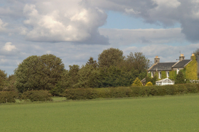
In addition to its historical significance, Midlothian is home to beautiful natural landscapes. The Pentland Hills Regional Park, located in the southern part of the county, offers stunning views, hiking trails, and opportunities for outdoor activities such as cycling and horse riding. The county is also intersected by the River Esk, which provides picturesque scenery and fishing opportunities.

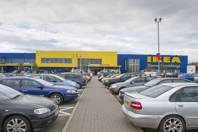
Midlothian's economy is diverse, with a mix of industries including agriculture, tourism, retail, and manufacturing. The county is home to several major retail centers, such as Straiton Retail Park and Dalkeith town center, offering a range of shopping and dining options.

Overall, Midlothian is a picturesque and historically significant county in Scotland, offering a blend of natural beauty, cultural heritage, and economic opportunities.

If you have any feedback on the listing, please let us know in the comments section below.
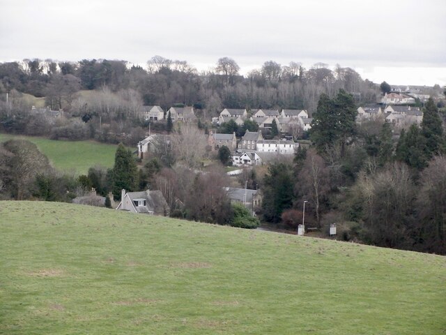
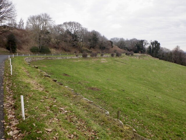
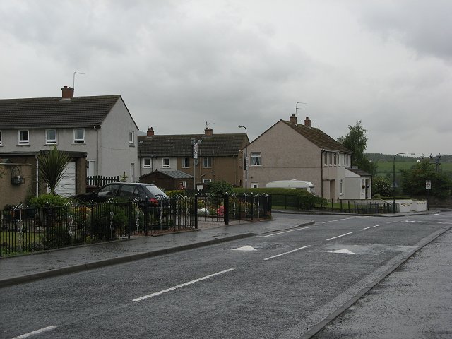
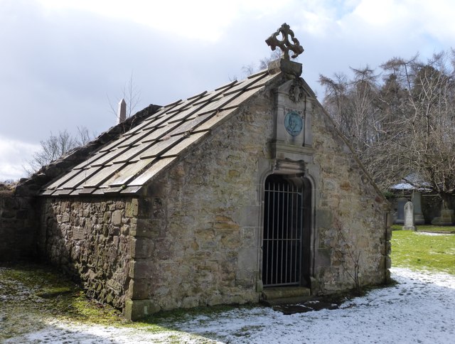
Midlothian Images

Images are sourced within 2km of 55.8778/-3.148 or Grid Reference NT2865. Thanks to Geograph Open Source API. All images are credited.

View over Lasswade
View over Lasswade
Road to Kings Acre golf courses
Eskdale Drive A wet morning in Bonnyrigg.
Eskdale Drive
A wet morning in Bonnyrigg.
Lasswade Old Kirkyard The first recorded church on this site was dedicated in 1240, and the churchyard is the burial place of many worthy citizens. Subsequently an Adam church was built on the site in 1793, demolished in 1959.
Lasswade Old Kirkyard
The first recorded church on this site was dedicated in 1240, and the churchyard is the burial place of many worthy citizens. Subsequently an Adam church was built on the site in 1793, demolished in 1959.
Lasswade Cemetery
Lasswade Cemetery
Mining Surveyors This gravestone in Lasswade Old Kirkyard is apparently unique in  Scotland, and shows two men surveying. One holds the plumb line, the other has the level on his shoulder and between them an early clinometer. The stone was erected in 1767 by John Ross, overseer of Melville coalworks in memory of his wife Marion McKenzie.
Mining Surveyors
This gravestone in Lasswade Old Kirkyard is apparently unique in Scotland, and shows two men surveying. One holds the plumb line, the other has the level on his shoulder and between them an early clinometer. The stone was erected in 1767 by John Ross, overseer of Melville coalworks in memory of his wife Marion McKenzie.
Lasswade Cemetery
Lasswade Cemetery
Viaduct, Esk Valley Railway A viaduct over the North Esk. The railway ran to Polton from Bonnyrigg and served paper mills.
Viaduct, Esk Valley Railway
A viaduct over the North Esk. The railway ran to Polton from Bonnyrigg and served paper mills.
Footpath near Lasswade The Roslin to Lasswade footpath
Footpath near Lasswade
The Roslin to Lasswade footpath
Footpath to Roslin The start of the footpath on School Brae Lasswade
Footpath to Roslin
The start of the footpath on School Brae Lasswade
Lasswade Old Kirkyard
Mining Surveyors carving, Lasswade Old Kirkyard Apparently unique in Scotland, this headstone was erected in 1767 by John Ross, overseer at Melville coalworks, for his wife Marion McKenzie. It shows a surveyor holding a plumb line while another supports the level on his shoulder with a clinometer between them for measuring inclines.
Mining Surveyors carving, Lasswade Old Kirkyard
Apparently unique in Scotland, this headstone was erected in 1767 by John Ross, overseer at Melville coalworks, for his wife Marion McKenzie. It shows a surveyor holding a plumb line while another supports the level on his shoulder with a clinometer between them for measuring inclines.
Gardener Stone carving, Lasswade Old Kirkyard Although flaking stone makes it difficult to establish when the headstone was erected, it can clearly be read that William Willson died a nonagenerian, aged 92. His first wife, whose maiden name appears to be Colwell, died in 1737 and his second wife, Agnes Nisbet, in 1767. The emblems of a gardener's spade and rake can be made out just below the figure.
Gardener Stone carving, Lasswade Old Kirkyard
Although flaking stone makes it difficult to establish when the headstone was erected, it can clearly be read that William Willson died a nonagenerian, aged 92. His first wife, whose maiden name appears to be Colwell, died in 1737 and his second wife, Agnes Nisbet, in 1767. The emblems of a gardener's spade and rake can be made out just below the figure.
Drummond Aisle, Lasswade Old Kirkyard The burial place of the renowned poet and scholar William Drummond of Hawthornden (1585-1649) who lived nearby. He gifted his library to the "Tounis College" in Edinburgh (the later University), thus helping it develop its own collection. <span class="nowrap"><a title="http://www.ed.ac.uk/schools-departments/information-services/library-museum-gallery/crc/collections/special-collections/rare-books-and-manuscripts/rare-books-directory-section/william-drummond" rel="nofollow ugc noopener" href="http://www.ed.ac.uk/schools-departments/information-services/library-museum-gallery/crc/collections/special-collections/rare-books-and-manuscripts/rare-books-directory-section/william-drummond">Link</a><img style="margin-left:2px;" alt="External link" title="External link - shift click to open in new window" src="https://s1.geograph.org.uk/img/external.png" width="10" height="10"/></span>  The aisle originally opened into the old church. When this was demolished, the aisle was restored in 1893 and received a new gate with a portrait plaque and the stone cross from the mediaeval church above. A further restoration was carried out in 1993.
Drummond Aisle, Lasswade Old Kirkyard
The burial place of the renowned poet and scholar William Drummond of Hawthornden (1585-1649) who lived nearby. He gifted his library to the "Tounis College" in Edinburgh (the later University), thus helping it develop its own collection. LinkExternal link The aisle originally opened into the old church. When this was demolished, the aisle was restored in 1893 and received a new gate with a portrait plaque and the stone cross from the mediaeval church above. A further restoration was carried out in 1993.
Drummond Aisle interior, Lasswade Old Kirkyard The burial aisle contains the effigy of a knight in full armour who is believed to have fought at the Battle of Roslin in 1303 during the Wars of Independence /<span class="nowrap"><a title="https://en.wikipedia.org/wiki/Battle_of_Roslin" rel="nofollow ugc noopener" href="https://en.wikipedia.org/wiki/Battle_of_Roslin">Link</a><img style="margin-left:2px;" alt="External link" title="External link - shift click to open in new window" src="https://s1.geograph.org.uk/img/external.png" width="10" height="10"/></span> . He has been moved here from the aisle that was built for Robert Preston of Valleyfield (1757-1848) on the south side of the old church.
Drummond Aisle interior, Lasswade Old Kirkyard
The burial aisle contains the effigy of a knight in full armour who is believed to have fought at the Battle of Roslin in 1303 during the Wars of Independence /LinkExternal link . He has been moved here from the aisle that was built for Robert Preston of Valleyfield (1757-1848) on the south side of the old church.
House near Burdiehouse Mains
Entrance and Car Park IKEA
Show me another place!

Midlothian is located at Grid Ref: NT2865 (Lat: 55.8778, Lng: -3.148)

What 3 Words

///famed.forest.riches. Near Loanhead, Midlothian

Related Wikis

Loanhead

Loanhead is a town in Midlothian, Scotland, in a commuter belt to the south of Edinburgh, and close to Roslin, Bonnyrigg and Dalkeith. The town was built...

Loanhead railway station

Loanhead railway station served the town of Loanhead, Midlothian, Scotland, from 1874 to 1968 on the Edinburgh, Loanhead and Roslin Railway. == History... ==

Mavisbank House

Mavisbank is a country house outside Loanhead, south of Edinburgh in Midlothian, Scotland. It was designed by architect William Adam in collaboration with...

Polton railway station

Polton railway station served the village of Polton, Midlothian, Scotland from 1867 to 1964 on the Esk Valley Railway. == History == The station opened...

Stewart Brewing

Stewart Brewing is an independent craft brewery based on the outskirts of Edinburgh in Loanhead, Midlothian, Scotland. It was established in 2004 by Steve...

Polton

Polton is a village located in Lasswade parish, Midlothian, Scotland, anciently a superiority of the Ramsay family, cadets of Dalhousie. In 1618 David...

Hawthornden Castle

Hawthornden Castle is located on the River North Esk in Midlothian, Scotland. The castle lies a mile to the east of Roslin at grid reference NT287637,...

Lasswade High School Centre

Lasswade High School is a non-denominational secondary state school in Bonnyrigg, Midlothian, Scotland. == History == A parish school was first established...

Nearby Amenities

Located within 500m of 55.8778,-3.148
Traffic Signals
Lat/Long: 55.8777744/-3.1482818
Traffic Calming: hump
Lat/Long: 55.8780427/-3.1532542
Loanhead
Name Sco: Loanheid
Place: town
Population: 6900
Source: npe
Wikidata: Q1011156
Wikipedia: en:Loanhead
Lat/Long: 55.8780811/-3.1487772
Traffic Calming: hump
Lat/Long: 55.8776674/-3.1537247
Crossing
Crossing: uncontrolled
Crossing Ref: zebra
Lat/Long: 55.8802204/-3.1545531
Turning Circle
Lat/Long: 55.8795524/-3.1437766
Mini Roundabout
Direction: clockwise
Lat/Long: 55.8755509/-3.1455526
Created By: Potlatch 0.10f
Historic: memorial
Wheelchair: yes
Lat/Long: 55.8775552/-3.1481418
Artwork Type: sculpture
Mapillary: 960274798108533
Survey Date: 2020-06-24
Tourism: artwork
Wheelchair: yes
Lat/Long: 55.8776368/-3.1483047
Artwork Type: sculpture
Created By: Potlatch 0.10f
Mapillary: 779579309587926
Survey Date: 2020-08-13
Tourism: artwork
Wheelchair: yes
Lat/Long: 55.8775911/-3.1483717
Loanhead Mini-Market
Shop: convenience
Lat/Long: 55.8780166/-3.1549149
Crossing
Crossing: uncontrolled
Crossing Ref: zebra
Lat/Long: 55.879149/-3.1541887
Entrance: main
Lat/Long: 55.8797099/-3.1541773
Give Way
Lat/Long: 55.8778247/-3.1436995
Give Way
Lat/Long: 55.8777515/-3.1453741
Crossing
Button Operated: no
Crossing: uncontrolled
Crossing Ref: zebra
Lat/Long: 55.8798668/-3.1492029
Loanhead SwimmingPool
Covered: yes
Leisure: swimming_pool
Sport: swimming
Wheelchair: yes
Lat/Long: 55.8797775/-3.1537862
Crossing
Button Operated: yes
Crossing: traffic_signals
Lat/Long: 55.8769019/-3.153572
Bus Stop
Hunter Avenue
Bench: no
Bin: yes
Bus: yes
Lit: yes
Naptan AdministrativeAreaCode: 130
Naptan Area Name: Midlothian
Naptan AtcoAreaCode: 628
Naptan AtcoCode: 6280326100
Naptan Bearing: W
Naptan CommonName: Hunter Avenue
Naptan Indicator: opp
Naptan Landmark: -
Naptan LocalityName: Loanhead
Naptan NaptanCode: 64323793
Naptan NptgLocalityCode: N0071589
Naptan QualifierName: Midlothian
Naptan SourceLocalityType: Add
Naptan StopAreaCode: 628G301350
Naptan StopAreaType: GPBS
Naptan StopArea Name: Hunter Avenue
Naptan Street: Linden Place
Naptan Verified: yes
Public Transport: platform
Shelter: no
Source: NaPTAN + Survey
Tactile Paving: no
Lat/Long: 55.8778097/-3.1422279
Bus Stop
Hunter Avenue
Bench: no
Bin: no
Bus: yes
Lit: yes
Naptan AdministrativeAreaCode: 130
Naptan Area Name: Midlothian
Naptan AtcoAreaCode: 628
Naptan AtcoCode: 6280301350
Naptan Bearing: E
Naptan CommonName: Hunter Avenue
Naptan Indicator: at
Naptan Landmark: -
Naptan LocalityName: Loanhead
Naptan NaptanCode: 64323792
Naptan NptgLocalityCode: N0071589
Naptan QualifierName: Midlothian
Naptan SourceLocalityType: Add
Naptan StopAreaCode: 628G301350
Naptan StopAreaType: GPBS
Naptan StopArea Name: Hunter Avenue
Naptan Street: Linden Place
Naptan Verified: yes
Public Transport: platform
Shelter: no
Source: NaPTAN + Survey
Tactile Paving: no
Lat/Long: 55.8778802/-3.1423953
Bus Stop
Academy Lane
Bus: yes
Naptan AdministrativeAreaCode: 130
Naptan Area Name: Midlothian
Naptan AtcoAreaCode: 628
Naptan AtcoCode: 6280326110
Naptan Bearing: W
Naptan CommonName: Academy Lane
Naptan Indicator: opp
Naptan Landmark: -
Naptan LocalityName: Loanhead
Naptan NaptanCode: 64323763
Naptan NptgLocalityCode: N0071589
Naptan QualifierName: Midlothian
Naptan SourceLocalityType: Add
Naptan StopAreaCode: 628G301340
Naptan StopAreaType: GPBS
Naptan StopArea Name: Academy Lane
Naptan Street: High Street
Naptan Verified: yes
Public Transport: platform
Shelter: yes
Source: NaPTAN + Survey
Lat/Long: 55.8775903/-3.1458138
Bus Stop
Station Road
Bin: yes
Bus: yes
Naptan AdministrativeAreaCode: 130
Naptan Area Name: Midlothian
Naptan AtcoAreaCode: 628
Naptan AtcoCode: 6280301330
Naptan Bearing: E
Naptan CommonName: Station Road
Naptan Indicator: at
Naptan Landmark: -
Naptan LocalityName: Loanhead
Naptan NaptanCode: 64323829
Naptan NptgLocalityCode: N0071589
Naptan QualifierName: Midlothian
Naptan SourceLocalityType: Add
Naptan Street: High Street
Naptan Verified: yes
Public Transport: platform
Shelter: yes
Source: NaPTAN + Survey
Lat/Long: 55.8778419/-3.1470891
Bus Stop
Muirfield Gardens
Bin: yes
Bus: yes
Naptan AdministrativeAreaCode: 130
Naptan Area Name: Midlothian
Naptan AtcoAreaCode: 628
Naptan AtcoCode: 6280325780
Naptan Bearing: E
Naptan CommonName: Muirfield Gardens
Naptan Indicator: opp
Naptan Landmark: at Bank
Naptan LocalityName: Loanhead
Naptan NaptanCode: 64323834
Naptan NptgLocalityCode: N0071589
Naptan QualifierName: Midlothian
Naptan SourceLocalityType: Add
Naptan StopAreaCode: 628G301910
Naptan StopAreaType: GCLS
Naptan StopArea Name: Muirfield Gardens
Naptan Street: The Loan
Naptan Verified: yes
Passenger Information Display: yes
Public Transport: platform
Shelter: yes
Source: NaPTAN + Survey
Lat/Long: 55.8777294/-3.148787
Bus Stop
George Avenue
Bench: yes
Bin: yes
Bus: yes
Naptan AdministrativeAreaCode: 130
Naptan Area Name: Midlothian
Naptan AtcoAreaCode: 628
Naptan AtcoCode: 6280301920
Naptan Bearing: W
Naptan CommonName: George Avenue
Naptan Indicator: opp
Naptan Landmark: at Memorial Park
Naptan LocalityName: Loanhead
Naptan NaptanCode: 64323769
Naptan NptgLocalityCode: N0071589
Naptan QualifierName: Midlothian
Naptan SourceLocalityType: Add
Naptan StopAreaCode: 628G325770
Naptan StopAreaType: GPBS
Naptan StopArea Name: George Avenue
Naptan Street: The Loan
Naptan Verified: yes
Public Transport: platform
Shelter: yes
Source: NaPTAN + Survey
Lat/Long: 55.8767328/-3.154443
Bus Stop
George Avenue
Bench: yes
Bin: yes
Bus: yes
Naptan AdministrativeAreaCode: 130
Naptan Area Name: Midlothian
Naptan AtcoAreaCode: 628
Naptan AtcoCode: 6280325770
Naptan Bearing: E
Naptan CommonName: George Avenue
Naptan Indicator: at
Naptan Landmark: opp Memorial Park
Naptan LocalityName: Loanhead
Naptan NaptanCode: 64323782
Naptan NptgLocalityCode: N0071589
Naptan QualifierName: Midlothian
Naptan SourceLocalityType: Add
Naptan StopAreaCode: 628G325770
Naptan StopAreaType: GPBS
Naptan StopArea Name: George Avenue
Naptan Street: The Loan
Naptan Verified: yes
Public Transport: platform
Shelter: yes
Source: NaPTAN + Survey
Lat/Long: 55.8767652/-3.1549068
Addr Housenumber: 95
Addr Postcode: EH20 9RE
Addr Street: Clerk Street
Disused Amenity: bank
Fixme: This looks to be becoming an estate agent. More info required.
Old Name: Bank of Scotland
Lat/Long: 55.877824/-3.1487271
Bus Stop
Muirfield Gardens
Bus: yes
Naptan AdministrativeAreaCode: 130
Naptan Area Name: Midlothian
Naptan AtcoAreaCode: 628
Naptan AtcoCode: 6280301910
Naptan Bearing: W
Naptan CommonName: Muirfield Gardens
Naptan Indicator: at
Naptan Landmark: Bowling Club
Naptan LocalityName: Loanhead
Naptan NaptanCode: 64323832
Naptan NptgLocalityCode: N0071589
Naptan QualifierName: Midlothian
Naptan SourceLocalityType: Add
Naptan StopAreaCode: 628G301910
Naptan StopAreaType: GCLS
Naptan StopArea Name: Muirfield Gardens
Naptan Street: The Loan
Naptan Verified: yes
Passenger Information Display: yes
Public Transport: platform
Shelter: yes
Source: NaPTAN + Survey
Lat/Long: 55.8773497/-3.1503673
Doctors
Loanhead Medical Practice
Addr City: Loanhead
Addr Housename: Loanhead Centre
Addr Postcode: EH20 9LA
Wheelchair: limited
Lat/Long: 55.8794899/-3.1542643
Traffic Calming: hump
Lat/Long: 55.8754594/-3.1451951
Traffic Calming: hump
Lat/Long: 55.875702/-3.1457724
Give Way
Lat/Long: 55.8769253/-3.1486545
Old Name: Allan Smith
Shop: vacant
Wheelchair: no
Wheelchair Description: There is a notice in the window saying staff will help wheelchair users.
Lat/Long: 55.8780877/-3.1488659
Fast Food
Dino's
Addr Housenumber: 56
Addr Postcode: EH20 9RG
Addr Street: Clerk Street
Cuisine: fish_and_chips
Fhrs Id: 158783
Source Addr: FHRS Open Data
Lat/Long: 55.8786046/-3.1492196
Fast Food
Greggs
Addr Housenumber: 80
Addr Postcode: EH20 9RG
Addr Street: Clerk Street
Brand: Greggs
Brand Wikidata: Q3403981
Brand Wikipedia: en:Greggs
Cuisine: sandwich;bakery
Fhrs Id: 158785
Shop: bakery
Source Addr: FHRS Open Data
Takeaway: yes
Lat/Long: 55.8781101/-3.148521
Addr City: Loanhead
Addr Housenumber: 54
Addr Street: Clerk Street
Lat/Long: 55.8786314/-3.1493049
Addr City: Loanhead
Addr Housenumber: 57
Addr Street: Clerk Street
Lat/Long: 55.8786263/-3.1495951
Addr City: Loanhead
Addr Housenumber: 60
Addr Street: Clerk Street
Lat/Long: 55.8785138/-3.1491362
Addr City: Loanhead
Addr Housenumber: 70
Addr Street: Clerk Street
Lat/Long: 55.8782466/-3.1487526
Addr City: Loanhead
Addr Housenumber: 73
Addr Street: Clerk Street
Lat/Long: 55.8782984/-3.1491205
Joe's Convenience Store
Addr Housenumber: 64-66
Addr Postcode: EH20 9RG
Addr Street: Clerk Street
Fhrs Id: 720057
Shop: convenience
Source Addr: FHRS Open Data
Lat/Long: 55.8783838/-3.1489008
Pharmacy
Numark
Dispensing: yes
Wheelchair: yes
Lat/Long: 55.8786603/-3.1496917
One to One
Shop: beauty
Lat/Long: 55.8788118/-3.1495227
Little Petals
Shop: florist
Lat/Long: 55.8785773/-3.149561
Fast Food
Peony Garden
Addr Housenumber: 70
Addr Postcode: EH20 9RG
Addr Street: Clerk Street
Cuisine: chinese
Fhrs Id: 875059
Source Addr: FHRS Open Data
Takeaway: yes
Lat/Long: 55.8782968/-3.1487788
R Brown & Son
Addr Housenumber: 76
Addr Postcode: EH20 9RG
Addr Street: Clerk Street
Fhrs Id: 159035
Shop: butcher
Source Addr: FHRS Open Data
Lat/Long: 55.8781561/-3.1485785
Scotbet
Shop: bookmaker
Lat/Long: 55.8780359/-3.1483955
Scotmid
Addr City: Loanhead
Addr Housenumber: 81
Addr Postcode: EH20 9RE
Addr Street: Clerk Street
Brand: Scotmid
Brand Wikidata: Q7435719
Brand Wikipedia: en:Scotmid
Fhrs Id: 158753
Shop: convenience
Source Addr: FHRS Open Data
Website: https://scotmid.coop/store/loanhead/
Wheelchair: yes
Wheelchair Description: Staff helpful. Aisles a bit narrow/crowded.
Lat/Long: 55.8782196/-3.1490645
Cafe
Stotties
Addr Housenumber: 72
Addr Postcode: EH20 9RG
Addr Street: Clerk Street
Fhrs Id: 341636
Source Addr: FHRS Open Data
Lat/Long: 55.8782382/-3.1486882
Pub
The Forrester's Arms
Addr Housenumber: 63-65
Addr Postcode: EH20 9RE
Addr Street: Clerk Street
Fhrs Id: 158787
Source Addr: FHRS Open Data
Lat/Long: 55.8784942/-3.1494635
Fast Food
New Joy
Cuisine: chinese
Takeaway: yes
Lat/Long: 55.8784737/-3.1490332
Fast Food
The Munch Box
Cuisine: sandwich
Lat/Long: 55.8784238/-3.1493485
Restaurant
The Radhuni
Addr Housenumber: 93
Addr Postcode: EH20 9RE
Addr Street: Clerk Street
Cuisine: indian
Diet Vegetarian: yes
Fhrs Id: 478411
Source Addr: FHRS Open Data
Website: https://www.theradhuni.co.uk/
Lat/Long: 55.8779626/-3.1487022
Traditional Turkish Barbers
Shop: hairdresser
Lat/Long: 55.8781922/-3.148636
Urban Beauty
Shop: beauty
Lat/Long: 55.8780075/-3.1487509
Crossing
Crossing: traffic_signals
Crossing Island: no
Crossing Ref: pelican
Tactile Paving: yes
Lat/Long: 55.8776829/-3.1455807
Give Way
Lat/Long: 55.8778627/-3.1476697
Atm
Lat/Long: 55.8782567/-3.1490602
Historic: memorial
Memorial: statue
Lat/Long: 55.8778872/-3.1479284
Post Box
Collection Times: Mo-Fr 15:00; Sa 11:30
Operator: Royal Mail
Post Box Type: pillar
Ref: EH20 94
Royal Cypher: scottish_crown
Source: survey
Lat/Long: 55.87665/-3.154876
Post Box
Collection Times: Mo-Fr 09:00; Sa 07:00
Operator: Royal Mail
Post Box Type: lamp
Ref: EH20 92
Royal Cypher: scottish_crown
Source: survey
Lat/Long: 55.877786/-3.1440144
Post Office
Loanhead Post Office
Addr City: Loanhead
Addr Housenumber: 8
Addr Postcode: EH20 9AF
Addr Street: The Loan
Branch: Loanhead
Brand: Post Office
Brand Wikidata: Q1783168
Check Date: 2020-02-20
Contact Website: https://www.postoffice.co.uk/branch-finder/3048241/loanhead
Ref Pol Id: 126241
Source: survey
Lat/Long: 55.877483/-3.1490671
Post Box
Collection Times: Mo-Fr 16:45; Sa 11:30
Operator: Royal Mail
Post Box Type: pillar
Ref: EH20 160
Royal Cypher: scottish_crown
Source: survey
Lat/Long: 55.8805138/-3.1540646
Atm
Check Date: 2024-01-17
Operator: Post Office
Lat/Long: 55.8775345/-3.1490138
Post Box
Collection Times: Mo-Fr 17:15; Sa 11:30
Operator: Royal Mail
Post Box Type: pillar
Ref: EH20 195
Royal Cypher: scottish_crown
Lat/Long: 55.8775434/-3.149086
Barrier: cycle_barrier
Bicycle: yes
Foot: yes
Lat/Long: 55.8799213/-3.1490852
Entrance: main
Lat/Long: 55.8811599/-3.1489715
Give Way
Lat/Long: 55.8812291/-3.1512047
Entrance: main
Lat/Long: 55.8812487/-3.1487764
Give Way
Lat/Long: 55.8821264/-3.1501123
Pub
The Masons Arms
Addr City: Loanhead
Addr Housename: Paddy's
Addr Housenumber: 102
Addr Postcode: EH20 9RB
Addr Street: Clerk Street
Alt Name: "Paddy's"
Fhrs Id: 158786
Lat/Long: 55.877568/-3.1477767
Place Of Worship
Hermitage of the Transfiguraton
Denomination: Episcopalian
Religion: christian
Lat/Long: 55.8783694/-3.1482126
The Paper Rack
Addr City: Loanhead
Addr Housenumber: 8
Addr Postcode: EH20 9AF
Addr Street: The Loan
Shop: newsagent
Lat/Long: 55.8774879/-3.1490276
Library
Addr City: Loanhead
Addr Housename: Loanhead Centre
Addr Postcode: EH20 9LA
Addr Street: George Avenue
Wikidata: Q62668046
Lat/Long: 55.8796264/-3.1535729
Crossing
Crossing: uncontrolled
Crossing Ref: zebra
Lat/Long: 55.8797059/-3.1550193
The Sweetie Shop
Shop: confectionery
Lat/Long: 55.8791416/-3.1503859
Bus Stop
George Drive
Bench: yes
Bin: yes
Bus: yes
Lit: yes
Naptan AdministrativeAreaCode: 130
Naptan Area Name: Midlothian
Naptan AtcoAreaCode: 628
Naptan AtcoCode: 6280326120
Naptan Bearing: NW
Naptan CommonName: George Drive
Naptan Indicator: at
Naptan Landmark: opp Church
Naptan LocalityName: Loanhead
Naptan NaptanCode: 64323784
Naptan NptgLocalityCode: N0071589
Naptan QualifierName: Midlothian
Naptan SourceLocalityType: Add
Naptan StopAreaCode: 628G326120
Naptan StopAreaType: GPBS
Naptan StopArea Name: George Drive
Naptan Street: Clerk Street
Naptan Verified: yes
Public Transport: platform
Shelter: yes
Source: NaPTAN + Survey
Tactile Paving: no
Lat/Long: 55.8791612/-3.1503001
Dentist
Linglas Dental Lab
Lat/Long: 55.8793109/-3.1501848
Fast Food
Lee Garden
Addr Housenumber: 22
Addr Postcode: EH20 9DR
Addr Street: Clerk Street
Cuisine: chinese
Fhrs Id: 158780
Source Addr: FHRS Open Data
Takeaway: yes
Lat/Long: 55.879253/-3.1501003
WHD
Alt Name: Woodstock Hair Design
Shop: hairdresser
Lat/Long: 55.8776039/-3.1478807
Give Way
Lat/Long: 55.8776709/-3.1469057
Give Way
Lat/Long: 55.8804675/-3.154134
Give Way
Lat/Long: 55.8792446/-3.1549134
Crossing
Crossing: uncontrolled
Crossing Ref: zebra
Lat/Long: 55.8791098/-3.1547619
Crossing
Crossing: uncontrolled
Crossing Ref: zebra
Lat/Long: 55.8791405/-3.1545497
Access: yes
Barrier: lift_gate
Lat/Long: 55.8794003/-3.1536291
Bicycle Parking
Bicycle Parking: stands
Capacity: 24
Covered: yes
Lat/Long: 55.8799315/-3.1524593
Turning Circle
Lat/Long: 55.8795516/-3.1547129
Give Way
Lat/Long: 55.8798307/-3.1550932
Community Centre
Paradykes Family Learning Centre
Lat/Long: 55.8799691/-3.1544977
Entrance: main
Lat/Long: 55.8800643/-3.1545666
Bicycle Parking
Bicycle Parking: stands
Capacity: 8
Covered: yes
Lat/Long: 55.8803814/-3.1537172
Entrance: main
Lat/Long: 55.8803385/-3.1537607
Crossing
Crossing: uncontrolled
Crossing Ref: zebra
Lat/Long: 55.8805032/-3.1538969
Give Way
Lat/Long: 55.8809591/-3.1528294
Give Way
Lat/Long: 55.8769222/-3.1537846
Give Way
Lat/Long: 55.8813616/-3.1513209
Waste Basket
Lat/Long: 55.878607/-3.1470011
Waste Basket
Lat/Long: 55.8785817/-3.1470597
Addr Housenumber: 5
Addr Street: The Green
Lat/Long: 55.8818702/-3.1489355
Addr Housenumber: 5
Addr Street: Mayburn Avenue
Lat/Long: 55.880601/-3.154077
Bench
Lat/Long: 55.8765507/-3.1537655
Bench
Lat/Long: 55.8765146/-3.1538916
Bench
Lat/Long: 55.8765161/-3.1540686
Bench
Lat/Long: 55.8764409/-3.1541812
Bench
Lat/Long: 55.8764258/-3.1539774
Bench
Lat/Long: 55.8764499/-3.1537601
Bench
Lat/Long: 55.8765176/-3.1535912
Historic: memorial
Memorial: war_memorial
Lat/Long: 55.8766575/-3.1539613
Waste Basket
Lat/Long: 55.8763009/-3.1531888
Waste Basket
Lat/Long: 55.8757938/-3.1529045
Give Way
Lat/Long: 55.8753545/-3.1528294
Give Way
Lat/Long: 55.8757216/-3.1515178
Addr City: Loanhead
Addr Housenumber: 23
Addr Street: Burghlee Crescent
Lat/Long: 55.8759625/-3.1508065
Addr City: Loanhead
Addr Housenumber: 25
Addr Street: Burghlee Crescent
Lat/Long: 55.8759974/-3.150682
Addr City: Loanhead
Addr Housenumber: 17
Addr Street: Burghlee Crescent
Lat/Long: 55.8760537/-3.1503556
Addr City: Loanhead
Addr Housenumber: 15
Addr Street: Burghlee Crescent
Lat/Long: 55.8760076/-3.1504469
Addr City: Loanhead
Addr Housenumber: 13
Addr Street: Burghlee Crescent
Lat/Long: 55.8760703/-3.150549
Addr City: Loanhead
Addr Housenumber: 11
Addr Street: Burghlee Terrace
Lat/Long: 55.8761126/-3.1504658
Addr City: Loanhead
Addr Housenumber: 9
Addr Street: Burghlee Terrace
Lat/Long: 55.8761644/-3.1503627
Addr City: Loanhead
Addr Housenumber: 7
Addr Street: Burghlee Terrace
Lat/Long: 55.8761781/-3.1503356
Addr City: Loanhead
Addr Housenumber: 5
Addr Street: Burghlee Terrace
Lat/Long: 55.8762356/-3.1502446
Addr City: Loanhead
Addr Housenumber: 3
Addr Street: Burghlee Terrace
Lat/Long: 55.876296/-3.150128
Addr City: Loanhead
Addr Housenumber: 1
Addr Street: Burghlee Terrace
Lat/Long: 55.8763575/-3.1500093
Addr City: Loanhead
Addr Housenumber: 25
Addr Street: Church Street
Lat/Long: 55.8769031/-3.1488305
Addr City: Loanhead
Addr Housenumber: 23
Addr Street: Church Street
Lat/Long: 55.8769569/-3.1486897
Addr City: Loanhead
Addr Housenumber: 21
Addr Street: Church Street
Lat/Long: 55.8770037/-3.1485675
Addr City: Loanhead
Addr Housenumber: 1
Addr Street: High Street
Lat/Long: 55.8770983/-3.1479645
Waste Basket
Lat/Long: 55.8771766/-3.1482804
Bench
Backrest: yes
Material: metal
Lat/Long: 55.8771623/-3.1482804
Bench
Backrest: yes
Material: metal
Lat/Long: 55.8771232/-3.1483568
Bench
Backrest: yes
Material: metal
Lat/Long: 55.8771548/-3.1483702
Waste Basket
Lat/Long: 55.8771413/-3.1483702
High Street No 1 L/Head
Location: outdoor
Operator: SP Distribution
Power: substation
Substation: minor_distribution
Lat/Long: 55.8768178/-3.1476353
Waste Basket
Lat/Long: 55.8774772/-3.1484353
Waste Basket
Lat/Long: 55.8773704/-3.1485399
Bench
Backrest: yes
Material: metal
Lat/Long: 55.8773485/-3.14856
Bench
Backrest: yes
Material: metal
Lat/Long: 55.8773892/-3.1485204
Bench
Backrest: yes
Material: metal
Lat/Long: 55.8774147/-3.1484943
Bench
Backrest: yes
Material: metal
Lat/Long: 55.8774873/-3.1484232
Addr Housenumber: 9
Addr Street: Gaynor Avenue
Lat/Long: 55.879059/-3.1556252
Addr Housenumber: 7
Addr Street: Gaynor Avenue
Lat/Long: 55.8790774/-3.1554953
Addr Housenumber: 5
Addr Street: Gaynor Avenue
Lat/Long: 55.8791019/-3.1552977
Addr Housenumber: 3
Addr Street: Gaynor Avenue
Lat/Long: 55.8791282/-3.1551017
Addr Housenumber: 1
Addr Street: Gaynor Avenue
Lat/Long: 55.8790727/-3.1549283
Addr Housenumber: 8
Addr Street: Gaynor Avenue
Lat/Long: 55.8792639/-3.1555822
Addr Housenumber: 6
Addr Street: Gaynor Avenue
Lat/Long: 55.8792846/-3.1554142
Addr Housenumber: 4
Addr Street: Gaynor Avenue
Lat/Long: 55.8793231/-3.1551919
Addr Housenumber: 2
Addr Street: Gaynor Avenue
Lat/Long: 55.8794121/-3.1551003
Loanhead Community Hub
Location: outdoor
Operator: SP Energy Networks
Power: substation
Substation: minor_distribution
Lat/Long: 55.8790502/-3.1545158
Traffic Calming: cushion
Lat/Long: 55.8783331/-3.1544096
Traffic Calming: cushion
Lat/Long: 55.8788146/-3.1546272
Traffic Calming: hump
Lat/Long: 55.8774701/-3.1540007
Addr City: Loanhead
Addr Housenumber: 29
Addr Street: Edgefield Road
Lat/Long: 55.8820209/-3.15055
Addr City: Loanhead
Addr Housenumber: 27
Addr Street: Edgefield Road
Lat/Long: 55.8819088/-3.1506925
Addr City: Loanhead
Addr Housenumber: 25
Addr Street: Edgefield Road
Lat/Long: 55.8818318/-3.1507832
Generator Method: photovoltaic
Generator Output Electricity: small_installation
Generator Source: solar
Generator Type: solar_photovoltaic_panel
Location: roof
Power: generator
Lat/Long: 55.8818437/-3.1508687
Addr City: Loanhead
Addr Housenumber: 32
Addr Street: Edgefield Road
Lat/Long: 55.8819916/-3.1501752
Addr City: Loanhead
Addr Housenumber: 30
Addr Street: Edgefield Road
Lat/Long: 55.8819133/-3.1502675
Addr City: Loanhead
Addr Housenumber: 28
Addr Street: Edgefield Road
Lat/Long: 55.8818244/-3.1504012
Addr City: Loanhead
Addr Housenumber: 26
Addr Street: Edgefield Road
Lat/Long: 55.8817485/-3.1504907
Addr City: Loanhead
Addr Housenumber: 24
Addr Street: Edgefield Road
Lat/Long: 55.8816664/-3.1505877
Addr City: Loanhead
Addr Housenumber: 22
Addr Street: Edgefield Road
Lat/Long: 55.8815763/-3.1506939
Addr City: Loanhead
Addr Housenumber: 20
Addr Street: Edgefield Road
Lat/Long: 55.8814906/-3.1508042
Addr City: Loanhead
Addr Housenumber: 18
Addr Street: Edgefield Road
Lat/Long: 55.8814147/-3.1508936
Addr City: Loanhead
Addr Housenumber: 16
Addr Street: Edgefield Road
Lat/Long: 55.8813312/-3.1510057
Addr City: Loanhead
Addr Housenumber: 14
Addr Street: Edgefield Road
Lat/Long: 55.8812651/-3.1510836
Addr City: Loanhead
Addr Housenumber: 22
Addr Street: Edgefield Gardens
Lat/Long: 55.8817006/-3.1515568
Addr City: Loanhead
Addr Housenumber: 21
Addr Street: Edgefield Gardens
Lat/Long: 55.8817526/-3.1516722
Addr City: Loanhead
Addr Housenumber: 6
Addr Street: Edgefield Gardens
Lat/Long: 55.8816221/-3.1521927
Addr City: Loanhead
Addr Housenumber: 5
Addr Street: Edgefield Gardens
Lat/Long: 55.8815797/-3.1520985
Addr City: Loanhead
Addr Housenumber: 4
Addr Street: Edgefield Gardens
Lat/Long: 55.8815332/-3.1520172
Addr City: Loanhead
Addr Housenumber: 3
Addr Street: Edgefield Gardens
Lat/Long: 55.8815047/-3.1519481
Addr City: Loanhead
Addr Housenumber: 2
Addr Street: Edgefield Gardens
Lat/Long: 55.8814862/-3.1519034
Addr City: Loanhead
Addr Housenumber: 1
Addr Street: Edgefield Gardens
Lat/Long: 55.8814569/-3.1518325
Addr City: Loanhead
Addr Housenumber: 21
Addr Street: Edgefield Road
Lat/Long: 55.8817385/-3.1509977
Addr City: Loanhead
Addr Housenumber: 19
Addr Street: Edgefield Road
Lat/Long: 55.8817008/-3.1510459
Addr City: Loanhead
Addr Housenumber: 17
Addr Street: Edgefield Road
Lat/Long: 55.8816405/-3.151113
Addr City: Loanhead
Addr Housenumber: 15
Addr Street: Edgefield Road
Lat/Long: 55.8815941/-3.1511722
Addr City: Loanhead
Addr Housenumber: 13
Addr Street: Edgefield Road
Lat/Long: 55.8815253/-3.1512584
Addr City: Loanhead
Addr Housenumber: 11
Addr Street: Edgefield Road
Lat/Long: 55.8814837/-3.1513115
Addr City: Loanhead
Addr Housenumber: 9
Addr Street: Edgefield Road
Lat/Long: 55.8813097/-3.1515314
Addr City: Loanhead
Addr Housenumber: 7
Addr Street: Edgefield Road
Lat/Long: 55.8812671/-3.1515859
Addr City: Loanhead
Addr Housenumber: 5
Addr Street: Edgefield Road
Lat/Long: 55.8811971/-3.1516471
Addr City: Loanhead
Addr Housenumber: 3
Addr Street: Edgefield Road
Lat/Long: 55.8811538/-3.1517024
Give Way
Lat/Long: 55.8763524/-3.1474762
Give Way
Lat/Long: 55.8776295/-3.1449221
Traffic Calming: hump
Lat/Long: 55.8782249/-3.1525396
Bus Stop
Edgefield Road
Bus: yes
Naptan AdministrativeAreaCode: 130
Naptan Area Name: Midlothian
Naptan AtcoAreaCode: 628
Naptan AtcoCode: 6280301310
Naptan Bearing: SE
Naptan CommonName: Edgefield Road
Naptan Indicator: at
Naptan Landmark: The Mayflower PH
Naptan LocalityName: Loanhead
Naptan NaptanCode: 64323767
Naptan NptgLocalityCode: N0071589
Naptan QualifierName: Midlothian
Naptan SourceLocalityType: Add
Naptan StopAreaCode: 628G301310
Naptan StopAreaType: GPBS
Naptan StopArea Name: Edgefield Road
Naptan Street: Fountain Place
Naptan Verified: yes
Public Transport: platform
Source: NaPTAN + Survey
Lat/Long: 55.8804049/-3.151782
Bus Stop
George Drive
Bin: yes
Bus: yes
Naptan AdministrativeAreaCode: 130
Naptan Area Name: Midlothian
Naptan AtcoAreaCode: 628
Naptan AtcoCode: 6280301320
Naptan Bearing: SE
Naptan CommonName: George Drive
Naptan Indicator: opp
Naptan Landmark: Library H.Q.
Naptan LocalityName: Loanhead
Naptan NaptanCode: 64323783
Naptan NptgLocalityCode: N0071589
Naptan QualifierName: Midlothian
Naptan SourceLocalityType: Add
Naptan StopAreaCode: 628G326120
Naptan StopAreaType: GPBS
Naptan StopArea Name: George Drive
Naptan Street: Clerk Street
Naptan Verified: yes
Public Transport: platform
Source: NaPTAN + Survey
Lat/Long: 55.8795406/-3.1505436
Bus Stop
Academy Lane
Bench: yes
Bin: no
Bus: yes
Lit: yes
Naptan AdministrativeAreaCode: 130
Naptan Area Name: Midlothian
Naptan AtcoAreaCode: 628
Naptan AtcoCode: 6280301340
Naptan Bearing: E
Naptan CommonName: Academy Lane
Naptan Indicator: at
Naptan Landmark: opp Arbuthnot Road
Naptan LocalityName: Loanhead
Naptan NaptanCode: 64323762
Naptan NptgLocalityCode: N0071589
Naptan QualifierName: Midlothian
Naptan SourceLocalityType: Add
Naptan StopAreaCode: 628G301340
Naptan StopAreaType: GPBS
Naptan StopArea Name: Academy Lane
Naptan Street: High Street
Naptan Verified: yes
Public Transport: platform
Shelter: no
Source: NaPTAN + Survey
Tactile Paving: no
Lat/Long: 55.8777549/-3.1451065
Give Way
Lat/Long: 55.8779421/-3.1419925
Give Way
Lat/Long: 55.8786906/-3.1421547
Crossing
Crossing: traffic_signals
Tactile Paving: yes
Lat/Long: 55.8796405/-3.1508631
Loanhead
Abandoned Railway: station
Railway: site
Lat/Long: 55.8786119/-3.1471374
Crossing
Crossing: traffic_signals
Crossing Island: no
Tactile Paving: yes
Lat/Long: 55.8778285/-3.148356
Crossing
Crossing: traffic_signals
Crossing Island: no
Tactile Paving: yes
Lat/Long: 55.8777106/-3.1485208
Crossing
Crossing: traffic_signals
Crossing Island: no
Tactile Paving: yes
Lat/Long: 55.8777998/-3.1479864
Crossing
Crossing: traffic_signals
Crossing Island: no
Tactile Paving: yes
Lat/Long: 55.8776701/-3.1481559
Crossing
Crossing: traffic_signals
Crossing Island: no
Kerb: lowered
Tactile Paving: yes
Lat/Long: 55.8808019/-3.1524686
Aim High Waxing & Beauty
Addr City: Loanhead
Addr Housenumber: 9
Addr Postcode: EH20 9RH
Addr Street: High Street
Phone: +44 131 440 0577
Shop: beauty
Lat/Long: 55.8771486/-3.1476701
The data included in this document is from www.openstreetmap.org. The data is made available under ODbL.

Have you been to Midlothian?

Leave your review of Midlothian below (or comments, questions and feedback).