Y Foel Chwern

Heritage Site in Glamorgan

Wales

Y Foel Chwern

Ffarm Pen-y-cae / Pen-y-cae Farm Adfeilion Ffarm Pen-y-cae ac am y rhan fwyaf o'r 19g bu teulu'r Harries (Harry gynt) yn byw yma ac yn ffarmio tuag 300 o erwau. Yn 1871 y deiliaid oedd William Harris, ei wraig Gwenllian a'u hwyth o blant. Erbyn 1901 roedd Gwenllian, bellach yn widw 72 oed ac yn uniaith Gymraeg, wedi symud gyda'i mab a'i merch i fyw mewn anhedd-dy o'r enw Abergwerlych.

The ruined Pen-y-cae Farm (trans. top of the field) and for most of the nineteenth century it was home to the Harris family (formerly Harry) who farmed approximately 300 acres. In 1871 the occupants were William Harris, his wife Gwenllian and their eight children. By 1901 Gwenllian, now a 72 year old widow and a Welsh speaking monoglot, had moved with her son and daughter to a property known as Abergwrelych.
Ffarm Pen-y-cae / Pen-y-cae Farm Credit: Alan Richards

Y Foel Chwern, located in Glamorgan, Wales, is a significant heritage site that holds both historical and cultural importance. Situated in the breathtaking Brecon Beacons National Park, this ancient hillfort stands as a testament to the region's rich past.

Dating back to the Iron Age, Y Foel Chwern is a hillfort that was once a strategic stronghold for the local inhabitants. It is believed to have been occupied from around 600 BCE until the Roman conquest in the 1st century CE. The fortification, built on a prominent hilltop, offers commanding views of the surrounding landscape, allowing its inhabitants to monitor and defend the area.

The site consists of multiple earthwork ramparts and ditches, which were constructed to protect the fort from potential invaders. The defensive features were built using local materials like earth and stone, showcasing the resourcefulness and engineering skills of its ancient builders.

Today, Y Foel Chwern is a popular destination for history enthusiasts, hikers, and nature lovers. Visitors can explore the well-preserved remains of the hillfort, walking along the ancient ramparts and taking in the stunning vistas of the surrounding countryside. The site offers a unique opportunity to experience the ancient past, providing a tangible link to the people who once called this area home.

Y Foel Chwern is not only a fascinating archaeological site but also a place of great natural beauty. Its location within the Brecon Beacons National Park offers visitors the chance to appreciate the stunning Welsh countryside, with rolling hills, picturesque valleys, and diverse wildlife.

If you have any feedback on the listing, please let us know in the comments section below.

Y Foel Chwern Images

Images are sourced within 2km of 51.718/-3.6 or Grid Reference SN8903. Thanks to Geograph Open Source API. All images are credited.
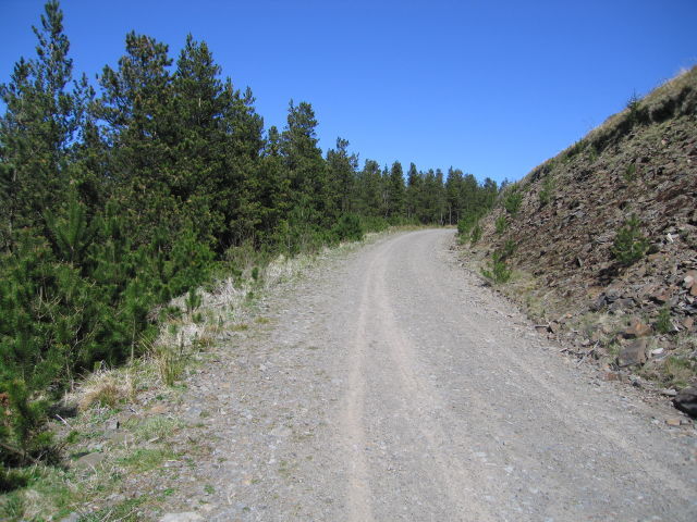
Ffarm Pen-y-cae / Pen-y-cae Farm Adfeilion Ffarm Pen-y-cae ac am y rhan fwyaf o'r 19g bu teulu'r Harries (Harry gynt) yn byw yma ac yn ffarmio tuag 300 o erwau. Yn 1871 y deiliaid oedd William Harris, ei wraig Gwenllian a'u hwyth o blant. Erbyn 1901 roedd Gwenllian, bellach yn widw 72 oed ac yn uniaith Gymraeg, wedi symud gyda'i mab a'i merch i fyw mewn anhedd-dy o'r enw Abergwerlych.

The ruined Pen-y-cae Farm (trans. top of the field) and for most of the nineteenth century it was home to the Harris family (formerly Harry) who farmed approximately 300 acres. In 1871 the occupants were William Harris, his wife Gwenllian and their eight children. By 1901 Gwenllian, now a 72 year old widow and a Welsh speaking monoglot, had moved with her son and daughter to a property known as Abergwrelych.
Ffarm Pen-y-cae / Pen-y-cae Farm
Adfeilion Ffarm Pen-y-cae ac am y rhan fwyaf o'r 19g bu teulu'r Harries (Harry gynt) yn byw yma ac yn ffarmio tuag 300 o erwau. Yn 1871 y deiliaid oedd William Harris, ei wraig Gwenllian a'u hwyth o blant. Erbyn 1901 roedd Gwenllian, bellach yn widw 72 oed ac yn uniaith Gymraeg, wedi symud gyda'i mab a'i merch i fyw mewn anhedd-dy o'r enw Abergwerlych. The ruined Pen-y-cae Farm (trans. top of the field) and for most of the nineteenth century it was home to the Harris family (formerly Harry) who farmed approximately 300 acres. In 1871 the occupants were William Harris, his wife Gwenllian and their eight children. By 1901 Gwenllian, now a 72 year old widow and a Welsh speaking monoglot, had moved with her son and daughter to a property known as Abergwrelych.
Ffarm Pen-y-cae / Pen-y-cae Farm Adfeilion Ffarm Pen-y-cae ac am y rhan fwyaf o'r 19g bu teulu'r Harries (Harry gynt) yn byw yma ac yn ffarmio tuag 300 o erwau. Yn 1871 y deiliaid oedd William Harris, ei wraig Gwenllian a'u hwyth o blant. Erbyn 1901 roedd Gwenllian, bellach yn widw 72 oed ac yn uniaith Gymraeg, wedi symud gyda'i mab a'i merch i fyw mewn anhedd-dy o'r enw Abergwerlych.

The ruined Pen-y-cae Farm (trans. top of the field) and for most of the nineteenth century it was home to the Harris family (formerly Harry) who farmed approximately 300 acres. In 1871 the occupants were William Harris, his wife Gwenllian and their eight children. By 1901 Gwenllian, a 72 year old widow and a Welsh speaking monoglot, had moved with her son and daughter to a property known as Abergwrelych.
Ffarm Pen-y-cae / Pen-y-cae Farm
Adfeilion Ffarm Pen-y-cae ac am y rhan fwyaf o'r 19g bu teulu'r Harries (Harry gynt) yn byw yma ac yn ffarmio tuag 300 o erwau. Yn 1871 y deiliaid oedd William Harris, ei wraig Gwenllian a'u hwyth o blant. Erbyn 1901 roedd Gwenllian, bellach yn widw 72 oed ac yn uniaith Gymraeg, wedi symud gyda'i mab a'i merch i fyw mewn anhedd-dy o'r enw Abergwerlych. The ruined Pen-y-cae Farm (trans. top of the field) and for most of the nineteenth century it was home to the Harris family (formerly Harry) who farmed approximately 300 acres. In 1871 the occupants were William Harris, his wife Gwenllian and their eight children. By 1901 Gwenllian, a 72 year old widow and a Welsh speaking monoglot, had moved with her son and daughter to a property known as Abergwrelych.
Cyffordd o draciau / Junction of tracks Cyffordd o draciau ger Pen-y-cae. Y trac ar y dde yw Heol y Ffirad (Offeiriad), hen ffordd a oedd yn mynd i Eglwys Glyncorrwg. Yma hefyd y safai anhedd-dy o'r enw Seler, enw a roddwyd ar safle glo brig a oedd yn weithredol hyd at ychydig flynyddoedd yn ol.    

A junction of tracks near Pen-y-cae. The track on the right is the Parish Road, and old route to Glyncorrwg Church. Also at this location stood a property known as Seler, a name given to an open cast site that was operative until a few years ago.
Cyffordd o draciau / Junction of tracks
Cyffordd o draciau ger Pen-y-cae. Y trac ar y dde yw Heol y Ffirad (Offeiriad), hen ffordd a oedd yn mynd i Eglwys Glyncorrwg. Yma hefyd y safai anhedd-dy o'r enw Seler, enw a roddwyd ar safle glo brig a oedd yn weithredol hyd at ychydig flynyddoedd yn ol. A junction of tracks near Pen-y-cae. The track on the right is the Parish Road, and old route to Glyncorrwg Church. Also at this location stood a property known as Seler, a name given to an open cast site that was operative until a few years ago.
Heol las i Ben-y-cae / A green lane to Pen-y-cae Heol las yn agosau at Ffarm Pen-y-cae.

A green lane approaching Pen-y-cae Farm (trans. top of the field).
Heol las i Ben-y-cae / A green lane to Pen-y-cae
Heol las yn agosau at Ffarm Pen-y-cae. A green lane approaching Pen-y-cae Farm (trans. top of the field).
Pownd ger Pen-y-cae / Pool near Pen-y-cae Pownd ger Pen-y-cae.

A pool near Pen-y-cae (trans. top of the field).
Pownd ger Pen-y-cae / Pool near Pen-y-cae
Pownd ger Pen-y-cae. A pool near Pen-y-cae (trans. top of the field).
Llwybr coedog / Wooded path Llwybr dymunol yn mynd drwy'r coed a oedd gynt yn heol a ai o Flaengwrach i Lyncorrwg a elwir Ffordd y Ffirad (Offeiriad), pellter oddeutu 6 milltir.

A pleasant path going through a wood which is in fact the old Parish Road the went from Blaengwrach (trans. upper reaches of the witch's stream)  to Glyncorrwg (trans. [river] Corrwg valley), a distance of approximately 6 miles.
Llwybr coedog / Wooded path
Llwybr dymunol yn mynd drwy'r coed a oedd gynt yn heol a ai o Flaengwrach i Lyncorrwg a elwir Ffordd y Ffirad (Offeiriad), pellter oddeutu 6 milltir. A pleasant path going through a wood which is in fact the old Parish Road the went from Blaengwrach (trans. upper reaches of the witch's stream) to Glyncorrwg (trans. [river] Corrwg valley), a distance of approximately 6 miles.
Pen-y-Cae farm, disused This farm house looked fine as we approached - it was only as we got near that the signs of dereliction were visible - the blocked off windows and doors. As we got closer, more obvious evidence of abandonment could be seen - TV aerial hanging limp off its mast and the guttering slowly disintegrating from the roof.

What was really poignant about this location for me were the left over children's toys in the garden - basket ball hoop, a football goal, but the saddest looking left over was a child's swing, slowly swinging, gradually being taken over by undergrowth. 

One can only imagine that this was once a happy family home and not the shell that now remains.  I hope the children, now grown up, still have happy memories of this home with a gorgeous view.

The house was left stranded by a nearby open cast mine which severed all road connections to the farm.  I can only suspect that it was compulsory purchased by the coal board as had so many properties in this area of South Wales when the open cast started mining.

In the picture you can clearly see the electricity and phone lines running off to the right.  They survive for about 200 metres before being cruelly severed by the open cast mine.
Pen-y-Cae farm, disused
This farm house looked fine as we approached - it was only as we got near that the signs of dereliction were visible - the blocked off windows and doors. As we got closer, more obvious evidence of abandonment could be seen - TV aerial hanging limp off its mast and the guttering slowly disintegrating from the roof. What was really poignant about this location for me were the left over children's toys in the garden - basket ball hoop, a football goal, but the saddest looking left over was a child's swing, slowly swinging, gradually being taken over by undergrowth. One can only imagine that this was once a happy family home and not the shell that now remains. I hope the children, now grown up, still have happy memories of this home with a gorgeous view. The house was left stranded by a nearby open cast mine which severed all road connections to the farm. I can only suspect that it was compulsory purchased by the coal board as had so many properties in this area of South Wales when the open cast started mining. In the picture you can clearly see the electricity and phone lines running off to the right. They survive for about 200 metres before being cruelly severed by the open cast mine.
The Coed Morgannwg Way at Twyn Corrwg Fechan This clear area is shown on the 1:25000 map
The Coed Morgannwg Way at Twyn Corrwg Fechan
This clear area is shown on the 1:25000 map
Rough path - good view This rather rough forestry track leads initially quite steeply up from the track below. There are magnificent views all the way.
Rough path - good view
This rather rough forestry track leads initially quite steeply up from the track below. There are magnificent views all the way.
What was once here? This is part of the Skyline Trail (and doesn't seem to be on the maps). It is a lovely path, just to one side of the nearby forestry road. At this point, there are piles of stones that may once have been a building, and there is a spring marked not far away on the 1:25000 OS map.
What was once here?
This is part of the Skyline Trail (and doesn't seem to be on the maps). It is a lovely path, just to one side of the nearby forestry road. At this point, there are piles of stones that may once have been a building, and there is a spring marked not far away on the 1:25000 OS map.
Step aside! These are good places for cyclists, though we explore on foot.
Step aside!
These are good places for cyclists, though we explore on foot.
A strange construction This bower was presumably covered in cloth at one time. The wooden poles enclose what seem to be barbecue areas. It would certainly be a good place for a party - if the weather was right.
A strange construction
This bower was presumably covered in cloth at one time. The wooden poles enclose what seem to be barbecue areas. It would certainly be a good place for a party - if the weather was right.
From one side..... This stream flows under the track........
From one side.....
This stream flows under the track........
...to the other .....and then on down the hillside.
...to the other
.....and then on down the hillside.
Strolling along in the sun A lovely day and easy walking made this a bit different from some of the geographs not far away that we collected in the autumn - when sometimes it was barely possible to see from one side of a track to the other.
Strolling along in the sun
A lovely day and easy walking made this a bit different from some of the geographs not far away that we collected in the autumn - when sometimes it was barely possible to see from one side of a track to the other.
Cwm yr Argoed A view down from the western end of Graig Isaf with the Vale of Neath in the middle distance. This is forestry and opencast mining country.
Cwm yr Argoed
A view down from the western end of Graig Isaf with the Vale of Neath in the middle distance. This is forestry and opencast mining country.
Craig Y Llyn and Llyn Fawr This is the view looking west from the lookout point on the A4061 just to the east. Craig Y Llyn is an outcrop of rock between two lakes - Llyn Fach and Llyn Fawr. Llyn Fawr can be seen here.

Llyn Fawr has been converted from a natural lake to a reservoir. While the bottom was being dug out to increase capacity a collection of bronze and iron artefacts was found. This is called the Llyn Fawr Hoard and was possibly an offering to a deity. 
Because of this important find "Llyn Fawr" has become the name for the transition period between the bronze and iron ages.
One of the items can be seen here <span class="nowrap"><a title="http://www.museumwales.ac.uk/en/2351/" rel="nofollow ugc noopener" href="http://www.museumwales.ac.uk/en/2351/">Link</a><img style="margin-left:2px;" alt="External link" title="External link - shift click to open in new window" src="https://s1.geograph.org.uk/img/external.png" width="10" height="10"/></span>
Craig Y Llyn and Llyn Fawr
This is the view looking west from the lookout point on the A4061 just to the east. Craig Y Llyn is an outcrop of rock between two lakes - Llyn Fach and Llyn Fawr. Llyn Fawr can be seen here. Llyn Fawr has been converted from a natural lake to a reservoir. While the bottom was being dug out to increase capacity a collection of bronze and iron artefacts was found. This is called the Llyn Fawr Hoard and was possibly an offering to a deity. Because of this important find "Llyn Fawr" has become the name for the transition period between the bronze and iron ages. One of the items can be seen here LinkExternal link
Llyn Fach at Craig Y Llyn This is the smaller of the two lakes at Craig Y Llyn, to the west of the outcrop. The view is looking north from the ridge above.
Llyn Fach at Craig Y Llyn
This is the smaller of the two lakes at Craig Y Llyn, to the west of the outcrop. The view is looking north from the ridge above.
Show me another place!

Y Foel Chwern is located at Grid Ref: SN8903 (Lat: 51.718, Lng: -3.6)

Unitary Authority: Neath Port Talbot

Police Authority: South Wales

What 3 Words

///ballparks.propelled.cupcake. Near Glyn-neath, Neath Port Talbot

Related Wikis

Foel Chwern

Foel Chwern is a Round cairn on the edge of the high plateau east of the Neath valley, and near the summit of Craig y Llyn. The headwaters of the River...

Craig y Llyn

Craig y Llyn (Welsh, 'rock/cliff of the lake') is a mountain situated to the south of the village of Rhigos in the Cynon Valley on the south side of the...

Llyn Fawr

Llyn Fawr ('large lake' in Welsh) is a reservoir that occupies one of a series glacial cirques that form the northern escarpment of the South Wales Coalfield...

Pen y Cymoedd

Pen y Cymoedd ("Head of the Valleys") is a wind farm located between Neath and Aberdare in south Wales. It opened in 2017. == History == === Development... ===

Nearby Amenities

Located within 500m of 51.718,-3.6
Generator Method: wind_turbine
Generator Output Electricity: 3.0 MW
Generator Source: wind
Generator Type: horizontal_axis
Height: 89.5
Manufacturer: Siemens Gamesa Renewable Energy S.A.
Model: Siemens SWP-3.0
Operator: Vattenfall United Kingdom
Power: generator
Lat/Long: 51.7157795/-3.5947679
The data included in this document is from www.openstreetmap.org. The data is made available under ODbL.

Have you been to Y Foel Chwern?

Leave your review of Y Foel Chwern below (or comments, questions and feedback).