Warsett Hill

Heritage Site in Yorkshire

England

Warsett Hill

Cattersty Sands World War Two bunker.
Cattersty Sands Credit: Ian Rob

Warsett Hill, located in Yorkshire, England, is a renowned heritage site that attracts visitors from all around the world. Situated in the picturesque countryside, this hill offers breathtaking views and holds significant historical importance.

The hill, standing at an impressive height of 200 meters, is covered in lush greenery and is home to a diverse range of flora and fauna. The landscape surrounding Warsett Hill is dotted with charming villages, rolling meadows, and meandering streams, creating a serene and tranquil atmosphere for visitors to enjoy.

What makes Warsett Hill truly special is its rich historical background. It is believed that the hill was inhabited during the Bronze Age, as evidenced by the discovery of ancient burial mounds and other artifacts. Furthermore, the hill has played a crucial role in various battles throughout history, showcasing its strategic significance. Ruins of fortifications and defensive structures can still be found on its slopes, offering a glimpse into the past.

Today, Warsett Hill is a popular destination for hikers, nature enthusiasts, and history buffs alike. The site offers a network of well-maintained walking trails, allowing visitors to explore the hill's natural beauty while immersing themselves in its storied past. Additionally, guided tours are available, providing visitors with in-depth knowledge about the hill's historical significance and the surrounding area.

Warsett Hill in Yorkshire is a captivating heritage site that combines stunning natural landscapes with a rich historical legacy. It offers a unique opportunity for visitors to connect with nature, delve into the past, and experience the beauty and history of this remarkable location.

If you have any feedback on the listing, please let us know in the comments section below.
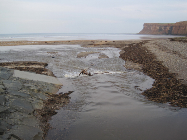
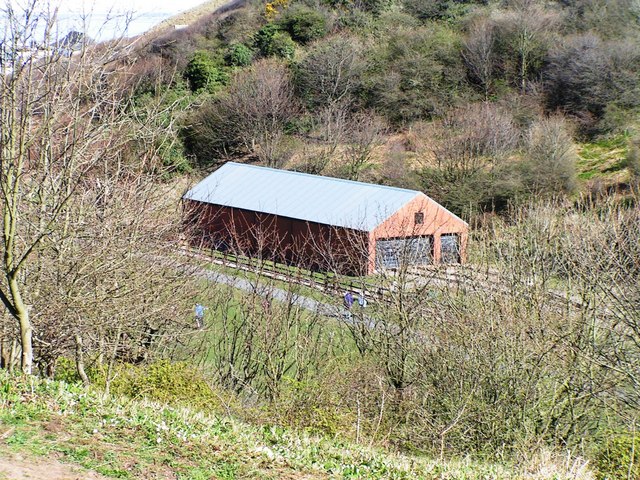
Warsett Hill Images

Images are sourced within 2km of 54.5829/-0.9309 or Grid Reference NZ6921. Thanks to Geograph Open Source API. All images are credited.

Cattersty Sands World War Two bunker.
Cattersty Sands
World War Two bunker.
Cattersty Sands Pleasant clean and quiet beach leading towards the unassuming coastal village of Skinningrove
Cattersty Sands
Pleasant clean and quiet beach leading towards the unassuming coastal village of Skinningrove
Looking South East along the Length of Cattersty Sands Lovely clean and quiet beach
Looking South East along the Length of Cattersty Sands
Lovely clean and quiet beach
Rocks and Boulders beyond the Northern End of Cattersty Sands
Cattersty Cliff The rather unstable cliff features erosion resistant outcrops like this.
Cattersty Cliff
The rather unstable cliff features erosion resistant outcrops like this.
Hunt Cliff A combination of mudstones and sandstone towards the top.
Hunt Cliff
A combination of mudstones and sandstone towards the top.
Cattersty Gill Nature Reserve According to the sign, before restoration in 1975 the meadow was a slag tip for the nearby steelworks. The slag has made it lime-rich, leading to an interesting flora.
Cattersty Gill Nature Reserve
According to the sign, before restoration in 1975 the meadow was a slag tip for the nearby steelworks. The slag has made it lime-rich, leading to an interesting flora.
Cattersty Sands A view from Hunt Cliff.
Cattersty Sands
A view from Hunt Cliff.
Polychromatic Arc From Cattersty Sands.
Polychromatic Arc
From Cattersty Sands.
WW2 Pill Box On Cattersty Sands. Clearly upside down having been flipped by landslip or sea action.
WW2 Pill Box
On Cattersty Sands. Clearly upside down having been flipped by landslip or sea action.
Remains of Old Buoy, Cattersty Sands This was washed up in the 1950s complete with brass bell which quickly disappeared. Sometime later several WW2 mines were washed up and the Royal Navy were called in to destroy them. Apparently according to local legend the RN had some explosives left which were "out of date" so used them up on the buoy.
Remains of Old Buoy, Cattersty Sands
This was washed up in the 1950s complete with brass bell which quickly disappeared. Sometime later several WW2 mines were washed up and the Royal Navy were called in to destroy them. Apparently according to local legend the RN had some explosives left which were "out of date" so used them up on the buoy.
Cattersty sands. Along the Cleveland way.
Cattersty sands.
Along the Cleveland way.
Cattersty cliffs. Looking north along the coast.
Cattersty cliffs.
Looking north along the coast.
Cattersty Sands Near Skinningrove Village, on the Cleveland Way National Trail.
Cattersty Sands
Near Skinningrove Village, on the Cleveland Way National Trail.
From Cattersty Cliff Looking out over Cattersty Sands towards Skinningrove, with Boulby Cliff beyond.
From Cattersty Cliff
Looking out over Cattersty Sands towards Skinningrove, with Boulby Cliff beyond.
Above Cattersty Cliffs Looking down onto Skinningrove with Hummersea and Boulby Cliffs in the distance. The fields in the foreground are reclaimed industrial land. Land which was still shown as slag on the 1985 edition of the 1:25000 O.S. Map.
Above Cattersty Cliffs
Looking down onto Skinningrove with Hummersea and Boulby Cliffs in the distance. The fields in the foreground are reclaimed industrial land. Land which was still shown as slag on the 1985 edition of the 1:25000 O.S. Map.
Looking east towards Cattersty Sands The view from the Cleveland Way clifftop path approaching Cattersty Sands and Skinningrove pier.
Looking east towards Cattersty Sands
The view from the Cleveland Way clifftop path approaching Cattersty Sands and Skinningrove pier.
Cattersty Sands
Cattersty Sands
Show me another place!

Warsett Hill is located at Grid Ref: NZ6921 (Lat: 54.5829, Lng: -0.9309)

Division: North Riding

Unitary Authority: Redcar and Cleveland

Police Authority: Cleveland

What 3 Words

///relieves.note.blatantly. Near Brotton, North Yorkshire

Related Wikis

Saltburn Gill

Saltburn Gill (grid reference NZ676205) is an 19.11 hectares (47.2 acres) biological Site of Special Scientific Interest in Redcar and Cleveland district...

Brotton

Brotton is a village in the civil parish of Skelton and Brotton, in the Redcar and Cleveland district, in the ceremonial county of North Yorkshire, England...

Freebrough Academy

Freebrough Academy is a coeducational secondary school and sixth form located in Brotton, North Yorkshire, England.Previously known as Warsett School,...

Brotton railway station

Brotton railway station was opened by the Cleveland Railway on 1 November 1875, and served the village of Brotton in North Yorkshire, England. It was built...

A174 road

The A174 is a major road in North Yorkshire, England. It runs from the A19 road at Thornaby-on-Tees, across South Teesside and down the Yorkshire Coast...

Skelton Beck

Skelton Beck is a small river in North Yorkshire, England. The beck only runs for 23 kilometres (14 mi) and feeds directly into the North Sea on the south...

Skinningrove Steelworks

Skinningrove steelworks is a steel mill in Skinningrove, North Yorkshire, England. The business was formed in 1874 as the Loftus Iron Company, after a...

Saltburn Miniature Railway

The Saltburn Miniature Railway is a 15 in (381 mm) gauge railway at Saltburn, in Redcar and Cleveland, North Yorkshire, England. == History == The railway...

Nearby Amenities

Located within 500m of 54.5829,-0.9309
Source: PGS
Lat/Long: 54.5867276/-0.9270391
Source: PGS
Lat/Long: 54.586827/-0.9282407
Source: PGS
Lat/Long: 54.5869265/-0.9290132
Source: PGS
Lat/Long: 54.5869762/-0.9298715
Source: PGS
Lat/Long: 54.587026/-0.9337339
Warsett Hill
Ele: 166
Man Made: survey_point
Natural: peak
Source: OS7
Lat/Long: 54.5836317/-0.9304963
Charm Bracelet
Artwork Type: sculpture
Mapillary: 449175263048744
Survey Date: 2020-11-25
Tourism: artwork
Lat/Long: 54.5851128/-0.9243156
Bench
Lat/Long: 54.5850847/-0.9243122
Artwork Type: sculpture
Tourism: artwork
Lat/Long: 54.5861537/-0.9304763
Artwork Type: sculpture
Tourism: artwork
Lat/Long: 54.5861318/-0.9308328
Barrier: stile
Stile: stepover
Lat/Long: 54.5841768/-0.9369577
Railway: crossing
Lat/Long: 54.5841834/-0.9371285
Archaeological Site: tumulus
Historic: archaeological_site
Lat/Long: 54.5830846/-0.9316988
Green Turf
Place: locality
Lat/Long: 54.5860641/-0.9256846
Barrier: stile
Stile: stepover
Lat/Long: 54.5841911/-0.9373068
Barrier: stile
Stile: stepover
Lat/Long: 54.5846423/-0.9246147
The data included in this document is from www.openstreetmap.org. The data is made available under ODbL.

Have you been to Warsett Hill?

Leave your review of Warsett Hill below (or comments, questions and feedback).